Showing posts with label Ettrick Hills. Show all posts

Monday, 24 June 2024

A misty Donald Tops Circuit down Ettrick way

Hill: White Shank (DT); Smidhope Heights (DT); West Knowe (DT); Capel Fell (D); Loch Fell (D)

Type: Donald: Donald Tops


Another day to push and test my walking fitness but when I opened the curtains expecting a nice view it was a full on shade of grey.

My plan was to pick off the two Donald Tops associated with Capel Fell.

An interesting single track drive with minimal visibility praying that I would not meet anything coming my way, luckily I didn't.

Start of walk

I knew the route up to Capel Fell so the weather was not an issue just hoping it would clear. Looking at the snaps it is amazing how a modern lens makes everything so much brighter and clearer, not quite how my eyes saw it.

Phawhope Bothy


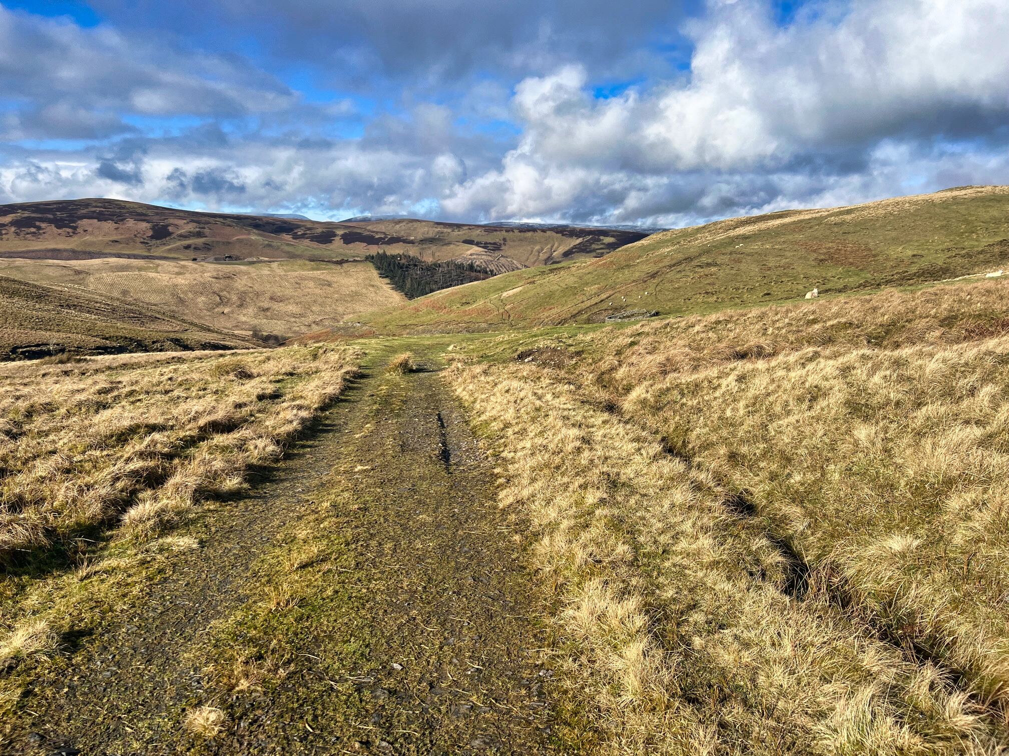
An hours trek from the car via Phawhope Bothy, utilising the Southern Upland Way, got me to the base of Capel Fell.

Fence to Capel Fell thought it would clear but not for a while

The mist was lifting with flashes of blue sky but the top was not in sight from here. Having been up Capel Fell before I knew it was a straightforward 20-25 minute grassy slog. I was following an ATV track and a fence so no difficulty. It took the 25 minutes!!

Right turn still following the fence to Smidhope Hill

On the top of Capel I was still in the mist and much colder it was, jacket on. I followed the fence as it made a right turn heading for Smidhope. This was new territory and I had not realised how much I had descended from Capel Fell until out of the gloom a steep ascent loomed into view. As we know mist and fog exaggerates everything.

Top of Smidhope

Despite my initial misgivings it actually was not too bad and beside me the fence had changed to an impressive dry stone dyke. However on reaching the top of Smidhope there was no marker to designate the summit, not unusual for Donalds.

Top of White Shank

On return mist cleared enough to look back to Smidhope

Onward in the gloom again, once more the dyke beside me reassured that I was still on track until I reached a high point and the cloud briefly lifted, there was nothing higher ahead. So final point reached and confirmed.

View from Smidhope to Capel

In terms of distance I had walked back almost level with the bothy and it would have been straightforward to make a circular walk out of it. But I wanted the longer exercise and made my way back to Capel and back down the hill.

Snap flattens out the climb had to go left then follow fence West Knowe high point on right

This was now my dilemma. I was feeling good but legs were tiring and I knew I had one other Donald top nearby. It was a question of do I return another day or do I put in a bigger shift today? As I descended from Capel the mist lifted and I could see across to West Knowe. Decision was made. I knew I would have to ascend via the Donald of Loch Fell first which was a bit of a pain and more effort but that is the price to be paid for not bagging West Knowe first time around.

West Knowe ahead on way back I cut across once over the peat hags

Whilst descending from Capel I spotted an ATV track across the way which I was able to ascend to the fence line which then took me to Loch Fell. After that it was a case of another right turn and followed the fence to West Knowe. It was no hardship as the views were excellent despite the cold wind.

Croft Head from West Knowe

Green Lowther radar ball high point in the back centre of snap

From the summit I enjoyed the scenery even spotting the golf ball on Green Lowther on the horizon. A small flock of birds suddenly appeared on the ground and the fence. At first I thought Chaffinch but no way up here until I looked closer through the zoom of the camera and they were Common Redpoll, never seen a group so high up before. I had read that there were good numbers being spotted in Scotland this winter so delighted with that.

En route I decided I would return cross country through the gorge. A bit of a descent and reascent but worth it as saved time and distance.

Into the forest for the tramp back to the car

Back to the SUW and then an hours trek back to the car. Not another person met or even spotted in the distance and on the moors next to no birdlife.

Ascent: 801m

Distance: 18.6km

Time: 5.08

Wildlife: Chaffinch; Blue Tit; Coal Tit; Meadow Pipit; Buzzard; Curlew (heard); Common Redpoll;

The Three cairns ramble.....Ward Law

Hill: Ward Law

Type: Sub2k

Height: 594m


I was pleased with yesterdays long outing and despite my unsurprisingly slightly painful calves I wanted to finish my wee trip with this short but steep Sub2k, an Ettrick hill.

I was staying at the quirky Tushielaw Inn, not often that I watch the rugby with two brothers, one a local scrap merchant and the other a world travelling chef as well as a cruise ship drag artist, interesting! Yesterday for brekkie I was simply asked did I want a cooked breakfast, yes I replied. Then it arrived! After that huge breakfast I was more wary today and just asked for just a few items, lesson learned.


So properly fed I drove the short distance to start my walk. There are only a few walk reports but parking was consistently a major issue. However, looking at the map last night there seemed a more straightforward approach with parking at the community hall.

Indeed there was good parking and easy access to the hill by walking up the track between the old school and a house where there is a wooden gate. Go through to a grassy track that goes up the right hand side of the trees. Even after a lighter breakfast my body was not quite ready for this full on assault to start the walk. Only 200m but to my calves it could have been a Munro. There is heavy bracken around, dead today but I reckon the track should still be clear.

Spotted a cairn over to my left

As the ground levelled off I spotted a cairn over to my left on the ridge. So I made my way towards that firstly heading for the sheep pen. The ground was a mixture of tussocks and bog but no real issues.

Looked at map re sheep pen wrong cairn

Just straight up through the tussocks

An alarm bell began ringing in my brain from one of the walk reports about a non summit cairn so a rest break to check my map and sure enough that was not the top cairn, way off line. No damage done I just straightened my line and plodded on uphill. Apart from the sheep it was silence, the only birds spotted on the moor were a pair of ravens.

False cairn on left with a nice view to Capel Fell

Another false cairn with the real one behind it

As always a few false tops until I spotted the top of cairn slightly to my right so off I headed. As it turned out this is another non summit cairn as a much larger beast lurked behind, surrounded by a deer fence with a ladder to climb. Actually there is not much to hold on to at the top of the ladder, the wind was gusting, it was an awkward turn to get balanced for the other side.

The proper summit cairn and the top of Ward Law is a huge beast, not that the other two are shabby. I presume with it being behind a deer fence that land is not the same owner as the other cairns? The large one is marked on the map as a Jubilee Cairn. The other two likely to be shepherds cairns but very well made.

White Coomb hills appropriately white

Wind had picked up and was chilly. Good views particularly down the Ettrick valley and across to the Moffat Corbetts with a dusting of snow up high. How many Donalds can be seen from here, quite a few?

Will be heading to the hump after visiting the other cairn

All 3 cairns visited

Will the bracken cover the path when grown? Nice place to stay.

As it had been a short ramble I wandered across to the original cairn before making my way back to the car.

Objective achieved, it was pleasing to have such good views for a short outing. An excellent trip which met the needs and got things restarted. What was surprising was 7 tops, about 25km of walking over the 3 days, some of it on the Southern Upland Way and not another person met on my rambles.

Time to rest these legs.

Ascent: 387M

Distance: 4.1km

Time: 1.52

Wildlife: Raven; Chaffinch; Robin; Blue Tit

Monday, 17 June 2024

The Wiss

Hill: The Wiss

Type: Sub2k

Height: 589m


After too long an absence it was time to get back on the hills and start improving my hill fitness. I wanted something on the gentler side so a wee Sub2k in the Borders was perfect. I had intended to do this last year from Ettrick Water but heavy snow on rough ground ruled it out. There are not many reviews for this hill and my intention last year was to use the same route as the others. However looking at the map there looked a better route from the opposite side starting at St Marys Loch. No reviews but it looked feasible and it was a shorter drive.

There had been snow recently so I was unsure of what I was going to find, reckoned it would be wet but packed the micro spikes just in case.

As I drove from Abington to Moffat the clouds were blowing through low and fast leaving snow cover quite low down. But as I drove from Moffat things began to brighten up even some blue sky.

The view from parking at the Loch of the Lowes


Parked up I could not see my target and the good news that the hills were green, but higher up?

The Wiss is the high point between the Yarrow Water (this side) and Ettrick Water (other side).

Follow the SUW

One reason for choosing this route was that I was utilising the Southern Upland Way for a stretch thus reducing the moorland bashing. I passed a herd of coos but they were slightly off the track and they simply stared. Climbing gently it was the sheep's to do the staring.

Skirting the new plantation

After the sheep pen there was a new plantation ahead which was not on any maps and before where I was planning to leave the SUW. I explored a bit further but backtracked where I left the SUW and followed the fence. Some open ground before I reached the trees I was looking for.

Had to leave ATV track and head towards end of trees

My plan was to follow the treeline but the ground was full of tussocks so it was easier to follow the odd ATV track, then tussocks, then ATV track keep repeating. The area is called Long Moor, aptly named.

Still it felt good to be out in the hills, super long distance views and the target was not too far away. The ground was firmer nearer the summit, much easier walking.

I reached a meeting of fences where I thought the trig was but nope not to be seen. Climbed the fence and about 50m later it came into view.

View back over Moffat hills

Looking West over St Mary's Loch

East over Ettrick water Eildons in distance

Zoomed in to the Eildons

From the summit there are excellent views all round with the exception when looking back towards Moffat where it was still ominously dark skies and the wind was blowing it my way. Light snow covered the higher tops looking spectacular when the rare burst of sunshine illuminated them. No idea what The Wiss means but looking at the map if you continue along the ridge the next section is called Moory Hass, fantastic names in the Borders.

The descent. A few Donalds on view including Capel Fell, Hermans Law.

White Coomb range snow topped

As I descended the wind reduced the temperature considerably along with a short burst of sleet, hood up but no rush lots to look at.

My target one of many sheep pens

It was easier descending until I was reminded things can go wrong. A bit of wet bog I thought was solid until my leg went down to my knee. Luckily the poles were anchored and stopped any injury but a useful safety reminder on my return to the hills.

Final track where are the coos?

On the final descent the coos were now all over the track staring at me but my saviour was coming uphill. The farmer with a big bale of hay on his tractor turned up went to the feeding station and off they followed.

The objective was achieved a pleasant short ramble with just enough ascent to make it a proper hill walk.

Ascent: 389m

Distance: 9.6km

Time: 2.39

Wildlife: Robin; Chaffinch; Crossbill; Blue Tit; Great Tit; Rook; Jackdaw; Pheasant: Skylark (heard); Buzzard


Wednesday, 21 April 2021

Graham bagging in the rolling Border Hills

Hills: Capel Fell (Horse Hill?) (678m) & Croft Head ( Hill above croft) (637m)

Type: Both are a Graham & Donald

With the new found freedom allowed for small ad hoc groups a break out group from Ayr OIR headed to Moffat to visit the Ettrick Hills. Having a motorway drive almost felt like a new experience. These hills offer a mixture of ridges and valleys as well as a lot of forestry. They are also fairly isolated and we did not see another walker all day.

We started from the the traditional spot near the fish farm, a small parking area so be warned. Crossing the Moffat water we will be heading to the parallel Ettrick water which flows in the opposite direction, a watershed indeed. 

A dry Succoth burn
We opted to not follow the Succoth burn but to cross it and go up the flanks of Croft Head and head directly to the surface.

Deer fence 1
There was a good track lower down before we met the first deer fence. Thankfully decent gates were integrated into the fences so no climbing but still drew blood. The land has been recently planted with the small pine tree saplings poking out, but despite the forestry scars the going was good. It would have been an ideal pleasant grassy slopes in bygone days.

Finally get full view of Croft Head
A few hillocks giving false summits before the final opening with a good view of the steeper final assault on Croft Head. Excellent views into the deep Cleugh as well as the ravaged flanks of Capel Fell where landslips had caused major damage.

Looking over Broken Back, Sailfoot Law, at back Saddle Yoke ridge
A few huffs and puffs and stops for the views before we reached the summit, a merging of fences, not very inspiring voiced Gordon, agreement from the rest. But the views made up for any disappointment, superb rolling hills and all 5 Donalds of this route in sight.

Descending Cat Shoulder impressive Scar

Closer view
The Southern Upland Way makes a high level detour up here and we used it to descend to the original trail. 

Looking back from cairn to zig zag descent

A very steep but a well made zigzag path makes light work of the steep gradient. 

Craigmichen Scar ahead and behind the flank of Capel
Once down we took the easiest route following the SUW as it climbs and descends, a narrow track hemmed between the hills a delightful walk to reach the coll.

Well constructed bridge better than Shalloch version
Before making the final ascent of Capel it was time for a relaxing lunch enjoying the views to the 3 Donalds across the way particularly Wind Fell.. 

Some more huffing and puffing following the fence line (the boundary marker Selkirk-Dumfries) and an ATV track, then the second hill was bagged. 

View from Capel summit to Swatte Fell & Saddle Yoke
Again no cairn or trig just an eroded post to mark the summit but the plus factor was even better views. We are spoiled today. 

Looking over to our ascent of Croft from Capel
The ridges and hills of Ettrick are fully laid out. On a day like this wonderful viewing.

Final descent
A good descent and we reached the Sailfoot forest where deforestation was in full flow but thankfully no workings today. We decided to follow a swinging S shaped track before deciding to go in a straight line through the deforestation. 

Trouble ahead
Not a mistake but not straightforward either over the debris, hidden holes etc. A few sweary words muttered. Still, we all survived and the cars were just ahead, walk over.

A perfect day for walking but I underestimated the weather, no sun cream and a skelped face tonight. Hopefully the Herman Law ridge next.

Ascent: 820m

Distance: 11.1km

Time: 4.51

Wildlife: Hare; Jay; Meadow Pipit; Pheasant; Raven; Skylark; Buzzard; Peacock butterfly