Saturday, 21 December 2013

Dun Deardail....Fort William

It was one of those days, grey and drizzly. The good lady was with me today, we wanted a walk with a view but it had to be relatively low level for the good lady's knees do not take well to hard descents. A review of the literature we had brought with us included walks in and around Glen Nevis. I had never been on Dun Deardail before so at least a 1st was welcome for today. Its height of 340m would give us views of the Nevis glen and in particular Ben Nevis if the conditions remained like this.
The walk includes a small section of the West Highland Way. It is a mixture of wood land paths and then open countryside. 
They all look the same
We parked at the Braveheart car park which was a good place to spend some time at the end of the walk. This is the same start for Ben Nevis and I looked jealously at the small groups making their way onto the Ben. We crossed the road, took in the field of Highland coos (Mrs B always stops at them, come along dearest we have only just started!!) and moved onto the path marked WHW. You are now entering the forest path. Whilst climbing keep following the WHW markers or you are in danger of going onto the Cow Hill track which would take you back to Fort William. A pleasant enough walk in its own right but not for today.
Camp site can just be seen
The walking is a little bit of the normal forestry track trudge. Still, listening and watching out for the normal forest birdlife keeps me interested until we break through the treeline and get the views. So far the normal culprits: blue, great and coal tits; chaffinch; blackbirds and song thrush but not a lot else. There are a few dog walkers around, particularly at the lower levels but all in all we have the lower stretches pretty much to ourselves. The fine rain continues but thankfully goes off as we start to break out of the trees. The sun even starts to make a brief appearance brightening things up. There have been a few twists and turns but so far it has not been the most exciting walk, but we are outdoors and that's what counts.
Ben Nevis
Now that we have broken the treeline the views are superb particularly of Ben Nevis which is on our left as we walk. From here I can train the binos on the Ben and I can see a good number of walkers making their way slowly up the 1st section of the walk. In this picture you can just make out the faint line of the trail going upwards from left to right. the path then winds behind the hill ( about the middle of this picture) before going upwards again. Through the binos I can see walkers quite a way up although from this angle you don't see the summit.
Mrs B nearing summit
Our path is now more pleasant walking. We have turned away from the WHW path which will go south to Kinlochleven and Glencoe. There is a lot of forestry work going on which would detract from the scenic views for the WHW walkers. the path is more grassy and with the views all around much more fun.
A raven flies over unmistakable due to its size and its fan tail as well as its call, searching for its partner.
Light snow on the peaks of Stob Ban
The name of the hill is taken after the Iron age fort that stood here. It is a vitrified fort which means that the materials used to build the fort were bonded together by heat as the outside of the walls were covered in timber and set alight. 
Me with Ben Nevis as a backdrop
These are all covered in grass and the slight height reduction took the edge off the wind and was a nice place for our picnic. The views were excellent.
As always I spent a few minutes surveying the landscape through the binoculars and I was rewarded by catching the movement of a golden eagle on the flanks of Ben Nevis. This side is a long way from the walkers so there were no people around here to disturb it. Along the ridge it glided then back again, it looked effortless. Then circling in a tight spiral it went higher and higher until even with the binos I could no longer keep it in sight. This sighting made my day and the memory of the walk. If I had been scanning with just eyesight there was a good chance that I would not have spotted the eagle against the background. 
Looking back towards the Banavie area of Fort William
After that it was time to make the return. This was simply a case of returning by the same route. Maybe it was the time of day but we met more walkers coming off the WHW looking fatigued but happy that there trek was coming to its conclusion.
I'm afraid to say but the walk back through the woods was again a bit of a trudge and not terribly exciting.
When we returned we spent some time in the centre before heading back to Fort William. It had all went to plan, a walk with super views at the end with the reward of the golden eagle. Now it is to be rewarded by a visit to the Grog N Gruel in Fort William to sample at least a couple of pints of whatever real ale they have on tap. If you like your beer do not pass up on this pub.


Tuesday, 26 November 2013

Harbour Hill

My good lady and I had a couple of hours of freedom to get some fresh air before heading to the rugby at Murrayfield. The way the rugby went we should have stayed on the hills. As we were in the area anyway we went up the Pentland Hills. We started from the Harlaw carpark which I cover in my Harlaw blog.

Today we took the Glencorse path. This is a well trodden route and we are joined by mountain bikers, dog walkers, model plane flyers and horses. Thankfully not too many all at once and to be fair the people are well spread out. Like yesterday the sky is blue and the sun is out, unlike yesterday there is not a breath of wind, a glorious day.
We followed the path to the junction where you have several options, most go straight on through to Glencorse reservoir. To the right lies Bell's Hill, where the model plane flyers headed, but we opted to go left to Harbour Hill primarily as nobody else today has chosen it. 

This is straightforward route and great for a short Sunday walk. It is only a short pull up to the summit, just over 400m, where, when you reach the summit it opens up and gives some great views. You have a panoramic view of almost all of Edinburgh below you, Arthur's seat, The Firth of Forth, across to Fife and going west. superb on a good day and well worth the short effort. 


My good lady striding up Harbour hill. Behind her is Bell's Hill, then Black Hill and the pointed peak of Scald Law well behind.
The top is flat with tussocky grass and lots of sheep so dogs on leads please. You can combine this walk with Allermuir, Caerketton & Castlew Hills. All just under the 500m mark and this would make a good half day outing. There are some restrictions in these hills as these are military firing ranges so follow any posted guidelines.
From Harbour looking across to Capelaw then Allermuir Hill with the peak of Caerketton just popping up in the middle of the photo.
Bonaly reservoir, Edinburgh below, Arthur's seat to the right.
Edinburgh with Fife in the background.
Today there were plenty of fell runners dotted all over the hills. I enjoy my running but on the hills I prefer to walk but good luck to them.
Looking back to Harbour hill from Harlaw carpark.
A couple of hours in the fresh air and just superb. Once again a little effort gets fantastic views.

Harlaw & Threipmuir Walk

I had a couple of hours to spare so I headed up to one of my favourite places, the Pentland Hills. These hills lie on the outskirts of Edinburgh and can be busy, particularly at weekends. Lots of these visitors stick to certain routes so you can usually free yourself from them quite quickly. Today I was only going for a short walk so I parked at the main car park at Harlaw reservoir. This is a starting point for many of the western walks into the hills. These hills have been a great introduction to hill walking for generations of Edinburgh and district residents. The views of Edinburgh, out to Fife & the Firth of Forth can be quite exceptional.
As well as walking there is fly fishing for trout at both reservoirs. There is a club attached to the waters but day permits can be had at a reasonable price from Balerno post office. I have not fished either of these yet but after my walk today I will do so next season. Harlaw is stocked with rainbow trout whereas Threipmuir I believe is brown trout only.
My walk started by going anti clockwise around the edge of Harlaw reservoir. There is a path but it is more fun going along the waters edge. I threw in a piece of bread and after a couple of minutes a rainbow trout came up to investigate. The waters are tree lined but there is still ample room for casting a line, yes, I will definitely give this a go next season.
The photo on the right is at the far end of Harlaw, taken from the Threipmuir banking.
You have an option at this point of continuing along the side of Threipmuir heading west but I decided to leave that for another day.
Coming from the west I normally expect to leave the wind behind me but not today, it was blowing an absolute hooley, not cold but strong stuff. I went along the bank of Threipmuir, and compared to the sheltered Harlaw this could be a totally different fishing experience. A much larger water than Harlaw and fully exposed to the elements. Walking along this side was a pleasant experience, wind now at my back and you are looking directly at the hills, particularly Black Hill which is on the right of this photo. I have now pretty much left the dog walkers behind and almost have the place to myself. The wind is blowing the water into the narrow funnel ahead of me. There were about a dozen or so mallard ducks sheltering on the far side, the only birds I spotted on the water today.
Surprisingly there was next to no birdlife around today which both surprised and disappointed. They were probably keeping their heads well and truly in the heather in this wind.
In this photo you can see a walkway which takes you to the foot of Black Hill. As you can see from the photo it is showing its true colours today. This is a grouse hill and further up the hill are the gun butts. During previous walks I have raised a few grouse when walking through the heather, but not today, I did not even hear one calling. In this photo you can see a small construction coming out of the water. Closer inspection makes it out to be a type of fish ladder. I'm not sure why unless it is for the brownies to go up into the sheltered water behind for breeding. If anybody knows please post a comment. At the water board hut you can go left or right, there are good walks in either direction. Because of my time restrictions I am going to the left to partially walk around the base of Black Hill.
Bell's Hill in front and Turnhouse Hill in the distance
The path gradually climbs but there is no great elevation in my walk today. Any reasonably fit person would thoroughly enjoy this. Turning back there is a fine view showing Threipmuir reservoir. At this point 2 buzzards glide off the hill and begin circling just down at the waters edge. Close up, with wings expanded you get a good understanding of how big these birds are. They are known as the tourists eagle as to many non birdwatchers they have mistakenly said that they have just seen a golden eagle when it was the common buzzard!! It is still a fine bird to spot in its own right. Still in splendid isolation I wander round the track. It has been recently used by mountain bikers as parts of it are now extremely muddy and difficult to walk. To some the mountain bikers erode the landscape, I have some sympathy with this but it is a free country and to each their own sport. It maybe that I'm slightly biased as I have biked for much of my life but in fairness I tried to stick to true rocky mountain tracks as opposed to the soft boggy ground that makes up much of these hills with the consequent churning up of the ground.
My original intention was now to come down and climb the flank of Bell's Hill, meet up with the Glencorse path and return to Harlaw from that direction.
However the bottom area was extremely boggy with no clear path through. It was not appropriate for the footwear that I was wearing so not wanting soaking muddy feet I opted to return back to the water board hut and make a slightly different way back from there.
At this point I spotted 3 walkers up on Turnhouse Hill. It seemed a bit late in the day to be doing the ridge walk to Scald Law. A fine walk in its own right. Probably they were going to come off the ridge and head down the Penicuik side.
The wind was now back in my face and had not eased any. The upside was the patterns the wind was making across the water, the reeds and the grasslands, quite mesmerising.
So back across the walk way, a right turn then up through a short wooded area brought me to the far end of Harlaw reservoir. I took the longer route back around the water, back to the dog walkers and returned to the car park.
Overall out for about 3 hours, a really good short walk and all the better for it.

Tuesday, 12 November 2013

Barassie - Shewalton Woods - River Irvine - Barassie

Today's walk takes me along the fringes of Shewalton wood to get to my main objective of a walk up a section of the River Irvine. This is the last week of the salmon fishing on the river and I was thinking about casting a line over the next couple of days, hence the recce trip.
It was a blustery day with heavy squally showers blowing in as I started. I was well wrapped up, my lightweight Sprayway waterproof trousers were on from the start, full Berghaus mountain jacket as well. Gloves and hat in the rucksack so off we went.
Shewalton wood is my first port of call where I find that a new pipe is being laid so part of the route very muddy. The wood is made up of a mixture of natural domestic woodland, willow and birch and forestry conifer plantations. The trees are now changing colour and dropping their leaves which makes it all more colourful. I will describe the full Shewalton wood walk in greater detail in another blog as today I am only skirting the edge of the wood. There is an active timber merchants at this end and you do have to be a bit careful and watch out for the very occasional transport train when crossing the railway tracks. A bit further along the path the walk is blighted by the Caledonia paper mill, essential for commerce I suppose but a blot on the landscape and there are constant rumours about the stuff that belches out of their chimneys not being particularly good for us.
There are some waterways and ponds throughout the woods but they do not attract much obvious wildlife, no wonder as some are permanently covered in this green algae. They are probably good for all sorts of invertebrates.

The walk along the tree edge does bring one nice surprise as a grey squirrel appears on the track about 50 yards ahead. It has a look around and spots me but does not seem overly concerned as it takes its time heading into the trees on the other side of the path. They are attractive animals but as a traditionalist I much prefer the natural red squirrel and I do support eradication of the invasive grey. A few birds have been showing today. Crows and magpies appear to be in each others company at this time of year albeit in pairs of each bird. Where one scavenges the others follow. A treecreeper makes its way slowly up a conifer tree winding up the tree in a corkscrew travel pattern. A few blue and coal tits dart in and out of the trees joined by several chaffinch and greenfinch. 
Leaving the woods at the Bookers end it was only a 10 minute walk to the River Irvine.
I joined the river at the White Bridge on Longdrive. This is a good spot to start fishing from but care must be taken when the river is running high and fast as it is today. A short walk takes me to another nice spot where it is time to have a snack and reflect. This is another good location for brown trout and salmon. I had another reason for stopping, this is where I saw my first otter on the Irvine, swimming in and out of the reeds on the left of this picture. But no such luck today. I continued my walk upriver and stopped to chat to a fisherman coming off the river. He had no joy today and had not seen any fish to cast to. I continued along the wooded path, leaves strewn across the walkway enjoying the rather warm day it had become. 
A flock of fieldfare came across the river and landed in the trees just ahead. They soon moved further in to the woods making sure that I didn't get a good sighting.
Very surprised that I have not seen any dog walkers today, I'm sure their time will come. 
Recently, when cycling along this path, a rather large roe deer leapt out of the woods on my left and crashed into the reeds beside the river. I'm not sure who got the biggest fright as it did not miss crashing into me by much. It quickly realised its error, being trapped by the water, and came out right behind me running straight into the woods once again, presumably to rest and recover from its adventure. That was an early afternoon encounter. I have seen these deer in daylight before but mainly in the early morning or early evening. Maybe it had been disturbed in its woodland resting place.
I am now approaching the Holmsford bridge, more commonly known as the 'Red Brig', for obvious reasons.
This stretch of water is a good holding pool for the salmon. Although it might not be obvious to a stranger the water level is quite high today. Just under the bridge you cam make out the turbulent water which is a weir. Under normal water conditions the salmon have to leap the weir which is always a spectacular sight. Today it will not take too much effort. 
Although I mention that the water is high today, I witnessed these flood conditions where the gap between the top of the arches and the road had reduced somewhat. This event was the floods of October 2011. No leaping of the weir for the salmon that day as they would simply have swam through with the high water.
In the summer the local kids will throw themselves off the platform into the river, doesn't help the fishermen but that's life.
Looking upriver to Wilson's corner
To continue walking up river you have to cross over the road bridge and continue on the other bank, the right side of this picture.
The picture was taken from the bridge today, the view looking upriver to Wilson's corner which is at Dreghorn crematorium.
Looking downriver to Wilson's corner from Holms bridge
This is another good stretch for the holding salmon. From these photographs the river looks good for fishing but it would be unsafe to wade in the river with the water at this height. In addition the water flow is considerable and wading in a current of this speed is hazardous. Most fisherman under these conditions will be fishing spinning lures from the bank. For the 2 weeks in November that salmon fishing is allowed only artificial lures and flies are allowed, no worm fishing etc.
On this stretch I spoke to two guys, who were well hidden at first. They said it was their first time on the river this season, mmm, I don't think they were members but I had no fishing ID on me so I did not challenge their right to fish. They did say they had neither caught nor seen a fish. Finally at Holms bridge I spoke to my last fisherman of the day. I recognised his face, probably from the river. He had been spinning also without any joy. He did tell me that he had spotted a kingfisher going downstream, not my luck to see that today.
Holms bridge
I suspect that the fish have run the water for this season, off to the higher reaches of the river, for the hen fish to release their eggs, for the cock fish to fertilise them, and sadly for most of them to die. Their bodies fertilising the river bed. Hopefully many eggs will reach fruition and will be the future fish for us to try and catch.

That was it as far as the river was concerned for me today. A walk up to Drybridge then down the road to Longdrive and the return walk home via Shewalton wood. In the wood I saw a nice flock of goldfinches, beautiful little birds that allowed me to get quite close before flying off. Some robin and a couple of wrens along with more blue, coal & great tits. I had hoped to see some bearded tits but it was not to be. Right at the end of the wood walk there were two delights. Firstly a greater spotted woodpecker flew into the trees just in front of me and it stayed around for a couple of minutes so I had good viewing through the bino's. And just as I exited the wood a sparrowhawk flew down the gorse bushes at the side of the path but unfortunately for the sparrowhawk it did not spook any birds out of the bushes. There were plenty chirping away as I walked past, I'm sure it will be back.
Well that was a good walk of just over 4 hours and distance wise it would be in the region of 12 miles. I will need to measure it properly on the bike if the weather stays good. The weather stayed good with only light rain.
Time for a well earned cuppa.

Monday, 11 November 2013

Isle of Cumbrae Nov'13

Cumbrae from the approaching ferry
This magical island is easily in my top 10 of walks that I never tire of completing. I go over to Cumbrae once every 3 months or so for walking and the same for cycling, and hopefully will continue to do so for many years to come.
It all starts with a short ferry trip from Largs. The Calmac crossing only takes about 10 minutes but this is enough to get you away from the mainland, with that I'm on an island feeling, is it my holidays? The ferry crossing always brings a smile to my face along with the anticipation of the walk ahead. It is also a great island to cycle. The ferry carries a small number of cars as well as its footfall and runs every half an hour, sometimes more frequent in the high season. Keep a look out on the crossing for porpoises, I see them about every third trip but you have to look closely for movement as they glide the water and do not leap like dolphins.
The island of Cumbrae is roughly 10 miles around. You can extend the walk to around 15 miles which I shall explain later. This is a great island for birdwatchers, particularly around its coastline, nut look inland as well.
Largs from Cumbrae ferry side
You can read elsewhere in great detail the history of the islands (there is Little Cumbrae as well). Christianity played a big role as well as the Vikings who reputably were based here before the battle of Largs.
The tranquil water in one of the many bays
There is a bus that meets the ferry to take people to Millport which is in the south of the island and its population hub. The bus does not do a circular route of the island so be wary if walking or cycling if your fitness is not up to it. I normally walk Cumbrae in an anti clockwise direction. The east side of the island is the calmest and it is nice to look back at the mainland. A short walk immediately gives you a sample of the tremendous views that you will get. You can follow the line of the mainland, turn slightly and you see the Dunoon peninsula and further left looking up Loch Striven into Argyll. One more look left and Rothesay comes into view. All of these with the background of majestic hills and mountains.
The great thing about this island is the peace and tranquility you get particularly at this time of the year. For about half an hour I did not see another person and until I got nearer Millport lucky if I saw half a dozen people in total. An island to yourself.
Having walked the top of the island you have the long (3 mile stretch) passing alongside Fintry Bay where in high season a tearoom is open.
You can just see the ferry approaching Rothesay
On this stretch you have good views across to Rothesay, Mount Stuart etc. Unfortunately it does block your view of the Kintyre peninsula beyond but you can get that if you climb a short distance, more of which later.
The bird-life was reasonable today, the main sea birds are the eiders with their unmistakable calls echoing across the water. Other ducks today included many mallards and a group of wigeon. Diving cormorant and shags at sea along with a grey seal which I spent 10 minutes watching it watching me. Its snout would just peak out of the waves, then the head, have a look at me and slip under the water. 30 seconds or so later the same procedure was repeated in a slightly different position. Great fun. Redshank, rock pippets and a nice shore lark all along this stretch. On this side if you do not look inland you might miss the Indians face which is painted on the natural rock formation. It is said that this was painted in the 1920's and possibly the eyes were used as a line of sight by boats but still an unusual sighting. It obviously gets touched up from time to time.
On the left Rothesay, just off centre Loch Striven
Looking north up the Firth of Clyde, Arrochar alps in the distance
A few hundred yards past the Fintry Bay tearoom you have a choice, you can either continue to walk the shoreline road taking you round the south westerly point of the island or you follow the sign to the left taking you over the hill to Millport. The advantage of this is that for a little effort the views are wonderful and you get a different feel for the island, not just the shoreline perspective. I have watched ravens tumble in the sky at this point plus last spring I spooked a few hundred greylag geese into a noisy flight, their grazing over for this trip. Also be on the lookout for cattle grazing but this is a rare occurrence. There are great panoramic views from this spot to the north, west and south. To the easy you are looking inland to the islands centre with the golf course in view, very much an up and downhill course.
The mountains of Arran in the background
At the top of this detour another choice, follow the path back down the hillside to Sheriff's Port to continue your coastal route or walk down to the golf course and you are a 10 minute stroll into Millport and its bay. Sadly Millport itself is showing signs of decline. Once a thriving holiday centre it can still have its moments of population explosion in the summer, with day trippers in particular swelling the numbers but at this time of the year it is very quiet. There are a couple of places for food if you want to sit in, although you have a lot more choice in the high season. I note 2 of the pubs are up for sale as well as a few shops, business not so good. For myself a hot Cumbrae pasty out of the butchers and a seat on the shore-front to watch the seals playing in the water was my lunch. There are a few boats in the bay, mostly tied up but not much activity. You can see from the photo above that the lens gives the impression of Arran being right behind the bay when in reality it is about 15 miles across the water.
Millport Bay looking east
Millport bay looking west


After lunch and leaving nothing for the herring gull which stalked my seat I had some options. In the past I have continued the coastal walk round the other side of the island and back to the ferry, this is about 10 miles in total. At this point you can also just take the bus back to the ferry if you have had enough for the day. However I set off inland to climb the short hill to the Glaidstone, a natural stone. You set off up the road past the Cathedral and follow the route uphill. It gives the lungs a stretch but once again you get a different perspective of the island.
View from Glaid stone north, Ben Lomond with its snow covered top on the left
This is the islands highest point at 127 metres so not exactly Munro bashing but as always the views are worth it. There is a direction indicator at this point confirming all you can see in each direction, which on a clear viewing day is a long way in all directions.
I am now following a road winding its way back downhill heading towards the ferry. There is a junction which gives you the choice of going back to Millport. If you opt for this route and then continue the coastal walk you will have about a 16 mile walk.
But for me today, the planter tendon is aching so its ferry bound. Once again a day that I thoroughly enjoyed, this island never fails me. And just as I hit the shoreline a flock of lapwings arrived, a beautiful bird but sadly becoming rare and it is a few years since I saw a flock this large. Thanks Cumbrae.

Friday, 1 November 2013

Rob Roy way.....Pitlochry - Grandtully

This is a short walk that I took earlier in the year. The stretch from Grandtully to Pitlochry is the climax of this Long Distance Route. The Rob Roy Way walk starts in Drymen and is up to 94 miles in length, depending on the options you take. Another excellent route through central Scotland. http://www.robroyway.com/
Today, my walk is a straight forward and back the same way route from Pitlochry to Grandtully via Strathtay. The walk begins near the Pitlochry Theatre, follow the sign up a short route until you reach the A9. Be wary when crossing here as there is fast traffic but you do have good views of the road in both directions.


You are going to climb gently following the path right up to the edge of the forest that you see ahead of you. On the way you pass this lovely farmhouse which was in bloom with the cherry blossom when we went past. The views here are mainly across open fields but if you have your binos good for bird-watching. Keep looking behind you as the views of Pitlochry open up to give some excellent panoramas of the town and far beyond, Vrackie etc.
Once you reach the forest line you have a choice. You could follow the man made forest road via the Clunie path which does rejoin the Rob Roy Way further up. If you want to meander through pine plantations for half an hour or so fine, go this way. It is also slightly easier walking. The more interesting route is to follow the Strathtay sign which climbs through a traditional natural forest with mixed trees and as such more wildlife to look out for. Look out for the normal woodland birds but if your lucky you might spot the not very common crested tit, red squirrel,  crossbills and as we did a Great Spotted Woodpecker. Also on a different day when following the Clunie path we spotted a black fox crossing a clearing. I didn't know such things existed but checked on the internet when I got back and yes they do, so keep looking.

The walk is an easy path to follow but keep your eyes and ears open for fast descending mountain bikes. The route climbs to about 380 metres, flattens out a bit then you break out of the forest. Very kind of them to put in a stile to make life easier. Although you have gone through a wooded area there is a tremendous variety of flora and fauna to keep you interested and if like me referring to my guide books constantly. At one stage we were under a tree canopy and the shades of green everywhere was just outstanding.
This is a good spot to take a short break, get out the coffee and biscuits and just enjoy the view. You have an excellent vista to take in ,apart from a wind-farm in the distance, thank you Mr Salmond. From this spot we looked down towards our destination of Grandtully. The might River Tay winds its way through the tree lined town.
From this point you are descending across open countryside for about 15 minutes or so then you take a sharp left which follows the Tullypowrie Burn. There is a smallish waterfall to look out for, it might be more impressive after rainfall.
The route skirts the golf course and brings you into Strathtay. Some very impressive houses here, looks a nice place to live.
A short walk takes you to the bridge that crosses the Tay. I'm not quite sure why Strathtay and Grandtully are two separate places but they are. In this picture you can make out the wires crossing the river as well the hanging posts. This stretch of water is famous for its kayaking and many championships have been held here. It takes a great deal of skill and strength to bring canoes and kayaks down this fast running water but a great sight to watch if you are around when an event is running or even when practice is taking place. In Grandtully itself there is a hotel for refreshments and food if required. Yes a cold beer. 
You could continue west heading for Aberfeldy or go right taking you to Logierait and Ballinluig. This is a main road and bus route so you could extend your walk and return with public transport.


We opted to retrace our steps. Once back in the woods we had a look for the stone circle marked on OS Explorer 386. The picture below is the best we could find, not sure if that is it or not?
All in all a pleasant walk of about 8 miles in total. We had not stopped for lunch so a visit to the cafe in the Pitlochry Theatre finished this trip. Recommended as a short walk with good views.

Friday, 25 October 2013

Barassie - Irvine Beach Walk

I am glad to say that the tendon is still slowly improving so I decided to do a favourite walk along the beach to Irvine. This walk is roughly 7 miles in total and as it is mainly on soft sand the pressure on the tendon will be reduced. The beach between Barassie and Irvine is relatively isolated, particularly in the middle section. It is a popular spot with walkers, runners, dog walkers and horsemen. It is a section of the Ayrshire Coastal Path. But, there are many times when I walk the beach without seeing another person.
View north towards Irvine
Down our way the wind is a constant factor and today was no different. In some respects this could be seen as a boring walk as it is basically a straight line along the beach, so you can see everything in front of you. No twists and turns so no major surprises. But you would be very wrong. On the shore side you are basically walking along a dune line so your views inland are limited. Erosion by the surging sea at high tide and in stormy weather has caused a lot of damage of late but the dunes are still holding on. On the seaward side there is a magnificent open vista across the sea to the island of Arran. The walk is ever-changing due to the fantastic changing quality of light due to the weather changes that we experience on this coast. It is no exaggeration that we can and do experience all 4 seasons in one day. There is a vast openness about this walk that people stuck in towns and cities would be impressed with.
Turn round, view south towards Barassie


The wildlife is principally of the bird variety and varies all year. Migrating birds will arrive for a day or two to plunder the rich waterline before heading off north or south. At this time of year it is common to see and/or hear the skeins of geese as they are coming down from Iceland and Greenland. A few will stop over in nearby fields but most keep going as their wintering grounds in Dumfries & Galloway are not far away now. They are a spectacle that I will never tire of seeing and always brings a smile to my face.
Today, out at sea, there are eider ducks and mergansers bobbing around along with cormorants and shags diving for fish. The shoreline has the normal gulls: the massive great black backed are increasing in number; lesser black backed and herring gulls next in line and the constantly noisy black headed gulls feeding in groups. If you are lucky you can also spot Glaucous, Iceland, Common and Mediterranean gulls along the shore. I notice that there is an increase in the number of bobbing pied wagtails on the beach, presumably a few migrants have joined the locals. Curlews and oyster-catchers are also feeding along the water line. I am absolutely delighted to hear a stonechat and get him through the binoculars, a handsome male sitting on top of the whin bushes amongst the dunes. These birds were common along this stretch but they have not been seen for 3 years so what a delight. As the walk progresses it is clear that there are a few pairs around, good luck to them lets hope for a mild winter.
About the middle of the walk there is a sight to smile about. There is a lot of flotsam on this beach, partly items dumped from fishing boats but also the rubbish from Glasgow which is dumped in the trenches in the Clyde.

Today I was so lucky with the changing light. Arran could only be seen in parts as the low cloud and rain engulfed it. Two tankers sit riding the waves apparently protecting the island. The weather front was moving northwards and a single ray of sunshine illuminated Arran as it moved north. The rustic colours of the hills in the sunshine, in contrast to the grey low clouds and black higher level clouds, were stunning. At one point a rainbow was focused through the gap at the same time. I have walked this beach hundreds of times and never seen this weather display. 
Arran with the rainbow shining brightly


Long and straight it may be but it is never boring and rarely looks the same twice. 
The wind changed direction to a westerly and now the rain that swept Arran is coming this way, time for the waterproof trousers.


Big Idea Bridge at Irvine Harbour
I have reached the end of the beach section and now take the short walk along Irvine harbour. Sad to say it is quite run down now. There are no local fisherman around the old pier today. The salmon have to pass through this stretch on their way to spawn up the rivers Irvine and Garnock. There are mullet and mackerel to be caught along with the normal flat fish. The dereliction is reinforced with the bridge to nowhere, where its middle section has been removed just in case anyone goes across. It did, for a short period play host to the 'Big Idea' a millennium project but sadly this did not last long. There is the Magnum leisure centre which is also due to close as well as the Scottish Maritime Museum. The housing in this area was part of a regeneration project, mixing new and old and fits the part but more can and needs to be done. 
Irvine harbour


Time for a coffee and scone in Small Talk. A small but excellent cafe for lunch or home baking. Not the cheapest around but I like it.

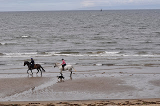
Suitably refreshed I reversed the journey back home. As it is an isolated beach horses are a frequent site as their riders take the opportunity to let them gallop along the waters edge. Frequently, as here, with a dog in tow. 

Nothing remarkable about the walk home but again some stunning views as the weather played its tricks of the light. The view below is from the beach looking across to Troon harbour with the Ailsa Craig in the background. The storm clouds passed over quickly and I'm glad to say none of it dropped on my head.

The foot is now throbbing but another nice day was had.
Time for a beer.