Showing posts with label Glasgow HF club. Show all posts

Sunday, 24 November 2024

It's a long, long walk to.....Carn a' Chlamain

Hill: Carn a’ Chlamain (Hill of the Buzzard or Kite)

Type: Munro

Height: 963m


I was slightly apprehensive about today’s Munro ramble. The main reason being the walk distance, which at 27k, was not far short of my early season outing to the Lairig Ghru, which was a long enough day. But today I was also throwing in a Munro. It is a solitary Munro at the top of Glen Tilt which is up there in my top 10 favourite glens to walk in. A 'plodmeisters' dream as Storer describes it but not mine.

I had this planned as a bike/hike for my summer programme but with my car issues that did not materialise. However, I saw that it was on the programme for one of the Glasgow groups so it was an opportunity to walk with some friends that I had not seen for a bit.

Weather forecast was not great for views at the top but as we gathered at the Bridge of Tilt parking area it was chilly but high clouds, fingers crossed. There were quite a few cars but more were cyclists than walkers although some might have been bike/hikers as I planned.


We opted for the higher outer track which is far more undulating than the hard packed estate vehicle track. We reached the firing range but no action today but there would be shooting tomorrow, it is a long enough walk without having reached this point and having to turn back.

Out of the trees it was mainly a narrow grassy track with the occasional muddy sections but overall good. I love this area of Glen Tilt where the hills start to encroach giving you a hemmed in feeling which is atmospheric. The Beinn a' Ghlo hills dominate your right side.

We rejoined the estate track at the Bridge of Gaur and wandered along towards Forrest Lodge reaching the bridge across from the ruined cottage at Balaneasie. 

At this point you have a choice to go further along and ascend via an ATV track. But we choose to go up the obvious narrow grass track. By this point you have already had a long undulating walk but now it was going to be steep right from this point.

Zig zagging trail got us up quickly before joining the ATV track. Then still more up and up on a stony track.

The scree topped destination can now be seen but still looks like a long hike. From this perspective it looked like a ridge walk but the reality was that it never becomes a narrow ridge.


Instead more up and up’s and my legs were feeling it. I was regretting yesterdays run along the beach to Irvine, too much taken out of my legs I suspect.

The ascent is a section of ramps and really should have been okay but I was feeling the legs tiring more and more in a way I have not for a long time. On the plateau there were excellent views north and I was surprised at how much snow was lying on the tops of the eastern Cairngorms.
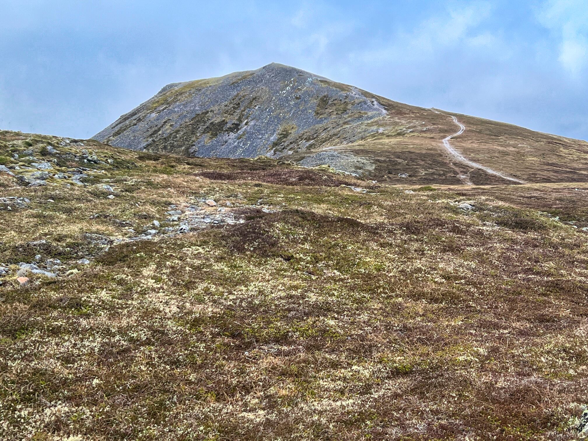
Finally the last ramp which started as a track before being the final awkward crossing of the stony terrain, hard walking, legs aching but the the small cairn was reached. The cairn a lot smaller than it looked when first spotted a few kilometers back.

There were about 4 small groups on the hill today so not total isolation. One couple were overnighting at the bothy, only problem is that they would have to summit this Munro again to get back again.

It was a chilly lunch stop, no snow but a bitter wind.

On the way down we followed the original path back to Balaneasie which was much grassier and a lot kinder on my feet.


Great views of the long walk back alongside the River Tilt. Instead of the high track we kept to the estate road for our return, probably saved us about 30 minutes.

Big disappointment was that this is the middle of the rut but we did not hear a single stag roar. Unlucky or have they been heavily culled in this estate?

It is a long way for a single Munro, save it for a good day.

Ascent: 1069

Distance: 27.1km

Time: 8.35

Wildlife: Buzzard; Raven; Wood Pigeon; Wren; Robin; Red squirrel

Monday, 15 July 2024

Last snow walk of the year.....Beinn Fhionnlaidh

Hill: Beinn Fhionnlaidh (Finlay’s Hill)

Type: Munro

Height: 959m


Still trying to improve my hill fitness so a longer walk for a single Munro was perfect. Finlay's hill. I challenge you to pronounce this as named above then go onto Walkhighlands and listen to how it is spoken, your having a laugh I thought.

When I looked at the forecast yesterday today was looking promising but I woke up to the rain thumping down, got soaked just walking to the car, not what I expected. Also there had been recent heavy snow including last night so what was the hill going to be like?

At the car big decisions, crampons, ice axe, spikes or the lot? Finlay could not be seen from here but just across the way was Beinn Sgulaird, just slightly lower. The snow looked like being from circa 700m. Any new snow should bet wet and soft so only the spikes taken, the bag was heavy enough.


Hill track starts at hump on right

Started the walk from the Glen Crerar car park and followed the Walkhighlands route description. At the start there are enough signs to get you on the hill, the estate obviously don't want walkers wandering about where they do not want them.

Nope the point in distance is not the top

The final ridge

For all the signs it could be easy to miss the cut off onto the hill proper. From here it is a constant climb on a good gradient but on a very rough boggy path. It is a ridge walk without really feeling like one. The lochans were bubbling with mating frogs.

Frog pond and top coming into view

For about 2 hours of the climb the weather was distinctly varied. Dry at the start, light rain, heavy rain. Very loud thunder claps followed by about half an hour of hail and in cloud for the almost all the final 300m.


Another couple on way to the top

The snow level was reached and as predicted it was mostly slush between the rocky landscape but there were also significant sections of knee deep snow. A few sledging style descents later on.


Ben Nevis big lump in distance


A round trig could be spotted sooner than expected and thankfully this was the summit. The weather was now much clearer and the views were magnificent. All the Etive hills, the Glencoe giants, further on the bulk of Ben Nevis and many more, spectacular and worth the long walk in. I would go a long way for views of mountain ridges topped with snow.


Evening light over sea to Mull


The views on the descent were equally superb, nearby Sgulaird and its surrounding hills prominent. Longer distance over the sea to Mull and much more.

The downside was the wet boggy track was a nightmare, full on concentration required to avoid slipping, rather tiring and became a long slog.

Overall it was a worthy outing, excellent views and fitness boosted.

Ascent: 1012m

Distance: 15.7km

Time: 7.56

Wildlife: Red Deer; Skylark; Meadow Pipit; Common Frog.


Friday, 26 May 2023

Not the most exciting Munro.....Meall Ghaordaidh

Hill: Meall Ghaordaidh (Hill of the shoulder)

Type: Munro

Height: 1039m


There is not a lot to say about this unexciting Munro so a brief description and some snaps is your lot.

A grey day but high clouds as we started from the traditional spot at Glen Lochay. Inevitably a cuckoo was calling as we donned boots.

The start goes through a sheep field before climbing a style then onto open moor.

Wander up a track until you find a small cairn where a left turn starts your hill climb.

There is a fair track which goes through some boggy peaty areas but by and large it is much drier than I expected.

Alongside the track there are a few deep holes to catch the unwary and could do a serious injury. At the bottom of one a frog looked up at us.

The walk is described as uncomplicated and that's exactly what it is until the boulders at the final section are reached. The main views to distract from the climb are the Corbett of Cam Chreag and the Tarmachan ridge. To be fair the higher you go more hills can be seen along Glen Dochart and beyond but a plod it is.

The final short steep section does weave between the boulders requiring the odd minor scramble, wow rising heartbeat.

Before long the top is reached, a broad stone shelter encircling the cairn.

Although it is still grey the views are good particularly down into and over Glen Lyon. The nearside Lawers range. The Corbetts and Munros over the other side of Glen Lyon. Closer by the Crianlarich tops plus a few Tyndrum ones and more further afield.

A straightforward return by the same route to finish a straightforward ramble. It was enjoyable enough but cannot see me returning.

Target from the start

Cam Chreag appears

Bracken will explode soon

Final lump in sight

Cam Chreag's long ridge

Getting to short rocky section

Top in sight


Loch Lyon and the Pubil Corbetts

Peak of Stucd an Lochain other side of Glen Lyon

Clouds now starting to cover Lawer & Tarmachan hills

Ascent: 873m

Distance: 10.3km

Time:5.38

Wildlife: Skylark; Raven; Cuckoo; Common Frog;

Monday, 22 May 2023

A very rough walk into the clouds.....Sgorr na Diollaid

 Hill: Sgorr na Diollaid (Peak of the Saddle)

Type: Corbett

Height: 818

I knew from descriptions that this was potentially a pathless boggy ascent right from the start to pretty much the summit. Quite often things are a lot better when you climb them so was it accurate? Absolutely bang on.


Ascend anywhere, we went left for a bit to ascend the ridge on left of snap

We parked up at the small area before the bridge over the River Cannich and then walked left up the road where we found the start of an ATV track that presumably leads to the mast that can just be seen. We left this pretty quickly and manoeuvred our way up the steep ground to get to a point just right of the mast. The ground was a mix of bog, heather and long slabs which aided the ascent.

Ascent to mast with Pt777 rounded lump back centre

Pt777 prominent headed for it then swung right after heather heading for summit area top right

A descent across boggy heather, flanking an obvious wet area before heading up the slopes, trying to stay more with the dry grassy tussocks than the heather but the reality is it is a mix of the two. No paths pick your best section and go for it.

View back down to Loch Mullardoch. Foreground shows the rough terrain

The views of the glen down Loch Mullardoch were excellent with several Munros standing out, the most notable Carn Eighe although tops in cloud.

An example of how deep the hag walking was

Around the 450m the gradient levelled out but still very rough ground. Spotted two herds of red deer. One lot were below us sitting in the heather until they spotted us. The other herd was high up to our left on the ridge of Meallan Odhar and there looked quite a few of them.

Pt777 on left but we are going up via crags on right


From crags looking back at hag terrain about to disappear in cloud at this point

Sadly as we reached around 700m the clouds came down and even though there was no wind it was bitterly cold, more layers put on. More peat hags to meander around and visibility became poor as we reached the more interesting craggy rock formations.

Twin peaks appear

More weaving and ducking up the crags before another peat section. The top is quite spectacular and we knew it was close by but we did not see it until we stumbled upon it, really disappointing.

Approaching from the east to avoid the worst scrambling

Hard grass frost it was very cold

It is twin peaked but the true summit is the easterly one, as it happens the one we reached first. It was so cold the grass was still frosted. A narrow scramble to the very small top and that was it. The other top looked higher but this is an optical illusion as we found when we climbed it. There are meant to be tremendous views looking over the 2nd top to Strathfarrer but I can only take the writers word.

A quick descent and up the 2nd top where, looking back, the 1st top looks much higher from here, odd.

Time to find shelter for lunch.

Walkhighlands has this as a straight up and down but the Corbett book suggests taking in the 3rd top at point 777m. This had been visible as we ascended but of course not now. This is not a long detour but it felt like it as we transferred ourselves across more boggy ground, descending then seeing grey lumps rise out of the gloom knowing these had to be ascended before we got a bearing back to the start.

Old ATV track helped descent from Pt777

Shortly after leaving the top we found a very faint ATV track which made the going a bit easier. There are some serious small bogs dotted around where, when tested, walking poles disappeared in full extension without touching the bottom.

The descent seemed easier than the ascent but it was still rough stuff and I was glad to reach the road. A cuckoo calling in the trees was a welcome sound.

Despite the non existent views up top it was still a good ramble in good company. I doubt I will be back to see those views it was a one off shot.

Ascent: 744m

Distance: 10.3km

Time: 5.46

Wildlife: Red Grouse; Red Deer; Meadow Pipit; Cuckoo (m) calling;