Showing posts with label Tyndrum. Show all posts

Saturday, 10 January 2026

More straightforward than expected.....Ben Lui circuit

Hill: Ben Lui (Calf Hill) (1130m) Beinn a’ Chleibh (Hill of the Creel) (916m)

Type: Munro x2


A month or so back, on a beautiful day, I drove towards Tyndrum and over on our left Ben Lui looked stunning, every bit a pointed Alpine peak. I remarked to the good lady that I was negligent to have not bagged this peak already. I reflected on why this should be as it was on my original 100 list. The main considerations were to do Ben Lui as a solo from Dalrigh or both with the day being potentially stopped in its tracks if the River Lochy was running too high to be safely crossed. The river crossing was the main deterrent.

So onto the new to-do list it went.

A month or so later the opportunity arose and my decision was to do Ben Lui as a solo by bike/hiking from Dalrigh. Everything was packed and prepared for that adventure. Bike attached to the car and all set to go early in the morning.

Then after dinner that evening I watched the weather forecast which had changed from a reasonable day until 3pm, instead being high winds from early doors and rain by 1pm. The Dalrigh route has 4 possible route options with some routes being exposed and some routes with significant scrambling. Despite watching videos I was still not convinced of the best route from Dalrigh in poor conditions so I changed my plan.

The Munro double was now on from the River Lochy side, river allowing.

I made an early start and as I drove north it was clear that the low clouds were unlikely to lift much. I still had the bike attached so if it came to the worst I would just go for a cycle, no hardship in this beautiful countryside.

Approaching the Glen Lochy car park the positive was that the river was running low so one potential obstacle ruled out. However looking upwards Chleibh was clear but Lui was well covered. Decision made, I am here so go for it.


Crossing the river was fairly straightforward apart from testing my balance on the boulders. Crouching low enough to get under the railway bridge was not so easy, my old body not as flexible as it once was.

Just after the river spotted this Scotch Argus hiding in the grass

Over the river the track was narrow and the growth full. After a burn crossing Walkhighlands recommends crossing another burn and going into a new plantation. The trees looked well established and from this side of the burn and I could see no obvious path in the plantation so just continued on the track this easterly side. On this muggy morning it was probably full of nasty beasties after my blood. A good decision as it was boggy in places but straightforward and brought me to the forestry road.


The next track was straight across the forestry road where I was now on the boggy path from hell. Walkhighlands describes it as ‘some sections are very boggy’. Really, almost all of it, for about 30 minutes is one of the worst mud fest I have walked through. At times I was prodding my pole to test the terrain and it was disappearing easily knee high length into the gloop.

It was a major relief to reach the deer fence gate albeit with muddy legs.

Heading up to the cloud doesn't look steep from here, snaps are deceptive! 

I decided to to take the easterly route and make a circuit of it. This was the grassy slog of all slogs, around 600m straight up. The faint track came and went before disappearing altogether. 

The ridge finally appears


Summit clouds were joined by these scudding through, made for a nice snap

Unrelenting grassy slopes were getting tiring, not helped by the clouds coming in and the route ahead becoming a grey vista with the odd big shape looming out of the gloom.

Soon be time to use my hands

Finally I met up with the western ridge track from Dalrigh, but the track did not last too long. It was still a steep ascent. Poles away as a section of light scrambling beckoned good fun. The track occasionally flirts with the edge with glimpses of grey crags but no downward views. After some minor hands on the good news was that the summit of Lui was unexpectedly reached. 

Summit cairn looking back the way I had come

Sadly no views in the clag and with a strong gusty cold wind I did not hang about. A brief chat with a couple of guys before heading back to find the track to Chleibh and lunch at the bealach. 

A brief glimpse of Chleibh & Fionn corrie

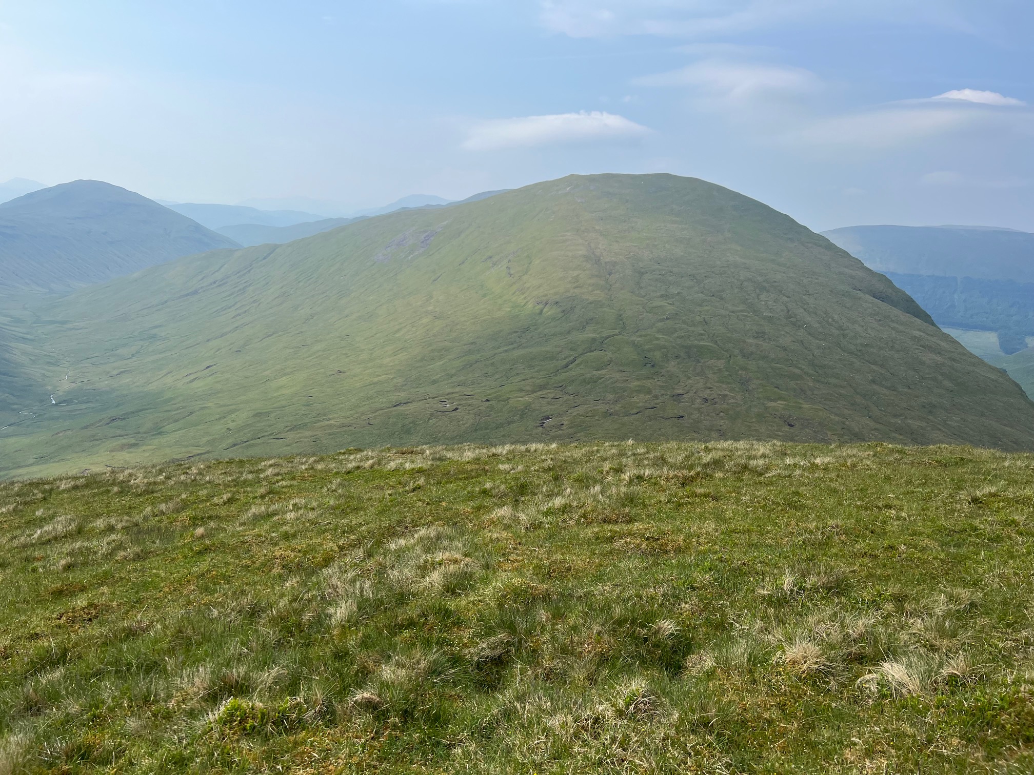
The clouds parted briefly to give a good sighting of the way ahead and as most people have said Chleibh looks an underwhelming Munro from this perspective. Not that I was complaining an easy ascent I was looking forward to, I had done my hard work.

This type of rocky, stony gravel track is not my favourite descent terrain but it does zig zag so not a severe downhill. After around 200 metres of descent I was below the clouds which lifted my mood as I had views again.

No climbing that erratic today


Final track to summit

I had my nutrition break at the track junction, thankfully now out of the wind, before making the final short ascent of my second Munro Beinn a’ Chleibh. Nice to have such a short hike to bag another Munro. 

Cruachan hills & Loch Awe


More passing clouds the rain is due anytime

The 1st cairn is the summit but I wandered along to the 2nd to take in the views, no rush now as my climbing over, time to enjoy the views. There is a 3rd if you fancy and if the rain had not been due soon I would have. Good views down to Loch Awe and across to the Cruachan Hills but not with great detail, still better than nothing.

Lui still under cloud


Back down the corrie to the trees, Ben Nevis can be seen back right

Spotted another walker on my ascent ridge

Back to the bealach where the descent track, initially steep, was a mixture of stone and grass, all with a flow of water, of course it disappeared from time to time.

The only section of gloop with some boards for assistance


Glad to have the odd section of trees

The descent through the gloop section was slightly easier as I could spot better lines and make better use of the trees but as soon as I felt smug another gloop section barrier was reached without an alternative.

Thankfully I reached the forest road and followed my original track back to the river and the parking area. As I approached the river light rain started to fall, good timing. The river was ideal for boot cleaning.

A good but tough ramble. A shorter distance than most double Munros but that was offset by the very steep climb to Lui.

Ascent: 1124m

Distance: 11.6 km

Time: 5.55

Wildlife: Scotch Argus; Golden Ringed Dragonfly; Meadow Pipit; Raven; Robin; Wheatear;

Thursday, 15 June 2023

Ton up as well as the number of clegs killed.....Tyndrum Corbett duo from Auch

Hill: Beinn a’Chaisteil (Hill of the Castle) (886m) & Beinn nam Fuaran (Hill of the Well) (806m)

Type: Corbett x2


I admit that I did not sleep too well last as I doubted the wisdom of this ramble. I booked accommodation at the last minute with a regular B&B I use, Inverardran House, in Crianlarich, as the forecast was for dry weather. It turned out to be not just dry but scorching and it was prolonged, unheard of in Scotland. Last night there were some thunderstorms that caused travel disruption and they were forecast to continue today from midday. Just about the time I would be traversing from Corbett 1 to 2. Would I be drenched, would I be hit by lightning, was I mad, possibility of all 3.

Alarm woke me from my disturbed sleep at 6am but I was determined so up, dressed and en route within 15 minutes. Traffic was light and I made better time than expected, actually 30 minutes too early for the Green Welly restaurant to open, no black pudding and fried egg roll to dry me out. So I went to the snack bar, a total rip off compared to the restaurant and far inferior food, avoid unless you must.

Drove to Auch and ready to go for 8.30, about an hour ahead of where I thought I would be. Just as I started off a call from the good lady. I immediately thought I had left something but nope just a courtesy call, suspicious!

Bulk of Chaisteil dominates with Fuaran peeking out behind


Munro of Beinn Mhanach ahead I turned right and walked below it

On the climb views of Dorain left and Dothaidh right

Levelling out

Top in sight

From top looking back down Glen Lyon

I walked down past Auch farm wondering where the body of the cyclist had been hidden, two drunks will pay a heavy price but not as much as the cyclist.

My route starts with Beinn nam Fuaran which is the furthest away and is a good 90 minutes walk before I even start climbing. It is pleasant enough through the Auch glen with at least 3 river crossings, all fine in today's arid conditions but I can imagine it could be wet feet at other times. The heat was feeling quite oppressive hemmed in here in the glen and again I was questioning my decision making.

The slopes had looked steep and intimidating so it was with some relief that the gradient looked better when I finally left the track and started my ascent. Fools optimism.

From here it is about 400m of ascent which does not sound too bad but it is pathless, very steep, over rough terrain particularly at this time of the year when the grasses and bracken are flourishing. The last 100m is less steep but under that sun it did not feel like it. I met up with the old fence and followed it for the last section to the summit. A strong wind was blowing, great to be cooler but was it the precursor of the weather warning? The haze meant that even nearby hills were not great viewing but it was what it was, I was there. Onwards or not, you know the answer.

Chaisteil ahead from Fuaran

Follow the fence all the way

Looking back from summit to Fuaran

My car is up at the big tree plantation still a way to go

View over Beinn Chaorach and Crianlarich munros beyond

The 2nd Corbett of the day in sight. I knew there was a drop of about 260m but it felt much more and I was once again questioning my sanity for doing both. My knees were feeling the descent and as I dropped it was getting hotter and hotter and the ascent looked more daunting. Looking at the map I had descended

This is bog and peat hag territory but I had studied a line which seemed to avoid the worst of the hags and indeed it did under these dry conditions but still plenty of wet stuff to remind you of what might have been, but it I wont affect me as I do not intend to be back but you never know.

I had descended away from the hill to avoid the crags so it was ‘relief’ to head back towards the hill and start climbing again.

It is only a climb of circa 350m and on a good gradient so it should have been straightforward but turned out to be anything but for a few reasons. It was hot, hot, hot and my 3 litres of water which had seemed excessive weight at the start was going down rapido. The clegs were more numerous than on any walk I can remember, I lost count of how many I killed never mind the ones I swept off my clothing. One did succeed above my elbow and though my top. Throw in a couple of ticks and it was an ascent of constant concentration but not always on the terrain. Finally with 200m to go my legs were gubbed. I was walking in short sections before having to stop. I assume it was the heat along with 2 weeks since walking but I had exercised every day so most likely the heat. After about 15 seconds of rest the cleg attack forced me to move for the next short section.

With immense relief I reached the small cairn and Corbett 100 had been ascended. My reward a water bottle with a dodgy tablet for rehydration and a Turkish Delight bar, smaller than I remembered but the sugar hit was appreciated. Again hazy but good views.

SE towards Chaorach

Descending and looking at the long track walk back in the heat

The hill is far too steep and cragged to descend from the summit so a track heads SE away from where you want to be and does so for quite some time. By now I just wanted to get back to the car. But the rehydration stuff and the sugar had worked so feeling better. When I reached a lochan I decided to just head down the slopes. It was painful as my socks and boots were not cooperating despite being regular companions. The clegs were back on the attack throughout the descent and although I could see the track it never seemed to get closer. Until it did and I was there.

Of course on this hard packed estate track, under the beating sun it was back to hot, hot, too hot.

There are three building projects you pass, a lot of dosh is being spent here.

Hot and bothered the walk is over, the yellow alert has been cancelled and I am in need of a cool shower followed by an even colder beer.

I had not heard any trains on my ramble and at the finish discovered last nights thunderstorms had caused a landslide that had blocked the route, no trains running so tomorrows long looked forward day out not going to happen. Honestly this is Scotland but obviously under climate attack, not just the clegs then.

Memorable ramble mainly because it was the ton up, but it was too hot for enjoyment and as such I was the only idiot on the hills it seemed, if anybody else was there I did not spot them.

Ascent: 992m

Distance: 18.6km

Time: 6.07

Wildlife: Small Heath; Chimney Sweep; Raven; Meadow Pipit; Linnet; Chaffinch; Oystercatcher; Common Frog; Cuckoo; Wheatear;

Sunday, 23 April 2023

Tyndrum Corbett double.....Cam Chreag & Beinn Charoach

Hill: Cam Chreag (884m) & Beinn Charoach (818m)

Type: Corbetts x 2


Today was my first big outing of the year with an assault on a pair of Corbetts that I have had hanging about my To-do list for too long.

After a big brekkie, too big actually, it was car defrosting time after a serious overnight frost. For once I had the luxury of only a 5 minute drive to my starting point, but slowly negotiated the last section as some serious potholes.

This is the start not the one on the other side of the bridge


Beinn Odhar directly ahead with Beinn Charoach on right

This ramble is not a regular route although the map suggests it should be. I headed up the track to the Shielings which should give me a good route to the bealach between the two Corbetts. I had read about meeting coos en route and it did not take long. Their feeder station’s surprise-surprise right beside the track with little room to avoid them. I got the evil eye but no more and was pleased to get that out of the way, the hardest part of the walk which would have to be repeated later.

The ridge of Cam Chreag appears far away

You can see the lines marking out the crofts

As I headed towards the shielings I noticed the fences on the hillside marking out the individual plots for each crofter. I am used to seeing these further north but not down here. The ground certainly looked like hard work required to get any reward.

Took the right fork at the shielings and the estate track up Glen Clachain took me a long way in towards the new plantation at a good gradient. The hard packed estate track now changed into the expected boggy mess. I am no expert but not too many of these trees looked like they were alive. The bulk of Ben Challum loomed over me on my right. I well remember that boggy walk.

Getting close

Cam Chreag ridge but you don't see the top until you are on it

This was a long walk in and slightly disheartening to be turning away from the target as I headed for the bealach. After existing the deer fenced tree plantation I decided to leave the faint atv track and head across the very rough ground to get to the bealach. Motivation higher as I was now heading towards my target.

Found track and broken fence

Onto the peat hagged bealach I was surprised, but pleased, to find a thin worn track. Certainly better than what I had been on before.

Precariously balanced rock

Foreground the 2 Corbetts from Auch with Orchy Munros behind


Charoch's humpack in foreground Beinn Odhar on right

Now the final stages of the climb to Cam Creag. Initially the track followed the broken fence line until it deviated leftwards but I want to go right. No track for the final assault to the top. Rough ground to be picked through and finally I was there. For the highest of the two Corbetts there was no marker of note. Never mind, the views made up for the tiredness in my legs, that had been a slog. Looking around I counted over twenty Munros and plenty of other hills, quite superb.

Track heads for the hags then find the fence

Heading down I had a boulder in mind as my marker and for once I picked the right one. Just after it I found the broken fence line back to the bealach. The descent was more tricky as icy ground kept trying to get me to heel slip.

Found the fence top on left
Back to the peat hags and from here I could see a faint track heading up the slopes of the 2nd Corbett, Beinn Chaoroch. This was now just a long grassy plod. Reminded me of going up Shalloch on Minnoch but much drier. Further up some significant ice on the atv track but thereafter it was back to following the broken fence to the summit. 
Left to Right. Dubhcraig, Oss, Lui and Chuirn (the gold mountain)

Beinn Challuim

The summit of Cam Chreag shows up from here

Despite being significantly lower this had a trig and equally impressive views in all directions, counted 20+ Munros that I could identify.

Descent with Crianlarich Munros as backdrop

Legs getting sore glad to get off this descent

Looking back to the descent

There was a worn track beside the broken fence so I followed it until it disappeared. Thereafter it was a case of heading down the steep grassy slopes aiming for the shielings track which I could see from a long way off. This was a much longer descent than I expected and if I was only doing the one Corbett I would not be ascending this way. My knees were complaining so I was very pleased to get off the hillside.

Back same way to the coos. Two of them were sitting happily but as I neared up they rose along with my heartbeat. But again the evil eye was the only thing.

Back at the car and quicker than I expected. The couple of reports I had read suggested 6.5 to 7.5 hours. Now I know why I was feeling knackered, pushed too hard. Time for a shower and siesta, not sure in which order. Silence is golden once again. Just the noises of nature and nothing else.

Ascent: 972m

Distance: 15.8km

Time: 5.07

Wildlife: Buzzard; Field Vole; Raven