Sunday 3 November 2024

The Scrape

Hill: The Scrape

Type: New Donald

Height: 719m


The forecast suggested a mostly dry day, blue skies but strong and cold northerly winds. Well I can get layered for the cold so a dry day was to good to miss.

I decided to pick off another New Donald and my nearest one left was The Scrape. I have fond memories of the Drumelzier round so this was no hardship to return. The last time I was here I was in company so would probably not have made the detour to The Scrape anyway.

It was a pleasant drive taking in the autumn colours and before I knew it I was at the small parking area where there were already 2 cars and a van. If one of the cars had parked up closer to the others it would have avoided a many point turn and tight parking but got there. No room for any other cars if anyone else turns up.

This area is reputed to be the burial place of Merlin, the Arthurian sorcerer. Buried on the banks of the River Tweed according to ‘Vita Merlini Sylvestris’ a medieval manuscript held at the British Museum. 

Lovely colours from the start

Walkhighlands suggests taking the track behind the cottage but I remember from my previous visit it did not end well so I stuck to the main track. I was higher above the suggested route and could see that it had disappeared in a bracken jungle, seem to remember that from before, a good choice made.

The track is soft grass for about the 1st third, very nice indeed. As was the scenery even in this harsh low light, should be a lot better on the descent. Through the trees and it was noticeable how prominent Robins have become recently.

Spot the track

I followed the track to Pykestone from where I would head for its subsidiary top. I was surprised at how high the bracken still was, glad that there was a track winding its way through it or it would have been left for another day. It was much warmer than forecast so it was jacket off all the way to the top.

After the soft grass the track is now more awkward, loose stones, laid to help the grouse shooters ATV’s get traction to power up the hill no doubt.

Middle Hill (left), Dollar Law (centre) and Drumelzier (right)

Still, it was a kind walking gradient but from here the tops still seems far away. When the track eases off it becomes more peaty and grassy. The terrain is now full on heather which would be awkward walking. Sprung about half a dozen red grouse, not many for the size of this heather moor.

On left 1st view of The Scrape


Views opening up Broughton Hills foreground, Pentlands behind

When I spotted The Scrape I considered going off route and cutting the corner earlier but chose to continue with the path up to the fence near Pykestone Hill, no rush and no accidents please.

The Scrape

From the stone cairn I could see The Scrape clearly and it was just a case of following a faint track alongside the fence all the way. Looking from above at the bottom section I just knew it would be wet and boggy. 

Looking back to Pykestone

Indeed it was, but only for a short section and 10 minutes later I was on the summit of The Scrape, at a fence crossroads, marked by about a dozen stones, better than some others I could name. It was now a very cold wind, particularly when the sun disappeared, but at least the wind was not the howling gale predicted.


Looking back ascent route

Always a fence

Layered up again before taking in the views which are very good. Looking east the Broughton hills in the foreground and beyond The Pentlands so clear. Behind me the other Donalds of Middle Hill, Drumelzier and Dollar Law.

Back towards my descent the Culter Fell range looked very enticing indeed.

Patchwork grouse moor. Culter hills left and Tinto right.

Too cold for food up top step so I retraced my steps until I found a boulder to sit on, in the sunshine, lapping up the views.

Full zoom to the Larsen trap

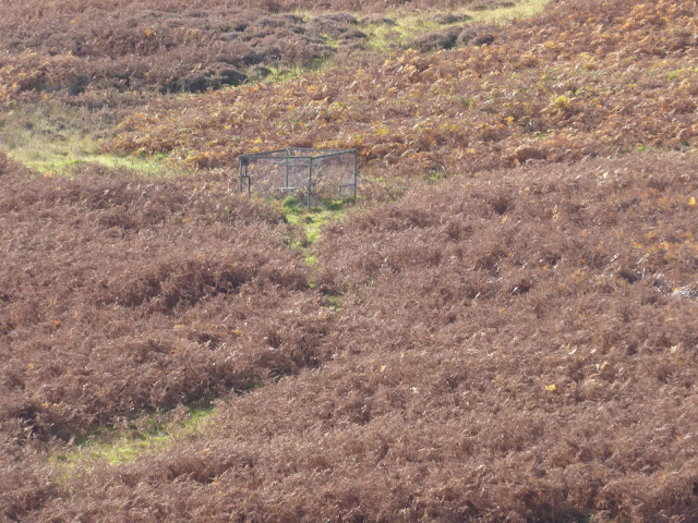
On the descent I spotted another Larsen trap, as usual well off the walking track. Looking through the binoculars this looked to be in good condition but nothing could be seen inside it. But yet again no corvids or raptors seen today!


Jacket back off I enjoyed the descent in the slight warmth from the sun but visually warmed by the stunning autumn landscape, indeed a great time of the year to be outdoors.

Another successful ramble on a glorious day. The extra time from Pykestone to The Scrape and back added less than 40 minutes.

Ascent: 620m

Distance: 12.1km

Time: 3.32

Wildlife: Red Grouse; Goldcrest; Meadow Pipit; Great Tit; Chaffinch; Robin

Straightforward hill with outstanding views.....Beinn na Lap

Hill: Beinn na Lap (Dappled Hill)

Type: Munro

Height: 935m


Today brought beautiful clear blue skies and unseasonably warm temperatures for this time of the year. This resulted in a last minute decision to ascend this Munro which I missed out on when doing my 100. Now it was on my ‘too good to have missed out’ list. As it turned out this was the 4th time I had planned to do this this year. I knew there were superb views so I was being fussy and the 1st two allotted dates were abandoned due to the poor weather forecast. The third time was just last month and another last minute good weather day but I was caught up in a road crash and missed the train by literally 1 minute, lots of bad language that day. There is no road access so it is either the train or a walk/bike hike in.

Today all was going well until I rounded Loch Lomond until all traffic on the ahead came to a halt. I then clocked that I had not noticed any traffic going south for some time, oh dear. As it turned out it was a very large vehicle that everyone was stopping for, no scraped paintwork thanks.

When I arrived at Crianlarich station I was early and it was already warm. The train was on time, all was good. A busy train but a scenic trip, what could be seen out of filthy windows, come on Scotrail this is a major tourist route.

Reached Corrour Station and as I had plenty of time I headed to the cafe for a brekkie roll and coffee, Nope too late for brekkie roll, lunch menu only. Really, how many customers are here that menus can be so time prescriptive. Even then they could have started the lunch menu 20 minutes after this train as not another one for a few hours.

Beinn na Lap on left


Off along the trail I went, munching my trail food of nuts and dried fruit, healthier I suppose but it's not the same. The hill and the ridge running high above Loch Ossian, which was a picturesque view in its own right, stunning blue water.

I had already removed any outer layers before I reached the point to depart the estate track and head up the boggy grassy track. It was warm.

Boggy trail clear to see

The trek up to the ridge at Ceann Caol was just a good gradient slog. The track was boggy but not as bad as I feared so just kept following the drier sections zig zagging all the way. A few stops to wipe away the sweat from my eyes were also good opportunities to take in the views. I had plenty of time but there is only so slow I can go. One has a natural walking hill rhythm so better sticking to it.


Pointed peak of Schiehallion

At Ceann Caol the track took a right turn and became a gentler gradient as it headed NE towards the summit. The ground became rockier underfoot but nothing to cause concern. The views were increasingly spectacular.

There were a few small directional cairns dotted around, not always helpful. I spotted a circular cairn in the distance, this was it but no, it was a shelter and a good viewpoint but looking around clearly not the top.

Across stonier ground I walked around a small lochan, the main sheltered circular cairn and summit was now just ahead.

Panorama from summit from Bridge of Orchy Munros on left through to Glenco ones on right

Grey Corries

Zoomed in to the back of Ben Nevis a view most walkers don't see

Truly on a day like this this it was a 360deg viewpoint like no other. Despite the warm weather the air quality was a clear air and all that held you back was your own eyesight, quite magnificent. I cannot remember if I have ever seen so many high tops at a viewpoint before. The bulky rear end of Ben Nevis looked odd, totally different from its normal Fort William view, as it is a perspective not seen by many. 

For the very fit with other transport arrangements this Munro can be linked to the Fersit Munros but that was definitely not on my agenda.

On descent the Corbett Leum Uilleum dominates

The descent was intended to be via retracing the ascent route. But I was following a faint track through the stony ground where I spotted a cairn and headed for it. I assumed it was the ascent cairn but it just didn't feel right. Took a bit of time to check where I was then I realised I was off my ascent track. Some rough ground was crossed before I reached the upward track. I don't know if it marked an old route but it proved a reminder that not all cairns are helpful.

On the muddy track it was a slow descent with plenty of time to take in the views of this truly wild landscape.

Having missed out on my brekkie roll a cold beer (or two) and a saddle of venison sandwich finished the ramble perfectly. What a stunning day, a short Munro but one to remember fondly.

Ascent: 577m

Distance: 10.2km

Time: 4.25

Wildlife: Meadow Pipit; Peacock butterfly; Gold ringed dragonfly