Showing posts with label Three Lochs Way. Show all posts

Monday, 27 December 2021

Three Lochs Way.....Tarbet - Inveruglas

Long Distance Walk: Three Lochs Way

Section: Tarbet - Inveruglas

The weather had been so horrible and changeable that todays outing was actually Plan D. I was concerned about river/burn crossings so ruled out my 3 hill options. No hardship as completion of this section and therefore the Long Distance Trail was on my Winter to-do list anyway.

Tourists getting on boats at Loch Lomond, Ben Lomond behind
It is the shortest section of the route so I decided to do an out and back the same way ramble from Loch Lomond.


Instead of 3 Glens it could be called Follow the Pylons Way

I was surprised and the steepness of the ups and downs, quite a roller coaster at times. It certainly got the heart rate up quickly.

High point  above Arrochar still misty over Loch Long

Stunning colour of the dying bracken

A Chrois
On the outer leg the mist and low clouds were a main feature but quite atmospheric even though it hid the big hills. On the way back it lifted enough to give better views. 

Mist clinging to Ben Vane

Zoomed

Ben Vorlich
Although it is a good track the recent heavy rains had turned it into a boggy wet affair. 

Cobbler starting to show itself

Loch Long without the mist
As it turned out there was no more rain today so a good outing that would be nice to do again on a crisp Winter day with hard ground and blue skies. 

Ascent: 563m

Distance: 16.6km

Time: 3.58

Wildlife: Hooded Crow; Jay; Raven; Dunnock' Blackbird; Chaffinch: Robin; Coal Tit;


Three Lochs Way.....Garelochhead - Tarbet

Walk: Three Lochs Way

Section: Garelochhead - Tarbet

After yesterday's roaring stags at Loch Doon this was meant to be much more sedate but it did not turn out quite that way. I had been saving this for a winter ramble but I needed to get out and this was not the day for high level unless you like to be in the clouds with no views. I had completed the 1st two sections so long overdue finishing it.

Logistically I decided the best way to tackle this was to leave the car at Tarbet, get the train to Garelochhead and walk the route back. Sound plan.

There are only about 4 trains a day so don't miss your connection and thankfully I didn't. Lol not like Scotrail it was late! Tarbet is a pretty and well kept little station.

Garelochhead is the total opposite. A building surrounded by stone chips. no wheelchair access here. Plus nae people this felt spooky lol. Even more so as I never saw a person in Garelochhead. The last time (also my first) was similar, it is an odd place.

Even the signs hide away

Not to be put off I followed a rising track to the A817 where after crossing it got a little trickier. Firstly boggy woods, then a track through thankfully dying ferns before the track itself also died. A crumbling dyke at least went directly up even if the path didn't. Various offshoot tracks headed into bracken/heather no thanks, struggle on this way.

Finally on top, I followed the fence near the Military Road and I had a bad feeling. Some military vehicles went past, soldiers giving me the evil glare but I was not on MOD property yet. 


When I climbed the barbed wire fence my worst fears were realised. Red flags flying with signs confirming no access to the Danger Zone as live firing taking place. It is advised to phone ahead but the chances of live firing are slim. Numpty. The dilemma was no buses to Tarbet from here. Zombie Garelochhead for 4 hours before another train, not option number 1.

So, I decided to brazen it and keep going and play the dafty if/when the military police zoomed up got aggressive before throwing me in the clink. I kept walking and looking out for soldiers on the moors. It is a winding road in all aspects and after about 15mins I could hear gunfire. More deliberation and on I went but the noise was getting louder and even to the layman there were some heavy duty guns firing. But it was off to my left hopefully the road ok? 

A noise then a military truck appeared coming towards me, game over. I stood aside and the driver waved as he drove past, bizarre as machine guns blasted away nearby, very weird.

The red flags were everywhere so how glad was I to reach the trees which I assumed was the end of the range, thankfully it seemed to be.

Lots of new budding Rhododendrum I thought they were a spring plant?
Relaxed and walked the track. This is a real up and downer through the woods plenty of ascent/descent on this walk and it was to get much higher roller coaster walking.

I wonder if the army blew it up
I reached the point where the 1st bridge should have been, it has gone. Instead today an easy burn crossing which could be much more awkward in other conditions. 


Looking back into Glen Douglas and from where I came 
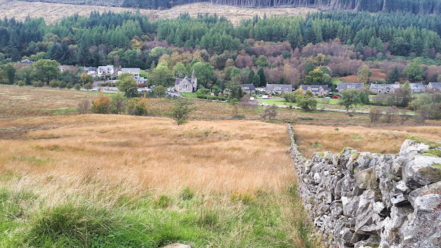
The middle section is thankfully off road through a new plantation. A track leads off to Luss!! The higher Luss hills of Beinn a'Mhanich, Cruach an-t Sidein and Doune Hill kept me company on my right. The stags were now roaring on the section between Doune Hill and Glen Douglas. I had the mini binoculars with me but sadly could not spot them. 

The route does stay with the pylons all the way

Crossed the Glen Douglas road and back on hardpack. Here the real steep up and down stuff began. Wow I was gaining quite a few ascent metres today and the calves were feeling it.


The upside of this section was the views of Loch Long and the Arrochar hills, albeit the drizzle had arrived but this did provide some nice rainbows. Constantly changing light showing off Scotland at its best. The downside was the construction vehicles had made the track a quagmire in many places.

Arrochar
The Ardgartan hotel came into view then the Succoth bend and finally Arrochar itself. It was nice looking down on a section of road that I have driven many times.

The track now descends to the waterfall and you have an option to go straight to Arrochar but my route is the continuation along to Tarbet. 

No more ups and downs and I was glad to look over the village to where my car was parked, ramble almost over. At the finish there are also good views over to Ben Lomond and yet another rainbow.

I knew that this section would be the longest of the route along with the most ascent but in its favour it also had the better views. That did indeed prove to be the case.

Ascent: 615m

Distance: 19.5m

Time: 4.25

Wildlife: Hooded Crow; Rook; Buzzard; Long Tailed Tit; Coal Tit; Wood Pigeon; Stags roaring;

Monday, 8 January 2018

Blood shed on Ben Bowie

Ben Bowie (some maps have it as Ben Bouie) 314m
Sub2000/Marilyn
Another fantastic winters day with clear blue skies forecast so an opportunity not to be missed. The good lady came along so it had to be scenic and straightforward.
We headed to Balloch, temperature -6.5, a very cold start. The walk took in part of the 3 Lochs trail which I completed with a group a few months ago but we excluded Ben Bowie that day, so that was our objective.
Open moorland the coffin trail
From the Lomond Shores follow the marked sign taking the footbridge over the A82 then straight uphill via the road before it breaks out into open landscape. The views across Loch Lomond are already starting to open up.
The coffin stone, ignore my shadow
Followed the old coffin road until we reached the fence and the coffin stone, resting place for the coffin and spend a few minutes soaking in the views, the loch and snow covered hills, superb. 
The tree climb
Then we followed the deforested landscape trail until the short climb through the woods. Ben Bowie can be seen from here but a short detour first.
Ben Bowie ahead
Up to Gouk Hill viewpoint and a surprise for the good lady, the fir tree with all its Xmas decorations. I believe local children do this good work. The last time I was here rain spoiled the view but no such barriers today. Fantastic view of the Luss hills, Ben Lomond, Loch Lomond and much, much more. Scenery to die for, quite a view.
Gouk Hill Xmas tree
To get to Bowie Hill I followed the John Muir trail for about a quarter of a mile. Where I expected the forest trail to be is now a deforested zone and very unappealing walking. So back up the track to the fence line. Previous reports on Walkhighlands have this as a bog but thankfully the severe cold has made the walking relatively easy. 
The fence trail, the deer were crossing the gap between the trees from our left to right
I picked a spot to climb the barbed wire fence and then clambered up the heather slopes to the high point. Checked GPS reading but another point looked possibly higher so tramped across to it to find GPS reading said it was 2 metres lower, just my eyes. Not sure why some stones lying about. Mrs B hung about at the fence, no barbed wire climbing for her.
View from the 2 metres lower top
Back over again and a trail was found taking me back to the fence about 50 metres down from where I crossed and guess what, barbed wire covered over an easy crossing.
Now the fun began, we spotted a pair of roe deer down below on our track. One jumped the fence, the other ran up and down the side of it, not prepared to jump. It had spotted us descending and then jumped the fence but got tangled. It was thrashing away so we hurried down. Its right hoof had somehow twisted the barbed wire around it really tight. It looked at us with its big sad eyes but calmed down and we managed to get walking pole tips wedged in enough to raise just enough space to free it. I had my hand on the hoof to push as well. However, when freed, the tension in the barbed wire sprung back and took its frustration out on my hand, multiple barb cuts and lots of blood as Bambi looked back at us before entering the trees. No camera snaps of the deer as it did not feel right clicking on a trapped and distressed animal, it’s rescue came first.
First aid kit finally in use from bottom of rucksack and then the walk back to Balloch without incident.
Deforestation viewed through some of the remaining trees
So another hill climbed on a beautiful day with a memory I will never forget. Take care, Bambi.

Time: 3hr 46min.
Ascent: 484
Distance: 14.53

Saturday, 18 November 2017

Three Lochs Way Helensburgh - Garelochhead

A change of plans gave me the opportunity to continue the Three Lochs Way sooner than expected. I knew that this section would be the most straightforward with more tarmac walking than I would like but the views actually more than made up for it. 
Car park start
I followed the route guide, albeit starting from the waterfront, which added .7 of a mile, following the rising gradient up Sinclair Street, reaching Helensburgh Upper Station, a quick left then right onto Upper Colquhoun Street straight uphill to the car park. Then go left onto a path signed for Rhu Marina and Glen Fruin.
A pleasant woodland walk crossing several bouncy railway sleeper footbridges, think some might need replacing soon.
1st Junction
After about 2/3rds of a mile a junction is reached, turn right onto a footpath signed for Garelochhead. The slightly muddy path continues uphill along the edge of the woods. 
Track to moor
At the top go through the gate and the track crosses moorland. Plenty of fresh cow pats and yes when I broached a top there they were just ahead. One by one their heads lifted to stare at me. No option, no going back, walk on through, make no eye contact, survived.
The views of the lower Luss hills are a treat to the eye, then a second gate is reached, the path goes over the Fruin Water to the minor road left through Glen Fruin.
Glen Fruin
This is now road and tarmac for most of the remaining walk, not so good for walking boots. You cannot get lost.
Today, the walk through the glen was an autumn feast of colour, tranquil for a while, just a few cyclists and one car. Then the guns were booming once again, reverberating around the hills and glen, pheasants turn be slaughtered this week. 
Glen Fruin 2
I am sure that is The Brack in the distance disappearing in a weather front, What, no rain today!! On with rain trousers just in time. As I walked on the light was constantly changing with the colours on The Strone light and dark. 
Strone House Peacocks
A loud calling beckoned and then Strone House along with its peacocks came before me. Warning signs ‘Army about‘.
The road climbs with super views around and back down the glen and a bit of history that I was unfamiliar with. A monument and seat on the right commemorate the Battle of Glen Fruin, where the MacGregors defeated the Colquhouns in 1603. 
Battle memorial
Reading the board and looking around the hills; The Strone; Chaorach & Tharsuinn, most in the sun brought it all to life.
Don’t take the MOD road beside the monument instead twist and turn uphill, the road soon levels out. 
Yankee Road
Now go right onto a tarred lane known as the Yankee Road ( American Rd on the signs, political correctness) - built by the American army in World War II. Immediately it forks; keep on the main tarred left branch, soon reaching the main A817 road. 
Good views northwards and now below to your left Faslane can be seen but no subs around.
I walked along the military road until the signpost for the route that takes me down to Garelochhead, this is on your left. 
There is a barbed wire fence here!!
Crossing the barbed wire fence was a bit of an effort. The wooded covered area swings alarmingly and not safe without someone to hold it, so I needed to use the wooden slat which was very slippy, fun!!.
Boggy track to Garelochead
Now this downhill section was without a doubt the muddiest, boggiest section of the walk, all the way down to the road. Just follow the gloopy path along the edge of the plantation, down a wall, avoiding your feet disappearing in the mud, through some woods then the road is reached. 
I crossed the road and followed the path into town and had only a 20 minute wait until a bus back to Helensburgh.
A good day. Mainly bright, blue skies, high wind chill and the odd shower. Hopefully complete the Way before the yearend.

Time: 3 hours 21m
Distance: 10.01mls (16.11km)
Ascent: 992ft (302m)


Tuesday, 14 November 2017

Three Lochs Way Balloch - Helensburgh

Formal sign for the way
A more sedate outing today with the good folks of KOIR, walking the first leg of the Three Lochs Way from Balloch to Helensburgh.
Parking at the car park opposite the railway station the first challenge for a few was to operate the automatic toilet at the tourist information. Sadly, not all successfully managed this so first stop in the woods!!
Such a mild day compared to yesterday's freezing wind but not the blue skies forecast.
Nice view to start the walk
On our way now pass the Lomond Shores shops, giving good views over the loch, and proper toilets for those in the know, woodlands saved.
A few twists and turns then over the footbridge and head up the steep road, watch out as quite a few cars on this stretch.
Watch out for cars
When the road ends the moor starts but just keep going following the clear track. When you reach the gate, on your right is the coffin stone, really just a big buried boulder but let your imagination go and think of the days past, manually carrying a coffin through this pass.
Ben Lomond
It is a good resting place as there are great views from here across the typical moorland terrain, of the loch, Ben Lomond, Conic hill and the Campsies.
Moor, Loch & Hills
A short but sharp climb through the trees brings you out at a small green water hole and continue on to the sign taking you up to a viewpoint. 
The only climb
Sadly rain showers diluted the views but some bedraggled fir trees with some Xmas decorations caused interest and speculation, is this the remains of last year or the start of this year? Feel free to post a reply if you know.
Xmas tree?
There is the option of taking in a sub 2000, Ben Bowie, looks a short but rough moorland ascent but not for us today.
Soon the track splits so take the left hand fork up to a gate which then gives a gentle descent towards Helensburgh. The views of the Firth of Clyde are excellent even on this grey day.
Firth of Clyde
Civilisation is soon reached, go past the school and then reach the main road. Go right and a lengthy road walk finally brings you to the railway station and the end of the section 1 walking. The most impressive building being this old school, I like the separate entrances for boys and girls.
Parish school
For us there is the excitement of two train rides (£1 with concession card, a bargain) to get us back to Balloch.
An enjoyable walk with plenty of laughs as always, very good company.

Time: 3hrs 50
Ascent: 1077ft (328m)
Distance: 8.27m (13.31km)