Monday, 30 June 2014

A Grey day on the Merrick

For today's bit of sweat & toil the chosen hill was the Merrick in the Galloway forest park. This was my 4th visit to the hill but I had not walked it for at least 10 years. I knew from previous experiences that the views can be quite wonderful from the summit and I looked forward to my return trip. However, today turned out to be a cloudy, slightly drizzly day and the views were almost non existent. So I apologise for the lack of nice photos.
The Merrick is a Corbett and is 843 metres high, it is the highest hill in the Southern Uplands. The Merrick sits as part of the western range of hills, Corserine and its hills form the eastern side.
Early trail through ferns
The walk starts in Glen Trool. Depending on how strenuous you want the day to be you can park in the 1st car park as soon as you come over the hump backed bridge over the Water of Trool. We were lazy and drove on to the upper carpark at Bruce's stone.
There were already 4 cars parked and at least one looked as if it could have been there overnight. As soon as we got out of the car the midges attacked and Skin so Soft was being sprayed on all exposed parts. How quickly they get in your ears. To be fair the SSS seemed to work fast. Still, we did not linger and off up the track we went.
The initial stages are over a clear but very stoney track with large boulders at every step. The going was damp so care was taken not to slip on these. The ferns encroach very close to the path and these were wet with the morning moisture so clothes were getting a bit damp. There is a nice cascading little burn, the Buchan Burn, alongside this stretch where you can take some good snaps.
Looking back through glen towards Curlywee
The path now becomes more of a forest walk. There are full forestry operations going on at present, where are they not, so just take a little care around these workings. We stopped to watch one of the machines strip a tree then cut it into the required sections in seconds. An impressive and no doubt costly bit of kit. We crossed the clearing to the Culsharg bothy before starting the last forestry section. Memories came back of this being my least favourite part of the walk, head down and just grind it out. 
Not too long and we are out of the woods into clear ground. Sadly when looking up the hills were covered in cloud and we couldn't see the top of Benyellary (719m), the 1st summit you reach and normally a good place to pause and take in the scenery. The wind was blowing hard and the hope was that it might blow off!!
Out of the mist we spotted a single walker descending. He had spent the night on the Merrick summit, tent set up behind a wall. He said it had been raining and windy for most of the night but nevertheless said he enjoyed it and he told us that it was a rare occasion to have the wind and rain when he camped out, mmm!!
Partner disappearing into cloud

Upwards we went, the cloud descended and it was not the nicest of days. Another couple appeared out of the mist. They had decided against going to the summit and were backtracking. Something in my head said they were probably wise but on we went. This stretch can be a bit of a slog under normal conditions but at least then you can stop and take in the views.
We reached the flat ground of the Neive of the Spit, this area is full of brilliant place names, which was slightly boggy but ok walking. The wind was now teasing us big style. The clouds would open up for about 10 seconds, giving us that tantalising glimpse of the views we so much wanted to see. What a tease as the clouds quickly enveloped us again. The temperature felt like an early spring day and we are almost into July. I refused to put on the gloves in my rucksack despite the temptation.
Clouds part briefly to give a view eastwards

On the Neive of the Spit

Upwards we continued and soon reached the summit. It took us 1 hour 50 minutes, far from a record time but not too bad. A couple of photos at the trig were taken but it was too cold to hang about and take the risk of waiting for it to clear.
Hanging on to the trig and the dog

We had considered descending over the Merrick's eastern flank down to Loch Enoch but with weather we simply retraced our steps. We came out of the clouds around the same spot we entered them and saw a party of half a dozen women at the deer fence going downhill. We assumed they had turned back with the weather and they confirmed that when we met up with them later. It was nice to get some views again albeit not the clearest of views.
Back to the carpark and a look at Bruce's stone and the views of Loch Trool. We talked to an American couple doing the tour of Scotland but the midges were once again on the attack. I guess the SSS had worn off.
Off the short drive to the House o Hill pub for a well earned beer. As we drove home guess what, yes, the clouds cleared and both summits were visible.
I enjoyed the walk but disappointed about the views but that's walking in Scotland for you. I will be back next year but will pick my visibility forecast better.
Looking West on the descent

Tuesday, 6 May 2014

Victory to the Tummel salmon but Harelaw fishery what a broonie

The fishing season has started pretty well for me. The downside has been two visits to the Tummel for the salmon. On the 1st occasion I fished the Pitlochry Angling club beat at the dam. The weather was poor, the river too high and fit only for spinning. In the afternoon I had a fish on for about 15 minutes before it inexplicably slipped the hook and back to safety. The take was a non affair, I thought I had actually just snagged on the bottom until suddenly the reel was spinning as fast as it could go as the salmon headed downstream back towards Dunkeld. I even got a friction burn on my hand trying to slow it down. Still good to get the heart rate up. The heavy rain continued overnight which washed out my visit to Upper Farleyer as the Tay had burst its banks and was too dangerous to go near. Bummer as I lost my money without fishing, aide memoire, do not book via Fishpal!!!
My 2nd visit to the Tummel saw me fish West Haugh. Catches had been low all over the river this week and it was not helped by the very low level of the water. Turns out they had shut off the flow from Faskally to do some repair work to the dam and the the fish ladder. During the day I saw half a dozen salmon move but no takers until near the end of the session, I was now thinking beer rather than salmon. I spotted some movement going through the fast water at the Sawmill beat and decided to try my luck. I was on the wrong bank to fly fish so resorted to spinning. After 5 minutes a new lure snagged on the bottom due to the lowish water and had to be cut, there goes another tenner after a just a few casts, the 3rd lost lure that day. I changed to a Payo lure which is a lure that swims closer to the surface so hopefully avoid the rocks below. After a few casts, bang what a hit, the line tightened, rod up and immediately a big dark salmon surged out of the river. No fresh run bar of silver this one but a salmon that had been in the water for a while. It aimed for the sky, twisted and plunged back into the water. Immediately the line went slack and the salmon was off the hook and had won again, but at least I got close. As both fish were going to be returned anyway no harm done but it would have been nice to get the photo.
Apart from that it has been a good trout season capped with a cracking visit to Harelaw Fishery last week. Once again it was a cold breezy day with a good chop to the water. The morning came and went without any of the 5 of us touching a fish. We stopped for lunch in the boat and thankfully started to see fish move. I decided dry flies were the way forward this afternoon. A standard dark dry hackled fly up top with an olive F midge and a black F midge on the droppers. After a short time a rainbow tried to drown the top fly. Soon after the gape appeared to the stationery top fly with a huge roll and tight lines. I saw the belly colour and thought of a good brownie. Down it went and stayed for a few minutes reinforcing my view of a brownie. After a good tussle it was landed and I was delighted, easily the best brown trout of my short fishing career. We didn't have a big enough weigh net but our conservative estimate is around 5lbs but possibly more, you can have your own view. It was returned safely to grow even bigger.
My best broonie ever
The rest of the afternoon went well with 2 blues and a rainbow landed. 2 more rainbows and 1 blue lost. All  of these to either of the F Fly midges. My boating partner had blanked all day until I gave him a black midge F Fly. After 10 minutes he hooked and landed his only fish of the day. The F Fly midge has worked very well for me this year, long may it continue.
Harelaw broonie
 

Friday, 18 April 2014

Beinn Dubh and the Luss horseshoe

We finally get a couple of days of high pressure, yahoo, golf at Seafield yesterday and a good walk today.
Loch Lomond from Beinn Dubh, Luss to the right
We opted to ease the legs in with a reasonably gentle but scenic walk. The views on this walk are well worth the effort. The walk starts at the village of Luss on the banks of Loch Lomond. You can park in the main Luss carpark and walk over the footbridge but at this time of the year they like to take money off you for that privilege, so being tight fisted Scots we parked at the start of the road that takes you through Glen Mollochan.
The forecast was good, the sky fairly blue but clouds were scudding over so the 1st decision was whether to carry all the gear or not. But, this is Scotland, so extra clothing was carried in the rucksack just in case.
Immediately there is a marked stile and you are straight into the ascent of Beinn Dubh. After 10 minutes the sweat was already breaking out so my light jacket was off and into the rucksack. This is sheep country and also lambing season and we had a dog with us so its lead was on for a good bit of the day. As it turned out I saw less sheep than expected and no lambs, maybe they were all elsewhere. The climb is constant from the off and fairly wet and boggy underfoot. Its always worth looking back as the views of Loch Lomond and the village of Luss are superb and get better as you climb. The sun was not in our favour for good photographs but still worth looking at. Also the additional benefit, it allowed us to get the breathing regulated again.
With my walking partners English Pointer 'Hudson'
Skylarks kept us company, rising regularly out of the heather, climbing high into the sky, to hover and sing beautifully before descending. Apart from an acrobatic raven that was about it for the birdlife on the ascent. 
The clouds had gathered and the wind-chill was significant so back on with the jackets and even gloves, yip it was cold. After about an hour and 20 minutes we reached the summit of Beinn Dubh, 641 metres of climbing. 
The summit Beinn Dubh
A touch slower than normal but it is early season. There are good views of Ben Lomond but today its summit kept its cloud covering.
If you want a shorter day you can simply retrace your steps and go back down to Luss. You will save about 3 miles or so but miss out on some great views. Although chilly it was a nice day for walking so we continued to do the horseshoe ridge. The walk takes you around the top of Glen Striddle although you don't really see into the glen until you start your descent.
Although you are on the top of the ridge the ground is still boggy in places with your feet frequently going into the marshy ground up-to your ankles. Did we bring gaiters, no.
As you continue the walk from Beinn Dubh to Mid Hill, 623 metres, take it slowly as the views are magnificent in all directions. On your right you still have Ben Lomond but the views are opening out so you are seeing the loch at the same time, magnificent.
Beinn Breac

Ben Lomond with its cloudy top
Stop and look down into Glen Douglas, the road goes from Loch Lomond to Loch Long. From up here it looks a good route for the bike, one for the future.
Arrochar Alps, The Cobbler in the middle
Now look straight ahead, north, and you have the Arrochar Alps. 
Stob Gobhlach

The distinctive Cobbler is prominent aside the larger Munro Beinn Narnain. In the foreground there is Beinn Breac & Stob Gobhlach, all future trips for the season ahead.
You can just see another walker on the ridge starting his descent
To your left Doune Hill & Beinn Lochain. All in all stunning views.
We have now reached Mid Hill and the beginning of the descent. It is a fairly steep grassy slope but walking conditions were good. Suddenly on the slopes of Beinn Dubh I spotted a small herd of red deer grazing. They were mainly hinds with at least one stag. Further on another herd was spotted at least twice the number of the first group. Great to see.
The deer were just to our left
As we progressed further down a pair of birds caught my attention, my first wheatears of the year, back for the summer. The views are all towards Loch Lomond but take care the apparently flattest area was actually the most treacherous. Suddenly we were slipping and sliding, the ground was sodden as were my trousers after one slip. Thankfully we reached road without damage to life or limb and a gentle half hour walk brings you back to the carpark. I frequently hear an early season cuckoo along this stretch but sadly not today.
The walk took us about 4 hours but we were not pushing it. The distance walked is around 10 miles with a few detours on the summit to take in the views. This is a super walk for a good day and one any reasonably fit person can do but do dress for the occasion and not the weather forecast.

Thursday, 13 March 2014

Cycle Ayr - Culzean

It has been a great 3 days. The blue skies and milder weather just makes everyone feel so much better. 2 rounds of golf without 4 layers of clothing was just superb. I also managed 3 bike rides the best of which is this post.
The weather forecast was excellent particularly with the most important element, minimal wind, I decided a coastal ride was on. I knew the views over the sea were going to be well worth the effort.
My route started at Ayr shore car park. Busy for 10am on a Wednesday. A gentle ride along the Ayr seafront eases you in gently followed by a short off road climb, I thought this was all tarmac, got the heart and lungs going. The track continues along a rutted and muddy farm-track, not the best on skinny tyres, but with care I got through the puddles.
The track joins the coastal road just before the old Butlins caravan park, I can't remember who owns it now. You are on a coastal road so be aware of the traffic. It is a gentle climb up towards Dunure but already the views are brilliant over the Heads of Ayr and out over the sea to Arran. Peregrine falcons are regularly seen at these cliffs. If you are on foot the walk along the beach, tide permitting, is a good walk.
Around this point there is a road that takes you over the Carrick Hills to Maybole that can be explored but today I am straight out and back along the coastal road.
Arran still holding snow

It is a steady climb up to the Dunure cut off. For those cyclists fitter than me then opt for the descent into the village of Dunure. There is a super pub, Dunure Inn, which has great seafood ( n.b. if you phone in advance, as I once did, they caught a lobster for me that morning ), but remember you have to cycle back up to the main road so not too much food & drink. Dunure village is the location of a ruined castle which has an interesting history, for more info look it up on Wikipedia.
Now another steady climb which for me its time to get out of the saddle for a bit, but not sweating yet so it could be harder. Plenty of lambs in the surrounding fields being closely monitored by crows and also a large raven that flew over my head. Not good news for the lambs unless their mothers are attentive but even then they can be powerless to stop the birds. Sadly I have seen them take the eyes out of newborn lambs but that is how nature works.
Views are still excellent, perfect cycling conditions, who needs to go abroad?
I now can see Culzean castle in the distance a nice sight. A brief stop at a parking slot to take on board some drink, dried apple and nuts as well as taking in the wonderful views.

Culzean castle from beach

The next climb is probably the hardest of the day for me but I make it to the top. You can take another detour down to Croy beach which is a lovely spot but another climb back up again!!
The end of this climb takes you to the Electric Brae which is an Ayrshire tourist destination. Basically it is an optical illusion whereby cars seem to go uphill when indeed it is downhill. I believe it is due to the cambers of the road. My kids used to get out of the car and roll a ball to see where downhill was.
This section of the road is over when you arrive at the T junction, left for Maybole, right for Culzean. A pleasant straightish road takes you to Culzean castle where there is an entrance charge for cars but cyclists straight through. Plenty of pheasants in and around this area and a pair flew straight out across the road, not close enough to cause me to crash but interesting nevertheless. Culzean castle is an impressive building and worth a look around. Depending on when you visit the cafe may or may not be open so make sure you have some rations. There are very impressive grounds to take a stroll around and for another day some easy coastal walks that show up the beautiful hidden beaches in the area particularly at low tide.

How about this for a cracking little beach with Ailsa Craig in the background. 
That was enough for me today and the return was a reverse of the above. A wonderful bike ride on a scenic route. I feel good!!!
Looking north to Croy beach from Culzean castle
All told my trip was around 27 miles which was nice for me and definitely easier going back. On the outward route the climb from sea level reaches 490 feet but there is a good bit of up and down to give you a higher total altitude of climbing. The last photo looks back at some of the coastal route we have just cycled. For younger fitter legs you have options to extend your ride. If you want to you can continue past Culzean to Maidens and Turnberry but you then meet the busy A77 if you are going back to Ayr that way. At the T junction you can go to Maybole and come back over the Carrick hills route or go back to Ayr via the A77.
But my recommendation is that you do this coastal ride and enjoy the magnificent scenery.

Thursday, 6 March 2014

Barassie beach to Bogside flats


Looking out to sea from Barassie beach
Hi I have been out of action for a while but back on my rambles again so the blog continues. It has been an interesting winter, lots of wind, lots of rain and very little sun. Luckily today's short walk had some real sunshine and more of that later.
Lappock Rock
This walk goes from Barassie straight along the beach to the Irvine bay flatlands. You can make it more of a circular route by heading inland for your return journey but today I was content with a straight out and back route. In total the walk is about 7 miles, great for a lazy Sunday or short family walk, no hills involved unless you go up to the dragon.
It was a calm, no wind, but cloudy day, so I wasn't sure what the weather would throw at me. The met office said dry so waterproofs were packed in the rucksack. Out at sea it was also flat calm as you can see from the two shots.
In the 1st photo there is a small fishing boat to the left. I think this might be the controversial boat that fishes for razor clams by electrifying the seabed. I had not seen the boat for some time as I thought it had been banned but possibly not. What I do know is that you always found razor clam shells on the beach but this is now a rare occurrence over the last few years. A coincidence I think not. 
Barassie sand dunes collapsing
Barassie sand dune protection falling apart
In the 2nd photo you can see that the light has changed as I took this picture of Lappock Rock, snapped looking more to the south (Ailsa Craig in background) whereas top snap was a northerly picture. Lappock rock is a shipping hazard warning beacon. Troon and Irvine were significant working ports in the 18th century but the rocks are still a danger for pleasure craft.
The winter storms have caused havoc all over the country. We have had our share as the high seas swamping the beach line has caused the dunes to cave in. The top photo highlights the collapsed traditional sand dunes. Behind the top line lies Western Gailes golf course which is not in any danger yet but in a few years who knows. In the past one of the dune restoration projects set a line of these concrete pipes but as can be seen these are now being destroyed by the pounding high tides.


Not all of the storm damage has been to the beach structure, sadly the casualties include the wildlife. There have been press reports all around Britain of the high volume of dead migrant birds found washed up on our shores. The main reasons are exhaustion battling the storms and starvation. I suspect this razorbill falls in the exhaustion category. Not being any sort of expert but having a close look this bird seemed in reasonable body condition so I don't think starvation was the issue. It has also just arrived on the last tide as the gulls or crows have not yet feasted upon it.
Looking north to Dalry hills
Walking along the beach the sun appeared briefly and illuminated the wind-farm on the Dalry hills. I'm saddened by these monstrosities which totally spoil the great beauty of Scotland. I could understand the case if we were reaping the benefits of cheaper energy but that is not the case. The massive subsidies and guaranteed earnings make only one winner here. One could argue that the Dalry hills are not the most scenic. In some respects I would agree but they do have a rugged beauty, fitting with this landscape. One thing I am sure about is the view was a dammed site better without them being there.
During most of this walk you are constantly looking ahead or out to sea with the views across to Arran. Many people find the experience of walking beside a gentle sea soothing and relaxing. If you have your binoculars you can spot almost every type of seagull on the same day as well as many other wading birds. Today I watched a male ringed plover go through its mating ritual with two females. Not sure if they were impressed but I was delighted with it.
Irvine bay estuary

At the end of the beach, approximately 3 miles walking, you arrive at the entrance to Irvine bay. Keep your eyes open as Roman coins were found in the grassy area nearby, albeit many years ago. I have avoided the picture of the carpark but I do show where the tide floods through at the beginning of the estuary. As can be seen the walk way has collapsed due to storm damage.
Bogside flats
Irvine town in the background
A short walk brings you to the area known as the 'Bogside flats'. This is a significant spot for birdwatchers. Many migrating birds will use this area as a stopping off point. It is fairly safe for them with very restricted access for people. Additionally when the tide comes in it can come in very quickly and cut off anyone foolhardy enough to be far out on the flats. Today I spotted over 50 widgeon arriving in 3 flights. Teal and mallard were grazing the water line along with redshank, dunlin and sanderling. 2 shelduck were at the far end. The largest of the ducks, in fact almost a goose, and so beautifully coloured. A huge flock of peewits arrived, gosh when was the last time I saw so many in one place? Just ahead of the sunken boat a grey seal watched me coming closer & closer, seemingly unconcerned, but as soon as I raised the camera it slid back underwater not to be spotted again. It is not uncommon to spot deer out on the flats. Raptors will fly over at speed trying to raise the birds and pick one off for lunch. At this point the estuary splits into 2 rivers, the Irvine & the Garnock. In late summer and autumn both are good salmon rivers.
Where the estuary becomes the River Garnock

The harbour area used to be a hive of activity for sea fisherman but it is rare to see them now. The occasional mackerel and mullet shoals will attract some guys.
The harbour used to be a vibrant active place and it is a shame to see it so quiet. The wildlife appreciate it of course.
The area has been a housing renewable scheme and I think that they have done a good job.
There are a few cafes and pubs near by so its a good point for a refreshment before you head back to Barassie.
Irvine Bay's dragon overlooking Irvine beach was the inpiration of 'DarkIsle'
Looking south from the dragon
Rather than return exactly as before I headed across to the Magnum beach park and walked the short distance and went up the short incline to the stone dragon. The dragon I believe is a nod to our Viking past. The dragon is meant to scare off any passing longboats. 
As always a little bit of effort to get the elevation gives you a totally different perspective and the views all round are impressive.
The first photo here from the dragon is looking south towards Barassie & Troon.
Looking north from the dragon
The second photo looks north back to the estuary. The Saltcoats peninsula can be seen in the distance to the right and the island of Arran on the left.
If you stay on this side there is a path that will take you along to Western Gailes golf club and shortly later brings you back onto the beach and the views across to Arran.
There is a right of way alongside the golf course if you wish to stay on this side but please act responsibly as this is a private course and stray balls are always a possibility on a golf course.
For the next half an hour or so the sun broke through and it was positively balmy, for us an early summer day. I was wearing my Craghopper Kiwi pro walking trousers which are fantastic. But they are a winter trouser and are lined, normally I say brill, but in this heat my legs were beginning to sweat. Never mind the sun is a cheerful thing and the smile & pleasure it brought outweighed the slight discomfort.

Arran

Looking north from Barassie beach
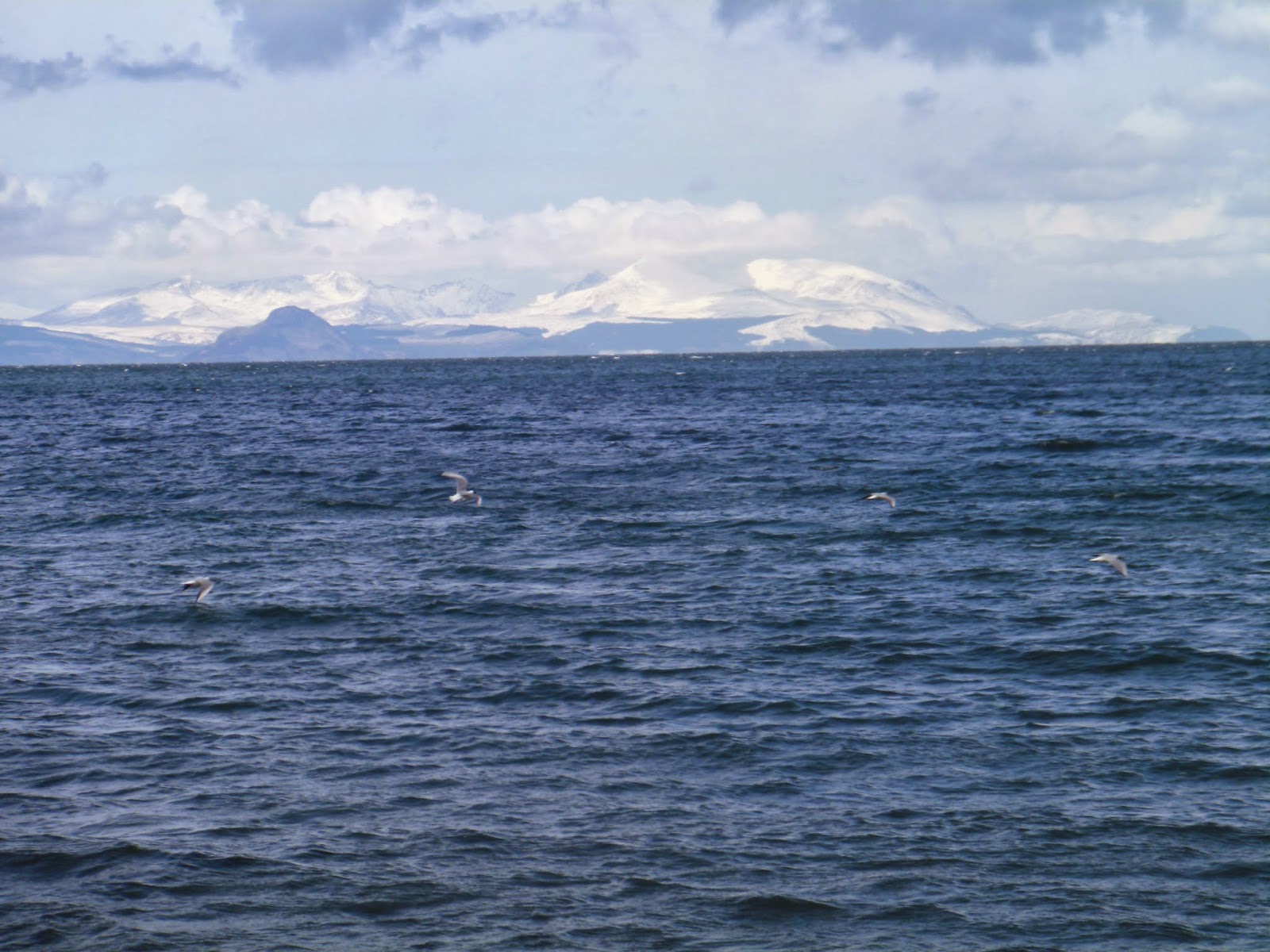
Above the island of Arran with the snow capped peaks mingling with the clouds. A bit surreal considering the heat.
Finally the end of the journey and the view looking north towards Irvine. A cracking little walk, took me about 2 hours 30 mins but I was stopping frequently to watch the birds and take some snaps.
Try it for yourself you will enjoy it.


Friday, 3 January 2014

A stormy New Year walk in Troon & Barassie

Today is the 3rd January and the 1st big storm of the year has just arrived. The next one is due in two days time so no respite. The last month has been constant wind, rain & dark grey days and sadly the next month is predicted to be much of the same.
I went for a walk along the front to be confronted by the road closed signs at the Ballast Bank. The police were just starting to shut off the streets as the tourists will be out and about taking their stormy weather photos (I know, pot, kettle & black).
This area is just as much a concern for walkers as for drivers, as there is a path that goes round the side of the banking which would more than likely result in a fatality if someone was washed into the sea. I know but there are always some idiots around. 
For me it meant a short detour back into the town to come back onto the front further along. The high tide was still a couple of hours away but as you can see it is quite dramatic already.
Both Troon and Barassie beaches are relatively shallow bays so the waves come running in unhindered until they hit the esplanade walls.
In these conditions the seas are fairly predictable but very interesting for the local snapper.
One minute you can see the church and the next second?
No you can't!!
I decided to head back towards Barassie along the esplanade and the Italian gardens were also getting pounded.
If I'm correct this area was the location of the open air swimming pool which is appropriate as in a couple of hours when high tide arrives this will be submerged.
Thankfully the walk along Barassie shore has the wind at my back, it is definitely much easier on the breathing.
The north shore is more exposed but as you can see from the above the waves are not as large but are bringing in more debris. As it is a southerly storm Troon harbour shelters some of this area.
Although the high tide might not be bringing huge waves to this beach the water surge is still high. In the next shot this is the beach walkway entrance to western Gailes golf club. The water is surging through the iron gate into the golf course. There will be no play today.
Time for lunch and a cuppa.

Saturday, 21 December 2013

Dun Deardail....Fort William

It was one of those days, grey and drizzly. The good lady was with me today, we wanted a walk with a view but it had to be relatively low level for the good lady's knees do not take well to hard descents. A review of the literature we had brought with us included walks in and around Glen Nevis. I had never been on Dun Deardail before so at least a 1st was welcome for today. Its height of 340m would give us views of the Nevis glen and in particular Ben Nevis if the conditions remained like this.
The walk includes a small section of the West Highland Way. It is a mixture of wood land paths and then open countryside. 
They all look the same
We parked at the Braveheart car park which was a good place to spend some time at the end of the walk. This is the same start for Ben Nevis and I looked jealously at the small groups making their way onto the Ben. We crossed the road, took in the field of Highland coos (Mrs B always stops at them, come along dearest we have only just started!!) and moved onto the path marked WHW. You are now entering the forest path. Whilst climbing keep following the WHW markers or you are in danger of going onto the Cow Hill track which would take you back to Fort William. A pleasant enough walk in its own right but not for today.
Camp site can just be seen
The walking is a little bit of the normal forestry track trudge. Still, listening and watching out for the normal forest birdlife keeps me interested until we break through the treeline and get the views. So far the normal culprits: blue, great and coal tits; chaffinch; blackbirds and song thrush but not a lot else. There are a few dog walkers around, particularly at the lower levels but all in all we have the lower stretches pretty much to ourselves. The fine rain continues but thankfully goes off as we start to break out of the trees. The sun even starts to make a brief appearance brightening things up. There have been a few twists and turns but so far it has not been the most exciting walk, but we are outdoors and that's what counts.
Ben Nevis
Now that we have broken the treeline the views are superb particularly of Ben Nevis which is on our left as we walk. From here I can train the binos on the Ben and I can see a good number of walkers making their way slowly up the 1st section of the walk. In this picture you can just make out the faint line of the trail going upwards from left to right. the path then winds behind the hill ( about the middle of this picture) before going upwards again. Through the binos I can see walkers quite a way up although from this angle you don't see the summit.
Mrs B nearing summit
Our path is now more pleasant walking. We have turned away from the WHW path which will go south to Kinlochleven and Glencoe. There is a lot of forestry work going on which would detract from the scenic views for the WHW walkers. the path is more grassy and with the views all around much more fun.
A raven flies over unmistakable due to its size and its fan tail as well as its call, searching for its partner.
Light snow on the peaks of Stob Ban
The name of the hill is taken after the Iron age fort that stood here. It is a vitrified fort which means that the materials used to build the fort were bonded together by heat as the outside of the walls were covered in timber and set alight. 
Me with Ben Nevis as a backdrop
These are all covered in grass and the slight height reduction took the edge off the wind and was a nice place for our picnic. The views were excellent.
As always I spent a few minutes surveying the landscape through the binoculars and I was rewarded by catching the movement of a golden eagle on the flanks of Ben Nevis. This side is a long way from the walkers so there were no people around here to disturb it. Along the ridge it glided then back again, it looked effortless. Then circling in a tight spiral it went higher and higher until even with the binos I could no longer keep it in sight. This sighting made my day and the memory of the walk. If I had been scanning with just eyesight there was a good chance that I would not have spotted the eagle against the background. 
Looking back towards the Banavie area of Fort William
After that it was time to make the return. This was simply a case of returning by the same route. Maybe it was the time of day but we met more walkers coming off the WHW looking fatigued but happy that there trek was coming to its conclusion.
I'm afraid to say but the walk back through the woods was again a bit of a trudge and not terribly exciting.
When we returned we spent some time in the centre before heading back to Fort William. It had all went to plan, a walk with super views at the end with the reward of the golden eagle. Now it is to be rewarded by a visit to the Grog N Gruel in Fort William to sample at least a couple of pints of whatever real ale they have on tap. If you like your beer do not pass up on this pub.