 |
| Start at Lochranza |
Height: 575m
I decided to tick off one of my outstanding Arran hills. After the bedlam of the ferry and the bus it was nice to start my walk just outside Arran distillery in Lochranza. I didn’t expect to see anyone on this walk today and I wasn’t far wrong.
The route I chose looked straightforward, a 3 mile walk through the tranquil and isolated Gleann Easan Biorach to Loch na Davie, then pick a spot to my right and go uphill to the summit. More on that later.
The bus was late arriving in Lochranza so my tight trip was even tighter to get my bus back.
The route through the glen has a burn all the way on your left so no excuses for getting lost here. To begin cut in at the bridge, there is a sign and now there is a straightforward but steep track which leads to a deep gorge which can be bypassed before it opens out into the moorland.
 |
| Past the gorge heading out onto the moor |
 |
| Lots of small waterfalls |
 |
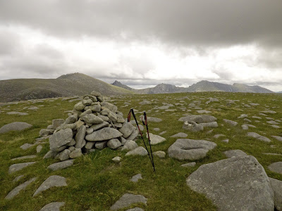
| Marker stones, this snap is looking back taken on the descent |
After the 3 miles I reach the lochan which despite its small size is important. Its run back to Lochranza feeds the distillery and its fine malts. At the other side it descends into Glen Iorsa and its waters.
 |
| Loch na Davie down below, Caisteal Abhail behind |
 |
| Castail, Cir Mhor & Tarsuinn in shot |
 |
| Glen Iorsa |
Time is not on my side so off I went descending further along the ridge before cutting down to the track, slow but sure as still lots of holes. I disturbed another group of hinds, certainly plenty of fresh poo around, there are lots of deer here.
Walking down the track I spot a Merlin flying low over the heather, stopping on a boulder and I get a grainy long distance snap confirming it. Maybe looking for one of these?
 |
| Meadow Pipit |
About half way down I meet a family with a young kid, tourists it turns out. I am asked if they are near the village, what village? Map out they were heading to Catacol and were dismayed when I showed them how far away they were from it, the rough terrain already getting to them and the kid not equipped. Thankfully they heeded my advice and followed me back to Lochranza.
 |
| Scotch Argus |
 |
| Lochranza in sight |
An excellent short walk, I am getting used to this isolation and solitude walking lark. The constant backdrop of running water helps the mind.
Wildlife: Red deer, Golden Eagle, Buzzard, Meadow Pipit, Merlin, Scotch Argus.
Time: 3.39
Ascent: 579m
Distance: 10.9k
No comments:
Post a Comment