Sunday, 27 April 2025

A cold day to visit a Borders moorland.....Roan Fell

Hill: Roan Fell

Type: Sub2k

Height: 568m


As I was in the area anyway this was an opportunity taken rather than a planned outing.

I had read about it a few months ago and remembered that it was a straightforward walk, ideal for these mixed conditions. I had time on my side but as it was a last minute drive by I had not read up on the route, leaving that until the starting point. Well you probably guessed but this is a very remote area so there was no phone coverage to check Walkhighlands reports. I recalled that it had a good track all the way and didn't involve cross country bashing so fine to go for it.

As I drove the minor twisting road, hoping not to meet anything coming my way, I had a sense of deja vu. But it was not until I checked the map once I had a signal that the start of the Donald of Cauldcleugh Head was just around here. I later read my blog but other than that sense of familiarity it was odd. I could well remember the circular walk but not the parking area.


Still hopefully today would be another successful walk. I parked up at what I was sure was the starting point. Got out the car and the wind that was blowing down the valley was Baltic cold. Looking around the nearby tops getting white shrouds, did I really want to do this? No turning back. Geared up and quickly walked up the track towards the farm. 


As I approached the dogs were barking madly so I knew from previous reports I was on track. It squeezes narrowly past going very close to the kennels for these hound dogs.


Despite the cold wind it was a lovely start walking beside a tumbling burn, gradually getting hemmed in by hills on either side. Three water crossings in quick session, none problematic although boots were fully in on two of them.

I spotted some red deer hinds, half a dozen of them in an enclosure so presumably farmed stock.

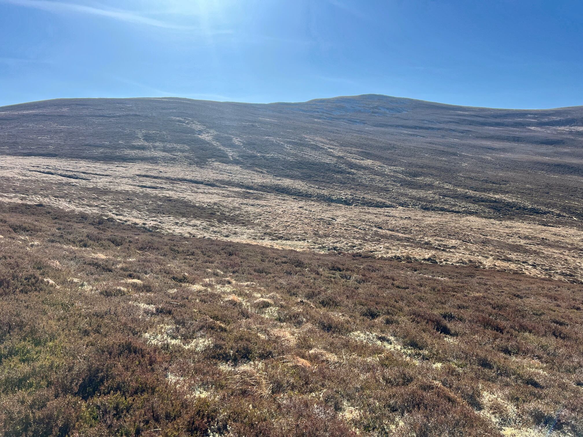
The track can be seen rising on the left

The track could now be seen heading up and around the flanks of Ewe Hill so I knew my lungs were going to be tested.


The track was initially stony but soon changed to a good walking grassy track. The gradient eased off and it was a pleasant walk despite the cold winds. Looking upwards I could see where the track was going to take a winding right turn.


The wind was definitely chilling as I spotted a cairn at Haregrain Rig. Much as I hoped this was the summit I knew it was not the case. Nevertheless, it was an excellent viewpoint, looking back down the upward path and over the Border Hills between Langholm & Hawick, Cauldcleugh Head the one with with the most snow cover.

Is that it, nope!

I was now into on-off  light snow showers and the track had a light snow covering which was icy but no need to put the spikes on. Soon I spotted a gate which I hoped was the top but nope this was the summit of Hartsgarth Fell.

Getting closer

Now in sight

From here, looking across the barren peat hagged moor I could see the cairn of Roan Fell roughly about 10 minutes walk away.

Amongst the hags were hidden grouse butts, no doubt the reason this track was in place, for the shooters not walkers.


A short fence crossing to the cairn. Even in this light there were good views, atmospheric but good enough.

Another hail shower battered me so time to get going and find a sheltered spot to eat my Scotch egg. Soft food only as a broken tooth which could not be seen for another 3 days and that is as a private patient, unreal.


I returned the same way taking in the views, trying to work out the other hills I have still to do nearby.

Despite the cold weather I enjoyed this short ramble. I was well clad so the weather was bearable and definitely better than being stuck indoors.


Ascent: 417m

Distance: 10.2km

Time: 2.36

Wildlife: Buzzard; Raven; Meadow Pipit; Red Deer

Saturday, 26 April 2025

A beautiful Spring day.....Greatmoor Hill

Hill: Greatmoor Hill

Type: Sub2k

Height: 599m


A stunning spring day saw me set out for another short Sub2k Border ramble.

I parked about 200 yards away from the farm entrance as I thought it was just too narrow if a tractor came rumbling down.

The birds were raucous as Spring partnerships were now being exploited. Great to hear.

Wandered up to the pylon and had a chat with the workies before going through the trees for a short distance.

Out of the trees and I get my 1st view of Greatmoor Hill

Scenic shot of the farm and lambing fields

Out of the trees and Greatmoor Hill is straight ahead. Lovely sight.

The track goes onto the working farm at Sundhome. Picturesque location with a green enclosed meadow full of sheep ready to lamb. Hopefully I would by pass them.

At the farm there a flock of hens were all penned up, just as well as I will explain later.


I crossed the wooden bridge and followed an Atv track up to a high point. I initially had planned to go cross country over the tussocky landscape. But as I looked at the summit area there appeared to be an Atv track. So I gambled and kept on this. It turned away from my destination but my faith was rewarded as it turned back and headed towards Greatmoor. Certainly squelchy and boggy in places but in my view preferable to the tussocks.

Follow the track to the top

A stunning blue sky March day, my jacket was already off. The silence was golden, just me and the Skylarks, it felt really good.

I spotted some birds wandering around the track ahead of me, around 20 of them, turned out to be Golden Plovers probably getting ready to head off back to Scandinavia or wherever.

I could see a thin pole on the summit which I assumed was the top but the atv track headed to the left so for an easy life I just followed it.

Cairn marking who knows what

On the slopes I looked over to some boulder scree where a huge cairn had been built, not quite the top. I wondered why?

In the blue skies I was surprised by the amount of aircraft flying over in both directions, clearly a busy transit point.


I was well up the hill  before I left the track and took to the grassy slopes to head to the top. A pair of ravens flew off the top to investigate me. One was making a strange throat clucking noise, probably mimicking my own death rattle. On the top I was going to head back to that thin pole but ahead of me was a huge cairn which was far to obvious to ignore so off I went. Indeed the large boulder cairn surrounded the trig. Summit reached.

Beautifully structured cairn with the Eildons behind

Funny how this has fallen apart but the other two cairns are intact

There was also a huge cairn on the other side of the fence descending off the North side, very weird.

Blackwood Hill foreground. Mast on Larriston Fell just visible, right of centre, on far ridge

The views were excellent in all directions. I spent time taking it in and identifying some recent conquests and some still to do.


I decided to head over to what I thought was the thin pole. It was an upside down one stuck in some boulders, another weird sight.

The lonesome pine

Enjoyed the slow wander down with the sole pine tree a good marker if required.

When I neared the farm the farmer was at the sheep pen and spotting me he waved. As I waved back I spotted a fox low in the grass heading towards his farm. A long time since I saw a fox on the hills. A brief glimpse but it looked like it was limping.

Lower down I engaged in a shouting chat with the farmer. I told him about the fox for which he thanked me and said he had seen it in his shed a few days ago and he thought it was injured, reinforcing my view. He said he would get someone out to shoot it!!

They had spotted Mr Fox

At the farm all the hens were caged in 2 and 3’s but they were all looking at the slope where I had last seen the fox, they had also seen or sensed it and were on high alert. What will be will be.

Overall a short but very enjoyable ramble on a beautiful spring day, what a joy to be able to enjoy it.

PS: Having a pint that evening a local asked what hill I had been up then told me the story of how he built the fence up to the summit, a small world.

Ascent: 434m

Distance: 8.8km

Time: 2.46

Wildlife: Chaffinch; Wren; Buzzard; Fox; Skylark; Pheasant; Meadow Pipit; Stonechat; Golden Plover; Raven; Jay; Golden Eagle?

Thursday, 17 April 2025

The very well hidden cairn.....Grange Fell

Hill: Grange Fell

Type: Sub2k

Height: 319m


Grange Fell appears to be an insignificant hill in terms of height and distance to the summit. Why then does it have so few people bagging it? Read the reports from the few that have to understand why.

So, with a slight apprehension I arrived at the Y junction start point, reversing into the trees as the farmer passed on his quad bike, not exactly a friendly look from him!

View from parking area

Walk decision, start up the treeline or the big track?

Higher up no mud

From here I had a good view of the of the short ascent to the treeline. There are two options. Head directly up the side of the treeline over rough ground or take the long zig zag up a grassy track. From the reports those going directly up the treeline did so to avoid a herd of cows but today it was only sheep in sight. So no surprises I went up the zig zag, a bit boggy but mainly a good grassy track until it reaches the gate at the deer fence post. Some reports mentioned how awfully boggy this could be and I understand if the cattle had been around they would have congregated here but not too bad today.

Deer fence gate 

Now the problem is that the summit cairn is buried deep in the tree plantation. From my readings most of the problems have been when walkers have entered the forest at this point, much too early.

However from looking at maps there appeared to be a solution that I chose to explore. At the fence there is a stone dyke that should be followed until you are roughly in line with the trig, from a bearing obviously as you are not going to see it.

Most of the wall was intact but this broken area made getting over the barbed wire 

There is a gate you should go through a walk on the rougher ground. I chose to stay on the left side as the walking was easier but meant that I had to cross the dyke which was protected by barbed wire. The barbed wire was offset enough to make it very awkward to get over it and the dyke. Thankfully I found a broken section. My little cover was very handy and saved some pain and blood being spilt.

Amazing how much lighter the camera makers it, heading for that light

Now it was a case of trying to find a gap in the trees that was walkable. I found one and although very dark a clearing was obvious not far ahead.

Main circular firebreak which is shown on map, still got leave this and head into the trees on my right.

After reaching the true circular fire break it was necessary to go back into the trees, as said if you have a bearing on the cairn it is reasonably straightforward. 

Totally encircled with trees and no firebreak, really weird.

I could see another patch of light ahead, the cairn I hoped, dodging around fallen trees I entered a rectangular open area and there was the trig.

No reason to hang about, armed with the knowledge I made a more direct line back through both tree plantations to exit the trees at almost the same point I had entered, well chuffed.

This time I stayed this side of the dyke and close to the tree edge the walking was fine.


Back down the zig zag. Across a few fields was a farm with cattle bellowing. Presumably they could see me and said ‘you got lucky pal’.

Turbines on horizon & on right the farm where the coos were bellowing from.

Also I looked across at about a dozen wind turbines, despite the wind not a blade turning, presumably we are paying them to not generate electricity, scandalous.

For all the bad things I had read about this hill it turned out to be reasonably straightforward. I wont be returning but another Sub2k ticked off.

Ascent: 280m

Distance: 4.2km

Time: 1.17

Wildlife: Raven; Blackbird; Wren

Wednesday, 16 April 2025

Not such a big lump but it is remote with stunning views and an easy way up.....Meallach Mhor

Hill: Meallach Mhor (Big lump of a hill)

Type: Corbett

Height: 768m


Most of the reports I had read about this hill were less than complimentary, mainly a pathless heather bashing slog, not a lot of fun at all.

Because of the long walk in, actually more the long walk out, I chose to Bike/Hike this trip.

I started early as the forecast was for this to be the warmest day of the year, have I heard that before? Yes I have and of course it wasn’t.

Parked on a scrape west of the Tromie Bridge. A crisp blue morning sky for my 6 mile cycle. It was a stunning cycle in through the Glen Tromie natural woodland but it was also very cold, 3 layers and I had forgot my gloves so a fast bike in.

I was surprised at how high the heather was on the surrounding hills but a local I talked to said the deer culling meant next to no deer which has resulted in lots of tree and shrubbery growth.

Looking back to the lochan 

I had noticed a track on the OS map which started just after the abandoned Bhran cottage. This appeared to lead up to the bealach between Mhor & Bheag. I talked to the occupier of a cottage who said she was aware of the track but the start was not obvious and she thought the track disappeared. Most people she said just went the awful route starting around the lochan marked on OS25 maps.

Undaunted I intended to try the track and if no good I could go cross country or retreat. I found the start of the track, not too obvious but not hidden either. From here looking upwards I could see some tracks going through the heather, worth the risk I thought. (PS: Afterwards I read the Walkhighlands route description which says this track does not exist at the lower end, it does as you will see BUT it starts about 100m further on from the cottage NN 75623 91203 , easy to spot when looking for it.). 

Track on right Bheag behind

Bike tethered to a tree and up the track I went. Initially it was pretty boggy for a couple of very short sections but okay going and I was making good time until I realised my water bottle had fallen off the rucksack. No way was I going up a Corbett on the hottest day without water. I backtracked and spotted a flash of blue almost fully submerged in a boggy pool, a lucky break.

Track going well up to the right of Bheag

The summit and the area I planned to cross but kept going

After that the track was pretty good, slightly overgrown in places but never lost. I got to the high point where I had originally planned to cut off and go cross country but the track was good so I decided to keep going. From here it looked as if the better option was to continue and go up the not so steep looking north ridge instead of going cross country.

Glad I did keep going now found the track to the top

At the bealach between Bheag & Mhor I thought I could see an animal track going up the ridge. As it turned out it was not an animal track, it was a narrow but well trodden human track which took me all the way to the summit. 1Hour 12min from leaving the bike. Why is this route not more prompted, no crap terrain, no heather bashing, a good gradient all the way up?

View to Loch an-t Seilich

Now to the Feshie Munros and beyond

View down to the start this side of the trees

Another advantage of bagging this hill is it is a stand alone hill so the 360deg views were spectacular. I could even see the place I was staying in Newtonmore.

Although I enjoyed the views my time on the summit was limited due to the very cold wind and my light clothing, where was the heat of recent days?

Kingussie in between the hills, Newtonmore on the left

The track coming up the flank of Bheag from Glen Tromie clearly seen

So instead of having my food break up on the summit I headed back down the same way to have lunch in the relative heat beside the river. As beautiful and tranquil spot that you could have for lunch.

Descent with the a track ahead all the way to the Munro of Meall Chuaich normally climbed from Dalwhinnie

As I descended I spotted a couple of walkers away to my left gaining the ridge from the boggy/heather slog circuit. I think they had spotted me as they stopped and looked my way. Maybe they had noticed my bike chained to a tree wondering where I had gone and now realised this was the way to go.

Overall an excellent ramble. But don't even think of the steep heather bashing unless that is your thing, this easy route is the future.

As I cycled out I flushed a huge black bird from a small heather patch, it flew into the trees crashing the lower branches.

Just after that i cycled round a bend where an estate worker was standing. I said can I ask you a daft question 'is it possible that I flushed a Capercaillie? He said where did you see it. I replied about 200 metres back there round the bend. He just smiled and said 'maybe'. I left it at that.


Ascent: 588m

Distance: 26.5km (19.97 bike)

Time: 3.48 (hill 2.12)

Wildlife: Wheatear; Meadow Pipit; Pied Wagtail; Chaffinch; Tortoiseshell Butterfly, Capercaillie?