Hill: Carn Dearg Mor (857m) (Big Red Hill) & Leathad an Taobhain (912m) (Hill of the Rafters)
Type: Corbett x2

After a longish period of inactivity due to a combination of things mainly weather and injury, I was slightly apprehensive about today’s outing. My main concern was whether my physical injury had actually healed as it was going to be a long way from anywhere if my body broke down at the far end.
When planning I knew that the distances involved made it a very big day if done on foot, too far for me these days. Bike/hike still a big outing distance wise but shorter in time.
So bike/hike was the chosen option. From the walk reports almost everyone bike/hiking started from Auchlean but I could not understand why. It is the other side of the River Feshie and involves getting the bike across a burn which could be problematic with water height. Then cross a bridge to get to the perfectly good road that is on the other side.
I suspected that there would be no unauthorised vehicle access up to Glenfeshie Lodge. In reality that was correct but there are quite a few parking options including one almost up to the Feshie bridge crossing, so even if walking don’t bother starting from Auchlean.

As I prepared the clouds were low, the mist was hanging and it was a beautiful autumn morning for my ramble. The forecast was for good views and no rain, perfect.
I began with a stunning ride along a tarmac road taking in the gorgeous colours of the autumn trees and the light catching the shimmering webs of the money spiders.
Although we have had a dry year there has been a fair bit of rain recently so I was surprised at how low the River Feshie was running. Not low enough to paddle across but still great to look at.
 |
| I was heading into those hills |
The views ahead started to open up after I passed the Lodge with very high slopes beginning to hem in the route. I was fully aware that after about 5 miles cycling I had not done any real climbing yet but that was to kick in super soon and it was not to be a lot of fun at times.
The track took a westerly turn and it had already changed just after the lodge to shale/small stone track but still good at this point.
 |
| The track between them snap taken just after I had to push the bike for a bit, looks fine but no grip on inclines if stopped |
But as I started to climb, steeply, the surface was much more loose stone and soft earth, the tyres were struggling to grip and the riding was now very technical. I had been going along ok but on a steep slope an estate quad bike appeared behind me and wanted past. I let him go but I could not get riding again as the tyres were just spinning with no grip. So a heavy MTB was pushed until it slightly flattened out.
 |
| The light patch is where the trees should be |
Back on the saddle I managed to get up to the point where the track forks for the 2 Corbetts. Decision time which to do 1st? I opted for CMD and cycled on the track up until I was in the middle of a tree deforestation site. The one main problem with bike/hiking is taking the time to stop and check the route. It looked like I had come too far so I backtracked looking for the track that the OS map showed skirting the edge of the now destroyed tree plantation. I did not fancy walking over tree devastation, too many risks involved.
I could see some people on the ridge, they had orange and yellow jackets on so workies of some sort. No way they walked from here so I cycled back up the track and went to try to find their van and maybe an easier way up the hill.
I was contouring further away from my objective so slightly concerned but then I spotted a van parked up ahead. Even better there was a rough track doubling back up the hill heading towards the Corbett.
 |
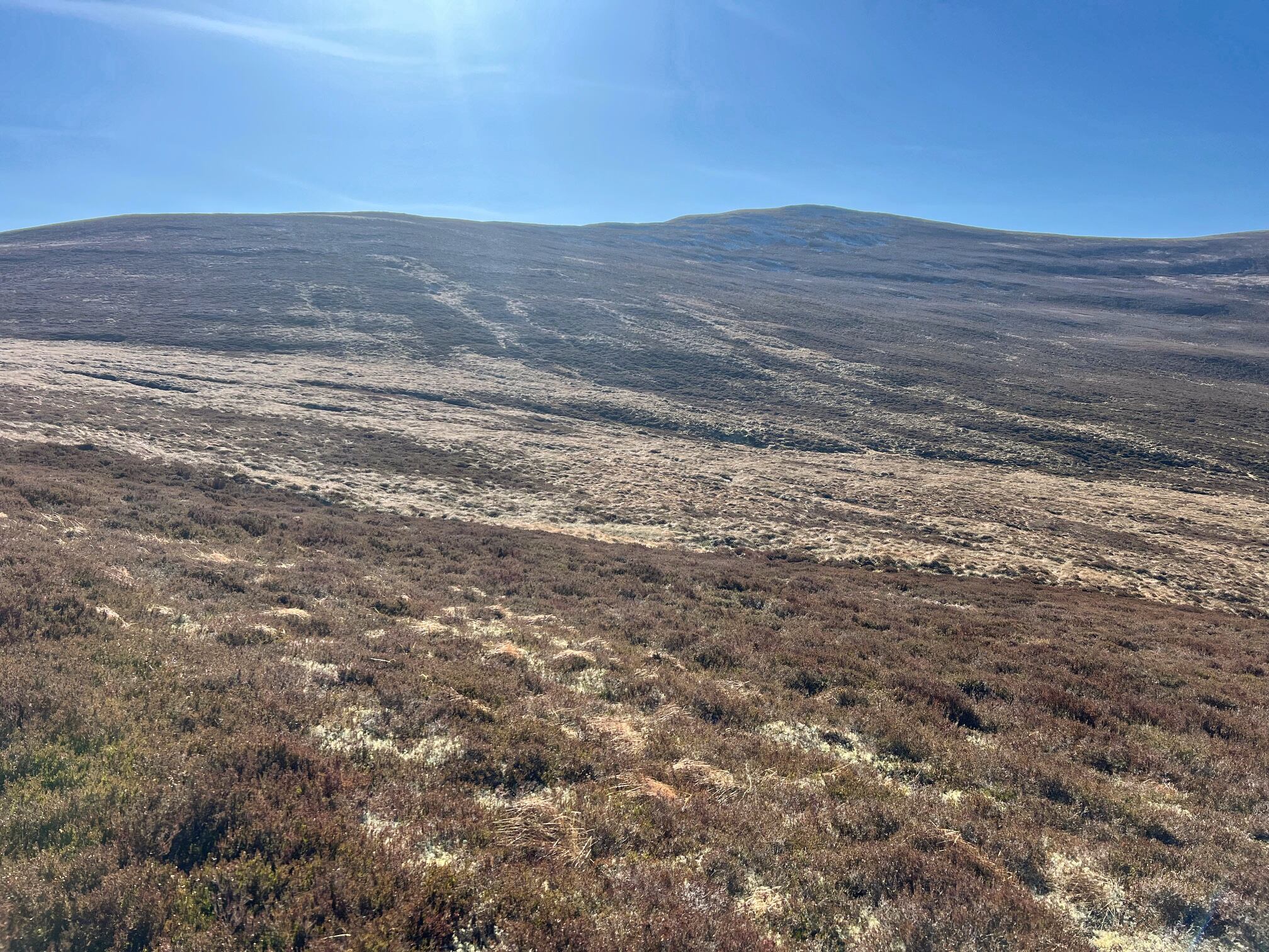
| Carn Dearg Mor ahead |
The track was rough but manageable and I was able to follow it to its end. In patches there was tree debris where non native growth had been cut and just left on the track. Fine for an ATV to get over but not so much fun for a bike.
Lay the bike in the heather, grabbed a mini pork pie and headed up the rough heather which quickly gave way to short grass so good walking until I hit the ridge. From here an ATV track took me to the summit of CMD. Views not bad as the Feshie Munros were dabbled in sunshine making them stand out but everywhere else was just rough peat hagged moorland. The autumn weather at altitude was decidedly nippy. This had already been more of an adventure than expected, injury was ok but I was feeling it so would I do the other one. I could see the track and it was even steeper than anything so far!!
Clambering down the rough ground I met up with a couple of the workies who told me the tree planting was a 10 year project involving 8 million native Scottish trees, quite staggering. The forestry manager said this would eventually be a forest again and not barren moorland, teeming with wildlife, but I will not be around to see it.
Carefully back along the track to the junction, I reckon that my back and forth and additional stuff probably added on about 5k of cycling.
I passed a guy with a puncture, did he want help but nope he had just finished. An easy place to puncture with these sharp stones everywhere. As I talked to him it dawned on me that my repair kit was not in my rucksack but still in the car, what a tube (sic), much added stress to my ramble!
I took the track to Leathad and soon caught up with a group of 6 females. I acknowledged them but didn't stop as I would not have got started again with the gradient and surface. Funnily never saw them again and there was no cut offs so I reckon they had taken a wrong turn and turned back to the track heading for Glen Tromie.
It had been a challenging ride so far but this track was the steepest gradient so far and much more loose stone. The wheels were jumping about everywhere and at times in different directions. It trying to unseat me or send me down the banking.
 |
| The point I had to abandon the bike and walk |
I got to the point about 200 metres from the plateau where I just had to give up and leave the bike. It was too steep to push it without a lot of hard work so off I walked.
Annoyingly when I reached the top where the track levelled off and I could have easily cycled another kilometre or so.
 |
| Shark fin stone on the top of Meall an Uillt Chreagaich pointing to my target |
I knew from my prep that there was a drop before reascending to Leathad. But when I first viewed it I was tired. I had not taken a proper food break and when I saw the steepness and length of the drop off and reascent my motivation just went. One option was to return tomorrow when I was refreshed. I had to give myself a good talking to. I was almost there, did I want that cycle that again? Nope.
It now drops about 100m or so with the following ascent of 160m but of course I had to come back the same way, so more ascent added to the ramble.
 |
| The start of the descent, the up track can be seen |
Thankfully it is not over the moor as there is an ATV trail to follow but in the lower slopes of both sides it is a bog. Still onwards and upwards before a short heather crossing to find the trig.
 |
| From trig looking back to the Cairngorms |
Was I happy when I reached the summit? Not really at first, too fatigued to be happy lol, but it was another blue tick, so smile I told myself. As said I was tired and my calf was beginning to ache and I just wanted that last reascent over and get back to my bike.

This is definitely a remote spot with very few people around if something goes wrong. There are more further down as the estate trail now links with Glen Tromie but not up here.
 |
| Bike just ahead and then the challenging descent. |
I was pleased to get back back to my bike and then the real heart rate raising adventure began. On this type of surface you cannot go fast as you will crash, no matter your skill level. But you cannot also go too slow as braking on the steep slopes creates wheel locking. Not a lot of fun when neither tyre still cannot grip and it is very difficult trying to control a bike in a situation like that.
What should have been a fast fun run out was without doubt fast in places; so very frustrating in others; painful in parts and it was with great relief when I hit the flatlands back to the lodge and headed back to the car. I will admit to losing it once and ended up with my face looking over the grassy bank but no damage done.
 |
| A recent storm has washed away a huge chunk of the opposite bank |
Overall it was a success ramble but the cycling element was far tougher than I anticipated.
Back at the car my legs were tired but so was my back and arms from all the pummelling and tension on the bars/brakes. Still I got through it and I would still not have walked them, so job done. A beer or two on the cards to celebrate a record day.
Ascent: 1309m
Distance: 44.3km
Time: 5.49 (Bike/Hike)
Wildlife: Raven, Fieldfare