Showing posts with label Cairngorms. Show all posts

Monday, 2 March 2026

Just a half a ramble today.....Beinn Bhreac Cairngorm

Hill: Beinn Bhreac (Cairngorm) (Speckled Hill)

Type: Munro

Height: 930m


I was still feeling tightness and tenderness with the medial calf that I strained a few weeks ago so I was a bit troubled about what to do today. I had signed up for this walk which I knew should be a straightforward Munro double. The distance was the issue as I was not convinced that the calf would survive a 30k hike so I opted to reduce that by cycling to Derry Lodge. My plan was to decide after Beinn Bhreac whether to continue or not but the tightness/pain had gone up a few notches on the morning of the walk so decision made, just a single Munro.

Derry Cairngorm in the shade, Carn a' Mhain left of centre


At the Linn of Dee start Gillian from ADRC was the only other walker apart from the guide. After I had told the organiser I was cycling part of it it appeared that we all did. We all cycled the almost 4 miles to Derry Lodge which was less than 30 minutes from Linn of Dee, where the walk officially started, time saved. Heard a cuckoo calling, must be about time for the males to start migrating back to Africa.

Start of ATV track

Views opening up Tor of Beinn Mheadhoin

All the reports that I had read described walking a kilometre before cutting up the hill. But after only a couple of minutes the guide surprised me by heading off up an ATV track. His reasoning was that it was less boggy and less populated. Both correct as no-one else was seen on this route until we neared the normal track.

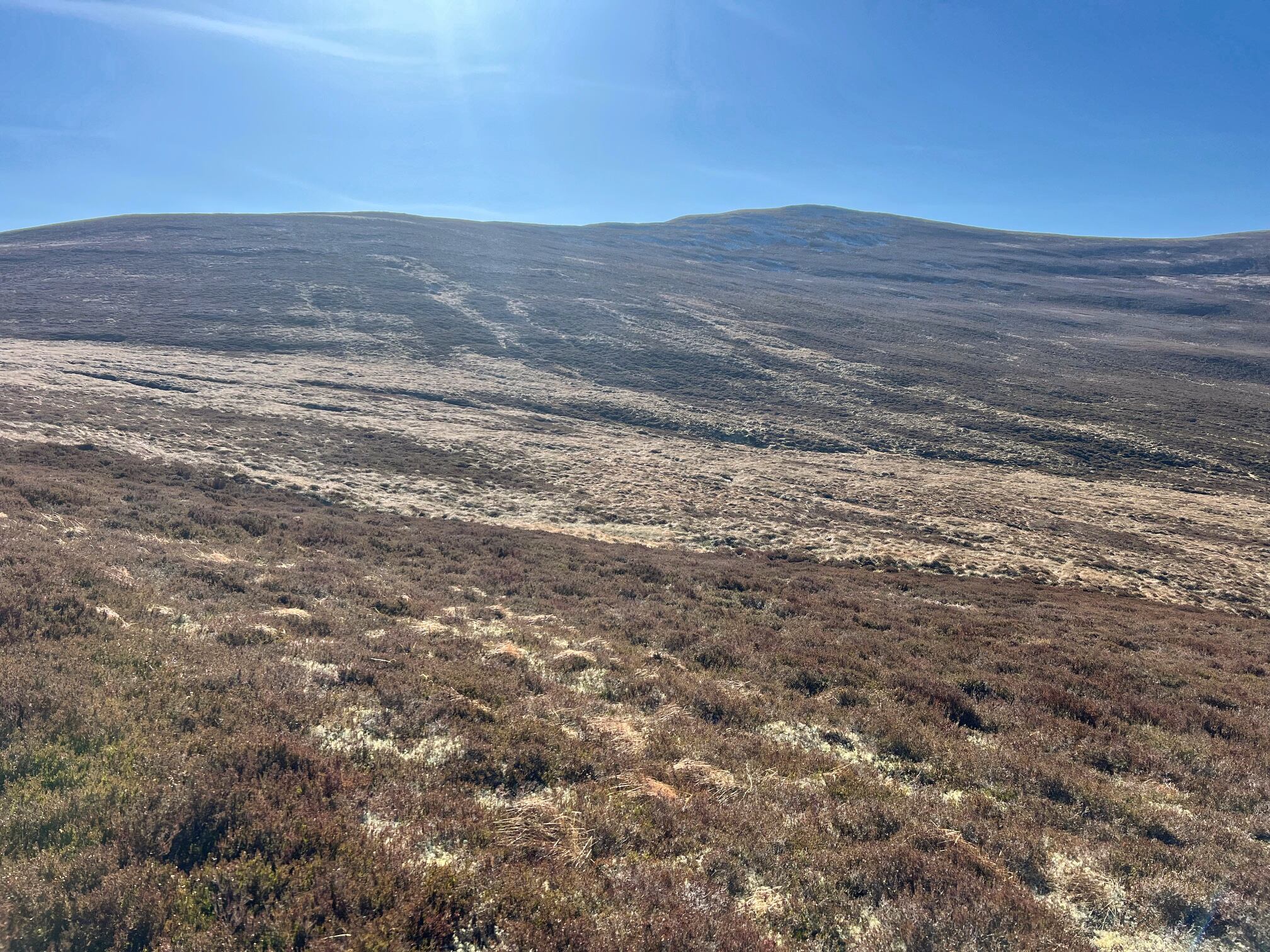
1st view of Beinn Bhreac on left we continue up to the right

This turned out to be a nice gradient and a pleasant walk, the weather good. Views getting better as we rose. We continued on the ATV track almost to the top of Meall an Lundain at 777m.

Full view of Beinn Bhreac 

Just before the top we headed cross country. We dropped about 70m and the terrain involved a lot of dodging the many peat hags. I could see a couple of walkers about half way up the final pull to the coll of Beinn Bhreac. There were other walkers around but I recognised their outfits as being the pair who were just in front of us at Derry Lodge. Although I enjoyed the different route it was a longer walk, added another 70m of ascent and about 30 minutes extra to the top. No issue for me but If I had been doing both it added extra on an already long day.

Ascent track on right, descent on left

Looking at the final climb our route was taking us up via a clear path on the eastern side but slightly further west walkers were using another track, the main one.

A straightforward ascent, losing and re finding the track a few times but no difficulty to the ridge.


The cairn was a short crossing across the boulder field but pretty easy going normally but today the rocky terrain was testing my calf. 

View to Lochnagar

Beinn a' Chaorainn in the centre

Great views all round. A bit hazy over to the Lochnagar group but the main view dominated by Derry Cairngorm and the torr's on Beinn Mheadhoin were spectacular.

With regret I had to leave the others. Disappointed as the other Munro involved no major ascent but as said not for me today.


I wandered across the stony terrain before deciding to just head down where I soon picked up the main track. I could see a small cairn in the distance. Again the track came and went but just headed to the cairn and picked it up again.


From the cairn another good view of the track heading far down but surprisingly nobody ascending. Solo time again.


Quite boggy in parts but once I hit the trees the bog factor went up considerably so 15 minutes of gloop avoiding before I hit the return track.

Azure Hawker

Then walked the kilometre as mentioned earlier back to to Derry Lodge and the bike was still there. It was a good section for birdlife and I had a brilliant bonus, an Azure Hawker. Pretty sure that it was my 1st sighting of the year.

Bike park

Biked the same track but when I reached the road I extended the cycle by a few more miles to get a bit more out of the day.

Back at the car my leg was throbbing a bit more so the right decision had been made to do just the one hill. A good ramble and an opportunity is there to return one day for the other Munro.

Ascent: 801m

Distance: 21.5km

Time: 5.02

Wildlife: Red Grouse; Red Kite; Common Frog; Vole; Redstart; Willow Warbler; Peacock Butterfly; Meadow Pipit; Coal Tit; Chaffinch; Goldcrest; Azure Hawker; Cuckoo;

Thursday, 1 January 2026

Tiring for the wrong reasons.....Derry Cairngorm

Hill: Derry Cairngorm (The Blue hill of Glen Derry)

Type: Munro

Height: 1155m


After the previous nights stop start sleep I slept soundly last night and awoke at 6am feeling fully refreshed, but more to follow.

I arrived at the Linn of Dee car park around an hour later and what a greeting the midgies were ferocious and they love biting me. Jacket fully zipped and hooded, glasses on, I quickly removed the bike from the back, boots on and cycling as quickly as I could.

Luckily I had kept on my light jacket from the midge protection as it was on the cool side when I cycled to Derry Lodge. 

The forest section ahead with Creag Bad an-t Seabhaig beyond

Upon arrival at the lodge and securing my bike the car park midgies cousins erupted so I was very quickly on my way across the bridge.

Apart from the buzzing of bees on the beautiful pink/purple heather it was silent as I made my way up the ever steepening track.

I had been surprised at my sound sleep, not normal for me to sleep so deeply. On the bike ride my legs did not feel too good and as I steeply ascended I was very chesty. I had two prominent insect bites from yesterday and I suspect one of these was responsible.

Now I was wondering how far I would get on today's ramble. I therefore had less focus on how nice a start this was. Upwards through the tree lined heather on a very good rising path the only sound apart from the bees and my heavy breathing was a small family of Coal Tits moving through the trees. They got quite agitated at one point but I could not see any predator.

I had a few short stops which were much required as I knew I was struggling a bit. The last break was where I took half a banana and an energy gell and these made all the difference. I have never known a nutrition hit to energise me so much. 

Easier walking and thus easier breathing

Mind and body improved, even more so when I cleared the steep ascent at Creag Bad an t-Seabhaig and the vista started to open up. An unexpected wow moment as I took it all in, the steep start was now worth it.

It was still much colder than expected. Blame the midgies, I had grabbed a lightweight jacket from the car but it was designed more for waterproofing than warmth.

Still looking at the summits ahead and around there was still a lot more cloud shrouding them, maybe the wet gear would be required.


I was really enjoying this open section with all round fantastic views. The first sighting of Derry was with a clear summit but at the next sighting it was cloud covered, one of those days.

View into Glen Derry and a very dry Derry Burn. Beinn Bhreac behind Beinn a' Bhurd behind that again.

Onwards and upwards, bypassing Carn Crom I now had Little Cairngorm in sight. Eventually this lump blocked out views of Derry itself. I had not realised that the term ‘Derry’ was a relatively recent addition as the hill was previously known simply as Cairngorm. But then you have had two in the region with the same name, hence the addition of Derry. Although does it matter, there are 3 Corbetts named Carn Dearg’s in the Fort William section.

Ben Macdui

Little Cairngorm

There were some smashing views on either side as I ascended which helped break the hike as I rested and checked what I was looking at.


As is frequently the case a nice ramble is spoiled by the final section to the summit. In this case a large boulder field which led to quite a few hands on manoeuvres and a few sweary words before I reached the summit.

Northern Cairngorms

Beinn Mheadhoin ahead and Beinn a' Chaorainn on right

Lochan Uaine

Thankfully no cloud up top with excellent views all round apart from Beinn Mheadhoin which did still have cloud cover so I did not get a view of its main feature, its Torrs.

I had considered doing it as well but it was now a hot day and my legs were feeling it. Knowing when to stop is as important on the hills as when out for a drink. 

Getting over this stuff is easier going up than down

The positive aspect of not going further was that I got to enjoy a leisurely descent taking in all the glorious views.


Although it wasn't as peaceful as the ascent. There was a lot of helicopter activity with a pair of very noisy Chinooks both in glens or hovering above ridges, possibly civilian hires bringing materials for repairing tracks etc. but they covered a fair amount of ground.

But the special moment was just as I passed Carn Crom. I heard a fighter jet down in Glen Derry and new it must be close and within seconds it had crested the ridge just in front of me. I have never been so close to a fighter plane, what a noise, ears pounding but a stunning sight. The plane did a full 360 degree roll, not for my benefit I’m sure, before heading towards Glen Tilt. Never mind the Munro that made my day.

Cracking spot for a break

No more drama on the descent. I stopped for my last break with excellent views of the descent where I had struggled earlier plus looking down on the start of the Lairig Ghru which brought back memories from last year.

Final descent and a view of Glen Lui for the ride bike

Collected my bike and cycled back to the car with no midgies at either spot.

A good ramble and it was just enough. When I got back to my digs I showered and fell asleep for almost 2 hours, not normal, blamed those bloody insects.

PS: After this away trip I was still fatigued a couple of weeks later so I went to my GP and got a full set of bloods including my 1st Lyme's disease test. All negative so good news on that front. Also it was good that I waited as the GP said they will not do a Lyme's Disease test until 2 weeks after a bite.

Ascent: 943m

Distance: 23.2

Time: 6.02 (Bike/Hike)

Wildlife: Meadow Pipit; Raven; Coal Tit;

Wednesday, 31 December 2025

The longest bike/hike of my ramblings.....Feshie Corbetts

Hill: Carn Dearg Mor (857m) (Big Red Hill) & Leathad an Taobhain (912m) (Hill of the Rafters)

Type: Corbett x2


After a longish period of inactivity due to a combination of things mainly weather and injury, I was slightly apprehensive about today’s outing. My main concern was whether my physical injury had actually healed as it was going to be a long way from anywhere if my body broke down at the far end. 

When planning I knew that the distances involved made it a very big day if done on foot, too far for me these days. Bike/hike still a big outing distance wise but shorter in time.

So bike/hike was the chosen option. From the walk reports almost everyone bike/hiking started from Auchlean but I could not understand why. It is the other side of the River Feshie and involves getting the bike across a burn which could be problematic with water height. Then cross a bridge to get to the perfectly good road that is on the other side.

I suspected that there would be no unauthorised vehicle access up to Glenfeshie Lodge. In reality that was correct but there are quite a few parking options including one almost up to the Feshie bridge crossing, so even if walking don’t bother starting from Auchlean.


As I prepared the clouds were low, the mist was hanging and it was a beautiful autumn morning for my ramble. The forecast was for good views and no rain, perfect.

I began with a stunning ride along a tarmac road taking in the gorgeous colours of the autumn trees and the light catching the shimmering webs of the money spiders.

Although we have had a dry year there has been a fair bit of rain recently so I was surprised at how low the River Feshie was running. Not low enough to paddle across but still great to look at.

I was heading into those hills

The views ahead started to open up after I passed the Lodge with very high slopes beginning to hem in the route. I was fully aware that after about 5 miles cycling I had not done any real climbing yet but that was to kick in super soon and it was not to be a lot of fun at times.

The track took a westerly turn and it had already changed just after the lodge to shale/small stone track but still good at this point.

The track between them snap taken just after I had to push the bike for a bit, looks fine but no grip on inclines if stopped

But as I started to climb, steeply, the surface was much more loose stone and soft earth, the tyres were struggling to grip and the riding was now very technical. I had been going along ok but on a steep slope an estate quad bike appeared behind me and wanted past. I let him go but I could not get riding again as the tyres were just spinning with no grip. So a heavy MTB was pushed until it slightly flattened out.

The light patch is where the trees should be

Back on the saddle I managed to get up to the point where the track forks for the 2 Corbetts. Decision time which to do 1st? I opted for CMD and cycled on the track up until I was in the middle of a tree deforestation site. The one main problem with bike/hiking is taking the time to stop and check the route. It looked like I had come too far so I backtracked looking for the track that the OS map showed skirting the edge of the now destroyed tree plantation. I did not fancy walking over tree devastation, too many risks involved.

I could see some people on the ridge, they had orange and yellow jackets on so workies of some sort. No way they walked from here so I cycled back up the track and went to try to find their van and maybe an easier way up the hill.

I was contouring further away from my objective so slightly concerned but then I spotted a van parked up ahead. Even better there was a rough track doubling back up the hill heading towards the Corbett.

Carn Dearg Mor ahead

The track was rough but manageable and I was able to follow it to its end. In patches there was tree debris where non native growth had been cut and just left on the track. Fine for an ATV to get over but not so much fun for a bike.

Lay the bike in the heather, grabbed a mini pork pie and headed up the rough heather which quickly gave way to short grass so good walking until I hit the ridge. From here an ATV track took me to the summit of CMD. Views not bad as the Feshie Munros were dabbled in sunshine making them stand out but everywhere else was just rough peat hagged moorland. The autumn weather at altitude was decidedly nippy. This had already been more of an adventure than expected, injury was ok but I was feeling it so would I do the other one. I could see the track and it was even steeper than anything so far!!

Clambering down the rough ground I met up with a couple of the workies who told me the tree planting was a 10 year project involving 8 million native Scottish trees, quite staggering. The forestry manager said this would eventually be a forest again and not barren moorland, teeming with wildlife, but I will not be around to see it.

Carefully back along the track to the junction, I reckon that my back and forth and additional stuff probably added on about 5k of cycling.

I passed a guy with a puncture, did he want help but nope he had just finished. An easy place to puncture with these sharp stones everywhere. As I talked to him it dawned on me that my repair kit was not in my rucksack but still in the car, what a tube (sic), much added stress to my ramble!

I took the track to Leathad and soon caught up with a group of 6 females. I acknowledged them but didn't stop as I would not have got started again with the gradient and surface. Funnily never saw them again and there was no cut offs so I reckon they had taken a wrong turn and turned back to the track heading for Glen Tromie.

It had been a challenging ride so far but this track was the steepest gradient so far and much more loose stone. The wheels were jumping about everywhere and at times in different directions. It trying to unseat me or send me down the banking.

The point I had to abandon the bike and walk

I got to the point about 200 metres from the plateau where I just had to give up and leave the bike. It was too steep to push it without a lot of hard work so off I walked.

Annoyingly when I reached the top where the track levelled off and I could have easily cycled another kilometre or so.

Shark fin stone on the top of Meall an Uillt Chreagaich pointing to my target

I knew from my prep that there was a drop before reascending to Leathad. But when I first viewed it I was tired. I had not taken a proper food break and when I saw the steepness and length of the drop off and reascent my motivation just went. One option was to return tomorrow when I was refreshed. I had to give myself a good talking to. I was almost there, did I want that cycle that again? Nope.

It now drops about 100m or so with the following ascent of 160m but of course I had to come back the same way, so more ascent added to the ramble.

The start of the descent, the up track can be seen

Thankfully it is not over the moor as there is an ATV trail to follow but in the lower slopes of both sides it is a bog. Still onwards and upwards before a short heather crossing to find the trig. 

From trig looking back to the Cairngorms

Was I happy when I reached the summit? Not really at first, too fatigued to be happy lol, but it was another blue tick, so smile I told myself. As said I was tired and my calf was beginning to ache and I just wanted that last reascent over and get back to my bike.


This is definitely a remote spot with very few people around if something goes wrong. There are more further down as the estate trail now links with Glen Tromie but not up here.

Bike just ahead and then the challenging descent.

I was pleased to get back back to my bike and then the real heart rate raising adventure began. On this type of surface you cannot go fast as you will crash, no matter your skill level. But you cannot also go too slow as braking on the steep slopes creates wheel locking. Not a lot of fun when neither tyre still cannot grip and it is very difficult trying to control a bike in a situation like that.

What should have been a fast fun run out was without doubt fast in places; so very frustrating in others; painful in parts and it was with great relief when I hit the flatlands back to the lodge and headed back to the car. I will admit to losing it once and ended up with my face looking over the grassy bank but no damage done.

A recent storm has washed away a huge chunk of the opposite bank

Overall it was a success ramble but the cycling element was far tougher than I anticipated.

Back at the car my legs were tired but so was my back and arms from all the pummelling and tension on the bars/brakes. Still I got through it and I would still not have walked them, so job done. A beer or two on the cards to celebrate a record day.


Ascent: 1309m

Distance: 44.3km

Time: 5.49 (Bike/Hike)

Wildlife: Raven, Fieldfare


Wednesday, 16 April 2025

Not such a big lump but it is remote with stunning views and an easy way up.....Meallach Mhor

Hill: Meallach Mhor (Big lump of a hill)

Type: Corbett

Height: 768m


Most of the reports I had read about this hill were less than complimentary, mainly a pathless heather bashing slog, not a lot of fun at all.

Because of the long walk in, actually more the long walk out, I chose to Bike/Hike this trip.

I started early as the forecast was for this to be the warmest day of the year, have I heard that before? Yes I have and of course it wasn’t.

Parked on a scrape west of the Tromie Bridge. A crisp blue morning sky for my 6 mile cycle. It was a stunning cycle in through the Glen Tromie natural woodland but it was also very cold, 3 layers and I had forgot my gloves so a fast bike in.

I was surprised at how high the heather was on the surrounding hills but a local I talked to said the deer culling meant next to no deer which has resulted in lots of tree and shrubbery growth.

Looking back to the lochan 

I had noticed a track on the OS map which started just after the abandoned Bhran cottage. This appeared to lead up to the bealach between Mhor & Bheag. I talked to the occupier of a cottage who said she was aware of the track but the start was not obvious and she thought the track disappeared. Most people she said just went the awful route starting around the lochan marked on OS25 maps.

Undaunted I intended to try the track and if no good I could go cross country or retreat. I found the start of the track, not too obvious but not hidden either. From here looking upwards I could see some tracks going through the heather, worth the risk I thought. (PS: Afterwards I read the Walkhighlands route description which says this track does not exist at the lower end, it does as you will see BUT it starts about 100m further on from the cottage NN 75623 91203 , easy to spot when looking for it.). 

Track on right Bheag behind

Bike tethered to a tree and up the track I went. Initially it was pretty boggy for a couple of very short sections but okay going and I was making good time until I realised my water bottle had fallen off the rucksack. No way was I going up a Corbett on the hottest day without water. I backtracked and spotted a flash of blue almost fully submerged in a boggy pool, a lucky break.

Track going well up to the right of Bheag

The summit and the area I planned to cross but kept going

After that the track was pretty good, slightly overgrown in places but never lost. I got to the high point where I had originally planned to cut off and go cross country but the track was good so I decided to keep going. From here it looked as if the better option was to continue and go up the not so steep looking north ridge instead of going cross country.

Glad I did keep going now found the track to the top

At the bealach between Bheag & Mhor I thought I could see an animal track going up the ridge. As it turned out it was not an animal track, it was a narrow but well trodden human track which took me all the way to the summit. 1Hour 12min from leaving the bike. Why is this route not more prompted, no crap terrain, no heather bashing, a good gradient all the way up?

View to Loch an-t Seilich

Now to the Feshie Munros and beyond

View down to the start this side of the trees

Another advantage of bagging this hill is it is a stand alone hill so the 360deg views were spectacular. I could even see the place I was staying in Newtonmore.

Although I enjoyed the views my time on the summit was limited due to the very cold wind and my light clothing, where was the heat of recent days?

Kingussie in between the hills, Newtonmore on the left

The track coming up the flank of Bheag from Glen Tromie clearly seen

So instead of having my food break up on the summit I headed back down the same way to have lunch in the relative heat beside the river. As beautiful and tranquil spot that you could have for lunch.

Descent with the a track ahead all the way to the Munro of Meall Chuaich normally climbed from Dalwhinnie

As I descended I spotted a couple of walkers away to my left gaining the ridge from the boggy/heather slog circuit. I think they had spotted me as they stopped and looked my way. Maybe they had noticed my bike chained to a tree wondering where I had gone and now realised this was the way to go.

Overall an excellent ramble. But don't even think of the steep heather bashing unless that is your thing, this easy route is the future.

As I cycled out I flushed a huge black bird from a small heather patch, it flew into the trees crashing the lower branches.

Just after that i cycled round a bend where an estate worker was standing. I said can I ask you a daft question 'is it possible that I flushed a Capercaillie? He said where did you see it. I replied about 200 metres back there round the bend. He just smiled and said 'maybe'. I left it at that.


Ascent: 588m

Distance: 26.5km (19.97 bike)

Time: 3.48 (hill 2.12)

Wildlife: Wheatear; Meadow Pipit; Pied Wagtail; Chaffinch; Tortoiseshell Butterfly, Capercaillie?