Showing posts with label Grantown on Spey. Show all posts

Sunday, 17 May 2026

Speyside Way.....Ballindalloch - Grantown on Spey

Walk: Speyside Way

Route: Ballindalloch – Grantown on Spey


By the standards of many other long distance walk sections this is relatively straightforward but for the Speyside Way this would be described as the Queens stage. That is a cycling term for the hardest or most difficult section. For sure it is the longest section if you exclude the optional Tomintoul loop and it has the most ascent of any section so it deserves its description. The ascent is undulating with several short steep sections rather than a full on climb.


Using public transport was not really an option so the good lady drove me to the start at Ballindalloch. A couple of overnighting camper vans were in the small parking area, the smell of bacon wafting around. Enticing but it was not for us and anyway I had eaten back at the hotel.

The last time I had been at this spot was when I cycled the previous stage and would have turned for the return cycle. It was clear from the route description that cycling much of this section was not an option and indeed that was the case.

Now a private house


An early morning stroll for just over a mile along the old railway line was amazing for the variety of singing birds. A woodpecker was hammering away, from the noises clearly changing trees but I could not spot it. Yet again Jays were calling another regular feature of my Moray rambles. The usual suspects were amongst the singing mixture but also included a male Blackcap. A flash of movement caught my eye flashing through the trees. Obviously a raptor it was a stunning chestnut brown. Sadly I did not see any other distinguishing marks. It was probably a buzzard but it looked smaller and flew faster than expected but not aware of any other raptor than could be so brown. The Spey was in sight alongside this section but despite the name of the walk I would not see it too often.


Turning left and taking a route towards the main road I was now in the first of the many fenced in sections that have been installed to keep walkers away from livestock, mainly cattle, more on this later. I met a couple of foreign walkers who were on a self sustained trip roughly based on the Moray trail. As it turned out they were the only walkers I met until the Abernethy forest near Grantown.


Buzzard approaching

Out onto fields and scrub, it was a potentially muddy section with walk boards to assist. Pheasants ran around and a pair of buzzards were on the hunt, I presume a pheasant is too big for them, maybe not as from the pheasants reactions they were taking no chances.

Crossed the A95 where there was a faint trail to follow, some light trees shielded me from the road traffic.

The track left the road heading up to the Garvault plantation. As I climbed I spotted a brown hare lopping around, it saw me and headed to some long reeds where it hunkered down. 

Garvault plantation


Not really sure why it is this weird design

I also encountered my 1st set of chain gates. Unique to me and I didn’t fully understand the benefit of them. As a walker they were awkward to get through. Easily 30+ of them.

Nice to fet a break in the trees for a view


Up through the trees until I came to an old but very wide forest track. A pleasant saunter until I met the indicator which sent me steeply back down.

Brief view of the Cromdale hills

Across some scrubland where it was nice to have views of the Cromdale hills before heading back up and into another plantation, the Woods of Knockfrink. There is a lot of forest plantation walking on this rambler, just me and the trees so be warned. I spotted another raptor flying through the trees, much narrower wings so either a Sparrowhawk or better still a Goshawk. Once again just a quick sighting and far enough away in the trees to recognise any features other than shape.

Heading to farmland for a few miles

I left these trees to head through Meiklepark Wood before heading down to Mains of Dalvey Farm. Again hemmed in by fencing and chain gates it was bizarre. Short sections would then open up to a section of open field to cross so if any livestock was around you were still walking through them.

A lot of the fencing was derelict and unmaintained by the farmer and at one point two only days old lambs were inside. Two young to move out of my way. The ewe was getting distressed so I had to do a loop across the field agitating other ewes and lambs but not as close walking as the 1st pair.

The walking was really awkward in the narrow confines and I was keeping my eye on a herd of cows and youngsters who were well aware of my presence but far enough away to not be agitated. Of course at the end of their field I had to leave the fence safety and go through their field for a short section.

The next narrow section now had me on full alert as there were fresh coo pats in the metre wide walkway, the joys.

At the next turn I headed downhill where another field of cows and calves had spotted me. I had to turn and walk alongside the fence, extremely flimsy I thought and the mothers were starting to circle and staring at me. I was edgy as I contoured very close to them, even more so when I saw that the fence had been flattened so not even that protection.

There only looks a few of them the rest are in ambush mode

Eyes down I got past them and turned the zig zag where I saw the gates I had to go through was right beside a feeding station and more cows and calves were staring at me. The calves looked days old as well and 3 of them were right at the gate. They were on the other side but the mothers were right alongside the fence and were now getting agitated at seeing me, mooing loudly the rest joining in. the farmer knew what he was doing when he sited that feeding station, a few swear words were uttered in his direction.

No way was I risking that so I decided to climb the lower fence into a ploughed field. A double barbed wire fence, for walkers not the crops!! A few tags to the trousers and more swearing. Walked across his field hoping his bloody crop fails.

Ideal breeding ground!!

Back into yet another tree section, Tom an Uird Wood. I was getting a bit fed up of trees but when I exited these trees it was to find the usual end of the world landscape scene of deforestation. At least I could see Cromdale ahead and I also saw the Spey once again. There was a sign that I should have snapped warning the lumber drivers to take care as this was a Capercaillie breeding are, the irony!

Final hemmed in section still had to be wary

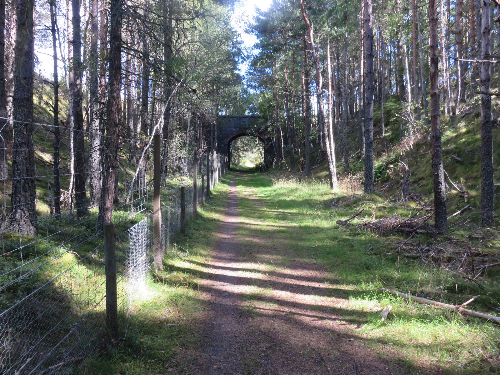
Back onto the old railway line all the way to Cromdale, grassy, softer on the feet nice but hemmed in again. More open sections with cattle around so still keeping a look out.

Finally arrived at Cromdale which is an interesting location where a battle with Cromwell's forces effectively ended the Jacobite rebellion albeit the Scots claimed victory out of defeat, not for the last time. The battle is also famous for being the first reported instance of hand thrown explosive devices being used in combat.

Yes there is a River Spey plus Cromdale Kirk

Crossed the Spey to find a sign indicating 2.5 miles to Grantown via the forest route or 4 miles via the riverside. Guess what I opted for? After about 10 minutes walking I came across another sign Grantown 2.5 miles, not happy.

So the final forest walk of the section. I have to say that the 2.5 mile ramble through the Anagach wood was just a few trees too many. I was overheated as I had dressed for the forecast of heavy spring showers with possible hail and none appeared. Now it was just a warming sun.

Although I had seen a lot of wildlife I had hoped to see the crested Tit on this section but not to be.

My legs were feeling it so I was relieved when I reached Grantown.

Overall it was a good ramble with the exception of the near cattle encounters. It was my last section of the Speyside Way which were spread over a few years so there was the added satisfaction of completing another of Scotland’s long distance routes.


Ascent: 566m

Distance: 24..17km

Time: 5.59

Wildlife: Brown Hare; Blue Tit; Coal Tit; Blackcap; Chaffinch; Robin; Blackbird; Woodpecker; Wren; Pheasant; Buzzard; Goldeneye; Mallard; Peewit; Wood Pigeon; Meadow Pipit; Jay; Willow Warbler; Dipper; Treecreeper,

Sunday, 18 January 2026

Another rough and ready sub.....Carn na Loine

Hill: Carn na Loine (Tufted/Snowflake hill?)

Type: Sub2k

Height: 549m


Today's ramble was a trip to the upper moorlands of Moray. I knew from my preparation that some of the lower sections of these hills would be typical horrible moorland terrain and it did not disappoint.

Whilst a lot of the country was still covered with low grey cloud Moray was almost all blue sky so I was happy that I was here. The most frequent option is to do a circular route but with my sore calf I opted for an up and down. As it turned out the distances would have been similar.

From the parking area a view of autumn trees was a nice start

There was no obvious parking near the start of my walk so I parked up on an off road grassy spot, which would have been the finish if I did the circuit. Walked the kilometre to the start of the mast track at Knock of Auchnahannet. The kilometre was a lovely morning walk, albeit walking on an undulating tarmac minor road. The return final kilometre was just as pleasant viewing but much more painful.

Walking down the road I could see the mast track winding up in the middle of the picture

A crisp morning, autumn colours on the trees, few sounds apart from cattle calling in a field somewhere nearby. A few up market looking houses were half hidden in the trees. On my right I also had a view of the track that I was going to use for roughly half of the ascent (the easy bit).

Lovely tree walk to the moor full of birdsong and a view of the hill ahead

The track is a maintenance track for a mast on the nearby hill of Tom Mor. Clearly it was used by the farm/estate more than for mast maintenance but I was glad it was there. Lower down this is sheep farming but the upper slopes are patched heather indicating grouse shooting.

I had an option but followed this track, correct! trees were full of Fieldfare but they scattered as soon as they spotted me.

It was one of those beautiful crisp autumn mornings that made me happy to live in Scotland. Air clarity meant great viewing and as the morning grew so did the temperatures.

One field had a large flock feeding and constantly on the move. Focused the camera lens on them and delighted to see my 1st Redwings on the year, 50+.

Walked up the track, listening to the birds, Fieldfares in good numbers; calf throbbing; probably a mistake but kept going.

As the crow flies I was less than 10 miles from Grantown on Spey but this felt like a different world, not that Grantown is big city stuff!! Big open landscape and no traffic noise, wonderful.

Entering the moor the target directly ahead

Walking up the hill path onto the open moor it was absolutely stunning enjoying that beautiful autumn day. Just me and a lot of sheep. You know, when you go past an enclosure or a transportation van full of sheep the smell can be overpowering and frankly not pleasant. But out here on the open moor, in their natural environment it was actually a pleasant smell, a gentle reminder that I was here at one with nature.

Finally the good track walking was over and it was time to go off piste and head up towards the ridge. For a couple of minutes I wandered up and down but there was no path that I could see. So I just took the plunge onto the moorland. My first steps was full confirmation of what lay ahead for the next half an hour and it was not going to be pleasant.

Horrible, headed for the thin line in the middle hoping it would be better going, it wasn't!

Think of your worst terrain and this was probably comparable. It was constantly changing underfoot to just remind me that the landscape was the boss here.

This section went something like this. Heather which was waist high at times making movement awkward and hiding everything underneath. Alongside and mixed with the tussocks, not quite Dumfries & Galloway worst but not far off, constantly twisting and rotating my feet thus constantly throwing me off balance. Bad thoughts beginning to be vocalised.

Not content with just those there were the boggy bits with the many hidden leg breaking water routes I could hear but not see. At one point when one leg was sunk into a narrow water slit, almost to my crotch, I did question my wisdom about this ramble.

My glass half full side was clinging to the belief that as I got higher the going would improve and thankfully it did but only marginally.

If I had kept heading to the ridge I would have met an ATV track but as I did not know that at the time I was now taking a contouring route to where I thought the summit was.

On the flatter rough ground at the top I now encountered proper peat hags which were shallow but still had to be avoided. I rambled around knowing the map showed a trig point but where was it?

Then over the top of a peat hag top I spotted a flat concrete shape. Finally reached it and it had a small peat hag trench right beside it.

Foreground the ridge I should have walked, beyond the Moray Firth.

As it is a stand alone hill the views were good all round. Looking North the ridge I should have walked but further on were the waters of the Moray Firth which shimmered in the sunshine. 

A good view of the best side of Corbett of Ben Rinnes

Turning towards the east the pointed peak of Ben Rinnes was so clear on the horizon. Memories coming back of my hike up there which was a few years ago, probably one of my earliest Corbetts.

As I was heading down I was glad to see the track along with a superb view of the Cairngorms.

Looking back the way I came I had a landscape view over Speyside with the Northern Cairngorm mountains in the distance. Some of the tops under cloud but most were clear. Worth the effort for these views.

Relieved to reach the track and spotted this grouse butt. There were many dotted around but no tracks beside them and no grouse seen or heard.

There was a cool northerly wind, not strong but enough to chill. As said I returned more or less the same way. I thought I had spotted an ATV track that might be easier so took a slightly different route through the crap but I was wrong and it was still crap.

Quick not in focus snap of the Roe deer buck

When I approached the farm buildings I spotted a Roe deer who had probably spotted me long before I spotted it. It ran about a bit, trapped,  before it stiff legged bounced away as if on springs. That made me smile at how lucky I was to see it.

A lovely ending to a short ramble in our special country but not that terrain. With hindsight I should have done the full circular route.

Ascent: 386m

Distance: 10.1km

Time: 3.07

Wildlife: Buzzard; Roe Deer (buck); Wren; Pheasant; Redwing; Chaffinch; Greenfinch; Treecreeper; Coal Tit; Robin; Goldcrest; Great Tit; Fieldfare

Sunday, 6 November 2016

Speyside Way Aviemore - Grantown


You will notice that I have incorporated 3 stages of the Speyside Way into this blog posting. I actually walked the Aviemore - Boat of Garten on one trip and the other two another day but all 3 can fit into a reasonably fit persons walking day or split them into 3 whatever you want.
View over golf course to Lairig Gruh
Starting at the railway station cross over the railway bridge, stop and admire the view south and of the station itself, and take the back road to Dalfaber (follow the cycle path signs if required). At the next road crossing head towards the golf course and that is you. The towns orbital path can be used as well to get to the golf course.
Watch out for bikers
The initial stages meanders past the golf course and through a natural wood to explore if you wish. The path to B of G is a busy MTB cycle route so take care they can be on you before you realise.
The terrain opens out with good views of the Cairngorms and the steam train might pass close by. Follow the good path until you reach a fork, the right hand takes you straight into B of G, the left is woodland trails used by the bikers eventually bringing you to B of G if you take the correct turns. I took the woodland trail, it added about a couple of miles but no views to interest me.
When you break out of the forest there is about half a mile of new and old, mostly very large, houses to admire if you win the lottery.

At B of G there is a cafe, shop and hotel if you want to get refreshments or even the bus or train back to Aviemore. 
If not turn left and follow the main road following the signs to the RSPB Osprey centre. Cross the River Spey, pause and look for salmon if it is the season, then there is a short stretch of road walking before entering woodland again and then into the forest proper at the T junction.
Typical track
The next couple of miles through the forest is a bit boring but plod on. If the right time of year you might want to take a slight detour to the RSPB Osprey centre, but for us they had already flown the nest back to Africa. Look up the tops for Scottish crossbills.
When I broke out of the forest the track had one of these frustrating signs pointing in a half direction. The track looked most used so I went left but of course I should have gone straight on upwards following the tree line. I had my doubts but I had walked another couple of miles before I was sure an error had been made. This mistake either meant a road section for a couple of miles or a similar about turn distance. I was under time pressure to meet someone in Grantown so just walked on via the road.
Bob Dylan where are you?
Nethy bridge is a typical highland hamlet, a mix of very old and new property. I had picked up a Speyside Way sign but there were no more to be seen going through through the village and to this day do not know where the route went. I knew I should now be walking the old railway line. I walked in the right direction going past the golf course and realised I should be somewhere down to my left hand side. Incidentally, I was told that Bob Dylan purchased a house somewhere near this golf course but no sight or even sound of him today. The detour did have its good points as I saw the golf course, look out for the short par 3 that is played across the Tomintoul road, quite unique in my golfing experience. Also I came across the beautiful Abernethy Old Kirk and its war memorial graveyard, very historic and interesting to spend some time here. 

I considered diverting across a couple of fields but too many cattle in them so no go. About a mile further on I spotted an opportunity and followed a farm track downwards which thankfully led me onto the Way again, very happy to be back on track. There are signs promoting the good work of the local farm in assisting wildlife to flourish, good on you.
Old Railway section
This section is straight forward flat walking along the old railway line, going through farm land but no animal blockages. Through some woods a huge brown and sandy coloured buzzard suddenly and silently takes flight moving away from me. Then the River Spey appears into view with 3 salmon anglers trying their luck or should I say skill.
Buzzard appeared here
This stretch is a bit more interesting with interchanging wood and open views. 
Finally I cross the mighty Spey and take the woodland walk to Grantown.
Overall an easy and interesting walk. Total mileage for the 3 sections was around 17 miles, 6 for the Aviemore - B of G, then 11 for the B of G - Grantown on Spey.
Salmon Angler on the Spey

River Spey