Showing posts with label Loch Doon. Show all posts

Friday, 1 April 2022

Annual January ramble up Craiglee

Hill: Craiglee (Loch Doon)

Type: Sub2k

Height: 523m

Time for my annual January trip up Craiglee. A friend wanted a walk but one that was not too onerous. I was originally planning a long overdue Wanlockhead outing but the forecast was for fog/mist. So off to Loch Doon to see if it was any better. As you can see from the snaps the answer was not a lot. Even the wildlife remained hunkered down nothing was about apart from a crow, not even finches in the bushes. Still it was a good leg stretcher and a good natter. Interestingly well over an hour quicker than last year albeit that had some deep snow conditions.


New to me


Ascent: 443m

Distance: 5.6km

Time: 2.2

Wildlife: Carrion Crow

Monday, 5 April 2021

Mullwharchar....the most remote hill in South West Scotland and at times it felt like it.

Hill: Mulwharchar (Hill of the Lapwing)

Type: Graham/Donald

Height: 692m

As I drove along Loch Doon at just after 7am, temperature showing -2deg, I was amazed at how many people had stayed here overnight. If I said 50 tents I think I would be underestimating. Yesterday afternoon the traffic was the busiest since the first lockdown, I guess people have just had enough, me included.

Sunrise over Loch Doon
The fog was down but it was a stunning morning. I suspect most of the tent occupants missed this, too blinking cold to get out of a sleeping bag. 

My first view of the Dungeon range.
Mullwharchar is certainly the most remote hill in SW Scotland and as you look down from Hoodens and look at the landscape below you can understand why. Because of its remoteness it was considered an ideal place to bury nuclear waste, thankfully that was rejected.

The Wolf Stock
It was cold enough when I started walking to have my hood up. I knew the initial stage was a walk along a hard packed forest construction track but surprised myself by doing it in an hour to the bridge over Gala Lane. Sore on the feet.

Gala Lane bridge with Mullwharchar & Hoodens
The next section was  certainly not sore on the feet, 20 minutes of bog, tussocks, water etc. I followed a track of sorts but it did the job and got me to the flanks of Hoodens Hill. 

Indeed I was looking at the intriguing named crags 'The Wolf Slock'. My short ascent full of tussocky ground avoided these and I saw no wolves.

Huge boulder precariously balanced
Up top I found a faint track which disappeared as much as I followed it. Hoodens hill was a tough little hill. Much longer than it appears, awkward walking and many false tops. Was it only 9.30am?

The sky was blue and it was warming up. My burning neck led to sun cream being applied, 1st week in April and snow next week wow. There are more crags off to the left 'Yellow Tomach' great name but what does it mean?

Typical slabs that aided walking
After what seemed like an age I reached the long plateau called Hoodens Hill. A mix of tussocks, stone slabs and the odd track kept me plodding along. A small cairn but this did not look like the highest point.

Mullwharchar left, Hoodens middle and Merrick right
Previous walkers have created small cairns all over the place although not sure how helpful they are.

M & M from Hoodens
Looking ahead I see Mulwharchar and then the descent down to the two lochans which I want to split. Its only a descent of just under 100m and the stone slabs aid progress. Plenty of small red/brown lizards or newts near the lochans. Far too quick appearing and disappearing to get a snap.

Harder walking to Mullwharchar
The 200m plus ascent of Mullwharchar is a case of using more of the slabs to aid progress, avoid as many tussocks as possible. You got the idea and thankfully no false summits.

The Awful Hand range from Mullwharchar
Once on top the views were stunning a fitting reward for the slog before and still to come. The best view was seeing the full range of the Awful Hand quite special on a day like this. To the south Dungeons Hill & Craignaw, another long day ahead for those two.

Meandering Gala Lane and the moor to cross plus Loch Doon top left
A careful descent and reascent of Hoodens and I was looking down over the moor that I had crossed from the bridge over Gala Lane. This really is remote ground. From up here there looked an alternative route but I knew the terrain would be poor, better sticking to the 20 minute sometimes track through the plantation. Indeed once down I found a better track than my in route and glad I stuck with it.

Over the bridge and back on to the hard pack road for the walk back to the car. Delighted to see a shadow flickering about and it turned out to be a Peacock butterfly. Not my first sighting but first snap of the year, spirits lifted.

Peacock
A long and tough walk, nobody else spotted, so almost 7 hours of just me and my mind games!!

Ascent: 894m

Distance: 23.7km

Time: 6.51

Wildlife: Kestrel; Buzzard; Chaffinch; Robin; Meadow Pipit; Raven; Peacock butterfly; Tadpoles: Lizard?

Tuesday, 2 February 2021

A fine day for a recce at Loch Doon

Looking forward to getting out of this draining lockdown with one of my key objectives for the year is my completion of the Donalds. The most awkward one left is undoubtedly Mulwharchar. There are a number of potential routes that I have researched, none of them looking great and a involving a long day whatever route.

I had been chatting to local worthies on my ramblings around Loch Doon learning from there experiences. The route from Glen Trool is clearly a long slog over rough ground and I am told to avoid unless there is a car at each end when it could be a memorable outing. Another route leaves from Forest drive or near Loch Riecawr the map suggests a lot of rough ground.

The Rhins looking cold up there
With my desktop research my and walking knowledge my preference, which thankfully was backed up by the locals feedback, was to head down from the southernmost point of Loch Doon to cross the small bridge marked on the OS map SE of Hoodens Hill.

So, the recce today was to find out if the bridge still existed and assess the ground from the bridge to Hoodens Hill.

No gritters out today but survived the icy drive along to the castle parking area where with relief my walk started. A crisp clear morning with low cloud hovering over the tops of Coran of Portmark and Meaul. No cars parked today but no doubt it will be full on my return. I had debated parking further on but it would only have saved 5 minutes as the barrier was closed before Forest drive.

Gala Lane just before it enters Loch Doon
A straightforward route admiring the renovation of Starr cottage, part of it looks like a bunkhouse so wondered if it is now a hostel of sorts? 

There is plenty of deforestation around so the track is in good condition. Briefly took the wrong turn at the junction, map out, turned back and now can't go wrong!

Take some trees away and the wind blows the front line down

A mix of open deforested ground, some forests still intact and plenty of trees wind affected and blown over. Hoped for some different bird sightings but it is barren so far.

The cloud was low over over Corserine. The wind was chill enough down here, up there it would be a lot colder, sub zero wind chill I imagine.

First view of The Dungeon Hills, Mulwharchar the peak mid left

Now out of the trees and wandering down the track both Hoodens Hill and Mulwharchar have looked close for a while but seemingly not getting any closer. 

Closer up the new bridge. This area still shows trees on my Harvey map 

Arrived at another junction to find a newly built forestry bridge, definitely a higher standard than the one I was looking for. A check of the map but I suspected that this water is the smaller Kirriereoch burn. Crossed and kept going up the new track to soon find its end, a turning point for the vehicles. 

Ahead the bridge I was looking for

Not all doom and gloom as the good news was the grassy trail heading onwards. And there it was directly ahead, another bridge, more substantial than I thought it would be and over a bigger and wider water. This had to be Gala Lane. A remote but quite stunning spot, no Covid walking hoards here. 

Beautiful remote with the objective ahead


More optimism was that there was a faint track heading off through the rough ground towards Craigmawhannel. No further today but the ridge of Hoodens hill was probably only 15-20 minutes walking away.

Time for lunch and reflection. It was almost 2 hours from the start so four hours to add and still no climbing yet. I reckon that from here to traverse both hills and return to here would be 3-4 hours. So an 8 hour day. However, it could be reduced. If I did it as a solo trip I could cycle to this point probably taking 2-3 hours off so worth thinking about.

The return walk was no hardship particularly once the views of Loch Doon opened up. This is one beautiful spot on a day like this.

Loch Doon ahead

Overall it was a perfect day for a recce and the learning was positive reinforcing my initial thoughts. Roll on when I do it for real.


Thursday, 7 January 2021

As promised a swift return to Craiglee and it didn't disappoint.

Hill: Craiglee (The Grey Crag)

Type: Sub2k

Height: 523m

The forecast was excellent for my swift return to Craiglee. This small hill can be climbed from Loch Finlas or by my choice, from Loch Doon starting at the castle, with it's historical connections to Robert the Bruce. 

View from the start
Once again an icy road driving in but the pink hue on the hills from the morning sun was breathtaking, well worth an early start. Plus met the gritter who was able to go more off road than me so a comfort knowing the road had been gritted.

Two overnight campervans already in the parking area but plenty of parking for us. The parking area was decidedly more slippery than midweek (-6deg from car) and I even considered my mini spikes but too much effort as I assumed they would be quickly off again.

Evident track lower down
About 50m up the track it was still icy but we were utilising the soft snow at the verges. Noticeable that there had been a significant snow melt since midweek. Indeed the track up to the Wee Hill was at times more ice than snow. The descent could be interesting if we returned that way!

Craiglea
It really was a beautiful winters day and now getting views of Craiglee off to our left. It didn't take too long to get the cairn on Wee Hill and take in the superb views. The SMC guide says it is one of the finest viewpoints in Southern Scotland and I would not argue.

From the top we headed NE and I don't think anyone had tramped in my footsteps since midweek so it was an obvious choice to follow them and save energy for the deeper stuff soon to be encountered. 

Deep snow to break a track
The snow levels up here were still the same, no real thaw at this height, some deep stuff to wade through and break a trail but it felt good to be out on a snowy hill on a day like this. Perfect silence which you don't experience too often. Plus feeling fine fitness wise, I reckon I had something just not right over the last month that had me breathing harder on my walks.

As we climbed we ploughed through the drifts. There were quite a few hare tracks but none spotted.

Trig in sight someone's descent track
When we crested the top the trig was in sight but this also brought about a significant temperature change. We clearly had been on the leeward on the ascent. Hat and gloves back on. Still time taken to enjoy the magnificent views. Seen it all before and it never disappoints but on a winters day like this it is extra special.

Winter wonderland
We headed back off the top to find some shelter for lunch and enjoy the vista in comfort.

Loch Doon
A surprisingly swift snowy descent only one really deep snow mishap where we went deep. From here I didn't fancy my original route contouring the hill so chose to go back up the Wee Hill. No hardship as it is a short walk and good to get more effort in the bank.

Looking back to Carsphairn
From the top we took a leisurely descent enjoying the views of the big southern hills. Great care was taken and surprisingly the spikes were not required. We only met one other couple on the hill but the carpark was rammed full, I thought Ayr OIR had changed there day, where were all these people?

A stunning short day out particularly as I love these winter snow conditions. The views were magnificent, fitness was good, bring the rest on.

Ascent: 457m

Distance: 5.7k

Time: 3.44

Wildlife: Red Grouse; Robin; Rook; Wren; Hare & deer tracks.

Thursday, 31 December 2020

A short ramble in a winter wonderland.....Wee Hill of Craigmulloch

Hill: Wee Hill of Craigmulloch, Loch Doon

Type: Tump:

Height: 427m

My original plan was to visit this hill on my way to Craiglee but more of that later. 

An interesting and careful drive alongside icy Loch Doon brought me to the ruins of the castle carpark. One other car already there, a person could be seen exploring the ruins so not a walker. Surprised at how many campervans were parked up along the road, some with tents. My car showed -4 temperature, rather them than me.

New site of ruined castle it used to be in the loch
It was a stunning blue sky snow covered hills morning.

However, as I was getting geared up I decided the air temperature was warm enough to get rid of my mid layer before starting. I prefer starting cooler and adding layers if required rather than taking off a damp sweaty layer on the ascent.

Followed the track up the side of the castle. Some icy patches but I was not putting on spikes just yet. A short steep start and I was breathing a bit harder. The plumes of steam coming out of my mouth as though I had a cigar on the go.

Too cold for a seat track just beyond
I crossed a main track to the less obvious minor track on the other side. This took me to some benches and behind them another less obvious route but I knew I was on the correct section albeit the snow does a good job in disguising that a small track was there.

The great thing about snow is the wildlife tracks. On the ascent I never spotted any in the flesh but saw tracks of hare, deer and something small with sharp talons, stoat or weasel?

A fairly straightforward ascent albeit some surprisingly deep pockets of snow going right in to the knee. 

Craiglee ahead and Wee Hill cairn just in view on the mid-right
Got to the lower top and wandered over to the loch side to get some excellent views. 

Back over to the real top and its small cairn, through more deep snow. From here Craiglee looked magnificent. In fact the views all round were particularly pleasing. The snow giving excellent profiles to the hills, everything stood out.

Craiglee looks like a track in the middle but when I got closer it is a burn
From my planning I knew I was ascending the right flank of Craiglee as I stood but my proposed descent route was more central and looked like deep snow fields. I did not really want to come back over Craigmulloch but it remained an option.

I headed down the short descent slopes of Craigmulloch and as expected there were deep pockets of snow but nothing too difficult although plenty of care taken as who knows where the hidden holes/burns were. 

Then everything was taken out of my hands. About a third of the way up Craiglee my wrist watch vibrated, a notification that a text had been received. No phone signal but the text had got through. A family issue that I needed to be involved in asap. 

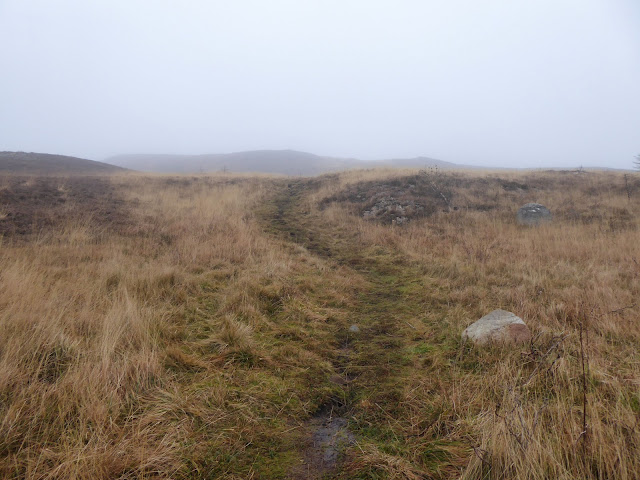
Retrace my steps back up Wee Hill
I was close to the top but would not have enjoyed the rest of the ascent so now simply a case of following my tracks back up and over Craigmulloch and then back down to the car. 

On descent car down at loch and Mullwharcher range in middle
Although there was a low sun the descent was enjoyable as the views of the high southern Galloway ridges were superb. And I had remembered my sunglasses!! Two pairs came up the hill and stopped for a chat with two locals from Dalmellington who pointed out a few routes to consider for summer walks.

Further west Shalloch on Minnoch
So, not the walk intended but a stunner none the less. What conditions, they were simply beautiful. The forecast looks good for the next few days so I will be back to finish what I started. Either way Craiglee will be the last of this year or the first of 2021.

Back at the car chatted to the park ranger who confirmed the quad bike cops I saw a few weeks ago were the real deal.

Despite all the Covid crap it has still been a good walking year

Ascent: 294m

Distance: 3.9k

Time: 2.05

Wildlife: Wren; Blackbird; Crow