Showing posts with label Graham hills. Show all posts

Saturday, 2 April 2022

Creag Rudah

Hill: Creag Rudah (Glen Tarken) (Red Crags)

Type: Graham

Height: 712m

I decided to tick this one off as I missed it last year when doing its pal Beinn Each. It was actually meant to be the easy walk of the trip but my legs didn't feel that way. 

I left a stormy home but as hoped the winds had dropped inland at the start. Huffing and puffing up the steep track, all going well until I cut off to head for the hill track. However the ford and burn were not to be crossed today neither at the ford nor after walking a fair way up. It could have been done with wet boots guaranteed and a potential risk as on my own and I did not want that that at the start.

I knew that there was a hydro track going right to the far end of the glen before curving round and passing the start I wanted. So grudgingly I took the longer trek on the hard track. There was a fair more ascent and descent than planned for. Feet did not like this one bit. I reckon it added at least an hour to the ramble.

Finally time to leave the track and headed up through the rough grass and heather. Animal tracks only to follow if lucky. I was on the wrong side of the ravine but it looked easier walking.

Rough walking and I came across some grouse butts, pretty remote shooting this. 

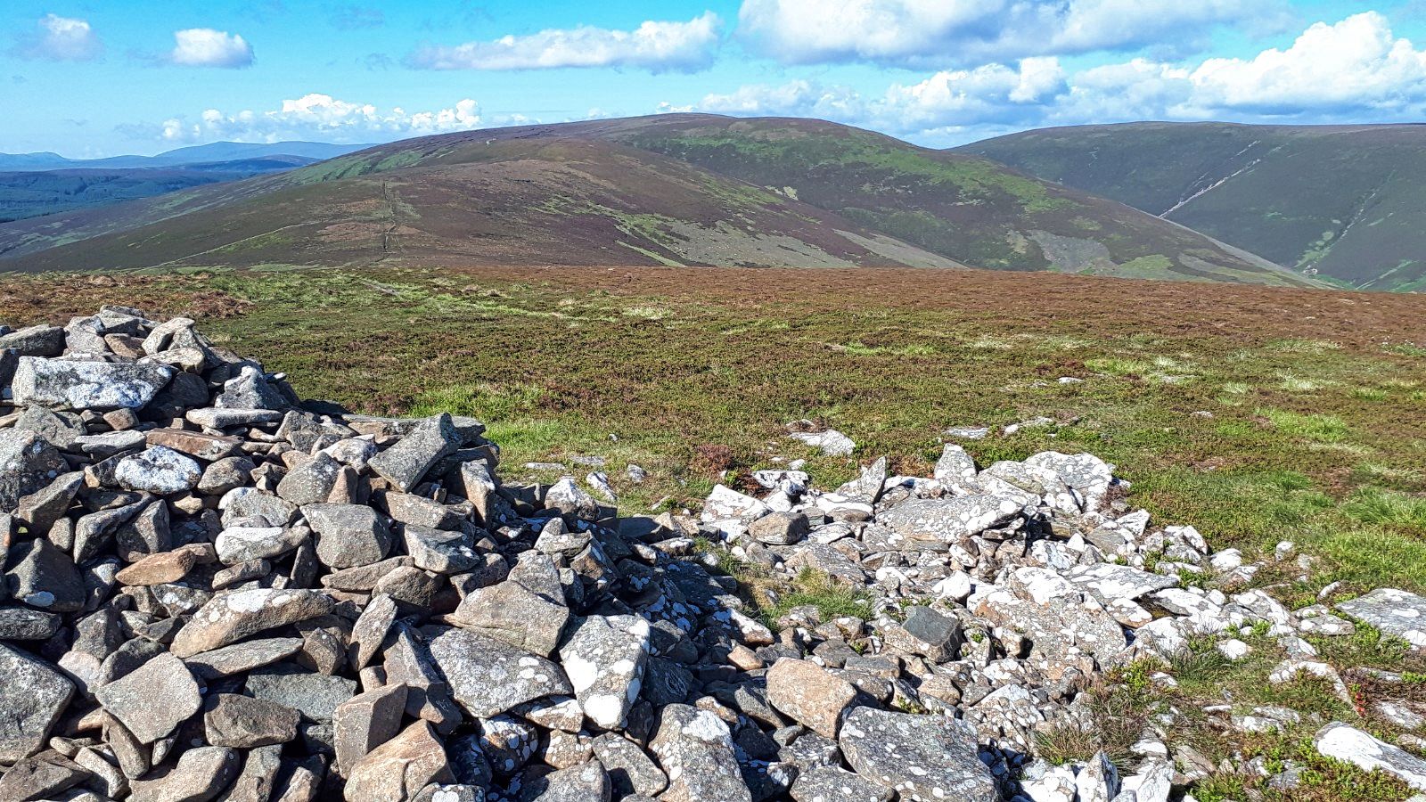
Of course this is peat hag countrty. Along with sodden underfoot conditions it seemed to take an age to get to craggy summit, not the nicest walking.  The wind was up and it was bitterly cold so I did not hang about for long. Full black clouds passing over. Good view over the Lawer hills and Ben More. 

The snow showers were coming through so a quick descent back to the track and the long plod back. At the least the wind and showers were at my back helping me along as my legs did not want to rush. A good walk but the legs knew it was a long one.


Ascent: 825m

Distance: 17.7km

Time: 5.02

Wildlife: Buzzard; Carrion Crow; Raven; Redwing 20+; Red Grouse; Fox Moth Caterpillar,


Beinn Bhreac from Inverbeg

Hill: Beinn Bhreac (Glen Douglas)

Type: Graham

Height: 681m

I had been up the summit before but from a different start, further down Glen Douglas. So a new route appealed but the weather didn't. The forecast was poor and the reality married with the forecast. Constant rain which became hail up top. Saturated moorland. Winds gusting to 50mph. The top was serious stuff trying to stay on my feet. Still it got me out and after a couple of weeks break my walking fitness needed it. Soaked but a good walk. Very few snaps taken.


Head up the treeline

Steep start, Loch Lomond behind

Bhreac appears out of the gloom


Ascent: 618m

Distance: 7.4km

Time: 3.39

Wildlife: Buzzard; Red Grouse

Thursday, 24 June 2021

Third time lucky....Meall Buidhe.....Glen Ogle

Hill: Meall Buidhe, Glen Ogle ( Yellow Hill)

Type: Graham

Height: 719m

On my way to a planned trip I was looking for a quick up and down hill and decided to travel via Glen Ogle to tackle this hill at the 3rd attempt. On the previous two occasions I was intending to stop off on my way home but the weather was awful both times. Not a walk to bother about without the views unless you are a don't care less bagger and to be fair there are a few of them around. This time the forecast looked good for everywhere in Scotland apart from this section which was forecast for showers and yes they arrived. The annoying thing was that 10 miles down the road Tyndrum had no rain at all, that's showers for you.

Although this is categorised as a Graham the starting point is at the top of Glen Ogle thus giving a head start so an easy walk. 

Ferns here had grown to head height
At the start the track starts beside the car park and the ferns had grown much taller here than recent hills but luckily I was not wading through them. Food for thought for planning future walks.

There is an aerial mast about two thirds of the way up the hill so unless you are a masochist and want to go cross country the service road is the one to take. This zig zags its way up the hillside making progress even easier. 

1st view of the crags at the mast
Initially the track meanders through trees but then opens up to give you a view of the mast. 

Almost out of the plantation
Further on the track escapes the trees giving good views which become better as you ascend. The clouds were rolling over but no rain yet.

High point Meall Buidhe from the mast just pick a route
From the mast the cairn can be seen but the terrain in between is full on moorland, not D&G tussocks but not far off. The walking was awkward but not difficult. There was the occasional very deep hole to keep me wary but mainly it was heather and sphagnum bogs. 

Typical peat hag moor
After about a kilometre the ridge was reached and surprise, surprise on came the rain. I had swapped to my light rucksack and had put in a waterproof jacket but not the trousers, so wet shorts!!

The big cairn as a shower passes
Once on top there are two of cairns, oddly the smallest being the high point. 

Looking down Glen Ogle towards Lochearnhead
Slightly further west there is a more substantial cairn which would normally give good views down into Glen Ogle but for me atmospheric would be a better description as the clouds prevented downwards looking, still not bad.

It had been a short walk and I was feeling good so rather than return the same way I decided to head along the ridge to the north top of Beinn Leabhainn. Strongly recommended as even in these conditions the views are so much better and on a good day would be quite stunning.

The traverse is not all ridge, there is a descent into more very wet bog but thankfully short lived before heading up the ridge again, once on top the cairn is in sight. Fresh deer and grouse droppings around but no live ones spotted.

Killin with Lawers range behind

Loch Tay
As you head towards the cairn good views of the Lawers hills directly ahead and to the east Loch Tay opening out more and more. 

Looking West up Glen Dochart to Tyndrum
From the cairn the full vista also covers the Tyndrum hills and closer the Munros along Glen Dochart. Pretty dammed good but would be fabulous with the air clarity I had on Dun Rig.

Mast ahead
From here the top of the aerial can just be seen peaking over the horizon. Easy navigation and an easy descent albeit along more poor walking terrain but the aerial mast is soon reached.

Winding track back to the start
To finish just follow the track back to the car. A young couple passed me heading up, the only people seen on the hill all day. 

Back at the car the humidity had brought out the midgies and they were having a feast with me on the menu. I had midge spray in the main rucksack but I was getting so many bites that I abandoned trying to find it. Simply jumped into the car and drove away with the windows open hoping they would be blown out. Maybe some did but others lived to continue the feast.

An enjoyable walk and definitely a small hill to return to when the weather allows the views to be enjoyed in full.

Annoyingly when I got to my digs and checked the weather forecast for tomorrow it had changed and was very poor indeed. I had planned to kickstart my Munro count with a Dalmally double but the forecast was predicting heavy rain and very poor visibility by lunchtime, so a rethink required. Next blog will tell what happened.

Ascent: 474m

Distance: 9.1km

Time: 2.28

Wildlife: Chaffinch; Blue Tit; Meadow Pipit; Small Heath


Wednesday, 23 June 2021

Rollercoaster circuit of Dun Rig

Hill: Dun Rig (Dull brown Ridge) (744m); Birkscairn Hill (Cairn above Birks(farm)) (661m): Glenrath Heights (heights above Glenrath farm) (732m): Stob Law (no known name) (676m)

Type: Graham x1, Donald x4

Another opportunity from my Edinburger trip to detour on the way home this time and save adding mileage to busy milometer on the car. Time to complete the long Dun Rig horseshoe. 

The star of the bunch is Dun Rig which is a Graham and the highest point of the Manor hills. Alongside the walk is a horseshoe collecting another 3 Donalds. Planning stage and this is a long walk as unfortunately all the bagging hills are at the far end of the horseshoe. The plus side is that it is a long walk in beautiful rolling border hills so embrace and enjoy. I was tempted to do this last week with some friends but the forecast was rubbish, glad I waited.

Looking back to Peebles shortly after the start
Today the forecast was good with blue skies overhead when I started the walk from the traditional spot at the end of Glen road. In my planning I debated the less reported anti clockwise route but ultimately stuck with convention. There were no wind issues to factor in so off I went, another test for the recovering legs.

It is a long walk in with quite a few ups and downs before the first Donald of Birkscairn Hill is reached. I followed the old drove road which is a cracking start but the climbing starts almost immediately. It was early morning but before long the I was dripping, boy was it warm. In the early morning light a stunning russet coloured field hare briefly appeared and disappeared. 

The high level walk ahead with Dun Rig centre
It did not take long before the views opened out and I had an option to go over or round Craig Head. On a better fitness day I would have gone over but still tired legs I followed the drove road round around the hill There will be enough climbing ahead. The signpost warned of coos which were spotted but not interested in me.

Cardrona forest on the left, track up to Kirkhope and Birkscairn behind centre
The drove road continued beside the forest with excellent views of the horseshoe ahead. A few more ups and downs before the long pull up Birkscairn Hill and its big cairn. I was having a break and eating my banana when I heard a snort and a springer spaniel appeared beside me. Its owner said a brief hello before jumping the fence and headed off downwards towards Birks Hill, He was the only person I saw all day.

Dun Rig ahead from Birkscairn, Glenrath behind on right
Off now with a clear view of the fence ahead that would lead me to the peat hags and then Dun Rig. The ground was as dry as it probably could be but no doubt that this section from here to Huddlestone Heights could be a significantly different/harder walk with the hags and sphagnum bog terrain.

Dun Rig trig
Dun Rig trig reached without incident, just under 3 hours, pleased with that. Another food break, a good scotch egg and take in the views. 


Half way view back from Pt713m

The horseshoe heads further south, following the high ground, before turning round to head for home and the next Donald of Glengarth Heights. This section had some serious hags here. Even in the very dry conditions my feet were breaking the crust and sinking in quite deep, the joys it could be after a prolonged wet spell!

A raven flies over, the first and only corvid spotted today and on Windlestraw circuit the other day.

Heading back now Glenrath Heights ahead with Stob Law back left

After the turn another fence to follow, plodding slowly up the slopes of Glengarth Heights with one eye looking at a top over to the far left which my mind was in no doubt, that was the spur of Stob Law. 

Glenrath summit looking to Drumelzier hills
Excellent views particularly to the western hills of Coulter, Tinto and the Drumelzier hills. No jagged peaks but still a special view.

Looking to Stob Law
When I reached Broom/Middle Hill the motivation to do an out and back to the final Donald of Stob Law was low but it had to be done. The descent was steep and when I reached the col it was rucksack off and followed the track to Stob Law, a strange feeling climbing a hill without the weight of a rucksack. 

The flatlands of Stob Law
Stob Law is a flat top with not a lot going for it, a few stones make up the cairn, it feels appropriate for the runt of the round. The descent however does give good views down into a deep valley on my left with some featuring crags interesting named 'Bleak Hope'.

The return to Broom Hill a lot steeper than the snap makes it look
I was feeling a bit bleak myself as I collected my rucksack for the return ascent to Broom Hill. A single wild raspberry was growing beside it. To eat it or not. I decided I would let it seed and maybe some future nutrition for Donald dafties. This was easily the steepest gradient of the walk so just kept muttering 'its the last climb' over and over.

Now really heading for home via Huddlestone Heights. Another moorland section strewn with hags and bogs, the softest terrain of the walk. A clutch of red grouse fledging's burst from cover, fun to see. 

Huddlestone Heights, Pentland Hills in background
Finally the last high point, Huddlestone Heights, a non status hill but it has a trig and more superb views of the horseshoe I have just walked in its entirety. There was a cooling breeze and the air quality was so clear I could see the Bass Rock and even further afield across the Forth the multi stories at Kirkcaldy and behind them the Lomond Hills. Makes all the effort worth while.

All that was left was the very long walk back out. From the trig there is an ATV track which follows the broad ridge of Dead Side passing more gun butts. Nothing left other than to enjoy the walk and take in the views. 

Raven trap
Near the old settlements I came across a raven trap. Clearly not in use at present but might explain the lack of birds seen. 

An excellent walk particularly with the weather but it was certainly a roller coaster of a walk, confirmed when I looked at the GPS profile. It would be a shame to do this on a cloudy day and miss out on the views. I would certainly do it again but miss out the spur, don't need to bag it twice lol.

Just two to go for a Donald completion, that will be July's task.

Ascent: 1068m

Distance: 24.7km

Time: 6.27

Wildlife: Field Hare; Woodpecker (pair), Pheasant, Buzzard. Raven. Blackbird, Jay (heard), Cuckoo (heard), Skylark, Meadow Pipit, Red Grouse chicks, Small heath butterfly,

Thursday, 10 June 2021
A spectacular ridge walk to bring up the Graham 50.....Coigath ridge horseshoe

Hill: Ben Mor Coigach (743m) (Big mountain of Coigatch district) & Sgurr an Fhidhleir (705m) (Peak of the Fhidhleir)

Type: Graham x2

Leaving Ullapool Coigach ridge still almost an hours drive away
I set off early and arrived at the parking area at Culnacraig to find one remaining tight squeeze parking slot. Chattede to a couple in a camper who said most cars were here overnight their occupants backpacking somewhere in the area.

Beautiful morning at the start, looks steep
The hill looks ominously steep from here lol. I headed down the track, over the bridge and cut in to follow the track contouring the hill which headed for the ravine. I suspect I cut in too early but the faint on/off path through the heather and ferns could be followed. Although in a few weeks time the ferns and bracken will have grown hiding it.

I crossed the impressive ravine of the Allt nan Coisiche low down but it can be walked up its left side and crossed higher up. I climbed the light heather slopes on the right hand side before emerging at the moor. Might be early morning but I was perspiring. The moor was very dry today although reading previous reports it can be a bog at times.

From the moor heading to the far right
I headed to the right side of a landslip and then zig zagged up the rocky sandstone flanks. No proper path until I spot one higher up, almost at the ridge. God knows where it started or maybe it just started here. 

Track appeared for a while, ridge starts at the peak ahead
The ridge top still looks higher up than the picture suggests, a mild rocky scramble with the vertiginous drops now on the right. 

Arran ferry not heading for Arran but Ullapool
Below I could see the Arran ferry on its last Hebrides sailing, heading into Ullapool, the MV Seaforth apparently back in operation from tonight.

Loch Broom
Now on the top where the views are spectacular and the walking awkward. There is another on/off path slightly down to my left for those who do not like exposure. 

First sight of helicopter with An Teallach ridge behind
I could hear a helicopter which sounded very close, spotted it over Loch Broom, lost it and then it appeared behind me. It flew up for a look at me, I have never been so close to a flying helicopter, had I accidently set off my locator beacon. The crew had a look then flew over to the summit of Coigath where another sole walker was standing. The chopper flew a circle over his head, that looked dramatic before heading off deeper into Assynt and out of my sight.

V junction summit on left full ridge walk on right
Wow, back to the knife edged ridge. About half way along you come to a V junction to take the left fork to get to the highest point Ben More Coigach. 

View back from cairn to the ridge and the ascent across moor and down to the start
There is a solid cairn, ideal for shelter but not needed today. Absolutely stunning views all around.

Peak of Fhidhleir centre from Coigath
The second Graham is looking quite spectacular. It is a proper triangular peaked mountain with huge drops on two sides but from this side a relatively easy ascent.

Closer view showing the easy side
Before that you can drop of these flanks to the quarry but you are better of returning to the ridge and following it to its end to get the views in full.

Now descend with the steep slopes of Fhidhleir prominent. A short moorland trek but stunning Assynt views on your right make this slow going, take it all in.

Fhidhleir left, Stac Pollaidh centre, Sgorr Deas right


Golf bunkers and summit ahead
Again a sandy ascent, some of this could be golf bunkers, before reaching the exposed summit and if you do not like heights do not wander from the trig, it is scary.

Beinn an Eoin ridge to Sgorr Deas, Pollaidh left, Suilven middle, Cul Mor & Beag mid right
I spent some time chatting to the guy the chopper circled, an Aberdonian. As you do we ate, took in the views, talked about hills we had climbed and in the sunshine, fabulous. The views are probably another notch up.

Fhidhleir summit
Out to sea the Summer Isles and in the distant haze just spot the Hebrides. Closer the ridge of the 3rd Graham, Beinn an Eoin. 

Panorama
Then go for it, Cul Mor & Beag. Stac Pollaidh & Suilven and much much more. Assynt has been described as a lunar landscape, I wont disagree.

Descent centre but you could go via right ridge
You can complete the walk with another couple of uncategorised hills but I simply headed for the obvious track on the broad ridge and followed it back to the start. No rush, soaking in the views out o sea, the peninsula and far beyond, this is my country.

Finally back at the car very warm and sticky a shower will be welcome but what views, a magnificent day.

Ascent: 896m

Distance: 10.6km

Time: 5.18

Wildlife: Dottrell (1st of year I think); Raven; Wheatear; Hooded Crow; Meadow Pipit.