Monday, 27 July 2015

Pitlochry to Bridge of Balgie Glen Lyon cycle

Bridge of Balgie post office
It was the day to tick off another of my bucket list outdoor adventures. My plan was to cycle from Milton of Fonab in Pitlochry to the Bridge of Balgie post office/cafe in Glen Lyon. Truly a beautiful part of the country to meander through. 
It was to be a one way cycle, getting on a bit you know, and the first decision to be made was which road to go from Pitlochry to Glen Lyon. There is an up and down back road via Foss but it leads to a long uphill grind that I suspected would be a long trudge and not so much fun. So I opted to go via Logierait & Aberfeldy.
The day I chose was meant to be the best weather day of the week, that's not saying a lot this year, but it was more overcast than I expected when it came the time to start. Fuelled with traditional West Scotland nutrition, a breakfast roll of black pudding and fried egg, very tasty, off I went.
The Logierait road is about to dip again
The opening 4 miles on the back road from Fonab to Logierait is a narrow rolling country road with some fast descents and also some climbs that start getting the lungs going. There are some good views around this stretch but do take care, it is narrow road with many blind corners where meeting a car/tractor at speed is not recommended. Shortly after the start you pass the entrance to the Dunfallandy Stone, a Pictish carving, which you might want to visit.
Attractive garden in Logierait
At Logierait the route follows the main road and the River Tay towards Grandtully. A pleasant scenic flat route but you do have fast traffic around so take care. Also, as I turned onto the main road I was now aware of a westerly headwind which accompanied me for most of the route at various degrees on intensity, so much for the warm day.
Strathtay but n ben
At Pitnacree I opted to get off the main road and followed the suggested cycle route to Strathtay and then the back road towards Aberfeldy. There was very little traffic on this stretch and some mightily impressive properties, no change out of a million for many of these. The downside is that there is a lot of tree cover so views were limited and it felt quite cool in the shade. Still look out for the wildlife, 2 deer standing in the shadows in a forest, only movement was their eyes watching me, a red squirrel runs across the road and rapidly up a tree. There are patches of farmland, plenty of sheep and cattle and regular views of the might Tay.
The footbridge over the Tay at Aberfeldy
The road continues to Weem so you have to slightly double back if you want to visit Aberfeldy about a mile away. Worth it if just to go over the General Wade's impressive bridge construction over the Tay. For the more energetic you can also use this route to include Kenmore before rejoining my route.
Past Weem it is still a flat road but with more faster traffic so still take care. On this road is the village of Dull with the brilliant town twinning names with a place called Boring, priceless. There is also a small safari park located here as well as the location for outdoor activities.

A few miles further on take the turn signposted Fortingall. The views are getting more impressive as higher hills begin to dominate the skyline. There is a famous Yew Tree in this village which is said to be one of the oldest living things in Europe, there you go.
Glen Lyon starts here
Now you take a turn right and the start of Glen Lyon. This is real outdoor cycling for me, taking your time in a stunning location. Stopping often, not through tiredness but to appreciate the surroundings, this is why I am out doing it. The glen is said to be one of the most isolated and lonely in Scotland and it certainly is one of the most scenic. The only cyclists I passed were all going the other way, starts to make you think a bit, and all appeared to be foreign. Some of them were clearly not fit enough to have cycled over the Ben Lawers route so not sure where they started from, maybe a bus dropped them off? A few of the cyclists went speeding past me and they could not have been taking in the scenery as they concentrated on the road at speed, what a shame for them.
Typical view Glen Lyon
If you want to cycle the full glen it is 25 miles from Fortingall to the finish at Loch Lyon but for me the trip was only as far as Bridge of Balgie. As I expected there are a lot of short climbs and descents. The river Lyon is on your left and as a fisherman I love watching the water so I was stopping at any falls just in case a salmon was trying to leap them, but sadly not that I saw today.
Nice stone bridge and waterfall
There is beauty all around you, the occasional but impressive farm or country houses. In the early sections still heavily forested which is restricting the views but as you go on through the glen it opens up to mountain and river scapes that are stunning and spectacular. It is not very warm at all, despite the forecast, in fact it is cool, so I keep on my wind proof jacket for the full cycle.
Glen Lyon but n ben
Finally I reach my destination which has to be one of the most remote post offices. It also has a cafe and outside seating. A cold ginger beer was just the business. 
The vista opens out
As it was Mrs B was meant to be driving to meet me. I did think that she should have driven past by now. I had not had a phone signal since Fortingall so I had no idea where she was, last heard of entering a cafe in Aberfeldy. Had she got lost, I had keyed the destination into the sat nav but could she use it? Had she crashed my car? Worrying times. After half an hour I decided to have lunch, in part because I was hungry but also to fuel up just in case I had to cycle the road back. Just as I ordered she did show up, no problems just took her longer than she thought.
The bike made it
Today my trip journey was just under 35 miles which I travelled at circa 10 miles an hour. As mentioned before it is the journey and the views that interest me not the speed. Again for those wanting longer rides there is the option of going fully into the glen, I am saving that for another day. There is also the option of going up the single track road which goes past Ben Lawers but that is for the fit people.
Highly recommended.


Sow of Atholl

Sow from car park
It felt good to be standing at Dalnaspidal once again. Ok it is just a muddy carpark beside a railway crossing just off the A9 but just look around, wilderness. To our left is the Sow of Atholl the Corbett we are going to climb today. Quite amazingly there are still pockets of snow dotted around these hills, it is only the middle of July after all.
As always a check of the weather app this morning indicated that it would remain dry up until 3pm then the rain would be coming through. Looking down through the glen I am amazed that the water level in Loch Garry has dropped dramatically, in fact it looks like drought conditions which it has most certainly not been. I assume water has been run off by the Hydro board.
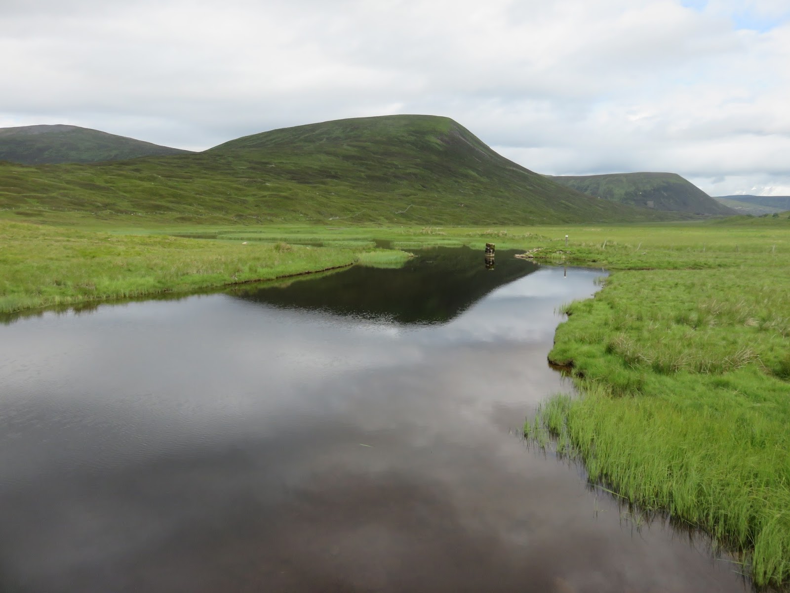
Sow reflected on a marsh pool
The Sow is a Corbett standing at 803m and it is one of the easier ones to climb as the height gained is only about half of that due to the high starting point being high up the Drumochter pass, Mrs B was very happy about that. But not so happy that I had forgot the walking poles although luckily I had my wading stick so Mrs B had some support.
The route begins by following a track heading towards the loch then follow the estate road. The Sow has no obvious path that we could find so it is up-to you where you cut in to make your ascent up the grassy slopes. Walking up the ugly estate road there are a number of new grouse butts erected just across the burn, they are very low down so I presume this track is out of bounds during shoots.
The estate track heading towards the Boar
Although the track goes much further up the glen we cut off to the right and started to follow faint off road tracks. Almost immediately the ground was boggy wet and peaty, this could be fun. The first 15-20 minutes was very careful walking to avoid boots plunging into deep muddy holes. 
The grassy slopes, Meall na Leitreach behind
Soon we were springing the red grouse out of the heather. We must have spooked a couple of dozen all told and fair to say some spooked us as they exploded out almost below our feet, fun just the same to see them so close.
I was scanning the hills to our left focusing on one of the snow patches when I realised the dots were actually 8 red deer, heads down taking the snow for water I assume. Over the course of he walk we must have seen 40+ red deer on the summits. I have seen more red deer this year than any other I can recall.
Most of the ascent is just a case of picking the easiest path through the heather and the many hidden small burns ready to catch the unwary foot. Just a bit of a slog really but worth stopping and having a good look around, after all it is the views we are out for.
A pair of hares on the skyline
Nearing the summit the hares started to show themselves, particularly the large ears erect on the skyline, and still with small white patches of their winter coats, these should have disappeared ages ago. They were actually quite timid and allowed us to get fairly close to them, great to see.
Also amongst the wet bogs were frogs and newts, still can't get my head around finding these so high up but delightful all the same.
A hill frog trying to hide
We finally reach the very broad summit where there are some good views but the vastness of the summit plain dilutes the effect slightly. The A9 traffic heading north but no sound reaches us up here. Some of the A9 Munros are showing well. The cairn is surprisingly small but I suppose the stones are limited on this hill. Some twites stood on small rocks chirping away again seemingly unfazed by us.
The plateau summit
It was only just after 1pm but the skies were grey and menacing so we decided to head down. About 10 minutes into the descent we heard the roar of the military jets passing up the A9. If only they had been 10 minutes earlier we would have had a great view of them below us.
The very small summit cairn collection of rocks
About 5 minutes  later we could hear an eagle calling above our heads, it must have been flying close by but we could not spot it.
A slow steady descent, trying to avoid slipping on the wet and boggy grassy slopes, and we successfully got back to the estate road. The walking poles would definitely have helped.
The Boar's ridge behind Mrs B
Overall a nice short walk with good views, what's not too like.
PS: when the heavens opened they did in style and the downpour lasted for hours, high summer in Scotland.
The dry and sandy  Loch Garry below

Tuesday, 14 July 2015

Drummond Hill Kenmore, well maybe a bit of it.


This has got to be the worst summer for many a year in Scotland, would it be too much to waken up to a blue sky?
Today was typical, according to the BBC app website it was rain from midday for about 5-6 hours. Well at 8am it was belting down so was the forecast rain arriving early and would it be a nice afternoon? Exactly right, this stuff was the bonus. It did dry up for an hour or so mid morning the the forecast got it right, the joys of summertime here.
Our original plan was another Corbett but no point in climbing and not seeing anything so a lower option was agreed much to Mrs B's delight.
At the carpark a very light drizzle arrived just as we started but off we went. According to the sign planner there are 3 recommended walks and we opted for the longest white route, time 2-4 hours.
Nice waymarkers..wild boars never saw any
A short uphill walk through a natural forest full of oak, beech and Scots pine was pleasant enough but soon this turned into the typical forestry plantation, lots of trees, darkness beyond and minimal wildlife, not really my ideal walk.
We decided to walk the white route in an anti clockwise direction and after we crossed over the blue/red routes we climbed again through a slightly deforested area. This was to provide one of the very few views of the day and the non pleasurable bonus was that we gathered a swarm of flies that never left us for another half an hour but seemed a lot longer as they buzzed around our faces. The joys of walking through trees on a damp humid day.
The flies joined us here
We had not brought the leaflet so at a junction we opted to take the fork climbing to the left thinking this would take us around the top and back towards the viewpoint, of course this was the wrong thing to do. A good stiff climb got us some exercise and some sweat which pleased the flies even more. We reached the radar/telephone mast to find the track petered out and returning was the only option. An hour into the walk.
The flies were now multiplying, the rain was getting heavier so we decided to just go back down and then just walk along to the 'Black rock' viewpoint. Another hour or so of tedious forest track with no views, swarmed by flies was not appealing so down we went.
Bird-life was minimal, plenty of wrens and robins and some wood pigeons were all that was to be seen.
A typical track
After we descended past the deforestation the flies disappeared, maybe they don't like natural woodlands. Along another viewless track we came to the Black rock viewpoint which on a nice day would give excellent views of Kenmore and Loch Tay but of course today was not that day and all we got was a grey misty vista with glimpses of what might have been.

Kenmore & Loch Tay just visible
On the last stretch we spotted a song thrush breaking into a snail shell for it's lunch and a female crossbill high in the pines.
There are options to continue the walk but it looked much of the same and we had had enough of this terrain and weather so headed back to the car and comfort of food at the Kenmore resort.
As we left there the heavens opened to bring the heaviest rain of the day, at least we escaped that!!
Anyone for Tenerife?

Thursday, 28 May 2015

Killiecrankie bealach including Meall na h-Aodainn Moire

Today's outing was a hill pass outing from Pitlochry to Killiecrankie and to include a hill that I have looked at many a time when walking from Fonab into town but never having been to the summit. Mrs B was with me today so it had to be something that avoided steep descents.
We started from Pitlochry going up to Moulin and followed the Ben Vrackie path through the woods and then followed the path up over the moors until we reached the split giving the option of going to Vrackie or veering off to Killiecrankie. I have described this stretch in more detail in a previous posting.
Today we were the only people taking the bealach which was fine by us. The weather was unseasonably warm which was a pleasant surprise. Out of my peripheral vision I spotted a flash of pink higher up to my right. Definitely not our local wildlife in that shade of pink, it turned out to be a pair of mountain bikers who did at least brake before the reached us on the narrow rocky path. As they careered down I half expected them to be going at full pelt with us having to take evasive action but not to be, considerate bikers.
Mrs B clambering through the heather Meall Uaine behind
It was at this point that I decided to take some photos. The camera took a bit longer to open up than normal which was a clear warning sign. I took one photo and then it shut down and yes the battery was dead. I had charged it not long ago but there you go always check and memo to self buy a spare battery. Never mind I thought there is always the backup of Mrs B's compact. Out it came and it would not even open up, another dead battery. A few curses were uttered so backup number 3 was the phone camera so apologies for the grainy photos.
As we continued to rise into Bealach na Searmon we met a couple of guys who had descended from the back of Ben Vrackie after an early morning start. We had a pleasant chat then we climbed a bit further and were now in the middle of two hills. The very long named Meall na h-Aodainn Moire and Meall Uaine. From the map I could scamper up both easily but to get to the high point of Uaine was a lengthy walk along the top and away from our route. Additionally Aodainn was the highest of the two at 633 metres so off I went. Not sure of the translation as I think Moire is 'Mary' but [possibly wrong.
Ben Vrackie from Aodainn Moire
Mrs B decided not to bother as it was a heather scramble but it was fairly easy walking so she decided to follow. Of course there was a false summit or two so slightly further than I thought but well worth it the views from the top were spectacular. As I arrived at the flattish summit, no trig or anything you are looking up at Ben Vrackie along its western slopes from a viewpoint that I had not seen before. 
Schiehallion and the Glencoe hills in the distance
When I turned back upon myself the views were magnificent of a snow covered Schiehallion and behind it in the distance the very snow covered peaks of Glencoe and in the foreground the hills of Glen Tilt. To my right looking up the A9 into the distance were the also snow covered tops of the Cairngorm mountains. You can spend a long time here picking out all of the locations that you recognise in all directions.
Looking north Cairngorm hills
And finally to the left the view over Pitlochry looking south down the Tummel towards Perth. Views just don't get much better than this. Mrs B was very happy that she put in the final effort to receive this vista as her reward.
The high point of the bealach
A scramble back down through the heather to the bealach and the walk takes us out into open and remote country. We have come over the highest point and a good path zig-zags down. I can hear a raven calling, presumably from the crags of Meall na Moine which I think means Hill of Peat. The terrain we are crossing is probably peat bog so likely that is correct. A few minutes later a raven is spotted to our right flying low over the grassy areas presumably trying to flush pipits or the like from their nests and a feast for the raven. I wonder if that is Mr Raven with Mrs Raven still calling from the crags that she and the bairns are hungry.
On the way down we have good views of Craig Fonvuick which we climbed last year and set out in another post.
The path is still in good condition as we descend only one boggy section, it is now hours since we met the 2 guys and not another person spotted. Walking in Scotland can be just great at times, who wants crowds.
Mrs B with Ben Vrackie behind
We descend into farmland and get a good view of the top of Carn Liath unmistakeable from its scarred and very steep path. Hello we spot a couple down below coming this way. When we meet up we have a brief chat about where we are heading. Are you going to stop at the Killiecrankie centre for coffee she says? Alarm bells ring, yes we are!! Well she tells us they have closed it for renovations and no other coffee shop between here and the cafe at Loch Faskally. We have been on the go for 4 hours with 2 more before we reach Faskally. Mrs B is not impressed. I get a good sighting of my first wheatear of the season (originally named white arse but too rude for the Victorians) but even this was not fully uplifting after the cafe news. We did check and yes it was closed.
The scarred Carn Liath peeks through
From Killiecrankie we followed the Garry back to Pitlochry, again described in a previous post. To be truthful this was a bit of a trudge without the refreshment stop to energise us. We decided to forego the cafe as 15 minutes onwards brought as beer, now I'm beginning to feel refreshed.
Another super walk with brilliant views. We were out for about 6 hours which was a long stretch without the break but nevertheless fresh air in relative isolation with the views, better than watching TV indoors.


Monday, 27 April 2015

Pitlochry to Rannoch Station cycle

Rannoch Station
Today was my chosen day to complete a bike ride that I had earmarked for some time. My only concern was my ageing body as already this week I have waded a river on 2 full days salmon fishing and completed two hill climbs and no day off yet. Muscles were feeling a little sore but as the forecast was good off I went.
I had thought about wearing shorts due to the blue sky but decided on leggings which turned out to be the correct decision as despite the blue sky I had a cool headwind for at least half the ride. I had a choice of going the north side of the lochs Tummel and Rannoch which follows the main road or go via the quieter back-roads on the south. As Mrs B was taking the car to the other end it was best to stick to the main route.
The bungee jump cage
We are staying at the south end of Pitlochry so my start was a ride up the main street of Pitlochry, from previous experience always the most dangerous section of the ride. The other day I had the wind behind me and flew up to the Tummel bridge, today with the headwind it was a bit more laboured.
As I crossed the bridge I could hear a terrified scream and laughter. Somebody was doing the bungee jump from the platform below the bridge, good on them as I'm not brave enough to do it. The stretch between here and the 'Queen's view' is typical winding Highland road, climbing through an ancient forest as the road constantly ascends. The gradient was not that severe, my lungs and breathing were fine but my thighs were telling me a days rest prior to this might have helped. However, on and upwards I went, a red squirrel climbs a tree to my right. As it is early in the day there is minimal traffic on the road which is perfect as this stretch is the worst for cars speeding round blind corners.
1st sighting Schiehallion
I cycle past the 'view' carpark, visitors there already but no stopping for me, a short climb and I break the tree cover and get my first glimpse of my favourite mountain, Schiehallion, the hill of the fairies.
The views are what you do this ride for and on this stretch I am looking down onto Loch Tummel and Schiehallion is always in view, slightly snow covered. I go through the hamlet of Strathtummel, the hotel looks welcoming and the Belhaven beer sign tempting but far too early.
River Tummel
I stop to take a photo and spot a dead badger on the other side of the fence. It looks in good condition and presumably only recently killed, probably by a car and crawled away to die, always a sad sight.
Loch Rannoch
I follow the road to Tummel bridge passing a view caravan parks. As it's name suggests there is a bridge, two in fact. By far the best is the ancient stone bridge built by General Wade in 1730, pedestrian only.
The road cuts away from the loch but you still have running water on your left as the road follows the River Tummel. Suddenly a nice twisting corkscrew downhill section at speed with a hairpin makes me dream of a Tour descent, a nice thrill it was. 
I stop at Craig Varr to take a photo. As I look up I think it would be nice framed with an eagle above. Unbelievably, before I could get the camera out an eagle appeared out of the blue sky, wings folded in a dive going behind the hill. No time to get glasses out and frame a shot I just pointed upwards and fired off a couple of shots. Later I checked and I had the eagle in them but far too small and not sharp enough to do anything about it.
More nice views as I pass Dunalastair Water and I come into Kinloch Rannoch. This roughly my half way point and I meet Mrs B who is heading for a cafe which I decline just in case legs stiffen up.
Glencoe hills over Rannoch Moor
At the edge of town Loch Rannoch opens up with a magnificent view right down the loch with the snowy hills of Glencoe prominent at the end.
The ride along Loch Rannoch was the flattest section of the ride and thankfully no head wind. Next to no traffic, fantastic views what is not to enjoy about this, great to be alive. The hills of Glencoe constantly in view.
At the end of the loch I actually see people, a couple of caravans are parked at the side and from the fishing rods on the bank I presume that they are pike anglers. Bridge of Gaur is the next hamlet. If you were doing a circular ride of Loch Rannoch turn left here but I am going straight on towards Rannoch Station.
The road has begun to twist and turn as well as climbing. It is actually the short sharp gradients that are now taking their toll on my thighs. The terrain is now opening out to be typical moorland, wide open space, tumbling water in the shallow rocky river, looks good for an evenings trout fishing.

I finally arrive at Rannoch Station, a beautiful spot but for some reason I had it in my mind that would be a totally open moorland scene. Not quite the case but certainly not a disappointment. This has to be one of the most spectacular and isolated railway stations in Scotland. It is an operational station but only a few trains run a day. It is part of the West Highland line and the station first opened for business over a century ago in 1894.
Thankfully it has a splendid tearoom which was very welcome and I recommend the home baking to anyone, the carrot cake was just the sugar rush I needed. We sat outside and were rewarded with a small herd of red deer hinds clearly visible in the field below.
Looking back Rannoch Moor tip of Schiehallion in distance
The ride was just over 38 miles and I would recommend it to anyone. My legs were feeling it with the gradients and the wind. I'm sure it would have been a better return trip but the bike is going on the car for my return trip. Next time I will have the rest before and enjoy a complete circuit. If you get the chance please do it I don't think you will be disappointed.
Schiehallion from Rannoch Bridge


Loch Rannoch

Friday, 24 April 2015

Meall na Leitreach

Meall na Leitreach from the carpark
After a full day on the Tay salmon fishing my legs were a bit stiff but Mrs B and I decided we go for a decent walk, kill or cure treatment. The weather forecast was in our favour possibly clouding over later in the day. So off we set up the A9 towards Dalwhinnie. Our destination was a Corbett, Meall na Leitreach which was chosen as it should be an easier walk for Mrs B as the start of the walk is already at altitude. This we soon found out was true when we approached Dalnaspidal lodge and could see snow on the hills. When we got out of the car the temperature was already telling us we were higher than when we left. The skies were still blue but!! Decision made we were going up. There was some snow lying on the hill but not enough to stop us. This hill, according to the Scottish mountaineering guide is often climbed with its northern partner, the Sow of Atholl, in one day but no chance of that with Mrs B in tow.
The hills either side of Loch Garry
The start of the walk goes across the railway line, take care please, past the lodge and joins the path to Rannoch via Loch Garry, a 10 mile remote walk if you fancy.
The gorge full of snow
The beautiful cry of peewits criss crossing the grassy areas in their magnificent flying display, definitely one of my favourite birds, sadly very much in decline. We cross the weir to the angry sound of greylag geese upset at our presence, presumably residents.

There is an outline of a track that goes more or less straight up to the plateau. It was a bit boggy underfoot which I think would be a wet marshy foot squelching walk after heavy rainfall. One of the reasons for the boggy path is the tracks of the estates hill vehicles churning the ground. The walk is straight forward but do keep stopping and looking around as the views are superb. Keep the gorge to your right and you will be fine. Fairly easy today as they are full of melting snow, not worth the risk of going through. Half way up the hill we get a good view of the first of three golden eagles spotted today. It's a good chance it was the same bird three times but still a superb sight. Also all the way up we spooked the red grouse, sometimes at the last minute which gives the heart a flutter.
The lodge sits in the trees below
At the top of the gorge we cut across the heather slopes towards what we thought was the top. At one of the boggy patches the water was alive with mating frogs. They all disappeared into the mud as they became aware of our presence, presumably vibrations. It never fails to amaze me when I find frogs at these high altitudes. The views are outstanding but it soon became obvious that to our left was a path leading to a hill slightly higher than this one. Ten minutes later we were at the real top. It is a bare grassy plateau but just stand and look around. Easy to pick out Vrakie, Schiehallion, the Glencoe peaks, looking down towards Rannoch, just superb. It took us 1 hour 20 minutes.
The summit
Photos taken we follow the track back down but then make the mistake of departing down the slope we thought we had came up. Fools as we joined the gorge a good way down but on the wrong side. I explored a bit further down but with the melting snow in the gorge I was not prepared to take the risk so we climbed again back up to the top of the snow field and back down the correct side, the gorge on our left. The mountain hares had come out to play, still with half a snow white coat it brought a smile to our faces.
Glencoe peaks behind Mrs B
Back at ground level we look over the bridge to the clear water below and a brown trout of at least 2lb slowly swam away, where's my fly rod?
A good easy walk with outstanding views.  Meall na Leitreach is 775m but as mentioned earlier the walk starts at altitude so the climbing is only about 400m, add another 100m plus for our detour.
 
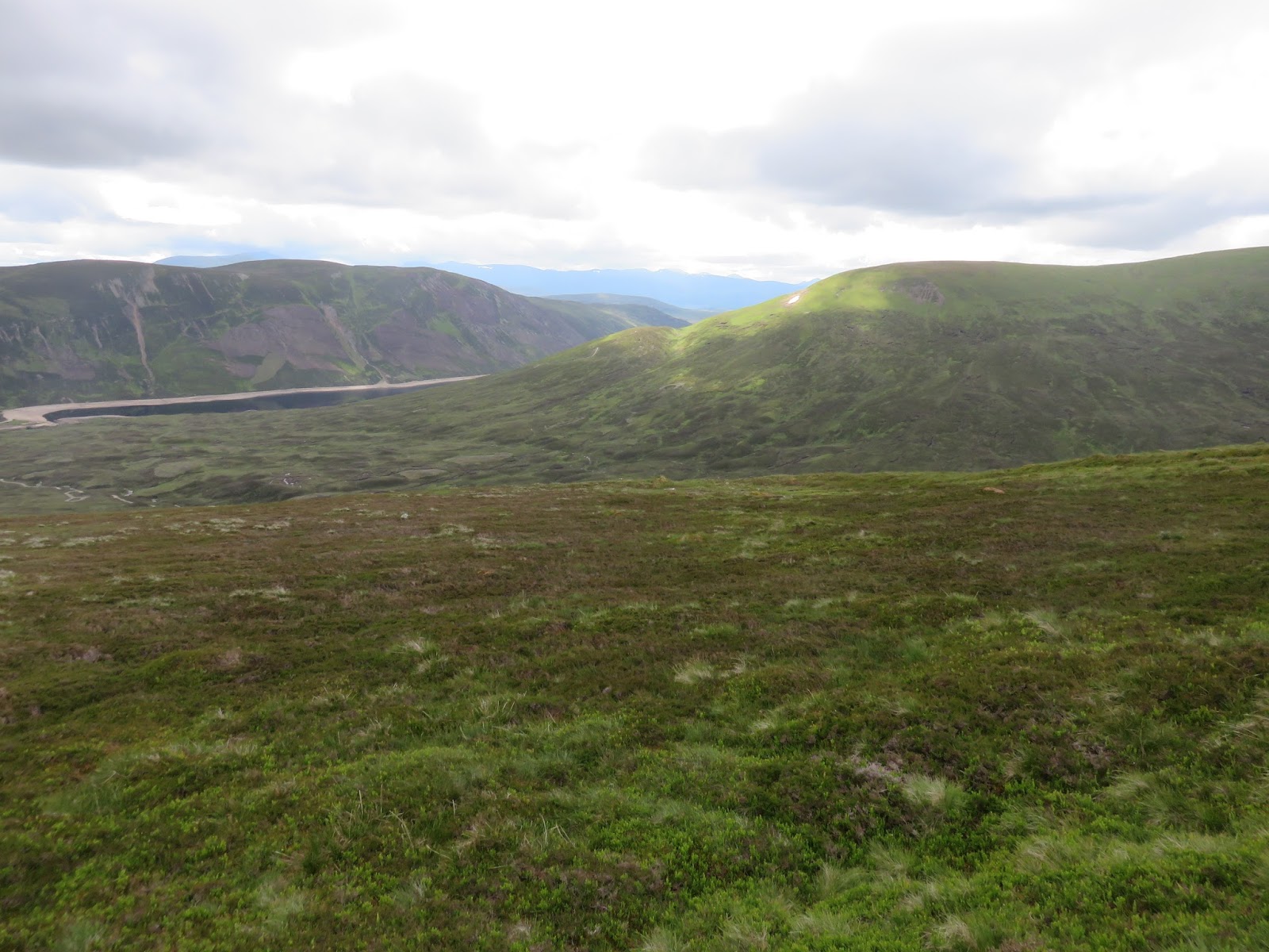
Looking down to Loch Garry