Showing posts with label Arrochar hills. Show all posts

Saturday, 4 July 2020

If you want a cracking view of the Arrochar Alps try Beinn Luibhean

Hill: Beinn Luibhean
Category: Corbett
Height: 858m

I had left this hill as my last of the Arrochar Alps to tick off, principally because it seemed a bit of a boring slog. What I wasn't expecting was the tremendous 360 degree views of the entire Arrochar Alps at their finest, quite spectacular.
I decided to follow the recommended route of the south ridge which is mainly a grassy pathless ascent.
Very small parking area at the start with the slopes in view
Started off at the small parking area at the Croe water, climbed the locked gate, over the new bridge and followed the track into the ferns which at this time of year were fully grown. Yesterday’s rain had left them dripping wet so simply brushing against them resulted in wet shorts, honest I didn't pee my pants.
The path climbs beside the Croe burn, sometimes boggy, until you break the line of ferns.
Coming to the end of the ferns grassy slopes ahead
From here you see the initial steep grassy slopes and the first crags. There is no track so head off anytime on a bearing for the top. Indeed it is consistently steep all the way up.
Wet underneath but going was steady but be warned, this is a hill of many false summits. There was the odd animal track which made it slightly easier.
The views up the glen improve as you gain height and on your left Lochain starts to show. I went right of the first rocky outcrops on the ascent.
First false top ahead
Just keep plodding on but we paused often to take in the views, no rush today as this is not a long outing. The Cobbler is showing us its backside, not as impressive as its front view. Ime is growing larger and more impressive with each step away on the right.
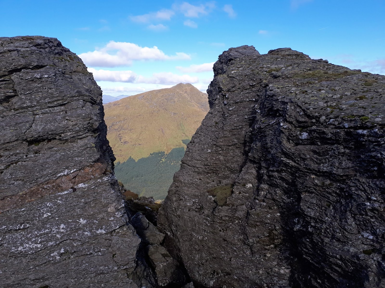
Impressive rock structures head up the grassy section
More of the same, keep plodding, more rocky crags, more grass and nearer the top finally more of a path. The grey clouds were coming and going, the forecast was for them to break, fingers crossed.
Getting there but false top number 3
As we approached the summit the grey cloudy skies began to clear and blue sky started to appear, maybe we would get a view after all.
Then we were there and plenty of time to lunch and take in the grandeur of this summits views.
Lochain slight cloud covering and the Fiddlers peak ridge
You really do see everything that the Arrochar Alps has to offer, directly ahead is Vorlich; Ime; Narnain & The Cobbler. Turn right a bit and it is now The Brack, Coinnich and Donich. Another turn and Lochain and the Fiddler ridge. As well as the longer views and looking down the Clyde this is indeed a top spot after all.
Narnain & Arthur
Finally time to head down, no clear paths and of course the outcrops look different from above so on the main part we now went left on the descent, much steeper grassy slopes but can you can slip on the wet grass and do a bit of rolling and possible damage. Just a case of take your time and enjoy the views over The Brack and the rest.
The Brack, Coinnich & Donich
Finally back at the car park where another car has arrived. Guy asks us if this is The Cobbler? Looking at him and the cars occupants this was definitely not the side for them. Encouraged him to go back to the main car park, which somehow he had managed to miss. Made is sound quite daunting even from that side so hopefully they went for a low level stroll.
Grassy slopes
For me another Corbett done and once again the Arrochar Alps prove why they are a very popular playground. Please only do this on a good viewing day it would be a pity to miss them and just have the slog. A good outing and preparation for the bigger rounds coming up soon.


Wildlife: Meadow Pipit; Wheatear; Hooded Crow
Time: 3.55
Ascent: 693m
Distance: 5.3km

Sunday, 21 June 2020

The big boys are back in town.....Beinn An Lochain

Hill: Beinn an Lochain
Category: Corbett
Height: 901m

It has been a mixed weather week with some violent thunderstorms around. Hopefully my weather research should see this walk completed in good weather.
It was time to get the legs and lungs into another gear and add another Corbett to the list. I have plans for some multiple hills hopefully from next month so walking fitness has to improve.
Start follow path and turn left at the trees
It was a lovely still morning and a good scenic drive to the start.
The parking area only had one other car but by the time we finished it was full.
The breeze was welcome at the start but shoved a light jacket in rucksack just in case it was colder up top.
Not the top
Thankfully with minimal rain the burn was an easy crossing but still had to stand on slabs under running water, could be more interesting at other times.
There is a track to follow right from the start. Initially heading to the trees before curving back and some light scrambling required.
The Cobbler from the ascent
There are good bits of easy scrambling for about two thirds of the way as the track meanders upwards. This is a true peaked mountain so you are climbing constantly from the start without let up.
The Brack & Donich
The views of the Arrochar alps are top drawer already. Every twist and turn of the track brings a different perspective so no hardship to stop and look around. But surprisingly I was feeling really good, COVID exercise obviously working.
Nope that's not the top either
Around the two thirds mark a young guy was coming down, sadly he had took a panic attack with some of the very steep drops but his pal had gone on.
Soon after leaving him we pass the exposed area and the top starts to show itself looking imposing and very steep, still work to do.
First view of imposing top
After another workout you reach a slight plateau and the final section towers above. If you were feeling tired it would look a proper challenge. But no negative thoughts here, I was feeling good so bring it on.
Not so large cairn, lunch at second top behind
Finally and quite surprisingly you reach a small pile of rocks, it is difficult to describe it as a cairn but it is the top.
Panorama looking north
However, on a day like this you cannot adequately describe the stunning views that greet your arrival at the summit, start with breath-taking. Hot as it was the unseasonal coolness of clear air gave a clarity normally only seen in Winter but soak it in.
Obviously all the local alps are showing off. Arran, Jura and Mull far away. Cruachan range and Tyndrum hills. Is the big one behind Ben Nevis, possibly? Crianlarich range including Ben More and many, many others. What a spot for lunch, I can think of much worse.
Descent shows the bulges that hide the top when ascending
As always when you have done some scrambling on the way up the descent is more awkward and care was required, a few backside slides but down safely we got.
Loch Restil & Beinn Ime
A cracking hill walk, views to die for, the big hills are back and I for one am delighted.
Need to keep working on the fitness but not tonight. Sunshine so beer in the garden. Cheers.

Wildlife: Meadow Pipit; Raven
Time: 4.36
Ascent: 754m
Distance: 6.7km

Wednesday, 4 December 2019

Too grim up top to fiddle today

Hill: Binnein an Fhidhleir (or Stob Coire Creagaich (Peaked Hill of the Fiddler)
Category: Corbett
Height: 817
I took opportunity to tick off another of my winter list today with this ridge walk. Which I am told,  in good weather has excellent views.
The ridge is up there somewhere in the clouds
As I stood waiting at Butterbridge car park the clouds were down very low, maybe even lower than 500m, ‘excellent views’ lets be optimistic, I actually could see a little sliver of blue up there.
We were walking west to east taking the ‘easier’ way as everyone that I talk to admits that the direct route is a beast at the best of times and a winter walk could be very difficult. As it turned out most of the snow had melted away.
As I stood in the car park a number of walkers appeared heading to their cars, were conditions too bad for them? On the contrary they were hardy folk having done a bothy stay, apparently it was a very busy bothy with around a dozen sleeping overnight, hardy or what?
Easy start from the masts
Our walk started along the far end of Glen Finglas and we took the short track up to the masts then directly up the slope from there. 
The start was a boggy mud fest of tussocks which Dumfries & Galloway would proudly adopt into their domain. Full of hidden traps to do in your ligaments or worse. One person went right through a narrow crack on the descent, could have been a bad one.
Deforestation on slopes of Beinn an t Seilich
Deforestation seems to be scarring the landscape all around this season.
It is a fairly straightforward ascent route heading for An t Stor. The only issue is that the angle from down below only allows you to see a short distance and it becomes hump after hump after, yip you got it.
One of the group makes a break for it
At least the underfoot is soft, no hardpacked tracks here.
Loch Fyne
What looks on the map as fairly short becomes a a long gentle slog. There are however great views looking back down Loch Fyne and over to the Fyne Oyster bar, a few cars already in situ, early oysters maybe.
The clouds descending to meet us
Then the grey stuff descended and nae more views. It slowly cloaked us in mist, unseasonably warm at first but that was not too last long.
Navigation was now more challenging particularly knowing there were some big drops not far away on our right hand side.
The mist and cloud was now wet stuff and the camera was put away, not risking it getting wet.
Thankfully the snow had mostly gone but it was slow going today. 
Beinn an Fhidhleir last camera shot
Still we were on the flattish bit and the rocky trig/cairn of Beinn an Fhidhleir appeared out of the gloom. The trig is apparently inside of the cairn.
It was now pretty miserable, a walk along the top to the high point and then a return back the way we came. For once I wished we did the straight down to Butterbridge where my car was but not to be.
It turned out to be a far quicker descent than ascent. The odd good views but the cloud was now even lower and the rain more prominent.
Looking down to the start but taken on way up
The better views looking down from the ridge showed just how steep it was.
A good walk but one I need to redo and on a good viewing day. There is a lot of good scenery out there that I did not enjoy today, but that is walking in Scotland.

Wildlife: Raven, Meadow pipit, Vole.
Time: 5.49
Ascent: 807m
Distance: 8.9k

Wednesday, 20 November 2019

A Winter walk on Beinn Ime

Hill: Beinn Ime
Category: Munro
Height: 1011m
Although we did not have the crisp blue skies of previous days the forecast was still in our favour for this late Autumn walk. I say late Autumn but up here Winter has been around for weeks so snow expected up top.
Today I am rambling with the AYR OIR for a straight forward Munro outing. Traffic delayed our start so it was after 10.30 when we were booted up and on our way. Interesting that with the sheer greed of Dumbarton Councils parking charges there were only 4 other cars in the car park, an unbelievably low number. It went from £1 a day to £9, nice one, not.
Still our walk plods up the zig zags where it was already warm enough for me to take my mid layer off, too early in the walk to be sweating.
Lots of frozen ice sticking to the rocks
It was with relief that we exited the tree line and finally got a view of something that didn‘t resemble a pine tree. A tumbling burn with ice still coating the sides of the boulders.
The Cobbler
Also ahead The Cobbler, even in monochrome was still spectacular.
As far as the walking is going at least the gradient was kind as we followed the excellent path, surprised, but pleased, at how little ice there was.
A quick snack at the Narnain boulders before wandering further up the hill to the junction of The Cobbler, Narnain & Ime. 
Final 400m from here up Ime
Proper snow ahead as Ime now has its early winter coat on. It will have a few more layers soon.
On the icy track now
Spikes donned as the track was icy and the final 400m of ascent is taken on. Surprised that it is mostly hard packed snow but step off line and sinking knee deep was the outcome, hard going so avoid at all costs.
We meet some workers who are rebuilding the path, a very muddy hill track in the summer, but today hardy boys.
On the snowy ascent, Narnain left and Cobbler right
Continued plodding up the white landscape, should put the sun glasses on but lazy, no snaps on the climb, just all white.
Despite the low cloud the light is stunning at times and so variable, what a landscape we live in.
Looking towards Loch Fyne
The long ascent is nearly over, we reached its steepest pitch and finally the long walk was over. The wind was now buffeting us, strong and cold but stand in the cairn top and look around, it doesn’t get much better than this.
The Summit
The snow makes it a spectacular 360 degree view of high summit tops with their snow hats on, too cold to stand and count them. 
Ailsa Craig just visible on horizon
Far away Ailsa Craig shimmers on the southern horizon. All the Arrochar Corbetts look so close as they encircle Beinn Ime, truly beautiful.
Getting gloomier time to descend
For the descent we followed the long walk back to the car park. We descended before stopping for lunch out of the wind and the workers have disappeared, not surprised. Clouds are thickening and the wind is rising.
We spotted a red deer stag in the trees near the finish. It was either not bothered or not well. I suspect the latter but still a magnificent sight to finish the walk.
No complaints about today’s walk, enjoyed by all, another mid week success, well done Dick.
Just don’t talk about the drive home, a nightmare!!

Wildlife: Raven; Robin; Vole; Red Deer.
Time: 5.29
Ascent: 1060m
Distance: 15.2km

Wednesday, 2 October 2019

Ben Donich

Hill: Ben Donich
Category: Corbett
Height: 847
Well there is no doubt Autumn has arrived as a blast of very fresh cool air greeted us as the Ayr OIR met up for the walk to Ben Donich. The advantage of the crisp weather was the cracking blue skies that gave us fantastic views. I have blogged this hill recently so simply posting some snaps this time. 
The new aspect of today’s walk was the descent where rather than back down the ascent route we went cross country heading for the Cowal Way junction near The Brack. A slippery grassy descent zig zagging to avoid the crags and the deep gashes in the rocks. Stunning views and enjoyable.
Another great walk in super company on a cracking day.
    

The start of the walk looking back to Loch Restil


Ben Donich a rugged but short climb

Beinn an Lochain behind left Beinn Luibhean back right
One of the geese skeins, Pink footed I think?
Beinn Ime now in view far right

Sitting on the edge

The cairn at point 516m The Cobbler now included

Beinn Ime through the gap

Rest and be Thankful looks a long way down


Wildlife: Raven, Skeins of geese,
Time: 4.25
Ascent: 731m
Distance: 10.8km

Monday, 9 September 2019

Beinn Bheula a challenging but fun Corbett circuit

Hill: Beinn Bheula
Category: Corbett
Height: 779m

Am I in dreamland I wonder, as I pull the curtains to see a blue sky morning, it seems an eternity since that happened. 
Not dreaming as it turned out it was a perfect day for walking, crisp air giving fantastic views from an excellent but tough walk. I can't remember a descent with such varied awkward walking and challenging terrain, still all part of the day out.
First view of Beinn Bheula
Still glorious weather when we set out initially following the Cowal Way hard track until we diverted left following the Way into the woods. I remember the Cowal Way across the water being a boggy trench and this side is no different. The path was a slippery deep mud section, the sides where navigable not much better, a few laughs when bodies slip.
Impressive falls
The Way route climbs up the sides of the very impressive waterfalls of the Struth Ban burn, more impressive with all the recent rain. My first mishap, heel slips and a very wet and muddy backside!!
The track does not improve but before long we head across the hill towards the distant fence, our guide for a short section.
Follow the fence but still rough walking
The views looking back are mighty impressive, all 4 Corbett’s across the water stand out against the blue sky. 
Loch Goil and the Corbetts
When we reach the crags at 636 the views open out across Argyll with the Mull hills looking remarkably close, just stunning, this is what I do it for.
Heading up to the gulley
The final section up the steep and narrow gulley is a leg muscle burner, hemmed in between Creag a‘ Bhuic. Checking the GPS later some of the gradients almost reach 50% and much is in the 40%, steep indeed. But stop and look back down, what a view.
Trig with Mull hills in the distance
Thankfully it eases of and the trig soon reached, very glad to see it and what a spot to have lunch looking down the coastal waters and across to Arran. What can you see, well everything today.
Great spot for lunch
A sample included the peaks of Luss, Tyndrum, Jura, Cruachan, possibly Glencoe as well as all the local stuff, what a spot. We did debate if Ben Nevis was just in sight, a maybe!
The ridge
We opted to walk along the ridge then descend via Lochan nan Cnaimh and make it a circular route. Additionally to look for the WW2 plane wreckage. If I thought some of the ascent was rough, as mentioned earlier the best/worst was to come.
We followed the ridge for a bit but started the descent too soon looking for the wreckage that someone in the group thought was close by. As it turned out if we had just followed the Walkhighlands route we would have came across part of it.
Wreckage
Steep grassy slopes with plenty of hidden hollows and holes careful walking.
We then found part of the wreckage ‘a Grumman Marklett fighter struck the mountain here in 1940, killing the pilot‘. 
Below us Lochan nan Cnaimh stands out, the only issue being more of the same moorland tramp with all its traps. Lots of deer around and their weight created extra hole traps.
Luss hills behind the Lochan
Finally we reached the loch, it looks a great place for a camp, a spot of evening fishing and wild swimming if you fancy. There is a small building across the water not sure what that is for up here. 
The ground has plenty of blaeberries to pick and eat, very nice indeed, blue tongues Pict style. 
Open moorland descent not as easy as it looks
Super views looking back up the hill. 
We leave the Lochan and head to the nearby forest and the real fun begins.
We started to follow the burn but the track was an eroded gloopy mud slide, dangerous to slip down into the fast running rocky waters of the burn.
So into the forest for a patch. If you’re a fungi fan with knowledge this floor was littered with them, many varieties. Deep slopes and if you slipped and crashed into these trees there was a good chance of a branch impaling you so again care and concentration.
Thankfully nobody fell in
The burn water was running high so the crossing was an obstacle but despite cameras out nobody fell in.
The firebreak section started reasonable enough with a faint path but it was no walk in the park, rough going. When we exited the forest there was a trail for a bit but it soon became a dangerous walk including clambering over large trees and many hidden holes.
We eventually found a better track about 5 metres above us, thank the lord and followed it back to the hard track near the falls.
Super views over Lochgoilhead and the Arrochar hills on the descent.
An amazing walk and probably the hardest Corbett circuit I have done, this fully justified its tick.
A cracking day with excellent company, hopefully a few more Autumn days like this.

Wildlife: Buzzard; Meadow pipit; Frogs; Vole; Red deer
Time: 4.49
Ascent: 2678ft 
Distance: 7.93m