Showing posts with label Ayr OIR. Show all posts

Friday, 4 July 2025

I could have done without that descent.....Beinn a' Chaorainn & Beinn Teallach

Hill: Beinn a’ Chaorainn (Hill of the Rowan)(1052m) & Beinn Teallach (Forge Hill)(915m)

Type: Munro x2


Beautiful clear blue skies yet again for an unplanned last minute ramble where I ended up bagging a couple of new Munros. I was in the area to do a couple of bike hikes but this opportunity appeared and I had a free day so went for it.

A group of us from Ayr OIR met up at Roughburn for a 9am start. Easy to find, just along the road, west of the Creag Meagaidh circuit. 

You could go up here but far better to keep walking for another 5 minutes

A pleasant walk through some woods, chatting away and listening to the spring birdsong brought us to the deforested area. A sideways walk along to where we would start the ascent of the 1st Munro. Some boggy sections of ATV track was encountered before we probably made a slight error and followed a track left instead of staying on the direct track. 

On off ATV tracks helped

It didn't make a lot of difference but we did end up in a newly tree planted section, lots of holes in the ground so awkward walking so pleased to get to the deer fence. 

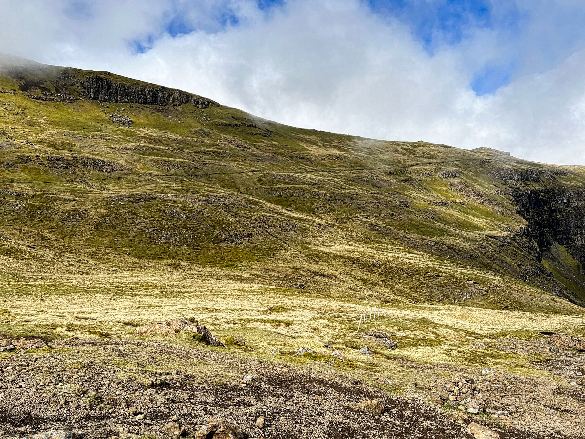
Where is that deer fence? 1st top peaking up top left.

We were slightly lower than the planned route but found a gate in the deer fence rather than the going over the style mentioned in walk reports. 

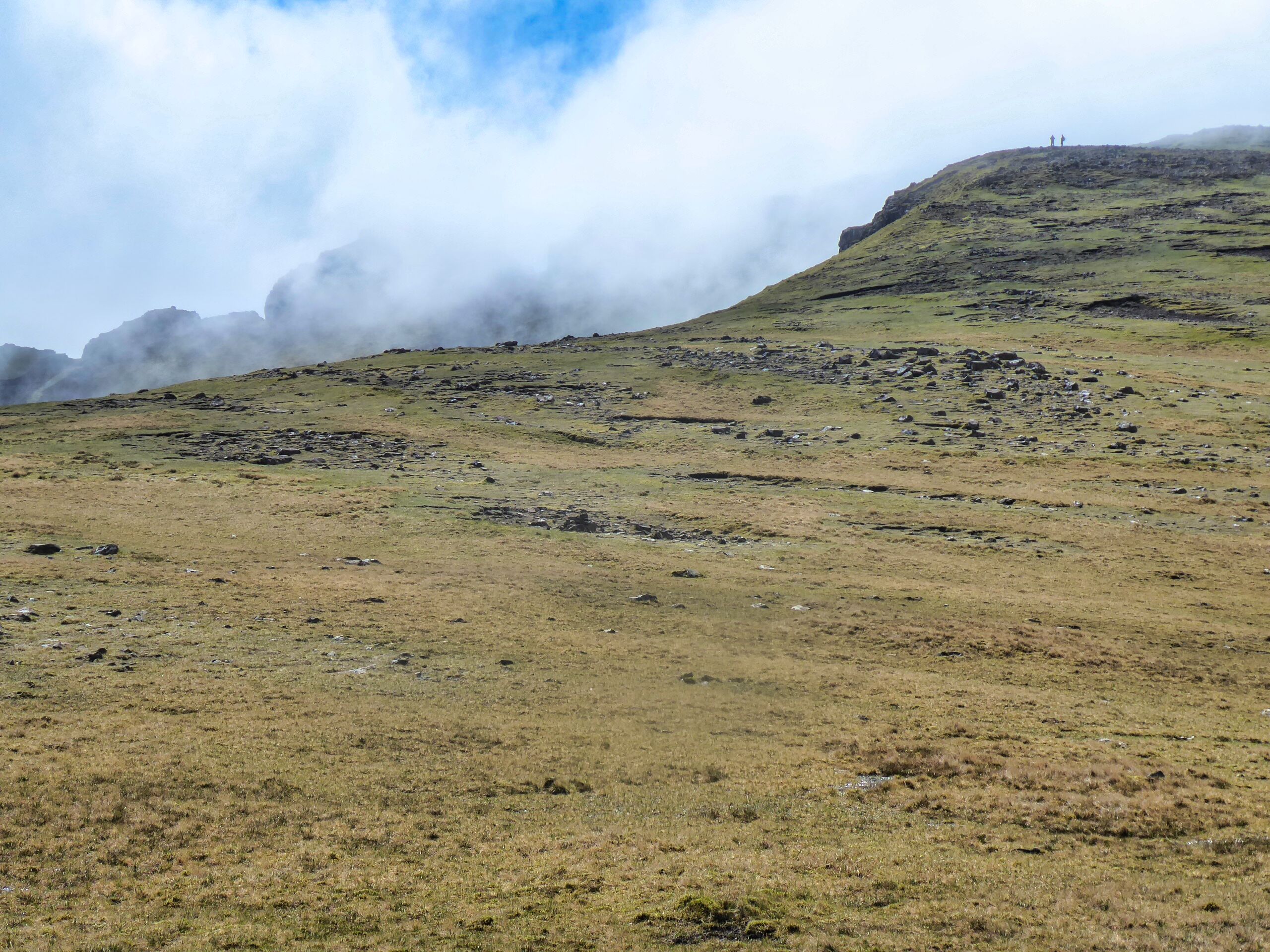
However, it wasn't too far away and as we wandered upwards we came across the path from the style. Path you might think, where did this come from as the description says pathless?

Looking back to the deer fence & the Fiona Creag Dhubh

The slog

But a faint path there was which helped morale as we climbed onwards and upwards, onwards and upwards, you get the picture. I was pleasantly surprised at the gradient which was better than I expected but nevertheless it was a relentless ascent without respite.

More elevated view back including Grey Corries and the two westerly Fersit Munros

Looking back the views were stunning. I needed plenty of short stops stops as the sweat was running the sun lotion into my eyes, very painful. Plus with rubbing my eyes so often I was irritating my recent operation which brought on a different pain, the joys.

The final section is a boulder/grass combo which meant frequently losing and regaining the track.

Creag Meadaigh Munros 

Levelling off and across the boulder strewn top we reached the first summit and cairn but this is about 10 metres lower than the middle top. Spectacular views over the Creag Meagaidh hills. Nice to see what they looked like as they were mainly in cloud when I climbed them. 


Loch Treig surrounded by the Fersit Munros Corrour beyond from South top

Turning around the waters of Loch Treig was shimmering in the bright sunlight, Corrour behind. All the big mountains in view Fersit, Grey Corries & Fort William giants.

True summit on the right then follow the ridge round on the left

View from summit back to top 1 (South)

The going underfoot had improved as we headed to the real summit and again took in more of the superb views.

Ridge walk, some of our group arriving at 3rd top (North)

A lovely contouring ridge walk leads to the third summit. Sadly deaths have occurred on this section with snow crevasses not being strong enough to hold the walkers from a long and fatal descent.


Today was different, a few clinging snow patches which did not affect us so we enjoyed it taking in a superb view of the tiny halfway lochan.

View over to lumpy & bumpy Beinn Teallach

As we walked the ridge we also had a good view across to the 2nd Munro of the ramble, Beinn Teallach. Once it was the highest Corbett, now the lowest Munro, promotion or how the mighty fall. From like afar this looked very different to Munros in this area, much more the rough and rugged type associated with our local Dumfries & Galloway hills.

I had felt really good on the ascent, pleased with my stamina and legs but the toughest section was still to come.

After the main ridge we had a slightly downhill contouring grassy section before the full on descent began heading steeply to the glen of the Allt a' Chaorainn. It is always slightly demotivating when descending knowing an ascent was coming next. But this descent was over 400m, a huge descent. A grassy boulder crusted hillside. We were constantly zig zagging to keep on the grassy sections.

Beinn Teallach was always in view getting higher and steeper the more we descended. As said if any hill could be transported to our local Dumfries & Galloway hills and not look out of place it was this one. No smooth parts just like a toads skin, a few grassy rakes and covered with small craggy sections.

Closer view of lochan also seen in above photo

The climb was just over 300 metres, the short steep sections were really punishing my legs. Lactate issues kicking in. Tracks found and lost. Constantly readjusting and that bloody top never seemed to be in sight.

Poor snap but final climb more Munro like now

View from summit to 2nd top

But finally a faint boulder trail climbed to a cairn which as soon as I arrived I spotted another one across the way where our two fastest walkers already were. But the guide says this first cairn is the Munro top although we do head over to the other one as it is said to have the best views, not that any of the views today have been shabby.

On the way down, good track for much of it

Glad to be on the homeward stretch even though that is still a long way off. Again grassy, stony up top, more wet and boggy as we descend. But the descent was hot, hot, hot. The dry spell meant the possible daunting river crossing was a breeze. My water bottle was filled in the cold fast running water, delightful, I needed it to revive me.

A cracking walk in beautiful conditions with great views throughout.

For me a walk of two halves. The 1st really good because we largely kept going and that suited my style. The 2nd half was much tougher. We had a few breaks, the big descent and then the uphill climb where I found myself in my mental ‘can/must do’ territory. But really getting to old for that.

Despite that a well worthwhile ramble in good company.


Ascent: 1208m

Distance: 17.6km

Time: 8.21

Wildlife: Chaffinch; Buzzard; Skylark; Meadow Pipit; Mountain Hare; Raven;

Monday, 15 July 2024

Three tops to get one tick.....Tarfessock South Top

Hill: Tarfessock South Top (via Shalloch on Minnoch & Tarfessock)

Type: Donald Top

Height: 610m


The Ayr OiR were out out today for a short up and down of the Corbett Shalloch on Minnoch. This is a straightforward walk but with good weather conditions I decided to join them but go a bit further and knock off the Donald Top of Tarfessock South. My planning for my summer walks had me doing this from the Kirriereoch parking area but although this was a longer walk it was too good to miss to do it today plus I would have company for part of it.


As we geared up at the Stinchar Falls parking area it was great to hear a Cuckoo full on calling. I have had two brief encounters with the bird this year but this was the first full calling experience, sadly still to see one.

Ten of us set off up the usual route to Shalloch, extremely boggy, accompanied by the singing Skylarks and Meadow Pipits, presumably mocking us as well as attracting a mate.

Final ascent to Shalloch summit


The way forward

Plucked male Wheatear

My partners coming up Tarfessock

At the cairn at the top of Shalloch five of the group decided to descend and four sad soles came with me to Tarfessock. A rough pathless descent of about 100m followed by an ascent of circa 50m found us at the top of Tarfessock. A cooler stronger breeze got up but still good viewing over this very rough and rugged landscape.

Spot the south top summit?

The crags mark the spot

Rough ground

Now for the return, Tarfessock first then Shalloch behind it

A brief lunch stop for me, longer for the others, before I went solo to Tarfessock top. Now it was unknown territory and a new section of the Awful Hand for me. From up top I could see the objective but I was surprised by how awkward the descent was. Rough ground, craggy tops to be rounded before reaching a boggy section. A trail of sorts and I was at the small cairn, better than many full Donalds I might add.

I had completed a flat walk of 15 miles yesterday so my legs were a tad weary. As such the albeit short re-ascents of Tarfessock and Shalloch were more intimidating than they should have been.

The shortest, but steepest section back up to Tarfessock was the worst, no path, tussocky ground, rounding crags, aching muscles but then I was there.


4 climbing the slopes of Shalloch

Looking ahead I could see my four companions were about two thirds of the way up Shalloch. I wish I was with them but would I catch up with them?


Clouds about to come down to my level

On the way up Shalloch I kind of lost the track and ended up just hiking straight up the straightforward but steep slopes until I reached the plateau and spotted the cairn further away than I expected but at least the terrain was flat and good going.

Now homeward bound but the descent was much more awkward than the ascent. Maybe because the ascent is slower and you are picking the route more carefully. On the descent I was rocking and rolling all over the place no consistent footing. I seemed to be plunging into boggy patch after boggy patch, it was horrible and very tiring.

At least the cuckoo was still calling, obviously no females around or not interested. At the small waterfalls a red squirrel crossed towards the trees, it was moving slowly. Delighted at my first sighting of the year but I suspect all was not well with it.

A good ramble in fine company, a new hill bagged, what's not to like.

Ascent: 845m

Distance: 17.01

Time: 5.22

Wildlife: Meadow Pipit; Skylark; Wheatear; Cuckoo (heard); Willow Warbler (heard); Red Squirrel (1st of the year)

Friday, 26 May 2023

An epic landscape.....The Storr

Hill: The Storr (The steep high cliff)

Type: Fiona

Height: 719m

Final walking day on Skye for me and I wanted a memorable walk so one thats been on my list for yonks was The Storr and Hartaval.

Cloud shroud

After clouds lift
Along with Gordon and Liz we parked at an already very busy car park and from here the views up to this amazing rock formation were already amazing, could hardly wait until we got closer.

It is fair to say that including Ben Nevis I have never seen so many people concentrated on such a short section of a walk. It was interesting seeing all the varying ages & fitness levels. No wonder a medical response team parked at the bottom I am sure they get regular calls. The mixture of accents and nationalities also enticing. Thankfully most of these would only be going to the Old Man of Storr and not further on.


It was a very good stone stepped track and it was steep so I was blowing a bit. The magnificent natural rock architecture was out of this world.

Finally we left the masses alone, a few no doubt wondering where we were heady off over a style onto a muddy track.


Trotternish path rising left to right
A short section of light scrambling and then the Trotternish trail was a black line against the green landscape. 

The route is a huge U bend but along the first section there were magnificent views over Rhona and onwards to the mainland and the big peaks of Torridon.

At the U bend we stopped for a break just as the clouds were lowering themselves enough to cover the top.


Top peaking out behind top with the two walkers on it
The trek to the top is mainly over grassy slopes with some erosion but is a gentle ascent. Out of the gloom I spotted a cairn over to our left, we had veared too far right but not in any danger. 

Liz & Gordon brighten up the summit
Redirected ourselves and reached the true top, another well built cairn/trig, very similar to the structure I saw yesterday on Meall na Suiramach.

It cleared briefly to give us some views but another huge deep cloud was making it’s way towards us. As such Hartaval was abandoned, we didn’t fancy the 200m descent and reascent potentially in cloud. 

Red Cuillin on left and Black on right
So we made our way down the grassy slopes towards the gully we had to find. At first I thought it was further away but Gordon rightly thought otherwise and we reached the correct gully to descend from.


From the top it was still a long way down and looks slightly intimidating. It did need full concentration but although rocky and pathless at times it was reasonably straightforward. A ring ouzel flew across us, my first of the year. It did pose but I was not quick enough to get the camera working whilst balancing on steep stony section.


Boulder debris
Finally to finish a wettish grassy final section where time was taken to discuss the boulder field from all the collapses from these cliffs. A few sheep were caught out by these no doubt.

Then onto the road section and back to the car.

A top ramble in excellent company. With regularity the views were outstanding. Only disappointment was the cloudy summit and missing out on Hartaval.

Ascent: 639m

Distance: 8.6km

Time: 4.28

Wildlife: Ring Ouzel; Skylark; Meadow Pipit; Feral Pigeon; Orange tip(m); Small White;