Showing posts with label Skye. Show all posts

Friday, 5 July 2024

A two day romp to do a Sub2k, really!!.....Ben Tianavaig

Day 1

Hill: Ben Tianavaig

Type: Sub2k

Height: 413m


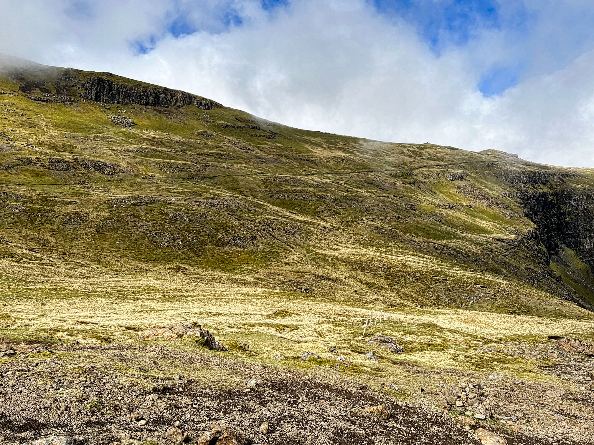
I could see the hill from the Cuillin Hills hotel whilst having an excellent breakfast. I thought my feast was large but seeing the amount Americans were putting away, wow. Maybe they are not intending to eat anything for the rest of the day but these were huge.

The skies were blue but the palm trees in the hotel grounds were swaying about big style. The mountain forecast was not encouraging re the wind strength but this was the morning I had allocated so off I went.

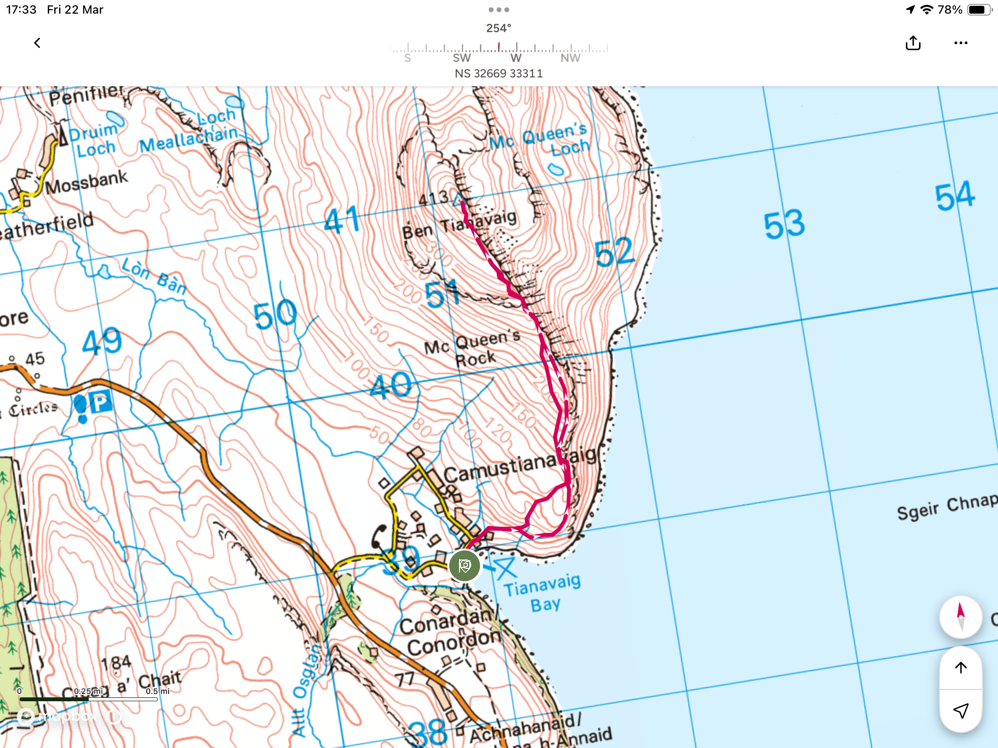
Parked at the scenic carpark at Tianavaig Bay where the waves were pounding in but the wind not too bad.


This was the safe bit before the turn with the drops

The track climbs quickly before bending its way round the point where there are already some very steep drops so I was leaning inland as I climbed.


Reached a break area where the smell of burnt heather was very strong. Another short ascent from where I could see the crags high above.

The start of the burnt bit

However it was the extent of the burnt ground that caught my attention, wow most of the slopes had been burnt. There are no grouse here so it was not muirburn but a seriously out of control moorland fire.

Well away from the cliff edge

This burning was actually helpful to me. The route can follow a couple of cliff tracks both very exposed and with this wind no way. So I headed on an angled curve well away from the edge. Under normal circumstances this would have been very rough walking but today it was walking over charred ground. Easier walking but the heather roots were not doing my boots any favours.

I was feeling good but the higher I was going the worse the wind. Not just the constant blowing but the bigger gusts, no lies I was getting concerned.

I had to change course away from the shelter to head back to the track at the first crags. I was able to creep around them but as I headed to the next crags at McQueens Rock it was not funny. I was very close to the edge, precipitous drops and as I got to these crags a gust almost turned me fully around. The wind was blowing towards the edge so I knew if I was blown over I would be rolled over the cliffs.

I reckoned I was only 15 minutes from the summit but as it was going to be the most exposed section I decided the best thing I could do was to turn back.

The point of abandonment

At least good views of the Cuillins

So disappointed I headed down, occasionally looking back and difficult to believe that the clear blue skies also had that wind hazard. The edging round the bottom cliff section had me fully concentrated.

On safe terrain the bay ahead

Took my boots off with a solitary grey seals head bobbing in the bay keeping a close eye on me.

View of the fire from Portree

Back at the hotel they confirmed the fire had only been last weekend and had been a major out of control incident with some of households having to evacuate until the fire was dampened down, luckily nobody hurt.

Ascent: 325m

Distance: 5.7m

Time: 1.45

Wildlife: Hooded Crow, Chaffinch, House Sparrow, Blue Tit, Blackbird,


Day 2

Hill: Ben Tianavaig

Type: Sub2k

Over breakfast the good lady knew my frustration from yesterday and agreed to give me another morning to walk so off I went.

A car was already parked up I wondered if they were on the hill.

Same start but this time I was able to enjoy the views as I rounded the hill before coming to the cliff tracks.

Calm water

On such a nice day I chose the outer path which had glorious views down to the Sound of Raasay. A single seal looked up at me, yesterdays seal?

The water was flat calm and I noticed some disturbed patches. Zoomed the camera in and it was a pod of dolphins a magnificent sight. I reckoned there were at least five different pods spread over the sea.

I caught up with a couple having a break, the other cars occupants, who had also enjoyed the dolphins.

Tors and North Raasay


Trotternish ridge and the Old Man

After a brief chat I left them and headed up taking in this magnificent landscape over to The Storr and the Island of Raasay.


The gradient is constant but with no difficulty, what a difference a day makes.


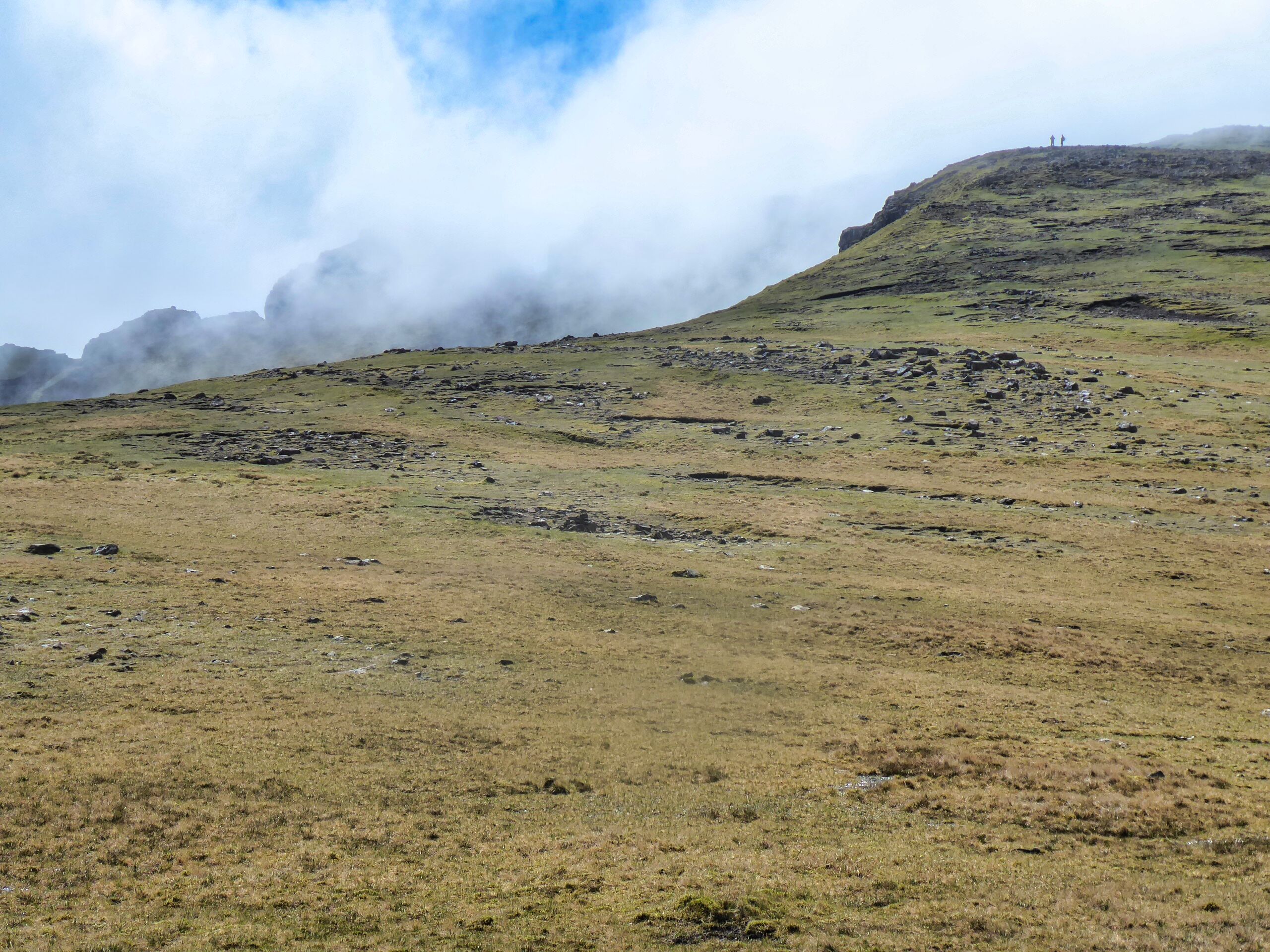
I got past the final crags and had a great view of the pyramid slopes to the summit of Ben Tianavaig.

Portree far left

Somewhere at the bottom of those cliffs the good lady and an otter

Dun Can summit caught by the cloud

The angle of the slopes hid the true vista which becomes apparent when the cylinder style trig is reached. Walkhighlands describes the hill as ‘Ben Tianavaig is a hill of real character - like a section of the Trotternish Ridge in miniature. The ascent along the ridge is a delight whilst the position and views are simply superb’. I could not put it better.

I called the good lady to tell her about the dolphins and to see if she could spot me. She was not interested as she had just spotted an otter dragging a fish into rocks, her favourite animal so delighted it was a good morning for us both. The couple arrived where we chatted and took in the views.

Raven was annoyed with me

Cliff path heading for the point, not yesterday I was far away

Word has got out about the dolphins


returned the same way with a smile on my face, it might only be a small hill but after yesterdays travails this a joy to complete.

At the bay there were 3 seals and 14 cormorants all feeding. Whatever fish the tide had brought in the wildlife were feasting.

Definitely a hill that I will never forget. Now time for coffee and cake with the good lady to celebrate our mornings

Height: 413m

Ascent: 411m

Distance: 6.1km

Time: 2.16

Wildlife: Raven, Dolphin, Hooded Crow; Skylark, Blackbird,


Friday, 26 May 2023

Possibly the greatest views in Britain but not for us.....Blabheinn (Blaven)

Hill: Blabheinn (Blaven) (Blue Mountain)

Type: Munro

Height: 928m

Walkhighlands describes Blaven as having one of the best viewpoints imaginable so it would be rude to do a walking trip and not include it, what could go wrong, well the weather for one. It is separate from the main Cuillin hills and some rate it as the finest peak on Skye.

We delayed our start to take advantage of the clear conditions as forecast by the Met Office.

A pleasant walk from the car park with the mountain in sight in all its magnificence. Looking at some of the scree slopes I was thinking that if I need to go up that I will be turning back. I was thinking of the Walkhighlands description ‘Good path at first, but later the going becomes very rough, with loose stones, a scree gully, and some very mild scrambling’. Okay bring it on and it did.

A narrow but good condition track brought us to the waterfalls of the Allt na Dunaiche carrying a bit more water than I expected so good viewing of cascading water.

A couple of burn crossings, these could be challenging after heavier rainfall, but even at this level I still managed to get a wet foot in the second burn. Gordon was struggling with his leg so left us at this point.

Once across it was a newly renovated but still very rocky track. We were now in the gloom and would continue that way right to the summit. It was a steady climb with good ascent gained quickly.

First route objective was a failure as we missed the sharp right turn at Fionna-choire but in fairness so did the 4 guys in front and the couple coming behind. Soon the scenario of us all, standing in the gloom, barely able to see each other, looking at gps etc, where do we go from here? As it turned out we found another track, obviously a lot miss the inconspicuous non extant track. This proved fine as it merged with the other one further up the hill.

Maybe at times it is just as well that you cannot see what's in front of you. We did have the benefit of hindsight looking back in clear air. A lot less intimidating when you are on the way down.

But in this moment in time we were on the way up and we reached the narrow stone scree gully. This was a long steep gully, it really should have a name to remember it by. It is the right hand branch of Great Gully which divides the main summit from its south top. There is no path. Clamber from side to side as you think best holding onto the rock edges to pull and steady yourself as the stuff under your feet constantly gives way and creating potential big boulder slides to endanger people behind you as well as listening out for some coming down your way from the walkers above. It was interesting to say the least.

Once above this gully we were back on the path but it was time for a short break to let body and mind recover.

Do not turn right at the cairn at the Great Pow

The path is quite good until the small cairn is reached. A large boulder forces an awkward scramble, particularly for short legs. As we pondered how to get over it I spotted a figure in the gloom scrambling up a steep face just ahead, surely that was not the route? Starting to feel iffy. I got over the boulder and left Liz whilst I explored ahead just to make sure we could go forward. Luckily the other person was either an expert scrambler or just an idiot.

Reassured Liz got over the boulder obstacle which only left a short walk led to the top where about a dozen people were sitting around hoping the clouds would lift.

We sat around for a while, had some refreshments but sadly they didn't lift so back down we went.

Views starting to appear

Around about the lower small cairn the clouds lifted enough at lower levels to get good views of the descent but looking back the summit remained covered.

Top of the stone/scree gully

Liz negotiating the last major obstacle

Both the boulder and the scree chute were easier on the descent than feared although great care still required. It was a descent of full concentration all the way to the burn.


Red Cuillins appear

Superb views of the small lochan and further down views through to some of the Red Cuillins.

Track still looks a long way down from here

The trees are the finish point

Still a ramble to remember although more of an adventure than a ramble. At least the views on the descent provided some reward for the effort.

Ascent: 948m

Distance: 9.8km

Time: 5.45

Wildlife: Cuckoo (heard); Meadow Pipit; Willow Warbler; Skylark; Great tit;

An epic landscape.....The Storr

Hill: The Storr (The steep high cliff)

Type: Fiona

Height: 719m

Final walking day on Skye for me and I wanted a memorable walk so one thats been on my list for yonks was The Storr and Hartaval.

Cloud shroud

After clouds lift
Along with Gordon and Liz we parked at an already very busy car park and from here the views up to this amazing rock formation were already amazing, could hardly wait until we got closer.

It is fair to say that including Ben Nevis I have never seen so many people concentrated on such a short section of a walk. It was interesting seeing all the varying ages & fitness levels. No wonder a medical response team parked at the bottom I am sure they get regular calls. The mixture of accents and nationalities also enticing. Thankfully most of these would only be going to the Old Man of Storr and not further on.


It was a very good stone stepped track and it was steep so I was blowing a bit. The magnificent natural rock architecture was out of this world.

Finally we left the masses alone, a few no doubt wondering where we were heady off over a style onto a muddy track.


Trotternish path rising left to right
A short section of light scrambling and then the Trotternish trail was a black line against the green landscape. 

The route is a huge U bend but along the first section there were magnificent views over Rhona and onwards to the mainland and the big peaks of Torridon.

At the U bend we stopped for a break just as the clouds were lowering themselves enough to cover the top.


Top peaking out behind top with the two walkers on it
The trek to the top is mainly over grassy slopes with some erosion but is a gentle ascent. Out of the gloom I spotted a cairn over to our left, we had veared too far right but not in any danger. 

Liz & Gordon brighten up the summit
Redirected ourselves and reached the true top, another well built cairn/trig, very similar to the structure I saw yesterday on Meall na Suiramach.

It cleared briefly to give us some views but another huge deep cloud was making it’s way towards us. As such Hartaval was abandoned, we didn’t fancy the 200m descent and reascent potentially in cloud. 

Red Cuillin on left and Black on right
So we made our way down the grassy slopes towards the gully we had to find. At first I thought it was further away but Gordon rightly thought otherwise and we reached the correct gully to descend from.


From the top it was still a long way down and looks slightly intimidating. It did need full concentration but although rocky and pathless at times it was reasonably straightforward. A ring ouzel flew across us, my first of the year. It did pose but I was not quick enough to get the camera working whilst balancing on steep stony section.


Boulder debris
Finally to finish a wettish grassy final section where time was taken to discuss the boulder field from all the collapses from these cliffs. A few sheep were caught out by these no doubt.

Then onto the road section and back to the car.

A top ramble in excellent company. With regularity the views were outstanding. Only disappointment was the cloudy summit and missing out on Hartaval.

Ascent: 639m

Distance: 8.6km

Time: 4.28

Wildlife: Ring Ouzel; Skylark; Meadow Pipit; Feral Pigeon; Orange tip(m); Small White;