Showing posts with label Donald tops. Show all posts

Sunday, 23 March 2025

Taking the long way.....Clockmore

Hill: Clockmore (641m)

Other Hills: Cramalt Craig

Type: Donald Top; Donald


If taken in isolation Clockmore could be a short, straightforward but steep climb over mainly heather clad terrain. Probably an hour or so up and down.

Researching the route and looking at the map I worked out a longer circuit which had more appeal as I wanted to ramble for longer than an hour.

On the day the weather forecast was not the most promising, consistent strong winds blowing in from the north bringing with them rain and snow. Throw in feel like temperatures of -10deg up top it was definitely still the season for full winter gear.

As I geared up the wind was howling, the reservoirs waves looked good for wind surfing, wow, was this a mistake?


My ramble started from the Megget reservoir parking area and headed up the track beside Cramalt Farm following the Cramalt Burn.

Clockmore as viewed from the track at the start

It was a good track rising in the direction of Dollar Law, much more ascent than I needed today to bag Clockmore but hey ho be positive, it is building my walking strength.

I had been suffering from a heavy cold/Covid so there was a bit of huffing and puffing as well as some stops to take in the landscape and recover. The wind and rain showers were lighter than expected so it the going was easier than I expected.

Good track winding all the way to the high point

My chestiness was apparent and I was really blowing towards the high point of the track.

Turned now, looking back to Dollar Law

Looking down on the start/finish point at the trees

Track winding round to Cramalt Craig, Broad Law behind

Up top the main track changed to a grassy ATV track as it headed towards Dun Law where I now had decent views over to Broad Law. There was a short descent where I was hit by the heaviest storm shower of the day, hail not snow, short but intense and I was glad that I had completed the first half of the circuit so the battering was more from the side and behind.

Cramalt Craig looking back

Another snow shower just about to hit me

Broad Law

My goggles were steaming up (they shouldn’t!) as I climbed up to the highest point of the ramble, Cramalt Craig, almost a Corbett, once was until re measurement. As I climbed I recalled first doing Cramalt as part of a longer ramble in conjunction with Broad Law. That was a tough up and down and back again on a very warm day as I recall.


Pykestone Knowe ahead

Leaving Cramalt Craig it was rough high moorland crossing to Pykestone Knowe but still with a partial ATV track.

Finally Clockmore with the shaft of light hitting the reservoir

Looking down from Pykestone I could see that the worst of terrain was now ahead. I knew from my planning this was going to be rough going but it is always different when you see it for real, not a map. It also became worse going than I expected. Looking down I could see a lot of heather, tussocks and peat hags and no tracks but there was no choice but to go for it, this hill was my objective after all.

High point looking back to my route

It was certainly not very pleasant and quite hard going so it was with a lot of relief that I reached the summit of Clockmore. Not that it is recognised in any way but this was the top.

The worst is to come as I head back to Megget reservoir

The descent back to the farm was by far the worst going. Quite steep and surprised with heather that was waist deep at times. Step by step, pole prod by pole trod, as I had no idea what was underfoot, slow going but I got there.

A long way for a short cut as my granny used to say but despite the mixed weather and mixed terrain it was a good day out and one bagged top closer to my full Donald completion.

Ascent: 704m

Distance: 11.5km

Time: 3.35

Wildlife: Raven: Snipe: Redwing: Pheasant: Great Tit.

A recce that became the real ramble.....Deer Law Circuit

Hill: Deer Law & Conscleugh Head

Type: New Donald & Donald Top

Height: 629m & 624m


I had missed out on these two when I did Blackhouse Heights. However, I did not fancy another trip to Black Law first. When I was returning from Blackhouse I could see a new estate track running along the bottom of these hills but where did it come from? I drove down to the Megget Reservoir and beside a cottage there appeared to be the start of a track over the other side of a field. Time to explore.

The weather was grey and damp and there was fresh snow on the hills so I decided to do a recce to see where this track went to.

A very cold wind was blowing down from the Megget water so it was a quick change well clad.

It's a track is it the one I wanted?

I was going to knock at the cottage to check the route was okay but it appeared that nobody was at home. The gate to the field was a simple hook so no climbing required before I crossed the mole hill studded grass to the track.


The track seemed more substantially built than that required for sheep. Not wide enough for a windfarm, maybe some tree planting going to take place.

Deer Law now in sight

The track winds around Broomy Law following the Glengaber Burn and after about 15 minutes Deer Law is directly in view. Rough hill ground and plenty of sheep.

Start of ATV track

Straight on I could see the track ahead going between Deer Law and Black Rig. But on the right my eye was caught by the quad bike trail going up the easier gradients of Deer Law before continuing into the snowline then into the clouds. That looked a lot better than the unknown terrain, so recce abandoned, Decision made to do at least Deer Law so off I went and followed the hill track upwards.

Looking across to Greenside Law another Donald

Nice and steady, gently plodding on, I was surprised how well I was going. Good gradients maybe but it was still a steep climb. The quad bike track was obviously well used and had compacted the ground. Certainly easier than heather and tussocks. A bit tougher underfoot when I hit the snow line which deepened as I got higher. I was also into the clouds along brought poor visibility. The wind was gusting, short sharp snow showers. Really glad I had full winter gear on along with Ski Goggles, vital.

Lower stone pillar

Summit stone

Out of the gloom a tall pointed stone appeared which I knew this was what I was looking for. Problem was that although the ground had flattened out there was still a higher point behind it. So on I went until another pointed stone appeared, this time surely.

Conscleugh Head this way, track soon to disappear

I was relieved to discover this was also a quad track junction which would helped make my decision to bag the other hill. As I headed off towards Conscleugh I reflected. I am not sure that I would have continued across peat hagged boggy moorland in these conditions on my own, but with the track off I went.

This was all moorland up here and of course the track disappeared into the heather, what! The ground had started to rise so I continued and was happy to see through the gloom a fence on my right. That would do nicely.


The solitary Iron rod

I kept as close to the fence as I could until the ground flattened. I had no idea how the top was marked if at all. According to my GPS and OS Maps this was the high point at 624m. A bit further on I spotted a thin solitary iron rod on the other side of the fence. I was comfortable that I was on the high point flat area Of Conscleugh Law so that would do it for me.

Back that way

I had no intention of going across the moor in these conditions to make a circular route so it was a case of following my footsteps back to Deer Law and then back down the quad bike track.

Glimpse of reservoir plus the burn and the track back

About half way down I came out of the clouds and was able to enjoy the views. At the high point I could just see some of the Megget Reservoir. I also took some time to grab some food and drink, well deserved.

The number of these beautiful sheep pens indicate how many sheep there were on these hills

There were grouse, deer and hare tracks in the snow but apart from the sheep not a bird or animal was seen.

Cottage and my car

Still an unexpected bag of a pair of hills on what was just to be a recce. Still don't know where that track went to and somehow I doubt if I ever will, although could be an opportunity for the good lady to stretch her legs without doing the hills..

A wild day for a ramble but a good one nevertheless.


Ascent: 536m

Distance: 8.1km

Time: 2.37

Wildlife: None

Tuesday, 1 October 2024

A Moffat hills circuit.....Great Hill & Carlavin Hill

Hill: Great Hill (770m) & Carlavin Hill (736m) Molls Cleugh Dod (785m)

Type: Donald Tops x2 + Donald


After yesterdays deluge I was not sure what I would be able to do today as my 'A' plan involved a burn crossing which might be too high and fast running for safety. 
But somewhere in the Moffat Hills it would be.

Blue sky start as I parked up at the Grey Mares Tail car park, £4 a car, National Trust property. I wouldn't mind if it had toilet facilities but this does not. I gave them the money any way but I am sure most don’t and you can park across the road if you wanted to.


Still the view from the parking area was vivid with the greens of the bracken and the purple of the heather outstanding. Also showing well was the clear line where the track makes a steep ascent, my future in a couple of minutes.


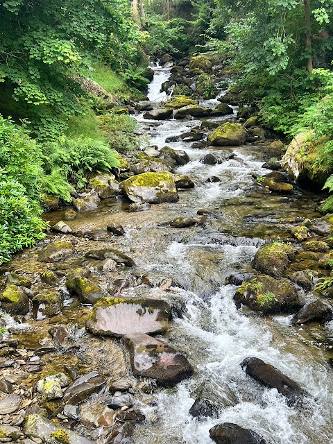
After all the rain the Grey Mares Tail waterfall was magnificent in power and colour fully living up to its name.

I was surprised that the climb treated me so gently as I did not have a lot of walking in my legs, pleased nevertheless. The waterfall was roaring but so was the wind, it was strong and cool once I topped out onto the open area.

Plan A had been to cross at the 1st ford and head up White Coomb but as expected the burn was running fast and deep. In my mind I was aware that last year a walker got swept away trying to cross this burn. He managed to anchor himself around a rock before being swept over the waterfall and almost guaranteed death. Mountain rescue got him out but he was a lucky man.

I walked up the track to the mouth of Loch Skeen where although deeper than I would have liked, it was still water so I waded across to the other bank. Mid calf deep at times but no fast running water, still water logged boots to empty.

Mid Craig

Lochcraig Head & Loch Skeen

A not very pleasant muddy boggy section followed before I started climbing up Mid Craig. Good views up top before a short descent and then up to Firthybrig Head. Here I had another disappointment. As it was a strong cold wind I stopped to put a light weight jacket on. But I realised the top thing in my rucksack should have been my food bag. No sign of it as it dawned on me that I had obviously left it in my car boot. At least I had water and I could do with shedding a pound or to.

Great Hill on the right

Broken fence & faint trail to Great Hill


View to Hart Fell

Upon reaching the fence line I turned left and followed an ATV track across mostly good ground. Reached a broken fence line which I knew took me to the Donald top of Great Hill, a straightforward 30 minutes out and back and not a lot great about it from this angle.


Molls Cleugh Dod & Carlavin Hill

Back at the dyke it was decision time. Having no food it was fairly straightforward, changed my plan for a shorter route. I decided to go Plan C and head back to tick off Carlavin Hill. As I was high up anyway the walk was straightforward despite the strengthening buffeting wind.

Molls Cleugh Dod

Carlavin Hill

View from summit to Megget Reservoir

View to the Culter hills

Wandered back to Firthybrig Head then the short walk to Molls Cleugh Dod. Another Donald that I had already completed but stupidly had not added on the top.

A 40 minute round trip but I was now starting to feel a bit tired. The combination of lack of hillwalking fitness and no nutrition was taking its toll so straight back was the plan.

Heading back to Moll with White Coomb behind

Wet feet ahead

The descent was a straightforward enough retracing of my steps. The views from the top of Mid Craig were superb over Loch Skeen and beyond. Wet feet once again and then the trek back to the car. More tourists around at this time in the day. Out of the winds it was also a more pleasurable walk back. Looking at the burn there was no obvious drop in the water levels.

Not exactly what I wanted out of today but it is an excuse to come back and finish the job, after a dry spell of course.

Ascent: 785m

Distance: 18.7km

Time: 5.19

Wildlife: Meadow Pipit; Wheatear

The direct route to.....Taberon Law

Hill: Taberon Law

Type: Donald Top

Height: 636m


Back to the Manor Hills today for the Donald Top of Taberon Law. This hill could be included as part of the Pykestone/Drumelzier circuit but it adds on almost 2 hours and 300m of ascent. The quickest route on the map was from the south but that was probably a steep heather/bracken climb. However, although it is not shown on the 1:50 OS map, I had spotted on my 1:25 map that an ATV track seemed to rise from the valley to the summit. Google maps also showed a faint line, not sure what state it would be in but this was worth a punt.

Cars are not allowed into the private road so I parked at a lay-by about 300m north. Walking back to the entrance to Stanhope Farm was the most dangerous part, a windy country road, fast traffic, minimal verge to get onto, good luck.


Stanhope farm

Stanhope burn

My next concern was that from the map it looked like I would have to walk through the farm buildings, was this going to be okay with the owners? It was a pleasant walk to the farm but no sign of activity, human or animal. There was also a sign directing walkers so all good.

Through a short section of trees to the edge of the valley. I could hear a bird that I was not familiar with. The app said it was a Spotted Flycatcher but although it kept singing it was high up in the canopy and I never saw it.


Into the unknown

Next concern was what livestock was going to be around. I did see some cow droppings but luckily it was just sheep all the way.

This track goes to Dollar Law and along the way joins up with the Thief’s Road for those wanting a long walk through to the Meggat reservoir.

It really was pleasant ramble at this stage. Hemmed in by green bracken and purple heather, the only sound the wildlife and the sounds of the Stanhope burn, the peace and tranquillity was just what I wanted out of this ramble. 4 Peewits flew across, only seen these a couple of times this year, sadly rare birds now.

Taberon Law

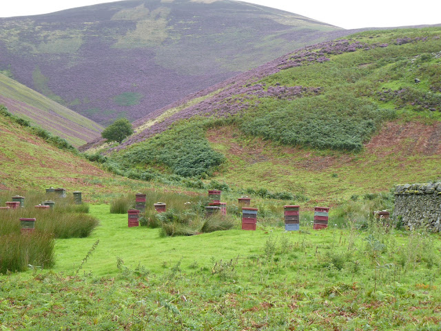
All these beehives but didn't see a single bee. I suspect the noise and sight on a summers evening would be interesting

Then Taberon Law came into view and I could see a scar up top, looked like my hunch was correct.


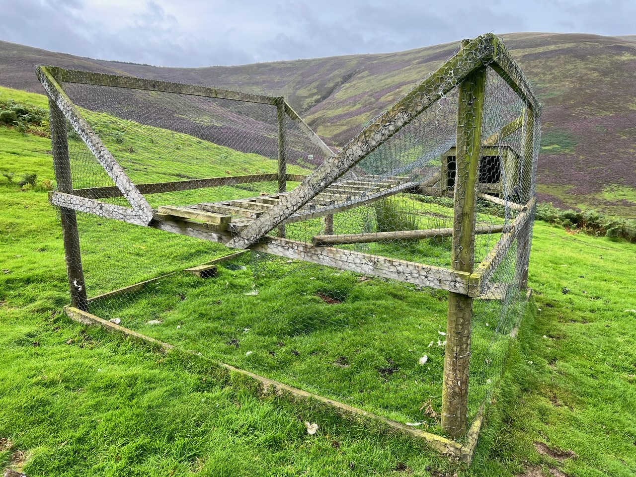
Larsen trap

The lower section was an unsightly section carved out of the rocks, a few twists and turns and I reached a green section where a Corvid/Rapture trap (sometimes known as a Larsen trap), was hidden away from walkers on the main track. Checked it out and it did have a registration tag on it. It was unused at present but not a corvid or raptor was seen on my ramble today.

Of course this estates main income will be grouse shooting. The hills were lined with many gun butts in case there was any doubt.

After this it was a proper ATV track, obviously for the shooters and not walkers hence not shown on the bigger map. Being a hypocrite I used it anyway.


It was a case of head down and keep plodding upwards. It reminded me of the direct assault on Culter Fell. I sprung a few grouse, maybe only half a dozen in total, possibly the rest shot on the inglorious 12th.

No difficulty apart from a few slips on the boggy sections churned up by the ATV’s. Sadly the weather had once again changed with a strong breeze, much colder than yesterday.


Looking east over to Drumelzier

View south to Broad Law

A small stone marked the summit. On a better day the views would be quite extensive but no so today.


Craig Head looks like ATV track continues over it

Jacket on as the first of a few showers hit me. I had intended to walk the ridge along to Craig Head and descend from there back to Stanhope. But I was too cold for that. 


The descent

Just one line of gun butts

A quick descent back to the less exposed valley. No need to rush, taking in the views and the many gun butts.


I spotted quite a few of these traps, another example of this just being a wildlife killing estate. Small satisfaction as I triggered this trap. Out of use until it is reset.


Two of the Peewits

Spent some time watching the Peewits watching me. Nice, as I said a rare sight so worth spending a few minutes with them. Also as I walked back I was intrigued by the huge cairn on the other side of the road, Worm Hill, I need to look it up.

Overall a short but worthwhile ramble and glad my hunch paid off.

Ascent: 452m

Distance: 9.51km

Time: 2.46

Wildlife: Peewit; Meadow Pipit; Rabbit; Spotted Flycatcher (h); Chaffinch; Blackbird; Red Grouse; Pheasant; Wood Pigeon