Showing posts with label Grey Mares Tail. Show all posts

Tuesday, 1 October 2024

A Moffat hills circuit.....Great Hill & Carlavin Hill

Hill: Great Hill (770m) & Carlavin Hill (736m) Molls Cleugh Dod (785m)

Type: Donald Tops x2 + Donald


After yesterdays deluge I was not sure what I would be able to do today as my 'A' plan involved a burn crossing which might be too high and fast running for safety. 
But somewhere in the Moffat Hills it would be.

Blue sky start as I parked up at the Grey Mares Tail car park, £4 a car, National Trust property. I wouldn't mind if it had toilet facilities but this does not. I gave them the money any way but I am sure most don’t and you can park across the road if you wanted to.


Still the view from the parking area was vivid with the greens of the bracken and the purple of the heather outstanding. Also showing well was the clear line where the track makes a steep ascent, my future in a couple of minutes.


After all the rain the Grey Mares Tail waterfall was magnificent in power and colour fully living up to its name.

I was surprised that the climb treated me so gently as I did not have a lot of walking in my legs, pleased nevertheless. The waterfall was roaring but so was the wind, it was strong and cool once I topped out onto the open area.

Plan A had been to cross at the 1st ford and head up White Coomb but as expected the burn was running fast and deep. In my mind I was aware that last year a walker got swept away trying to cross this burn. He managed to anchor himself around a rock before being swept over the waterfall and almost guaranteed death. Mountain rescue got him out but he was a lucky man.

I walked up the track to the mouth of Loch Skeen where although deeper than I would have liked, it was still water so I waded across to the other bank. Mid calf deep at times but no fast running water, still water logged boots to empty.
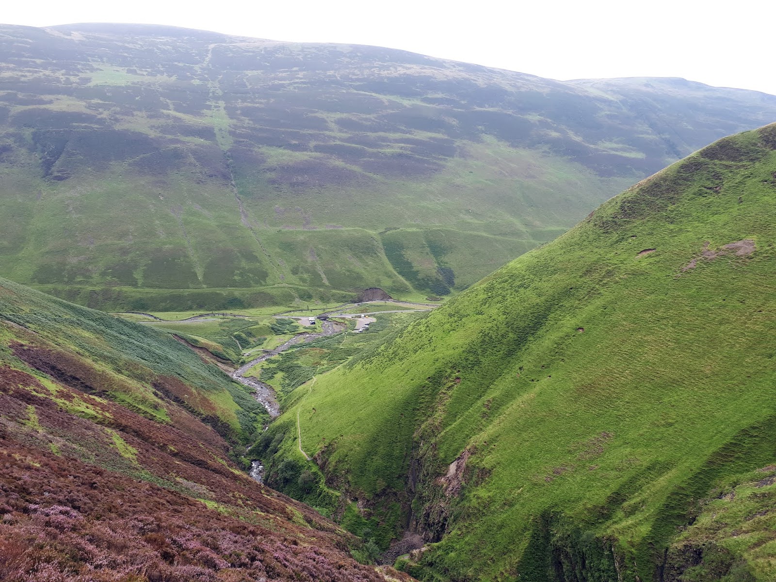
Mid Craig

Lochcraig Head & Loch Skeen

A not very pleasant muddy boggy section followed before I started climbing up Mid Craig. Good views up top before a short descent and then up to Firthybrig Head. Here I had another disappointment. As it was a strong cold wind I stopped to put a light weight jacket on. But I realised the top thing in my rucksack should have been my food bag. No sign of it as it dawned on me that I had obviously left it in my car boot. At least I had water and I could do with shedding a pound or to.

Great Hill on the right

Broken fence & faint trail to Great Hill


View to Hart Fell

Upon reaching the fence line I turned left and followed an ATV track across mostly good ground. Reached a broken fence line which I knew took me to the Donald top of Great Hill, a straightforward 30 minutes out and back and not a lot great about it from this angle.


Molls Cleugh Dod & Carlavin Hill

Back at the dyke it was decision time. Having no food it was fairly straightforward, changed my plan for a shorter route. I decided to go Plan C and head back to tick off Carlavin Hill. As I was high up anyway the walk was straightforward despite the strengthening buffeting wind.

Molls Cleugh Dod

Carlavin Hill

View from summit to Megget Reservoir

View to the Culter hills

Wandered back to Firthybrig Head then the short walk to Molls Cleugh Dod. Another Donald that I had already completed but stupidly had not added on the top.

A 40 minute round trip but I was now starting to feel a bit tired. The combination of lack of hillwalking fitness and no nutrition was taking its toll so straight back was the plan.

Heading back to Moll with White Coomb behind

Wet feet ahead

The descent was a straightforward enough retracing of my steps. The views from the top of Mid Craig were superb over Loch Skeen and beyond. Wet feet once again and then the trek back to the car. More tourists around at this time in the day. Out of the winds it was also a more pleasurable walk back. Looking at the burn there was no obvious drop in the water levels.

Not exactly what I wanted out of today but it is an excuse to come back and finish the job, after a dry spell of course.

Ascent: 785m

Distance: 18.7km

Time: 5.19

Wildlife: Meadow Pipit; Wheatear

Tuesday, 5 December 2023

Beyond the Grey Mares Tail.....Nickies Knowe

Hill: Nickies Knowe (761m); Lochcraig Head (801m) (The cliff of the loch)

Type: New Donald, Donald .

Another good weather forecast so another trip to bag a Donald Top. Last night the stars were sparkling so the early start meant the first defrosting of the car this autumn, likely only a light frost so a 5 minute job.

Main landslip huge, other one top and left
Arrived early at the Grey Mares Tail car park with only half a dozen cars around, it would be a different scene when I came back down. Looking ahead a huge landslide and at least one other which I snapped later.

Superbly constructed path plus Grey Mares Tail lower waterfall

Upper left landslip from earlier snap

Grey Mares Tail upper waterfall
I was well wrapped up as I began the ascent, too well wrapped at this stage, always start cool!! The recently repaired stone track is superb but I had forgotten how steeply it goes up so once again huffing and puffing away. I dont mind paying for parking if there is a benefit to the walker and the National Trust have delivered on the path. But where are the toilet facilities?  At least there was a good excuse to stop and take a picture or two of the waterfall which was quite spectacular.

I had been unzipping as I climbed but when I reached the top of the falls the wind was back with full force so everything zipped up, hat and gloves donned. Earlier this year a man had fallen into the burn and was swept over the top waterfall, badly injured but luckily was removed before he went over the main waterfall.

Unfortunately the blue skies were now less existent, all the tops swathed in grey. I spoke to a couple who were struggling to find a spot to cross the burn and with the low clouds were debating whether to just go back, I left them to their debate but she looked determined to go back, wonder what the outcome was?

Cold Loch Skeen with Lochcraig Head behind and in cloud
Loch Skeen made me shiver, it looked a cold place today, grey water, large waves crashing into the sides, no wild swimmers spotted this time.

Caterpillar still out, Fox Moth I believe
I was now focused on getting across the heather bog trap to the fence to see if it was easier walking. Indeed it was, well at least for a short time. The wet patches were extreme traps of peat bogs and sphagnum going as deep as half way up my poles, not putting my foot in these traps.

Follow the fence at times better going
Negotiated safely and back to the fence where a narrow worn track meandered to the base of the hill.

The large cairn for the false top of Lochcraig Head

Lochcraig Head's true summit point
Time for the 2nd assault of the day as I followed the fence to the end of stage 1, from prior experience I knew that when the fence took a left turn then another gentler ascent led to the large cairn on the fringe of Lochcraig Head and its dramatic views over Loch Skeen and beyond. A cairn no doubt mistakenly bagged by a few walkers as the Donald summit.

I did not go over to the cairn but crossed the style and followed a faint grassy path to the true baggers top of Lochcraig Head, no frills here just a few rocks. The clouds had started to lift and the vista was expanding nicely.

My objective, Nickies Knowe, as a New Donald implied a few ups and downs. Yes there were but the ground was a delight to walk on, good grassy trails and even the off piste sections had no difficulties.

Nickies Knowe ahead

The Eildons stand out in distance from one of East Tulla's cairns
I could see ahead to the first area marked on the map called Talla East Side, This had been a fairly gentle descent and over the fence were two very large stone cairns, what were these recognising, no idea? Many a Donald or Graham would have been proud of them.

Tulla reservoir with Culter Fell & Tinto behind
Nickies Knowe was about a kilometre away. A gentle 50m descent and about 20m uphill and I was there. As I said earlier, this top would have appreciated one of the cairns on Talla East.

Still good views now that the clouds had lifted even though the wind was still trying to blow me over. Hood, hat and gloves still on.

Nickies Knowe summit

Looking back the way I came White Coomb back right
I liked the view through the blue water of Tulla reservoir across to Culter Fell. But the best surprise was looking SE where the Eildons of Melrose were proudly standing above the surrounding countryside, easily the highest hills in that area. I was well out in isolated country and had hoped to hear some Red Deer rutting but not a thing. There must be some around here in this barren landscape but not today.

I returned the same way to Lochcraig Head.

Loch Skeen passing clouds covering White Coomb
I had considered adding in Carlavin Hill via Molls Cleugh Dod but in these winds it looked a tramp too far. Plus I had been looking at the map yesterday and spotted a more straightforward ascent from the Tulla side and from this perspective it looked a goer.

Cracking view for a late lunch briefly out of the wind
As I descended I bumped into a group from Livingstone Ramblers. Talked to them about their planned route which to me sounded a bit optimistic considering the time it now was and add in that a few of the group were still well down the ascent, good luck.

Back to car park Donald of Andrewhinney Hill behind
The day had been a mixed bag weather wise but thankfully any rain missed these hills. Despite the wind I enjoyed ramble, never a hardship coming to the Moffat Hills.


Ascent: 775m

Distance: 13.2km

Time: 4.47

Wildlife: Wren; Pheasant; Raven; Red Grouse; Meadow Pipit; Caterpillar

Monday, 26 August 2019

An impressive White Coomb circuit

Hill: White Coomb; Lochcraig Head, Molls Cleugh Dodd
Category: Corbett/Donald x3 (WC counts as both)
Height: 751m ascent?

An early morning start with a B & B brekkie in the tummy. A few overnight campervans but obviously too early for other walkers, a huge contrast with my return to the parking area.
Grey Mares Tail
With the recent rains the falls of The Grey Mare’s Tail were in full flow, a superb sight and sound as huge amounts of water crash down. They are rightly in the top ten waterfalls to visit in Scotland. A good excuse to stop and take a breather and take it all in, excellent views back down the ravine. You can appreciate how there have been fatalities here particularly in winter. A peregrine flies over so fast it soon disappears out of sight as it goes after unseen prey.
Tail burn looks ok from here but not when close up
As I amble alongside the Tail burn I am looking for opportunities to cross on my way back. Not surprisingly the water is high and fast, few stone jumping opportunities, I mark one spot.
Loch Skeen with Lochcraig Hill on right
A couple are wild swimming in Loch Skeen, far too cold for me to try that but they say it is good for you. Lochcraig Head’s crags look mighty impressive and steep, from here.
I should have left this boggy track earlier and cut across to the dyke. As it was I had a long arduous plod through deep heather, peat hags and moss water traps all with clegs buzzing around my face. How I was not bitten today I do not know, they have liked me well enough in the past.
I finally reach the dyke and follow the worn wet path slowly up the hill. Legs are feeling tired today and it is harder going but I have had 4 big walks this week, must getting too old for this.
A pair of kestrels appear, twisting and turning with each other before static hovering, eyes on the ground, but no luck, away they spin. Not sure how large their territory is but conceivably the same pair as yesterday at Whitehope Heights.
Loch from Lochcraig Hill, White Coomb on right
Finally I reach the flat plain and go to the large cairn overlooking the loch, a nice but hazy view. The true summit is over the other side of the dyke, not photogenic.
I thought I was going to get a breather but nope a descent into Talla Nick and backup the other side. It was boggy down there, I tried walking the dyke but too dangerous, stuck to the mud.
More raptor diversions to take a breather. There were more wheatears in these hills over the last two days than I can remember seeing. Every few steps birds flew out of the stones. A sparrow hawk was well aware of this and patrolled up and down the dyke. Most birds were out and back in again before the hawk could strike, I am sure it has its turn. I wonder if the wheatears are migrating from the north and stopping here in the good weather? 
Molls Cleugh Dodd, small cairn straight ahead on horizon
At the top I knew there was an optional diversion to take in the Donald Molls Cleugh Dodd. Looking at the map last night that I saw that it was a fairly level walk so despite the protesting legs I took it in. Another case of a larger cairn and a smaller one. Take them both in again just in case. Nice views of many rolling hills.
Now high level grassy walk to White Coomb
Thirty minutes later back on track and I could see White Coomb over to my right, no more big drops just a solid slowly ascending high walk, following the fence line. Taking it easy and enjoying the views.
Before long I was following a track that moved away from the fence. I was just strolling along before instinct said this was not right. A quick check and now a drudge over the moor to a stile in the fence. It was surprising how much more effort was required in the longer grass.
White Coomb cairn
Over the stile and almost immediately there is the top of White Coomb. A good all round short view, too much haze to see far into the distance, that has not been much of an obstacle this year. Clegs are still buzzing around I wish I had one of those bush hats with the dangly bits.
Follow the dyke back to the Tail burn
I followed the obvious track down, sometimes very steeply. I knew from my earlier look at the burn there was no point in following the dyke to the normal crossing spot. From up here the track to the loch was mobbed, had a coach load of ramblers arrived for a day out? 
Once down a good bit I left the track and took a line through the heather and moss heading towards the mouth of the loch. There are fords marked on the map but none were crossable today. A couple of maybe attempts but the wet rocks were so slippery that I could not get a grip for the final jump. An audience was now gathering on the other side, I was today’s entertainment!!
Finally one a few spots where dry tips of rocks protruded, walking poles a must for balance for the final leap, made it. 
Looked at my watch exactly 4 hours, wow after the initial struggles I made very good time considering I also took the detour.
Looking down to the car park
It was very warm so now I took my time amidst the tourists back down the trail to the car park. 
At the bottom I put my cap in the burn and poured the cold water over my head. Relief and the highlight of the walk.
A very enjoyable walk and glad I did it early in the day.

Wildlife: Scotch Argus; Peacock butterfly; Burnett moth; Peregrine; Kestrel; Sparrowhawk; Meadow pipit; Wheatear
Time: 4.38
Ascent: 835m
Distance: 15.1km