Showing posts with label Inchnadamph. Show all posts

Saturday, 6 September 2025

Plenty of boulders, stones and scree, typical Assynt.....Conival & Ben More Assynt

 Hill: Conival (Adjoining Hill) (987m) & Ben More Assynt (Big hill of Assynt) (998m)

Type: Munro x2

Ascent: 1291m


This pair of Munros had been on my original 100 Munro list but for various reasons it did not happen but today I had the opportunity to try and tick them off.

I knew from my research that this was almost certainly going to be a gruelling ramble, not just are they the highest peaks in Assynt but the terrain, mainly made up of boulders and scree for much of the higher terrain, made for hard going. Throw in yesterdays heavy rain which should make the lower boggy sections even more so. Forewarned is forearmed as they say.

I arrived at the car park just after 7am where the only other occupant was just walking out without any form of acknowledgement, I wondered if we were doing the same hills.

Health & Safety risk of the day

After yesterdays deluge today was forecast to be drier but right now the low grey skies suggested not a lot had changed. Indeed there was light drizzle at the start but that did not put off the midgies.


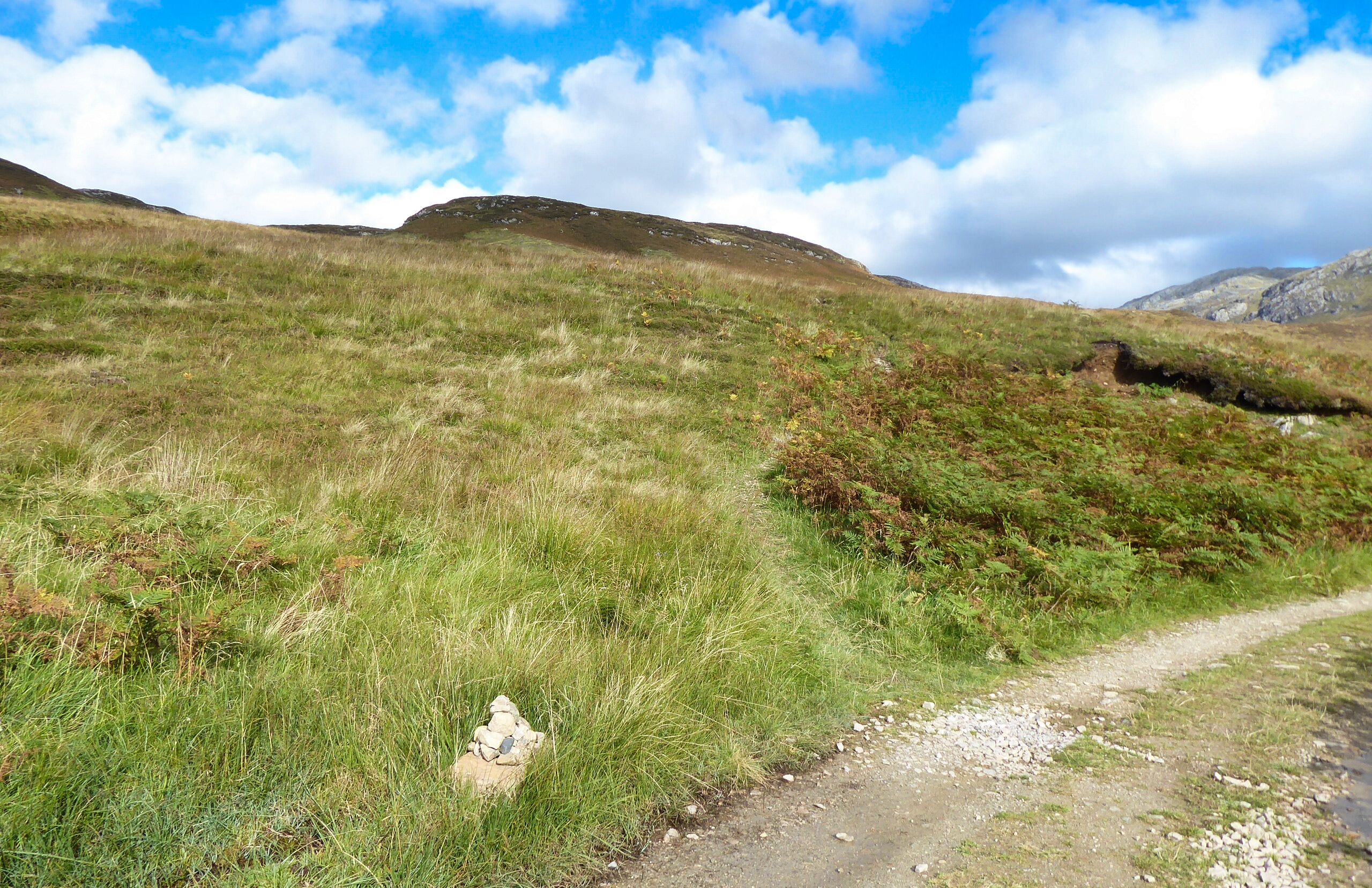
It is a fairly long walk in before gaining any height but I enjoyed my ramble along Gleann Dubh which looked atmospherically scenic in the early morning light. I spotted a walker a good way ahead, presumably car park man.

Time to climb towards the Coll

The track was mainly good, very narrow and eroded in places but no issues. Just avoided taking the turn to Tragill Caves or I would have added to the distance with a U turn. The burn was making a fair old noise as it flowed over many small falls but as a Piscean i enjoy that sound.

After around 4k the track started the seemingly never ending ascent to Conival. The clouds were slowly lifting so I was now getting a view of just how high I was going to ascend, maybe I didn’t need that reminder.


The track followed to the left of the Allt a’ Choinne Mhill and although it had been relayed with large irregular stones it was still a muddy climb. The burn was running full and fast, the rocks all covered in moss and I was very aware that I needed to cross it at some point. Indeed after the deluge the hills were shedding water big style and the at times the track was itself a mini burn. Glad I had put on the leather boots.

Scramble required

The looming crags looked interesting particularly as I could not see an obvious way up, a scramble was clearly necessary but where?

As it turned out the burn crossing was straightforward as was the minor scramble on the section I chose, just to the right of the waterfall.

After the scramble the terrain was full on scree and boulders, not so hard ascending but I knew the descent would be a different story for my legs.

BMA on the left

Still no sign of the summit of Conival

The meandering track rose and rose, every point I thought might be the top was definitely not. On my left I could see the ridge to BMA and initially my mood dropped as I mistakenly thought that I was looking at Conival with the further ridge being BMA. My initial feel good thoughts that I was making good time disappeared. A pause for a map check confirmed it was BMA but where was Conival? Finally after another potential top the cairn finally appeared and I was right on the SMC time of 3 hours, very pleased with that.

View from Conival to BMA

From Conival looking down on the Corbett of Breabag

Having arrived at Conival BMA looked not that far away but I was well aware that it was not as close as it looked and would not be a stroll in the park. A quick break for nutrition as well as taking in the views.


The route to BMA

Indeed there and back was probably the most uncomfortable stretch of Munro walking that I have experienced. The SMC route stated it would take 45min each way. I managed 55min out and 1 hour back which I felt was good and I was surprised it did not take me longer. The constant scree/boulder walking/scrambling was so awkward that absolute full concentration was required. There was always the constant risk of tripping with non thinkable potential consequences. My legs and hips were getting a full workout.

View from the ridge down to the Dubh Loch Mor

Typical terrain

View from BMA summit across to its twin top


Looking from BMA back to Conival, wild stuff

At the top of BMA my plan was to eat but I decided to snack only and get the return stress out of the way and eat properly at Conival. The return seemed slightly easier but on the final scramble up to Conival I was feeling tired, too little nutrition. Some great views but that is one section I will never do again, Conival yes, BMA a big no no. The scree hills in this area produces spectacular scenery, one great example below looking north.

Back on Conival nice to see some greenery

View back to the start at left of the Loch Assynt

A deserved food break on Conival but now I was not really hungry so more snacking. Enjoyed the views before the long descent which just repeated the ascent. I had forgotten just how far down the stone section lasted. 


My tortured legs, feet and hips really struggled until I reached the flat track back along Gleann Dubh. Highlight was spotting a small herd of red deer hinds. Initially just one appeared profiled on the ridge but once it started grazing more appeared.


Back on the relative flat the sun was now out and it was hot which brought out the clegs and midgies.

I was relieved to get back to the car and refresh my feet with some cooling wipes.

I was delighted with my time and stamina. A good tough ramble with spectacular views but I cannot see me repeating it.


Distance: 19.5km

Time: 8.14

Wildlife: Golden Eagle; Common Frog; Red deer hinds & stags; Pied Wagtail; Grey Wagtail; Sparrowhawk (m); Meadow Pipit; House Martin; Sand Martin; Moth;

Friday, 21 October 2022

Remote Glas Bheinn.....The hill of the ticks

Hill: Glas Bheinn (Grey Hill)

Type: Corbett

Height: 776m

Feeling better today so decided on a bigger test. I was thinking about Quinag but not really in that shape so opted for its singular neighbour, Glas Bheinn. I knew this was a 6-hour ramble today, but the forecast was the best day of the trip so made use of it.

Two options for this hill and I opted for the longer, less direct route. I parked at the car park near the Inchnadamph Hotel. My jinx is still with me as my GPS did not have this walk in its memory. I knew I had set it up last night but no idea what happened. Mmm decision time. The hills were shrouded in cloud but were forecast to lift. I did have my OS map and compass, with the route highlighted so old school today, off I went.

After the hostel I bumped into a couple of walkers staring at a map. Are you heading to the Munros they asked? Nope, we looked at their map and got them right and to be sure I walked the track with them to their cut off. But because we were talking, I missed my cut off into the hills indicated by a very small cairn.

This is a Corbett, not an almighty Munro so no motorway size tracks here. I was expecting a small wooden post as this is also a section of the Cape Wrath trail. It has a reputation as an extreme challenge so maybe markers don't go with it.

Gate to nowhere
The non-obvious path now became a recognised one and had me puffing as I climbed to reach the old gate to nowhere, by this time I was sweating back style, where had this heat come from, jacket and hat off.

The only sound was the gurgling of the river as I ploughed on climbing all the time.

I reached a small shelter with a wooden bench, room for two but a good view of a waterfall, more about this shelter later.

After about an hours walking I got my first view of my target the ridge still in cloud.

More ups and downs on the rocky/stony/boggy narrow track but at least someone had put some work into it. But this is real isolation, a very remote piece of our land.

Eventually the path descended via a very boggy section to reach the outflow of the larger Loch Fleodach Coire. This was the bit I was unsure about, if the river was in spate turn back time. Although the stepping-stones were slippery and some of them submerged it was passable.

Green lochan
After crossing the outflow where was the path? I walked along the very boggy edge of the loch to meet another burn crossing, then another!! Some trampled grass indicated a path, yippee. But it was going up away from where I wanted to be albeit I knew from my map that it would turn around higher up. Looking at the terrain a direct route to the base of the hill was clear but unpredictable. Being on my own I stuck to the path for now. With the ups and downs there is a lot more ascent than the hill height suggests.

Heading for grassy rake mid left
Now another decision as my map was now differing from the Walkhighlands description which thankfully I had downloaded as text on my phone. I had to take a much longer walk than expected to the base of the hill, crossing some very wet and boggy sections.

Turning from grass to boulder scree

A few of these hiding in the grassy bog
I knew this was now a series of elevations to the plateau. Sticking to grassy sections as much as I could I reached an open grassy area surprising some hinds but were they bothered, nope.

1st of a few sightings
The next two lifts were awkward boulder/scree sections. Now I was into proper Assynt Corbett tops terrain.

Finally a plateau was reached but no sign of the top. I had seen what I thought was the top cairn but just a line of sight one. Easier walking with areas of grass and stones but aware of how close to the drops I was.

Then I spotted it over the plateau at 10 o’clock so a different angle to the one I was on, yes I had not been looking at the map. With relief the big cairn and shelter was reached. Decent views but not the best I have had on these hills, not a patch on Breabag for instance. Looking back the clouds were romping towards me so I wasn't hanging about.

Quinag

Looking back along the plateau

Canisp & Suilven

Glad to be off the scree. More deer on the grass

Inchnadamph looks close but still a few hours away
The views over to Quinag showed its tops still covered in cloud. Nice views out to sea and the stony landscape close by. As I was self-navigating I wanted to get away from the steep drops before the cloud covered me. Big plateaus can be awkward to navigate for my skillset.

Heading back to the stepping stones, Conival's peak just in shot


Snap doesn't do waterfall justice, the noise was spectacular and soothing
Got back down, over the moor and across the stones safely and climbed back to the shelter for my sandwich. I sat on the grass listening to the waterfall tumble down from its great height, genuine tranquillity. A wilderness all to myself. Just as I finished my sandwich, I noticed a tick crawling up my arm. I killed it but noticed another on my underarm. As it was despatched, I saw one on my jacket sleeve and another on my rucksack. Despatched those two then headed off at a pace with still at least another hours walking. On the descent I felt something on my neck and scalp, three more times, each a tick was killed but now every itch or whatever had me paranoid.

Almost back. Took this on the ascent as loved the sky.
Was I glad to get back to the car and go through all clothing and gear but no more ticks found. Thankfully likewise back in the shower.


Overall, ticks aside, a superb long-distance ramble. Certainly not one to be walked in poor weather unless absolutely sure of your outdoor skills. This is genuinely one very remote place. I was solo in more ways than one, not another person spotted. But it is a while since I had the buzz of solo walking in a remote environment. Certainly not a feeling I get in group walking or even with just one other. This being alive buzz only comes from solo walking. You really can get Scotland to yourself.

As I looked over at Quinag it was heavily covered in very dark clouds, I made the right choice.

Ascent: 900m

Distance: 18.1km

Time: 5.38

Wildlife: Chaffinch; Meadow Pipit; Red Deer (hinds); Raven (heard); Buzzard; Scotch Argus; Red Admiral;


Wednesday, 24 April 2019

Cracking little walk to the Bone caves

Walk: Bone Caves, Inchnadamph
Category: Trail
Height: circa 200m
Rest day so out with the good lady to take in this short walk that I noticed on a map. Glad we did it was a little cracker.
A beautiful day for a short but extremely scenic drive from Lairg along roads most tourists have yet to discover.

Start
Missed the turnoff, a very small camouflaged wooden pole it turned out, but found it on drive back.
A lovely warm spring day and it starts with a walk up the glen beside the fast rushing Allt nan Uamh.

Falls
 The waterfalls were in good flow considering the lack of rain but there was a better surprise for this burn later.
Just after the falls I spotted a stag on the near horizon on our right with a big hind, both turned and disappeared when they spotted us.
Metres above springs arid
A couple were dangling their feet in the water when it dawned on me that the water concourse above was totally dry, rocks and boulders. On closer inspection the water was bubbling out of the ground, small pockets of amazing springs which in a matter of metres was a fast flowing burn. Never seen that before, a natural wonder.
Metres below springs full burn
There is an easy track to follow that climbs gradually although probably more awkward for poor footwear in wet conditions.
Easy track in
I saw more Wheatear today than I have ever seen on a single outing, beautiful birds. We also had a short sighting of a similarly upright bird, slightly larger but beautiful blacks and greys. My immediate thought was a shrike, I know of no other like that, no binos but we both saw it. If so a gem of a sighting.
With the glare of the sun and the shadows we almost missed the cave entrances up on our right.

Caves
A continuation up the track then turns back on itself climbing along a narrow path to the cave entrances. It is steep and exposed, loose stones so take care. A raven had been flying close by it turned out its nest was just above one of the caves. It made close fly pasts but nothing threatening.
Looking towards Conival
These caves have bones from many of past animals including: arctic fox; lynx; reindeer; bear; wolves etc probably occupied by the hunter gathers. There are links between some of them but only for the brave. In one it looked like a small shaft of light far back but no exploring for us.
Standing on the ledge outside the caves you can appreciate the importance of the site as well as for us the views it gives. A stunning stony but bleak and barren landscape.

Looking back towards the start
Scanning our eyes across to Creag na h Iolaire, ever hopeful, but no eagles only the raven patrolling the ridge.
Either retrace your steps or follow the obvious path back down to the valley.

Colour in the grey
The dried up burn mentioned earlier provided colour with gorgeous yellow primroses breaking up the many shades of grey.
Newt
On the way back we stopped at a deep black pool which had pond skaters on top and newts below.
A cracking little walk and one that I would highly recommend.

Wildlife: Raven; Wheatear; Red Admiral & Peacock Butterfly; Newt; Red deer stag & hind, Meadow pipit, Grey shrike?

Time: 2 hours
Ascent: 200m
Distance: circa 3 miles.