Showing posts with label Kilmarnock Ramblers. Show all posts

Sunday, 9 October 2022

A return to the moors.....Blaeloch Hill

Hill: Blaeloch Hill

Type: Sub2k

Height: 407m

After a bad week of weather and family stuff I needed fresh air so happily headed out with the Killie group today. It has been a long time since I have tramped these moors from this direction so that was fun. Another benefit was that the walk had a different finish from my previous trips so a slightly new route. Indeed I have now been on this top 3 times all by different routes.

Surprisingly we started in rain, this was not in the forecast. The usual walk up through the woods of Fairlie Glen, heavy drops of rain hitting my skull from the trees, not good hood up.

Thankfully weather brightened when we left the trees and stayed that way for the rest of the walk. Good views looking back. Not so good looking at the turbines where the Spanish & French are laughing all the way to the bank at our expense, quite shocking.

Asa we neared I missed the aircraft wreckage last time but spot on today, an amazing site considering this crashed in 1944.

A short walk but a good day out in good company.

Single file through the bracken

1st stop and look at the view


All these eyesores with no benefit to us


Firefly remains from 1944. Both crew perished.


Final viewpoint with Misty Hill the dark bit above the the walkers on the horizon


Ascent: 477m

Distance: 11.9km

Time: 4.44

Wildlife: Fox Moth caterpillar; Great Tit;

Thursday, 10 September 2020

A return to the Culter Hills but the weather forecast was more than a little innaccurate.

Hills: Culter Fell (Originally named as Fiends Fell)(748m); Chapelgill Hill (696m)

Type: Donald/Graham

It was good to return to the rolling Culter Hills in the company of friends from Kilmarnock Ramblers. A smaller group due to Covid travel and a midweek outing but reached my target number. The Culter Hills are on the watershed between the valleys of the Rivers Clyde (draining into the Atlantic) and Tweed (draining into the north Sea).

According to the forecast it was to be a blustery but dry day with lots of sunshine, err nope. A weather front was predicted to blow through overnight and indeed I was aware of the rain hammering down when I went to bed. However, on travelling it had not cleared through as intended, more shades of grey up there in the sky than in the book.

The walk start was again from Culter Allers farm where as we prepared one of the biggest sheep I have ever seen tried to get away from the shepherdess by charging our lines. It didn't make it and when caught she gave that sheep a bawling out, wouldn't want to be on the wrong side of her myself. Still all were cheerful as we headed up the sheltered steep slope to the treeline where the wind let us know it was still around. I took the easier route to avoid the worst of the wind and also I was unsure of the group fitness.

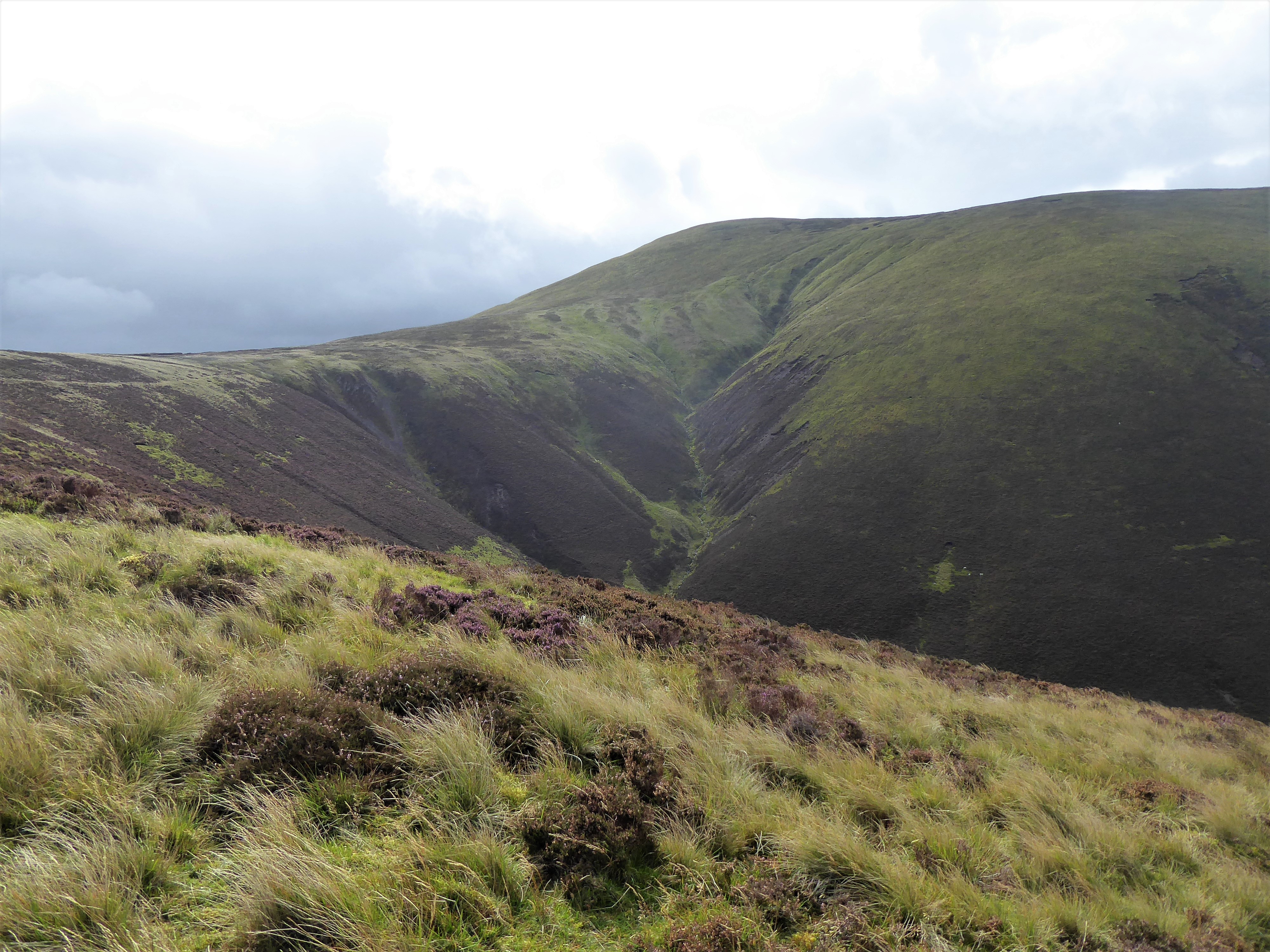
We had a good view of Culter Fell and its huge deep cleugh. Before long the going got wetter underfoot but we reached the fence crossing in good time just as the wind increased. 

Some people wishing they were a bit more supple when crossing the obstacle. At least the clouds were not low enough to cover our tops but from this high viewpoint it was clear the weather front was broken and continuous.

We followed an ATV track Chapelgill Hill thus avoiding the peat hags which would have been a gloopy mess. Enjoyed the views over the Pentlands which looked to be in full sunshine. Closer to us the Broughton hills less so. Still the views down to Glenkirk farm were appreciated. As for the wind turbines they were rightly in the gloom.

At the summit it was far too windy to have a break so after reviewing the memorial plaque we backtracked to find a sheltered spot out of the westerly wind and indeed we found one so lunch was a more relaxed and pleasant affair.

On the steeper approach up to Culter (pronounced Cooter) Fell the wind upped its game and our group were staggering about as if drunk as the gusts tried to spin us around and make us lose our footing, but still the dark humour continued to make light of it all. Some heavy breathing on this ascent not all wind related.

Photographic battle in place.

We staggered to the top of Culter Fell where the wind decided it had not yet had enough fun and became almost storm force with some rain thrown in to not amuse us. The irony was that I had postponed this walk a few weeks ago as the forecast had been for excessively high winds!! It was also blinking cold on the top.

Once everyone had reached the top we were off. I decided against the shoulder as we would have been exposed to the full frontal so headed to lower ground as quickly as possible.

Thankfully nobody slipped on the sodden grassy surface and we reached the calmer ground and enjoyed the views over to the areas where there appeared to be blue skies and sunshine, jealous, yes. Tinto clear in this picture.

Back at the cars all agreed it had been an effort at times but that it had been an enjoyable walk and that is always the main objective. Exercise and laughter always a good combination particularly in these trying times. 

As I got changed at the car a weasel emerged from the grass beside me and sprinted into some other cover, a nice finish to the walk.

Wildlife: Red Grouse; Pheasant; Weasel; Meadow Pipit.

Ascent:709m 

Distance: 13.2km 

Time: 4.40m


Monday, 18 November 2019

A proper ramble to Benbrack

Hill: Benbrack
Category: Other walk
Height: 581m
Today was a bit different from the normal group walk in that we had the company of Ben Dolphin, President of the Ramblers organisation in Scotland. A really nice guy who added value to the outing and hopefully we returned that with our feedback and company. 
Ben & Jeanette
On Thursday I had climbed one of the other Striding Arches at Colt Hill and here I was completing another within a few days. Like Colt Hill I had a previous failed attempt at this hill so second time lucky. The previous outing was another group walk, this time with the Ayr & District group. Heavy snowfall was our downfall that day significantly slowing progress, turning us back before Benbrack.
Today was a totally different experience, you could not have picked a better day to walk in November. Although the temperature dropped to  minus 2 on the drive down there was a crisp but not cold feeling at the start.
The start onto the moor
Our route to Benbrack followed the Southern Upland Way but for these hardy long distance walkers their day is a lot longer than ours. Our interim bit is part of the longest section of the SUW which goes from St Johns Town of Dalry to Sanquar, a long haul at 41.5km.
Still our walk starts at the old byre and goes past the working farm. There are signs warning of dogs, working collies I presumed, but on the way back I saw the owner walking a beast of a Rottweiller type dog, huge and one to stay clear of. Probably a gentle giant but not for me to find out.
No navigation required as we followed a clear path, muddy and boggy at times. 
Plenty of SUW markers around
Keep looking up and see the yellow topped SUW marker posts for reassurance and head for them.
Up and down grassy trails we wander. Criss cross some of the estate and forestry roads  but basically keep on a straight course.
Manquhill Hill
Finally from Manquhill Hill the Arch on Benbrack could be seen in the distance, looked a lot further away than the reality.
Benbrack ahead
The views were stunning Moorbrock, Carsphairn, Blacklorg and lots of others seen from non traditional perspectives. Can’t describe this properly, it was what getting outdoors is all about without slogging up huge Munros etc.
Moorbrock & Carsphairn Hills
Now we had only one hill left, a steep ascent but a gentle walking gradient and in these warm November conditions gear was being shed as we climbed. The expected humour didn’t disappoint.
Messy top from this approach
Then the Arch was reached and we had views of the other two on Colt and Bail hills. 
Again super long distance views the radar golf ball on top of the Lowthers shimmering in the light. Even brighter was the very white snow covered top of White Coomb, I will be doing that soon, on my winter list. Looking south the low pressure had created grey clouds and limited visibility but looking north the high pressure blue sky, a cracker. We were right in the middle.
Arty shot!! Colt Hill arch in distance
We followed the same route back as there were forestry diversions around and better on the feet to tramp soft muddy paths than hard stone packed forest roads.
A top day out in excellent company but particular mention to our walk leader today, Jeanette. An excellent job in preparation, what home baking. Cannot lose her the bright colour scheme outstanding. As a person true to herself, and with the pressure of Ben Dolphins presence, well done to her, I enjoyed this one.

Wildlife: Buzzard; Crow; meadow Pipit; Blue Tit.
Time: 5.22
Ascent: 1616ft (596m)
Distance: 9.11m (14.7km)

Monday, 21 October 2019

Hill: Wedder Law and Gana Hill
Category: Graham/Donald
Height:

Today’s outing was leading a walk for Kilmarnock Ramblers over some Southern Lowther hills. We bagged two categorised hills, Wedder Law and Gana Hill.
I have reported on this route before so just a brief review and some nice snaps.
The walk started from Durisdeer village where we headed up an estate track with an initial 300m steep ascent to Black Shoulder (468m), certainly got the breathing going, before descending (the sting in the tail) and re-ascending via the same track to Wedder Law (672m).
We then descended about 150m before crossing rough moorland and then followed the fence to Gana Hill (688m). It was a strong cold wind but the views were tremendous.
From the Solway across the the Lake District. Criffel; Cairnsmore of Fleet & Carsphairn; The Merrick; Arran through the gap and the Wanlockhead Lowthers just super.
The colours of the local hills just reminders of the beautiful country we live in.
Next we followed another estate track over to Garroch Fell (606m) the biggest cairn of the day.
Visibility was good so now the hardest part of the day for some. We descended contouring at times across the steep stony and heather flanks of Garroch Fell to join up with the estate track to take us back to the start. Saved us a mile or so of estate track.
An excellent walk, great views and good company.


Wildlife: Raven; Red Kite; Buzzard; Meadow Pipit; Red Grouse; Red legged Partridge.
Time: 5.47
Ascent: 893m
Distance: 16.4km

Saturday, 24 November 2018

A ramble up Meikle Bin

Hill/Walk: Meikle Bin
Category: Sub2k
Height: 570m
Another short winter walk with Kilmarnock Ramblers to get to the top of Meikle Bin, the Kilsyth Hills highest hill.
We started from Todholes Farm under grey skies. I had forgot my waterproof jacket so fingers crossed for no rain. 
The walk is firstly on good forestry track hemmed in by the pines. Not a lot to see just the conversation to entertain us.
Reservoir burn
There are occasional views of Carron Valley reservoir through the trees but better views when we gain height. This burn will be a perfect trout spawning area further up in the shallows. I have fished this water and from the boat watched walkers summit Meikle Bin, today it was to be my turn.
The valley was dammed in the 1930s to create this very large reservoir which is around 4 miles long and three-quarters of a mile wide at its widest point and it feels every bit of it out on the water with the waves slapping the boat. The reservoir is linked to the River Carron and provides water for the Falkirk area. There are dams at both ends which the trout like to gather at.
1st view
When we cleared the trees the top was shrouded in cloud which came and went but never fully cleared. Lots of locals out walking the hill today.
The cloud lifts briefly so the trig in sight
A short steady walk up the grassy slopes, wet, slippery but straightforward and before long we arrive at the trig.
Trig
The cloud occasionally clears to let us see the waters of the reservoir below but just as quickly hides them again.
Clouds coming and going
Too cold for us to hang about for lunch up here so we descend to look at the plane wreckage.
Wing section
‘A Royal Navy two-seater Fairey Firefly crashed near the summit in January 1950. The bodies of the two occupants were found nearby. Just west of the trig point can be found part of the wing section‘ which we had a look at.
Local hills
It is said that there are superb long distance views which to the west includes the tops of Arran and to the east the Bass rock but not for us today. We had to settle for local stuff including Earls Seat.
Back down the same route. A good short winters walk up a nice hill in excellent company and no rain.

Wildlife: nil
Time: 3.53
Ascent: 1329ft
Distance: 6.47m

Thursday, 22 November 2018

Ben Donich V2

As I posted a walk report on this hill from the recce just a couple of weeks ago I have left the words to a minimum and just posted some snaps.
Out with the Kilmarnock Ramblers today for the ascent of Ben Donich. In contrast to the recce  there were no clouds, the skies were clear blue and the visibility was fantastic, you could literally see for miles and miles.

Sitting at the top for lunch and the vista included the hills of Arran, the Paps of Jura and the hills of Mull, all with only turning your head a fraction. Turn a bit more and Cruachan and the Dalmally horseshoe. 
Throw in all the local stuff and it was a day to remember, absolutely stunning. I thought yesterday on Durisdeer was good but this went up a notch.
A great walk in great company, better than watching the telly. On the scrambly bit one or two might have preferred the telly, lol.
Snaps in no particular order.

Time to move on after coffee break

Rugged and rough terrain

Descending just before the scramble

Luibhean in front, Ime behind left, Narnain right and Cobbler flanks

Same group shot lower down

Single file ascent

Derek on the edge!

Ben Lomond in distance, The Brack fore right

Loch Restil with its Corbett guards

Same shot lower down