Thursday, 7 January 2021

As promised a swift return to Craiglee and it didn't disappoint.

Hill: Craiglee (The Grey Crag)

Type: Sub2k

Height: 523m

The forecast was excellent for my swift return to Craiglee. This small hill can be climbed from Loch Finlas or by my choice, from Loch Doon starting at the castle, with it's historical connections to Robert the Bruce. 

View from the start
Once again an icy road driving in but the pink hue on the hills from the morning sun was breathtaking, well worth an early start. Plus met the gritter who was able to go more off road than me so a comfort knowing the road had been gritted.

Two overnight campervans already in the parking area but plenty of parking for us. The parking area was decidedly more slippery than midweek (-6deg from car) and I even considered my mini spikes but too much effort as I assumed they would be quickly off again.

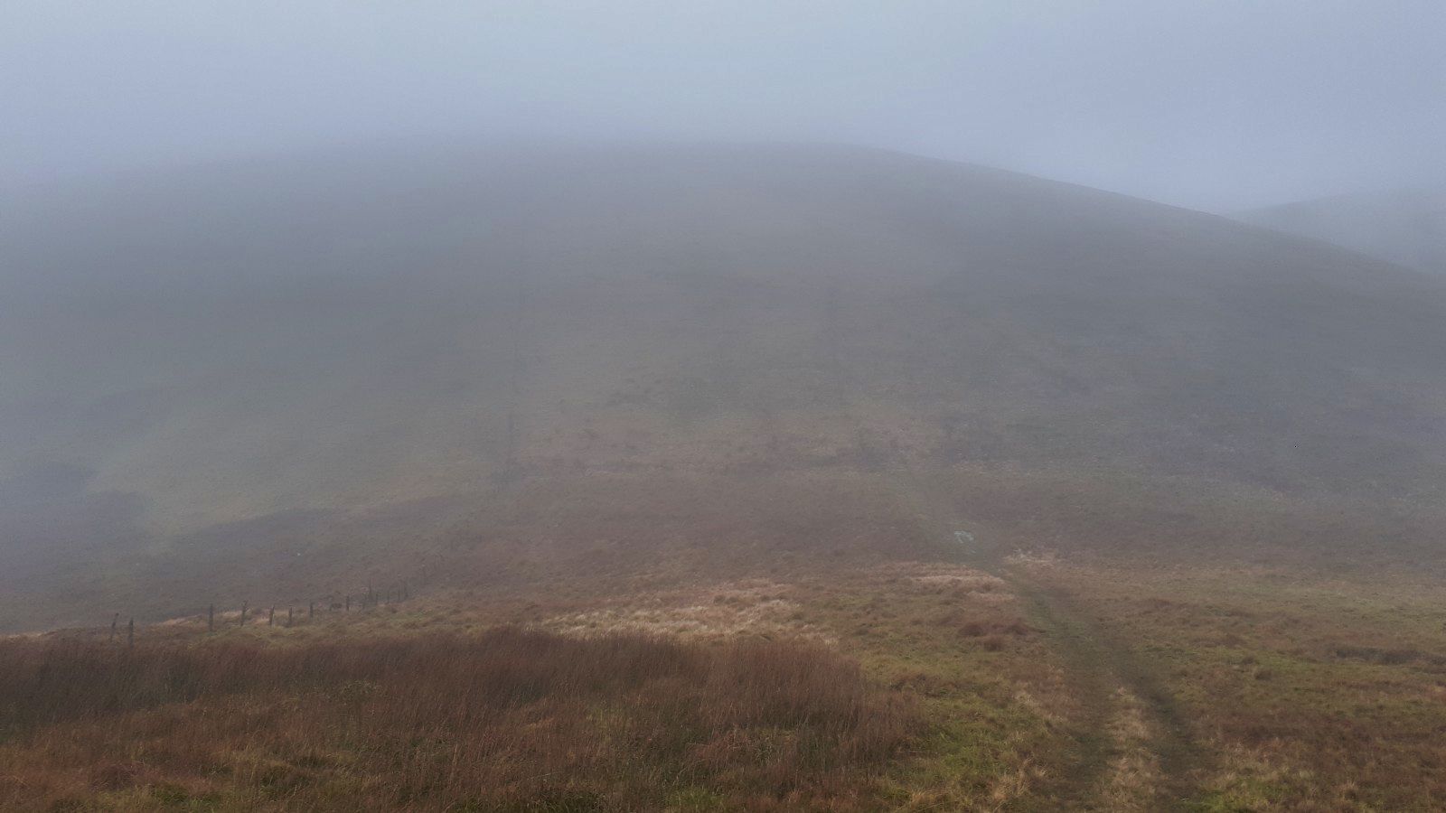
Evident track lower down
About 50m up the track it was still icy but we were utilising the soft snow at the verges. Noticeable that there had been a significant snow melt since midweek. Indeed the track up to the Wee Hill was at times more ice than snow. The descent could be interesting if we returned that way!

Craiglea
It really was a beautiful winters day and now getting views of Craiglee off to our left. It didn't take too long to get the cairn on Wee Hill and take in the superb views. The SMC guide says it is one of the finest viewpoints in Southern Scotland and I would not argue.

From the top we headed NE and I don't think anyone had tramped in my footsteps since midweek so it was an obvious choice to follow them and save energy for the deeper stuff soon to be encountered. 

Deep snow to break a track
The snow levels up here were still the same, no real thaw at this height, some deep stuff to wade through and break a trail but it felt good to be out on a snowy hill on a day like this. Perfect silence which you don't experience too often. Plus feeling fine fitness wise, I reckon I had something just not right over the last month that had me breathing harder on my walks.

As we climbed we ploughed through the drifts. There were quite a few hare tracks but none spotted.

Trig in sight someone's descent track
When we crested the top the trig was in sight but this also brought about a significant temperature change. We clearly had been on the leeward on the ascent. Hat and gloves back on. Still time taken to enjoy the magnificent views. Seen it all before and it never disappoints but on a winters day like this it is extra special.

Winter wonderland
We headed back off the top to find some shelter for lunch and enjoy the vista in comfort.

Loch Doon
A surprisingly swift snowy descent only one really deep snow mishap where we went deep. From here I didn't fancy my original route contouring the hill so chose to go back up the Wee Hill. No hardship as it is a short walk and good to get more effort in the bank.

Looking back to Carsphairn
From the top we took a leisurely descent enjoying the views of the big southern hills. Great care was taken and surprisingly the spikes were not required. We only met one other couple on the hill but the carpark was rammed full, I thought Ayr OIR had changed there day, where were all these people?

A stunning short day out particularly as I love these winter snow conditions. The views were magnificent, fitness was good, bring the rest on.

Ascent: 457m

Distance: 5.7k

Time: 3.44

Wildlife: Red Grouse; Robin; Rook; Wren; Hare & deer tracks.

Saturday, 2 January 2021

New Year Ramble Irvine bay & Shewalton Woods

It was once again a cracking morning. After yesterday's grey dreich gloomy day optimism once more as blue skies dominate bringing a welcome brightness. 

Just beautiful

The local view across to the snow capped hills of Arran, quite magnificent. So disappointed that I cannot get across to walk them but hopefully sooner rather than later.

Frozen course

A local walk today, completed many times but still enjoyable. I took a circular route walking over Western Gailes golf course before joining the coastal path route behind the dunes. The course was frozen and not unsurprisingly no golfers around, maybe later in the day.

Definitely don't hit your ball in there, that's a gonner

Too many tourist walkers on the beach itself so happy to ramble along behind the scenes. A short hike up to the dragon then over to Irvine Harbour.

Irvine harbour and the Big Idea building in front of Arran

There is still talk of regeneration and reopening the bridge to the Big Idea building. Been a lot of talk over the years but little action, time will tell.

MV Garnock

It is difficult to conceive that on days way back this was the 3rd most important harbour in Scotland. The harbour tug MV Garnock has still not been moved out of the water. I believe there is a funding drive to get the cash to repair it.

Do you know what they all mean?

Into Irvine itself, always stop and smile at the Scots patter under the railway bridge. Surprised to find M&S was open, so bought some fruit to keep me going on my walk as well as my dinner tonight, no slaving over a hot stove.

Finally over the bypass to circle Shewalton pit before walking through Shewalton woods and home.

Iced Shewalton pit

The pit was iced over for about 2/3rds of its area. There was a single swan which looked stuck but probably wasn't. There was another pair trying to break the ice to get to the individual. It was bloody hard work. They could only break about a metre or so each time before resting. A long day(s) ahead!

One of the Shires

My route took me past the Shire horses and I was glad to see they were back to three. One had been ill earlier in the year and not been around so glad to see it has recovered.

Not quite the line to nowhere but it is a dead end

The local woodyard operations were shut down today so no trains on the track.

A fine walk in no hurry with plenty to admire.

Bigger stuff tomorrow.

Distance: 15.4km

Time: 3.45

Wildlife: Wren; Robin; Blackbird; Carrion Crow; Flock thrush; Jackdaw; Mute Swan; Eider; Goldeneye; most gulls. 

Thursday, 31 December 2020

Roll of Honour 2020

That was the year that was. Sadly we all know what that was about. Still I set out with the vision to ascend 100 new hills this year and sitting in the garden during the first lockdown I could not have dreamed of getting so many completed, not 100 but a good shot. Highlight has to be the single file deer herd climbing their way up the flanks opposite that I spotted when descending Mount Keen. A real case of right place right time probably never to be repeated. Plenty of wildlife and stunning new views but the pine martin still eludes. Maybe 2021 and maybe 100 new hills. Donald completion first priority.


Completed new Hills 2020

  1. Hods Hill…. Sub2k…..Lanarkshire

  2. Fell of Fleet…..Sub2k…..D&G

  3. Normans Law…..Sub2k…..Fife

  4. Cairnie Hill…..Sub2k…..Fife

  5. Mount Hill…..Sub2k…..Fife

  6. Badandun Hill…..Graham…..Angus

  7. Beinn an-t Sidhein…..Sub2k…..Loch Lomond

  8. Ben Venue (Ledard Farm)…..Graham…..Loch Lomond

  9. Cat Law…..Graham…..Angus

  10. Craiglee (Glentrool)…..Sub2k…..D&G

  11. Craignell…..Sub2k…..D&G

  12. Cruich Tairbert…..Sub2k…..Loch Lomond

  13. Hare Cairn…..Sub2k…..Angus

  14. Innerdouny Hill…..Sub2k…..Fife & Stirling

  15. Lendrick Hill…..Sub2k…..Fife & Stirling

  16. Mayer…..MUNRO…..Angus

  17. Dreish…..MUNRO…..Angus

  18. Meall Mor…..Sub2k…..Angus

  19. Mile Hill…..Sub2k…..Angus

  20. Mount Keen…..MUNRO…..Angus

  21. Steele’s Knowe…..Sub2k….Fife & Stirling

  22. Torlum…..Sub2k…..Perthshire

  23. Turin Hill…..Sub2k…..Angus

  24. Pykestone Hill…..Donald…..Borders

  25. Drumelzier Hill…..Donald…..Borders

  26. Middle Hill…..Donald…..Borders

  27. Fell Hill…..Sub2k…..D&G

  28. Bogrie Hill…..Sub2k…..D&G

  29. Mochrum Fell…..Sub2k…..D&G

  30. Beinn an Lochain…..Corbett…..Loch Lomond

  31. Hudderstone…..Donald…..Borders

  32. Hillshaw Head…..Donald…..Borders

  33. Chapelgill Hill…..Donald…..Borders

  34. Culter Fell (new route)…..Graham…..Borders

  35. Beinn Luibhean…..Corbett…..Loch Lomond

  36. Earls Seat…..Sub2k…..Loch Lomond

  37. Bennan…..Sub2k…..D&G

  38. Mealna Letter…..Graham…..Angus

  39. Carn Liath…..Munro…..Perthshire

  40. Braigh Coire Chruinn-bhalgain…..Munro…..Perthshire

  41. Carn nan Ghobhar…..Munro…..Perthshire

  42. A’ Bhuidheanach Bheag..Munro…..Cairngorms

  43. Carn na Caim…..Munro…..Cairngorms

  44. Ben Challum…..Munro…..Crianlarich

  45. Meall Chuaidh…..Munro…..Cairngorms

  46. Cul Mor…..Corbett…..Assynt

  47. An Coileachan…..Munro…..Ullapool

  48. Meall Gorm…..Munro…..Ullapool

  49. Sgurr Mor…..Munro…..Ullapool

  50. Beinn Liath Mhor Fannaich…..Munro…..Ullapool

  51. Broad Law…..Corbett…..Borders

  52. Cramalt Craig…..Donald…..Borders

  53. Talla Cleugh Law…..Donald…..Borders

  54. Beinn a’Chrulaiste…..Corbett…..Glencoe

  55. Sgurr Dhearg…..Munro…..Glencoe

  56. Sgurr Dhonuill…..Munro…..Glencoe

  57. Meall an Fhedain….Sub2k…..Assynt

  58. Cul Beag…..Corbett…..Assynt

  59. Canisp…..Corbett…..Assynt

  60. Bidein Clann Raonaild…..Sub2k…..Torridon

  61. Fiarach…..Graham…..Argyll

  62. Meall Garbh….Munro…..Perthshire

  63. Meall Greigh…..Munro…..Perthshire

  64. Benvane…..Corbett…..Loch Lomond

  65. Erie Hill…..Donald…..Borders

  66. Garelet Dod…..Donald…..Borders

  67. Cape Law…..Donald…..D&Gs

  68. Culardoch…..Corbett…..Cairngorms

  69. Creag an Dail Bheag…..Corbett…..Cairngorms

  70. Mona Gowan…..Graham…..Cairngorms

  71. Ben Gulabin…..Corbett…..Cairngorms

  72. Geallaig…..Graham…..Cairngorms

  73. Morvern…..Corbett…..Deeside

  74. Mona menach…..Corbett…..Angus

  75. Tolmount…..Munro…..Cairngorm

  76. Tom Buidhe…..Munro…..Cairngorm

  77. Dollar Law…..Donald…..Borders

  78. Greenside Law…..Donald…..Borders

  79. Goseland Hill…..Sub2k…..Borders

  80. Dungavel Hill…..Sub2k…..Glasgow

  81. Craigmasheenie…..Dodd…..Carrick


Walks and long Distance Trails new sections completed

  • Clyde Walkway….Crossford – New Lanark (Completion)

  • The Old Man of Stoer (Assynt)


Repeated Walks

  1. Coran of Portmark/Bow/Meaul

  2. Ullapool Hill

  3. Meall Greigh

  4. Chapelgill Hill

  5. Culter Fell

  6. Shalloch on Minnoch

  7. Wee Hill of Craigmulloch

  8.  Isle of Cumbrae circuit

A short ramble in a winter wonderland.....Wee Hill of Craigmulloch

Hill: Wee Hill of Craigmulloch, Loch Doon

Type: Tump:

Height: 427m

My original plan was to visit this hill on my way to Craiglee but more of that later. 

An interesting and careful drive alongside icy Loch Doon brought me to the ruins of the castle carpark. One other car already there, a person could be seen exploring the ruins so not a walker. Surprised at how many campervans were parked up along the road, some with tents. My car showed -4 temperature, rather them than me.

New site of ruined castle it used to be in the loch
It was a stunning blue sky snow covered hills morning.

However, as I was getting geared up I decided the air temperature was warm enough to get rid of my mid layer before starting. I prefer starting cooler and adding layers if required rather than taking off a damp sweaty layer on the ascent.

Followed the track up the side of the castle. Some icy patches but I was not putting on spikes just yet. A short steep start and I was breathing a bit harder. The plumes of steam coming out of my mouth as though I had a cigar on the go.

Too cold for a seat track just beyond
I crossed a main track to the less obvious minor track on the other side. This took me to some benches and behind them another less obvious route but I knew I was on the correct section albeit the snow does a good job in disguising that a small track was there.

The great thing about snow is the wildlife tracks. On the ascent I never spotted any in the flesh but saw tracks of hare, deer and something small with sharp talons, stoat or weasel?

A fairly straightforward ascent albeit some surprisingly deep pockets of snow going right in to the knee. 

Craiglee ahead and Wee Hill cairn just in view on the mid-right
Got to the lower top and wandered over to the loch side to get some excellent views. 

Back over to the real top and its small cairn, through more deep snow. From here Craiglee looked magnificent. In fact the views all round were particularly pleasing. The snow giving excellent profiles to the hills, everything stood out.

Craiglee looks like a track in the middle but when I got closer it is a burn
From my planning I knew I was ascending the right flank of Craiglee as I stood but my proposed descent route was more central and looked like deep snow fields. I did not really want to come back over Craigmulloch but it remained an option.

I headed down the short descent slopes of Craigmulloch and as expected there were deep pockets of snow but nothing too difficult although plenty of care taken as who knows where the hidden holes/burns were. 

Then everything was taken out of my hands. About a third of the way up Craiglee my wrist watch vibrated, a notification that a text had been received. No phone signal but the text had got through. A family issue that I needed to be involved in asap. 

Retrace my steps back up Wee Hill
I was close to the top but would not have enjoyed the rest of the ascent so now simply a case of following my tracks back up and over Craigmulloch and then back down to the car. 

On descent car down at loch and Mullwharcher range in middle
Although there was a low sun the descent was enjoyable as the views of the high southern Galloway ridges were superb. And I had remembered my sunglasses!! Two pairs came up the hill and stopped for a chat with two locals from Dalmellington who pointed out a few routes to consider for summer walks.

Further west Shalloch on Minnoch
So, not the walk intended but a stunner none the less. What conditions, they were simply beautiful. The forecast looks good for the next few days so I will be back to finish what I started. Either way Craiglee will be the last of this year or the first of 2021.

Back at the car chatted to the park ranger who confirmed the quad bike cops I saw a few weeks ago were the real deal.

Despite all the Covid crap it has still been a good walking year

Ascent: 294m

Distance: 3.9k

Time: 2.05

Wildlife: Wren; Blackbird; Crow


Saturday, 12 December 2020

A walk in the clouds.....Haggis Hill circuit

Hill: Haggis Hill (510m) circuit including Craigenreoch (565m)

Type: Haggis Hill Dodd & Craigenreoch Sub2k

Where to go my weekly walk? Dick had recently mentioned the Haggis Hill round and that seemed a good place to relive some memories. I had only completed the round once before and that was a grim day with poor visibility. I was told then that the views are good so decision made. Looking at the weather forecast the brightest was Wednesday morning becoming cloudy later.

Unfortunately my trusty Harvey's map of the Galloway Forest did not include these hills. So, once again, I put together a straight line between hills rough route on OS maps. The only issue was I could not remember exactly where I started the last time. I remember a small parking area going up the hill road to Barr, named the Nick of the Balloch, time will tell.

A grey start to the walk
An early start and a bright red sky as I set off. By the time I approached Stincher the clouds were already down. I found what I thought was the parking spot in the gloom along with now a drizzle. Out of the car and I had to motivate myself as I could not really be bothered, going home and back to bed seemed a better option.

Always the fool, gear on and where to start going up this hill? I had thought there might be an obvious footpath through the wet grass from previous walkers but nope maybe this was the wrong starting place. Just head up desmondo.

Clouds lifting or falling?
My memory did recall a steep start but this seemed more brutal. There is no doubt that recently without much high walking, little cycling or gym my fitness has taken a decline. As I huffed and puffed with regular stops this slope confirmed that. 

For a brief moment a moorland view
I reached the top at Brandy Well after 170m of direct ascent where I had a view of the barren countryside ahead, relieved. That lasted about 5 minutes before the clouds descended not to lift again during the high level walk.

The ground was soaking wet and my right boot clearly has a leak somewhere as the front of my foot was already squelching, the joys.

At least a track to follow
Initially I was plodding across the heather until I found an ATV track just before Rowantree Hill. 

Craigenreoch the highest point
Ultimately I then just followed this in a clockwise direction over the named hills of Craigenreoch (the highest point); Polmaddie; Pinbreck and Changue hills. 

Gloom
The visibility remained at about 50 - 80 metres throughout so all I was looking at was the track, some fencing and the odd tree. Apart from a lone curlew  the only sounds were me splashing through the sodden terrain and my chuntering to myself, nobody to offend.

Haggis Hill
I had forgotten about the steep descent from Changue until out of the mist loomed the genuine haggis shaped mass of Haggis Hill. The cloud thinned enough to torture me with a view of the climb ahead before closing down again. I know it is not much of a climb but with my mindset today it felt much higher.

Marker stone on Haggis Hill
Not too breathless I reached the small standing stone at Haggis Hill and knew the worst walking was now ahead and I had two burns to cross!

Time to head down
I am not sure if I descended from a different spot than the previous round but this was in the very steep category and I don't quite remember it as bad as that. At least I was out of the cloud so had a good view way down. Care taken as any tumble could be a long roll down. Down below me was a large stone sheep pen, I don't remember that. Slowly I edged my way baby steps down to the burn. As I descended I did think that I get myself in some pickles when on my own.

Thankfully the burn wasn't running too fast but it was wide and on my side previous heavy flows had severely eroded the bank so no step downs. After a wander I found a tussock in the middle that I could step on and a straightforward leap to the other bank. 

Steep slopes
One thing I did remember was that this last section was the worst of the going, trackless rough ground and another burn to negotiate. Wonder why I remember that?

Decision time the car is beyond the V
After circling the mass of Glengap Hill I reached another sheep pen. Decision time as I could see the burn I had to follow heading up the hillside. Two decisions were the rough/stony terrain and then crossing the burn higher up where it was much steeper and from here I could see a number of waterfalls. Or cross the burn here and head up to the road.

I was not in the mood for the gamble so forded the burn and headed up to the road close to the Witches bridge. Relief at walking on the road, don't say that too often. As I walked I could see below that there was an old ATV track that could have been followed so maybe for the next time.

The cloud was back down it was cold, windy and damp so I was well pleased to reach the car.

Well how to sum up? It was needed exercise so a tick for that. Fair to say not the best walk that I have had. And I do need to come back as I have still not seen those views!

Ascent: 513m

Distance: 10k

Time: 3.08

Wildlife: Curlew; Raven; Red Grouse; Grey Heron; Buzzard: Kestrel


Tuesday, 8 December 2020

Wee in stature but Galloway tussocks win out again my legs are gubbed....Craigmasheenie

Hill: Craigmasheenie (539m) via Sheil Hill (508m)

Type: Dodd

I had this pair on my list for this week and coincidently noticed that the OIR were doing them earlier in the week along with Shalloch on Minnoch, a big round.

I could only find minimal route descriptions, not surprised, so it was a case of plotting my own rough route beginning from the Stinchar car park. My only uncertainty was whether to return by the outward journey or head across to Cornish Loch and pick up the circular trail. Final decision would be made after Craigmasheenie.

With the relative lack of walkers there would be no obvious paths but I had expected to pick up more animal paths than I did. The going was typical Galloway tussocks, rough, rough, rough.

Found the track
From the Stinchar parking I headed down the road towards Loch Bradan. Plenty of deforestation so I hoped my initial plotted track still existed. After I crossed the burn there it was, unmarked but still there.

Loch Bradan blue water but snow cloud approaching
I followed it up to what I thought was the high point then simply picked a point and headed into the undergrowth. That was the start of the rough going and it never ended. The climb to Sheil Hill was full of false promise. With the angle of ascent you always just had a short point of focus ahead. There were many descents then re-ascents, not overly long but a bit of a roller-coaster walk. The terrain was already requiring full concentration, plenty of tussocks, plenty of water and plenty of holes to catch you out. It didn't help that the low sun was right in my forward vision and guess what numptie had not brought sunglasses or goggles!

Sheil Hill, the pointed bit
Finally I reached a flattish area and I could see the trig on Sheil Hill. No problem I thought but it seemed to take an age getting to it with detours round pools of water. I found a reasonable track which started to go round the contour of the hill but was descending so more navigation, more ascent and finally I reached the trig. 

View east from trig
Great views looking over Loch Bradan and Craiglea, rust red in the winter sun but snow clouds were belting past as well just my luck to catch one.

Craigmasheenie ahead point on right the highest point wedge gully clear
Craigmasheenie was disappearing in and out of cloud and Shalloch behind never emerged from it. I was in two minds but a look on the map, one and a half squares so just over a mile. However, a mile is a long one in this landscape.

Rough terrain the deer have scarpered
I opted to stay as high as I could as I did not fancy descending all the way down to the marshy moor to climb again. This took me over the Nick of the Strand

As I wandered, every step a challenge, a small herd of red deer hinds ran in front of me. I counted eight but suspected more. It has been a long time since I saw red deer in these hills so glad I went on.

Further along I almost stepped on this frog, was it sunning itself, I don't know but even when I stooped close for a snap it didn't move nor did it budge when I stepped over it.  

I was keeping high to the east but I knew there was a big gulley between Craigmasheennie's two ridges. If I had mapped it right I should not have to descend too far but doubts were creeping in as I ascended the eastern side, the western side the high point, 'trust the map Des'. 

Frozen lochan looking over the crags
When I reached the small lochan I knew I was on track but that final climb to the top of Craigmasheenie was stiffer than expected. Good views from the top which is classed as a Dodd, not a category I am familiar with. Its parent Hill, Shalloch still covered in cloud.

View from top back to frozen lochan and Craiglea
Decision time, I could see Cornish Loch and the map suggested just over a kilometre. I knew the going would be rough but I underestimated just how rough going it would be. It is often said that the hardest bit is the last section and this was right in that category.

Down the gully Cornish loch on left
Initially all was good as I headed down the gulley with occasional deer paths to follow. A red grouse burst out of the heather. Then it all got really tough. Every step was taken at tortoise pace and despite this I was going knee deep and more into hidden holes. Full on concentration over the tussocks and the many hidden water hazards.

I could see the odd walker coming down the Cornish hill path and the closest point was my objective. Then the burn not hidden bringing the snow melt down from Shalloch into Cornish loch! This was too wide to jump and very deep, my pole went full in. Wandered up and down and found two solid tussocks to stand on going about a third of the way across the burn. No other option. I stood balanced one foot on each one, with both poles jammed into the other bank my angle not the cleverest. The opposite bank was steep, just dropped into the water, i had to land on the bank. So it was a huge push and jump and got one knee into a tussock and with the poles heaved myself up. Wow that was close to a proper soaking.

From safety looking back to Craigmasheenie I came right of loch as per snap
Eventually on to the path, it was a short descent but felt a lot longer. Time to have an apple and look at the ground I had just crossed happy in the knowledge I will never be doing it again.

The outflow from Cornish loch running fast
To finish I followed the track back to the parking. Interestingly two police on quad bikes were talking to car owners, wee nippys Covid tier investigators? if you had said a year ago that police were checking on walkers car parks you would have been laughed at, now for real, unbelievable. As I changed at my car one was on the radio saying they were coming back for their lunch break so presumably others in the park as well. Then they shot past. Honest guv I am here legally. in that short time four cars came into the parking, saw the police, 3 point turns and scarpered, outsiders, I did laugh.

A good leg stretcher for sure, my legs and buttocks are feeling it right now, will be stiff tomorrow. Galloway terrain wins again.

Ascent: 571m

Distance: 10.2km

Time: 3.31

Wildlife: Long tailed tit; Blue tit; Coal Tit; Red Grouse; Red Deer; Frog

Wednesday, 2 December 2020

Must be in the top 10 list of the wettest Corbetts.....Shalloch on Minnoch

Hill: Shalloch on Minnoch (Middle Heel)

Type: Corbett

Height: 775m

This was meant to be the best hillwalking day of the week, clear blue skies and the crispness of an early winters day. It certainly was cold during the night and the car needed defrosting time.  Soon after leaving the house I could see I could see the ridge in the distance and the summits were cloud free, yipee.

For once a short drive but even in that time the clouds had descended so what would I get at the top?

According to the SMC book, Shalloch is 'middle heel'. Not sure what this refers to, I get the heel bit as it is at the end of the ridge but middle? However this is a great but gentle hill set in the barren landscape that you either love or hate, the former for me. It would be a short walk so I extended it by parking at the Stinchar are, no other cars! The downside is that the extra walk is on tarmac to get to the normal starting place but no hardship.

The falls are a favourite spot to start a walk
Once off the tarmac I entered a wet, wet world. The weather has been extremely damp to put it mildly. Even so the normally damp and boggy sections had transformed itself into one deep footstep into mud, bog and the deep water holding sphagnum bog patches. Wow what a start and whats the chances of dry feet today.

Shalloch is a teasing hill. You cannot see the summit top from the start but the hill is a series of gentle ascents, each one kidding you on that you are are near the top. Well today you could not see any top in the clouds so no teasing just a gentle walk. Well not so gentle. Not hard on the feet but sinking in every step was good training for the soon to be snow walking, not so heavy breathing time pleased with that.

Off the tarmac and the boggy walk into the clouds
I was reflecting previous visits and particularly the last time I was here which was probably just before wee nippy locked us up for the first time. There has always been a path of sorts but it was now a wide 4 or five abreast. Clearly a lot of folk have been up here this year.

Cloudy ahead but excellent view looking east
The wet section lasts for almost half the ascent before with relief more normal walking terrain. I wish i could say the same for the weather but although not a pea souper the clouds were hanging about so forward distance was minimal. However looking left there was the odd glimpse of the world I wanted to see.

Something suddenly appeared sparkling in the distance, it was a brief glimpse of the sun breaking through the clouds and shining down on the wee lochan. Not far to go now but I could still only see about half way up the final ascent.

Knockdolian peaking up
This is normally straight up through the stones but they were very slippery so I followed the grassy flanks SW to creep round to the hill. Wow, finally the cloud lifted and I got atmospheric views over to Knockdolian and its twin volcanic plug of Ailsa Craig.

As I summit clouds still holding along 'the hand'.
Final section and the clouds are still hanging about the tops to the south. Finally I stumble across the trig. Looking north and west the views are great including Ailsa.

Trig with marker cairn in the distance
To the south I could see across the flat walk to where the crags are, this was to be my lunch spot so over I went. Glad I did as the views were excellent. 

By the time I got there cloud almost gone the Awful hand shows itself

The ridge was still holding fragments of cloud. You can opt for a long but good ridge walk over Tarfessock, Kirrereoch and even the Merrick but certainly not for me today. Brilliantly named as the Range of the Awful Hand.

Lochs Riecawr & Macaterick. Bothy (white) just at edge of trees on the right 
I was more than content stuffing my face and looking down over the rugged terrain including Loch Macaterick and another winter target Mulwharcher. 

Hoodens Hill and Mulwharchar
The white painted Tunskeen bothy stands out isolated in this shades of brown landscape. Sad but true story. Last year walkers were refused entry to the bothy by a group of 'revellars'. They were forced to continue their journey but the weather conditions were so bad they ended up having to be rescued by the emergency services. The scum inside the bothy were sadly never charged.  

Re the scenery as said earlier, your choice, but it is rugged beauty and a fantastic landscape and what a spot for lunch.

On descent clouds coming and going
Time to head back and as I left the top the clouds were moving in from the west once more. Both plugs had disappeared already. I had a possible option in my mind to descend via Cornish Hill but from previous experience I know it can be brutal terrain so left for another day.

When I reached the wet underfoot (halfway down) a drizzle came on, nothing heavy but just to let me know the weather does its own thing around here not the weather forecasts computer modelling.

Still back at the car I was in good spirits. Damp in one foot and damp in outer clothing but far better than a day spent indoors and a day closer to ending this Covid madness. A good walk not spoilt.

Wildlife: Buzzard; Curlew 12+; Red Grouse

Ascent: 555m

Distance: 12.5km

Time: 3.37