Showing posts with label Crianlarich;. Show all posts

Thursday, 10 November 2022

WHW.....Crianlarich - Tyndrum

Walk: West Highland Way

Section: Crianlarich - Tyndrum


Woke up to the sound of rain battering the window, not exactly what I wanted to hear. The forecast was to be grim all morning, high winds all day so no high tops today.

As the afternoon was for showers, I decided to get the train to Crianlarich and walk back to Tyndrum via the West Highland Way. Short train journey, but it was packed and humid, the chances of Covid?

As always, the hard bit is finding the start. Crianlarich is a fair bit off the official WHW according to my map. I headed down to the Post Office where I found a tourist map/board. Back up to the station and follow the Drovers Loop which should connect to the WHW. Good but where is this trail at the station. Turns out you go through a tunnel, head up a flight of steps and there is a marker. 

I did not have a map and had not looked at the route beforehand, so I was surprised at how much elevation is gained so quickly and how high above the road the track goes. Still plenty of peace and quiet, only bumped into two people until Dalrigh area.

After a lung bursting ascent from Crianlarich this is what greets you
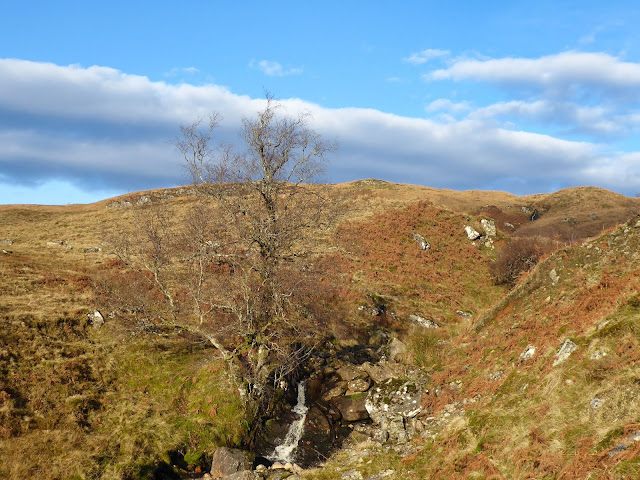
Typical scenery

I love the moss on top of the rock, a small croft!!

Spotted this unusual plant, Heath Speedwell my app says


Hill middle right one of the Corbetts that was Plan A
There has been much deforestation, but I suppose it does open up the views. Up and down the track goes. I spotted movement on a tree branch, quickly disappearing. I was certain it was not a squirrel which only left a Pine Martin, if so, that would have been my first ever sighting but not conclusive enough.


River in full flow

Just one reason for this being an amazing country
Out of the woods and across the road to the ancient historical ruins at the Fillan's priory and graveyard. As I was looking about the farmer drove into his yard with a trailer. All hell let loose. I assume it was a bull and the noise it was making it was far from happy. I made a quick movement to get through the farmyard gate.

A pleasant stroll then back across the road again for the the final few miles to Tyndrum. I spoke to a Swedish woman with her three daughters. The youngest one looked at her mother and said, 'this is so beautiful'. Despite the poor weather it was a reminder to remember what we have in Scotland.

So, an afternoon of showers and very high wind gusts. When I reached Tyndrum it was just too cold in that wind. But remember the wee girl, no complaining. On a cold day the reward had to be a fish supper at the Real Food Cafe. A good ramble.

Ascent: 391m

Distance: 12.2km

Time: 2.52

Wildlife: Coal Tit; Chaffinch; Blackbird; Swallow; Sand Martin;


Thursday, 30 December 2021

It lived up to its reputation.....Beinn nan Imirean

Hill: Beinn nan Imirean (the ridged mountain)

Type: Corbett

Height: 849m

Full moon against a clue sky, a cracking start
The coldest morning of the year with the car needing a long defrost. Cold yes, but it was not a day to miss out on the great outdoors. The sun was already turning the nearby hillside a stunning burnt orange. Desperate to get going. A car pulled up beside me as I put my boots on. A voice said 'honestly not stalking you'. Turned out he parked beside me yesterday at the start of that walk, some distance from here. There are a lot of hills around here so it can be a small world. As per yesterday same carpark but again we were doing different hills so a brief chat and on my way.

Beinn Imirean has a reputation, not a particularly good one it has to be said. I had put this ramble off a few times due to doubts over the terrain but the day had arrived to tackle it even if at the beginning my heart was not fully with this ramble. 


The route shares the ascent track for about half the walk with the Munro baggers heading to Meall Glas. There is an identifiable track for much of the way but underfoot it is a wet, boggy, gloopy mass for most of it. All part of its reputation being confirmed.


Now is the time for the open moor, a proper open moor, with its reputation to keep up it didn't disappoint. Any track you may now stumble across is almost certainly animal and not human and don't expect it to last for longer than about 10 paces. Proper peat hags, wet and soft from the recent rains, so expect black slimy stuff if you wander in. Of course your boots soon get clean as the ground is also saturated sphagnum moss and saturated it was, you can go deep here. There are many hidden streams. My right leg went into one hidden narrow slit, right up to my knee and only stopped by my poles anchoring the rest of me. With nobody else around not a place to have an accident.

Imirean finally comes into view
There is some higher ground around Meall Garbh which is marginally better. It was  with relief that the lower slopes of Imirean came into view. It is ridden with hags but you will find passage up the steep grassy slopes. Some  crags first, then a short walk to the true summit where a few boulders make up the cairn. Out of the wind it was glorious but in the wind it was a real cold blast.

Ben More panorama

Ben Challum
But here the reputation backfired as I was not expecting such stunning views. Probably the largest number of Munro & Corbett peaks that I have seen for ages, I even spotted the Lomond hills out east. As a nearly stand alone hill it has a magnificent vista of the Loch Lomond/Crianlarich hills with Ben More directly across. Many of the Tyndrum and Orchy hills even through to Cruachan. Then take in all the nearby ones and views down into Glen Dochart, well worth all that crap terrain. But if you are coming make it a good viewing day. To have done that on a grey day with no views, well the reputation would have been more than enhanced.

Starting descent as sun went behind Ben More dropped the temperature somewhat

The Munro Sgath Cuill's pointed tops

Here we go, a lot of rough terrain to descend
Back more or less the same way when I noticed a figure sitting on a rock having his sannie and enjoying the view. This was getting unreal as another coincidence I recognised that I had spoken to him on a hill two days ago, what are the chances of two brief encounters on one day with minimal number people around? 

Back on track
The path did not get any drier on the walk back, indeed more care was required to avoid damaging heel slides. I was glad to reach the car. 

Without a doubt the views made the ramble and the hills reputation stays intact. 

Ascent: 747m

Distance: 11.8km

Time: 4.09

Wildlife: Snow Bunting; Red Grouse; Robin; Chaffinch; Meadow Pipit

Tuesday, 28 July 2020

Boggy and breezy on Callums hill

Getting prepared as the rain hosed down so a good test for the new jacket. Not such good news for an ascent that already has a reputation for being boggy. 
Dreich beginning hill hidden in the clouds
However, the forecast was for it to dry up around noon but with strong 30mph winds, a narrow ridge, the joys.
We walked through the farm which surprisingly has two graveyards, one newish, well attended and attractive and the other very run down with some ancient headstones. Interesting tales in there no doubt. 
Religious site
There was a priory on the site and the map shows 'Priests Well' behind the farm so religious connotations.
We managed to negotiate the railway line and on reflection did not hear any trains during the walk. Still a sound idea to look and listen before crossing.
The good news was that the constant rain had eased considerably and the sky behind was brightening from the west.
Mud and the fence
The bad news was that it was really boggy in places, deep sucking black gloop, glad I had put on my gaiters.
This is a popular hill so navigation is not an issue during the main section for two reasons. Firstly there is a muddy track to follow and secondly the fence is a constant until almost the first summit.
First summit cloud clearing
There are two deer fences to negotiate. The first is a walk through but the second is a high stile, not the most robust construction.
Looking down the steeper section
It is a long trek albeit with a good easy going gradient before you reach the hardest section up to the first summit. The views as you rise are great particularly across to your right where from Ben More south the whole Munro collection standing out.
Crianlarich Munros
Whilst on the very steep pull the winds were at their fiercest making walking really difficult, glad I had brought my poles as the extra anchoring points were needed at times.
Now on the first top where navigation is required in poor weather as there is a narrow ridge to cross with a big drop off.
Today's concern was not a case of seeing where we were going but in these winds the issue was would we walk or crawl across?
Final climb
Thankfully we walked and did not get blown off. A short descent before the final pull up to the summit and its cairn. As you would expect the views are extensive. Nearby all the Tyndrum hills. 
The Ridge and ben More behind
Looking east and close by Glas Maol and partners. As mentioned earlier the full Crianlarich Munros and plenty more besides.
Heading back over the ridge
However, not a day for lingering as the wind is still blowing strongly so back over the ridge and sheltered for lunch.
It was simply a case of retracing our ascent route but greater care required as easy to slip and my tendon was now giving me some grief. 
Descent, Ben Lui and companions
Almost all the way down when my foot went into a hidden grassy hole and badly twisted the already sore tendon. Luckily the poles kept me from further damage but it was the last thing the ankle needed.
New graveyard on descent
Overall what was not a promising weather start became a very good walk with views to remember.
As we changed cars were constant heading south so no doubt a very slow drive around Loch Lomond lay ahead.

Walk: Ben Challum (note OS 1: 25000 has a slightly different spelling Challuim) (Callums Hill)
Category: Munro
Height: 1025m


Wildlife: Pied Wagtail; Meadow pipit.
Ascent: 947
Distance: 12.4km
Time: 5.32