Showing posts with label Kintail. Show all posts

Saturday, 8 August 2026

Watch out for the drop.....Carnan Cruithneachd

Hill: Carnan Cruithneachd (Hill of the Picts)

Type: Fiona

Height: 729m


The forecast indicated that today was to be the only fully dry day of our weeks break. So a pretty please to the good lady and I was given permission to ramble. So I headed for this nearby Fiona which I thought would be a quickie. An early start but as it turned out the ramble took an hour longer than I envisaged.

A beautiful morning when I parked up at the Mountain Rescue centre. That was an error as I could have gone a bit further and parked at the outdoor centre which would have saved me half an hour of road tramping.

An encouraging start when I heard the first of many cuckoos as I laced my boots, a smile brought to my face. I know some see them as parasites due to laying eggs in other birds nests but I find them remarkable and as said who doesn’t like the call of the male cuckoo. As an aside would you recognise the females call?

Before long I spotted the first of many small red deer herds on the flanks of the Corbett Sgurr an Airgid.


There were more people on the walk in than I expected. I knew of the 2 nearby Munros and the long distance route to Glen Affric. But what I didn't realise was that my walk in was also an option for Cape Wrath Way walkers. I spoke to a few of them en route, another reason for taking longer and surprisingly all bar one English guy were foreigners.


The initial stages had the bulky Munro of A’ Ghias-bheinn directly in my vision. At first I thought this was my target but soon realised my error and mine was still a long way away.

Target in the distance

The track split and I almost made the rookie error of not concentrating taking in the surroundings and following the people in front who were Munro baggers.


But I remembered I had to take the left fork which led to woods and across a well constructed bridge before hitting another tree plantation. A heavy shower ended the fully dry day prediction but thankfully it only lasted a few minutes. Although I did see many showers passing by on either side. When I returned the good lady commented that it must have been horrendous in that hail storm, another break as it did not hit me.

Another split in the trail but the left one was my possible descent route, at this stage I had not fully decided.

I went up to the side of the heather on the right

So up the right hand track until clear of the woods where a single narrow track steeply wound its way up onto the moor in short time. Heavy breathing time. I caught up with more walkers who were on yet another option, this is also the track to the Falls of Glomach.

The SMC book’s route was to follow this track to the high point. But this looked a long way away and I knew that the summit was almost a 90deg turn straight up.

Looked ok from here

So one of those last minute decisions was made and I went straight up. The initial slopes were steep but easy going on the good short grassy sections between the heather. But then the going got much tougher. 60deg slopes meant I was facing right into it and for about 30 metres I was on my knees at times, using the heather to hand pull me up.


Gradient eased and as I looked back down it was certainly steeper than it looked from below. Easier going but of course 3 false ridge tops before I got to my high point and had a view of the hill.

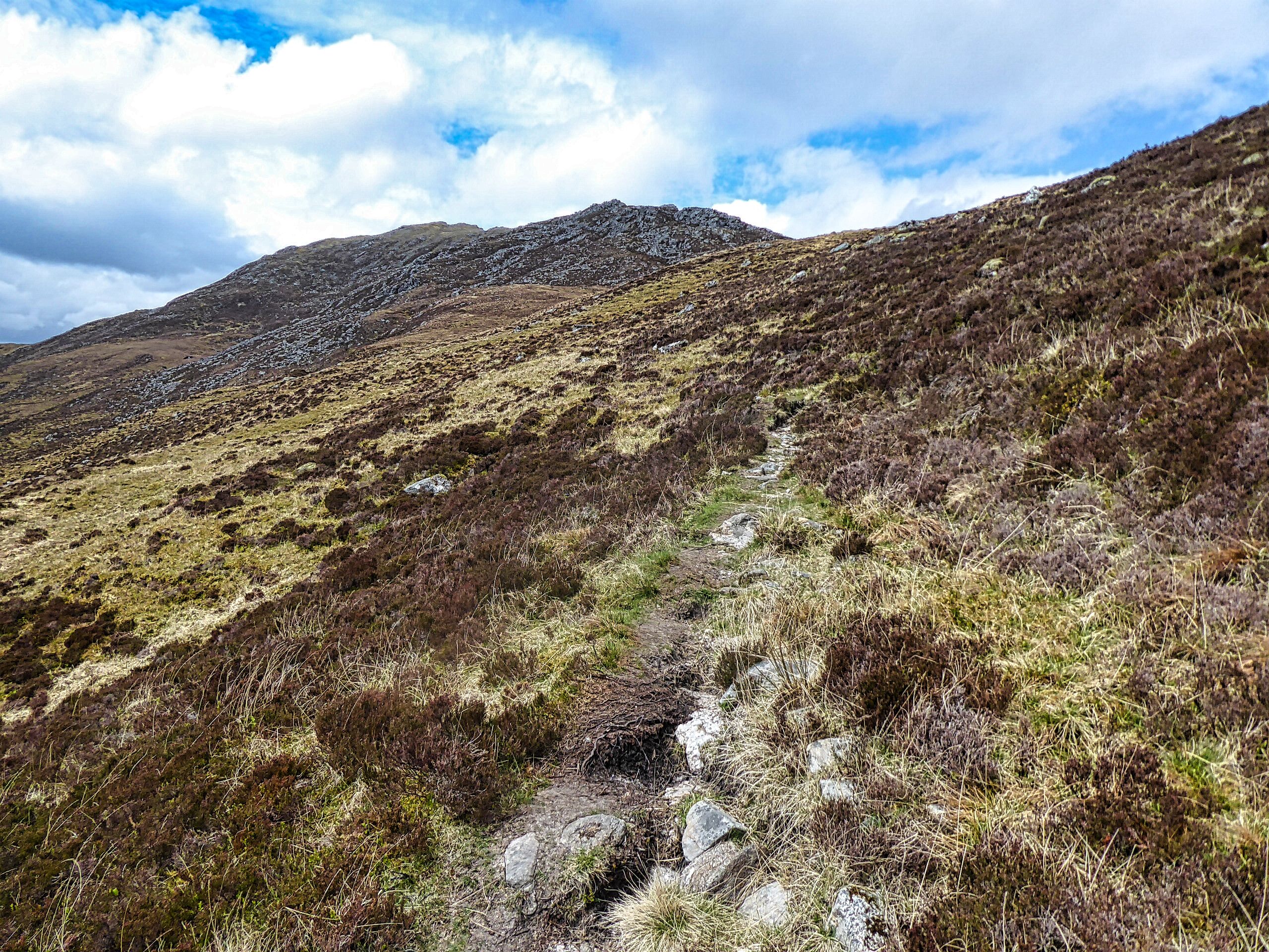
Thankfully I can see it

Still a lot of moor to cross to get there

It was probably about 2 kilometres away but it looked further across the undulating peat hagged moor. The going was fairly straightforward but it was very undulating, quite a few exhales as I crested one height to drop quite a bit before repeating a few times.


Got to the base and although it is craggy there were plenty of grassy rakes to evade them. As said plenty of red deer around and 3 let me get really close to them before moving off.

Summit in view

Puffing a bit I wound my way up to the high point. When I reached the top I got a fright as I glanced down to my left and realised it was a precipitous drop all the way all the way down to the River Elchaig. Wow a real vertigo moment, I had not expected that and glad I had arrived with full visibility and not in cloud, one step too far! Later I was speaking to an ex Mountain Rescue guy who said there had been fatalities from there.


The views were really superb in all directions so it was time for a seat and enjoy my mini pork pies and take it all in. These moments are what the slog is all about, well worth it.

Heading for the trees to the right

Finally time to descend and I opted for the circular descent as I could see the ATV track coming out of the woods. Tramped over the moorland to the track which was rough in places but better than the hags.

Relief no fence to climb

From the ascent I knew the plantation was enclosed by a deer fence so my only concern was if there was a locked gate but it was wide open. In the forest the track was extremely steep covered in stones and rocks so sliding as it was like walking on marbles so it was slow progress.

Finally back on the out route which somehow felt longer. Although I have heard quite a few Cuckoos this year I have not yet snapped one. At a clearing one was calling loudly. On the slopes there were only five small trees and patience paid off when I spotted it. Got my camera out and as I woke it up I heard a bleep, the battery had died.

So apart from the no cuckoo snap it was a good ramble. The gradients tested my fitness but I passed although I know it was at my pace, more comfortable with that now than trying to keep up with faster walkers, old age does not come without some drawbacks.

Back at the car more yacking with other walkers. I think chatting too often was my other half hour lost lol.

Ascent: 820m

Distance: 16.9km

Time: 5.23

Wildlife: Red Deer; Raven; Meadow Pipit; Cuckoo; Chaffinch; Coal Tit; Mistle Thrush; Wild Goats;

Friday, 27 June 2025

A superb Corbett/Munro ramble.....Am Bathach & Ciste Dubh

Hill: Am Bathach (The Byre) (798m) & Ciste Dubh (Black Chest) (979m)

Type: Corbett & Munro


Last year when we were staying at Cluanie Inn I watched a walker descend the ridge heading back from the Corbett of Am Bathach. I turned and said to the good lady that it looked spectacular and I was adding it to my To Do list.


Well today was the day for it and I was really looking forward to it. It stands out from the A87 as it is a narrow peak/pyramid like hill with steep slopes it looked interesting.

Time for a breather and a look back to the start and Loch Cluanie

I began from the plantation on the A87 and I knew that the initial series of ramps were just going to be a slow slog, head down, step by step just keep gaining height. There was a decent path to follow, pretty firm after this dry weather but sections showed where it can get very boggy under different conditions. By the time I climbed to the ridge proper I did have a bit of a sweat going, it was warm.

A proper undulating ridge

View down to the Cluanie Inn


From that high point the ridge undulates well aware of its narrowness and the steepness of its flanks, a long way down to either glen. Still no difficulty, just the wow factor of this superb hill surrounded by its bigger Munros but in no way is this hill walk inferior.

Am Bathach is the middle peak

Up top Aonach Meadhoin on left

Ciste Dubh ahead but a big descent first

Reached the summit. 1 hour 40m pleased with that. Time for some refreshments and enjoy the views.

This was the 1st of a double ascent today as I was also taking the Munro of Ciste Dubh which was directly ahead. I was aware that the SMC book says that it is not as near as you might think, ok.

Common frogs love bogs

I knew I had a long descent to the Bealach a’ Choinich but in fairness it gave me a good perspective of the route ahead. The bealach is a peat hag strewn area but was fairly dry, lots of deer prints in the mud but none spotted.

It looks benign but ahead is the worst section

An Cnapach peaks out

Starting to climb again with the track going to the right of the crags. This was the worst section, even in dry conditions it was a black gloopy quagmire, the very eroded track frequently lost and it was with great relief to get back on a decent path heading for the prominent peak of An Cnapach.

Contouring An Cnapach

The magnificent summit of Ciste Dubh, track can be seen on the left

The track continued to its left but there is a short drop before climbing the narrow exposed final section. It had been a beautiful day but as I reached the narrow section the winds got up and buffeted me all the way to the summit. Being very aware of those massive drops on my right at times it was a wow moment as the gusts tugged and pulled.

Summit view back to Am Bathach centre & An Cnapach right

Five Sisters peaks left Glen Affric on right

The Brothers centre & 5 Sisters on right

On descent An Cnapach's jaggy peak

It really is a top viewpoint, a stand alone hill but the many other Munros are not far away along with a great view through to Glen Affric.

On descent The Brothers ahead

Nice view of the descent side of Am Bathach

The wind gusts had ceased as I descended back to the bealach, thankfully the higher perspective allowed me to pick a better line through the gloop.

Higher view of the walk out on left side of the burn

View from the bealach

At the bealach I had a bit of phaffing around before finding the stalkers path that would lead me back to the car. It was a long walk through the glen and the heat had brought out the beasties so glad to get to the end of the track.

Without doubt my favourite ramble of the year so far.

Ascent: 1099m

Distance: 13.6km

Time: 5.41

Wildlife: Ringed Ouzel; Meadow Pipit; Cuckoo (heard); Common Frog; Raven;

Monday, 22 May 2023

All praise the stalkers path.....Sgor an Airgid

Hill: Sgurr an Airgid (Silver peak)

Type: Corbett

Height: 841m


A last minute change of plan which for once was a good idea. I had originally intended to do this tomorrow but the forecast for then was for rain and low cloud, nae views. Today was an unexpected bright day with the rain not due until later so change made.

As this Corbett rises from sea level it was going to be a full on walk.

You could go straight up from the start, if mad

Due to the change of hill, sorry forgot to say I was at 1st choice before changing my mind, the car park was almost full but I squeezed in.

Don't fall off the narrow track!

Initially nice green zig zag path

A positive about this ascent is that it uses a stalkers path for about 80% of its ascent. Whatever your views on deer culling I guarantee that you will use the track rather than go full frontal directly up the hill on rough ground.

Heading to the top of the gouge


Path got rougher

It is steep but has many zig zags so the ascent is done at a good gradient and a reasonable walking pace. Surprisingly I wasn't blowing too badly. The path is stony at times, definitely narrow in places but it feels right. The constant calling of Cuckoos and the views over the nearby Munros keep ones interest. I only had on a base layer but the heat was unfamiliar and I was sweating away.

The stalkers tracks only negative is that it mainly took me away from the summit leaving a longish walk once I reached the plateau. A huge gouge in the hill looked far away and is getting increasingly closer but thankfully that gorge does not have to be crossed.

The steep ascent is right of middle

A small cairn on the moor/plateau gives a good view of the final steep section. There appears to be a track going steeply up to the right, surely not, surely yes as I found out.

The wind was blowing strongly and pretty cold as I crossed the moor so jacket on. I was climbing the steep section when I noticed a figure coming down towards me. I had expected to see descenders sooner bearing in mind how full the car park was. Brief chat where he said there was only one other person behind him. The car park must be for Munro baggers as well.

The final climb was good to start with but my legs were beginning to run out of steam on the final third. A Ptarmigan called nearby but unless it moved there was no chance of spotting it. Its grey/white colour scheme was an immaculate match with the rocks.

Lots of rocky tops to explore, where is the summit?

Got to the top and had a look along the ridge. Yip quite a bit away were a few lumps but the furthest away, of course, looked like a sizable beehive cairn.

View to Skye

Torridon jagged hills

Kintail Munros

So on I plodded, descending and reascending via rocky, grassy ground until I reached it and yes that was it. Excellent views but the disappointment was that it was too far back to have a proper look down at Loch Duich below. How many tops can you see? Rather a lot actually. Loch Duich can be seen heading out to the Atlantic. Skye looks monochrome, rather like the forecast for the OIR groups few days on the Isle.

Closer to hand the eastern view much better. The Five Sisters so close. The Saddle and the Forcan ridge holding small amounts of snow. The Affric-Kintail trail heading up Glen Croe looks worth a visit. There was a huge black cloud heading in from the west which seemed to be pushing the strengthening cold wind so not exploring the other tops.

Heading to rocky high point to descend on the left

Descent line just above the crack

Back down the same way and although I have to descend more carefully than once did the views are terrific. It is only on the descent that I realised how much climbing there had been.

Sgurr a Choire Ghairb on right

Beautiful view to the start and Loch Duich

About half way down back into the heat and sweating again. Cuckoos are calling everywhere how many are there? Views are still spectacular.

At the end the short tree section is full of birdsong and butterflies, a lovely way to finish the ramble.

Ascent: 932m

Distance: 10.7km

Time: 4.02

Wildlife: Meadow Pipit; Tree Pipit; Lesser Redpoll (heard); Skylark; Wren; Blackbird; Robin; Long Tailed Tit (heard); Orange Tip (m); Speckled Wood; Ptarmign (heard); Cuckoo (heard)