Monday, 14 June 2021

Undistinguished hill but the name makes up for it.....Beinn Liath Mhor a'Ghiubhais Li

Hill: Beinn Liath Mhor a'Ghiubhais Li ( Big grey hill of the coloured pine)

Type: Corbett

Height: 766m

I had a rubbish sleep and awoke feeling washed out. Disappointed as I had a big circuit planned for today but did not feel up to it so plan B in force, a Corbett which is a Fannich outlier. A straightforward Corbett on my to do list and only a short drive away, that will do.

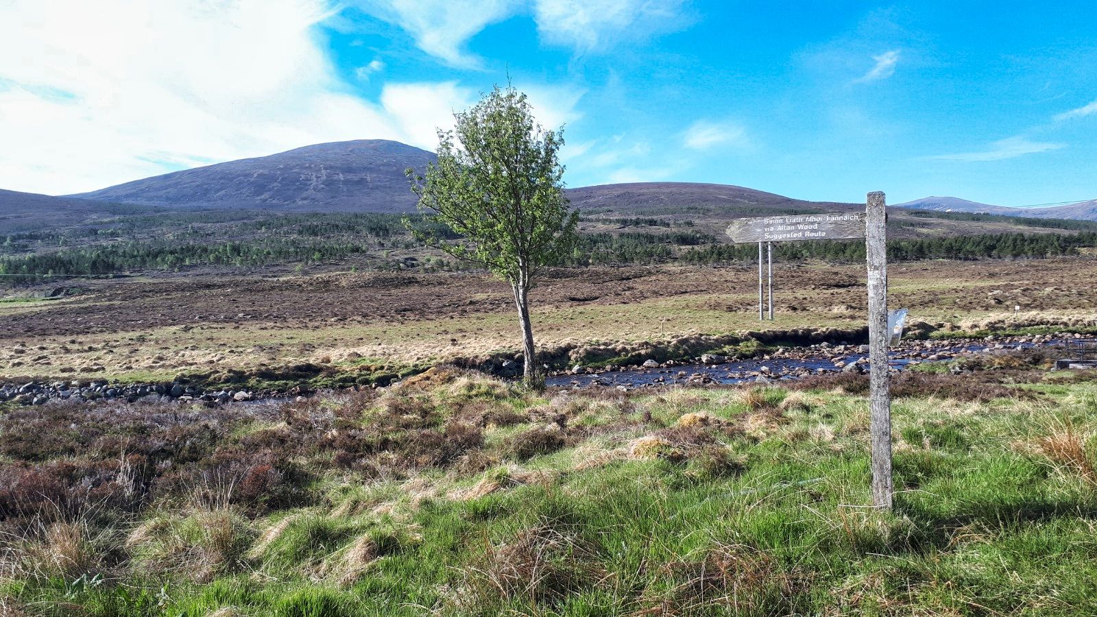
From parking the objective to left of tree
It was still an early start to the day but the eastern Fannichs car park at Loch Glascarnoch was already almost full. The target was in sight but still a good distance away. As I walked from the car I caught the whiff of decay and there in the ditch was a dead red deer, no doubt hit by a vehicle. I have seen quite a few roadside deer kill recently, very sad.

Deer fence into woods, Fannich Munros behind
Initially the track was through a deer fence, gate, then the beautiful old woodland bringing back memories of the Eastern Fannichs walk last year, same start and finish. The views of the Fannichs ahead looking good in the blue sky and snow patches.

Ignoring the Fannichs cut off I continued on the track to a break in the deer fence, saved me a climb but obviously the deer can get into the woods and do damage! The deer obviously do use this spot as well, churned up, muddy, boggy and some deep deer prints.

Used to this terrain just head up it
Pick a point and a take pathless ascent through the heather. Surprisingly very wet underfoot squelching noises with every foot step.

First view with the hags showing on the right
I crested the heather top now with a view of the hill and more disturbingly to find peat hags en route and big ones at that, revived recent bad memories.

Typical deep hags
At least it was straightforward to pick a route as I meandered through that lot to start the final ascent. 

The moor turns into wet short grass mixed with stone then it became mainly stone and boulders, more Fannichs bad memories. 

Boulder strewn plateau and cairn
Picking my way through the stone layers I neared the top plateau. Out of nowhere the wind appeared with serious buffeting and very cold. Wow, this was meant to be the warmest day.

Eastern Fannichs ridge, An Coileachan far left and pointed Sgurr Mor on right
A decent sized cairn provided some shelter to get a light jacket on which let me take in the views. Close up of the Eastern Fannichs, turn a bit An Teallach, turn a bit more and the Beinn Dearg range, not bad at all for a back up hill.

Hags traps visible from here. An Teallach far distance centre
Being wind battered was not fun so I headed back down taking in a good view of the descent, moor hags etc. 

The bad memory Fannich, Beinn-Liath Mhor Fannich straight ahead
At least from here I could pick a better route skirting the hags before contouring through the heather back to the deer fence. 

The car is at the Loch ahead
Great views to enjoy but still squelching away.

Beinn Dearg centre & Am Faochagach ridge on right
After that a case of following the estate track back to the car. I well remember at the end of the Fannichs how long it seemed to take to get back to the car and this was exactly the same. But great views of Dearg etc.

A short walk, another Corbett bagged, just what the doctor ordered.

Ascent: 556m

Distance: 9.9km

Time: 3.16

Wildlife: Hooded Crow; Skein geese; Meadow Pipit; Chaffinch

Thursday, 10 June 2021

A spectacular ridge walk to bring up the Graham 50.....Coigath ridge horseshoe

Hill: Ben Mor Coigach (743m) (Big mountain of Coigatch district) & Sgurr an Fhidhleir (705m) (Peak of the Fhidhleir)

Type: Graham x2

Leaving Ullapool Coigach ridge still almost an hours drive away
I set off early and arrived at the parking area at Culnacraig to find one remaining tight squeeze parking slot. Chattede to a couple in a camper who said most cars were here overnight their occupants backpacking somewhere in the area.

Beautiful morning at the start, looks steep
The hill looks ominously steep from here lol. I headed down the track, over the bridge and cut in to follow the track contouring the hill which headed for the ravine. I suspect I cut in too early but the faint on/off path through the heather and ferns could be followed. Although in a few weeks time the ferns and bracken will have grown hiding it.

I crossed the impressive ravine of the Allt nan Coisiche low down but it can be walked up its left side and crossed higher up. I climbed the light heather slopes on the right hand side before emerging at the moor. Might be early morning but I was perspiring. The moor was very dry today although reading previous reports it can be a bog at times.

From the moor heading to the far right
I headed to the right side of a landslip and then zig zagged up the rocky sandstone flanks. No proper path until I spot one higher up, almost at the ridge. God knows where it started or maybe it just started here. 

Track appeared for a while, ridge starts at the peak ahead
The ridge top still looks higher up than the picture suggests, a mild rocky scramble with the vertiginous drops now on the right. 

Arran ferry not heading for Arran but Ullapool
Below I could see the Arran ferry on its last Hebrides sailing, heading into Ullapool, the MV Seaforth apparently back in operation from tonight.

Loch Broom
Now on the top where the views are spectacular and the walking awkward. There is another on/off path slightly down to my left for those who do not like exposure. 

First sight of helicopter with An Teallach ridge behind
I could hear a helicopter which sounded very close, spotted it over Loch Broom, lost it and then it appeared behind me. It flew up for a look at me, I have never been so close to a flying helicopter, had I accidently set off my locator beacon. The crew had a look then flew over to the summit of Coigath where another sole walker was standing. The chopper flew a circle over his head, that looked dramatic before heading off deeper into Assynt and out of my sight.

V junction summit on left full ridge walk on right
Wow, back to the knife edged ridge. About half way along you come to a V junction to take the left fork to get to the highest point Ben More Coigach. 

View back from cairn to the ridge and the ascent across moor and down to the start
There is a solid cairn, ideal for shelter but not needed today. Absolutely stunning views all around.

Peak of Fhidhleir centre from Coigath
The second Graham is looking quite spectacular. It is a proper triangular peaked mountain with huge drops on two sides but from this side a relatively easy ascent.

Closer view showing the easy side
Before that you can drop of these flanks to the quarry but you are better of returning to the ridge and following it to its end to get the views in full.

Now descend with the steep slopes of Fhidhleir prominent. A short moorland trek but stunning Assynt views on your right make this slow going, take it all in.

Fhidhleir left, Stac Pollaidh centre, Sgorr Deas right


Golf bunkers and summit ahead
Again a sandy ascent, some of this could be golf bunkers, before reaching the exposed summit and if you do not like heights do not wander from the trig, it is scary.

Beinn an Eoin ridge to Sgorr Deas, Pollaidh left, Suilven middle, Cul Mor & Beag mid right
I spent some time chatting to the guy the chopper circled, an Aberdonian. As you do we ate, took in the views, talked about hills we had climbed and in the sunshine, fabulous. The views are probably another notch up.

Fhidhleir summit
Out to sea the Summer Isles and in the distant haze just spot the Hebrides. Closer the ridge of the 3rd Graham, Beinn an Eoin. 

Panorama
Then go for it, Cul Mor & Beag. Stac Pollaidh & Suilven and much much more. Assynt has been described as a lunar landscape, I wont disagree.

Descent centre but you could go via right ridge
You can complete the walk with another couple of uncategorised hills but I simply headed for the obvious track on the broad ridge and followed it back to the start. No rush, soaking in the views out o sea, the peninsula and far beyond, this is my country.

Finally back at the car very warm and sticky a shower will be welcome but what views, a magnificent day.

Ascent: 896m

Distance: 10.6km

Time: 5.18

Wildlife: Dottrell (1st of year I think); Raven; Wheatear; Hooded Crow; Meadow Pipit.

Short grassy and woodland trip.....Killyleoch Hill

Hill: Killyleoch Hill

Type: Sub2k

Height: 240m

I decided to pick off an easy hill so opted for the Sub2k of Killyleoch hill in Dumfries & Galloway. As usual the hardest part was finding the start but after a false start, studied the map, then I realised that I had to go through a working farm, the joys, angry dogs etc.

From the feeders around clearly shooting land, pheasants this time.


The start field number 1
My concern was the number of fields that I was going to cross and what sort of livestock would be in them. I could see that they were large fields with no hiding place!!
Field number 2

Now in open ground
As I headed through field 3 I was aiming for the tree edge in centre. No sign of beasties but there were fresh droppings so eyes constantly roaming I headed for the bit of scrub ahead which was beside a small stone dyke and a double barbed wire fence, more blood drawn. 
Over the barriers and I did spot beasties but they were all far away so good so far.
Then the rough stuff deforestation had made a real mess and destroyed any trails and the rain came on.
Found a way out of the trees to another stone dyke, through the gap and onto the open land with the summit somewhere up to my right.
And then the reward one of the smallest cairns around but to be fair not a bad wee view of Dumfries & Galloway and I could spot at least two sub2k tops previously conquered.
Open country but I am back into the trees.
Found a wall to follow for a while which led me to another field which was full of ponies but again a distance away.
NIce to see open woodland for a short spell.
The opposite view of field 3 and the barrier in the middle. I am heading for the gap in the trees but beasties still far away but they can run faster than me.
Buzzard

This buzzard was so big I thought it was a golden eagle at first.

A short but fun little countryside ramble with nice views but on another day those fields might be filled with killer coos!! 

Ascent: 252m

Distance: 4.4km

Time: 1.18

Wildlife: Buzzard; Pheasant: Carrion Crow; Blue Tit; Chaffinch,

Monday, 7 June 2021

A rolling hills circuit.....Wauk Hill

Hill: Wauk Hill (D&G)

Category: Sub2K

Height: 383m

My first visit to the Keir Hills, a range of small rolling hills in beautiful Dumfries & Galloway.

In the planning there appeared to be a ‘straightforward’ short up and down. I wasn't tagging on any other wee hills today so planned for the option of traversing the ridge to the mast on The Mull. Further options to return the same way or make it a circular via a longish road walk. Weather and terrain will decide.

Start to quarry

I found a parking spot beside an old quarry as I decided to follow a track on the map to a disused quarry higher up. The gate was half open so I parked in a small grassy area just in case traffic around.

I had plotted the longer route via Walkhighlands but for some reason it was not showing on the GPS. For back up I had downloaded the area from the OS maps on the phone. Opened the app to find it wanted my password. About two days ago I upped my security and changed about 20 passwords, this being one of them. Is my memory good enough to remember 20 passwords, nope, so app useless and phone back in pocket.

The coos are waiting
I was reasonably sure I was at the correct starting point so up the track I went. Turned a bend to find stacked logs so the track was operational. First decision time, a junction I am sure was not mapped. I followed the track into a wood, more logging, as I exited I could see the old quarry with a lot of black coos in it, all looking at me.

Boggy stuff off road

Up there somewhere 1st wall climb

I knew I was going uphill from the quarry so as a true coward I went up early. There was a wood ahead so climbed a gate into the other field. The 1st of many climbs today!!

I followed a well constructed still fully intact stone dyke but it was leading away from where I thought I wanted to go so dyke climbed back into trees. Before long I reached wall 2 and I could see where I was heading for. The direct route was passed a feeder where more coos where eying me up. They let them onto the fields early here.

So I headed diagonally across the field hoping not meet any more coos but what I did meet was a fence, a barbed wire one, which drew blood getting over. Who said this looked straightforward on the map?

Trig sighted another wall climb

Now proper wet moorland, good enough to just keep plodding in the direction I thought Wauk Hill was. I knew it had a trig but none of the visible tops had one, as always it must be over the back somewhere.

Wauk Hill trig
Then it was sighted but wall 3 had to be climbed. It was either higher or my leg had stopped stretching but this was an awkward traverse. A short heather crossing and trig reached.

Although it was a mixed day it was decidedly chilly up here. The views were good particularly over to the Lowthers and back to Carsphairn. The sun glare/haze shortened the other views but on a really good visibility day another good spot to linger.

View from Wauk Hill to mast
It was too soon to return the same way and the flat ridge along to the mast was visible. So back over the wall again, counting?

He was not for moving
The farmer had left an ATV track to follow which made for easier walking but in poor weather just follow the wall.

Preachers Stone?
About half way along the ridge at Breconside Hill I knew from the planning that there was a Preachers Stone. ‘On Breconside Hill, on the boundary between Glencairn and Keir parishes, is a large boulder known as the Preaching Stone. It is 1095 feet above sea level. Rev James Renwick preached here a number of times. His name is said to be inscribed on the stone’.

After climbing another dyke, this time with a back up of electric fence, thankfully not live. This was the only boulder I could find, possibly not it but it is nearby and it does make you think of Covenanter times, religious ceremonies held high up on moors and hidden places.
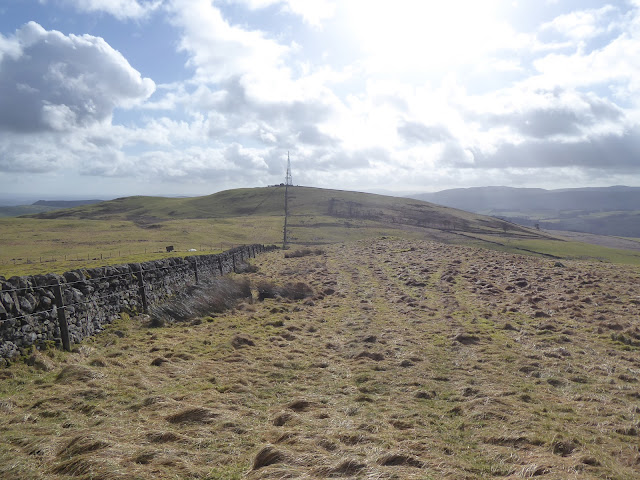
Mast not far now

Looking back to Wauk Hill

Now for the mast, more damp ground across Barjarg moor and also more coos. I had had enough of climbing dykes so through them I went. They just sat chewing the cud not bothered with me.

Rerached the mast on The Mull and yes another double dyke and wall, thankfully the last of the day.

There is a house down the mast track with a cracking summer house built right on the edge, what a view.

Red Kite

Horses track

View back to the ridge

Now it was horses time as I went down the track to the road but thankfully they were uninterested in chasing me.

Walked through woodland, birds singing away and two roe deer that spotted me as I spotted them and disappeared before I got the camera out.

No hardship road walking

Spring flowers

Rural chapel with its own fishing pond

Then the road walk but really in this countryside, in this weather, no hardship at all. Even the local bus stopped and asked if I wanted a lift, nice touch.

So a short extended walk, very enjoyable but if they electrify those wires it could be fun!

Wildlife: Red Kite; Buzzard: Carrion Crow; Raven; Rook; Blue Tit; Skylark; Wren; Roe Deer

Time: 3.07

Ascent: 539m

Distance: 11.6km