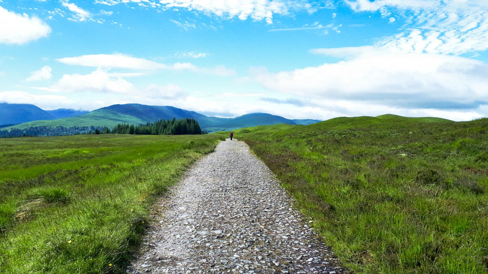
Tuesday, 20 December 2022

Short and sweet.....Creag Ruadh Dalwhinnie

 Hill: Creag Ruadh (Red Cliff)

Type: Fiona/Graham

Height: 658m

There are times when the worlds collide, and events transpire to say this is really not your day.

I was heading north for a short trip when within the space of five minutes I received two calls about different relatives and hospitalisation. No choice turnaround required.

A few days later I tried to retrieve something from what was left of my trip. Typically, the main event I was heading to and now missed was ascended on a beautiful day. Now storms forecast, the joys. I was for just of a mindset to forget the trip, but the good lady persuaded me to use the last couple of days of the booking I had made.

So, an early morning start as the storms were due that afternoon. After a few hours' drive a break was required, I was looking for a short leg stretcher. Creag Ruadh was on my to-do list so on paper this fitted the bill perfectly. Another benefit was a high-level start meaning less ascent, quicker and therefore less effort. What's not to like for a mid-drive leg stretcher like this.

My original plan was to have some food at Dalwhinnie before the ascent. But as I drove north the clouds had lowered and were much darker so just on with the ramble.

This was now my 2nd ascent of Graham with the same name and there is still a 3rd out there.

There are varying options to ascend but I chose one of the most direct routes primarily as I was mid journey. Looking at the map there are some grouse shooting ATV trails that could be used but most walking would be across rough pathless heather. At this time of the year, it should be fine.

Creag Ruadh is basically a big featureless heather clad lump, not sure why it is not a top of the nearby Munro of Meall Chuaich but I don't make these lists.

Easy to miss ATV track
I found a report online and parked at a field entrance beside the A9. The start was an ATV track directly across the road, watch out for the fast traffic.

There was an immediate steep ascent of about 150m. More than enough to get my lungs blowing.

When it flattens out the ATV track contours back towards Dalwhinnie. For a longer ramble it can be followed and then a gentler gradient of ascent.

Bit boggy at times but straight up from here

Hidden butts

Drying out a bit as muirburn patches help

But with the weather front approaching I left the track and headed directly across the moor aiming for the high point. It was rough going but aided by muirburn patches and animal tracks good progress was made. Before long I was there.

A huge cairn for by Graham standards even with a built-in shelter. I suspect this is for the benefit of the grouse beaters and not us walkers. 


Good views across to the nearby Munro of Meall Chuaich. 


More impressive views looking south towards Loch Ericht and The Fara whose ridge is under the cloud. 


Looking north the Cairngorms pleasant viewing but nothing standing out, cloud too low.

Rough descent but saw all 3 hares going down

A more direct line of descent spring plenty of red grouse. Also spotted 3 different mountain hares, very nice to see. Interestingly they were all close to muirburn patches, the fresh growth tasty, I wonder.

I nearly stepped on a snare trap, used my pole to spring it and tossed it into some deep heather, my feel-good moment of the day.

Car still parked across the road

A9 south

A short but satisfying ramble, met the objectives. Headed to the Truck Stop at Newtonmore as still early enough for a brekkie roll and coffee. I have earned it. As I sat in my booth and looking out the window, the rain and wind arrived, good timing for a change.

Ascent: 346m

Distance: 4,01

Time: 1.28

Wildlife: Red Grouse; Mountain hare

Saturday, 10 December 2022

WHW Inveroran - Glencoe Ski Centre

Walk: West Highland Way

Section: Inveroran - Kingshouse

After yesterdays wash out at least it was dry this morning, even though the temperature was still low and the clouds well down. So what to do with the good lady? She felt up to a small section of the West highland Way, fine with me. 

Inveroran Hotel
Off we drove to our start at Inveroran Hotel, a historic inn dating back to early 1700's. No chance of coffee and scone as yet another place that has a sign up 'only catering to residents'. I wonder what our visitors think of this as it is now so common? The next opportunity to buy food is just under 10 miles away. It really is not good enough for an area dependant on tourism and on a National walking route.


This is a straight forward section of the WHW, even the good lady could not get lost or so I thought. 'Where do we go now' was heard early on. The Black Mount Munros were covered in cloud but breaks give a glimpse into the magnificent corrie.


The road structure can be clearly seen
After the tarmac road to Forrest Lodge the route became more interesting as we were walking on a historic drovers route which was made into a harder foundation as a Parliamentary Road by Thomas Telford. We passed a small derelict quarry where I presumed the stones came from. I could imagine the navvies breaking up the rocks with their hammers, very hard graft. There are the deep depressions on either side of the road, pushed down from the weight of the many carriages of various types over the years. Trees on the other side prevented us getting any sighting of the Black Mount lodge, a private dwelling I think. At least the trees kept the wind at bay.

Good lady heads back to the car

Whilst I keep going
Then it was out into the open moor. This is one of the most exposed sections of the WHW. Today it was fine but yesterday it would have been awful. After an hour of walking the good lady turned back and I hopefully I will meet up with her at the end.

As I walked I was looking at a couple of hills when it clicked that they are a pair of Sub2k's I did last year. Different perspective is why I did not recognise them at first.

Munro Meall a' Bhuiridh comes into view

Rannoch Moor starts here
Not a lot to say about this section, grass and moor with some Glencoe corries and tops to provide interest. It is however, the start of the famous Rannoch moor. I passed a few walkers almost all foreign from the voices, most smiling. 

In the distance I saw this long moving line, my eyesight is not great but even I could tell it was a large human convoy coming my way. When I met up they were sitting on either side of the Ba bridge, most head down, no youngsters and from the few voices I heard a group of Germans. They didn't look the fittest bunch and probably will be even less happy when they reached the hotel 'residents only' at Inveroran if they were hoping for refreshments!! 

Munro of Creise just poking out behind Bhuiridh

Clouds now into Coire an Easain 
I had now completed the highest section, my last small piece of Turkish Delight the reward, before turning and contouring towards Glencoe. The wind was now stronger and colder and the clouds seemed even lower. My hopes of a clear view of the Buachaille dashed. It was there but with an atmospheric cloud covering sadly. At least I have seen these views before. It would have been nicer for the 1st timers behind me to see it in all its glory.

Stob Dearg but hidden in its shroud today
Then the good lady was spotted, not quite dashing to meet up me, more huddled in layers desperate to get to the ski centre cafĂ© for warmth and cake. Thankfully it was open!

I walked the route faster than most would so that I caught up with the good lady before she panicked. It meant that I did get a slight sweat on despite the coolness. Overall it was a good short ramble to finish what has been a less than inspiring start to the summer.

Ascent: 332m

Distance: 13.8km

Time: 2.59

Wildlife: Raven; Chaffinch; Blue Tit; Meadow Pipit; Pearl Bordered Fritillary; Large White;

Thursday, 8 December 2022

Meikle Says Law

Hill: Meikle Says Law

Type: Sub 2k

Height: 535m

A dull day was forecast so I opted for a straightforward ramble. Meikle Says Law is the highest of the Lammermuir hills and also the highest in East Lothian. Andrew Dempster in his book 'The Hughes' describes the Lammermuir hills as the southern equivalent of the Monadhliath range in the Highlands. Rolling plateau with few distinct summits. I can relate to that

As I drove through the scenic village of Gifford there was brief hope for the ramble with some blue sky showing and the moor looking as scenic as it did the last time I visited for Spartleton.

Before long my first obstacle of the day was encountered as the back road over Redstone Rig was closed to all vehicles. A look at the map and measured just over an extra kilometre each way from the junctio0n to the walk start. That was fine as only a short ramble today.

As I walked the tarmac the Fallago Rig wind farm was on my right rising above the moor. Sadly those turbines are where I was heading but I shouldn't be going through the turbines. This area is another grouse moor but I was surprised to see gun butts just a few yards from the road.

Ahead I could see flashing lights but I reached the turn off before hitting the works, whatever it was.

The signpost shows that this is also an ancient walkway, part of the Herring Road, now recognised as a Heritage Pass. I described this in my Spartleton walk description. They were hardy souls these herring women, not an easy life at all.

Not the track on left
I knew from the Walkhighlands walk description that there is an immediate steep descent, probably 50 metres at least and it was steep. The renovated Faseny Cottage on my left, chairs outside, probably a fancy bothy for the grouse shooters lunch.

I could see a track on my left accessed by an expensive looking footbridge. Not a vehicle bridge as too narrow and the ATV’s would use the ford, thought the shooters would as well.

Thats the track I want

But this was not my crossing, I had to get across the ford about 100 metres along, which after last night's rain was running highish. Some slimy stepping stones to negotiate, not fully successfully as my boots did get wet. 


I haven't seen one of these traps for a while. The last time in Perthshire a dead stoat was in one but thankfully empty today.

At this stage the track was well constructed. After a short ascent I reached a junction and another dilemma as I doubted the accuracy of the Walkhighlands description. It wanted me to follow the track left and descend to the burn again and then follow a track across 4 fords.  But my OS map showed it stopping well short of MSL. My map, however, does show a narrow track going to the top so I turned right at the junction.


The track was now heading across the moor, sometimes faint and sometimes disappearing completely. Along the track there are support boxes for the grouse so it is still used by shooters. There were plenty of grouse around but the season still has a few months to go for the slaughter to continue. I was now still heading upwards but veering away from the summit but have faith Des.

Eventually I ran out of track at a peat bog. Off track now and headed across the moor in a direct line for the top. The terrain was awkward patchwork heather and bog but not an issue. But had I made the right choice?

As I neared the top I stumbled across a narrow but well trodden path, was this the one on my map? The trig was soon in sight along with the turbines but this was the edge of them, I was not going into the badlands.

Diverting my eyes from looking at the turbines the view was not too bad if a bit horizontal. I could see the bright blue Firth of Forth and the Bass Rock, in sunshine or was that Leith.

To my left the Pentlands ridge was just in sight and to my right was Spartleton Hill. It was a bit chilly so didn't hang around for too long. There was the option of descending via the path heading northwards before dropping down to the Faseny Water and following it back. WH does not recommend it but it was a proper path up here and I can't imagine it being much different from my ascent.

I was only out for a short ramble so I decided to stick with what I knew and returned via my new found track. Although it too disappeared from time to time it was more there than not. Indeed, I passed a few spots where I realised that I had been ascending the rougher ground within metres of the track but did not spot it.

An enjoyable descent allowed me to study the terrain of the moor. Along with the longer views that were still in the sunshine I had good views of Spartleton and its surrounding wind farms.

Steep climb to finish


Feet wet at the burn again and now that steep ascent back to the road and it felt as steep as it looked.

Back on the road and it must be knocking off time as a few workies vans sped past.

Not the most glamorous of rambles but good enough. I enjoyed it and ticked off another high point as well as completing all the Lammermuir Sub2k’s.

Ascent: 315m

Distance: 10.66km

Time: 2.38

Wildlife: Red grouse; Blackbird; Flock of Fieldfare;

Friday, 25 November 2022

Cracking views for not a lot of effort.....Rhue lighthouse & Meall Mor

 Walk: Rhue Lighthouse and Meall Mor

After yesterday's efforts in the wind and rain I woke up this morning all aches and pains. Looking out the window it was grey, drizzly and very low cloud so nothing high today.

Close by was the Rhue lighthouse walk with options, not one I had done before so that will do.

Some days a walk that had minimal expectations ends up being superb and this was one. The views for only slight effort were simply stunning, who needs the big mountains?

A bench with a cracking view
A short walk from the small parking area to a seat to relax and enjoy the views. Through the binos I spotted a couple of porpoises. Spoke to a couple with big scopes who had seen a few dolphins but far out at sea.

Storm clouds over Ben Mor Coigach

Fab rock formations

Beinn Ghobhlach top under cloud
The narrow track goes through the bracken, thankfully dying away and soon the lighthouse. It is a pretty but small lighthouse in a spectacular situation. Spoke to a fisherman who was hoping to catch a Pollock off the rocks. Must bring my spinning rod next time.

Light constantly changing but cloud staying low

Looking north, Ardmair on left
I wandered along the coastline and found a faint track heading round the bay. At times it was very narrow and very exposed. A bit muddy so care required, leaning inland to avoid a big drop into the sea. It is possible it is a local track going round to Ardmair.

Instead, I sat on rocks just admiring the view. For a brief spell it was summer like heat, jacket off. The light was constantly changing and I was simply enjoying it.


I spotted the Shearwater going close to the sea eagle nest. I imagine any chicks will be away by now. But through the binos a big shape took off from the nearby cliffs, gained height and flew down the peninsula separating Little & Loch Broom. Presumably one of the adult birds still hanging around the cliffs, might be its winter roost.

3 anchor hoops, interesting as lighthouse accessible by land, maybe heavy stuff comes by sea
Wandered back to the lighthouse and studied the amazing rock formations surrounding it. Wish I knew more about the geology.

Meall Mor from lighthouse
I ambled back along the road where a big lorry was being loaded with sheep from one of the crofts, just moving or off to slaughter I wondered.

The fence had a clear opening onto a steep grassy track which headed up through the nonchalant sheep to the first level. Then the track turns into a muddy, rocky track, it must be a good ATV to get up this.


Finally reached the mast but the small cairn at the top of Meall Mor was only a few more paces ahead. Meall Mor it is called, only 165m high but in view terms it feels like much, much higher.

Ardmair Bay
I was not anticipating a wow moment, but this was WOW in capitals. Nothing beats a top with a vertical descent into the sea and this was one, don't go too close to the edge. However just look around. On my right was Ardmair Bay overlooked by the huge bulk of Ben Mor Coigach, still immense despite its ridge being under cloud.

Summer Isles directly ahead
Looking straight up The Minch the Summer Isles sat on the blue sea and on the far horizon were the peaks of the hills of Lewis. Truly spectacular. The views west of the coastline and Beinn Ghobhlach also under cloud.

 Loch Broom
Finally, over Loch Broom and Ulapool onwards to the Fannichs, Dearg group etc. Grey today but on another day the 360-degree views would be spectacular. A crisp winters day, ideal.

I don't usually spend too long on a top but today was an exception. The constantly changing light was amazing. Lobster fisherman moving the boat between pink buoys. The boat was rolling big style when out of the sheltered waters. Small private rib could be seen sailing in and out of isolated coves. A great viewpoint even the obligatory Ravens appeared.

Back down and commotion in the trees, the answer evident as a Sparrowhawk appeared, circled above the trees, obviously disappointed at missing out.

Overall, a most unexpectedly splendid short ramble.

Ascent: 196m

Distance:

Time: 2.38

Wildlife: Sea Eagle; Sparrowhawk; Raven; Wood Pigeon; Robin; Porpoise; House Sparrow.