Monday, 26 February 2018

A fine winters ramble on Lamachan Hill

Back on home turf and out with ADRC today but ironically after my five D & G hills this week I was back in D & G for more fun. Another glorious blue sky day was forecast albeit with the possibility of high and very cold winds up top. Our target the Graham/Donald of Lamachan Hill 717m, from Glentrool.
Fence walking
Parked at Caldons burn area and headed up the opening track. Quickly the old route had disappeared as the area has been deforested. We had to clamber along a narrow, boggy and tree debris littered route clinging to the fence at times, really not good enough for a national forest park looking to encourage visitors.
Raptor tree
We then had to walk along a new forest track before veering off and started climbing a bracken rocky area, no more ‘easy’ walking. Within the ugly deforestation debris there is always that lone one left standing allegedly for the raptors but I rarely see one being used. 
Getting steeper
The gradient was more or less continuous until the summit of Lamachan.
As we climbed towards Mulldonoch the route twisted and turned so there were plenty of opportunities to look back and take in the great views of the Galloway hills, Merrick, Mullwharcher, Corserine etc. Looking down Loch Trool looked dark and imposing.
Gentle scrambling
At one point when we looked down we could see an old remote and isolated farm building at Glenhead and one of the group mentioned that his grandmother was brought up there, also related some amusing anecdotes but what a hard life it must have been.
The big stane
The winds were picking up, getting much colder but not as bad as feared. Loch Doon now in view on my left looking much larger than I remembered from a few years ago when I fished it.
Just one more top to go
We had a quick lunch in the shelter of the rocks on top of Mulldonoch 562m.
From Mulldonoch the top of the patchwork snow clad Lamachan still looked a fair bit away. Most of the climbing had been done but from Mulldonoch we dropped about 50 metres before making the steeper ascent of Cambrick Hill then the plateau to Lamachan cairn. 
Sunlit snow

However, overall the ascent was now straightforward. Walking at group pace it was slowish at times, I think the bigger hill was catching a few out, but there you go.
Snow topped Merrick


When we reached the top and the small stone cairn the photo shoot was short and we were glad to head downwards with the biting wind now at our back.
Descending Craignaw on left
The descent was via the Caldons Burn, a mostly untracked descent although faint paths appeared and just as quickly disappeared. Craignaw was in our sights as we descended, If I had been on a solo trip I would probably have ticked this one off as well. 
Crossing Caldons burn
An interesting descent. There was a lot of criss crossing of the Caldons burn, the stone dyke, ice patches, many boggy sections and some good views, all combined kept the mind concentrated. The odd small but noisy waterfall to enjoy.
Eventually we all survived intact, well some muddy backsides, and reached base. A good walk in excellent varied company helped the day pass quickly and the weather was better than expected, a real bonus.

Time: 5.34
Ascent:758m
Distance: 13.2km

Sunday, 25 February 2018

Yes I can See Morris Hill

Initially it was the name that attracted me to this hill. Did some internet searching but could not find the origin so if anyone knows why it is called See Morris Hill please enlighten me.
I have completed a couple of sub 2000’s in recent days that will go towards the rear of my memory bank but surprisingly enough I thoroughly enjoyed this little one, despite 2/3rds of it being on tarmac.

Start parking for 2 cars max
It had been a frosty start but it also really felt like a welcoming spring day, the kind you are really glad you are outdoors and not stuck in an office or whatever.
Parked up the car and walked the tarmac up to the mast, so cannot get lost. However, one joy was the varying light flickering between the trees as I progressed.

Sun lit tree boulevard
The trees and bushes were alive and noisy, full of song as the tits, chaffinches, blackbirds, thrushes and more, all singing in mating mode, quite a delight.
Farm road goes right
A farm came into sight, empty, but the track goes round to the right anyway, then passing a couple of cottages, the only sign of life today as a chainsaw makes short work of some trees. You could drive to here I suppose but is life really that short?
No shooting today
A gate blocks traffic going further anyway, secured with seven strong padlocks attached to one end, would one big one not do?
Also a sign regarding shooting in progress but I’m sure we are out of season, but there are varying seasons, what is being shot? Just then a pheasant calls, close by, no boom boom, so ok to go further.

How many years to grow this covering
I love seeing fresh dark green moss covered old stone walls and this dark and damp section had plenty of these contrasted with white pockets of snowdrops. I watched a tv interview recently where a grower could charge over £100 for an individual specialist snowdrop bulb, wow!! Apparently it is all about the pattern of yellow spots inside the head.
Mast
The track now breaks out onto open land where sheep are grazing.  Some look heavy underneath, ready to lamb soon so care taken not to frighten them. The mast is reached and if you follow the track around to the left and into the field the trig is behind. Exactly 30 minutes from the car.
See Morris Hill is over there
As most will know the trig maybe the high point but it is not See Morris Hill, that is across the open field.
Thankfully gate open
From a previous post I had a slight concern this field might be full of coos. Plenty of evidence they have been here but today only sheep in sight.
I’m in no hurry so an easy ten minute tramp across the grass to the hill and its small ridge is no effort. Despite the haze the views are well worth that little effort getting here. Peace and tranquillity like this, you cannot buy it. I think I spot a fox down by the trees, maybe not so tranquil for the sheep but no lambs around.
Simply returned by the same route.
This was a really enjoyable feel good short walk. Proving that an hours walking exercise really can make you feel good.

Time: 1hr 14min.
Ascent: 680ft
Distance: 3.32m


Friday, 23 February 2018

Bengairn Hill

A beautiful blue sky that could almost pass for a spring day.
Once again getting the walk started was my issue. I drove past the turning and was almost at Auchencairn before thinking I shouldn't be this far and turning back. Caused hooting behind as I braked sharply at a very old difficult to read sign ‘Bengairn House 1 mile’.
Start up this track
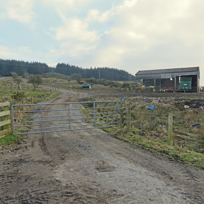
Only about half a mile up, it seemed too soon, I passed another dilapidated sign that I thought said Bengairn Hill, slow reverse back the narrow road and turned car, not much parking here but a beautiful view over Bengairn Loch.
The dirt track was churned up but a straightforward walk to a gate. Sprung two roe deer almost on the track, surprised they hadn’t heard me.
Turned right over gate and then followed track left. Straight ahead was all the coos staring so you wont want to go that way.

Foresthill ruins end of track
This is now a straightforward track to the ruins at Foresthill. It is always sad to see ruined buildings. Indeed from the quantity of stone lying around at one time this area would have homed a few families.
End of track Bengrain on left
Views of Screel Hill at first then the vista opens up showing Bengairn Hill  ahead but you don’t see the rig or cairn until the last minutes from my direction of ascent.
The ATV track is very wet but can be followed for a while before I cut left and made a more direct route to the summit. There were excellent views looking back of the route and the Solway beyond. Just the light today creating a lot of haze.
Looking back to Solway ruins at the trees
No doubt this could be a different walk once the marshland grasses have grown but today relatively straightforward. Followed some sheep trails and then found a more beaten trail but it goes sideways so straight up again and the trig is in sight.
Top in view
Excellent views all around, not a big hill but one where time can be spent soaking it all in. 1.14 from car to top and this could be easily cut by fitter walkers. My chest infection has still not cleared so a few short stops were required.
Big cairn all those old ruins for stones?
Vista includes snow topped Merrick. Out to the Solway but a haze restricted this. Screel Hill which would be a double objective for some. Indeed most of the local guides I looked at had walks up Screel Hill but Bengairn largely ignored.
Screel Hill from trig
A pair of ravens call and fly over for a look. Your not getting my cheese and mango chutney roll. On descent flush a Jack Snipe, an infrequent sighting these days.
Return more or less the same way. Surprised to see a huge clutch of frog spawn, wonder how many will make it?

Just one of the many batches of frog spawn
I meet the farmer and his 3 dogs, up to round up his 250 sheep for lambing, he was disappointed to hear they were all over the hill. I mentioned I expected to see some red kites but he said not really coming this far south. Ten minutes after leaving him a pair of you know what glided over, mmm.
Straightforward walk good views, why not go for it.


Ascent: 1064ft (324m)
Distance: 4.67m (7.52km)
Time:  2.31 hrs


Thursday, 22 February 2018

Bainloch Hill been there, done it

After Criffel my afternoon walk was to be a nice easy saunter, indeed.
I drove past the barn to get to other option but up ahead the narrow road was blocked with farm stuff. I chatted to the farmers son then farmer himself neither of whom knew of the un-mapped track. Where I thought it was they said led to their silage tank and not allowed. They were friendly enough and talked me through the forest route and let me park at the barn.

Start here
The big coos were patrolling this area but although giving me the eye they let me through without incident, a few gates quickly climbed over just in case.
Boring forest road
Boring walk up the forest road until I reached a firebreak beside an old dyke wall.
1st firebreak
I followed this in for a while, underfoot ok, but seemed no sign of an opening, it started to descend so I went back.
Further up road another firebreak which seemed to close in quickly so pass again.
Follow that light
Just before the turning area I looked through the trees and could see light at the top. GPS indicated almost in line with top. The trees are planted nice and straight so a much easier walk up through pine needles to the light than fire break stuff.
Cairn ahead
A steep heather bracken plod for 5 minutes and I could see the cairn. This area looks like cleg heaven later in the year. On top but where are the other 2 cairns?
View from cairn
A walk around the top taking in the beautiful Solway views. Sadly light not good enough for decent snaps.
Solway
Looking down from the far side a stone dyke was below maybe the same one I followed. Cold and cloudy so then back down the reverse route.
A quick walk and another sub completed but cannot see me rushing back for a second go.


Time: 1.21hr
Ascent: 762ft (232m)
Distance: 2.64m (4.25km)


Wednesday, 21 February 2018

Find the cairn on Woodhead Hill, good luck

My afternoon walk was Woodhead Hill and from reading previous reports it was a toss up from being an awful ascent to relatively straightforward. After my experience I will go with the latter and it could have been even easier, read on.
As always getting started is the hardest bit, as per OS 84, I put Lochanhead into sat nav but it stopped me about half a mile short. I knew it didn’t look the right place, map out and on I went to park on the main road beside a cottage at a road turning signposted to Lochfoot. Narrow parking and busy road so take care.
Crossed road and walked to Woodhead Farm, follow track left to white house and turn right on forest road here. Signs up saying no cars beyond this point, indeed no entry without authorisation.

Straight on
I passed the Xmas tree decorations from a previous report but I was in no hurry so I kept on the track and it is a short enough walk anyway.
Left turn
At next junction keep left and before long an MTB track appears on your left.
Left again
From the map I expected another forest road but nope just a dirt track.
Walking back on yourself but still climbing I came to a deforested zone and tree gap around 200m up. Checked GPS, yes, summit up there somewhere so a scramble through and around deforested are was undertaken.
BUT, and this is a very big but, continue along the track for circa 200 metres and an ad hoc MTB descent trail will meander you all the way to the top. The joys you find on descents!!


After scrambling through stumps etc for a short while I was about to check GPS when I spotted an MTB rider up top taking snaps of me climbing. He hung around and we had a chat about the MTB trails particularly the aforementioned one which I joined about 10 metres from the top (walk in another 10 paces you will see cairn). 54 minutes from car to top.
Mini cairn on tree
We talked about the mini cairn of which he was unfamiliar and both looked around the devastated landscape for a minute or so. He decided to head down and just then I spotted this mini cairn. Shouted but he had gone. If I had not seen a snap in a previous post I doubt I would have found it either.
Criffel I think
Some ok views but not really a place to hang about so followed the ad hoc MTB trail down to the track and then leisurely retraced my steps.
Footie fan heron
Actually a very straightforward walk for those following this report. Even liked this football supporting heron, made my day. Don't think those are QoS colours though.
Ascent: 565 ft
Distance: 3.74
Time: 1.40

Saturday, 10 February 2018

Tighvein a beautiful day on Arran

I had a chest infection this week and was going a bit stir crazy, short flat walks only. Lying in bed this morning I felt better. I looked at the weather forecast on my tablet, cold but blue skies for most of the day, and made an instant decision, up, showered and at the ferry within an hour heading to Arran.
Sub off Arran
After my normal ferry breakfast I went out on deck for a look around and I spotted this submarine on the horizon heading out to sea to wherever. Probably see one at least once a year.
A short bus trip to Lamlash and I was ready for my walk to Tighvein, a sub2000/Marilyn, the highest point on the south of the island.
I got off the bus too early and had a walk of about a mile to the car park at Dyemill in Monamore glen, the official start.
Why not Loch Urie?
A signpost directs you right across a bridge and a fairly straightforward track heads you climbing immediately. Not sure why the loch ahead is called Urie loch and not Loch Urie?
Track getting wetter
Once I broke onto open land the track was ok but started to get boggy and it would get a lot worse.
Track getting worse and worse to come
Soon it was back into a forest section for a mile or so trying to avoid the ankle deep gloop, not easy. Hail was penetrating the trees, so much for the blue skies.
As the trees thinned I was in the snowline quicker than I expected at just over 300 metres. Out in the open it was no longer hail but light snow.
Now snow as well as bog
The track had now disappeared under the snow and for the next section I followed the tree line on my left as best I could. The Urie flanked me on my right, difficult to go wrong.  However, there was much walking through knee deep heather and snow drifts. I had passed a young couple earlier who were not really prepared for this but at least they could follow my tracks. My chest had not cleared as well as I thought, with my heart now pounding at this effort but I had come this far so do or die.

Track around here I think?
As it was last minute I had not set a GPS track but I could see from the device that the Urie loch was up and over the ridge to my right. At the end of the tree line I picked a route and waded through the drifts onto a small plateau where soon the loch came into view. There is the possibility I left the track earlier as some reports mention marker posts, none of which I have seen. I expected the loch to be fully iced but no so, just the fringes.
Urie loch looking south trig just up hill on right
Across the far side of the loch (west) the trig was in clear sight, according to GPS it was 800 metres. You have done all the hard work getting to the loch and although it was a bit of an effort through the drifts there was only another 30 metres of ascent.
You can go from this point, as I did, round the back of the loch or as other reports have headed down the near side as per the picture and heading up the short hop west from there. I suppose it depends or which end of the loch you arrive at when you crest the hill. I will come back in the summer and see where the trail comes out. 2 hours from my start to the top so a short walk.
Looking north to the 'big' hills Arran Alps
Looking north the perspective looked like it was a flat moorland hike towards Arran’s big northern hills, an illusion of course but a great view nonetheless.
Thankfully the forecast was now accurate with clear blue skies. Clouds were building to the west so no view over there but far reaching in all other directions. It looked like home in Ayrshire was being battered by the weather. Mrs said there had been a very heavy hailstorm. 
Holy Isle (Mullach Mor) without snow
Some reports have described various routes back, most seemingly not enjoyable, deforestation was in progress today so I just headed back the way I came taking in the superb views on the descent. I was surprised that Mullach Mor was snow free, a good reminder of my visit.  a couple of years ago
All in all really glad I made the effort.
Only hitch was the ferry developing a technical problem and sitting out in the bay, would I get home? Thankfully they fixed it or it just sailed away, home better late than never.

Time: 4 hours
Ascent: 492m
Distance: 11.6km

Tuesday, 6 February 2018

Vrackie bealach on a stunning Winter's day

After watching the Banff mountain film festival yesterday it was our day to get out and enjoy Scotland’s great outdoors. Pitlochry was shrouded in mist this morning but being familiar with the town you don’t normally need to go too high to clear it and today was a case in point. As the good lady was with me today we opted for the Vrackie bealach circular, demanding enough for her, but should have great views if the blue skies came through.
Misty Pitlochry Kirk
After a tasty cooked breakfast it was time to work it off. We walked from the town and by the time we reached the Vrackie car park it was already the overspill park in use, a busy hill.

A straightforward, short, but pleasant woodland climb brings you to the moorland where the views begin to open out. Snow covered Ben Vrackie has been drifting in and out of view. The bright white snow contrasting with the autumn/winter coloured bracken and trees, just stunning. We had came out of the mist and pristine blue skies were now above.
Vrackie peaks out
Onto the moor to head for the junction of the bealach and also take in the views back to Pitlochry which was still shrouded in its blanket of mist.
Pitlochry & the Tummel still covered
Up here it was spring conditions, no need at this stage for hats and scarves. Indeed most other walkers we could see had jackets off as well but I knew when we soon crested the ridge it would be cold again.
Vrackie track
At the junction we decided to go anti clockwise so headed up the Ben Vrackie route. The snow and in particular ice was now prominent hence a bit of extra care needed. Vrackie was rising up and looked magnificent. Small dark figures could be seen both climbing and descending.
Frozen Loch a Choite
When we made the final turn around Stac an Fheidh the picturesque scene was stupendous. Loch a Choite was mainly frozen with occasional uniced patches of water, the sun was catching sections, surrounded by the snowy hills, quite beautiful. 

Vrackie was so tempting. In fairness the good lady did say I could go up but she could not do it and it was not fair to leave her behind. I have seen the view from the top twice but never in the snow, another day.
Into snow line again
We crossed the icy dam and headed north along its far bank, slushy, icy and boggy. Then we followed the path climbing to our highest point, 633 metres, Meall na-h Aodainn Moire, and then spent some time taking in the northern views. The Atholl glens prominent, particularly Glen Tilt, and the surrounding broad white hills just more great views.
Looks like smoke from a volcano
Now it was just a case of following the bealach back round to the junction and following the route back to Pitlochry. The fog was now burning off which also gave us nice views on the descent.
Follow the markers home
An excellent winter walk with magnificent views, just what the doctor ordered.
Time for a coffee and a large slice of carrot cake.

Time: 3.41
Ascent: 532m  
Distance: 11.88km