Thursday, 28 March 2019

No royalty just common old me on Kings Seat

Hill: Kings Seat
Category: Donald
Height: 648m
After a full day wading in the mighty Tay searching for the elusive salmon I had forgotten how much a strong current takes out of your legs. I soon found out when I started Kings Seat. Additionally, I only had my rigid winter boots so the first half hour or so was painful as my calves rebelled.
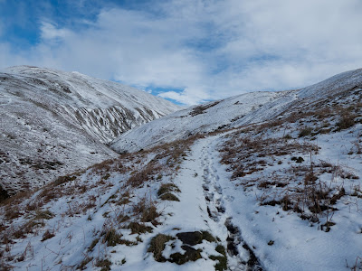
Was it only the other day I was up here in knee deep snow? Now there was only an isolated patch or two.
Castle with Bank Hill behind & Kings Seat peaking out behind it
I passed the impressive Castle Campbell which has some repairs taking place, at least I think that was the noise. It does seem an odd spot for a major castle at the top of the gorge but attackers managed to get at it a few times.
Dollar Glen
Through the impressive, tight and steep Dollar Glen with the evocatively named Burn of Sorrow running fast as it cuts through the gorge, bet its aptly named. Delighted to get a close up of a red squirrel, surprisingly the first of the year.
Not long and I am out on the open hilly moor. 
As normal in the Ochils the going underfoot was pretty good, just my legs were the problem.
Open ground with Bank Hill ahead
The climb to Bank hill was steep enough. At times walking can be amazing for dafties such as me. As I headed up Bank Hill I was looking to a big hill on my right wondering which other steep biggie it was, noticed a trig or something. Then it dawned this is where I was going, legs protested further.
As always you are rarely alone on these hills, a double going up the steep ascent, a trio ahead and a solo behind me.
The forecast had potential cloud cover over the tops but so far so good.
There is a straight forward ATV trail for much of the lower slopes 
It is such a popular hill that once the gradient steepened regular eroded footmarks to follow.
I was in a shut down mindset as I laboured up the slopes, wallowing in deep thought about catching that blinking salmon next month, two opportunities then, but also four more hills to choose. 
Spitfire memorial
On a regular basis the hills fool me. As I climbed a steep section I unexpectedly spotted a cairn and rejoiced, the top, but it was far too soon. It was a memorial for three WW2 spitfires that crashed, one pilot survived. A moments pause to reflect on that experience, one can only imagine.
Sheltered cairn
A couple more false tops then the big sheltered cairn where the couple were sitting in having lunch.
I hoped that they went further on to the true summit, but maybe not I am sure more than few assume the big cairn is the top. 
True summit
I did walk on and by the time I reached it the clouds enveloped me. Disappointed as I hoped to see the tops of Andrew Gannel & Ben Cleugh.
Despite my protesting legs I got to the top in less than 90 minutes, happy with that. 
Fife with West Lomond prominent
Never mind I had eaten a full breakfast so no hanging about, retraced my steps enjoying the views across the Forth, Fife etc and of course these fantastic rolling hills. As well as excellent views of Dollar itself, no-one on the golf course.
Banks of Dollar
On the descent I had a closer look at the Banks of Dollar, an unexpected craggy area for these hills.
Back at the car a piece of a nice strawberry coconut cake from M & S did the trick before the drive home.
A very good short walk with fab views, what’s not too like? 

Wildlife: Meadow pipit, Skylark, Buzzard, Red Squirrel,
Time: 2.32
Ascent: 1843ft 
Distance: 5.35 

A short Ochil tramp to Dumyat

Hill: Dumyat
Category: Sub2k
Height: 418m
Dumyat is a popular hill in the Central belt, an outlier of the Ochils, with a dose of Scottish history thrown in. Way back it was a Pictish highpoint, particularly the old fort which has fantastic views over the Stirling area and the Wallace monument.
Dumyat centre old fort to right
Any guards would have to have been pretty robust on a day such as this. At the top of Dumyat the wind was so ferocious that not being blown over was an achievement in itself. I was glad that I had not gone higher today. Looking over the higher hills I could not spot any walkers, wise people.
In fact I was intending to walk Kings Seat on my way up for a fishing day but with the forecast opted for the lower hill of my two.
It was dry when I started the tourist trail and I wondered if this was a good idea with the number of people descending the track. Too popular for me.
Wallace monument in shower
Looking across to the Wallace monument a shower was blasting through but thankfully missing me.
I layered up and went up the hill track, too many clothes on, too warm but decision made to keep the gear on as the descent might be different, it was!
The descending walkers were mostly Asian of all ages and sexes, great to see, many were friendly but sadly some need to be educated in hillwalking. On a few occasions they covered the full track with no intention of making any room. Well my low centre of gravity and stocky shape means that a couple of times with no where else to go I stood my ground and they bounced off me rather than than their intention, sad but lesson learned.
Top in sight
Back on the walk it is a straight tourist track to the top from here. There is a more strenuous route from Blairlogie but not for me today. It does have excellent views down to the plains and the industrial belt.
Towards Grangemouth
Even in bad weather it would be difficult to lose this eroded track. it did not take that long to get to the top but the wind meant taking a snap without a shake was very difficult.
Summit looking to Fife
Whilst trying to balance I could still take in the excellent views across the Forth. The tracks to the other big Ochil hills were clear without walkers, wonder why?
Modern War Memorial
The war memorial, to the Argyll and Sutherland Highlanders, is modern and eye catching but does seem in some aspects out of place, just my view and probably not universal.
The fort hill from Dumyat
On the descent I went cross country to the old fort summit known as Castle Law. Dry on the way up but the first of two very heavy showers hit on this summit so limited time to take in the views but still a good look back to Dumyat.
Dumyat from fort hill
My descent was hood up head down. Short showers but very strong my face well stung from the hail.
A short sharp excellent walk that I will repeat but in the longer version.
Of course blue skies back at the car.

Wildlife: None, wise of them
Time: 1.32
Ascent: 890 ft
Distance: 4.29 km

Monday, 18 March 2019

A white day in the Ochils

Hill/Walk: Ben Cleuch via Andrew Gannel
Category: Graham/Donald
Height: 721m
Out with the good folk of Ayr today where we headed to the Ochils for our exercise. It was a cracking day.
As we approached the start the hills were looking majestic with plenty of snow blanketing them.
Mill Glen
Starting from Tillicoultry we headed up the Mill Glen. After yesterday's rain the burn was fast flowing with lots of waterfalls of various heights and all showing well. Quite a few walkers around after yesterday's washout.
The Law
It didn’t take long to get our first view of The Law, the traditional route to Ben Cleuch, but  not for us today.
Single file
We took the right fork and were soon in follow the leader formation as the track narrowed.
Snow line
It was not long before we hit the snow line, a soft slippy consistency at this low level.
The Law again
Cracking views already.
Our route was to follow the track above the Gannel Burn eastwards. This was a long slog as nobody had been along here before us today, soon found out why. The track was at best just a white line but it disappeared many, many times.
Track in Andrew Gannel on left
Breaking the snow was arduous with hidden drifts knee high.
We could see the hill across the way but this track takes you past the high point before turning back to head west again to the summit.
Slopes of AG, Kings Seat behind.

The contours suggested a gentle climb to the top of Andrew Gannel. However the wind picked up considerably, spindrift conditions along with the heavy underfoot it was a bit of a slog but we got there. Black clouds on either side, were we in for some rain?
Again the section between here and Ben Cleuch would be a doddle normally but once again we were the trailbreakers, breaking deep snow to get there. 
Viewfinder
We were very glad to get to the top of Ben Cleuch. The views up top were stunning all the way to the Lawers range. Such a strange light to the north, it looked more like a dull edited snap rather than reality.

To descend we headed over to Ben Ever where the grassy downhill section was a real slippery slope with most of the group taking a slide or two.
Snow melting
From there we headed down towards Alva and the woodland walk back to the cars. It was a different world down here as a lot of the snow had melted away from the lower slopes.
A longer and more arduous walk than most expected but satisfying nevertheless. A good workout out in excellent company. 

Wildlife: None
Time: 6.11
Ascent: 2665 ft
Distance: 8.55 ml

Saturday, 16 March 2019

Magical Fairy pools circuit, Skye at its best

Walk: Fairy Pools Circuit
Category: Walk
Well there was good news and not so good news. 
Firstly on awakening this morning all was calm outside, on and off rain but the winds of Storm Gareth had dissipated. The not so good news was that this was not the forecast. Last night it still forecast the storm continuing so over a glass of wine or two I agreed to the good lady's suggestion for a low level walk.
Now after another fine hotel breakfast we headed to the Fairy pools with the proviso that we were going to do the circuit route and you know what, I really enjoyed it.
At the parking area I knew there was a donation required, what I did not expect was that it would be a fiver, in cash and no receipt, not clever.
Still plenty around parting with their cash and mainly foreign tourists from the voices
Impressive views ahead from the start
Heading down the track the Cuillin views ahead are stunning, wish I was going higher.
The burn was running high so first adventure was a good stone stepping exercise in not falling in. There were a few people struggling!!
We had a few tourists on the out section for company but all seemed to be stopping at the first falls and returning, an expensive fiver.
Sgurr an Fheadain
Still the views ahead, particularly of Sgurr an Fheadain and its famous climbing gash, Waterpipe gully, were just stunning. Just thinking about the technical difficulties I am full of admiration for the skill and toughness of these mountaineers. 
Not that the further backdrop of the impressive, dark and gloomy Grey Cuillins were any less interesting.
Twin falls
The walk follows the burn (Allt Coir a Tairneilar) as it tumbles through and over many waterfalls back to the start.
Aqua
Some of the pools were a beautiful aqua blue but my slight colour blindness did impact as my good lady was seeing colour when I could not. Still it was great to be here.
Another pool
We reached the base of the hills (final point for all tourists) where we turned left and followed a muddy trail along the base. There was a small cairn and I believe that if you went about 20 metres higher there is a better track. Hemmed in by the hill on one side makes it more dramatic for the good lady.
Mrs questioning my route finding again lol
Still this muddy path was fine for us and clearly a route well used. Total silence and tranquillity apart from us bickering away.
Lovely lichen
There were some beautiful examples of lichen, varied in their colourings. Wonder how old this age, probably older than me and that is saying something.
Great views looking down of the tourists following the burn. God knows what it must be like in high summer.
Heading back
We met up with the above mention track and complete the triangle heading back to the start alongside the trees. Two ravens appear, the only wildlife seen all walk.
When we got back to the burn it was too high to cross and this point so back to the stepping stones.
Apart from the many tourists on the first section this ended up being an excellent short walk in a great landscape.

Wildlife: Raven
Time: 2.46
Ascent: 323m
Distance: 7.6km

A Skye coastal cliff walk on a stormy day, mad or what? Sithean a Bhealaich Chumhaing

Hill: Sithean a Bhealaich Chumhaing
Category: Sub2k
Height: 393m
Apart from the above mention the hill will not be named again, it is too long to keep typing and if you can pronounce it correctly, well done.
What a day to pick for a high level coastal cliff walk, winds constant 20mph plus, gusting to 40mph plus, hence great care needed. What a contrast in weather. But it was fab, glad I did it.
Start
I walked directly from the hotel to the hill with the unpronounceable name, which was a bonus. A mix of showers and blue sky greeted my start but the light winds were a bonus. 
Followed the Scorrybreac trail around the bay. A mostly good stone track in the dry but today very wet, it was very slippy in these conditions.
First hill ahead
Before long there are excellent views of the route ahead, the cliffs look imposing from here and I cannot see my top from this angle.
Devastation
Passed this rock slip, a significant landscape fall, boulders and trees and no chance if you were under it.
Not modern farm machinery
As I crossed the grassy pasture a buzzard flew over with a large looking vole or similar in its talons. I watched it for a few minutes as it flew back and across as it tried to draw out its partner from the cliffs without success, wonder if it just ate it itself?
Now the hard work started as it climbed steeply, I followed a fence line as not fancying the gap in the crags in these wet conditions, a long way to fall.
Looking back to Raasay on left and Ben Tianavaig
Got to the top and constant care was needed as the path is very close to the edge (sounds like a Yes song) and the winds are now increasingly strong and gusty. No shame in being a coward to occasionally take a slightly more inland route away from the exposed crags.  
Just behind one grassy knoll a hill runner suddenly appears, a good wild bearded and long haired Scot. Half expected a large claymore to be whipped out. At least he stopped for a brief chat, nice guy.
Trig can just be seen
The trig can be seen and you might make out from the snap it is right at the edge of the cliffs. And as the wind was a strong westerly, food for thought, one big gust and hill walking no more.
A skylark rises silently, no others around apparently so no effort wasted in singing just for me.
A wet moorland section and then I am on the final push to the top. The wind was trying to push me on faster and with the strong gusts, so being the coward I am, I crawled the final few yards to touch the trig, sad I know but there are  other hills I want to climb.
You can continue this walk to The Storr area if you have arranged transport or timed it for a rare local bus.
Looking north from near the top
On a windless day you would get some great views down of theses cliffs but not for me today. Still when the sky was blue and the sea the same colour some lovely views over the islands and back to the mainland.
Ben Tianavaig behind the cliffs
As I looked over the sea I was ecstatic as a flying barn door appeared, yip a sea eagle. Two ravens took off from the crags below to warn it off, down they went, out of sight, just thirty seconds but a welcome sighting.
Weather was deteriorating as storm fronts blew through but thankfully I was avoiding the rain/hail/sleet but not the winds which were stronger than ever. 
Grey day as storm blew through
The landscape was now monochrome ahead. This view is looking down the Sound of Raasay to the Black Cuillins.
Looking back to ascent trail & Portree
The view back to the plateau was quite dramatic it looked a long way down.
Back over the fence I stayed high and the followed a farm trail back to the rock fall and followed the same route back to the hotel. The hail got me here for a few minutes but better than up there.
A cracking walk with extensive sea views, nice one. It was truely a day with all 4 seasons in one short session, truely only in Scotland.
Three sub 2k hills surround Portree and that’s me seen the excellent views from two of them hopefully the last one later in the year.

Wildlife: Buzzard, Sea Eagle, Raven, Skylark, Feral Pigeon,
Time: 3.10
Ascent: 2153ft 
Distance: 6.97m 

Tuesday, 12 March 2019

A wild walk as Storm Gareth approaches

Hill: Beinn na Greine Skye
Category: Sub2k
Height: 417m
I had four walks mapped out for this 3 day trip but all that planning changed with the imminent arrival of Storm Gareth.
I thought it had already arrived last night as the hotel was constantly battered with torrential rain driven in on the gusting winds.
This morning the winds were already strong first thing but at least it was to be dry until 11ish. Three of my four walks were on ridges with significant drops, not advised if a gust got me, so the plateau top was chosen.
Start looking west
A short 5 mile drive inland from Portree, via Struan and Glenmore turn offs to the walk start, one track roads and nobody else about.
We parked at the start of a service road, marked private road. As soon as we got out the wind was already significant.
Start parking area
First section is a straightforward track. 
Keep following track
Headed up the service road towards the telecom masts which are marked on the map. There are masts left and right but for the ascent turn right and continue for just under a kilometre to the telecom masts. Most of the ascent has been done, a dip in the moor and a short ascent.
Still active at this point
The wind was now so strong the good lady was almost knocked over and elected to return to the car. A wild, wild day and the storm has not yet hit us!
1st view of summit
From the masts the destination can be clearly seen straight ahead, just over a kilometre on the map but rough moorland ground to cross, pockmarked with peat bogs.
Getting closer
 It is on and off wet and having ruined two cameras this one was now packed away.
Cairn shelter can be seen
Twenty minutes to the summit cairn and trig and on a day like this time for an immediate turnaround into the now seemingly gale force wind. Glad I had goggles as the hail being driven on the wind is extremely painful on any exposed facial area.
On the descent either by retrace your ascent route, or head to your right (west) towards the other telecom mast, and rejoin the service road.
I could see the farmer down below rounding up the coos on his quad bike, better down there.
On a better day there should be excellent views of north Skye up to Uig, Trotternish area etc, but not today.
Back at the car the storm has arrived and is full on. Not looking good for any of my other chosen walks!!

Wildlife: Raven, sheep & coos.
Time: 1.55
Ascent: 305
Distance: 6.1km