Walk: Three Lochs Way
Section: Garelochhead - Tarbet
After yesterday's roaring stags at Loch Doon this was meant to be much more sedate but it did not turn out quite that way. I had been saving this for a winter ramble but I needed to get out and this was not the day for high level unless you like to be in the clouds with no views. I had completed the 1st two sections so long overdue finishing it.
Logistically I decided the best way to tackle this was to leave the car at Tarbet, get the train to Garelochhead and walk the route back. Sound plan.
There are only about 4 trains a day so don't miss your connection and thankfully I didn't. Lol not like Scotrail it was late! Tarbet is a pretty and well kept little station.Garelochhead is the total opposite. A building surrounded by stone chips. no wheelchair access here. Plus nae people this felt spooky lol. Even more so as I never saw a person in Garelochhead. The last time (also my first) was similar, it is an odd place.
 |
| Even the signs hide away |
Not to be put off I followed a rising track to the A817 where after crossing it got a little trickier. Firstly boggy woods, then a track through thankfully dying ferns before the track itself also died. A crumbling dyke at least went directly up even if the path didn't. Various offshoot tracks headed into bracken/heather no thanks, struggle on this way.Finally on top, I followed the fence near the Military Road and I had a bad feeling. Some military vehicles went past, soldiers giving me the evil glare but I was not on MOD property yet.
When I climbed the barbed wire fence my worst fears were realised. Red flags flying with signs confirming no access to the Danger Zone as live firing taking place. It is advised to phone ahead but the chances of live firing are slim. Numpty. The dilemma was no buses to Tarbet from here. Zombie Garelochhead for 4 hours before another train, not option number 1.So, I decided to brazen it and keep going and play the dafty if/when the military police zoomed up got aggressive before throwing me in the clink. I kept walking and looking out for soldiers on the moors. It is a winding road in all aspects and after about 15mins I could hear gunfire. More deliberation and on I went but the noise was getting louder and even to the layman there were some heavy duty guns firing. But it was off to my left hopefully the road ok?
A noise then a military truck appeared coming towards me, game over. I stood aside and the driver waved as he drove past, bizarre as machine guns blasted away nearby, very weird.
The red flags were everywhere so how glad was I to reach the trees which I assumed was the end of the range, thankfully it seemed to be.
 |
| Lots of new budding Rhododendrum I thought they were a spring plant? |
Relaxed and walked the track. This is a real up and downer through the woods plenty of ascent/descent on this walk and it was to get much higher roller coaster walking. |
| I wonder if the army blew it up |
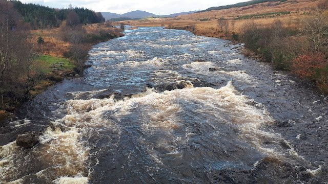
I reached the point where the 1st bridge should have been, it has gone. Instead today an easy burn crossing which could be much more awkward in other conditions.
 |
| Looking back into Glen Douglas and from where I came |
The middle section is thankfully off road through a new plantation. A track leads off to Luss!! The higher Luss hills of Beinn a'Mhanich, Cruach an-t Sidein and Doune Hill kept me company on my right. The stags were now roaring on the section between Doune Hill and Glen Douglas. I had the mini binoculars with me but sadly could not spot them.  |
| The route does stay with the pylons all the way |
Crossed the Glen Douglas road and back on hardpack. Here the real steep up and down stuff began. Wow I was gaining quite a few ascent metres today and the calves were feeling it.
The upside of this section was the views of Loch Long and the Arrochar hills, albeit the drizzle had arrived but this did provide some nice rainbows. Constantly changing light showing off Scotland at its best. The downside was the construction vehicles had made the track a quagmire in many places. |
| Arrochar |
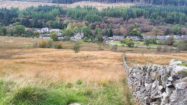
The Ardgartan hotel came into view then the Succoth bend and finally Arrochar itself. It was nice looking down on a section of road that I have driven many times.The track now descends to the waterfall and you have an option to go straight to Arrochar but my route is the continuation along to Tarbet.
No more ups and downs and I was glad to look over the village to where my car was parked, ramble almost over. At the finish there are also good views over to Ben Lomond and yet another rainbow.I knew that this section would be the longest of the route along with the most ascent but in its favour it also had the better views. That did indeed prove to be the case.
Ascent: 615m
Distance: 19.5m
Time: 4.25
Wildlife: Hooded Crow; Rook; Buzzard; Long Tailed Tit; Coal Tit; Wood Pigeon; Stags roaring;