Friday, 2 February 2018

A glorious day to walk up Beneraird

In Pete’s report (Walkhighlands) he had not expected coach loads to follow on and in my case he was right, just me and not another person did I meet until I was almost finished and he was a cottage owner, not a walker.
Pete approached it from the same direction I was planning with the only difference being I started from Ballantrae. It was a glorious day and I was in no hurry so the longer walk suited, adding almost 4 mile to the trip. It also meant doing the hill from sea level so getting the full height workout.
For anyone doing this I turned at the attractive parish church and a couple of hundred yards down towards the sea a car park and a sign for toilets.

Castle and war memorial
Back up to main road, turn right and enjoy the view of the Old Bridge over the River Stinchar. There is a history board just before the bridge, on your left covering the castle, the bridge and the war memorial, worth a read.
Then you have a couple of hundred yards of walking the busy A77, but the grass verge is roomy, just take care, before long you reach the 2nd turn off after the bridge, with a ‘Stinchar trail’ sign.

Cannot get lost
As I wandered up the track wildlife abounded, almost everything I saw was on the first lower half of the walk. Pheasants burst out of the hedge giving me a big start. A large mixed flock of tits/chaffinch etc were engaging. Then as I was looking at Knockdolian I spotted 5 deer hinds in the trees, they had obviously spotted me as well. But it was their size, big, they looked like 5 red deer hinds not the normal roe deer. I was not aware of reds being here but someone reading this might know better.
Look like red deer hinds to me


You can’t really get lost just follow the road until it becomes the track and climb the gates as appropriate. Plenty of pheasant feeders around must be a big shoot here.
One thing that surprised me is the gradient. It is a gentle but continuous incline from start to finish and really has know level sections, very unusual but nice walking.
When I climbed over the gate bordering the moorland section I spotted the red back of a fox wandering away from me through the marsh clumps of grass. Never saw it again but a few minutes later loud agitated pheasant calling from the woodland edge, a warning or prey?

Muddy track
Plenty of sheep around but no moos. Some sharp calling nearby and a pair of buzzards are hunting the grass, targeting voles and mice I presume.
Looking back even muddier track
The path is now a mix of wet slippery grass and outright bog. Gaiters advised as I went ankle deep a few times. The sun is strong and it feels like a warm spring day and I am dressed for winter. Hat and gloves long since in bag and most zips opened, still sweating.
Abandoned or left for another day
Twisting and turning with the path I take the left fork and go through the really boggy section and before long I spot the abandoned farm machine. Not sure if it just waiting for another day.
Thin kissing gate trig up right
Soon after the trig comes in sight. But first the very narrow kissing gate and a short trek across the spongy wet moor to the trig. 1 hour 44min from the car park.
Looking west from trig
The views don’t disappoint if you can ignore the many wind turbines. Like Pete’s review there is a haze so although I can see the Solway, Lake District mountains are hidden from view. Good views across the snow covered Galloway hills, Knockdolian & its twin Ailsa Craig. Arran just in view through the haze. A ferry from Cairn Ryan heading to Ireland.
Ailsa Craig and its twin volcanic plug Knockdolian
Some food and a relaxing stroll back down taking it all in. A lovely little sub 2000 hill with excellent views, glad I was here today. A wonderful feeling of isolation in a remote location, feels very good.
Time: 3.43
Distance: 16.25k (10.10m)
Ascent: 1503ft (458m)


Tuesday, 30 January 2018

A breezy trek up Duncolm Hill

Duncolm 490m
Sub2000/Marilyn
It seems ages since my Cairngorm adventures so I was looking forward to today’s walk. In fairness I had a Munro planned for last Saturday but with the extreme winds up top it was considered to dangerous, the correct call.
Instead today’s forecast indicated a good chance of cold sunshine along with the strong likelihood of being hit by a thunderstorm. Dress appropriately.
My choice was the sub2000 Duncolm, an hours drive and not too high should the weather deteriorate.
The walk began from the Kilpatrick Braes parking area, almost under the Erskine Bridge (signed Kilpatrick Hills car park). Only one other car here this morning but as I was putting on my boots one of the biggest dogs I have seen in my life got out of it, thankfully the owner tugged it the other way. 
Follow that track

The route follows a minor road going past the gas works, boy what a smell of gas, don’t light a match here. It then curves left before you turn right at the next junction - signed 'Path - Kilpatrick Hills'. The tarred lane now leads gently uphill, passing a stone house and later crossing a cattle grid.
The Walkhighlands description of height being gradually gained was not being felt by my legs or breathing. I am not out of condition must be just out of sorts today. 
You cannot get lost, just plod on up the track with the benefit that there are great views back towards the Erskine Bridge and Greater Glasgow, as well as along the Clyde, Greenock etc. A good excuse for a breather The self catering Gavinburn Cottages have an excellent view. From the start the track is 800 feet (244m) of steady climbing to reach Humphrey Loch.
When at the top and off to my right I spot 3 people, pretty far away, I presume on the Slacks.
Loch Humphrey
The wind is chilling as Loch Humphrey comes into view, cutting a heavy chop across the water. No fish rising today, I presume the fishermen are allowed to drive up here unless there is another way in.
The weather has blown rain showers through before and behind me but so far so good.
Trees planted but allowing view of route ahead
As you will see there are stacks of tree planting taking place but they are newly planted so you get a view of the grassy track heading towards the hills.
With all the rain and snow melt the track is now significant patches of very boggy ground as it heads towards the first small hill. Behind which I can see Middle Duncolm, the main target still hidden.
Mid Duncolm
There is a choice of going round the left flank of Middle Duncolm but this is a hill walk so over the top I plod.
Now Duncolm and its trig is a short distance away but there is a slippy grassy descent to negotiate first.
Duncolm from mid Duncolm
Safely down but more boggy ground at the bottom so I simply head up a faint track which weaves its way around the hill and before I know it the trig is in my face.
Nice view to the Campsies from the trig
The trig point is the highest point of the Kilpatrick Hills and the views do not disappoint: the islands of Loch Lomond disappear in a shower but I am compensated by a rainbow forming. The Campsie Fells are briefly in sunshine but give a great view of the ridge. Parts of Glasgow and surroundings can be seen. The Luss hills etc, all in all a nice spot with the moorland and some more lochs down below.
Shower passing nearby
But it is too cold to linger and I head back by the same route. I get hit by the fringes of a squall, the hail stinging my face but I overall got lucky with the weather.
However, on the way down from the loch instead of being alone I pass numerous people, the track to the loch has become very popular, maybe some are even going to Duncolm.
It could be a Highland summer snap
Back at the car park it was now almost full of cars, the blue skies bringing them out.
An excellent short return to the hills.

Time: 3.20
Distance: 14.00km GPS
Ascent: 553m GPS

Saturday, 20 January 2018

A winters walk in Rothiemurchus forest

After the adventures of the last couple of days I had a sub 2000 in mind to have an easy hill walk but with all the snowfall over the last few days and still continuing the journey via the minor untreated roads to it were a no-go.
Hi Range chalet
As the snow was still falling this morning it was the perfect morning for a forest stroll. When I left the motel the colours of the lodges against the blue skies and the snow, picture perfect.
Snowy railway line
Just down from the motel I crossed the main railway line and then the River Spey which was barely flowing. The surroundings were monochrome except one flash of coloured tree which I think is a beech.
Calm River Spey with a flash of colour
No pavements cleared here so it was deep walking and alternating jumping over to the road for easy walking but then jumping back when a car appeared. The snow ploughs had piled up the road verges with deep drifts so getting good exercise. Interesting to note from the electronic sign that the ski road was going to be open today from 9.30, hope it stays that way.
Just after the Rothiemurchus centre I crossed the road and headed up the minor road towards Loch an Eilein.

Heavy snow track
Perfect nobody else around and a tranquil walk ensued. Deep snow drifts and every bush and tree clad in their snow coats. There was the constant noise of falling lumps of snow. One large drop hit my head, I wonder if a squirrel brushed it from the tree.
Cold bedroom
I came across this cottage which appeared deserted, possibly a rental or holiday home. Looking at the bedroom window with the icicles I suspect that would be one cold room to sleep in.
Ponies
Further on a large fence and gate, last time I was here it was full of coos but today it was ponies, thankfully some with their coats on. They all came to say hello but sadly I had no offerings for them.
A couple of runners appeared, no youngsters good on them, we chatted for a few minutes, they were from the Lake District.

Ord Ban
Round the next bend I spot some red deer hinds grazing in the snow over towards the hill of Ord Ban, wild or farmed? 
Where's my pals
When I reach the loch it is snowing heavily but I spend time to take in the views, despite the winter scape there is the odd flash of colour to deflect your eye from the white and grey. I speak to some elderly ladies who are hoping to ski tomorrow, go on yourselves.
Loch an Eilein
I’m hungry and head back to the Rothiemurchus café for lunch. I hear a noise and a cyclist goes past on one of the fashionable fat bikes. I suppose these conditions are ideal but I still think it would be hard work with those big tyres driving them through the snow.
Fat bike cyclist
Arrived at the café to find it is closed for refurbishment, stomach grumbles, so tramp on another mile or so into Aviemore for a late lunch.
A superb low level winters walk that I really enjoyed, great to be out enjoying it.

Dig out time
Once again I have to work off lunch by digging out the car, there sure has been plenty of snow fallen in these parts over the last couple of days.
Distance: 5.91 miles
Time active: 2.42
Ascent: 311ft

Friday, 19 January 2018

Winter Skills Cairngorms Day 2

Glenmore Lodge Day 2.
Once again the day begins with a detailed briefing re the weather expected on our day's activities which is the foundation to route choose accordingly. It was an in depth look at Met office data, local data and Avalanche data. Basically, the day was going to be a lot wilder than yesterday's action, stronger blustery winds possible plus -20 wind-chill, could be interesting.

Meall a' Bhuachaille (round hill of the shepherd)
Before we went up the hill we had avalanche rescue training in the grounds locating a probe as a search team, how to narrow in, using probes then team shovelling techniques all done in a windy snow storm fun and very interesting.
A very short bus trip, soon aborted, to find the access road to the ski centre closed due to weather. This quite unbelievable considering the resort relies on snow. So back to the lodge to re-evaluate the day.
We decided to incorporate navigation training whilst walking up Meall a’ Bhuachaille (round hill of the shepherd) but nor by the tourist trail. We went up a very rough and formidable snow walking route.
Our objective was to use the Harvey walking map 1:40 and compass to get to the summit cairn. Not allowed to cheat and use my GPS!!

Forest track from lodge
We started right outside the lodge and followed an obvious track up through the trees until we reached a track, utilising what little info the map could give to navigate, in this case fire breaks.
Where is the track?
On the next main track we were looking for a non obvious track, the area had been deforested in part which did not help, so distance measuring via map and pacing used. Simple technique but I had not used pacing before and I now know I do circa 66 steps per 100 metres.
We all agreed the spot but no obvious track so we headed in to the forest edge but we were just a bit too soon before the unobvious track was found 10 metres to our right in the snowy terrain.

Lunch
Time to feed the hungry before tackling the open terrain.
Once we broke the trees we were navigating to a fixed spot on the map at 675 metres which had a clear map aspect in the form of a U shape. The terrain was really tough going, straight up a steep incline. Underfoot it was heather based which was mostly covered with deep snow so every step was a real effort. No denying this was tough going, very laboured breathing and I thought I was fit but looking back from time to time others were just as bad. In normal conditions you would at least be looking for sheep trails weaving around the heather but not an option.
Cold, windy, steep
As we climbed conditions worsened considerably with the predicted strong westerly winds whipping up the snow, almost white out at times and very cold when we stopped to take bearings.
Take a bearing
We found the point at 675m following an educated discussion about the map features, took a new bearing and made our way to the cairn which provided some shelter. Not before the wind blew the map out of a colleagues hands, wonder if he had to pay the stores for it.
Group on the summit
Some snaps then a quick decision to descend eastwards via tourist track route, under snow, but al least wind at our back. One of the instructors described the weather as ‘uncomfortable’ an under statement.
Descent looking East
The gods were looking out for us as the weather broke to allow us see the vague outline of the trail and then some good views of the surroundings. The Cairngorm tops had significant spindrift blowing across the tops. Our weather was poor but the original plan up there would have been a lot worse.
Looking south to Bynack Mor
Although we could see the outline path it was too icy under the snow covering so could not be risked for the most part. We had left our crampons at the lodge to save weight, just goes to show, in winter prepare for everything. Instead we had long clambers through knee deep heather and even deeper snow once more, a few falls but no injuries and Ryvoan Bothy was reached. Busy place, walkers were already in situ, fire burning, they were staying outdoors for two days.
Ryvoan bothy
A walk back along the Ryvoan the trail passing the green Lochan and down to the lodge, a cyclist fully laden heading up the difficult track, snow covered and icy, well laden, another overnighter?
Back at the lodge debrief time and cake.
Overall a superb but challenging two days, both mentally and physically which in fairness made me rethink my fitness for long winter high level walking.
Very glad I went as it was a good group and instructors.

Digging out time
Last task was to dig the car out, then I could not get the car up the icy hill to the track. Two of us managed to grit the hill and I just made it up and no more.
Enough excitement for 1 day, I need a beer.

Time: 4.38
Ascent: 1556ft
Distance: 4.86m

Winter Skills Cairngorms Day 1

I was excited to be attending Glenmore Lodge outdoor activity centre, just outside of Aviemore, situated at the base of the Cairngorms. The course I was enrolled on was about winter skills training and we certainly got winter.
View of Cairngorms from Lodge briefing room
A briefing started the day, 7 of us pupils plus the 2 instructors. If full it is a 1:6 ratio but two instructors for seven gave us more personal attention. The first hour was spent reviewing a selection of the available websites that gave us the weather information required to make today as safe as possible. The decision taken was to walk into Coire na Sneachda, exciting a first for me.
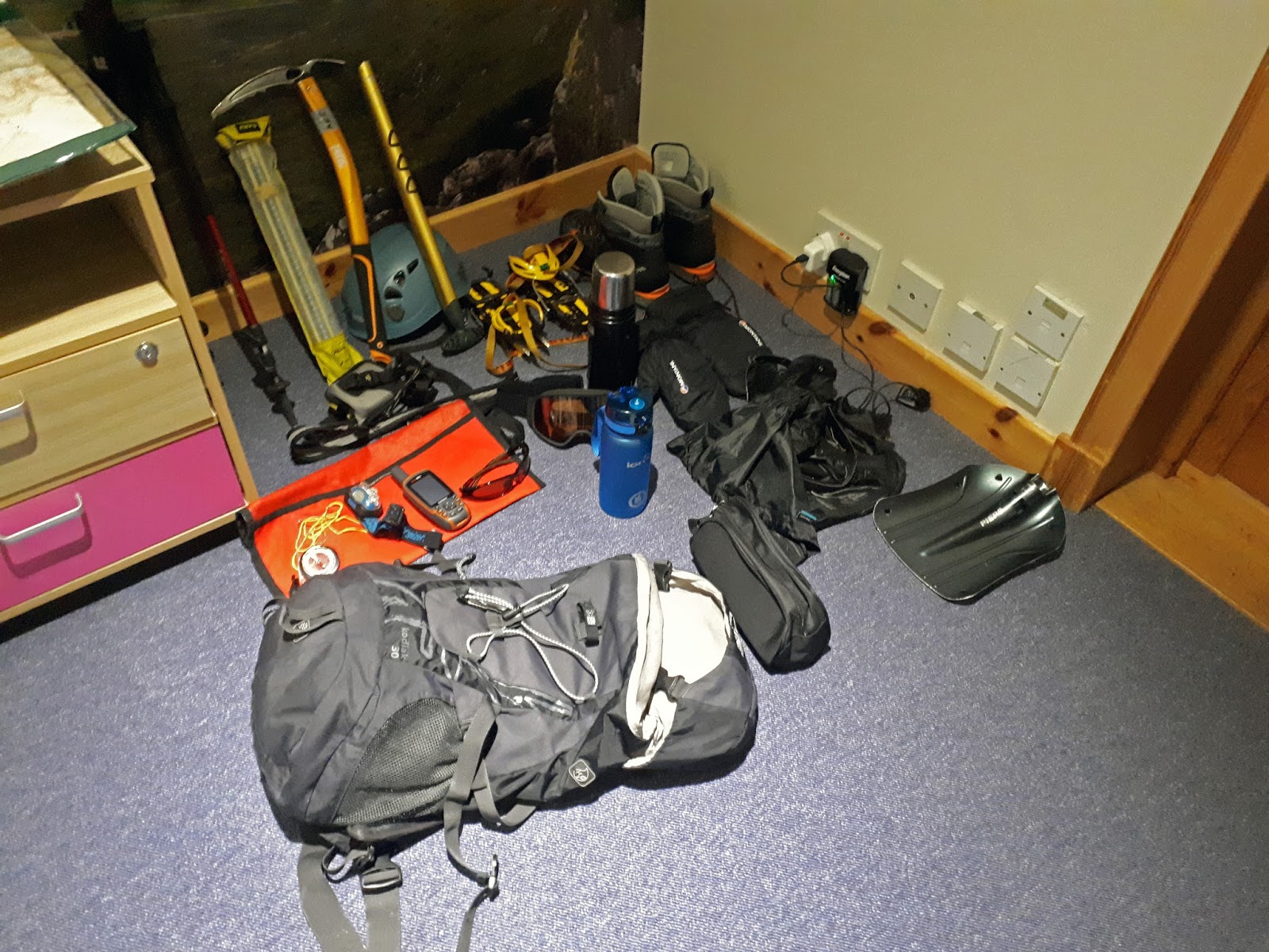
My kit before adding extra clothes
But before going out it was a check of the gear we needed to have compared to what we had and anything that was missing could be picked up from their fantastically equipped store.
Ready to go and it was a short drive to the ski centre.

Lodge Van
As soon as we left the van at the ski centre and went to the path it was time for crampon use. The bridge and path were sheer ice. I had never used full crampons before and what an eye opener, once I got them on, total grip.
Crampons on route directly ahead
Navigation up to and into Coire na Sneachda involved some of us leading for a while, a stop to study the topography, both from our eyes and from the map, taking a correct bearing then onwards and so on. The weather regularly opened up and closed in again giving superb glimpses of the surroundings. Also at times other groups could be seen, some rock climbing, some skiing, other walkers a reasonably busy place for a wild Monday. A party of 10 or so were already strung out climbing the crags up to Cairn Gorm. I don’t think that I would have the strength for that.
Coire Na Sneachda


I took my gloves off for a couple of minutes whilst retying my crampons and when I put my gloves back on I realised how cold it was, my right thumb was painful but recovered quickly, a good lesson. The forecast showed 20-30mph gusts with a temperature of -2 but a wind chill factor of -20. Cold as it was I was pleased that my layering system worked perfectly not needing to add or remove clothing.
All of the snaps in this blog were from my phone as the cold had affected my main camera, it did thaw out for use the next day.
Crampon walking practice
Crampon walking on hilly snowy terrain was a lot of fun. Practising front and side foot techniques very useful.
Crampon and ice axe techniques on snow wall climbing was even more fun. Maybe the best of the day for me, felt like a mountaineer climbing Everest lol.
The winds really picked up at this stage, picking up and swirling the loose snow into white out conditions. Goggles on and they were a godsend, I would not have coped without them. A snow hole was dug to prove its life saving effect from the wind.

Rocky top of Fiacail a Choire Chais
Next was an uphill steep walk up the crags of Fiacail a Choire Chais. This was quite gruelling as it was on deep snow and rocky terrain. The rocks being dangerous for the crampons. It was tough going and energy sapping as each step was knee deep into the soft snow, a zig zag pattern adopted and a lot of heavy breathing.
Up and over the ridge and now ice axe techniques including stop arrest whilst walking without crampons was also a lot of fun.

Team talk


The final section of the day was a long walk back to the ski centre without crampons. Again some of the ground was firm then although it looked the same you plunged straight into knee deep soft snow hollows. This was tough and gave me added respect for snow covered terrain particularly as darkness was falling as we reached the van.
Back to the lodge for coffee and cake but don’t linger the day was not over. A lecture on navigation for an hour, quick dinner then another lecture on avalanches and time for bed, wow a long but very different and exciting day, you only live once.


Wednesday, 10 January 2018

A saunter across North Ayrshire with history thrown in.

Another day and another walk, this time with the KOIR walkers. The route was to be a very mixed terrain walk consisting of the beach; lanes; fields; hills and farms, a few stiles and barbed wire fences to negotiate.
The day started at a car park on the Ardrossan-Seamill Shore and exiting the car the wind was bitingly bitter. Yesterday was far colder according to the car temp gauge but today the wind chill was significant. So between getting the boots on and meeting up there was minimal hanging around before the group was heading towards Ardrossan along the still icy shore.


After a mile or so we turned inland up a country road which was live horses and ponies in every field, a bit unusual.
As we headed further inland the fields were a hive of farming activity and odour. The tractors were spraying the silage and it was clearly potent stuff, not the place to linger for a tea break.

Across several fields and it was time for a tea break beside some quarried stone, feel good factor as sheltered from the wind and despite the haze good views out to sea.
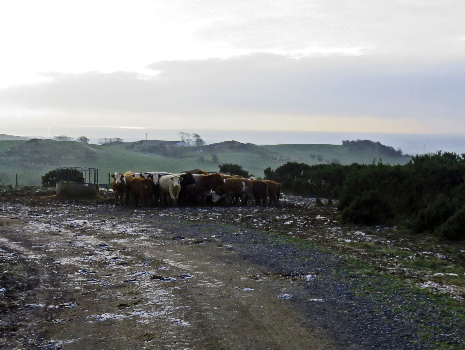
Now we set off for the obligatory wind turbines (Haupland Muir), in the main skipping the flanks. We came upon herd of cows who were eating their breakfast. Disturbed they huddled tightly together and faced us. They were starting to get a little excited by our presence but thankfully we got past them without incident.
The Coos circling
The fields were frozen and rutted with hooves which was just as well, this would be a very muddy walk in different weather circumstances i.e. a bog fest.

Across more fields up to the TV mast and then down towards the new pine plantation below Blackshaw Hill. Good views as we descended across the valley to Dalry, across towards Kaim Hill and over to Hunterston etc.


Soon after this we came across the Neolithic stones marked with the cup and ring symbol. These were carved around 10000 BC (the beginning of farming), that was a very long time ago. Nobody is quite sure what they represent with religion being the best guess. I have seen similar examples before over at the Ballochmyle viaduct area and they are also dotted about the country so there is a consistent reason, just what?

Up another short hike to Lawhill summit which contained a direction pointer. There were also a large number of stones laid out here, cosmetic or historic? Looking down we could see the 'coffin road' track where the Lords of the Isles bodies would be transported to nearby Portencross Castle, before being shipped to their burial grounds on Iona and other places.

We followed that track for a bit before heading down some lanes and farm tracks back to the cars.
Another good day in excellent company with a bit of history thrown in. Every day is a learning day, you cannot beat it.

Time: 4hr 53min
Distance: 8.89m
Ascent: 1161ft