Thursday, 6 October 2016

Deuchary Hill Dunkeld


My expectations were that this was going to be a straightforward smallish hill with attitude and good views. It was, but it turned out to be a lot more adventurous than my expectations, all my fault of course.
I am using the 'The Hughs' book as this years walking guide and too be fair I have discovered some hills and landscapes that I would have passed by.

From my holiday spot in Pitlochry I drove the short distance to the starting point at the Cally carpark Dunkeld. However, I was to follow the A923 which had a road closed sign just by Dunkeld, diversions in progress and two cars three point turning as I arrived at the turn. Not knowing how far up this road the carpark was I was either brave or foolish, but went through the closed signs and found the car park only about 100 metres ahead, good.
A very bumpy quarter of a mile drive, got parked, only car in situ, got gear together and wandered down to signposts which as you can see there are a few paths around here.

Onwards up the Mill Dam track I went, in good fettle, taking in the changing Autumn colours of the countryside. The guide told me that at Glack kennels go through a metal gate. I reached a big metal gate, sign Glack kennels alongside attached to the fence, so through I went. Yes you have guessed. After a mile and more of steady climbing on a newly laid forest track I was doubting myself. 
Wrong track

It just did not seem right. I had not brought an OS map as I thought it would be straightforward and the book had a small map, big mistake. Luckily the phone had a 4g signal in the middle of a forest, surprising as it doesn't have one in Pitlochry!! Google maps confirmed I was in the wrong place although a faint track might have joined up. Not taking the risk as this was a newly laid forest track so back I went.
At the junction, guess what, a yellow marker sign pointing to the right, twat.
Onwards I went hearing dogs barking in the distance, the kennels? The track is good and I went by Upper Hatton and entered an open area. On my left sheep were being ushered in to a field higher up than I. Watching the sheep I then heard my arch nemesis, coos, bellowing behind me. Looking back a herd of black cows with young were moving at pace down the path I was on. Where had they come from? I walked faster heading towards the building I assumed was the kennels. Safety was reached without a coo attack and guess what a big metal gate!!
Track up the side of Mill Dam
Shortly after I reached Mill Dam and then as guided followed the track turning immediately right following the upper path to Loch Ordie. Fully laden Rowan trees all the way up.
Turn Right
You get some water views of the loch, but no fisherman or boats, and a pleasant, sometimes boggy, path up to a ruined bridge where you then take the immediate right fork.

Again the path has some boggy sections as it climbs gently upwards. I have a hill in my view which I mistakenly think is the objective, not for the last time on this walk. On the slopes I spot a deer in the ferns apparently undisturbed by the shooting on our right, grouse shooting I presume with double shots each time.
Easy to miss turn left
This path is actually a route heading for Loch Ordie, Deuchary hill seems to be a by product as you could easily walk by the almost hidden exit from the track taking you up the hill. It seems just a break in the undergrowth, no sign.
Now, there is a faint trail to follow and a short but pretty steep section, my heart was pounding, lost fitness. The track breaks out into a picturesque clearing and I look to my right at the climb ahead. Wrong again as I soon spot that the track actually goes towards the hill on my left. As I plod upwards, head down, sweat dripping, my peripheral vision catches some deer disappearing over a top, I presume I had disturbed them.
Loch Ordie below
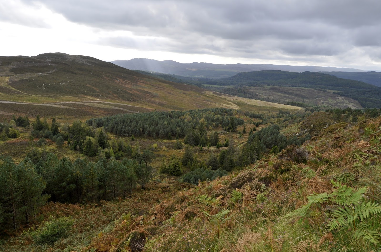
The wind was now pretty strong and cold so outer layer jacket on. I reached the summit and the trig, although it was a grey cloudy day the views are still worth it, albeit not as far and wide as expected. Loch Ordie shows well along with a large white country estate mansion, rich people live down there.
Fallow deer stags
I move the short distance from the trig to the sharks fin of rock which is the true summit when I get my reward for my effort. Two stags are sitting just below the summit, sheltering from the wind. One of them had an unusual coat with a line down its centre and I was unsure about the shape of their antlers. Later research informed me that they are Fallow deer which was a first for me. I watched them for 5 minutes or so before the cold wind decided I was off the top but this is what the effort was worth.
Lochan na Beinne and River Tummel towards Pitlochry
On the way down I spooked a partridge which decided to run down the path in front of me, constantly stopping and looking back, turn into the ferns I thought. On the hill to my left two figures with dogs appeared on the horizon, obviously part of the shooting party, grouse season I presume.
View towards Dunkeld on descent
Back at the kennels I decided to take the cowards approach and avoid the field of cows so followed an alternative track, parallel I thought, towards the Loch of Craiglush. As the trail continued to head in the opposite direction from my destination I got a sense of deja vu from the start of the walk. This time 4g indicated a dead end path. Dilemna I set myself a target of walking a further 1.5 miles and if I had not reached a sign/water/road I would turn back and face the coos. Almost to the mark I saw water and descended to the loch and then walked the road back to the carpark.
There was meant to be a forest trail back to the carpark from the Loch of the Lowes but I did not see it.
Two diversions meant a round trip of 11.97 miles instead of the expected 7-8. Time was 4 hours 44 min. An ascent 1889 ft but all in all a good trek and another 'Hugh' achieved.
Lonely car park
Definitely time for a beer.

Friday, 5 August 2016

Geal-Charn Mor (big white hill) Aviemore

It was a family holiday week in Aviemore but I also wanted a morning to myself and to get in a new hill. A study of the map made it a easy selection of Geal-Charn Mor (big white hill), a Corbett, straightforward route and just outside the town, perfectos.

The weather was cooler than late, cloudy with rain forecast for early afternoon but hopefully I would be off the hill by then.
I had about a 5 mile cycle from our holiday lodge to the start of the walk at Lynwilg Farm, which is just off the A9. You can go further up to another parking area just outside of the scripture union outdoor centre. Do not enter their premises. There is a turning point/small parking area just at the gate which is the start of the Burma road.
Young Pheasants
However, I wanted the longer walk and chained up the bike at the farm. Soon I spotted some young pheasant in the undergrowth and then on the road. Turned out to be a pheasant breeding field with hundreds of them moving around freely.
Small parking area
Through the gate and the climbing starts but with a nice surprise. A wooden structure stuffed full of home baking and an honesty box. Homemade millionaires shortbread, huge and for a quid, my sugar hit for the top of the hill.
The initial stretch is a well worn trail used by the estate vehicles as well, initially climbing through some woods but it is not long until you break out of the treeline.
Yummy surprise
The purple heather is showing well and on the left there are excellent views of Creag Ghleannain which at almost 600 metres is a decent outing on its own and may well offer better views than my destination.
The track meanders gently ever on and upwards. Silence reigns as apart from the odd wood pigeon and meadow pipits there is strangely little other birdlife to be seen or heard. Odd considering there is minimal human activity. But plenty of sheep for company and the flowering purple heather a contrast to the green slopes.
Just after tree line
As it was a last minute choice I had no OS map with me just the SMC Corbett guide description. It's walk description describes coming across a memorial at a watershed then heading across a broad ridge to the summit. 
A stone cairn just ahead
I was now two miles into the walk and as far as I could see no memorial and no trig to be seen on any hills to my left. After around the 2.5 mile point I had crossed over the only burn I was aware of and I could still not see anything up the track. Was this the watershed? I decided to go another half mile then rethink and just as I neared that mark a stone cairn became obvious further up the hill and beside the track. When I reached it there was actually another stone cairn plus the aforementioned memorial which is dedicated to a local gamekeeper.
2 stone cairns plus memorial
I followed the track at the first cairn, which was in good condition, onward up the ridge and I spot my first mountain hare, life at last, closely followed by another 3 hares. I am then surprised to come across a newly constructed fence which had a padlocked gate blocking the path but it had a stile built to the left-hand side for walkers to cross it. Strange what is this about? After crossing I soon spot the trig and follow the track to the summit.
Barren track to summit
The wind is blowing a hoolie and is cold, if I had brought gloves I would have been tempted to put them on, it is July!! I wander around the broad summit taking in the views which despite the weather were still rewarding apart from the new landrover tracks reaching far and wide, planning permission I doubt it.
Geal-charn Mor summit
The rain was already sweeping from the SW hiding the Cairngorms for periods but I was untouched. 
Too cold to hang about I followed my ascent route. I spot a tractor in the distance, which must have came up the Burma Rd behind me, heading into the wilderness. This was the only human spotted all day until back down on the level. Also still minimal birdlife and no raptors, no ravens or crows, except one eagle seen through the binos away in the distance. I had spotted predator traps on beams across the burn so has this estate been killing everything? It looked grouse country but no sign or sound of them either.
Nice views on descent
The views heading down were excellent, there is no such thing as a bad hill. 
On my descent I realised that as I had not hung about on the summit I had not eaten so the shortbread was still in my rucksack, it was superb home baking. Sadly I had no more change or I would have stopped again and taken some home.
My legs were stiff from yesterday's exertions so along with today's activity the thighs and calves were burning on the cycle ride back.
It was a good outing for me, a 10 mile bike ride plus the walk of 8.16 miles, longer than I expected. I climbed almost 600 metres and it took me about 3 hours in total. I was not rushing as I like to spend time taking in the flora, fauna and views so you could knock half an hour off that for faster walkers.

Sunday, 17 July 2016

Scald Law East & West Kip


A pleasant day for another walk in the Pentlands and I'm excited to include a couple of hills, East and West Kip, that are new to me. I have been up Scald Law before but I include it again today to make it a better ridge walk and give me a better workout.
The guides normally bring you up from the Penicuik side but I will be coming from Currie and returning via Balerno to make my circular walk.
Green Cleugh
I take my normal route via Harlaw reservoir heading towards Black Springs and then following the track around Black Hill. Views are excellent including the flat top of West Kip, peeking through the gap. The descent takes you back down into an old drover's pass, Green Cleugh, which is stunning today. I catch a buzzard flying the ridge to my right but more interesting is the very fast raptor flying low just below the ridgeline to my left, trying to flush birds from the heather and scrub. Big, fast with quite pointed wings this looks like a possible Harrier to me but not certain. It swiftly goes back and forth repeating its glide four times before swiftly heading for some trees on Scald Law.
Summit Scald Law, Carnethy behind
A short steep climb up to the ridge which splits Scald Law and Carnethy Hill. I have not climbed a hill since Goatfell as the weather has been so poor but still surprised that breathing is laboured. Up the zig zag hill to Scald Law, the Pentlands highest hill at 579 metres, topping its neighbour Carnethy by a whopping 3 metres. 2nd wind breathing now sorted out.
East & West Kip
There is a trig point here to stop and take in the views and get a good look to the west at today's principal objective the 2 Kips. The spans of the new Forth road bridge can be clearly seen. Just as expected for this year the cold northerly wind is blowing strongly and glad I was not wearing shorts.
Scald Law from East Kip
The entire Pentland ridge is a roller coaster walk so down I wander and climb up the slopes of East Kip. Being so close to Edinburgh these hills are well walked so there is a well worn trail. The views are good and a raven keeps me company, maybe hoping I will throw it some food but none to hand. 
Grouse moor
The wind seems to be even stronger so a brief look around at the nice farmland and moor scenes. The patchwork quilt of Hare hill across the way indicates a grouse moor that has been scorched to create new heather growth. I look back and see a hill runner on top of Scald Law running the track to South Black Hill. Once maybe but too old for that now.
East Kip & Scald Law from West Kip
Up and down and reach the top of West Kip. It is described as the narrowest top on this ridge but it is fine. Looking back I see a runner coming down the flanks of Scald Law, looks like a different person.
I descend and take the trail heading back to Balerno. At first this is a wide expanse of open moorland. Ravens and crows are walking the heather and scrub looking for nests to raid. A call of a raptor and a merlin flies low clearly carrying a bird in its talons. The runner does not pass me so I presume there was a return run back along the ridge.
Carnethy, Scald Law, East & West Kip
Looking back there are excellent views of the hills I have just tramped. To my left I can see people on the ridge of East Cairn Hill, be doing that soon.
As you get close to Balerno you can head back towards Harlaw reservoir but I elect to go to Balerno and walk back to Currie alongside the Water of Leith.
Checked the GPS and exactly 12 miles walked with 1550 feet of elevation so a reasonable workout. Sadly driving home tonight so no beer to look forward to, sad.

Saturday, 25 June 2016

Goatfell Arran

Goatfell from Brodick
Blaming Euro 16 I had not been out for a walk for a few weeks so with the forecast looking good I had pencilled in Goatfell. Then the day before son number 1 turned up, we went out for a meal and a few beers thus changing my plans.
However, the next morning I woke feeling okay so grabbed a quick cup of tea, threw a few things in the rucksack and headed to Ardrossan for the later than planned 9.40 ferry. This would offload me at Brodick about 10.45. I wanted to get up and down Goatfell in time to catch the 16.40 ferry back as the next ferry was not until after 7pm, a wait I could do without.
The ferry was on time and after a black pudding/fried egg roll & coffee onboard I ventured up and spent the crossing outside. Good decision as I briefly spotted a pair of porpoises skimming the waves alongside our boat.
At Brodick I decided I had the time to do the full walk starting from the ferry. There is an option to get a bus saving a couple of miles each way, maybe take it after the descent I was thinking. My usual stop at the Coop for their meal deal and off I went.
The walk along Broddick shorefront on this warm day gave me great views of the Goatfell and anticipation heightened. The route I would normally take along the shore and alongside the golf course was closed for construction work so it was more or less the main road along to Claddach with a brief shortcut through the golf course.

At Claddach turn in at the Arran brewery and the walk starts proper from here. The initial uphill stretch is through the grounds of Brodick Castle although if you see it you have missed the route. There are signposts and so long as you don't take any of the left or right turns you can't go wrong, although I did on the descent, more later.
Lower track
The track is good but narrow through the trees with the benefit that you do get the occasional glimpse of Goatfell. There were a few people around today, probably because it was the only really good forecasted day of the week. 
I was already sweating away, a mixture of the heat, effort and last nights beer. At the bridge and deer gate, about 250 metres, paused for a break, water intake as dehydration was a possibility today, look back and enjoy the views back to Brodick and Holy Isle. About a third of the way up.
Middle section
The middle stretch is open moorland countryside. The 'path' is fairly hard going as it is now mostly rocks and boulders which necessitate a high foot lift, the front thighs will be sore tomorrow. However it is a good restoration by the National Trust and its volunteers. Looking ahead I can spot the occasional spot of colour, walkers amidst the boulder strewn terrain. Because of the rocky terrain you need to keep looking at your next step so enjoying the view is limited. However at one look up I spotted the familiar huge shape of a golden eagle gliding below the summit, circling a few times then swinging West over the tops not to be seen by me again.
Surprisingly I was moving well and had overtaken a few people and was heading for the horizon to the point near Meall Breac, about 600 metres, where the route takes a sharp left and the steepest section beckons.
Around this point a runner comes past me descending at an alarmingly fast pace, brave man. The record for the annual run is around an hour and a quarter, the physical effort going up is admirable enough but the descent at speed on this stuff, unbelievable. A light wind is blowing up here but enough to make me put on the windproof jacket.
Holy Isle
The ant trail of walkers ahead of me has grown as the gradient takes it toll and the pace slows down dramatically. There is no obvious path just finding the best route up the smallest boulders to step on. I am now regretting last nights beer and good food, it is tough going, thirty steps then thirty seconds rest, sort of thing. Also a serious wind starts blowing which on tired legs on this granite is not welcomed. A gust blows my baseball hat off, thankfully into the rocks and not down the gully, so it is retrieved but stuffed into pocket. It lasts about 10 minutes but interesting if you were on an exposed ledge.
Cir Mhor
Then you notice the gradient has eased a bit and thankfully this is the summit area. You need to wander about a bit to get the views but they are absolutely stunning and fully worth the effort. They say that Arran is Scotland in miniature and these views remind me of Skye, rocky peaks and gullies, just breathtaking. Other Corbett's, Casteal Abhail and Cir Mhor stand out in clear the air. Four ravens swoop and play above us. They intrude in a couple of my snaps, makes them looking like a mark on the lens but I know what they are. The path to North Goatfell and the Saddle from Corrie stands out. I can see 3 pairs of walkers at different points.
North Goatfell
I eat my sandwiches just soaking the view in, a herring gull lands on a rock, staring at me, will he give me a scrap or not it thinks? The ravens 'caw' overhead. On a day like this you don't want to leave but I do have a ferry to catch. The descent is obviously quicker but is also sore on the legs.

My one issue comes at the bridge where I met up with a walker and he asked if we were on the right track. Surprised at this I reply yes and a woman walking her dog assures us we are on the right track. However after about half a mile we realise we are too high up entering the forest. The OS map indicates the track would eventually loop back but we take no chances and we re-track back to the bridge where somehow we missed the fairly obvious route marker to the other path. Tiredness or just lack of concentration, I don't know but a good reminder all the same.
A good descent and I walked back to Brodick, stopping for a welcoming ice cream cone, large, and I made the ferry with 30 minutes to spare.
According to the GPS I walked 12.48 miles (can be shortened by 4 miles if buses used) and climbed 2944 feet. Goatfell, a Corbett, is a better achievement than many Munros as it starts from sea level climbing to its official height of 874 metres. It was tough walk but the views are certainly worthwhile and as good as they come.
Time for that beer.

Tuesday, 7 June 2016

Rahoy Hills - Black Water River- Gleann Dubh


I had completed my 30 mile cycle this morning along the stunning Sound of Mull so I was looking for an easy but interesting walk and boy did I find one. Our cottage in Ardtornish had a folder with some short walks so we chose this one as Mrs would be accompanying me so not a long one.
The following details are taken from the Rahoy website and saves me typing:
There are excellent views on route of the surrounding hills of Braigh Uladail to the east and Meall Achadh a’ Chuirn and Monadh Meadhoin to the west, and Meall Lochan nan Lorg, Mam na Cѐire, Meall a Chaise, Tom Aonghais, Beinn Bhan and Beinn nam Beathrach to the north. 
The route passes through Atlantic oakwood, open heath and grassland. These Atlantic oak woodlands, designated as a Special Area of Conservation, support diverse assemblages of lichens, mosses and liverworts, as well as a species rich ground flora, dominated by the compactly tufted purple moor grass (Molinia caerulea), interspersed with hard fern (Blechnum spicant), male and butler ferns (Dryopteris spp ).    Calluna-Erica-Vaccinium assemblages dominate the open areas of the hillside, with bog myrtle (Myrica gale), bog asphodel (Narthecium ossifragum), cotton grass (Eriophorum angustifolium) and heath spotted orchids (Dactylorhiza maculata) in the wetter areas.  Look out for patches of insectivorous sundews (Drosera spp) and butterwort (Pinguicula vulgaris), as well as the mixed bryophyte communities in the boggy areas.   There are also intricate patchworks of lichens on boulders and outcrops.
Look out for golden eagle, buzzard, golden plover, greenshank, stonechat, skylark and red deer in the hills and heath.  Listen out for tree pipit, flycatchers, redstart, redpoll, wood warbler, siskin and greater spotted woodpecker in the woodlands.  Look for dippers and otters in fast flowing sections of the river.  Along the route seek out the tracks and signs of pine marten, wildcat, short-eared owl and fox. Overall, a good place for seeking out wildlife associated with hills, mountains, heath, woodland and rivers.
The route is a mixture of gentle ascents with flat sections along a well-defined track. 
It was already 20 plus degrees when we parked the car and made our way up the initial section which is a gradual steady climb on a decent path. Already good views of the Rahoy Hills particularly the flanks of Meall Achadh a'Chuirn on our left, a few sheep grazing the steep slopes. An excellent variety of trees some of which we could actually identify. 
Black Water river
There was a constant display by brown/orange dragonflies, blue damsels abound. Strange as these blue ones only get seen on my trout water at the end of summer. Patches of cotton grass sway in the gentle breeze. 
Cotton grass
Disappointingly not much birdlife in the trees. We spotted the occasional chaffinch and blue tit as well as a dipper in the river but not a lot else. No raptors the entire walk, very disappointed in that.
U formed hill view
Further along the track there were pools of water drying out. In one were about 20 tadpoles but with no forecast of rain the future was not looking good for them.
Stranded tadpoles
Just as we left the trees a cuckoo flew past going into them. At one point we had 3 different males calling. Over the last month cuckoo's calling has been a constant for me, no shortage of these males.
Meandering Black Water River
Once out of the treeline there is a real feeling of large scale wilderness only marked by the Black River meandering through the glen. Although wide spaced there is still a feeling of enclosure, not threatening but a real sense of isolation. 
Then I spot movement on the ridge of Beinn Chlaonleud, get out the binos and yes there is a solitary stag looking into the glen, at us I don't know but pretend so. As it turned out the only one we saw all day.
As we cross the old bridge over the river small brown trout can be seen moving across the rocky bottom, I don't think these will have seen many artificial flies.
Mountain other side of Loch Sunart peeks over
The walk heads towards a ruined homestead and the views north are spectacular and rugged. These apparently bare, stony hills come together to give you a U shaped perspective, quite stunning. No doubt before the clearances many families made a hard living here but now not a sole bar us. We walk on towards a more modern house at Crosben (a place name on the OS map), empty but looking in reasonable condition, I wonder if it is an estate shooting lodge.
Barren countryside
Our walk description ends here and it was enough for the Mrs. The return is by the same route.
The old and modern
However, later whilst relaxing with a well deserved beer (Jarl) I was studying the OS map which shows a low level trail continuing further up the glen heading north then east to eventually join up with the road to Lochaline/Loch Sunart. I also spotted a couple of hill lochs worth a diversion from the track and will explore with my travel rod on my next visit.
Golden-ringed butterfly
On the way back we had some great close views of Golden-ringed dragonflies, big, the female is the UK's longest dragonfly. Then on the track a pearl-bordered fritillary butterfly wings spread sunning itself.
Pearl-bordered fritillary
The distance was just under 6 miles with only 300 foot of elevation but boy it seemed like the walk was wort much more. Do it if you can.
Mrs had enough heading home