Showing posts with label Morvern. Show all posts

Monday, 4 August 2025

A fine day for an outstanding hill.....Beinn Resipol

Hill: Beinn Resipol (Homestead)

Type: Corbett

Height: 845m


This was my 4th attempt to bag this cracking hill which has been on my to-do list almost since I started hillwalking. On the other occasions my free day had been wet and/or cloudy but I was holding out for a clear weather day as I knew that the views would be spectacular and today was one such a day. The SMC book describes the view from the top as ‘ one of the finest views along the West Highland coastline’ so not too be missed.

There are two options for the ascent and I chose the one from Resipol caravan site which is arguably tougher, longer with a greater ascent as starting from sea level. But, you do have the conical view of the hill whereas from the eastern approach the summit is of the flatter ridge and not quite so scenic.

I had been warned that the walk from here could be a bog fest but I was confidant that after these weeks of no rain the going would be ok.

Lovely view down Loch Sunart at the start

I was aware that the caravan park had changed hands and was not sure about parking but good for them they have left space for about 5/6 cars for hill walkers.

It was a very quick boot change as the midgies were in full biting mode, wow, should I get my head net out?


Headed off through the beautiful oak woods full of birdsong and thankfully no midgies. A short open section before hitting a mixed natural wood, there was good shade for a while. I was struggling to get a good walking/breathing rhythm as the track steepened.

The boggy (dry) section

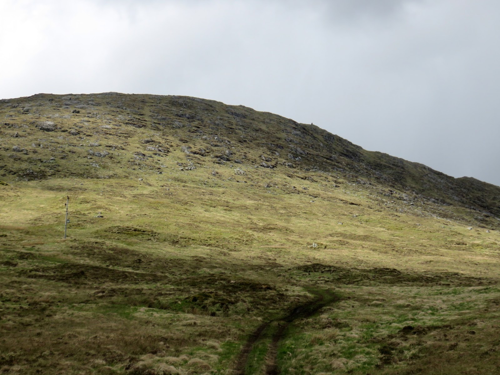
Out on the hillside I now had a view of the hill which it looked quite steep from here. This middle grassy section was the bog fest and although it had dried up considerably there were still many unavoidable boots in mud sections but a lot better than it might have been.

Then onto rougher ground following the right hand side of the Allt Mhic Chiarain where it enters a nice narrow gully. The track is very narrow at times and is easily lost particularly as the ascent steepens sharply and slight hands on sections add to the interest.

Looking ahead I could not see any obvious route but the as I gain height the track does begin to head towards the bealach on the left of the summit. It looked very craggy but I was sure a route would be there.

Large cairn is up there

A slight plateau is reached and you could head up at any spot as there were a few narrow grassy sections between the boulders.

Views east Ardgour Corbetts forefront Mamores behind

Loch Sunart

But I continued on the rising plateau until it almost drops away before making my meandering route upwards through the boulders to the top.

Loch Sunart to left Loch Shiel on the right

A short easy scramble leads to the top and its huge cairn. Then a wee scramble up the stones to the wooden pole marking the summit.

Loch Shiel back to Glenfinnan

The SMC description did not mislead. The views, despite the slight haze, did not disappoint. Quite stunning a widespread as the snaps show.

Back down via the lochan

Sadly up top the midgies had returned now supported by clegs, I killed two of them before deciding to down by the same route.

Eigg on left, Rum behind

Back at the car I was delighted to find that there was a breeze and it was midge free, yippee.

Today was a top ramble to a fine peak and I was so glad that I had waited for that blue sky day. Also worked up a good appetite for the taster menu at The Kilcamb Hotel which was only a few hours away.


Ascent: 868m

Distance: 12.9km

Time: 4.56

Wildlife: Mistle Thrush; Greenshank; Meadow Pipit; Grey Wagtail; Cuckoo (h); Woodpecker (h); Willow Warbler;

Sunday, 4 October 2020

A walk in cloud and sunshine.....Morven

Hill: Morven

Type: Corbett

Height: 872m

My final outing of this trip was the second most easterly Corbett which is situated in beautiful Deeside. Morven finished the triangle of hills that I wanted to complete in this area. The others have been technically Cairngorms, I suppose something has to be over the boundary. No good lady today so a solo ascent should be a little bit quicker.

Although it was a slightly longer drive to the start I tackled it from the normal shorter but steeper eastern side. What an beautiful atmospheric early morning drive as the light and heavy mist rippled through the trees all the way, stunning.

No other car in the parking area and a red squirrel ran closely past as I tied my boots, only feet away and apparently totally unconcerned. smile on my face.

Smile disappeared as I checked my GPS to find that I had not downloaded my route. It was a last minute decision as I was originally going to walk another Corbett but still a silly error. I also knew I had no map for this section. The clouds were low but I decided to take a chance that there would be a track although looking from here there was nothing obvious.

Ruined cottage and lower slopes of Morvern
I remembered that I had to go past the ruined farmhouse and go through the gate onto the moor, so that bit was straightforward. From here there were two faint tracks, right or left. Both quickly disappeared into the heather.

Narrow wet track into the clouds
I opted to right and indeed there was a narrow track through the heather. Only issue was the heather was wet and I had not put on gaiters. Result was I had to brush past the heather my trousers from knee down were soaked, should I give up? No kept going and rewarded with a Black Grouse bursting out of the heather just in front of me.  

The first 300m section was steep and then got steeper, this got the lungs blowing and the pores exuded last nights very tasty Australian Pinor Noir. The clouds were coming and going and when they stayed it got cold but the narrow track continued.

Is that the top, of course not false top number 1
Above the clouds for now and onto a flatter boggy section before another short steep climb to the large mid cairn. Gun butts line the flanks but quite a few red grouse have survived so far. Then it repeats flat then steep. 

Finally summit in view, large cairn on left, cairn and trig on right
Finally the angle of gradient eases and the large cairn can be seen. The wind is bitter but the clear air gives fabulous views.

Red kites
I was glad to reach the sheltered trig to get a mid layer on. Also delighted to see a pair of red kites flying slowly and fairly close but the sun hindered my view of them. They seemed equally unconcerned with the buzzing ravens. Great views across Deeside but Lochnagar has heavy cloud cover.

Heading back to Mid cairn with Deeside countryside
Decided to just descend by the same route. I knew there was an easier less steep descent but as I was not sure where the track went no point. The descent was more awkward than the ascent as the steep path was full of loose stones/rocks and heel slipping dirt.

Back into the hanging clouds
Glad to get back through the lingering clouds. An excellent little Corbett and in good time.

Below clouds sun shining and after the moor lush fields looking down to the start
Although we have had a couple of poor days overall it has been a rewarding trip. This area never disappoints with plenty more unconquered hills so health permitting I will be back for years to come.

Wildlife: Red Squirrel; Red Kite; Red Grouse; Black Grouse; Meadow Pipit: Wheatear; Raven

Ascent: 674m

Distance: 7.7km

Time: 2.42


Sunday, 21 May 2017

Beinn nam Beathrach Right day wrong hill

The trig will be slightly right of the gorge
There are times when you go for that unplanned hill and you get a pleasant surprise, this was one of those days. But it might have been different.
On a few occasions when driving between Loch Aline & Strontian I had noticed a prominent trig that I could also see from the hotel in Strontian. From the parking area altitude it looked like a quick hour or so up and down. It was our last afternoon and we had nothing planned. Plus I had read about a recent post about Beinn Chlaonleud decided to tick another Marilyn.

The masts and the hill
I was happily surprised that Mrs B wanted to walk after her exertions yesterday but we took the short drive to stop at the parking area beside the track leading to the two masts. The cairn prominent up to our right. Visibility was good, no need to check the map!! See later.
The cairn just visible slightly right
Immediately Mrs B stood in a black gloopy mudhole and was not a happy camper, not a good start. We followed the short boggy track to the first mast and then basically headed up the slope following the line of least resistance through the tussocky grass and wet patches.

Once we reached a steep section, hands required at times, Mrs B decided that was enough for her and she would sit, take in the view and do some sketching. Happy to let me go to the top, shades of Arran a couple of weeks ago with my pal. Time pressure again.


With the angle you no longer see the top so just keep going on your line. As you gain height many large boulders abound. About 30 minutes after starting I broached what I thought was the last level, no steep climbs left. I headed upwards on a right angle and before long I spotted the cairn away to my right. Now the brain starts functioning and I realised the problem, there was higher ground behind the cairn, so it was not the trig point.

Cairn over there, Resipole in the distance
I walked over to it and the views are indeed special, well worth the short climb, and yes I can clearly see the hotel as well as the hills Garbh Beinne I think, and its surrounding peaks. As I turn and look through the gap it could be Kentallen and the road to Oban. Resipole to my left.

So time to get the OS map out and then realised I was on Beinn nam Beathrach and not Beinn Chlaonleud. This cairn does not show on the map so not sure why it is there, just a better viewpoint from the one above? What a tube, on another day that could have been a serious error but today my concern was timings to get back to Mrs before she panicked. I had a phone signal but she did not, so no communication, txt just in case.

Through the gap Kentallen area
Luckily from the map I had completed almost all the climbing, the trig was only about 30 metres higher but about 10 minutes away to my north west. A quick hike meandering around the small lochans, a large plateau terrain, wish I had more time to explore, views opening up all the time but only time to get to the trig and immediately back down looking to my right at what should have been my target.
Balancing act
Well down the hill Mrs B could be seen pacing about, looking up and now glad we could see each other. Trekked back to the car where Mrs B put her foot in the same bog she had at the start, I could not believe it, more unhappiness!!
Again hoping for an eagle but nothing to be seen, not even any red deer although a few prints in the mud.
At least it is another sub 2000 completed, I did get to the cairn that I planned to, the views were superb and Beinn Chlaonleud remains for another day. Finally a reminder to look at the map before starting.
The trig is 582 metres but my ascent was only 301m. Time taken was 1 hour 23min (but if not in a hurry add another half an hour at least to walk around and take in all the views) and distance walked was 2.03 miles (3.27m).


Tuesday, 7 June 2016

Rahoy Hills - Black Water River- Gleann Dubh


I had completed my 30 mile cycle this morning along the stunning Sound of Mull so I was looking for an easy but interesting walk and boy did I find one. Our cottage in Ardtornish had a folder with some short walks so we chose this one as Mrs would be accompanying me so not a long one.
The following details are taken from the Rahoy website and saves me typing:
There are excellent views on route of the surrounding hills of Braigh Uladail to the east and Meall Achadh a’ Chuirn and Monadh Meadhoin to the west, and Meall Lochan nan Lorg, Mam na Cѐire, Meall a Chaise, Tom Aonghais, Beinn Bhan and Beinn nam Beathrach to the north. 
The route passes through Atlantic oakwood, open heath and grassland. These Atlantic oak woodlands, designated as a Special Area of Conservation, support diverse assemblages of lichens, mosses and liverworts, as well as a species rich ground flora, dominated by the compactly tufted purple moor grass (Molinia caerulea), interspersed with hard fern (Blechnum spicant), male and butler ferns (Dryopteris spp ).    Calluna-Erica-Vaccinium assemblages dominate the open areas of the hillside, with bog myrtle (Myrica gale), bog asphodel (Narthecium ossifragum), cotton grass (Eriophorum angustifolium) and heath spotted orchids (Dactylorhiza maculata) in the wetter areas.  Look out for patches of insectivorous sundews (Drosera spp) and butterwort (Pinguicula vulgaris), as well as the mixed bryophyte communities in the boggy areas.   There are also intricate patchworks of lichens on boulders and outcrops.
Look out for golden eagle, buzzard, golden plover, greenshank, stonechat, skylark and red deer in the hills and heath.  Listen out for tree pipit, flycatchers, redstart, redpoll, wood warbler, siskin and greater spotted woodpecker in the woodlands.  Look for dippers and otters in fast flowing sections of the river.  Along the route seek out the tracks and signs of pine marten, wildcat, short-eared owl and fox. Overall, a good place for seeking out wildlife associated with hills, mountains, heath, woodland and rivers.
The route is a mixture of gentle ascents with flat sections along a well-defined track. 
It was already 20 plus degrees when we parked the car and made our way up the initial section which is a gradual steady climb on a decent path. Already good views of the Rahoy Hills particularly the flanks of Meall Achadh a'Chuirn on our left, a few sheep grazing the steep slopes. An excellent variety of trees some of which we could actually identify. 
Black Water river
There was a constant display by brown/orange dragonflies, blue damsels abound. Strange as these blue ones only get seen on my trout water at the end of summer. Patches of cotton grass sway in the gentle breeze. 
Cotton grass
Disappointingly not much birdlife in the trees. We spotted the occasional chaffinch and blue tit as well as a dipper in the river but not a lot else. No raptors the entire walk, very disappointed in that.
U formed hill view
Further along the track there were pools of water drying out. In one were about 20 tadpoles but with no forecast of rain the future was not looking good for them.
Stranded tadpoles
Just as we left the trees a cuckoo flew past going into them. At one point we had 3 different males calling. Over the last month cuckoo's calling has been a constant for me, no shortage of these males.
Meandering Black Water River
Once out of the treeline there is a real feeling of large scale wilderness only marked by the Black River meandering through the glen. Although wide spaced there is still a feeling of enclosure, not threatening but a real sense of isolation. 
Then I spot movement on the ridge of Beinn Chlaonleud, get out the binos and yes there is a solitary stag looking into the glen, at us I don't know but pretend so. As it turned out the only one we saw all day.
As we cross the old bridge over the river small brown trout can be seen moving across the rocky bottom, I don't think these will have seen many artificial flies.
Mountain other side of Loch Sunart peeks over
The walk heads towards a ruined homestead and the views north are spectacular and rugged. These apparently bare, stony hills come together to give you a U shaped perspective, quite stunning. No doubt before the clearances many families made a hard living here but now not a sole bar us. We walk on towards a more modern house at Crosben (a place name on the OS map), empty but looking in reasonable condition, I wonder if it is an estate shooting lodge.
Barren countryside
Our walk description ends here and it was enough for the Mrs. The return is by the same route.
The old and modern
However, later whilst relaxing with a well deserved beer (Jarl) I was studying the OS map which shows a low level trail continuing further up the glen heading north then east to eventually join up with the road to Lochaline/Loch Sunart. I also spotted a couple of hill lochs worth a diversion from the track and will explore with my travel rod on my next visit.
Golden-ringed butterfly
On the way back we had some great close views of Golden-ringed dragonflies, big, the female is the UK's longest dragonfly. Then on the track a pearl-bordered fritillary butterfly wings spread sunning itself.
Pearl-bordered fritillary
The distance was just under 6 miles with only 300 foot of elevation but boy it seemed like the walk was wort much more. Do it if you can.
Mrs had enough heading home