Monday, 20 July 2020

A ligament test on the hill with two names.....Mealna Letter aka Duchray Hill

Walk: Mealna Letter
Category: Graham
Height: 702m

Walkhighlands: ‘Mealna Letter - alternatively known as Duchray Hill - divides Glen Shee from Glen Isla, and is a fine viewpoint. It lies to the north of the much better known Mount Blair’.

Today was a big test for the achilles/tendon before the big weekend, if I did not pass this I would not be attempting them. I picked this hill knowing it was pretty much grass all the way, the tussocks would twist and turn the foot so a real test without the hard ground.
The weather had changed en route from the miserable damp start to the day the weather front was passed as I entered Perthshire even some blue skies, they still exist.
Mealna Letter
It was a lovely drive and but pleased to get parked up and ready to go. The last time I attempted this a shoot was on, large guns, so advised not to risk it!
After a dozen strides the pain was intense as the boot was tight on the Achilles. Back to the car, thankfully I had my leather boots for tomorrow so changed into them and thankfully much better but for how long?
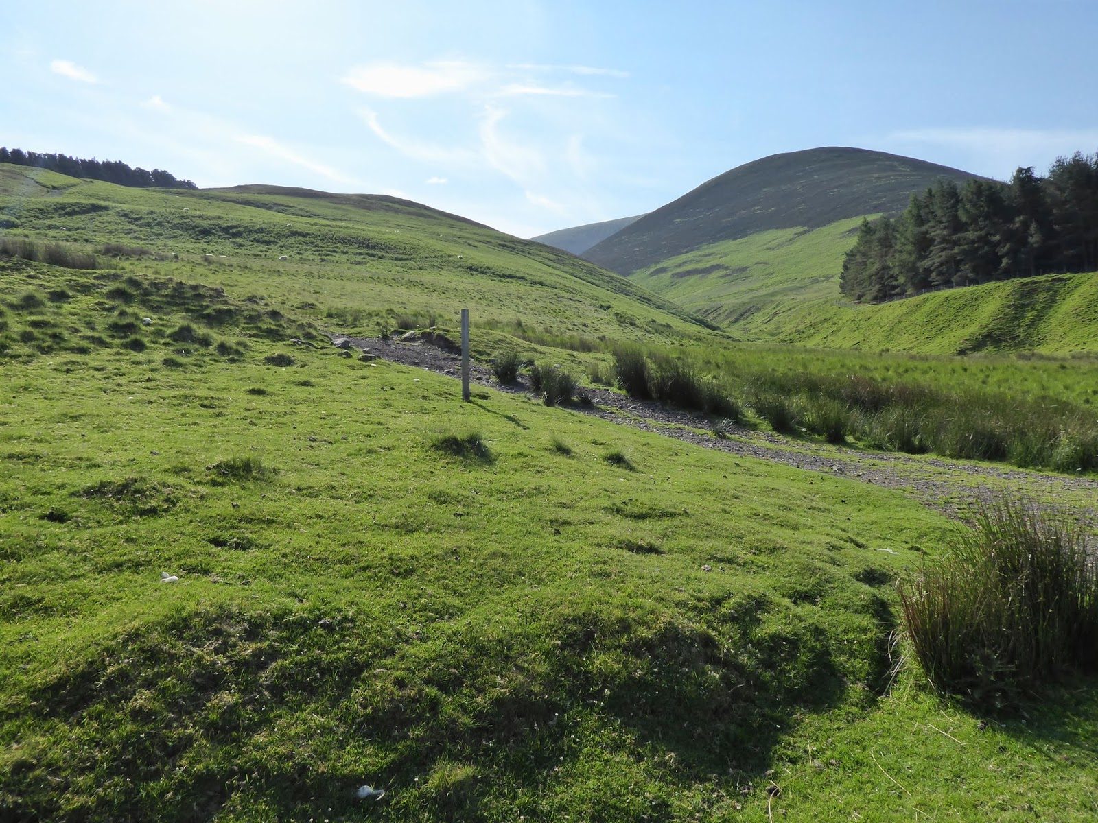
I knew that the initial stages would be boggy and this proved right. Indeed some of the tree planting meant hidden holes, almost up to my knee in one, care required.
The temperature had risen and in these humid damp conditions the flies surrounded my head by the hundred, please some wind.
Butterflies were out in numbers including ringlet, fritillary and small heath.
Bog over ridge ahead
No navigation problems up the side of the treeline, then turn east and follow the stone dyke all the way.
After the boggy section there is a faint track in the grass which made walking easier.
Superb views
Taps aff then back on again as when I crested the ridge the wind was blinking fresh. However it was compensated by the magnificent views up the Spittal of Glenshee and to the Munros beyond.
The big gate is the section that opens!
At one stage there is a new deer fence. Although there is a gate it is substantial and would take at least two people to lift. So a climb over required. The wooden straps are not substantial I can see them broken before long, stupid, why no walkers gate?
Cairn spotted across the way
There is some remote land out there and as I enjoyed the view a large shape rose into the sky. Even with the naked eye the size meant a Goldie and the binos confirmed. A few low level swoops across the moor then it found an updraught and spiralled higher and higher until it disappeared.
Loch Beanie down below
Before long I reached the top and soaked in the beautiful panorama. A sweep from the Cairnwell hills, Lochnagers cairn prominent and the steep sides of Mayar & Driesh take it all in, stunning.
Looking down, the small Loch Beanie looks a good brown trout water, I suspect it does not get many visitors.
The sun was out but time to get back down.
Descent, Mount Blair on left
On the descent super views of Mount Blair. On the slopes a couple of workers were still planting the new trees. It will be a few years until they block any views.
Back at the car and although I was in some discomfort I was pleased. Now a case of seeing whether it stiffens up in the morning.

Wildlife: Golden eagle: Buzzard; Wheatear; Flock Thrush; Meadow Pipit; Fat voles; small brown lizard; Common blue; Ringlet; Small Heath; Green fritillary.
Ascent: 409m
Distance: 8.2km
Time: 2.35

Friday, 17 July 2020

The AOIR are back in action.....Meaul

Walk: Coran of Portmark/Bow/Meaul
Category: Donald x 2
Height: n/a
Today was the first outing of the year with the AOIR. Due to the COVID restrictions we had 4 different small groups out at different places, social distancing of course.
The start a tranquil country scene
My group were out covering some of the Rhinns of Kells which included two Donald category hills. Although I have been tramping the hills recently and have reasonable hill fitness this was the first big one for the others.
Carsphairn Lane (burn)
We started off from the Green well parking area and noted how high the Carsphairn Lane was running, maybe overflow from Loch Doon? We followed the Garryhorn farm track up to the abandoned lead mining community at Woodhead. All that is left are some ruins and a chimney stack. Hard to imagine that a community of around 300 people lived here including a church, school and library.
Mine ruins and our ridge behind
There are good views of the hills but the forecast is for poorer weather lunchtime onwards.
There is a reasonable ATV track to follow climbing up to the tops but some of it is pretty muddy. Two frogs spotted in quick succession, one small and brown, the other much larger yellow and black. Luckily I spotted them before squishing them.
ATV track
The first high point was Coran of Portmark a Donald category. Good views of the track ahead but today's summit, Meaul, is in the cloud.
Looking down on Loch Doon
The Rhinns are by and large good high level walking and we soon reach the cairn at Bow which provide us with excellent views over Loch Doon and countryside.
Ridge to Meaul
The weather deteriorated and once again we could not find the Covenanters stone where one was shot and killed, third time unlucky, one day I will see it. Garryhorn farm was used as a base to hunt down Covenanters in the hills. The dragoons leader, Grierson of Lag, was believed to be in league with the devil and a black corbie (raven, crow or rook) sat on his hearse until it reached his grave.
We headed on to Meaul for lunch, sheltered beside some rocks as the rain got heavier, soggy sandwiches and a shorter than planned lunch break, nae views anyway.
Before the rain
The decision was to return by the same route as we were not convinced that the Garryhorn burn would be safe to cross, bearing in mind how high the Lane was running.
Featureless moor
Once the clouds lifted there were excellent views of the rugged landscape and a reminder of how long a walk in it is. Opposite Cairnsmore of Carsphairn never lost its cloud covering.
An excellent higher level walk, apart from my Achilles which was throbbing, not good news, need icing and Ibuprofen before the weekend.
Overall nice to get some chat with friends not seen for a while, a good day out.

Wildlife: Pied Wagtail; Meadow Pipit; Ringlet butterfly: Frogs (Common).
Distance: 18.4km
Ascent: 787m
Time: 5.34

Monday, 13 July 2020

A short walk to the memorial of the man who predicted his death....Bennan

Hill: Bennan
Category: Sub2k
Height: 385m

Yet again my original plan was for a big walk today but my troubled Achilles was still sensitive so opted for a short and easy new Sub2k.
Last nights weather forecast said that ‘a high’ would keep the poor weather out in the Atlantic. Somebody never told Dumfries & Galloway. As I drove down the weather gods were not playing ball as the clouds got lower and lower, grey to black and spots of rain on the windshield.
Start with Bennan top visible to right of sign
Once again I headed into deepest Galloway's single track D roads and a lovely drive it is. From miles away I spotted the monument on top of Bennan.
GPS got me right to my parking spot where as I emerged a fair old breeze was blowing, no sun tan lotion required. The inevitable Red Kite flew over, no problems with their numbers down here.
The walk is signposted to the monument but in the past was a full on moorland crossing. Times have changed. The local estate have bulldozed tracks throughout the landscape one of which twists and turns its way almost to the top.
Estate track to top
I wanted an easy walk but not this easy. In fairness with the weather lowering my motivation I just took the easy option.
Plenty of meadow pipit family groups around with the odd skylark but not much else. Too cold and windy.
Large cairn for small hill
Still enough was enough so tramped into the heather and moor and headed for a decent sized cairn. Why this is there can only be a guess, a memorial to a shepherd or farmer?
Memorial now in view
There are a few sheep tracks to follow but this is easy walking.
Now the real memorial is reached and it is as big as I thought when spotted from miles away. 
Cairnsmore of Fleet
The story of the memorial to John Turner is an amazing tale of the man who predicted his death!! I have included this link if you are interested and it is worth a read.
Impressive memorial
https://www.dunscore.org.uk/johnnie-turner-sp-118.html
Despite the minimal effort there are really good 360deg views from up here.
Looking south: Dumfries on your left, Criffel and the Solway behind with the English coast also in sight but not the Lake District hills. 
Durisdeer Hills
Turn a bit and Cairnsmore of Fleet off to the right. Turn a bit more and the Carsphairn hills, a bit more Wanlockhead and Durisdeer hills. In addition the nearby local farming countryside, definitely a nice spot.
If you want the sound of silence this is perfect, the odd birdsong and farm animals and that was it, no traffic noises, excellent.
Solway and Criffel in distance on right
Headed back down the same way taking in the view. Flushed a buzzard out of the heather, did not see it go in or if it had some prey. Achilles still the same but still have a weeks recovery before the real stuff begins to make the most of what's left of this season.

Wildlife: Red Kite; Buzzard; Meadow Pipit; Skylark.

Time: 1.12
Ascent: 256m
Distance: 4.1k

Saturday, 11 July 2020

A Campsie hills ramble.....Earls Seat


Hill: Earls Seat
Category: Sub2k
Height: 578m
I have had a inflamed achilles for a while so changed my plans at the last minute and opted for another new Sub2k, Earls Seat. The ascent is about the same but the walk shorter. Ibuprofen digested and headed off.
Set off early and just arrived in time to get a parking spot. There is limited parking across the road from the Glengoyne Distillery not helped by an articulated lorry taking up most of the area. Headed back south to another slot where I managed to squeeze in, the parked up big Audi obviously wanted the slot for just them, pillock.
From here just cut across the grass over a small stile and follow the track up to the pine trees, over a couple more styles and the steep flanks of Dumgoyne are ahead.
Eroded track visible on Dumgoyne
There are a couple of options at the start both of which meet up to become the main path further up, your choice left or right.
The coos have been around so some boggy patches before a more eroded but fine path is reached (never did see the coos).
Looking back narrow track
About two thirds of the way up the track contours right then curves back round to make it an easier ascent to the summit.
An overweight couple appear descending, I reckon these are the Audi owners so don't talk to them lol!
The views are excellent from this volcanic plug albeit the very low clouds are hiding the big mountain tops, where are you Ben Lomond?
View ahead from Dumgoyne
The immediate grassy route ahead is obvious but no sign of Earls Seat yet, hidden away.
The very steep eroded slopes off Dumgoyne are far and away the hardest part of the walk, great care required, a slip could lead to a big roll and do some damage.
There are a few tracks merging but the main track is obvious. As we slowly go up the first section a hill runner sprints past, we look suitably impressed.
Open moor Earls Seat centre left
There are a few false tops and the track does rise and fall to the small cairn of Garloch Hill. From here over on your right is Clachertyfarlie Knowes, who makes up these names?
Away in the distance and over to the right Earl's Seat is finally in view. Not a hill as such but the high point of the moor on the Campsie Hills. The runner is spotted already on the ridge near the top, blimey. Ominous big black clouds are coming over lots of juice in them I suspect.
Trig looking NE
The track is fairly wet and boggy on this last stretch before we have to climb a fence to reach the trig point which at least is on this side as the fence behind it is barbed.
Luss Hills clearer in light than camera
At last the clouds are lifting enough so the views have improved. The Luss hills and its horseshoe show particularly well across Loch Lomond and the islands. Ben Lomond finally clear and behind it peaks are popping up everywhere as far as The Lawers range. To the east the Pentlands can just be seen in the distance, still cloudy in Edinburgh but close by a strange looking object on Dunmore catches the eye, large cairn, a metallic ball structure on top! Could not see it clearly enough. Checked the map, there is an old fort showing but nothing else, odd one. Not clear air viewing but good enough for today. After lunch we decided to retrace our steps to keep the views in sight for as long as possible.
This way also avoided the large peat hags which could be messy today.
Dumgoyne on the descent
The plug of Dumgoyne looks more picturesque on the descent. The conurbation of Glasgow and the Clyde sprawling out on the left.
Decided not to go back up Dumgoyne but skirted round it to meet up with outward track, lazy.
Weather not as good as was predicted last night but at least the clouds lifted and it did not rain. A few people around but not as many as I feared and at least 4 hill runners, that sport is gaining in popularity.

Wildlife: Raven; Pheasant; Meadow Pipit; Ringlet butterfly and a pure white moth no idea what kind.

Time: 4.28
Ascent: 818m
Distance: 11.0km

Saturday, 4 July 2020

If you want a cracking view of the Arrochar Alps try Beinn Luibhean

Hill: Beinn Luibhean
Category: Corbett
Height: 858m

I had left this hill as my last of the Arrochar Alps to tick off, principally because it seemed a bit of a boring slog. What I wasn't expecting was the tremendous 360 degree views of the entire Arrochar Alps at their finest, quite spectacular.
I decided to follow the recommended route of the south ridge which is mainly a grassy pathless ascent.
Very small parking area at the start with the slopes in view
Started off at the small parking area at the Croe water, climbed the locked gate, over the new bridge and followed the track into the ferns which at this time of year were fully grown. Yesterday’s rain had left them dripping wet so simply brushing against them resulted in wet shorts, honest I didn't pee my pants.
The path climbs beside the Croe burn, sometimes boggy, until you break the line of ferns.
Coming to the end of the ferns grassy slopes ahead
From here you see the initial steep grassy slopes and the first crags. There is no track so head off anytime on a bearing for the top. Indeed it is consistently steep all the way up.
Wet underneath but going was steady but be warned, this is a hill of many false summits. There was the odd animal track which made it slightly easier.
The views up the glen improve as you gain height and on your left Lochain starts to show. I went right of the first rocky outcrops on the ascent.
First false top ahead
Just keep plodding on but we paused often to take in the views, no rush today as this is not a long outing. The Cobbler is showing us its backside, not as impressive as its front view. Ime is growing larger and more impressive with each step away on the right.
Impressive rock structures head up the grassy section
More of the same, keep plodding, more rocky crags, more grass and nearer the top finally more of a path. The grey clouds were coming and going, the forecast was for them to break, fingers crossed.
Getting there but false top number 3
As we approached the summit the grey cloudy skies began to clear and blue sky started to appear, maybe we would get a view after all.
Then we were there and plenty of time to lunch and take in the grandeur of this summits views.
Lochain slight cloud covering and the Fiddlers peak ridge
You really do see everything that the Arrochar Alps has to offer, directly ahead is Vorlich; Ime; Narnain & The Cobbler. Turn right a bit and it is now The Brack, Coinnich and Donich. Another turn and Lochain and the Fiddler ridge. As well as the longer views and looking down the Clyde this is indeed a top spot after all.
Narnain & Arthur
Finally time to head down, no clear paths and of course the outcrops look different from above so on the main part we now went left on the descent, much steeper grassy slopes but can you can slip on the wet grass and do a bit of rolling and possible damage. Just a case of take your time and enjoy the views over The Brack and the rest.
The Brack, Coinnich & Donich
Finally back at the car park where another car has arrived. Guy asks us if this is The Cobbler? Looking at him and the cars occupants this was definitely not the side for them. Encouraged him to go back to the main car park, which somehow he had managed to miss. Made is sound quite daunting even from that side so hopefully they went for a low level stroll.
Grassy slopes
For me another Corbett done and once again the Arrochar Alps prove why they are a very popular playground. Please only do this on a good viewing day it would be a pity to miss them and just have the slog. A good outing and preparation for the bigger rounds coming up soon.


Wildlife: Meadow Pipit; Wheatear; Hooded Crow
Time: 3.55
Ascent: 693m
Distance: 5.3km

Friday, 3 July 2020

Last of my Culter Donalds, Chapelgill Hill, with Culter Fell thrown in for exercise

Hill: Chapelgill Hill & Culter Fell
Category: Donald & Graham/Donald
Height: 696m & 748m

A quick return to Culter Allers Farm to complete my Donalds in this range.
Parked up at the same slot for my Hudderstone route but heading the other side, I hope the crowds mentioned in that blog not around today.
There are two options to climb Chapelgill and initially I was going to come up via Glenkirk on the other side. But I had used this on my first climb of Culter Fell so opted for a totally new experience.
Once again I started from Culter Allers Farm, this time the only car in the parking space. I was early but wanted to avoid the predicted very hot temperatures later on.
Up this track, Culter Fell on right.
Going past the large farmhouse there was more farming activity, dogs barking but never seen them.
A short walk up the reservoir road before heading upwards along the flanks of the tree line. A short steep section had me blowing away, don't seem to be getting much fitter! The patchwork heather flanks of Culter Fell in view but I would not see my objective for some time.
Follow the ATV track round and up to the fence-lines meet. 
Follow fence to the top of grouse moor
There is a slightly shorter track across the heather but I was in no rush. Although managed for the red grouse I did not see or hear any today.
Another fence to follow again Culter Fell ahead
Another short but steep section over Tippet Knowe before reaching the peat hags. I walked round these to the fence and then followed it up and over Kingsbank Head. There are a lot of peat hags which could be very muddy walking under other weather circumstances. But today I jumped about like a young lamb and missed most of them.
over the moor and hags, first views of Chapelgill ahead
You can also take in the Donald top of Cardon Hill but I sloped round with the ATV track and headed up the ridge to Chapelgill Hill and its two small cairns, one on each side of the fence. Curlews calling and diving must be nests close by. As predicted the wind had really picked up so light jacket thrown on.
Chapelgill cairn looking to the Pentlands
The views were excellent particularly looking east to the Pentland Hills and back to Tinto as well as the local Culters.
Gathersnow behind Culter
It took just 90 minutes walking to the top so after an energy boost from a banana I reversed my route back through the hags and decided to throw in Culter Fell which is the highest point of the Culter hills.
Loved the sky trails above Culter Fell
Stayed this side of the fence, an easy walk to the trig, with a few pauses to take in the views of course.
As befits the highest hill in the range the views continued to impress and you can see the four other Culter Donalds as well as the three Donald tops from here. The masts on the Corbett Broad Law can just be seen through the heat haze.
Culter Fell trig looking to Chapelgill & Pentland hills
A delightful stroll back down taking in the spectacular green rolling hills and all the lumps and bumps around. It was really hot now so glad I was not going up.
The sky had been amazing today, constantly changing and the westward clouds bubbling up. Driving home I soon entered solid cloud, turn around please!
The only noises for the majority of the walk were the birdsong and the sheep, nature at its best, peaceful and relaxing.
Descent with Tinto beyond
Some movement made me look over to my left and I could see three different groups slowing heading up the steep slopes of the Fell Shin track heading to Culter Fell.
Back trough the trees and around a dozen cars parked up so still popular but I avoided everyone yet again.
Back at the car and it was so warm my chocolate bar had melted in its wrapper in the rucksack. That was the only bad point about this excellent walk on a beautiful summers day like this.

PS: If this is too easy you could always try running it!! Chapelgill Hill Race, took place on 14Mar this year.
‘The route must pack in the most amount of climbing for any race so short. A relentlessly steep climb followed immediately by a thigh-burning descent’. Winning time 23.08minutes. Wow.

Wildlife: Kestrel; Buzzard; Raven; Meadow Pipit; Skylark; Curlew; Oystercatcher.
Time: 3.44
Ascent: 774m
Distance: 13.1k