Sunday, 6 October 2019

A trudge up Meall Dearg Amulree

Hill: Meall Dearg (Red Hill) Amulree 
Category: Graham
Height: 690m

Last fishing trip so a walk on the drive up.
Another hill that I have had my eye on for some time but I honestly could not get motivated to do it. From my research I suspected it would be quite a bleak and barren walk. And I was right.
I had not read any reports coming up from this side starting at Loch an Craigie but the SMC book offers it. Nice parking area but secluded from the road would my car be safe, time will tell?
Start
Anyway the start is via a wind farm hard packed road which winds up through the forest. Three roe deer unaware of me browsing at the edge of the trees but disappeared sharpish when I was spotted.
Looking back the track Chonzie in background
After the road it becomes an estate track, there are plenty of these tracks around scarring the hills but I am using them so what am I, lazy maybe. The turbines thankfully are over to my right so I don’t have to walk through them.
Onward and upwards on the track just me and sheep but this is a grouse moor and now I am flushing them. Compared to recent hills where there were none I must have flushed over a 100 today, some last moment getting the ticker going.
Sad sight
Confirmation of the grouse moor was the sight of this dead stoat in the trap, not a nice death. I must have seen hundreds of these traps but this is the first time an animal has been caught in one.
No path now Meall Dearg ahead
I could now see Loch Fender and my target but the path had ended, in some ways a relief but the next section was very rough boggy peat hagged moorland and I had not put my poles in the car, curses.
Loch Fender
I followed an eroded sheep track up the flanks of Creag an Loch. The guide says take in the loch views, I was too busy trying not to fall down the slope into the bloody thing.
Back down the moor across more peat hags then the going got better as I climbed the slopes of Dearg.
The top looking to Lawers range
Finally the trig is reached blinking cold up here, a fresh breeze. It is an open panorama with the distant tops of Lawers range in cloud. Close by just open patchwork grouse moors take your own view on how attractive it is but better than a concrete jungle. Ignore the wind turbines all around.
View towards Amulree 
Down the slopes to a newly bulldozed track which again lazily I followed.
There was a point on the SMC route where there is the  option of following a fire break. I could not see an obvious way through the fence and it looked extremely rough walking through the break. As I was on my own I passed and had the long track out.
Just jump!!
Alongside the deer fence I came across another victim of the fence, a good sized stag was pacing up and down trying to find a gap. As it is the rut it could probably smell some hinds and was getting stressed. Hopefully it got back over after I had gone.
Hedgehog squashed on the track, mightily unlucky to get run over with the lack of traffic up here.
That’s it completed and the box ticked, somehow I don’t see me revisiting it.


Wildlife: Roe deer, Red deer stag, Red grouse, Meadow Pipit; Blue tit, Coal tit. Do the dead stoat and hedgehog count?

Time: 3.28
Ascent: 1417ft
Distance: 10.01m

Wednesday, 2 October 2019

Ben Donich

Hill: Ben Donich
Category: Corbett
Height: 847
Well there is no doubt Autumn has arrived as a blast of very fresh cool air greeted us as the Ayr OIR met up for the walk to Ben Donich. The advantage of the crisp weather was the cracking blue skies that gave us fantastic views. I have blogged this hill recently so simply posting some snaps this time. 
The new aspect of today’s walk was the descent where rather than back down the ascent route we went cross country heading for the Cowal Way junction near The Brack. A slippery grassy descent zig zagging to avoid the crags and the deep gashes in the rocks. Stunning views and enjoyable.
Another great walk in super company on a cracking day.
    

The start of the walk looking back to Loch Restil


Ben Donich a rugged but short climb

Beinn an Lochain behind left Beinn Luibhean back right
One of the geese skeins, Pink footed I think?
Beinn Ime now in view far right

Sitting on the edge

The cairn at point 516m The Cobbler now included

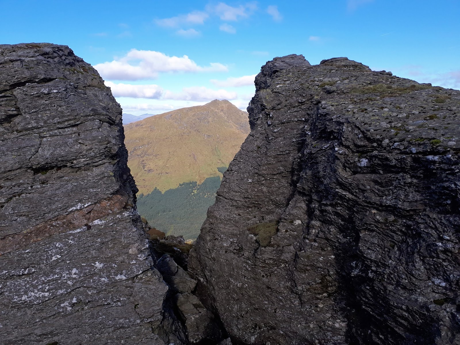
Beinn Ime through the gap

Rest and be Thankful looks a long way down


Wildlife: Raven, Skeins of geese,
Time: 4.25
Ascent: 731m
Distance: 10.8km

Sunday, 29 September 2019

Fifty Up on Blairdenon Hill

Hill: Blairdenon Hill 
Category: Donald
Height: 631m
Well once again the salmon failed to show in my mid river beat, annoyingly the lower river beats did very well yesterday, curses.
So on the road back I decided to visit this isolated Ochil hill, classed as a Donald. Because of its location it is tended to be climbed on its own. I debated whether to start at Sheriffmuir or Menstrie before opting for Menstrie.
This route is in the SMC book but I could not find any reports starting from here so should I be worried?
A cracking autumn morning so eager to get walking. Since the SMC book was written there has been new housing built around the start, easy to confuse me but I did find the track I wanted.
Good track, Dumyat ahead
Ochil walkers know that these hills go up steeply from the start and this one  was no different but the advantage of this route is that the start gate leads onto a farm track that zig zags up the hill to the 230m contour, handy. Easy peasy, not quite but a lot better than some starts. I followed the track which is a good gradient for about 1.6 miles. Dumyat looks good in the crisp blue sky to my left hand side as I ascend.
You can see the grassy path going uphill to the left
The end of the track for me is just here so go through a deer fence gate, thankfully no climbing and then the track crosses over the First Incha Burn. 
The reason all these scarred tracks are here
Almost immediately veer right onto the obvious grassy track heading through the new tree plantations. Wet and boggy but follow this, crossing another estate track, and basically keep climbing to Colsnaur Hill (558m) the bulk of the climbing now done. Great view looking back and to the north.
View from Colsnaur to Blairdenon
Blairdenon is now topped with cloud hopefully blowing away soon.
Straightforward walk with no navigation issues as there is a track on the left of the dyke and fence which becomes just a fence across Menstrie Moss. 
Boggy Menstrie moor
The downside is the walk from Colsnaur to the Old Wharry Burn is extremely wet and boggy. No point trying to bypass the bog, just wade on through and guess who had forgotten to pack his gaiters, wet trousers the result.
The very small cairn Blairdenon
Leave the fence for the final ascent and pick the best path through the terrain and when you meet up with the fence that’s the top. Hop over the fence to the small pile of stones, the summit. Two hours to the top.
The bowl of Glen Turret with Ben Chonzie on one side and Auchnafree Hill on the other looks magnificent. 
Enjoy the views Lossburn reservoir
As always on these hills you are never alone and I had a couple of blethers with other walkers.
Descending the grassy track
Views excellent and despite my initial concerns this was as straightforward a route as I have walked recently.
Scarred track back to Alva
Back the same way, that’s now 50 Donalds completed, deserves a beer I reckon. 

Wildlife: Magpie; Red Legged Partridge; Red Grouse; Raven; Red Kite; Meadow Pipit, Wood Pigeon; Dunnock.
Time: 3.52
Ascent: 791m
Distance: 14.5km

Up to see the hame of Macbeth on route to Kings Seat

Hill: Dunsinane and King's Seat, Collace
Category: Sub2k
Height: 377m

On my way to another fishing trip I had a look at nearby hills and this caught my attention. I wanted to climb Kings Seat but it had the added bonus of initially climbing the hill fort reputed to be Macbeth's. Was this really the hill fort where he was brought down by Malcolm? Legend says yes but nobody can say for certain other than there was a fort here, indeed two the original probably another very early Pictish one. 
Dunsinane Hill to the right
Dunsinane is famed as the location of Macbeth's castle in Shakespeare's play, where it was predicted that he would never vanquished be, until Great Birnam Wood to high Dunsinane shall come against him. 
If the prophecy of the Three Witches was correct legend implied Malcolms men cut down trees from Birnam to disguise themselves. Maybe but Birnam is quite a few miles away surely there would be closer woods!!
Start
Still enough of that time for a walk. The initial wee hill climb up Dunsinane Hill to the fort had my calves complaining and a sweat dripping not a good sign, MacBeths doing. 
Kings Seat small point in distance
Short sections of jaggy gorse to get through, painful.
Still soon there and there are good views, if you ignore the quarry, but much better from Kings Seat, why was that not a fort?
The way ahead from Dunsinane cairn
Leaving the hill you have to descend 70 metres to the bottom to climb up Black Hill. A faint track winds its way up but the coos use this too and from the pats they are nearby, on alert.
Good views looking back to Dunsinane Hill.
Small mast no more estate track after this
There is a small sub station up here as well as plenty of dead heather. Another walk across a grouse moor without seeing or hearing one.
After this the terrain deteriorates big stile, faint tracks but mostly overgrown heather and boggy moor, hard walking but I can see my target at least a mile away.
I also spot the coos, a much larger head and with calves. Thankfully they were on the moor to my side so I did not have to walk through them.
This really was tough walking until I met a track after Little Dunsinane. This grassy track leads you along the high ground passing very dilapidated grouse butts below on the left. It runs parallel to the trig where you now have to take a line and clamber through more heather and moor upwards to the trig. This is clearly not a frequently visited hill.
Looking back to Dunsinane from Kings Seat
As promised the views are extensive and on a clearer day would show beyond the Angus hills and more. Although the masts on Craiglow are clearly seen. The predicted heavy rain had missed me but it was passing close by on both flanks so no time to linger.
The coos had now moved in to ambush me on the return track so I decided to head for the Broch on the map and contour round the hills.
Follow Coo track around the hill
What appeared to be a track looking down from Kings Seat turned out to be the route the main body of cattle used, it was a muddy boggy route, as you can imagine deep muddy holes, the joys.
Follow dyke ground was rough walking
I headed across the pathless moor, swamp grass my height at times, to reach an old dyke which I then followed, not without difficulty back round the hills. Of course once you see your destination the last half mile or so was probably the most awkward terrain.
Saw these that had been pecked not sure which bird laid these
Still back on the cattle track I met up with the ascent trail and back to the car just as the rains arrived. Just two miles away on my drive back the roads were mini rivers I was very lucky to be dry.
That's number 90 in this category, should get to the ton by the end of the year.
A short sharp walk with a bit of interesting history thrown in. I just hope the salmon are in good form tomorrow.

Wildlife: Snipe, meadow pipit, skylark, red admiral
Time: 1.59
Ascent: 954ft 
Distance: 4.17m 

Wednesday, 25 September 2019

Speyside Way Buckie to Fochabers

Walk: Speyside Way Buckie - Fochabers
Long distance trail
Height: n/a
An interesting day which definitely comes into the category of a walk of two halves, the first being by far the most scenic and interesting.
I had never visited Buckie before so another tick in my places of Scotland. We had scenic drive through the Moray Whisky countryside before arriving at a very blustery Buckie.
A great traditional bakers near the square armed us with freshly made rolls and local fudge and off we went.
Walk goes right here at Yardie
From the sea front you immediately realise this is a unique place with the old fishermen’s cottages, the area is called Yardie.
Drying areas
The drying greens between them and the water, some with clothes twisting and turning trying to get off those pegs, good drying weather at least.
There is a long section of housing on one side and the wild seas on the other. This area was the original fishing village of Buckpool. The houses are looking tired and the inland view is a bit run down. Most of the houses look unoccupied, holiday homes most likely.
Portgordon barometer
You continue through the area of Buckpool before reaching the small harbour of Portgordon built by the Duke of Gordon some small craft in the water. In 1859 a barometer was installed for the fishermen, this is a replica. Sadly a few days after our visit a man was rescued from the water but died.
The walk is still a mixture of grassy beachside and road walking.
We turned a corner and there was a travellers campsite on the path directly ahead, dogs barking and straining on their leashes, thankfully tied up but still we head onto the road.
Waves show how windy it was
We get good views of a dozen or so large grey seals hauled up on the shingle. We are spotted by some and stay our distance to not disturb them.
Old railway line
Finally, about 3 miles into the walk the housing has ended but the walk also leaves the shore heading inland on the old railway line. A straight line to the trees before it twists and turns and enters a wooded section for a few miles.
Glimpses of the golf course through the trees, it looks in good condition, need to play it sometime.
Spey bay estuary
Finally some country roads and we head to Spey bay for the impressive ice-house where the ice was stored for packing locally caught salmon years ago. This road also take us to the Dolphin centre at Spey Bay, none in sight but I do get my first sighting of the mighty river Spey which accompanies this trail. 
Not many salmon around now for the Osprey
Lunch round the back out of the wind before admiring the Osprey sculpture.
Now part two of which not a lot to be said as almost all of it is a woodland/forest tramp of about 5 miles with minimal views unless you like looking at trees.
Finally get a brief glimpse of the Spey
At times you can hear the Spey but to see it you need to clamber up the embankments.
Initially the farmer baling his grass was an interesting accompaniment, amazing machines and the birds were around singing like it was spring, the weather was good enough. But when I entered the trees proper it was silence. 
Sole angler
A walk is never bad but this tramp was becoming a touch dull until the Spey is met again albeit briefly, only one angler spotted. Had its company for around half mile or so before woodland again until this walk ended at Fochabers.
I was glad to get to the Baxters visitor centre for coffee and cake.
Glad I walked it but cannot see me repeating it.

Wildlife: Kestrel; Buzzard; Roe Deer; Goldfinch; Black backed gull; Herring Gull; Cormorant:; Stonechat; Curlew; Wren; Wood pigeon; Redshank; Grey Seal; Yellowhammer.

Time: 3.29
Ascent: 272ft 
Distance: 10.7m 

Sunday, 22 September 2019

A Cromdale history lesson on Creagan a' Chaise

Hill: Creagan a' Chaise (Small crag of the cheese?)
Category: Graham
Height: 722m
I was looking for something different for my last walk from Aviemore and when I came across this it met my days objectives and more:

  • Somewhere new
  • Excellent views
  • History included
  • Potential new wildlife
  • A visitors book!!

I parked at the Cromdale sports ground, public WC at the playing fields if required.
Road to the Castle
Walked up the road beside the (abandoned) Haughs hotel and headed straight up to the sign for Lethendry Castle. One of the cairns can be seen clearly as the clouds are lifting from the tops to create a splendid viewing day. 
Castle ruins
As you can see there little left of the Castle but for historic importance to have stood in this place and use your imagination at what happened at the castle and on the nearby moors. Apparently one of the first recorded use of grenades in warfare.
In 1690 the Jacobite guards at the castle were bypassed by the Government army who charged the Jacobite infantry which numbered somewhere between 800-1200 or so. The government forces including cavalry charged, killing over 400 and taking over 100 prisoner. The survivors fled up the hill, more of this later.
This is a grouse shooting estate as well as livestock so a good path takes you up and around the trees. I thought I had to pass a large bull but thankfully there was a small fence between us.
Looking down on the battlefield
The track bends round and then takes a right turn onto the moor proper just before the Piper’s Stone.
There is a slightly muddy path that is well used to service the nearby gun butts that line the hill. 
Coronation cairn
Just keep heading up the heather clad flanks until the cairn comes into sight. You see it a long way off as this is a biggie. It is the Coronation cairn built on the site of a huge bonfire in 1902 to mark the coronation of Edward & Alexandria. 
Looking across the moor to the summit
From this cairn the second cairn and true top can be seen just over a mile away.  Also I spot a golden eagle slowly rising on a thermal, got a snap to confirm, but clear from the large wings held forward.
Heading across the boggy moor top I was glad I had kept my gaiters on. Not the worst but lots of water and gloopy bits. The views ahead of the Cairngorms are stunning in this clear light and I am sure that is the white hotel in Aviemore far away.
I am also keeping my eyes open for sight of the reindeer herd that live on these hills. I saw tracks in the soft mud and clear trails across the grassy slopes but disappointingly no sighting today.
Jubilee Cairn
The second cairn and trig is reached, the summit of Creagan a’Chaise. This cairn is for Victoria’s Jubilee. 
Surprise Malt
On the south side I find the opening with the visitors book but surprised to also find a bottle of Glenlivet and a note telling you to have a swig after signing the book. A bit early in the day but I cannot refuse.
A honking makes me look up and huge skein of geese are flying high heading south, early arrivals.
High level walk to 2nd graham, Ben Rinnes on right
After soaking in the fantastic views it is a return back to the Coronation cairn. There is an option to continue this as a high level ridge walk to take in a second Graham but it looks too much for today to get back to my car within my time limits. Two ravens appear to do a bonding flight, thought that was a spring thing but it was impressive stuff.
Pipers Stone
On the way down I stop at the two trees standing in isolation with a large stone. This is the Pipers Stone where a wounded piper (Hugh or Hamish) fled the massacre and played on top of this boulder as a rallying call to the fleeing Jacobites, until he died from his wounds. A poignant and beautiful spot to reflect on our history.
I decided to circular back to the car and almost a mistake. As I cleared the trees I spotted the coos with their youngsters across the track at a feeding station. It was a long way back so I walked on, the youngsters scattered but a few females made a slight charge then stopped. Heart in mouth I kept going and boy was I glad to scale the fence. That night I read about a woman trampled to death by a herd of coos!!
A very warm walk, our Indian autumn, and as I passed a woodland a huge flock of chaffinch were coming through the trees, winter migrants along with the geese? 
Speckled Wood
Plus my first sighting of a speckled wood butterfly, actually a few around.
A red squirrel comes close and makes me smile as it leaps from tree to tree, having a look down to see if I was still watching, yip.
Back to the car and a huge roar above me and two fighters were doing similar acrobatics to the ravens. Slow speed twists and turns for a few minutes before formation flying north, back to Lossiemouth base I presume. 
What a sight and what an ending to an excellent and very different walk, just a pity those reindeer never showed.
Plaque at Kirk
Finished with a visit to Cromdale Kirk which was a lookout post. When the troops crossed the river the church bells rang an alarm but it was not heard, a plaque is situated here.

Wildlife: Buzzard; Golden Eagle; Red Squirrel; Raven; Wren; Meadow Pipit; Skylark; Chaffinch; Speckled Wood butterfly.
Time: 4.16
Ascent: 625m
Distance: 17.1km