Saturday, 15 July 2017

Craigenreoch and Haggis Hill

It was good to get back out with the ARC once again but what a weather difference from warmth of the last outing. Last night I was sitting in the back garden, sun lotion on with a cheeky beer. Not today, totally different, a grey and wet day forecast.
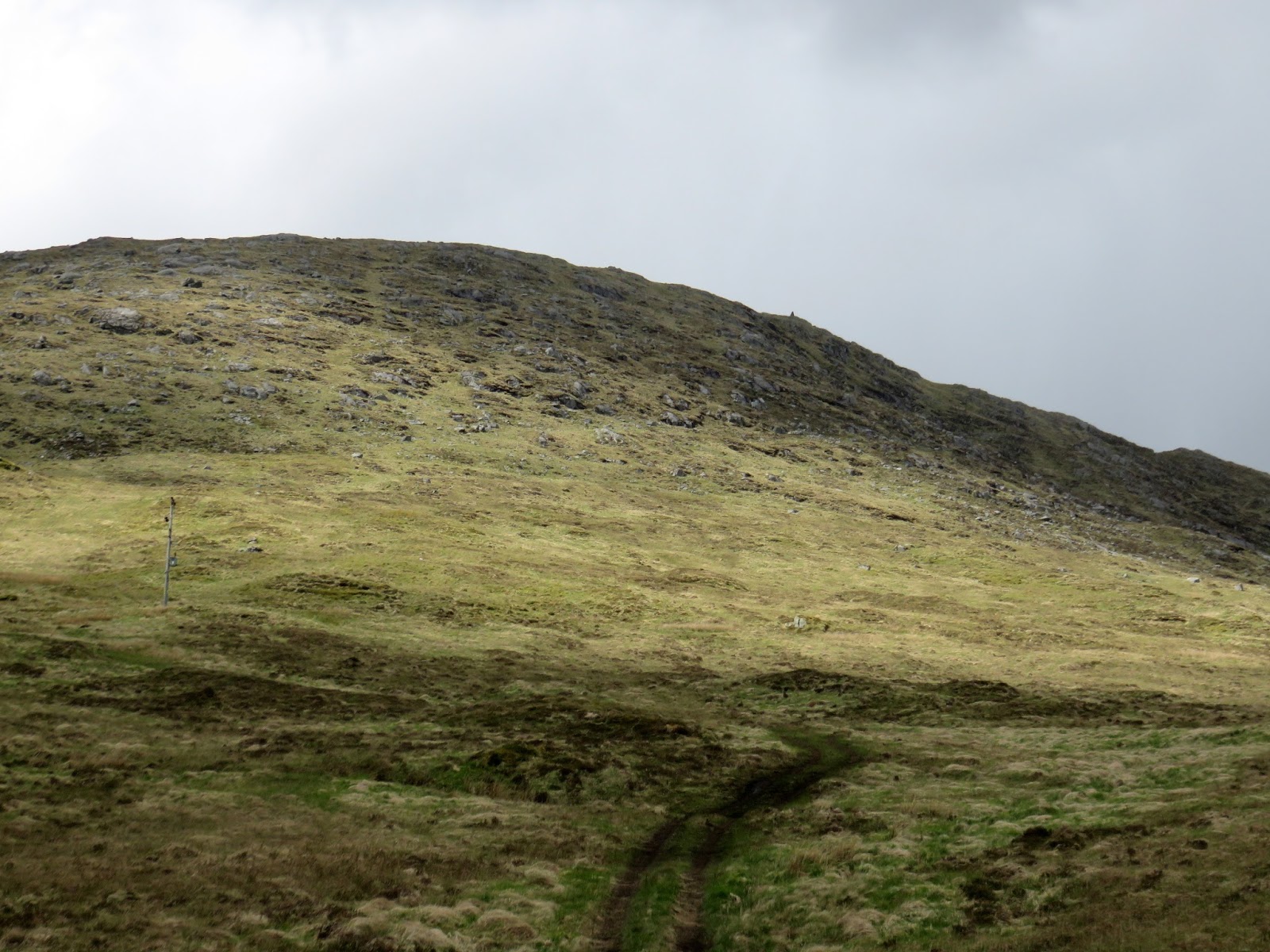
The start on Rowantree hill
Still the group were doing a circular walk encompassing quite a few hills including the Marilyin, Craigenreoch (565m), along with its outlying hills Rowantree and the quaintly named Haggis hill. Sadly not many quality photos as normal as the conditions were just too wet.
From Ayr we drove past Straighton southwards on the Glentrool road until we reached the Bell memorial, then a sharp right leads you onto a single track road for about half a mile and a parking area on the left has space for 4 or 5 cars.
The rain had already started so wet gear on. Immediately into the walk and a stiff pull gets the heart and lungs going but it is not too long before the top of Rowantree hill is reached.
Craigenreoch trig ahead
From the top and in the distance the trig point of Craigenreoch can be seen in the gloom. It is an easy and straightforward approach, but very wet underfoot walk. The record rain over the last has been well held in this mossy moorland although it is probably never fully dry underfoot.

As we reach the trig the rain and clouds ease briefly to let us see on our left the Solway glistening in the distance. On our right can be seen the ridge, including the small trig on Haggis hill, that we will be returning via and directly ahead the trees that will be our turning point.
The very brief weather interlude ends and we continue by following the helpful fence as well as the shepherds quad bike trail. Everyone is sopping wet by this time but the banter is good.
Typical terrain
On the route we topped Polmaddie, Pinbreck & Changue hills but I was not getting my map out to check as we walked. A short up and down from Changue and we reached the single stone trig of Haggis hill. In some ways the single stone seems more authentic than the piles commonly seen. 
Haggis hill trig
The weather has eased and we start to get views again particularly good looking down to the meandering Balloch burn. A big puddle is in view, Loch Bradan I think. I did check later and apparently the hill was named because it looked like a haggis!! Not in my eyes but a good name nevertheless.
Balloch burn
A very steep descent on the wet grassy slope keeps everybody concentrated and after fording the fast running Balloch burn, some more even wetter feet, but at least it was lunchtime. Very pleasant break it was beside the noisy running water. If you walked back up the glen you would reach the ‘Linn of the Darkness’ waterfall, what names!
Looking back to Haggis hill
A short squelchy moor walk followed and a then short but sharp climb brought us to the road that we left our cars on. This road is on the pass of fabulously named ‘ Nick of the Balloch, a historic smugglers path. You could follow the burn up to the waterfall at the Witches Bridge, then follow another quad bike track instead of taking the road. 
Final stretch
Back to the cars and the inevitable comparisons about which brand of wet gear performed and which didn’t. My newish Jack Wolfskin should have performed but I was wet on the chest. It is possible that I did not have the zip fully engaged so will try again but still disappointing.
All in all a shortish and straightforward days walk. Good company but crap weather. I will need to return on a better day to fully enjoy the landscape.
Ascent 1588 feet, distance 6.38 miles and 4 hours including stops.

Monday, 5 June 2017

Ben Vorlich Lochearnhead

Ben Vorlich
Today was my 2nd outing with the KRC and as we drove to our destination I was wondering if I was the weather jinx on them or vice versa. The forecast was for heavy showers but this was a lot more consistent than a shower. However, when we approached the start at Lochearnhead it had eased off and some blue sky appeared in the direction of our walk.
The walk was Ben Vorlich, a Munro at 985 metres. Munro baggers will most likely combine Vorlich with Stuc a’ Chroin but we were only intending a straight up and down.

We parked near Ardvorlich house with quite a few cars around already. Wet gear on and the group headed through the estate track, through a few gates and out onto open land. 
It is a straightforward hill with a clear track from start to finish and going by today is a popular route. The walk up Glen Vorlich gives clear views of the objective ahead. 

There is not a lot to write about as it is simply a case of a constant uphill walk gaining height at a steady rate, quite comfortable. The track is a reasonable stone and shingle route but if you stepped off this the grass and worn areas were muddy and slippy, more of which later. A couple of wooden bridges have seen better days so take care crossing them. Two runners have passed us by never to be seen again and now a mountain biker, half cycling/pushing and half carrying the bike.
Ben Our
The main rainfalls thankfully had now passed, some gear removed, but plenty of showers still around. In the good weather there are views of the flanks of Ben Our on the right. There is a slight track heading that way that I had not noticed on the map but walkers on it.
Final section approaches
We have now reached the final and steepest section but you can see the trig from here. For me this section was a 20 minute head down plod up the zigzagging track. I just keep thinking of the biker with the bike across his shoulders going up this, fit bloke.
The trig
At the trig there is a short ridge walk to the slightly impressive cairn where we chat to the biker who is just about to descend. Heavily padded just in case of accidents. Good luck to him. 

It took me 2 hours 25 to summit, longer than I expected but we had stopped for a tea break which on solo walks I would not have done.
From the top the effort is worth it as the views are excellent in all directions: amongst others Ben Lawers & Schiehallion can be seen to the north; the waters of the Firth of Forth glistening with I believe the Lomond Hills beyond; directly behind us the other Munro Stuc a’ Chroin and to the west Ben Lomond and the Arrochar Alps. 
Stuc a' Chroin
We get out of the wind and what a fine place it is to enjoy lunch. Other people arrive including two young girl runners who hop about a bit taking in the view then run off towards Ben Our.

The descent I found harder that the ascent. Twice I slipped, without damage except to my pride and muddy trousers, first on wet ground and then the scree. Concentration was full now on.

The rain stayed off for the descent but the passing clouds and light gave ever changing views of the countryside to the north.
A good but long day. Time taken was 4 hours 35 including our food stops. Ascent was 3100 feet (945m) and distance walked was just under 7 miles (11.26k).

Saturday, 3 June 2017

Ayrshire Coastal Way Blackwaterfoot - Pirnmill A long road walk


Back to Arran for another leg of the coastal way. I was getting the earlier 8.20 ferry to give me extra time on the island. However, on arrival at Brodick this ferry is met by only one bus, which goes across the island to Blackwaterfoot. So my decision was made for me to walk north heading for Imacher or even Pirnmill to meet the bus to the ferry. Rant time. Why on a tourist island can they not run a circular bus hourly, there surely must be demand and it would ease traffic on these narrow island roads.
Blackwaterfoot
This is a long mainly tarmac road section. It does run parallel to the beach for much of the time but this coastal section is mainly rocks and pebbles with very little flat sand. By all means choose it but it will be very hard and slow going.
The crossing was late in sailing which meant there would not be time to get to the Co-op in Brodick for supplies. Another Calmac black pudding & fried egg roll to start the day, it’s a hard life. A very smooth crossing so out on deck with the binoculars. Spotted porpoises, gannets, guillemot, razorbill and shearwater. Plus the non nature bit, a submarine on the surface just off the south west coast of Arran.
Got onto the only bus with 6 others and it deposited me in Blackwaterfoot for 10.10. A very pretty small village with a hotel, not many of them on Arran. 

First beach section
The walk heading north crosses the attractive bridge and heads along the road where it quickly joins the beach at the very attractive Shiskine golf course. More people around than I expected, as it was all day, I think it is England’s half term school holiday. The sand is very soft, feet sinking well in, could be a long day but it only continued for a short spell. The official route cuts across the golf course but today I stayed on the coast without any problems and I would recommend this. 
Boulder field & basalt crags
After a mile there is short but tricky boulder crossing. There is a faint route to follow but take care particularly if wet and slippy. Once through this and past the basalt rock crags the path points upwards. Why, out with the map. Do not follow the zig zag as I believe that this takes you to the Kings Cave car park. For some reason this detour takes you a short distance up then follows a higher path but it is just as easy to stick to the coast. Good sea views across the Kilbrannan sound to Kintyre. I spot a pair of Goosander with 9 fluffy chicks trailing behind. Got me thinking that you see lots of fluffy chicks with their parents but you never see them ‘teenager’ size, what happens do they become adults overnight?
Kings Cave
A bit further on you spot a series of caves including the metal gate of the Kings Cave which is open for you to explore and look for ancient carvings, difficult to see them, at least for me, it is also rather chilly in here so not stopping for long. Funny incident, I could have sworn there were people approaching the cave on the noisy rocks. When outside nobody to be seen, odd.
Machrie & Beinn Bharrain
The route then climbs away from the coast and gives you great views of the moor and the way ahead. The mountains stand proud in the blue sky. The walk flanks the forest heading inland for about a mile until you reach a car park. This is annoying for a coastal walk. Presumably land issues stopping it following the coast. That is about 5 miles walked and most of the way forward is now tarmac. Turn left and head towards Machrie and look out for traffic it is a narrow twisty road.
Burial chamber
At Machrie moor I decide to break from the tarmac and walk into the burial chamber, adding about a mile to the route. I opt against the walk to the standing stones as doing it later in year with my good lady. If doing it add another mile and half to your trip.
Machrie golf course
Back on tarmac and the quaint Machrie golf course is reached along with a tea room should you wish to stop and refresh. The police helicopter is buzzing about the moor nearby along with coastguard rescue support, people spread out crossing a field with dogs, an exercise or for real? ( I found out next day it was for real, a missing local man).
The weather is glorious and I am glad I am walking north, the light is so much better and the views of the mountains along with the seascape, wonderful. The heat is well up and the sun lotion is applied, wish I had worn shorts. Plenty of cyclists doing the round island trip today along with many picnickers parked alongside the sea wherever they can.

Walk ends around left hand side of the mountains
A pair of seals are thrashing about close to shore, mating or playing? Both spot me, heads only visible then they continue their whatever. Delightful. Herons aplenty looking to spear lunch.
Across the bridge at Dougarie lodge, an impressive home and still follow the coastal road. Annoyingly I have got pain and the start of a blister, odd as these shoes and socks have never blistered before, I can only put it down to the tarmac walking. Even more annoyingly I have left my plasters and cream in my fishing bag. A change into lighter socks helps a bit but too far gone. I reckon on 4 miles still to go, decision time, sit and wait on the bus, not  due for 90 minutes or so or walk on. I don’t even pass any sheep to get some coat to use as medicinal padding which I have read about but not tried.

Peacock & pal
I carry on and the road turns uphill. There are no route signs that I could see pointing north along the shore and in retrospect I should have followed the coast from here for about 2 miles of tarmac relief. Instead, I went past what I presume are the Imacher cottages. A very loud piercing screech from the derelict courtyard is surprising and I soon spot a culprit, a peacock amazing, when I got out of bed this morning I never expected to see one of them today.
Leave road on right here
A bit further hobbling down the road I can see Pirnmill ahead. I also come across the children’s swing where you leave the road for the short coast section if you are walking from Pirnmill. 
Pirnmill
In the village there is a restaurant and shop but more importantly in 20 minutes the bus to the ferry. My foot is throbbing, thankfully not a full blown blister as got a Munro planned for the weekend.
Great coastline, superb views but a long tarmac walk.
Distance 13.96 miles (22.47km). Time 4.34. Ascent 1173 feet (347m).

Saturday, 27 May 2017

Hart Fell what a difference a day makes

A misty start
After Sundays dreadful weather day I was back at Moffat to redo the Hart Fell. Hart Fell 808m, is classed as both a Corbett and a Donald. The forecast was for Scotland’s warmest day of the year so an early start was made. I left the house at 6.20 and was on the hill for 8, walking from the green hut.
As you can see from the snap the fog/low cloud was almost a pea souper particularly as I started to climb. Luckily I had recent memories so I decided to go for it rather than waiting for the stuff to lift.

Not improving
Following Sundays route I was soon out onto the moor. There was a quad bike track to follow but it does have cut offs from time to time particularly to the left. Although I knew from the compass that I was moving in the right direction but it was also memory time as one bit of cut grass starts to merge in with the surrounding moor, particularly with this visibility. There is a significant drop on your right side but you should be aware of it.
There was the occasional noise of sheep and lambs calling. Twice a grouse was sprung. They give you a start at the best of times and today made it even more interesting.
For some reason the bio rhythms were not good today and I was struggling a bit, the poorest I have felt on a hill for a long time. Sweating much more than normal and generally a bad legs day, it happens but I had come all this way and I was not having two failures in a week, so head down and plod on.

Breaking through
It was almost an hour before the light was brighter and I came out of the gloom into a bright blue sky and confirmation that I was on the right track.
I took my time as the emerging views were top drawer and spent as much time looking back as forward. The numerous wind turbines to the east were a disappointing sight.

Arthur's Seat
Before long I was at Arthur’s Seat and its small trig. Great views down the gorge and to the ridge of Swatte Fell plus the trail heading up to my destination. Across the top fence line a couple of deer are moving fast, did I spook them? Wild I presume and not escapees from the farm at the start.
Wind Turbine abomination
This is not a difficult hill just a continuous uphill grassy walk and before long I had reached the summit plateau. I headed eastward the trig not yet in sight, just follow the small wire fence which I had to clamber over to get to the trig. Time taken 1.53 which was ok considering my condition.
The views were excellent even if the light was now bright and harsh particularly to the south. To the east the wind turbines must number around the 100 mark, an SNP abomination to the landscape.

Path over the edge
Still keep focused and enjoy the other views. The heat was now living up to the forecast, glad I was here early, more sun cream applied.
The path down
It was an up and down the same way day which was made more interesting as the cloud was only just breaking up constantly changing the views of the landscape all the way down.
Devil's Beef Tub
There is an excellent view of the Devil’s Beef Tub and the ridge to Whitehope Heights, a Donald trip for another day.
On the way down I meet a couple of ladies and later a single guy, my only companions on the day.

The end contrast with start photo
Another really good walk and a new area for my exploration. I am glad I returned quickly to embrace it and I will be back sooner rather than later.
Time 3.34
Distance 7.26miles or 11.68km
Ascent 2156ft or 657.15m

Friday, 26 May 2017

Hart Fell part 1

On Sunday I was out for my first walk with the KRC group to climb the Corbett Hart Fell just outside of Moffat. I had a very enjoyable day except for the weather. All agreed that the weather forecast was completely different to the end result. On the drive down the clouds were a lot greyer and lower than expected.
Spitfire Moffat
First stop in Moffat was to visit a house with this full size replica Spitfire in the garden, wow. At this point the rain started gently.
When we arrived at the start the rain was heavy enough for most to don waterproofs, those that had not soon did.

Low cloud light rain but ok
A slightly damp tramp through a field of sheep followed by going past a field of farmed red deer. At this point we could see the route ahead and the rain slowly increasing.
Deteriorating
After a soggy tea break the walk continued until about 1700 metres when we the wind, rain and cold was making it no fun. Even good waterproofs were starting to let in water due to the driving rain. Plus without a view it was a tick box exercise so walk abandoned, the hill will be here for another day for the group but I will be back later in the week as good weather forecast.
Close to the end
Ironically when back home no rain and I talked to relatives in Edinburgh also no rain. We were very unlucky.

Sunday, 21 May 2017

Beinn nam Beathrach Right day wrong hill

The trig will be slightly right of the gorge
There are times when you go for that unplanned hill and you get a pleasant surprise, this was one of those days. But it might have been different.
On a few occasions when driving between Loch Aline & Strontian I had noticed a prominent trig that I could also see from the hotel in Strontian. From the parking area altitude it looked like a quick hour or so up and down. It was our last afternoon and we had nothing planned. Plus I had read about a recent post about Beinn Chlaonleud decided to tick another Marilyn.

The masts and the hill
I was happily surprised that Mrs B wanted to walk after her exertions yesterday but we took the short drive to stop at the parking area beside the track leading to the two masts. The cairn prominent up to our right. Visibility was good, no need to check the map!! See later.
The cairn just visible slightly right
Immediately Mrs B stood in a black gloopy mudhole and was not a happy camper, not a good start. We followed the short boggy track to the first mast and then basically headed up the slope following the line of least resistance through the tussocky grass and wet patches.

Once we reached a steep section, hands required at times, Mrs B decided that was enough for her and she would sit, take in the view and do some sketching. Happy to let me go to the top, shades of Arran a couple of weeks ago with my pal. Time pressure again.


With the angle you no longer see the top so just keep going on your line. As you gain height many large boulders abound. About 30 minutes after starting I broached what I thought was the last level, no steep climbs left. I headed upwards on a right angle and before long I spotted the cairn away to my right. Now the brain starts functioning and I realised the problem, there was higher ground behind the cairn, so it was not the trig point.

Cairn over there, Resipole in the distance
I walked over to it and the views are indeed special, well worth the short climb, and yes I can clearly see the hotel as well as the hills Garbh Beinne I think, and its surrounding peaks. As I turn and look through the gap it could be Kentallen and the road to Oban. Resipole to my left.

So time to get the OS map out and then realised I was on Beinn nam Beathrach and not Beinn Chlaonleud. This cairn does not show on the map so not sure why it is there, just a better viewpoint from the one above? What a tube, on another day that could have been a serious error but today my concern was timings to get back to Mrs before she panicked. I had a phone signal but she did not, so no communication, txt just in case.

Through the gap Kentallen area
Luckily from the map I had completed almost all the climbing, the trig was only about 30 metres higher but about 10 minutes away to my north west. A quick hike meandering around the small lochans, a large plateau terrain, wish I had more time to explore, views opening up all the time but only time to get to the trig and immediately back down looking to my right at what should have been my target.
Balancing act
Well down the hill Mrs B could be seen pacing about, looking up and now glad we could see each other. Trekked back to the car where Mrs B put her foot in the same bog she had at the start, I could not believe it, more unhappiness!!
Again hoping for an eagle but nothing to be seen, not even any red deer although a few prints in the mud.
At least it is another sub 2000 completed, I did get to the cairn that I planned to, the views were superb and Beinn Chlaonleud remains for another day. Finally a reminder to look at the map before starting.
The trig is 582 metres but my ascent was only 301m. Time taken was 1 hour 23min (but if not in a hurry add another half an hour at least to walk around and take in all the views) and distance walked was 2.03 miles (3.27m).