Sunday, 16 May 2021

My last two Galloway Donalds, thank god the Dungeon Range no more.....Craignaw & Dungeon Hill

Hill: Craignaw (Craggy hill of the rock) (645m) & Dungeon Hill (Hill above the dungeon lochs) (620m)

Type: Graham & Donald

My priority this year is to achieve a Donald hill category completion. I had been avoiding this pair for some time but numbers were reducing and they had to be done. Gordon messaged me recently about doing them before the bracken and midgies overtook us, a wise suggestion. So I agreed as I did not want to leave them to be the last hills. My final comments will endorse why!!  You only need to read a few walk reports to get the picture. This is often pathless and rough going and even when it is a path it is often in poor condition. As per my blog reports I am fully familiar with notorious tough Galloway terrain so I was mentally prepared but even so it was tough walking!  

The green colour at the start is pleasant but did not last for long

All cars arrived promptly so we made early start with optimism as the good weather was forecast until mid afternoon. We set off from the Bruces Stone car park. A small group of mainly focused Donald baggers. Shortly a cuckoo was heard calling, plenty of them have arrived now, Spring is here.

Ascending the Gairland burn green disappearing

Height is gained quickly as we ascended on a slanting angle via the Gairland burn track. A few weeks ago this was apparently bone dry but not today, back to its boggiest best and we haven't had that much rain. I have read this area described as savage scenery, constantly changing. 

As we rise the burn narrows and flows faster

No doubt that today the landscape has that rugged beauty along with with the spectacular addition of the burn, flowing noisily as it cascades down some falls. We are hemmed in with the flanks of Buchan Hill on our left and White Brae top across the burn.

Loch Valley with Craignaw slopes mid right

Time for a food break at Loch Valley where I observe the trout rising frequently. Apparently a sluice was installed some years back to improve the fishing in these upland lochs, long since destroyed and this was the only water where I saw fish rising so no idea whether it has been successful or not. I might not rush back to walk these two hills again but I will be tempted to come back for some wild fishing. 

A short wander up to the next Loch Neldricken, where we cross the burn via some large boulders, nobody fell in and then headed directly to Snibe Hill. The terrain is littered with huge boulders, erratics to give them their Sunday name. When the glacial ice melted these were left in situ wherever they dropped, certainly adds to the wild scenery.

Heading to Snibe Hill huge boulders/erratics dotted around

Nice to be dry underfoot but only because we are onto the famous Galloway tussocks with only the occasional granite slabs to provide some relief. 

Snibe Hill looking south

Snibe Hill is not a categorised summit and can be by passed but it is worth the short effort as the views are really good.

Dow Loch on right and the one section of good walking to Craignaw summit


Down to the almost dry Dow Loch with the short ascent of Craignaw ahead. Dow Loch was made from the frequent torrential rain running off the granite slabs onto a granite bowl, maybe climate change has dried the area. 

Craignaw has been described as a compact but complicated hill. I can see that in poor visibility the crags could be a lot more complicated and dangerous than today but most of the danger of these hills lie on their east flanks not touched by us. Thankfully the granite slabs come to our aid and makes short work of the ascent. Craignaw summit reached but its small cairn has disappeared, its boulders strewn around, possibly a weather victim.

From Craignaw summit, Loch Enoch left, Mulwharchar centre and Dungeon hill mid right

It has been a tough walk but that was the end of any help from granite slabs. A steep descent down a narrow grassy passage known as the Wolf Slock with the impressive granite rock slabs on our right. 

Our approach to Dungeon Hill

We contoured west avoiding having to descend fully before starting the ascent of Dungeon hill. Followed tracks and paths which disappeared as quickly as they appeared, sheep and deer not human. A bit of huffing and puffing and before long 2nd summit achieved. Time for nourishment and take in the fabulous views. To the south the hills of the Lakes and Ireland can be clearly seen, still not summer air!

The Range of the Awful Hand

Mullwharchar and the Merrick including the full Awful Hand range (Merrick, Kirriereoch, Tarfessock & Shalloch on Minnoch). 

Silver Flowe bog bottom left and our Craignaw descent route in middle of hill

Lastly views back to Craignaw and down into the peat bog, ditch network, ground of the Silver Flowe. A similar bog existed nearby on the banks of Cooran Lane but has since fully dried up.  Behind that the Rhinns of Kells ridge and down to the blue waters of Loch Doon. A tough walk rewarded with superb views.

Down below lies the butterfly shaped Loch Enoch, the size of which is remarkable as no burn feeds it. It is very deep at least 39m, formed in a rock basin in glacial times.

The descent heading for Locn Neldricken

For the descent we flanked Craignairney heading directly for Loch Neldricken. There was a path of sorts but many a time the foot would go straight down a mud hole or worse, plenty of traps to catch even the wary.

The fine sands of Loch Neldricken

Finally we reached the loch with patches of its fine sand, famed for its sharpness in knife grinding, a very pleasant spot even if some litter left behind. Sadly came across a dead large yellow duckling. There were a pair of Canada Geese on the water with at least three youngsters I wonder if this was one of theirs?

We took the eastern side where there was another faint track back to where we crossed the loch outlet earlier. Sadly missing the famous literary 'Murder Hole' on its west bank.

Descending via Gairland Burn

Now we were descending via the out track but it was still full attention required as very awkward walking, wet, slippery boulders, lots of traps. A female wild swimmer was at the side of Loch Valley but she did not acknowledge us, odd. Then we were given an air display by an RAF training aircraft swooping up and down, spectacularly, very fast and very loud, no suppressors on these engines.

Relieved to see Loch Trool

The descent had been a long slog over very similar scabby terrain. At least on the ascent there is the excitement of the adventure ahead, differing terrain, ascent & descent etc. But this bit not to be repeated.

An indicator of how poor the terrain was is the time taken, I would expect to complete a walk in 3-3.5kph but this one was only 2.63kph.

Still that's the Galloway hills finished for me in bagging terms, any visits purely for pleasure from now on. Good company helped the time go by and the weather played its part, pleasant blue skies and a high temperature considering last weeks snow.

I have earned that cold beer or two.

Ascent: 841m

Distance: 17.2km

Time: 6,54m

Wildlife: Raven; Meadow Pipit; Canada Geese; Chiffchaff; Cuckoo( heard)

Tuesday, 11 May 2021

Definately a white mountain today and another fine Corrie.....Beinn Bhan (Great Glen)

Hill: Beinn Bhan (Great Glen) (White Mountain)

Type: Corbett

Height: 796m

My legs were stiff and achy, there is no doubt that Covid jab took its toll. But overnight there was doubts about my planned walk on Saturday due to an incoming storm apparently! A different type of storm  from the snowstorms we are experiencing. So decided to get a walk in today just in case.

The forecast was similar to yesterday, lots of showers snow and hail on the higher tops. Out for my pre brekkie walk I noted that the local hills had received a fresh dusting overnight. Looking for somewhere local I decided to do the walk covered by Gordon & Liz earlier in the week. But rather than be a copy cat I decided to walk this anti clockwise. Looking at the map the gradient looked easier, selfishly thinking about my poor body.

A short drive to the beautiful Glen Loy and the walk start at Inverskilavulin. Construction work at the bridge but the workies okayed my parking in the turning area. This already looked a steep climb from here.

Shooting & fishing sign
I had to laugh at the sign on the riverside, warnings to kayakers. Today there was barely a trickle of water but clearly it can get full and hairy.

Start with initial climb up the middle gorge and trees
I took the track around the estate buildings and holiday homes ( not cheap a self catering studio from £325 a night!!) and started following the various on-off tracks through the dead bracken which in a few weeks will be a different beast. Then reached the stream and followed it up. 

Lots of lovely small waterfalls cascading well, presumably snow melt. I saw a grisly scene quite high up a dead sheep obviously the carcass being eaten by scavengers, another reason not to drink from a burn low down. I was just reading this morning about two kids drinking water from a burn, got e-coli and both had serious kidney damage.

Crossed the burn here
I was already painfully slow and struggling as I crossed the burn heading for the old broken fence line. 

From the fence it was a case of very slowly plodding up the grassy moor terrain. I have never had so much leg/backside muscle ache on a walk ever. And I don't think I have taken so many short pauses, again ever. This really was a case of mind over matter, I could easily have turned back but was determined not too, I had plenty of daylight.

Coire Mhuillinn
Thankfully I had on off views of the top ridge and good views into Coire Mhuillinn, excellent excuses for many a breather.

I had a small rock formation as my target. I knew this was far from the top but it would be the beginning of the end of the steep gradient. Light snow showers on and off so hood stayed up.

Finally reached the rocks and I knew from the map, now confirmed with eyesight, that the gradient eased which was gratefully received. Motivation improved. 

Trig just visible middle of photo glad the snow shower passed through 
A lot rockier underfoot along with a covering of soft snow and then the trig was spotted. It looked too far away!!

Excellent views from summit
Obviously it wasn't that far and in 5 minutes I was at the summit in 2.05. I would have sworn it was another hour onto that with all these stops, very surprised indeed.


Panorama looking North
But the effort was well worth it. The views of snow topped hills was long and far and the vista was the full 360 degrees. The snow showers scudding through all round made everything atmospheric. 

Meall na Teanga snow topped beside Loch Lochy
Snow underfoot, snow topped clouds, blue skies, dark grey clouds and a rusty landscape, not bad at all. 

Loch Arkaig
I loved the views down to Loch Arkaig, memories flooding back.

Perfect horseshoe ridge
Now the fine long ridge walk to get me back. It is a proper high level horseshoe with old fenceposts as a guide if required. 
About to get a snow shower

The only down side was the heaviest snow of the day walked the ridge with me only ending as I descended. At least it was side on then at my back.

The descent grassy slopes (taken on my ascent) with the Graham Stob a Ghrianain behind

The long grassy rocky descent was a scabby one, quite horrible walking. The only satisfaction was that I had not ascended this route. With the way I was feeling a seemingly never ending climb with my nose stuck into the grass I would probably have turned back, my motivation would not have matched the effort required.

Before long the estate houses came into view, I took my time, no ankle twists  wanted with freedom to travel out there.

Back at the car in under 4 hours absolutely delighted with that. It took a lot of effort today but so glad I continued as those views will remain in memory. Another walk with lots of deer prints and droppings but still no sight of the mysterious reds.

Back to the car to find walk cancelled for tomorrow. Time to rest this body anyway until I feel normal.

Ascent: 776m

Distance: 9.1km

Time: 3.49

Wildlife: Cuckoo (m & f calling); Woodpecker (knocking); Wheatear; Meadow Pipit; Robin; House Martin; Blackbird; Blue Tit

Saturday, 8 May 2021

A long moorland grind but a fine Corrie and 50 up.....Stob Coire a'Chearcaill

Hill: Stob Coire a'Chearcaill (Peak of the circular corrie)

Type: Corbett

Height: 771m

We now have our Covid freedom but recently life for me has been one of changing plans. I couldn't do my planned itinerary but decided to complete the Fort William section. Covid freedom wouldn't be the same without Covid vaccinations. I had my second one earlier in the week and it had a much more debilitating effect than the first.

So with weaker legs, dodgy breathing and wondering about my fitness I set out on my journey. Not just Covid the bloody weather has gone nuts with heavy snow forecast in many places. As I drove through Lomond, Orchy, Glencoe plenty of white stuff on the hills but as I pulled into the Coran ferry the Morvern hills were clear, I could see the back of my target, the highest in Ardgour, with minimal snow and some blue patches up there. Along with my first ferry journey of the year I was excited.

Got to the start point at Blaich and the expected 'no parking notices' were in place but pulled into a grass strip opposite, nae problem. One of those days what to wear? It was certainly going to be cold up top, strong chance of snow showers so I went for winter gear.

Good trail
I knew it would be a plod of a hill and the initial section is an estate track that goes all the way to the top moor. Down here my winter gear was a mistake as I was sweating going through the sheltered tree section. I was not feeling brilliant due to the jag and if it had been snowing hard I probably would have said no way! But it wasn't so headgear off, zips down, jacket vents opened. I ascended the trail to the accompaniment of a calling cuckoo, was it calling for a mate or laughing at me, 'cuckoo', quite probably.

Reach the cairn and get my first view of the ridge
Moor reached and the first objective is a large cairn which is reached by pathless walking across the moor, some awkward walking but under these relatively dry circumstances it was fine. It is just a slog for me today but at least the all round views are superb, on the ascent, mainly the Glenfinnan hills. Carefully watching tops engulfed in a heavy grey cloud which disappeared leaving a fresh coat of white stuff. And wondering when one was going to engulf me.

Attractive sweeping ridge
After the cairn another long stretch but this time your view is focussed on the crags surrounding Coire a'Chearcaill looking good.

The terrain becomes more rocky and slightly tougher walking but a fine ridge leads you to the top. 

Trig and the large cairn, a good windbreak
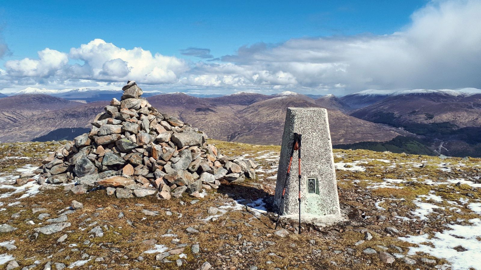
Suddenly and a bit unexpectedly the trig is seen then soon reached and the large cairn was welcome shelter from that wind. For the last 200+ metres the wind has been raw but at least I was still dry. 2hours 10m, I will take that with these dodgy legs. 

Morven hills left side heading to Glenfinnan range surprisingly snow free

Looking over to Glencoe hills
From here the superb views focus on Morven hills, still without snow and the Mamore's & Glencoe ranges with plenty of the stuff.

Just a superb view
It was interesting during the moor walk watching the number of herring gulls that were soaring over the tops, pairs and larger groups, rising from Loch Linnie and descending down to Loch Eil. Must have been over a hundred over the course of the walk. Mating time or just having fun surfing the wind?

In poor conditions the corrie could come into play
Nourished but with one eye on the weather fronts I headed back down, examining the views into the corrie, deep and isolated. Red deer must be in there. I had seen plenty of signs of them but no live beasts. However back to the corrie, in full winter conditions or bad weather and with a cornice one would need to take care up here.

Yip that's the long moorland trek back down
The descent was a repeat of the plod up but this time the views are dominated by Big Ben and the surrounding hills, Dearg & the Aonach's. Plenty of snow and I am sure a few tourist walkers might be regretting their choice to ascend it today.

Aonach (left), Dearg (centre) and Big Ben
Still plenty of snow showers over Glenfinnan hills and over the Ben but other than a few spots hitting me still dry.

Steam power
A plod back to the car without incident. But the unmistakeable sound of the Jacobite had me looking and then spotted across the waters of Loch Eil, a great sight and sound. An enjoyable walk for the views of the corrie and the 360 degree vista of hills but not so much for the plod. 

Tight, tired legs and a beer deserved for number 50, sadly will be canned or bottled. But at least I can choose whether to walk a local hill tomorrow or relax before Saturdays commitment. 

Looking back at the hill from Loch Eil it is definitely a featureless nothing but as always it depends how and where you look at something that angle not its best.

Ascent: 828m

Distance: 14.7km

Time: 4.11

Wildlife: Cuckoo (heard); Meadow Pipit; Blue Tit; Grey Heron; Buzzard: Curlew; Red Grouse

Wednesday, 5 May 2021

More ice dancing than maypole dancing on May 1st.....Beinn Udlaidh & Beinn Bhreac-Liath

Hill: Beinn Udlaidh (gloomy hill) (840m) & Beinn Bhreac-liath (Speckled grey hill) (802m)

Type: Corbett x2

It was May day which many see as the first day of spring, dancing round the maypole etc. Didn't quite seem that way on my very early morning drive through the Loch Lomond area as newly dusted snow tops hinted at a very different time of year, made me shiver looking at the tops.

I was looking forward to todays walk but now wondering what we were going to face weather wise. The forecast was for regular showers and at our top altitude possibly sleet or snow.

Beinn Bhreac-Liath from start, Beinn Udlaidh off to the right
An early start and the cars heading north passing Loch Lomond  at just after 7am showed how popular the countryside was going to be today.

The SMC book kind of dismisses these two hills, not even a full page. A short description head up the burn then bear more steeply onto the ridge. Right, I can tell you they deserve much more. Whichever hill you choose to ascend first you have a very steep and very long pull up. These hills don't take prisoners.

Steep, steeper and steep again slopes of Udlaidh
We started with Beinn Udlaidh, a wise choice for two reasons explained later. After walking through the wooded area we reached the parched burn before going through a deer fence gate and after that. Well just start walking uphill and keep walking uphill etc, there is no relief until almost at the top. At least the ground is reasonable walking, far better than if you started with the other one. 

Quartzite rock formation
There is also the line of quartzite rock forming a dyke which is a main feature of this harshly named dull/gloomy hill. A good reason to stop, look, take in the views and just take a rest.

Top around here somewhere
As I plodded up the hill the sweat was running down my face but the skies suggested things would soon change and they did. Sods law, very close to the summit the first full on snowstorm. No sleet, no hail, this was the real stuff heavy snow and lying. When the skies relented the views were excellent but so much better when we reached the 2nd top. On Udlaidh the grand old summit cairn has been removed and now only a small pile of stones marks the spot.

Tyndrum Munros Ben Lui right of centre, Oss to the left of it
Food break minimalised we all geared up with our worst weather gear, remember this is Mayday! If we had done the round clockwise we would have had the snow storm driving into our faces so a good choice meant we had it at our back.

Mighty impressive Coire Ghamhnaim
Careful navigation required in this poor visibility. There as some potentially deadly drops into Coire Ghamhnaim, as we descended the 300m drop to the bealach and then our next deer fence, through the gate and then plodded up more snow covered grassy slopes. 

Beinn Udlaidh and our descent via the crags on left
Thankfully the weather cleared and we decided to have our food break, good, I needed some nutrition. No cooked breakfast today just a banana before the start and light grazing as we climbed.

As we ate we enjoyed the views into the Coire and back up the snow covered descent. Good views over to Ben Lui and the other Tyndrum Munros. Refreshed and nourished we headed up the grassy slopes, at least we had got half way up these slopes before eating. 

Fast ones get to ridge first
So a shorter ascent and then we reached the flat plateau before heading to the small cairn summit of Beinn Bhreac-Liath, 2nd Corbett achieved.

Beinn Dorain on left
Another break in the weather as the clouds closed in and moved away to give brief and longer views of the beautiful landscape. Just stunning how many Munros and Corbetts can be seen in a 360 degree panorama. I don't know the answer but it is plenty, it really is special and the snow coverings just improve the vista. All 4 points of the compass and all you see are hills and tops, stunning, we are so privileged to have this beautiful landscape and thank god we can get out and enjoy it. As fine a viewpoint of the peaks of the Southern Highlands as you could ask for. 

Beinn Odhar & other Corbetts
Looking across the Corbett Odhar looks a long steep slog from this side, worthy of many a Munro. Indeed for the super fit there is a 5 Corbett traverse of the these hills but too tough for me. Probably a 3 and a twosome.

Long plateau with Dorain peaking up.
Back here a long broad plateau is walked before starting the descent. Fantastic with the constantly changing conditions and light. 

Just about to start descending with the road to Glencoe and Loch Tulla
But yet another deer fence is reached, this one with no gate so a climb is the only solution. why have all the other ones got a gate and on the walkers route this has none?

All safely climbed over and it left a long grassy downhill section. The grass is quite deep and clumpy so walking is awkward. Another good reason to do the round anti clockwise. 

Cottage in cleared horseshoe
About two thirds of the way down the cottage at Invergaunan comes into view. A slight alteration of direction and we head straight for it and our finish.

An excellent walk, super company, fantastic views, mixed weather but a super day out. After 12 hills in 7 days it is time for a few days rest before my next trip.

Ascent: 997m

Distance: 13.5km

Time: 5.37

Wildlife: Hare; Osprey; Meadow Pipit, Cuckoo & Woodpecker (heard).