Thursday 28 September 2017

Speyside Way Aviemore - Kincraig

It had rained heavily during the night but it was a lovely blue sky morning and we went for an unadventurous but highly enjoyable section of the Speyside Way, walking from Aviemore to Kincraig.
Tree cutter
We decided to start the walk from the house which added about a mile to the route before joining it formally at La Taverna. As we walked through the woods a jet fighter appeared very low heading north up the Spey. It was triangular in shape and very, very loud. The other highlight was watching a guy high up cutting down a tree, a large section dropping and just missing a lodge. Luck or design?
Dying autumn colours
The short road section led to the road crossing before heading down under the railway and onto the route proper.
You cannot get lost, just follow this very well made walking and biking trail. You are walking alongside the railway but only 3 trains passed us on route.
More autumn colours
The pathway is lined with trees and ferns most of which are turning to their autumn colours, lovely. Excellent views of the Cairngorms along with the prominent memorial to the Duke of Gordon sticking up from a hill.
Duke of gordon monument
We come across some deep deer prints on the track. I know the track build is softish but I reckon this was a large Red deer landing hard after a leap or fast run, speculate why?
Deer prints
A lovely up and down section zig-zagging then over a burn and an excellently constructed wooden bridge, want to redo my fence?
Railway bridge
Into another woodland section now along with the option of a detour, if required, to Dalraddy campsite/caravan park for refreshments. Their log cabins seem to go on for ages it must be a big site.
Woodland track
Pass some new houses and reach a new wooden bench with excellent views over the Spey to the mountains (lunch break in the warm sunshine). 
Spey valley
The river Spey has been conspicuous by its absence until now which considering the name of the way is slightly disappointing.
New bench good spot for lunch
Follow the Badenoch trail section which is a narrow track meandering through the ferns with high views of the river below, a bit more interesting than the other track. 
Typical Badenoch section
A buzzard cried over head but better still when I put the binos on it I could see a pair of golden eagles circling high in the sky until they disappeared.
We enter the outskirts of Kincraig and pass many old cracking looking granite houses, I want one of them. I love the 'get in there, fist pumping' lion on this gate in the village.
Fist pumping lion
The walk for us ends at the war memorial next to the bus stop. Walkhighlands route description says that there is a village shop but if so we could not find it. Disappointed as I was looking forward to a bar of chocolate and a can of Irn Bru, healthy or what.
Kincraig war memorial
Instead we just sat on the bench and enjoyed the sun shining on our faces for the 30 minutes until the bus back to Aviemore. A good walk, a good day.

Distance 7.9 miles (12.71km)
Time: 3.01 hours
Ascent: 460 ft (140m)


Beinn Mhor Grantown

The good lady had a bit of a sore hip following yesterday's efforts but was still game to try another small hill. A review of Walkhighlands came up with the perfect solution, Beinn Mhor just outside Grantown on Spey. It is a Marilyn/Sub 2000 category at 471m.
Parking area
We drove from Aviemore to the turn off at Glenbeg and immediately it was decision time, turn left or right, no signs. We picked to the right which was wrong, private house, so about turned. Immediately there is another option and again we turned immediately right. Thankfully the correct decision this time followed by a drive of about a mile (seemed longer) up a single track road to the parking area which is just before the wooden bridge. Just as we parked up a tractor and sheep trailer came down from the farm, glad we did not meet it on the single road, guess who would have been reversing!!
A pair of buzzards are screeching above us as we walk up the pleasant tree lined route. Suddenly a number of pheasants burst from the undergrowth right beside us. This was to be a feature for the next mile or so, they are heavily reared here. Daft birds they are but brought smiles as they run all over the road in front of us.
Farm Beinn Mhor behind
At the farm and Glenbeg bothy you have the first view of the hill, not the one to the left with the masts on it.
Walk straight through the farm but take care as it is a working farm. Soon you arrive at the trees and there is a track off to the left. I reckon you could take this and cut off the loop, but only if you are in a hurry, this is not a long walk.
Plenty of these
Soon another decision has to be made, about 1.3 miles from start of walk. The obvious track continues bending down a hill but there is a definite 90 degree left turn option. We elect to turn left and walk up the track passing the pheasant feeding areas where more birds go mental.
Breaking out
Further up this track we come to a T-junction. I reckon the left is where the first mentioned track joins up so we went right and before long we break the tree line onto open moorland.
Turn right here
The track now curves round anti clockwise and when we reach this high point I am looking for a trig, none to be seen anywhere. A check of the map and the hill to our right is our target, small crags up  top but still no trig.
The main route appears to head towards the masts (Laggan Hill) so we cut right and followed a muddy track through the heather, an estate vehicle has been here. There is an obvious flatter area ahead so we decide to follow it heading towards the crags that we could see.
The trig is behind and between scar & crag
Some of the going was quite deep heather, particularly for the good lady, but if care taken it was not too difficult. From the high point of the crags the trig could now be seen, not too far away, and thankfully for the good lady the plateau was easier walking. All the way Autumn colours are dominant, ferns already golden orange and many leaves not far off.
Autumn moorland Grantown in distance
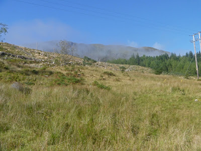
Despite the cloudy day the views were still very interesting with reasonable 360 degree visibility. For all the mountains around there are plenty of flatlands as well. Huge deer fences but we spotted none.
Looking NW
At the trig there is a very small fenced tree plantation, maybe this is the new way forward rather than the huge plantations that we are used to.
Trig
The shafts of sunlight made the landscape very interesting. A wander around the top is pleasant enough today. Grantown on Spey can be clearly seen looking good in the sun.
We followed some sheep trails downwards which made for an easier descent in the first section before meeting up with the original track. I am always fascinated how in these remote uplands one tree always survived apparently growing through the rocks

Always a survivor
An excellent day in beautiful tranquil countryside and a walk that fully met the objectives, not too steep and not too long but good views. A bit windy but thankfully no rain and isolation as no other walkers here today.

Time: 2.31 hours
Distance: 4.33 miles (6.97km)
Ascent 857 ft (261m)

Tuesday 26 September 2017

Not so slippery Carn na h-Easgainn

Woke up in Aviemore to fast moving clouds and some blue sky. The forecast said no rain. With the good lady in tow it had to be a fairly straight forward one and right out of the box was Carn na h-Easgainn (Hill of the eel!! Eels up here?) which is a Graham top (618m) but it has to be one of the easiest to walk. The hill overlooks Strathdearn and is on the opposite side of the A9 from another Graham, Carn na Tri-triggerman. This is easy as it has a track all the way to the summit.
The start
Our trip was a short 10 mile drive from Aviemore before turning south off the A9 onto a road signposted to Lynebeg. The short tarmac stretch ends opposite the houses where there is a parking area, just before the cattle grid. The SMC book says that it might be possible to drive to Lynemore and possibly a little further but for all the distance that is involved don‘t bother, unless you are in a real hurry, this is a short enough walk as it is. Once on the track the twisting route can be clearly seen on your left.
Follow that track
The route follows an obvious estate/stalkers track all the way to the trig point. According to the SMC book the high point is then some 50m to the south east.
The clouds were gathering ahead, surely no rain today. You cannot get lost on this track even in bad weather. After 15 minutes walking we could see shapes on the path far ahead, coos? On we went but after cresting a rise we spotted them and they were sheep, nice Herdwick’s I think.
Herdwick sheep
Bit further on we came to a deer fence where saw our only other people on our walk, a couple of estate workers. The surrounding terrain is open moorland, peat bogs etc and the view is what you make of it. To some it might be boring but for me there is rarely a bad walk. This is a shooting estate and there were plenty of red grouse being sprung by us as we walk past but no shooting today.
Trig in sight
After only an hour we were at the trig, even at the good lady’s pace, where the wind was up quite a few notches and the clouds remained stormy and threatening.
She made it
We had a short wander around the boggy top taking in the views where thankfully the 40 wind turbines of the Farr wind farm on the other side were in and out of the cloud. 
Red moss
Some nice reddish moss on the ground to add some colour. Looking around we can just make out Loch Ness also Inverness is obvious in the distance. 
Plateau looking to Carn Moraig
There are estate tracks on either side if you want to extend your walk but with Mrs it was back down the way we came. The plateau is fairly flat. The SMC book has a circular route via Carn Moraig which I would have taken if on my own.
Turbines in the cloud
On day of better visibility I am sure the views would be more than worth the short effort.
Looking back down to Loch Moy
But, no doubt the best views today are on the descent looking over Strathdearn with Loch Moy prominent and sadly more wind turbines only half hidden behind.
 
Red Admiral

Little wildlife, a few meadow pipits and lots of black caterpillars, not sure if they turn into this Red Admiral. I have seen more of these in the last few weeks than I have for years, hopefully they are doing well.
A short but enjoyable walk, not burned enough calories for cake today, maybe tomorrow!!
Time: 2 hours 05.
Distance: 3.99 miles (6.42k)
Ascent: 987 ft (301m)

Sunday 24 September 2017

Now I know why it is called Grey Hill

Byne Hill from the start
It was too much to hope for that I would get 3 walks in a week all in good weather. Out with the ARC group today, the original plan was a Culter Fell horseshoe but last night it was cancelled due to bad weather, take your pick: high winds, mist, fog and rain not worth the long drive. A local substitute walk was put in place down by Girvan, walking Grey hill and then followed by Byne hill. Grey hill is a small Marilyn/Sub 2000 category at only 297 metres.
Ailsa Craig from the start
I had suspected, but now know for sure, why this is called Grey hill. The forecast was windy with rain around 2pm. On the radio Calmac had already disrupted sailings. As we parked up the reality was that light rain had already started and the tops were already covered in mist. Good camera packed away in a dry bag so mobile snaps only, sorry for quality.
We left the car park and walked south alongside the road cutting behind the nursing home before crossing the busy road and starting the walk proper. 
I suspected that this walk could be a mud fest and I was proved very much right. It didn’t help that a herd of cows had churned up the already boggy ground it was ankle deep areas of sludge in places with little options, the joys.


Follow an obvious track that initially heads up the flank of Byne hill. We now find ourselves amongst a large herd of horses who thankfully did not seem too concerned by our presence and then reached the memorial monument. This old monument, apparently to a James Craufurd, looks out from the Byne Hill across water to Ailsa Craig.I was told that he was some local worthy who was involved and possibly died in some far flung war, apologies if incorrect.
After going through a metal gate there was fresh evidence that the coos were around. We had to leave the path as it was so churned up. 
Dreich hollow
So an extra small hill (I think Mains Hill) had to be climbed, up and over, follow the hoof marks before descending through even more churned areas, weave through sharp gorse needles to a hollow to start Grey hill proper. The wind was now gusting so hard a couple of our walkers were almost blown over on the small hill, bad omen for further up. Rainbows over Girvan.

With the wind and rain there is not a lot to say about Grey hill it was a trudge, mainly following the quad bike track, a walk to be endured rather than enjoyed. 
Track to Grey Hill
At the trig point there was a misty view of Knockdolian and out to sea its twin volcanic plug, Ailsa Craig. On a clear day the 360 degree views would make the muddy walk worthwhile but no sign of Ireland, Arran etc today.
Grey hill trig Knockdolian in distance
We descended by following sheep trails down the leeward side, more or less retracing our steps to get back to the bottom of Byne hill. The weather has not relented, it was not my favourite walking day but at least it was not cold.
A short clamber gets us towards the top and guess what we meet the coos. Quite a large herd, some with young calves so all be wary. A few of them decided to run for it but a couple held their ground and we had to pass very close. The rest of the herd stood firm and gave us a good stare.  
Byne Hill looking back to Grey Hill
We continued the short climb upwards to the summit where there is a direction indicator and good views down to Girvan and out to Ailsa Craig. It actually looked like the sun was shining on parts of the town.

The walk continued along the hilltop before making a steep descent down a wet and slippy grassy slope. Byne hill caravan park sits below along with a less attractive scrapyard.

The obvious descent from here is discouraged as the local farmer does not want walkers across his land, he can’t stop walkers but no need for aggro. So, we now headed west and cut back along the flank of Byne hill, following a very faint route through ferns before finding a half hidden style.

Clamber over this and then cut across a field to meet the track we started on. Right at the end there was a field of pretty sheep that I had not seen before, later identified as Balwen Welsh mountain sheep. 

Not a day for other wildlife.
It was a good few hours of exercise in good company but I can’t see me rushing back too quickly to this terrain, certainly it would need to be a day with visibility guaranteed to get the views.
Time: 4 hours 23m
Distance: 7.1 miles (11.43km)
Ascent: 1312 ft (400m)


Wednesday 20 September 2017

Panoramic views from stunning Ben Ledi


Another outing with the good folk of the KOIR ramblers to a hill that was highlighted in my diary as soon as I saw the list of walks at the beginning of the season. Another central belt classic, Ben Ledi, just outside of Callander. Ben Ledi is the highest hill in the Trossachs, this is a Corbett classification with a height of 879m (2884 ft).
The forecast was excellent but doubts were evident in our car as we cut off the A9 heading towards Callander where we met low lying mist. It started to lift as we started our walk thank goodness. We opted to walk against the norm heading anti clockwise which I think leads to a better gradient for the ascent, predominantly through a typical scenic highland glen.
Ben Ledi
Turning right from the car park follow the track past some cottages with a view of the hill on your left. After a short distance of gentle ascent follow the Ben Ledi sign which soon reaches the tree line.

The ascent is now in place as you climb through the trees before soon breaking out into more open countryside and the are known as Stank Glen. We had fears that this might be wet and boggy but considering the recent weather was actually quite good.

As you enter the glen you are constantly looking around the amphitheatre trying to spot the wildlife but no deer to be seen. A bird glides along the skyline, is it a buzzard or an eagle. Its flight looks more eagle like to me but too far away to be sure.
Ben Vane
The path on this grassy slope continues meandering upwards, good height being made and before you know we crest the ridge at the Bealach nan Corp where the summit of Ben Avon along with Stuc Dhubh can be clearly seen to our right. The views are tremendous and about to get even better. Despite the blue skies and the earlier welcome warmth, the wind has picked up strength and it is decidedly cooler now blowing from the north.
Summit in sight
But we go the opposite way and take the faint path to the left where a fairly broad ridge leads us towards the summit, the remains of an iron fence would help navigation in poor weather.
Lubnaig below
Before the final pull there is a ridge, Coire na Fuaire, with fabulous views down to Loch Lubnaig, don’t go too close to the edge it’s a long way down.
Then all that is left is the final short ascent to the trig point. 

No visit to this top should be without spending time at the famous cross dedicated to police Sgt Harry Lawrie, a mountain rescue team member who died during a rescue on Ben More, and also reflecting on why there is a need for these heroes, don’t just snap the cross and walk on bye.

Time for lunch and take in the breathtaking views, Corserine’s views on Sunday were superb but this takes it to another level and the reason to hill walk. The air clarity gives great distance. 

What can you see, well too much to go into. In no particular direction there are so many lochs to view including Katrine, Venachar, Finglas & Lubnaig and many more.  In the distance the Lawers range, turn slightly Ben Lomond. Another turn the Campsies, then the Ochils. Close by Stuc a Chroin & Ben Vorlich. The Wallace monument and behind the Pentlands. Another turn the Fife Lomond’s and so many others far and wide, quite outstanding and quite memorable.

Our descent is down the excellent tourist path, slightly steeper than the other side, different views but still plenty to keep you interested. A whooshing noise makes me look around a paraglider is doing some tight loops, I hope he is enjoying himself, I am too much of a feartie for that sport.
We are taking our time, in no rush but soon reach the crossing point back to the car park. However, we decide to extend the walk and follow the track south before dropping down and following the cycle track back beside the river. An extension of about 4 miles.

An outstanding hill on a great day with views to die for. This is a day to stick in the memory for sure. Sadly the photos do not do the reality justice but my memory will.
A very tasty fish supper, eaten in good company, sat beside the River Teith in Callander, on a glorious evening made a perfect end to a perfect day. Many more days like this to come, I hope.