Saturday 31 March 2018

To Alhang and back

I woke up to a crisp clear sky morning and decided to complete my Glen Afton walks, best intentions but not fulfilled. A quick Met Office check showed good or very good visibility all day, fine. Targets Windy Standard and Alhang.
As I drove into Glen Afton the clouds were already very low covering most of Blackcraig Hill, not the best start.

Afton Dam
I parked at the last slot before the dam and walked up the OS marked track to the end of the reservoir. When I say track, once past the dam it is a full on building site road as they are levelling the last untouched section for construction.
The walk from car to cutting off to Alhang was 1.7miles and I lost count of the number of vehicles I had to stand aside for. To be fair nobody tried to chase me away and I got plenty of waves from the drivers for standing aside.
It is not just turbine construction but pylon construction as well so a hive of activity.

Firebreak track
Finally reached what is marked as a firebreak on the map, most trees cut down, but is a new track that leads to the marked Sheepfold alongside Afton Water. The objective still shrouded in mist but behind me blue skies, which would win, and it was bitterly cold.
Sheepfold
I followed the farmers ATV track SE around Lagower Hill which led me all the way to Alwhat top.
Afton reservoir from Alwhat
There is a fence here and I was sure it was a case of following it SE but time for map and compass to confirm as no line of sight in this cloud.
Alhang ahead
Just as I started walking to my bearing the cloud lifted and now I could see the next summit ahead, Alhang. There is only 20 metres difference between Alwhat & Alhang, but I dropped about 80 metres to climb again, marshy but not too bad.
Afton reservoir from Alhang
I followed the fence to the top but soon realised the summit was over on the other side and back a bit. A clear track, soon found, led me to the small cluster of rocks, my first target.
Cairnsmore of Carsphairn
Really good views now over Carsphairn and Moorbrock Hill, basically everything south looked good.
As I stood and looked around, taking it all in, the magnitude of the active construction was mesmerising. Vehicles, people and cranes were moving all over in all directions. I hate the things but I can appreciate the employment and money to the economy.
However, as I looked to Windy Standard I realised that although getting there was ok my descent was going to be through many layers of active construction. Every hilltop seemed covered. I admit I lost heart. It can be left to another day, a few years away, when all this work is completed.
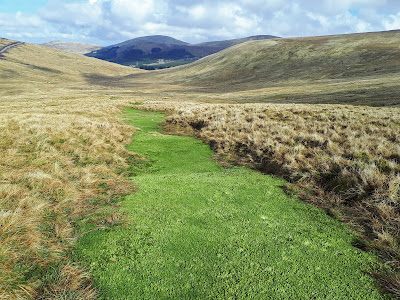
Sphagnum steps

I then had a very pleasant descent alongside the Afton Water. Rugged moorland but surprisingly little noise, only the odd sheep and raven, very tranquil indeed. Steps of vivid green sphagnum moss, the likes of which I have not seen before, invite you to step on them but only if you wanted a wet foot.
I came around the west side of Lagower Hill and arrived back at the sheepfold and then back to the car stepping aside for the many convoys.

Typical hilltop
When I was up last Sunday work was in progress but on this midweek day was on a different scale altogether.
There is a never a bad walk and this was fine. Shorter than intended but I will be back.


Time: 3hr 20
Ascent: 1313ft
Distance: 7.39m
Monday 26 March 2018

Blackcraig Hill circuit

Blackcraig Hill (Graham) 700m & (Blacklorg Hill) Donald 681m
The forecast for the day was better than the reality when we arrived. Heavy cloud covering Blackcraig Hill, maybe it will blow away.
We parked exactly 4 miles into Glen Afton, marked parking area is on the left, deep potholes drive carefully. It can be a remote and wild place, a windfarm worker died here this winter trapped by the snowstorms.
Then walked back the .3mile to Blackcraig farm entrance, a camper and car parked up, boots outside long lie today, well the clocks did go forward?

Quintin Knowe cairn in distance 
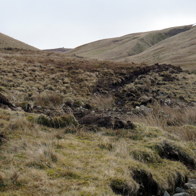
Now we followed the normal track, climbing gradually until we reach Quintin Knowe. A bulldozer track has been dug in for most of this climb before ending abruptly, more turbines I wonder. Rather a bleak section of countryside.
Blackcraig Hill from QK cairn
We spot a runner with his dog coming down the flanks, a lot faster than we were ascending.
Some new turbines below
Then up to Blackcraig Hill, staying close to the fence and crossing the soft snow patches. As we spot the cairn it drifts in and out of cloud, likewise the trig when spotted.
Trig in distance
Patchy wetland but not too bad. At the summit hide in the small structure to have a snack, a cool wind blowing. Sadly the vista is wind turbine city, not pretty.
Turbines on flanks of Windy Standard
The clouds have lifted so down and up to Blacklorg, staying to the right of the fence following old sheep trails. Nearing the top we look back and spot 3 walkers coming over the top of Blackcraig, so not alone today.
Striding Arch zoomed in
I wander a bit and look down at the wind farm tracking cutting below us and continuing way south. It is clear enough to spot one of the Striding Arches, probably Benbrack.
Blackcraig Hill from Craigbraneoch
We decide to omit Cannock and make a moorland beeline crossing directly to Craigbraneoch. At the tree plantation we stop for another break and spot yet another couple of walkers topping Blackcraig, busy today.
Summit Craigbraneoch
Although rough ground the walking was fine. Super views from the top down Glen Afton and surrounding land.
Glen Afton
Descend to the dam from cairn heading for the tree line at the reservoir. Now the boring bit 25mins downhill tarmac walk back. Looking back it is possible to descend the crags without cutting back to the dam, thus reducing the road walk.
Looking back to Craigbraneoch
I enjoyed the walk, minimal wildlife: raven; buzzard and skylarks.
Time: 4.48hr
Ascent: 766m
Distance: 14.5km


Friday 23 March 2018

Drymen - Conic Hill - Balmaha - West Highland Way


An excellent walk with the KOIR today. The perfect mix of a beautiful spring day, great company, a super walk with magnificent views, what’s not to like.

We started from Drymen and followed the West Highland Way trail to Conic Hill. Still deep patches of snow. We met very few people on this section but that was to change big style at Conic Hill.

As we approached Conic Hill looked good from this angle with the blue sky background. 

A meander around its flanks started to bring us into people traffic. As we made the short ascent there were about a dozen other people here but significantly most of them failed to realise that the bare section at this top is not the summit.

That is an up and down over two hills to the east and your reward for this effort is a small cairn and at a whole 3 metres higher, this is the real top of Conic Hill.
A lingering look over the snow topped Luss hills, Arrochar tops and of course Ben Lomond. The rain predicted from tomorrow should clear most of the white stuff.

On our descent a constant trail of people were coming up, mostly young, some foreign. This was a Tuesday afternoon do they not have work or education to do, shocking.

Finish at balmaha and the statue of the great outdoor Scot Tom Weir, I reckon this will divide opinion, the likeness is not for me.
Overall a great day out.

Time: 4.06
Ascent: 509m
Distance: 13.6km
Sunday 18 March 2018

Cairnsmore of Carsphairn

Info board
Out with the ADRC to Cairnsmore of Carsphairn, a Corbett, and the forecast was for challenging conditions at the top 40-50mph winds with a wind chill factor of -20, fun at the top. It must be 15 years since I have been here but some things never change. Parked at Green Well of Scotland, take care big holes and drop for the car.
Burn fence or Coo muck
For a start, no change re the coo field covered in their droppings which with this cold weather they were at least solid on top but the tail enders might be breaking through the crust, if so we will smell them before we see them.
Landrover track
Another factor unchanged was the dyke wall up Willieanna, Dunool etc but today were skirting it in the ascent. Snow topped summit seen peaking up ahead.
Straight forward up the rough track until we meet the dyke. Plenty of frozen water patches and these icicles show that not much sun gets here.
Still cold

Simply follow the dyke so can’t get lost.
Dyke to top
 It was already pretty cold but we had been partially sheltered from the wind. But as we reached the snowline it was picking up big style. The new snow was soft enough to kick into but the icy patches around rocks care had to be taken.
Wild winds nearing summit
Then the last 100 metres was a different world, it felt like gale force winds battering us and even the biggest and heaviest of us were struggling to keep our feet. It has been a while since I have been on top in such strong winds. 
Trig
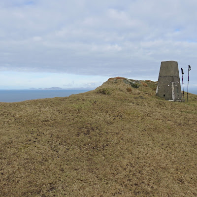
Some were hiding behind the cairn, others tried sheltering beside the trig, snow clings to the transmitter mast. One bonus was we could not spend any time looking at the Glen Afton wind turbines. 
The descent
After regrouping a change of plan as we would have been descending into the wind so opted to descend just below the crest of the hill via Black shoulder; Dunool & Willieanna. Still cold and windy but the right choice. Great views of the Rhinns on the descent amidst the many snow flurries.
Black shoulder and top
Finally back through the coos but following burn fence, no volunteers to risk the potentially thawed coo dung swamp.
A wild experience up top but a good day out.

Ascent: 645m
Time: 4.37
Distance: 12.6km

Thursday 15 March 2018

Beinn Bhreac Skye

The morning was spent walking along to the beautiful Coral sands, well worth the short walk and we were rewarded to see a pair of otters swimming at a fair pace on the surface, a real bonus as we have seen individual sea otters before but never a pair, a good start. 
After that the walk leaves from the same car park with a walk to the Sub 2000, Beinn Bhreac at 329m, hopefully another one that the good lady could manage. From our cottage at Stein we look onto the hill from the other side. A trig is visible from the cottage side but this is a fair distance from the real top.
Start here
If I was doing this walk again I would do my route to the summit, then the ridge walk to this trig and descend the rough pathless slopes with the car park in view.
To begin walk up the track for only a 100 metres to a stile and from here there is a great grass farm track that takes you in line with the summit top at 329m. No livestock today but no doubt there will be at other times.
Trig descent route for next trip
Once over the stile straight ahead there is a good view of the trig point and the crags beside it.
Destination in sight
The track turns right and you now look at the crags below the high point of the summit. A gentle gradient rise with this excellent grassy track allowing you time to take in the views, buzzard calling, a hoodie eating something.
Good grassy track
Just before the track ends head up to the crags. This is now deep moorland terrain but ok if you are used to the Galloway hills, not so in the case of the good lady she found this tough.
Off track here to crags
The expected high winds were kicking in as well but thankfully only spots of rain, but when we reached the crag it was enough for her. Almost all the climbing has been done now but still a bit to go.
Trig along ridge
She was settled down so I moved on to towards the high point. From the crags there are two plateaus and at this stage I can see the trig to my left but not the top so followed the GPS line. As expected this area is now very wet marshland with peat hags thrown in so progress slowed.
Summit cairn?
At the next crest I am surprised to see a 2nd trig/cairn to my left, check map nothing marked, but the high point is to my right. I head for that and confirm map and GPS, 329m point located and these small stones appear to represent it within a peat hag.
Looking back to Dunvegan Head
I did have some views back to the cottage but they would be even better from the trigs. Great views over the Tables, the Western Isles and the snow covered Cuillins. As said I will be back and walk the rest of the ridge.
As I have lost sight of the good lady my purpose was to get back ASAP as I knew she would be concerned. Met up, some Jelly Babies as a treat and descended the same way.
So another short walk with excellent views. Not a huge hill but if looking to pass a couple of hours with views at the end, I recommend it.

Wildlife: Skylark, Meadow pipit, Buzzard, Hoodie,
Time: 2.14
Ascent: 358
Distance: 6.1km

Wednesday 14 March 2018

Biod an Athair dramatic cliff views

First day of our short Skye trip. The good lady with me today so a short local walk. Picked Biod an Athair because of its fairly straight forward moorland terrain but more importantly the reward for the Mrs of the spectacular views from the trig and they were just that.
We followed the Walkhighlands directions for the outer walk.
Pothole avoidance on this narrow road a priority if you want out again, some big holes.
Parked at the end of the Galtrigill minor road and side on with the croft. Did look around but nobody to chat with to check leaving car ok.

Crags from coo field
Took the rough track up the hill to the left and after climbing a gate soon encountered the coos. No way of avoiding them but apart from looking at us and an extremely pregnant one blocking the path they never moved.
After the mess of the coos field you are onto rough moor. No tracks just keep Ben Skriaig to your left. Biod an Athair is in view for most of the walk from and from here it is slightly to your right at one o‘ clock. The track passes through another gate.

Tight barbed wire fence
Keep the higher ground to your left and after just under a mile you reach the barbed wire fence and the Galtrigill burn. Tight barbed wire so take care.
Looking back to Coral sands
The forward views are all moorland so stop and look back over to Waternish as well as the Coral sands. Walking is reasonable, and as expected, wet in places.
Easier walking
The route report suggests arriving at the skyline well to the left but we must be out a bit as our line took us right to the trig but no issues doing this.
Western Isles behind trig
Once there the views open out big style and two paces on from the trig is the might drop down, a thousand feet quick descent, not good for my vertigo. 
Sheep down there

Bravely, peeking over, I can see sheep on a football pitch size very green plateau, how did they get there?
Brave lady

The good lady loved the island views but so disappointed no whales, dolphins or even porpoises could be seen on the vast open water below. Getting rather cold up here, very strong wind. 
Eagle came this way
However, coming up the cliff tops with the wind, from Neist direction, a golden eagle glided majestically along the tops before planting itself on an old fence post not very far from us. What a beauty it was, close ups through the binos but as I slowly moved the camera up it looked us right in the eye and dropped off the cliff, gone, photo shy.
On the way down two skylarks flew, hung and sang. I have seen a few this year but none singing in flight, spring is coming even if this cold wind doesn’t feel like it.
White croft in sight
On the descent we stayed well away from Ben Skriaig and followed the line of the burn with the fence on our right, far easier walking and also a faint track to follow although not needed. Enjoy the views.
The farm is in sight all the way. Near the bottom some stones have been placed, cross fence and burn here. Meander up and down some fields and the original track found almost at the farm. No coos this way, always a bonus.
A short walk with excellent views, what better.


Wildlife: Golden eagle, skylark.
Time: 2.32
Ascent: 253m
Distance: 5.86km