Sunday 23 June 2013

Darvel - Loudoun Hill

I am ashamed to say that until I did this walk I did not realise the historical significance of the site at Loudoun Hill and surrounding area. I was aware of the battle at Drumclog (1679) in general terms, mainly due to reading about the local history of the Covenantors. Their history features in many of our walks in Ayrshire, Dumfries & Galloway.
Wallace monument
In addition William Wallace fought a battle with the English in 1296. A monument called the Spirit of Scotland was erected to Wallace in 2004. His group of circa 50 men ambushed and routed a force of around 200 men commanded by the English general Fenwick. Fenwick is alleged to have killed Wallace's father and during this battle Fenwick himself perished.

If that was not enough Robert the Bruce fought a battle in 1307 over almost the same terrain as Wallace did. This was a much larger battle with Bruce commanding at least 500 men with the English force around 3000 men.
In all 3 instances the outcome was a Scottish victory. There is a stone inscribed to Bruce on the summit just below the trig. If you visit Drumclog kirk there is a stained glass window portraying the Covenantors as well as a painting of their army standard.
For the walk itself we opted to start in Darvel, follow the old railway track to Loudoun Hill, cross over the A71 and follow a back road back to Darvel. In total this was a walk of around 11-12 miles, easily achieved by a reasonably fit person. However if you have a dog take care as there are animals in the open fields on the route.
Start of walk Darvel
We parked in the main street of Darvel, there is plenty of on street parking. Darvel itself was a centre of lace-making and at one time over 3000 people were employed in the mills. Additionally Alexander Fleming of penicillin fame was born nearby.
The overgrown path.
We walked the length of the main street until just as the road bends to the right you take a left turn following the cemetery road. You come to the marked start of the walk although as you can see this is more than a little overgrow. This surprised us as this route seemed to be well known. I had read about it on a few blogs and walking sites and had assumed most people started from here, but it is clearly not used from Darvel too often. It is only like this for 10 minutes or so but take care, bare legs and nettles = irritation and for once not many dock leaves to be found. Once it opens out it is much more pleasant walking.
This part of the walk takes you back in time to an uncultivated landscape. The route that we are walking is along the disused Darvel - Strathaven railway line. The line was opened in 1905 but was not heavily used with trains few and far between. This resulted in an early closure in 1939, we can't blame the Beeching cuts this time.
Old railway
Ayrshire is a farming county and in this area sheep & cattle are popular. As such it was not long before we had our 1st encounter when we noticed an open field on our left. The markers indicated we climb into this field on the left which surprised us as the track went straight on. We soon found out why as the path came to an old bridge which was no longer a bridge, just the supports. The big black bull in the field now had his eye on us. He was too close for comfort so we took the cowards option going down to the right through a muddy patch but when we climbed up the bull was head down, eating his grass, and had lost interest in us, good.
Ayrshire meadow
Now the landscape was opening up with beautiful traditional country fields with views of the local farming countryside. The weather had promised well but when we started grey clouds had gathered big style. By this time normal service was resumed and the Scottish summer was back in play.Not long after our 1st encounter we could see the path blocked by a low fence and behind it were a number of heifers sitting looking at us through the fence. Then up stood the daddy, if we thought the last bull was a biggy then this was a giant. He moved the youngsters aside and stood at the fence staring at us. It looked like he could step over the fence without any effort. Discretion time again and we went down to a minor road and skirted the field. As it turned out we would have joined this road anyway. You follow this upwards and round the back of Loudoun Hill until you came to a stile allowing you to cross the fields.

There is no obvious path up the hill, so up we went with some minor scrambling to add interest and soon we were on the summit.
Loudon trig and the Bruce stone
Loudoun Hill (316 metres) is a volcanic plug that stands in isolation giving a 360 degree view of the countryside. When we ate our lunch we got out the large scale map and studied the landscape. Quickly we identified in the distance: Cairnsmore of Carsphairn; Cairn table at Muirkirk; the paper mill at Irvine and the mountains of Arran. More locally the horrible wind farm that stretches from Eaglesham via Fenwick into this area, a truely horrible blot on the landscape. It is another great example that for or a little effort another superb view is the prize for your workout. 
Just below the trig point is the memorial stone to Robert the Bruce as seen in the photograph on the right.
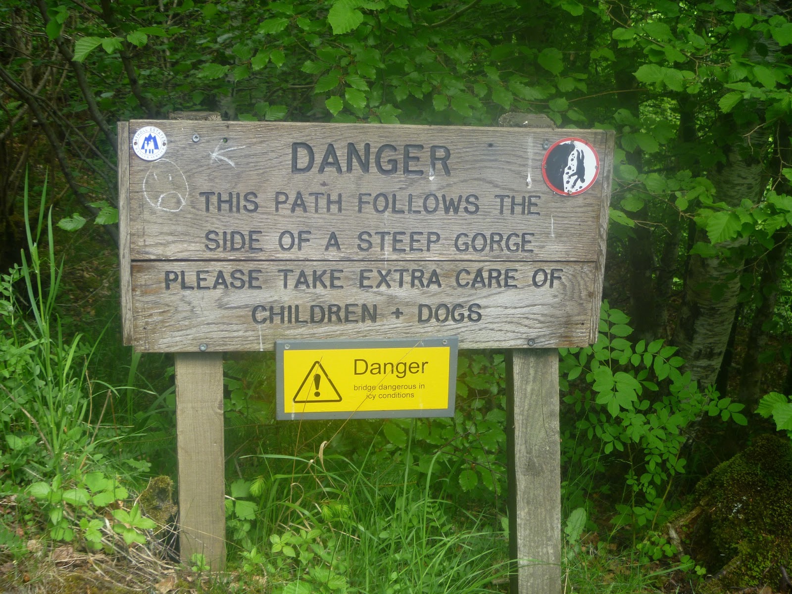
Do take care on the summit as there are some very steep drops that would do some serious damage if not death. These crags are sometimes used by mountain climbers.
Loudoun Hill from car park
However, it is worth looking downwards as well as to the horizon, the local landscape is also impressive. Rather than retrace our steps we found a route that took us down and around the side of the hill, across some fields ending up at a small car park where I guess most people park to walk the hill. Certainly it wont take you long from here to climb the hill.
The remainder of the walk was straightforward. We walked to the A71 and crossed over following a minor back road which eventually brought us back onto the A71 near Priestland  and followed the road back to Darvel.
Overall another pleasant day out and recommended.

Tuesday 18 June 2013

Ness Glen - Wee & Big Hill of Glenmount


Today's walk to us through one of the most exciting gorge walks that you can get in Scotland despite its low level, Ness Glen which begins at the dam in Loch Doon. We walk downriver towards the village of Bellsbank but turning off through the woods at Craigengillan Home Farm, taking the path to Little Shalloch. We then went up Wee Hill of Glenmount followed by the main objective Big Hill of Glenmount. Finishing with a hike across to Glesser Hill and down the slopes to the cafe and our starting point. An interesting circular route that you can guarantee few folk have walked. The water in the Glen was a rumbling, tumbling cascade all the way downriver. We had had some rain recently which livened the water flow up, but it must be even more spectacular with a greater overflow from Loch Doon and the water cascading naturally down the sides of the glen to rush into the flow. 
Ness Glen
Ness Glen
 I appreciate that the main water outage from Loch Doon is in a different location from the dam but at very high water this dam is also used. As you can see from the pictures the the variety of the shades of green were just spectacular. Borders lined with wild garlic, yet more of the stuff!! A good walking path with the tranquil sound of running water. Under different circumstances you can see the brown trout in the holding pools and I have seen salmon this far up the Doon. There is even a salmon ladder to the side of the dam wall entering Loch Doon. You never know your luck.
Our walk also crosses over the track to the Dark Star observation site, the first in the UK. For obvious reasons better visited on a dark clear starry night. 
You can detour off and have a look at the observatory and the fort, yes a fort and you could shorten the walk but I would not recommend this unless you were short of time. Our walk continued for 10-15 minutes or so, along a clear woodland path, bordering the river, until we cut into the woods on the left hand side after going over a stone bridge. A short scramble through the woods brought us out into some fields populated with sheep. Do take care as cattle could be in these fields as well. Almost immediately we spotted a fox in the long grass just ahead. It had a magnificent orange coat, I doubt I have ever seen one that colour before and my first daytime fox this year. Amazingly as we headed up the small hill another fox appeared, this time a traditional dark red, rusty colour. I presume from the same family. This one disappeared over the hill towards some sheep, sending into the air some dozen or so crows, I wondered if a lamb carcass was over there. From the hilltop we climbed you get a good view of Bogton Loch, near Dalmellington.
Bogton loch

Time for a break and some food plus jackets on, it was cooling down and threatening to rain, bonny Scotland in June.
We next followed a clear track to Little Shalloch (266 metres). You are now crossing a fairly bleak moorland landscape, plenty of sheep with their lambs, farmers quad bike tracks, a few lochs dotted about but mainly lots of moorland grass. If you were in bad weather a compass & map would be required. From here we had a view of our main goal, Big Hill of Glenmount, although its summit was slightly covered in cloud as per the picture.
Big Hill over the moor
Some of the walking was difficult tussocky mounds, water concourses, hidden holes etc all good ankle breaking stuff. So the decision was made to directly climb the ridge which gave us more solid footing and better views. We were even regularly seeing skylarks instead of the meadow pipits earlier. The skylarks never ending song from high in the sky is one of natures great moments.

On up we went to the Wee Hill of Glenmount (322 metres) fairly easy walking, good views all around now particularly to the west. Once at the top we realised that, not for the first time on our trips, we had not looked at the OS map too closely and that the ridge now ended here. To get to our goal we had to descend about a hundred or so metres to climb back up to the Big Hill of Glenmount (382 metres). It actually wasn't too bad walking, we had time on our side and even if we had read the map properly it is likely that we would have chosen this route. On the way back up we had the close company of a raven, soon joined by another two. Good for us but maybe not so good for the lambs. Ravens are making a comeback but are being accused now of some brutal attacks on newborn lambs and even the mother themselves, which is allowing licences to be issued for some culling to take place. A difficult decision.
Loch Doon from Big Hill
At the summit we had super panoramic views. Once again it proves you do not need to go very high to be well rewarded with the views and scenery. Get the OS map out and have a look for yourselves: the Merrick Range; Shalloch on Minnoch range; the Rhins of Kell; lochs Doon, Finlas, Derclach And Bradan in the distance. What more do you need? 
Merrick range & Loch Finlas
The last stage was a tramp across to Glesser Hill and back to the cafe. Most of this was the hardest walking of the day. Although it was fairly level elevation this was the worst of the ankle breaking stuff you get on these hills. I was glad when it was over with only one good scare.
Finally the views over the north end of Loch Doon were a good way to end the day.
Moi at summit
The walk was around the 4 hour mark and like most of the ones we do a reasonably fit person would cope with this just fine. Just get out there and enjoy it.

Monday 17 June 2013

Glen Tilt - Old Bridge of Tilt - Gaw's Bridge

For my final walk of this trip I opted for a short low level walk into Glen Tilt. This was a new glen for me, but it looked magnificent when I saw section of it on the TV. This was a programme about the new long distance walk from south to north Scotland by Cameron McNeish. As time was again my enemy I decided against starting in Blair Atholl but went up to the car park at Old Bridge of Tilt. There were only a couple of cars in the car park this morning but it is clearly popular as when I returned it was almost full. 
By starting here I missed out on on walking part of the forest walk alongside the River Tilt from Blair Atholl, if you want to start here ample parking is available. However, I joined the forest walk section almost immediately on leaving the car park. There is an option to walk the forest road but pick the river/gorge section first. 
Beware there is a warning sign about the steepness of the gorge and it is true, at times the drop was massive, straight down and no protection along the path. If you are careful it is not a problem. You follow the track & gorge path through Leathad Mor Wood. Again carpets of wild garlic scent the air, I cannot recall seeing as much wild garlic as I have this year. After about 30 minutes I was hoping to take the track off this path to climb out of the wood and get some views. Unluckily today the route was closed as it skirts a rifle range and today was a shooting day. Just as well as the noise of the shots, creating a major whooshing sound reverberated in the glen. I have never heard shots like this. It made me think about the poor people in war zones being trapped by high power sniper rifle-fire  I don't know much about the power of rifles but these were clearly the top of the power range. Shortly after from the path I could make out the shooters high in the hills and at least half a mile later I spotted the targets.
Open countryside at last

At Gilberts bridge I could have crossed over and joined that closed path but I did not realise at the time that I had passed the limit of the firing range. I only found this out when I rejoined it on the way back. You are now coming out of the woods into hill country still bordering the tumbling and gorgeous River Tilt. 

River Tilt
There is something about rivers, not just because of my fishing interests, that are special places. The path follows the river so no climbing involved. So far not met anyone else. The views north of the mountains ahead are spectacular on a day like this with blue sky and patchy clouds, some heat, brilliant.
The path has now fully opened out to the countryside, plenty of sheep around a cuckoo calling. I pass Marble Lodge and the cottage for hire. Its got a satellite dish which you would need as you are a long way from Blair Atholl. I take a break at Gaw's Bridge and look at my map. Just as I was doing so over the hill to my left flies a golden eagle, what a sight. 
Looking north from Gaws Bridge
Flying in circles lower down at first, then it catches a thermal and spirals onward and upward into the blue sky until even with the binoculars it has gone from sight. That just made my day. I was now about 2 and a half hours into my walk so that was far enough for today.
Good news, the map showed that I could walk back on the other side of the river for a good distance, some elevation would give me a different perspective and alternative views rather than just retracing my steps. My main concern regarding this route was the firing range closure but as said earlier you rejoin the main track again after crossing Gilberts bridge. If the firing range access was open then you continue on this side and do not cross the bridge. There is a fairly clear line re a path on this side so you can't go wrong. Still plenty of sheep to avoid and I spotted a couple of deer on a ridge ahead of me. But it was just a fleeting glimpse, no posing for the camera. A slight detour took me to some ruins with a viewpoint looking north.
As I was coming back to rejoin the path I noticed 5 groups of teenagers, all with full rucksacks making their way up the glen. Probably doing the full trip with an overnight stop, lucky them.
Viewpoint from the ruins
The return is straightforward, backtracking your walk in back down the forest track, not the most exciting but still enjoyable.
In total out for about 5 hours which fitted in with my schedule. Next year might try the full route to Braemar. It also looks a cracking mountain bike ride.

Tuesday 11 June 2013

Pitlochry to Killiecrankie via Craigower

This is an excellent walk that can be undertaken by most reasonably fit people. You can opt for just the Pitlochry - Craigower walk itself which is a very good stand alone walk with the advantage of the excellent views from Craigower, well worth the little effort. You can pick your starting point in Pitlochry giving yourself a couple of options. We opted to walk up to the village of Moulin first, the village has its own brewery.
Moulin Village Hall
 For some you might want to do this route in reverse which gives you the option of a welcoming beer at the end although it is fair to say that the Moulin brewed beer is not to everyone's taste but you will only know if you try it. Your other option is to go directly from Pitlochry to the golf course, cutting out the Moulin section.
Once in Moulin the signpost takes you along a back-road which leads you to the golf course. Keep your eyes open along this road as deer are frequent visitors to the tree edges. You also get good views of Ben Vrackie from here. 
Ben Vrackie from path
Follow the path which takes you partially through the golf course towards the tree line. This is a very interesting golf course, great views, plenty of up and down fairways, it looks fun to play. As you reach the treeline there is a cottage with an amazing garden, cultivated, but looks wild and natural. On our walk we watched two red squirrel play for over 5 minutes. My good lady said she thought she had seen a jay but by the time she told me it was gone, suspicious. Got a flashing glimpse of a crested tit, rare so nice to see plus numerous tits, chaffinches and wood pigeons.
The path follows the side of the golf course, climbing gently until you join the Craigower - Killiecrankie route, through the Tay Forest path. You know have a choice of detouring up to Craigower or going straight through to Killiecrankie. There really is no choice, Craigower is 407 metres and at this point you are about 270 metres so the short pull up for the views is a must do. 
You don't have to retrace your steps as there is a path down the other side to meet up with at the Pass of Killiecrankie. The steep climb is mainly through forest and the storm damage from last autumn is obvious with some mighty grand old trees destroyed, the power of nature. Look out for siskins on this stretch. Another option is to follow the forestry commission road but this is not nearly as scenic. Whichever way you take, when you get to the top of Craigower the views are fabulous. The old saying of you don't have to climb high to appreciate the views is appropriate here. From the viewpoint indicator you can clearly see Schiehallion, looking right up the Tummel and following the A9 north, stunning views of the Cairngorm national park site. But go to the westerly point and you get super views over Pitlochry to the south. You will also have noticed corrugated iron sheets dotted around in the grass. Do not lift these as breeding sites for adders among others.
We reversed back to the path and followed this along the forestry path, down under the A9 road bridge, literally, to join the path to Killiecrankie. You go past majestic trees, some that will be hundreds of years old, what sights have they seen in that time?
At Killiecrankie there is a visitor shop but make sure you go on a bit further and pop down to see the Soldiers Leap viewpoint. Surely fictitious when you see the chasm he allegedly jumped but who knows. 
Soldiers Leap
The previous time we visited this spot we were lucky enough to watch a salmon making fruitless attempts to jump the leap. Your heart went out to the salmon as surely it must be near the end of its epic journey, back to the place of its birth. The water was a swirling maelstrom and although we did not see it succeed I am sure it eventually found the strength to leap the barrier.
Now heading back to Pitlochry via the path alongside the River Garry, this is one of General Wades military roads. Entirely a forest walk now alongside the river gorge with its dramatic scenery, the walk continues down river until it tumbles into Loch Faskally. 
Wades road through the forest

River Garry
At Garry Bridge we could hear excited screams and when we spotted the bungee jumpers on the spars below the road bridge we knew why. I like outside sports but rather them than me. Just below the Clunie bridge we stopped at the Faskally fishery cafe where they were just placing a freshly made carrot cake on the counter, decision made. The slices were huge and delicious. Well we had walked a fair distance today.
Another mile saw us back in the centre of Pitlochry and time for a beer. If it is your only trip make sure to go to the dam and the salmon fish ladder, you never know your luck, around 5000 fish ascend each year.
Overall distance was just over 13 miles and a good day out. Well worth the effort if you are in the area.

Monday 10 June 2013

River Ayr a short walk

Hi another wild windy stormy day, home from home on the coast in the West of Scotland. Decided to go slightly inland today and it never fails to surprise how quickly the wind drops just moving a few miles inland from the coast.
Today is about photography and working out how to use the Nikon D5000 SLR camera in manual mode, very much trial and error day and lots of tears and sweary words.
After a short stroll I came to the Enterkine viaduct, picture below, impressive structure, used mainly for coal transportation. Looks a good spot for a peregrine to nest, will need to check that out on another trip.
Just after this photo I came past a landslip area which I suspect has more to slip and if so the path may be blocked soon, no obvious detour route. However, a bright spot, within the soft mud were fresh otter pawprints, but I did not see the live otter today. Although mainly nocturnal I have seen an otter 3 times, during the day, on the nearby River Irvine just in the last couple of months.
The following photo is looking back upriver towards the viaduct area. A nice area and during my 2 hours or so I had a solo day, did not see anyone until I returned to the parking area.
Encouragingly around this stretch of the river I noticed a few brown trout rising to feed, I was thinking about joining this river next year, looks a good wading river so one to investigate as it has both brownies and salmon.
By this stage I have taken and deleted countless images, thank god for digital cameras. The old days being full of anticipation, getting your photos printed and realising your limitations cost a lot of money. Quite liked this tree fungi snap.
Further upriver I came across a dead tree which had some amazing patterns running both horizontally and vertically. Liked this abstract version which reminded me of the running river bed.
Strolled along the river to the weir at Stair, I did attempt to walk further upriver but another landslip had totally blocked the path. A diversion was in place up country lanes etc but I decided to retrace my steps.
Disappointingly little birdlife around today, some female goosanders on the river, also spotted wren; robin; woodpigeon; crow; rook; greenfinches and a buzzard.
Lastly some trees in autumn colours looking downriver from the Gadgirth bridge.
PS just beside this there is a section of woodland for sale with some fishing rights if you have a spare £19000!!
 

Ben Vrackie Wow the views

I was staying in Pitlochry for a few days so I decided to take the opportunity to climb Ben Vrackie ( a Corbett). I have frequently looked a the hill from Pitlochry but for one reason or another never got around to climbing it. Well today was the day. I was staying in the nice Dundarach Hotel in Pitlochry and I made the decision to walk from the hotel rather than drive up to the mountain parking area, which is just past the village of Moulin, this would give me the full height of the climb from sea level. It was a splendid morning with not a cloud in the sky, has summer arrived, was it going to be too warm, see later? I had enjoyed a full Scottish breakfast so at 9.10 I was on my way. A short stroll into Pitlochry then up the road to Moulin.
You can see the top of Vrackie from Pitlochry as the picture shows, doesn't look too intimidating from here. When I reached the car park starting point there were already 3 cars in situ so some other early starters were already on the hill. The car park sits around the 200 metre mark saving some climbing effort. The start  from here follows a path through some woods before breaking out into the clear heather and bracken countryside after 20 minutes or so. Whilst on this path I stopped and chatted to an elderly gent out with his 3 dogs. He was a local fisherman so we passed 5 minutes discussing fly fishing in our respective areas. A bit further on I heard dogs yelping, barking and male(s) shouting and reckoned of the old boys dogs had got into the nearby field which contained sheep. However, a couple of minutes later a dog walker arrived, Gibby was his name, with a spaniel that had been dusted up by the old guys 3 dogs but no damage done. We had a good natter walking up the path to the extent that Gibby went further than he planned for himself and buddied me up to Loch Choire. 
Ben Vrackie just before you turn into Loch Choire
This was a good walk for him today as this loch is at the 500 metres level. They say that there are wild brown trout in here but I didn't see any movement. To get here the path is in good nick and it is a fairly straightforward haul upwards, a reasonably fit person should cope with this ok. Very little bird-life around, a family gathering of half a dozen song thrushes in the woods along with the usual suspects of the tit family, chaffinches etc. but on the hill only meadow pipits were jumping out of the heather whenever we got too close to their nesting bush.

Loch Choire


If you don't want to take the climb to the Vrackie summit from the loch you can head along a hill path leading to Craigower & then Killiecrankie (see other blogs for both of these).
But I was going up Vrackie and this is where the hard work starts. From the loch there is now a relentless climb of  341 metres straight to the summit. There is a rocky made path which in some respects makes it easier but personally I would rather have a hard packed path rather than the rocks & stones. The weather was now cooler with a fresh breeze so time for another layer, a light windproof jacket did the trick, comfortable again. There is little respite on this climb now unless you stop on the path and take in the views, which is recommended as they are stunning. About 2/3rds of the way up I met up with a couple who I would say were in their 70's. The lady noticed my binos round my neck and asked if I had seen the ringed ouzel. My reply was no as I told her, that for the last 20 minutes I was in the mode of one foot at a time, head down, sweat dripping, just wanting to get up the hill as the climb was getting tough.
Steep hillside now, Loch Choire below
She then admitted she had not seen it only heard it. My visual sighting of birds is ok but I did not have a clue what an ringed ouzel sounded like but I didn't think I had heard anything apart from my thumping heart. The top was now in sight, a couple of minor false tops and then I was there. Looked at my watch and only 2 hours 10 minutes from setting off, delighted with that. The views were every bit as good as I hoped for. The summit of Vrackie is 841 metres but its real advantage is that it stands alone so little gets in the way of the view. I had a great view of Schiehallion and out towards Rannoch Moor. Straight north up the glen were the Cairngorm summits many still with snow showing brightly.

To the south you follow the meandering River Tummel, Ben Lawers to the side, magnificent. A couple of French guys arrived so we all took photos of each other at the main trig point, there are two on the summit, and just then the older couple arrived, well done to them.
Small trig looking North


From summit looking down to Loch Choire and the trail 

Main trig
After 10 minutes of taking in the panorama and sending some boasting texts, the clouds were now around in force, no more clear blue skies and they were getting quite black promoting potential rain. This is summer in Scotland after all.  We all decided to head off downhill for some shelter. After only a couple of minutes on the descent I heard a bird calling and as I looked up, yes you guessed, the ringed ouzel was flying past, my first ever sighting so another bonus. I called to the old couple who were behind me, their concentration looking downwards on the path and to my delight both saw the bird and I got the thumbs up for alerting them. 
http://www.rspb.org.uk/wildlife/birdguide/name/r/ringouzel/index.aspx
Descending I was now taking more care as more accidents happen on the descent that the ascent, but even being cautious I still made good time and I soon reached the loch. I passed another 4 parties heading up the hill but I was glad I climbed earlier as the summit was now dark and foreboding, the views would not be so good. One of the guys had a fly rod attached to his rucksack so maybe grilled trout for lunch!!
One final bonus, as I walked through the car park a rare red squirrel moved between the cars back into the woods.
That was as good a morning as I have had. Magic.