Friday 26 May 2023

Not the most exciting Munro.....Meall Ghaordaidh

Hill: Meall Ghaordaidh (Hill of the shoulder)

Type: Munro

Height: 1039m


There is not a lot to say about this unexciting Munro so a brief description and some snaps is your lot.

A grey day but high clouds as we started from the traditional spot at Glen Lochay. Inevitably a cuckoo was calling as we donned boots.

The start goes through a sheep field before climbing a style then onto open moor.

Wander up a track until you find a small cairn where a left turn starts your hill climb.

There is a fair track which goes through some boggy peaty areas but by and large it is much drier than I expected.

Alongside the track there are a few deep holes to catch the unwary and could do a serious injury. At the bottom of one a frog looked up at us.

The walk is described as uncomplicated and that's exactly what it is until the boulders at the final section are reached. The main views to distract from the climb are the Corbett of Cam Chreag and the Tarmachan ridge. To be fair the higher you go more hills can be seen along Glen Dochart and beyond but a plod it is.

The final short steep section does weave between the boulders requiring the odd minor scramble, wow rising heartbeat.

Before long the top is reached, a broad stone shelter encircling the cairn.

Although it is still grey the views are good particularly down into and over Glen Lyon. The nearside Lawers range. The Corbetts and Munros over the other side of Glen Lyon. Closer by the Crianlarich tops plus a few Tyndrum ones and more further afield.

A straightforward return by the same route to finish a straightforward ramble. It was enjoyable enough but cannot see me returning.

Target from the start

Cam Chreag appears

Bracken will explode soon

Final lump in sight

Cam Chreag's long ridge

Getting to short rocky section

Top in sight


Loch Lyon and the Pubil Corbetts

Peak of Stucd an Lochain other side of Glen Lyon

Clouds now starting to cover Lawer & Tarmachan hills

Ascent: 873m

Distance: 10.3km

Time:5.38

Wildlife: Skylark; Raven; Cuckoo; Common Frog;

Possibly the greatest views in Britain but not for us.....Blabheinn (Blaven)

Hill: Blabheinn (Blaven) (Blue Mountain)

Type: Munro

Height: 928m

Walkhighlands describes Blaven as having one of the best viewpoints imaginable so it would be rude to do a walking trip and not include it, what could go wrong, well the weather for one. It is separate from the main Cuillin hills and some rate it as the finest peak on Skye.

We delayed our start to take advantage of the clear conditions as forecast by the Met Office.

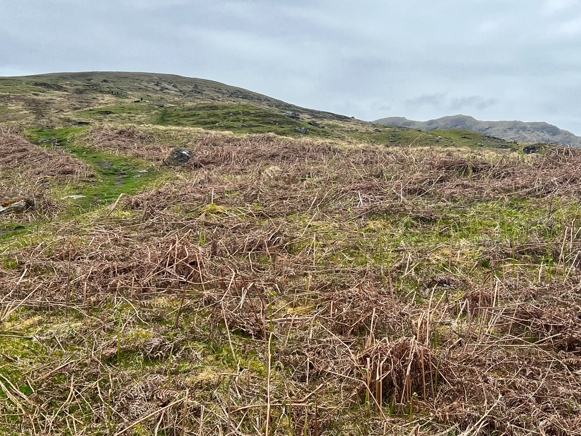
A pleasant walk from the car park with the mountain in sight in all its magnificence. Looking at some of the scree slopes I was thinking that if I need to go up that I will be turning back. I was thinking of the Walkhighlands description ‘Good path at first, but later the going becomes very rough, with loose stones, a scree gully, and some very mild scrambling’. Okay bring it on and it did.

A narrow but good condition track brought us to the waterfalls of the Allt na Dunaiche carrying a bit more water than I expected so good viewing of cascading water.

A couple of burn crossings, these could be challenging after heavier rainfall, but even at this level I still managed to get a wet foot in the second burn. Gordon was struggling with his leg so left us at this point.

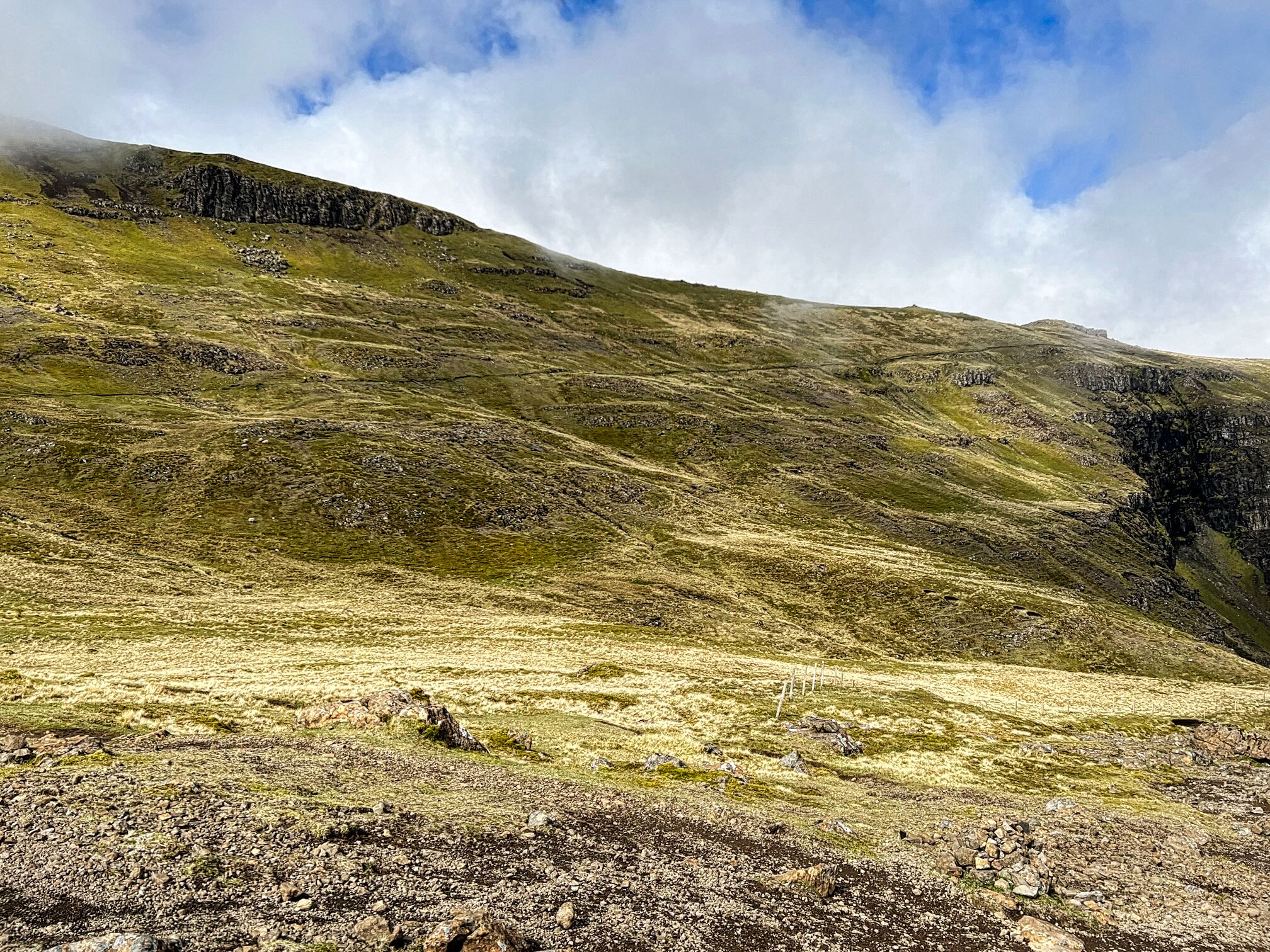
Once across it was a newly renovated but still very rocky track. We were now in the gloom and would continue that way right to the summit. It was a steady climb with good ascent gained quickly.

First route objective was a failure as we missed the sharp right turn at Fionna-choire but in fairness so did the 4 guys in front and the couple coming behind. Soon the scenario of us all, standing in the gloom, barely able to see each other, looking at gps etc, where do we go from here? As it turned out we found another track, obviously a lot miss the inconspicuous non extant track. This proved fine as it merged with the other one further up the hill.

Maybe at times it is just as well that you cannot see what's in front of you. We did have the benefit of hindsight looking back in clear air. A lot less intimidating when you are on the way down.

But in this moment in time we were on the way up and we reached the narrow stone scree gully. This was a long steep gully, it really should have a name to remember it by. It is the right hand branch of Great Gully which divides the main summit from its south top. There is no path. Clamber from side to side as you think best holding onto the rock edges to pull and steady yourself as the stuff under your feet constantly gives way and creating potential big boulder slides to endanger people behind you as well as listening out for some coming down your way from the walkers above. It was interesting to say the least.
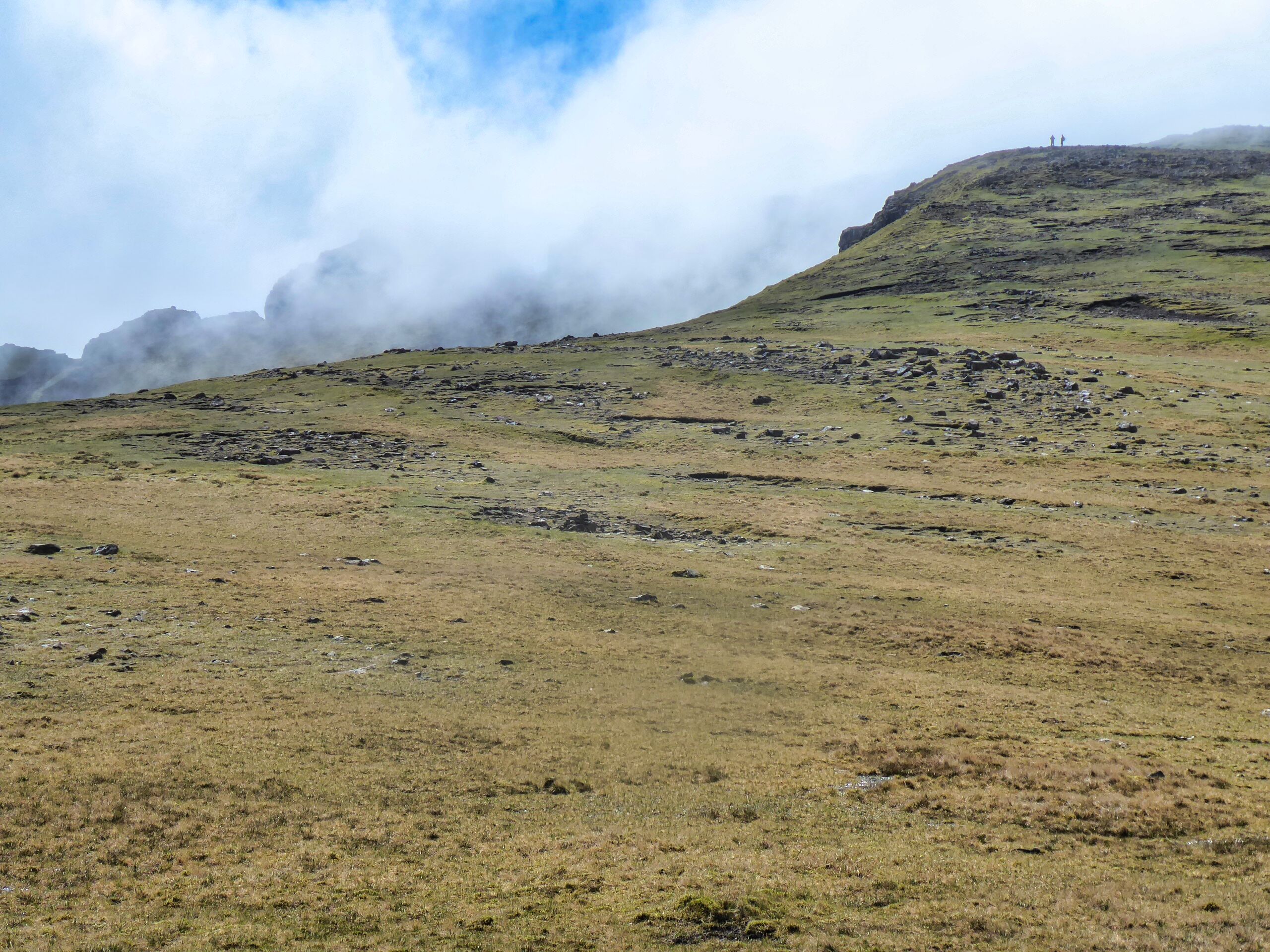
Once above this gully we were back on the path but it was time for a short break to let body and mind recover.

Do not turn right at the cairn at the Great Pow

The path is quite good until the small cairn is reached. A large boulder forces an awkward scramble, particularly for short legs. As we pondered how to get over it I spotted a figure in the gloom scrambling up a steep face just ahead, surely that was not the route? Starting to feel iffy. I got over the boulder and left Liz whilst I explored ahead just to make sure we could go forward. Luckily the other person was either an expert scrambler or just an idiot.

Reassured Liz got over the boulder obstacle which only left a short walk led to the top where about a dozen people were sitting around hoping the clouds would lift.

We sat around for a while, had some refreshments but sadly they didn't lift so back down we went.

Views starting to appear

Around about the lower small cairn the clouds lifted enough at lower levels to get good views of the descent but looking back the summit remained covered.

Top of the stone/scree gully

Liz negotiating the last major obstacle

Both the boulder and the scree chute were easier on the descent than feared although great care still required. It was a descent of full concentration all the way to the burn.


Red Cuillins appear

Superb views of the small lochan and further down views through to some of the Red Cuillins.

Track still looks a long way down from here

The trees are the finish point

Still a ramble to remember although more of an adventure than a ramble. At least the views on the descent provided some reward for the effort.

Ascent: 948m

Distance: 9.8km

Time: 5.45

Wildlife: Cuckoo (heard); Meadow Pipit; Willow Warbler; Skylark; Great tit;

Not the bog fest I expected.....Meall an Fhudair

Hill: Meall an Fhudair (Hill of the powder)

Type: Corbett

Height: 764m


Another Corbett that I had on my to-do list but had dithered over completing due to its unpleasant reputation. I had read that it is boring, a long trudge, a bog fest, one that you are only going to do if bagging all the Corbetts and lots more of not so positive stuff.

I spotted that one of my walking groups had added this as a last minute addition to the programme. I was not doing anything anyway so decided to go for it. Mistakenly did some pre walk research last night and watched a few You Tube videos which reinforced its tough image.

We met up at the normal parking area at Glenfalloch farm where there is room to park 3-4 cars if parked very carefully. Climbed over the locked gate, 10 locks attached to the chain.

Railway bridge

A good track built mainly for the for the Power and Water utilities not for walkers. It gains height quickly with good views over loch Lomond and beyond. A bit grey but good enough for walking.

A rising track with quite a few twists and turns as well as a couple of possible wrong turns. Don't miss the big rock with a small one on top of it, this is where you leave the track and hit the hill proper.

Loch & Ben Lomond

Now it is the unrelenting uphill slog which today was at least fairly dry underfoot and there was a faint track to follow. Heading for the electricity pylons, the tops of some just peaking out. I thought there would be a road but nope they are anchored into the hillside.

Troisgeach ridge in distance

l-r Chleibh-Lui-Oss-Dubhcraig

Still steep
The track comes and goes, just pick your favoured line through the rocky crags and grassy rakes. Keep heading up until you reach the summit of Troisgeach at 733m, that was quite a pull.

Looking back to ascent from top of the ridge & Crianlarich Munros

Fhudair from the hags
Now with the grand total of another 30m of gain required you think it is nearly over but no. The Corbett top Meall an Fhudair is in sight but to get that reward you have to lose some of that height you worked so hard to gain. Enter a peat hag basin and walk 2km before making the final ascent. We had reasonable visibility but many comment on how difficult this terrain would be to navigate in poor conditions.

Loch Fyne top left & Beinn Bhudie on right

Summit to Tyndrum Munros
There is a broad round rock shelter that marks the top. The surprising view for me was looking over to Loch Fyne and Beinn Bhuide. My mind thinks they should have been a long way away but nope that road makes a surprising big turn. There are also exceellent views of the back of the Tyndrum Munros, a perspective that I had not seen before. Actually pretty cool and my hands were cold by the time we finished our refreshment stop.

Descent terrain

Hydro pipes
We descended from the summit backtracking to the hags where we followed the Walkhighlands route back to the hydro system. If you do this expect a steep pathless descent over rough terrain, constantly meandering to find the best walking and once again surprised at how dry it was.

I was pleased to reach the grassy track before joining the hydro track proper. There is still an hours walk on the hard track and this was the hardest part of the walk. Mainly as the sun appeared for that stretch and it was hot, not used to this heat.

To summarise it was a lot better than expected. We did have good visibility and mainly dry underfoot conditions. I can imagine how it would live up to its reputation on a murky grey wet day after prolonged rain.

This is one of the lower ranked Corbetts for height but the ascent is further made up with all the rises and falls which puts the ascent closer to the highest Corbetts and many a Munro.

So overall a good ramble for me but you have been warned.

Ascent: 882m

Distance: 10.3km

Time: 5.38

Wildlife: Golden Plover; Meadow Pipit; Blackbird: Wren; Robin; Willow Warbler; Goldfinch 


An epic landscape.....The Storr

Hill: The Storr (The steep high cliff)

Type: Fiona

Height: 719m

Final walking day on Skye for me and I wanted a memorable walk so one thats been on my list for yonks was The Storr and Hartaval.

Cloud shroud

After clouds lift
Along with Gordon and Liz we parked at an already very busy car park and from here the views up to this amazing rock formation were already amazing, could hardly wait until we got closer.

It is fair to say that including Ben Nevis I have never seen so many people concentrated on such a short section of a walk. It was interesting seeing all the varying ages & fitness levels. No wonder a medical response team parked at the bottom I am sure they get regular calls. The mixture of accents and nationalities also enticing. Thankfully most of these would only be going to the Old Man of Storr and not further on.


It was a very good stone stepped track and it was steep so I was blowing a bit. The magnificent natural rock architecture was out of this world.

Finally we left the masses alone, a few no doubt wondering where we were heady off over a style onto a muddy track.


Trotternish path rising left to right
A short section of light scrambling and then the Trotternish trail was a black line against the green landscape. 

The route is a huge U bend but along the first section there were magnificent views over Rhona and onwards to the mainland and the big peaks of Torridon.

At the U bend we stopped for a break just as the clouds were lowering themselves enough to cover the top.


Top peaking out behind top with the two walkers on it
The trek to the top is mainly over grassy slopes with some erosion but is a gentle ascent. Out of the gloom I spotted a cairn over to our left, we had veared too far right but not in any danger. 

Liz & Gordon brighten up the summit
Redirected ourselves and reached the true top, another well built cairn/trig, very similar to the structure I saw yesterday on Meall na Suiramach.

It cleared briefly to give us some views but another huge deep cloud was making it’s way towards us. As such Hartaval was abandoned, we didn’t fancy the 200m descent and reascent potentially in cloud. 

Red Cuillin on left and Black on right
So we made our way down the grassy slopes towards the gully we had to find. At first I thought it was further away but Gordon rightly thought otherwise and we reached the correct gully to descend from.


From the top it was still a long way down and looks slightly intimidating. It did need full concentration but although rocky and pathless at times it was reasonably straightforward. A ring ouzel flew across us, my first of the year. It did pose but I was not quick enough to get the camera working whilst balancing on steep stony section.


Boulder debris
Finally to finish a wettish grassy final section where time was taken to discuss the boulder field from all the collapses from these cliffs. A few sheep were caught out by these no doubt.

Then onto the road section and back to the car.

A top ramble in excellent company. With regularity the views were outstanding. Only disappointment was the cloudy summit and missing out on Hartaval.

Ascent: 639m

Distance: 8.6km

Time: 4.28

Wildlife: Ring Ouzel; Skylark; Meadow Pipit; Feral Pigeon; Orange tip(m); Small White;