Saturday 31 December 2022

A ramble along the Southern Upland Way to Scaw'd Fell

Hill: Scaw’d Fell

Type: Sub2k

Height: 549m


Due to the heavier than expected fall of snow and the treacherous road conditions it was plan B today, only 2 miles of driving instead of 22 and that short trip was interesting enough. As I descended from the main road to the walk start it was the 1st time that I have used the cars off road setting and it coped well with the tricky descent.


As I set off I met the father and son farmers and had a wee chat. I enquired about any livestock issues on route. I didn't like the hesitation before he replied ‘just the big cats’, more of which later.

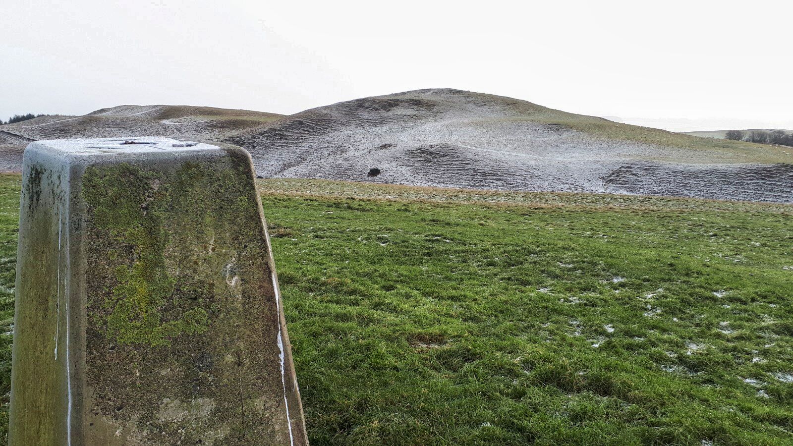
My objective was Scaw'd Fell which lies southeast of Moffat and is one of the Ettrick Hills. Its summit is clear but its flanks have large areas of forestry much of it deforested and replanted. I had read reports of walkers going up via the deforested areas and found it tough going. With snow on the ground no chance I was doing that on a solo trip. I was surprised as the OS map showed a longer walk along the SUW came to a trail tat ascended bordering a plantation before cutting through to open ground almost at the summit. That was my plan if the trail still existed. Google Maps satellite view looked as if it still was.

Thought the clouds coming my way were more snow bearing ones but not to be
The day was bright enough and soon after walking the temperature had risen enough to take off my gloves. The route is straightforward following the Southern Upland Way so even with snow on the ground it was easy going. These farmers like to keep their sheep enclosed as I must have crossed 6 cattle grids whilst walking through their ground. Went to take a phone snap and realised I had left it on the charger in the car, not smart. Did have my small digital but it had its own trauma, more later.

Detour

Doesn't really capture the extent of the tree devastation
After the final grid there is a no further access sign describing how to take the detour due to forestry work ahead.. Had a look at it and it seemed to go well away from where I wanted to be. It was a Sunday and I could not hear any workings. There were a set of tyre tracks in the snow but not a big lorry. So, onward I went sticking to the main trail. Not long after I came to an area of tree devastation, probably last years storm, but some of the cuttings looked fresher than that. From the amount of trees down the SUW would have been blocked but not today. As I looked at the carnage a Sparrowhawk flew past my nose amazing flying twisting and turning through the branches.

Scaw'd Fell in distance. If wanted the poor terrain route go right, I went left as seen.

There are a few main offshoot tracks but I had prepared a route last night so still on my track although detour required if wanted to climb the deforested zone. Good thing about snow walking is the animal tracks. Plenty of hare and roe deer had walked this section recently.


As I puffed my way up a steeper section my blurry vision spotted two things sitting down looking at me. Oops time to get the glasses on and yes, it was the big cats. Two stone lions sitting at the driveway to a small very remote cottage.

Shortly after my wildlife encounter I broke out into the open area. The deforested and replanted area was on my right and the ridge of Scaw’d Fell was not that far away but as said earlier that route was not for me. I was wondering whether my track still existed or had gone with the workings but delighted to find it was still there.

Cold caravans
Up the track passing an old caravan until I reached the end of this track where another two caravans were. The gradient had been excellent as almost on 500m level without trying. Just another 50m of ascent.

Track into short tree section
My map showed a small track to the left which isn’t evident until you are actually at it. This short section of forest was the hardest bit of the day as at least a dozen trees were down which involved crawling under, scrambling over, lots of sharp bits before breaking out again on the gentle flanks of Coomb cairn, and then easy slopes onto Scaw’d Fell itself. At the summit the minimal fence post marks the spot. I realised no camera in rucksack pocket. I knew I last used it just before I entered the trees. Good views all around, Capel Fell the nearest biggie, but no hanging about it was find that camera time. Another good thing about snow walking is you easily retrace your steps. I was lucky and found it below a tree I had crawled under. It must have got forced out of the rucksack pocket as I did my assault course training. As I went back over the obstacle course I could hear a Roe deer’s warning bark. I’m sure everything around would have heard my moans and curses.

My return route is the line just above the trees

Following my footsteps back. Note how hills in distance on other side of M74 had no snow


Still it was a lovely walk back although it was turning colder again particularly when the sun disappeared. This route is definitely preferable to other options and if those trees had not been down it would have been a breeze. Largely unpopulated is this area and today I was the only walker around, a new adventure and solitude.

Ascent:476m

Distance: 14.9km

Time: 3.46

Wildlife: Buzzard; Wren; Raven; Sparrowhawk; Blue Tit


Highstown Hill

 Hill: Hightown Hill

Type: Sub2k

Height: 250m


Walkhighlands description ‘Hightown Hill is the highest point of the rolling countryside northeast of Dumfries. Or is it? A survey has shown that adjacent White Hill is the same height. Best climb both these summits to be sure of bagging this one’. Mmhh.

I was heading to Moffat to blue tick Scaw’d Fell and took the opportunity to tick off this tiddler as well. A slight diversion via the Dumfries road so not too far out of the way. The temperature never rose out of sub zero numbers but the main roads were fine even if my screen wash was obvious at summer settings. The hill is so short that it makes you wonder the validity of some of these lists, but a Sub2k it is so I did it.

Hightown hill is located in the middle of extensive farmland so getting parked on these single track roads is a bigger challenge than the climbing the hill, particularly with very wide farm equipment coming by.

So a six point turn, parked as close to the hedge as I could get and the walk was on.


Climbed the gate as it had a combination lock and headed across the field to the next gate. Big holes indicated cattle had been here but thankfully not today. Climbed the next gate and plodded up the grassy slopes. Light snow was falling but no issues. A huge flock of starlings rose and noisily flew round the other side.


Criffel rising out of the mist

Reached the cairn where there are nice views particularly looking over towards Criffel.

Another hill fort to bag!
Across the way lies the aforementioned White Hill. All the maps I looked at have it as lower than Hightown but as it had taken no time to get up Hightown I might as well do them both. Another attraction is that is marked on the map as the ruins of a hill fort.

Do the slopes like like structures? Electric fence ahead 
As I went down the slope I could see a hole in the dyke but could also see a fence behind it, maybe there is a gap, nope. Touched the top wire and got a significant electrical pulse so glad I had no rucksack and squeezed my large frame through the middle wires.

View back to Highstone Hill
Up to the top of White Hill where two stones marks its top and a flock of sheep that seem unconcerned by my presence. Little evidence to my untrained eye of the fort. Anyway, that is both climbed just in case so I can confidently get my blue tick. It does have a slightly better all round view to justify its hill fort status.

Avoided the electric fence on my descent by heading to an ATV track which leads back to the farm. But with hindsight I should have stuck to the fields. This track is alternatively hard rutted or boggy, not easy walking. But I did flush a snipe at two different points close to each other but not the same bird. Both took off silently rising on a S shaped manoeuvre, like a fighter plane avoiding being hit.

The tricky bit 
At the farm I followed the road back to the car. This was the hardest part of the walk as the road had a solid coating of ice and it was all downhill. Survived. Another short ramble but at least rewarded with another blue tick.

Now, I have an appointment with the Lowland Brewery at Lockerbie, if I can get out of the maze of these country roads. Not quite sure that hill ramble deserves a beer but lack of height/distance/time has never stopped me so far. Cheers.

Ascent: 162m

Distance: 2.3km

Time: 0.47

Wildlife: Starling 50+, Snipe, Meadow Pipit

Wednesday 21 December 2022

A return to the South West.....Cairnharrow

Hill: Cairnharrow

Type: Sub2k/Marilyn

Height: 457m

Cairnharrow hill
Another poor weather week so had to take advantage of the one good day. Another week and another trip to South West Scotland and the Galloway hills.


It was a beautiful morning for a drive, the countryside burnt orange was impressive. On a day like this I could keep simply keep driving and taking in our beautiful landscape but there is a small hill to be tackled.

After leaving the A75 it is a twisting minor road with minimal passing places. Fingers crossed that nothing was coming my way. It would be a long reverse for someone, probably me. But I reached the pens without incident and went on to the long farm track. At least this is straight but again no room to pass each other but again nothing encountered. 

The car had been washed yesterday and will be washed again after this. Mud and coo stuff spattered all over. A small muddy turning area where maybe a couple of cars could squeeze in.

Still the morning sun was glorious and off I went for this short ramble.

Glad the bracken has died away
At least I timed the season correctly as the bracken had died down. There is a stone dyke to follow but initially the route is through the middle of the fields unless you like climbing over big stone walls.

At the top of field one there is a gate in the middle of the field but it was tied and bolted so I did climb after all. Just sheep in the field today.

Through field two with no livestock and again a gate that was open, good.

Now heading for the stone dyke where a worn track accompanies it. After all the rain the ground was a lot drier than I expected so far so good.

Big tor in the wall!
There are times when you have to go cross country through the tussocks and heather but keep heading back to the wall to find the track.

A left turn alongside the wall and the target is in sight. You are hemmed in a bit between the grassy humps and the wall so not a lot of viewing interest.


Earlier on I had noticed that the dyke was an unusual build with the stones mainly vertical. Up top it was a mixture with the bottom half horizontal stones and the top half vertical. Need to look at dykes more carefully!

Towards the top the wall gets flanked by an old barbed wire fence sometimes on both sides. As I neared the top I spotted a broken section of wall so hopped over the barbed wire easily thinking the top was this side. A couple of minutes later I spotted the trig but of course it was on the other side of the wall and fence. 

Fortunately, another broken section and there I was although the real top is not the trig but a small cairn through yet another hole in the dyke.

Pibble Hill directly behind with Cairnsmore of Fleet the big lump

View across to Wigton

Arty shot lol
Very good views although the low bright sun meant the views down to the Lake District were poor. But good across the Solway towards Wigton. The best views were inland looking over Pibble Hill and behind it Cairnsmore of Fleet with the Glentrool hills further behind. A nice spot.

Still plenty of greenery around here
I returned by the same way flushing a snipe. There was lots of heather but never heard or spotted any grouse. Plenty of meadow pipits flying in pairs.


Another reason for doing this hill was that I wanted to visit the nearby historic Neolithic burial chambers at Cairn Holy which are said to be older than the Pyramids, wow. There are all sorts of theories about the site just like many others eg. are the stones lined up with the stars for pagan rituals or just burial chambers. But there is no doubt important people were here, possibly the mythical Scottish king Galdus/Corbred II. The acidic soil has removed all trace of the bodies but their belongings survived. I was taken with an axe head made of Jadeite whose stone had come fronm the Alps. An indicator of somebody important and of the trading between the communities here and abroad.

So, a ramble that was ‘just what the doctor ordered’. Spectacular weather, an easy ramble along with another Sub2k bagged. An enjoyable traffic free drive in great scenery and some history thrown in. I will take that to pass a day.

Ascent: 287m

Distance: 4.01km

Time: 1.41

Wildlife: Meadow Pipit; Robin; Chaffinch 30+, Snipe, Carrion Crow

Tuesday 20 December 2022

Not sure where it gets its name from but no white up here.....White Top of Culreoch

Hill: White Top of Culreoch

Type: Sub2k/Marylin

Height: 344m

For a number of reasons, I have been unable to walk much recently and I was well fed up. Typically, now that I had some freedom the weather has been pants. The only decent forecast was for today, reasonable for some, but my objective lay on the border line between a dry or a heavy shower day, what chances of it being dry?

I decided to have a scenic winter drive and tick off a small Sub2k at the same time. I only have 4 remaining to do in this SW section of Scotland, so my choice was limited. White Top was the nearest and has the distinction of being the 1065th highest hill in Scotland, thus well off the Munro baggers radar and most other peoples for that matter. Still, it is not all about height as D&G hills are notoriously pathless, tussocky and tough going. Throw in the effects of deforestation and it can be a tough ramble.

I did my research, and the most used and quickest ascent is a direct assault from the parking place. However, I wanted a slightly longer walk so roughly followed another route from Walkhighlands. 

Heading to mid left of the tops
I walked along the 'main' road for about 10 minutes before reaching the unmade road leading to Grobdale of Girthon. I have searched, but not yet found a site, where the meaning of these unusual local names can be explained. Always disconcerting to start a walk by heading away from the summit you want to be on. 

Walked down the track to the old stone dyke and cattle grid before veering left and following an ATV track. 


There were a few of these options
Now all the way to the base of White Top there is everything I expected from this terrain. ATV tracks will get you almost there, eventually, but expect them to disappear many times and if lucky you find the original or another. The lower section of the track is extremely boggy, really just a deep mud track at times, no surprise given the amount of rain we have had. Additionally, I am following the trail of a herd of cows, a very big herd from the amount of dung dropped and the huge depressions in the track that they created. My dodgy eyesight is not as reliable, so every other sense is on high alert, where are they?

Time for the tussocks
After a bit of ascending I hit the tussocks. God only knows where the ATV track has gone. These are proper D&G tussocks. Deep with hidden depths to rock the ankles. 

I find another ATV track but so have the coos from the fresh droppings. At least I have turned and now heading towards the hill. Varying terrain but I reach a high spot with good views of the very rugged and isolated land surrounding me. The rain clouds are not far away, flanking to the west, but I am still dry so far. 

A descent to another dyke, flanked by a barbed wire fence, thanks. After some thought I found a bit of wire I could push down, safely over. 

The war zone
Followed by a short steep wet grass ascent and I reach the deforested zone. I have crossed worse sections and thankfully this was fairly short. But these are high risk injury areas, so progress was slow and sure.

There was no obvious indication of a top although it was clear I was on the summit. Browsing around I spotted the few small stones beside the upturned trees, the summit marker. Sadly understated but understandable for only the 1065th highest hill!! I was thinking that a few years ago it would have been in the middle of trees and harder to find as the surrounding slopes falling away would not have been as obvious.

There was a reasonable view of the wild terrain surrounding me but over towards the Solway Firth the light suggested the brightness was still with them, not me.

Heading for the small row of trees on right. ATV track takes you away.

Remote and rugged landscape
I returned the same way with a few detours from the ascent trail as I spotted so called better options. Some were and some were not. 

The trees get closer and the stag is roaring off to my right
On the descent, I could hear at least one stag roaring, must be right at the end of the rut. Judging by the sound of the roaring it was coming from the small ridge of Craig of Grobdale, over to my right. I had considered descending that way but decided against as I did not fancy solo walking across that rough ground. Although on reflection I might even have seen the stag!

Back to the car where I reflected on a short but good ramble. Plenty of ups and downs added to the ascent. The terrain was rough but been in worse. Never encountered the coos. After changing I started to drive home just as the heavy shower arrived, my luck was in.

 Ascent: 299m

Distance: 7.2km

Time: 2.16

Wildlife: Red Kite; Raven; Red Grouse; Meadow Pipit; Red Deer Stag (heard)