Saturday 4 March 2017

Great Glen Way Laggan - Fort Augustus


After yesterday's hill efforts, Meall an t-Slamain, today's plan was to walk another stretch of the Great Glen Way.
A grey and wet morning was my vista from the hotel windows as I tucked into my breakfast. A damp walk through the equally bleak Fort William centre to the bus station. Why do the planners allow outer town shopping areas to have such a detrimental effect on the towns themselves, you have a lot to answer for.
A 30 minute ride on an under populated bus takes me to the Laggan swing bridge to continue my Great Glen journey.
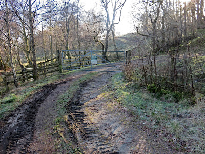
As I crossed the main road taking the track towards the Great Glen Water Park the sun was coming out and the birds were singing, this is the life.
Invergarry station
The route follows the old railway line alongside Loch Oich so you cannot get lost, yet another of General Wade's roads, how many did he create? There is a project going on to restore Invergarry railway station in some form. A nice siding and a few old wagons but not sure what else is going to happen here apart from a static example of some kind, a museum maybe, but good luck to them.

The new hard packed track sits about 10 feet above the old track as described in Walkhighlands but essentially it is the same route. One issue for a walker is that the lower track was almost loch side and good views across the water. This higher track has an almost constant tree line between the walker and the water. Not an issue at this time of the year as few trees in leaf but at other times your view of the water might be quite limited.
There is evidence of lots of improvement work being carried out and a I even spot a tree with a bat roost sign, I presume they are all still tucked up inside the tree today. A red squirrel appears and I spend a few minutes watching it making its way through the trees, a smile on my face, such simple things make you feel better.

Spend some time and look across the water to the ruins of Invergarry castle and smile at the equally ruined boat on the banks. The castle has stacks of history, destroyed after Culloden, yet another one and think about the misery of that time, rich and poor alike. The boat was a tourist boat, just surprised the authorities have not forced a removal of the wreck.
Next, I come across a clearing that is used by the canoe trekkers for overnight stops. One bonus there are some modern composting toilets and the good news, they were unlocked. I did not need to explore this further.
Composite toilet
A bit further on the walk goes under an impressive stone railway bridge, it’s a loch on one side so where was it going and interestingly there are bat signs on this too.
Looking back down Loch Oich
Next point of interest is the renovation work at the Aberchalder road crossing, which is all noise and construction, so I quickly cross and back to the tranquillity. So quickly I forgot to snap the historic cantilever bridge over the River Oich. Loch Oich is now in the past and the route now follows the canal to Fort Augustus although the River Oich is still spotted frequently on your left hand side. 
Wide canal between Oich & Fort Augustus
At these locks there is a cracking lock keepers cottage where I spend some time talking to the owner. Tranquil he described it and with this rainbow behind you cannot disagree.

There were a lot of aircraft flying today both low and high level. I also spotted a couple of Chinook helicopters above a far hill, I wonder if an exercise is ongoing. I heard the roar and just pressed the shutter as these two flew past, no sound oppressors on these engines.

Whilst studying the river an angler appears through the trees, we have a good chat, the early salmon are running but not for him so far. I get the sad tale of the devastation the hydro works have caused to the salmon runs, or indeed lack of them. As we talk the orange breast of Mrs sparrow hawk lands in a tree right beside us before realising her mistake and swiftly flies away.

At Kytra lock, a beautiful spot indeed, a barge inn is docked, all shut up, I don’t know if this is its usual spot for walkers, water folk etc wanting drink and food, but none to be had for me, dig out another small pie.
My waterproof leggings have been on and off, dry now but the last few miles see a major temperature drop along with high winds. Still it is behind me and blows me along to the locks of Fort Augustus and my finish. These locks are identical to those at the start of the Way, Neptune’s staircase at Banavie. I had originally considered going further today onto Invermoriston but the change in weather and the knowledge that one of the infrequent buses back to Fort William was due in 15 minutes made my mind up to finish here for the day.
Fort Augustus 5 minutes prior to the storm
Whilst waiting for my bus (in the shelter out of the wind and rain) a tourist bus pulled up and deposited a lot of Italians, who in their fashionable dress and style, looked under whelmed with the heavy rain. Not wet enough to stop almost all of them lighting cigarettes. Double whammy for them, as my bus went over the canal I saw them all queuing up for the incorporated small boat loch cruise. In this wind and rain, happy memories of Scotland.
Despite or because of the mixture of wind, rain, sun and blue skies I enjoyed my walk.  Distance was 9.46 miles with minimal ascent. 3 and a half hours of splendid Scottish countryside, nowhere else I would really want to be.


Meall an t-Slamain

Slamain from Fort William
If there is a finer 360 degree perspective, for a hill of this size, anywhere in Scotland, then I have not yet been on it, point me in the right direction. The Hughs book strikes out yet again. Meall an t-Slamain is special. Indeed the views will outdo many a so called superior: Munro; Corbett; Graham; Donald etc. I know I was possibly lucky in that the air clarity was superb, the snow encrusted tops and the bursts of blue sky defined the beauty of Scotland but still I was there today and the views were magnificent. It is a rarely climbed hill in this area as it sits across the water from the great Ben and all the wonderful mountains that surround it.
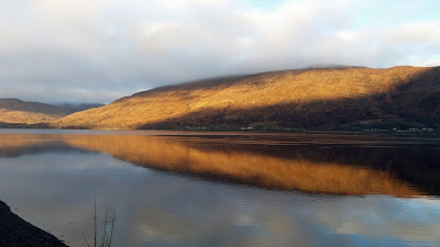
I was based in Fort William and had the option of a short walk from the hotel to catch the 15 minute ferry across Loch Linnhe to the start of the walk.  My only issue was matching descent time with a ferry back, if like me when a walk is over so am I, no hanging about. So I decided to drive the Mallaig road then cut around Loch Eil and glad I did with this mornings moody perspective.

Beautiful.
Loch Eil
As I was driving I decided to start from the radio mast/view point Agro track at Achnaphubuil, only because it was the first point reached, rather than the conventional ferry start at Camusnagaul.
The start
There had been overnight snow and an ice warning, a cold day ahead? But soon after starting the walk I had already shed my mid layer and proceeded to sweat profusely all the way up to the radio mast. I had been blocked up all week so put it down to that rather than lack of fitness . Why sweating considering the temp gauge showed only 2 degrees at the start.
The track and the summit top right
The Agro track pulls you all the way to the radio mast at 290 metres. It is a man made track, not pretty but it gets you there. Don’t worry there is plenty of non track moorland ahead to keep the purists happy. The sun was directly in my eyes so limited looking up. Just as well as it is a steep pull so head down, just get on with it.

Once the mast is reached, stop and take in the views all around, enjoy in the knowledge that it gets even better.


From the small trig there are a couple of posts suggesting a track but you know it is really not there and after 100 yards or so just take some bearings and head across the moorland towards the summit. As always there are a few false summits to keep you interested, am I nearly there, no. 

The false markers
About 2/3rds of the way up the snow line is reached but the worst of it is on the northwest flanks so pick your way between the snow, the bogs and there is some good walking. I spot some fresh deer tracks and follow them for a bit before realising that unlike me they are not interested in a trig point so I leave them and readjust my direction. The walking poles go deep into some of the drifts, iced up streams to be avoided, but if care taken the walking is okay and different enough to be fun.
The humps to the summit
Finally after about 90 minutes I reach the top. There are about 3 small false cairns along the way. The views in every direction are just outstanding. The large peak away west can only be Ben More on Mull. Loch Eil and its hills stand out. Looking north the canal locks at Banavie and the Great Glen. And just across the loch Ben Nevis and all the hills, quite outstanding.
Ben Nevis and Fort William
I head back via the same route and about 5 minutes down I hear the fighters engines roar. Close by but where. I spot it down on Loch Eil then it turns and climbs and I think its heading right to me. Then it goes side on through the glen between me and the Corbett Stob Coire a’Chearcaill, the plane outlined below me, what a sight, what a noise, then it heads south climbing into the sky. Had I been on the summit the view would have been even better.
Cairn looking south
Soon after whilst picking my route descending I hear music, what, and two youngsters appear. T shirt clad, I know I was sweating on the way up but that is for youngsters only. Getting a chill just thinking about it.
Cairn looking over Loch Eil
A reasonably straightforward descent to the radio mast although take care, my foot did sink in a few times to ankle depth through the moss.
Another 10 minutes spent at the trig point taking in the wonderful view then back down the Agro track to the car.
Apart from one red grouse, a distant kestrel, a flight of geese and the deer tracks that was it for the wildlife today.
Ascent was 452 metres, distance 4.68 miles and time taken 3.18 hours ( you can spend a lot longer taking in the views). Well worth the effort, big style.