Friday 24 June 2022

Up there with the best 360 degree view I have had.....Breabag

 Hill: Breabag (Little Height)

Type: Corbett

Height: 815m

I had put this hill for ages as I thought it would be a horrible scree sloped ascent. I could not have been more wrong. A last minute decision turned out to be a really enjoyable ramble.

I had another ascent planned for the day but as I had been wakening so early each morning I did not bother setting an alarm. You guessed it, awoke and looked at my watch 8.30am, wow. So by the time I got ready a shorter day was required.

Plenty of water from small stream
Parked up at the Bone Caves, only a few cars around. Beautiful morning so emptied as much waterproof gear from my rucksack and set off.

This vibrant scene is only feet away from the dry river bed

Usually find a Small Heath on this path
The burn was in full flow, I really like this section up to where the burn disappears higher up. Realisation that it is created not higher up from the mountains but from bubbling limestone springs underneath, fascinates me every time.

First dry bed

2nd gully
As the path turns for the higher bone caves track I headed left alongside the dry burn for a short section before a sharp right up another dry burn gully. Going was better than expected.

Follow this, crossing from bank to bank as suits, until the moor is reached. Mainly heather but grassy swathes can be found to ease the going.

My route headed for the waterfall which lies beneath the break in the hills, a small gorge/fissure which you climb through. The scree slopes surrounding gave negative thoughts of the possible hard work ahead.

Not true. Another plateau is reached where there are more grassy sections than expected so the scree can be avoided for now.


I spotted quite a few deer on the ridge, they had also spotted me and were looking right at me. As I headed to the rocky summit there were small pockets of deer everywhere. They were all hinds with their calves and most stand their ground before moving. I have never seen so many deer spread over a plateau but staying apart. Plus, I have never got so close to wild deer on the tops , it was fabulous.

Cul Beag & Mor, Suilven, Canisp

Panorama

Suilven & Canisp
An easy rocky climb to the summit. And the views were out of this world. I have had great views in Assynt but nothing to beat this, it was spectacular. Every Assynt stack in perfect view. The Western Isles clear. The views are open to the Fannichs and up to the Sutherland mountains. 

Lunch companions heading off when I moved
I ate my lunch listening to deer so close I could hear them chewing and lightly coughing. This was absolute magic, so tranquil, the only noises are natural ones and then the midges started biting.

Conival & Ben More Assynt
I wandered over the scree with deer all around to have a look at the Coirean Ban, spectacular drops and views to Conival.

Top of fissure heading back
As I headed back to find the gorge and my descent an eagle appeared in the distance. Luckily I had my mini binoculars and as it turned the white pathcesv underneath and the pure white tail made my day. It never came really close but so what.

Bone Caves in big lump above grassy slopes

Back down the same way, it got very hot lower down.

All in all a special day on a runt of a hill that turned out to be one of the best.

Ascent: 707m

Distance: 10.6km

Time: 4.36

Wildlife: Red Deer; Small Heath butterfly; Meadow Pipit; Golden Plover; White Tailed Eagle.


To track or not to track.....Meall na h-Airse

Hill: Meall na h-Aisre (Hill of the defile)

Type: Corbett

Height: 862m

The clouds were higher today but even without blue skies the drive along from Laggan to Garva Bridge is rather stunning and well worth the effort by itself. Taking you to almost where the River Spey comes to life. Garva Bridge is another General Wade route.

View from Garva bridge of the River Spey
I wanted something straightforward today and this hill gave me two options. Option 1 is for the purists follow the Walkhighlands route, boggy in places but a straightforward ascent. Or option 2, for the sloths follow the pylon construction path for most of the way.

I chose the latter but beware, it is longer and it is on stone covered hard-pack so not kind to the feet. Also don’t take the wrong track or you will be climbing Geal Charn.

Garbain straight ahead, Airse turn right


Summit behind highest point but track goes way left behind the hills
This is a short blog as there is not a lot you can say about trundling up a track with limited views until you are near the top.

One of many skeins

This was The Boss
At least the many skeins of geese gave me an excuse to stop and look up. The migration is fully on, no doubt influenced by the strong southerly to help them along. Also I spotted these stags, mainly juveniles but one full antlered, the boss!! I had seen hinds already this year but this was the first stags.

When the track runs out take to the moor, very boggy for a short stretch. You might stumble across a faint ATV track but guaranteed you will lose it just as quickly. Regardless, the summit is not far away so take a line of sight and just go for it.


Zoom to Corrievairack Pass, Garbain on right. Does the pass look red?
If you dismiss the pylons the views are rather good particularly over the Creag Meagaidh range and up the Corrieyairack Pass. On the other side is the aforementioned Munro of Geal Charn. To the right of the pylons the mighty Monadhliath range. With snow covered peaks not bad at all.

Long trek home
It was very cold, time to be heating up. So an uneventful return by the same route.

A limited walk with good views up top.

Ascent: 637m

Distance: 17.6km

Time: 4.11

Wildlife: Meadow Pipit; Skylark; Buzzard; Grey Wagtail; Red Deer (stags); Skeins of geese

A stunning taster of Torridon.....Sgurr a' Choaracain

Hill: Sgurr a’ Choaracain (Peak of rowanberries)

Type: Corbett

Height: 792m

In terms of height this is not the most impressive of Corbetts. Neither is it in terms of ascent or distance. But in terms of the surrounding landscape, the mighty sandstone cliffs and the huge drops to the corries this has a wow factor up there with the best, stunning views all round. A true sample of Torridon mountains.

For those wanting a fuller experience other routes are available but not for the inexperienced.

The initial danger was ascending the Bealach na Ba, meant to be a no go for campervans but too many ignoring this. One cyclist was knocked off the road by one, could have ended badly.

It was rather chilly at the starting point from where we headed up to the mast. Some people stop here thinking it is the top. It is only from here that the real summit is seen several kilometres away. Maybe the amateurs think it looks too far or even too scary as the initial view of the apparently narrow ridge and the vertical drops look too challenging.


The terrain is initially rocky and goes very close to the edge at times. There are a few interesting ascents and descents, sometimes pathless and at times light scrambling with some interesting views particularly for anyone without a true head for heights. Maybe facing in might help at times.


Finally the roller coaster is over with a short ascent to the cairn. The views on a day like this cannot be beaten. Mountain tops in every direction as far as the eye can see. Throw in water, the Skye bridge, Raasay (Dun Can) etc and it was a superb place to spend half an hour.


The descent is just as spectacular mainly dominated by the amazing A Chioch ridge. Its vertical drops are jaw dropping and it has been climbed, rather them than me.

So a short but top drawer ramble. One that will live in the memory for a long time.

Now time for that coffee shop in Shieldaig, carrot cake waiting.

Ascent: 395m

Distance: 6.9km

Time: 3.25

Wildlife: Meadow Pipit;

The birds might be timid but the weather was not.....Beinn Enaiglair

 Hill: Beinn Enaiglair (Hill of the timid birds)

Type: Corbett

Height: 890m

A day out with the ADRC at their away week in Ullapool.

Forecast for the morning was grim and it turned out accurate. It was then meant to improve after lunch, inaccurate.

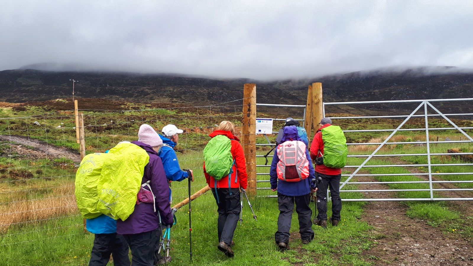
Cloud very low at the start
We followed the normal anti-clockwise circuit which involved a long moorland walk before contouring the Corbett on stalker tracks, which were wet but in good order. 

Despite the WH description there thankfully was a gate at the deer fence. Home Loch looks a nice fishing spot.

We started in light rain which moved to heavy rain for long spells. The winds at times were ferocious making walking pretty arduous when it was at full blast, less so when leeward. It got pretty dammed cold, under freezing point with the wind chill factor, as we gained height near the summit. The clouds had lowered so visibility was minimal for much of the time. No photos for a large section. In the gloor until we had almost descended the ridge and met up with the stalkers path again near Loch Feith nan Cleirieach.


Hat boulder

Track goes round the flanks

On the ascent we had a short food break sheltered behind the enormous boulder of Clach n h-Aide - the hat-shaped rock. Nice to get out of the wind. After that you could have been anywhere in the clouds.

They say the stand alone hill gives superb views, it can be seen on You Tube, but for us we could have been on any hill top at any height.

A view at last

Graham on the left
We had considered adding on the nearby Graham but the walk had been long enough.

Quite a bleak review but it was actually a good walk for much of it. That is down to the group dynamics, friendly and good banter despite the poor conditions. Navigation was shared with Liz and Gordon which was really helpful on a day like this. When visibility is so poor more heads were better than one.

Still, we did come across the timid birds that the hill is named after. Indeed one of the party almost stood on a Ptarmigan nest. Its owner did protest.

At least rain leads to a nice waterfall

Finally heading home
The clouds lifted enough to give us some views for the walkout but the weather never really improved beyond grey and damp. A poor weather day for the end of May.

Still another blue marker and a good time with friends. But I want blue skies and warmth.


Ascent: 754m

Distance: 16.4km

Time: 6,07

Wildlife: Meadow Pipit; Snipe; Ptarmigan; Red Grouse; Common Frog, Curlew