Wednesday 30 August 2017

Cow Hill Fort William but are there coos?

After my recent exploit’s the legs were feeling a bit stiff so they needed a bit of exercising. But not too much as I have the big Ben outing in a couple of days. Also Mrs wanted to come along so reasonably gentle walk required. A study of local walks showed a good possibility, traversing around the loop of Cow hill along with the summit diversion, this could be done easily from the house. Now, the only question is in the name of the hill, does it have any of my nemesis, coos, time will tell?

Sunshine and showers yet again so annoyingly waterproofs donned from the start. An uphill walk got height gained quickly even before we reached the formal start along an old drovers road. Most people will start the walk from the Glen Nevis car park side but this side suited us just fine.

A solid track takes us inland, the aerial mast on top of Cow Hill can be seen and we soon reach the circuit junction, choice left or right? We chose to the right mainly because the views to the west were spectacular as the rain and light created an ever changing vista. Through the gap in the hills looking towards Kinlochleven and down the loch the air cleared and then the next shower could be seen racing in from the west. Frustrating, especially when looking behind back across Loch Lhinnie, Meall an-t Slamain and its Corbett, Stob Coire a’Chearcaill, appeared to be permanently bathed in sunshine.

Still the Ben is starting to show itself, it is huge and imposing. We take it all in as we divert from the loop to take the track up to the mast and the top of Cow Hill. 

A closed gate looms ahead with a big yellow sign, warning, I can guess what this is about, yip coos ahead. We clamber over the style a follow the track. As we progress there are lots of coo pats and the further on we go the fresher they are, steaming and covered in flies. There is all this grass and heather around yet they always want to walk on the track, amazing. 

The track twists and turns for a mile or so, I keep waiting to see the huge shape when we turn a corner but we reach the top without being ambushed. One side of the mast it is their path and is so churned up, so deep and boggy so we forget that side but the other allows you to get past and there are outstanding views of Loch Lhinnie and Fort William, well worth the short effort.

On the way back we reach the stile without seeing a coo, where were they? The views of the Ben are fantastic, come on Thursday. At least 2/3rds of it the top section is fully immersed in cloud and no doubt will be the same for me. A large number of ant like figures can be seen spread out along the trail, it really is a popular tourist hill.

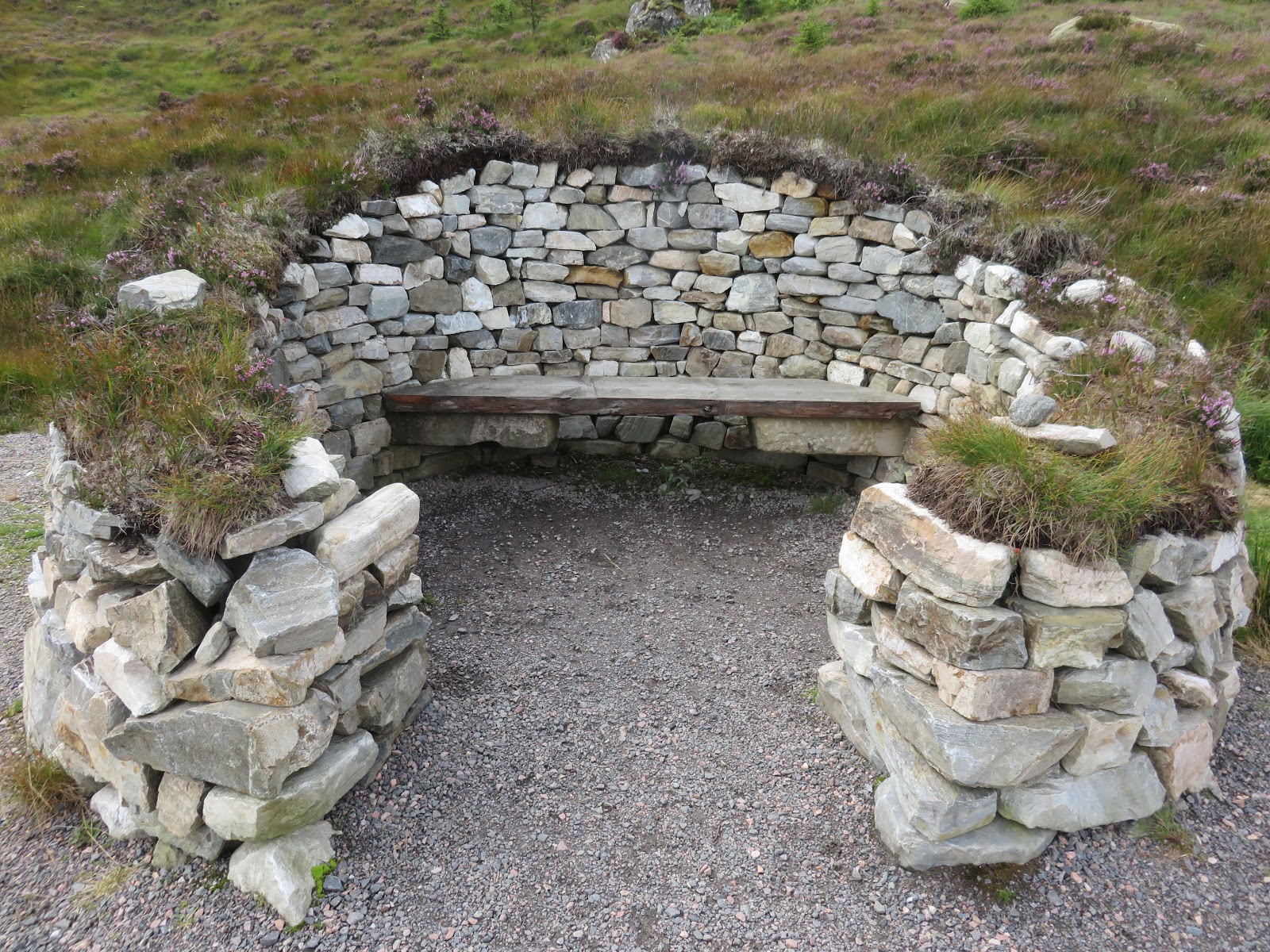
We now continue to follow the yellow loop trail which takes us into the forest, a red tent, all set up, can be seen well into the trees an odd place to escape to. An MTB rider comes past, a good trail for them. The sun briefly breaks through, should we take off the waterproofs? No. A bench provides a break in the trees and a final view up the glen. A small flock of long tail tits are almost within touching distance, very attractive birds.

As we continue to follow the circuit there are good views of the industrial sectors of Fort William to keep you interested. A few helicopters around today, including a Chinook heading west via the loch. The final section back to the junction was a little bit of a trudge but at least the rain was off for now. The views are still excellent and if wanted there are cut off options down into Fort William.
An excellent short walk that did just what was required. With the weather I expected this to be a lot busier but not too many tourists to be seen.
Time: 3 hours 15min.
Ascent: 1476 feet (450m)
Distance: 7.56 miles (12.17km)


Monday 28 August 2017

Great Glen Way Fort Augustus - Invermoriston but no Nessie

Whilst I was in the area it was an opportunity to complete another section of the Great Glen Way. Time was not fully on my side so the short section from Fort Augustus to Invermoriston via the high route was today’s walk.
The car park at Fort Augustus was almost full with plenty of tourist coaches around. They were to create bedlam later, blocking cars from leaving, police called so be aware which section you park in. The charge is 60p (4 hours)-£1(10 hours) but there is also a free car park up the hill at the start of the route.
Weather was grey but dry so we turned left out of the car park then soon another left and followed the sign up the hill. This excellent seat is a maybe for walkers coming the other direction but too early for us today.

Take a short walk through here on a tarmac road via some nice housing and just before this rejoins the main route another signposted left turn takes you into an old forest. The track winds its way upwards on a zig zag easy trail past some magnificent huge fir trees amongst others.

On a flat section the bench is reached where an opening should let you see the signposted Crannog. Well maybe in the past you could but now the trees have grown too tall, even standing on the bench no view of the Crannog.
Left for the high route
Avoid the white sign post opposite the bench and go further down the track, 1.5 miles from the start, the track forks giving the option of the high or low routes. 
High route today for the views. Again quickly off the hard packed route the track goes left and for a mile or so steeply zig zags through lighter woods with the pleasant noise of a burn tumbling down for company. Lots of different mushrooms here for those foragers in the know.

The walk breaks out onto open moorland and 5 minutes later the first good views both up and down Loch Ness. Pleasure boats are taking tourists on sedate trips whilst small rib style boats are doing fast tight turns, the squeals can be heard up here. Thankfully this does not last for long.
Looking back down the Glen & Fort Augustus
This recently well constructed high route path continues at this high level for another 3 miles before it starts its descent, plenty of time to take in the outstanding views. 

About half way along a newly built sheltered stone seating area has been constructed, ideal for a break to check the map and identify some landmarks. The radar station ahead is the hill that we will bend around. Had a good look but no sign of Nessie on the water today.

The track is still staying high but the gradient is now more of a descent. Surprisingly little wildlife to be seen, a few meadow pipits and stonechats, a couple of butterflies and that was it. No raptors nor even ravens and crows.

The route now winds its way around the hill and begins a very steep descent through the forest. Less of a zigzag than the ascent this would be a steep pull up. The striking white of Invermoriston lodge can be seen through the trees.

At a marked intersection go across, do not be tempted to stay high, and follow the track through the lower woods. It is slightly disconcerting as for over half a mile it takes you inland away from the loch before reaching a signpost where a right turn leads you to a road. Another right turn and the road takes you back to the striking bridge at Invermoriston.

We took in the short walk to visit the falls before finishing with a visit to the café, just a stroll up the Skye road, for a well deserved coffee and cake.

Probably my favourite section of the walk so far, mainly due to the high level views.
Time: 3.06
Distance: 7.99 (12.86km)
Ascent: 1769ft (539m)

Saturday 19 August 2017

Ariundle woods and lead mines

We headed over to Strontian for a 3 day walking and cycling break but sods law the weather forecast was really poor, the reality was even worse, and the 3 day Plan A has already been scrapped. The forecast was so bad that I did not even take my bike.
Never mind, an internet search for low level walks threw up the lead mine trail which included the Ariundle woods. It is also the approach track for the Corbett Sgurr Dhomhnuill which I want to climb but not in these conditions.
The walk normally begins at the nature reserve car park but as we were staying at the Strontian hotel we walked from there after a very good breakfast.
As we exited the hotel door the rain arrived so we immediately sat on the bench outside the hotel and waterproof leggings on (more of that later).
Various options but we walked the road taking in the interesting array of houses and crofts, a few stalls outside some with signs for fresh eggs, jams etc which can be bought on the way back, honesty boxes. When we looked in one the two egg boxes were empty, had someone took the eggs and left the boxes?

There is a good track through the woods which today was boggy at times but considering the rain we have had no surprise there.
The woods are a fine example of ancient coastal Atlantic woodland. As soon as you are in the woods you get the feeling of authenticity, this is how a traditional mixed woodland should be. Massive oak trees dominate but plenty of smaller birch and larch as well as many others. Not planted in uniform lines so a natural environment. 
In the damp atmosphere deep moss clings to trees and boulders, habitat for millions of bugs and insects but there are relatively few birds around to take advantage of this feast. Low level birds were few and far between, wrens, thrushes and blackbirds the ones we spotted. If you are into your flora & fauna this is a place for you, the diversity is huge. I would love to walk a wood like this with an expert eye. We must miss so much, still that's for another life. 
There are a few examples of these solid boulder dividing lines. Not sure if these are legacies of the industrial past or land boundaries. Either way they would have taken a lot of manual labour toll and strife building these on slopes angled as much as these.
The track continually rises but at an easy steady gradient, the missus is happy. Despite the inclement weather outside, under the trees it is humid. There are a few options to branch off and head down to the river and meet the path below but from what we can see it looks pretty damp and exposed so we will leave that for better weather. At least under the tree canopy the constant rain does not penetrate so much.
River Strontian
As we approach the top end of the woods there are now occasional gaps in the trees giving us glimpses of the hills and glen, views which would be even better on a blue sky day.

Looking down I spot some small very dark scat on the track. It is fresh as some flies are still interested. It looks like there are some berries in the mix. Not sure what but pine martin must be a possibility. This is also a habitat of genuine wildcats. I suppose stoat/weasel are other options.

Some signs that the seasons are already changing, some of the ferns are turning orange-brown and rowan trees with their red berries which are prominent and normally only appear at the end of summer, not that we have had one this year.

Just before you break out into the open landscape you have to cross a wooden bridge that has clearly seen better days. Rotten wooden planks and gaps let you see down into the gorge below without looking over the barriers. Not a long way down but enough to do damage to a fragile human body.

The views are superb, even on this bleak day. The Corbett and its impressive outlying ridges, one day I will be climbing you! Down in the glen cattle are munching happily away, some traditional Highlanders and mostly black Aberdeen Angus I presume. The river is running fast and full and again no clear path can be seen, very wet and hard going.

After about a mile we reach the lead mine ruins. We potter about but did not find the lead mine entrance indicated on the sign board, the rain and wind made hanging about a disincentive so in fairness we did not look too hard.
Lead mines
We returned by the same route and were glad to reach the sanctuary of the hotel, now when does the bar open? As it was still warm I had taken my lighter golf leggings which were not up to these conditions so damp trousers. My new Jack Wolfskin jacket had let in water through the top zip so another item to be returned. Why are so many items of outdoor clothing not fit for purpose?
Still a wet, windy but an enjoyable tramp exploring a new setting and its views.
The Ariundle centre has home baking on offer so after a change guess where we are going.
Time: 4.08
Distance: 9.62 (15.48km)
Ascent: 1206 (368m)

Loch Laga A very wet ramble


Last day of Strontian trip and sadly the weather was not for relenting, still pouring down, how much water had been dumped on us recently?
We drove to Laga where depending on the conditions my objective was Ben Laga. Under other circumstances I would have combined this with Meall nan Each, as both are Marilyn category hills. However, Ben Laga is in The Hughs book with great views so number 1 choice.
The good lady fancied the great outdoors today but when we parked up at Laga the rain almost made it a no goer. However, made of sterner stuff and all layered up we headed off. The parking area is just after the second burn (Allt Mor), opposite the Marine Harvest sign, a small dirt area with room for 2 or 3 cars.
Track to woods
Go back over the bridge and turn left,  follow the new house track until you see on your left a fence and gate ahead which takes you onto the recently planted forest area, EEC money, no more soon.
A twisty grassy track meanders upwards, stop and admire the woodland if you wish. The gradient is good, continually getting higher without too much real effort. Some beautiful black with yellow spots caterpillars cling to the grassy stems, well disguised.
Easy gradient good but wet track
Great views looking back down Loch Sunart a couple of large fishing trawlers in sight.
There is not much to see ahead as the low clouds and rain obscure the hills. The track now is a mixture of grassy areas and a stony land rover track. The water is running down these unofficial mini burns like Usain Bolt. No side steps off the track as it is even wetter.
Open moorland
We cross through another gate/deer fence which takes us out onto the open moorland. The track is straightforward to follow although quite a few of the burns have escalated in size and crossing these makes it more exciting for the missus.
This track meets up with the Glenborrodale to Acharacle longer distance trail just after you get to Loch Laga.
Loch Laga
After about an hour and a bit we get sight of said Loch Laga, looking good, but on each flank neither hill wants to shed its grey curtains of cloud. 
We reach the point just before the loch where you need to leave the track and Ben Laga is the option, but the terrain is so boggy that I am not going to risk the good lady and in these conditions and I am not leaving her down here. The rain eased and the cloud lifted briefly to let us see the terrain up to Meall nan Each, it looked like another initially boggy crossing.
Meall nan Each
Weather is crap, it is very remote and rugged but perversely we are enjoying it. 
Looking down the left side of Loch Laga you can see the track that continues to Acharacle, another nice one for a nice day. I thought I spotted a walker just off the path but it is 3 red deer grazing.

The winds have picked considerably up so we make the descent with the rain now in our faces. Up on Ben Laga 3 stags are standing on the crest of a ridge, magnificent profiles, looking down at us. As soon as I point them out to missus they disappear. An occasional meadow pipit rises from its nest and a group of 4 wheatears and that is the wildlife for the day. Not quite, a very fat vole runs across our path, just as well no buzzards flying.
Loch Sunart
In typical fashion the rain even increased in intensity as we reached the car to get changed.
Although a relatively short walk it was important for missus to get the outdoor buzz, which she did. Still the hills will be there for my next visit and now it is time to visit the nearby Heritage centre for coffee and cake.
Ascent: 844 ft (258m)
Time: 2 hours 38m
Distance: 2.75 (4.43km)


Sunday 13 August 2017

Ben Arthur aka The Cobbler


Other stuff meant that I wasn't going to make the Killie group walk tomorrow so I decided on a solo trip for today. I also missed out on Ayr's walk to The Cobbler last week so that seemed an opportune choice, must be 25 years since I have been up here.
Early start, missed the traffic and ready to walk for 9. The carpark is under repair so at least no parking charge.
Forecast was for no rain, yippee, might get a view from the top at last.
I quickly remembered the easy zigzag start to the walk, lined with flowers, bushes & trees, building the gradient up gradually. Last time when I was here I went to the right and up the front of Narnain but not today. At the Cowal path a quick left, then right and onwards up the well made path until about an hour into the walk I break out onto open land and get my first sighting of the hill. 
There is no deviation from the path so happily there are no navigational issues to worry about, this is a tourist trail for the moment. Plenty of dogs around today but sadly also some piles of dog dirt on the edges, not nice. The Allt a Bhalachain (burn) is roaring loudly just below on my left. The water is running fast with all the rain we have had recently. Even though I am an early starter a couple are already descending followed by a runner. In the group ahead a couple of guys, in the true Clydesider tradition, are smoking on the way up.
Left scramble route Right tourist path (also for Narnain & Ime)
Just after the Narnain boulders the tourist track continues following the Narnain sign. However I am going to ascend via the scrambling route which is new to me. On the Walkhighlands route this is an optional descent but from my experience I would rather go up than down it. Definitely not a tourist path. There are some people climbing ahead to take a steer from. I can see small figures on the summits so still a fair way to get up there.
Scramble joins ridge just below North peak
Quite quickly the path has gone along with my stamina, I am puffing away. To be fair there is a faint line of sight that this is the way to go. At times it is full on scrambling, hands, feet, knees you name it. The walking poles are a hinderance not an aid. Water is streaming down in places so a lot of wet and slippery boulders to contend with as well as the scree. 

I was well and truely blowing know but later checking the heart rate data it showed it at a reasonable level, it didn't quite feel that normal at the time. Looking back down the slope a few more walkers are following this route as well.
Looking back from scramble Ben nevis
Finally I am getting there, near the top, a short section of path appears and is very welcome. Reaching the ridge I spot the small boulder pile which marks the end of that bit. Not sure why I struggled a bit, just an off day I hope.

Another short ascent and I am now at the pinnacle, the highest point of the hill. Sadly I am too much of a coward to to go through the opening (didn't do it 1st time either) but a couple of climbers did, well done to them.

Thankfully the views are superb today, the first in how many outings? Even though it is a cold wind up here I spend quite some time just soaking it all in.
A wander about the tops, all great views and then I decide to follow the tourist trail back. The steps are sore on the knees, the scramble seemed easier. Stop and looking at Ime I am surprised how many walkers are on the hill. One big group are about 3/4's way up (maybe a Ramblers group), and below another group about to start their ascent. Cloud briefly smothers the top but quickly blows over. People can be seen climbing up Narnain as well, probably a few are doing double or even triple hills today. Not for me I have climbed Narnain but will make another day out for Beinne Ime. a great day to be outdoors.
North peak with Beinn Narnain behind
On the descent I pass many of the daytrippers who are now out in force, glad I started early. Some of the gear being worn looks more suitable to the clubs than the hills but their choice.
Nice views of Ben Lomond, Loch Long and the Luss area hills to keep me interested on the descent.
Overall an enjoyable nostalgic trip and the weather stayed good, the views superb, what's not to like.

Sunday 6 August 2017

Beinn Dorain

Beinn Dorain (Hill of the small Stream).
Munro: 1076m
Beinn Dorain from south last winter
This iconic hill stands tall and proud, a magnificent volcanic structure, as seen from the south, as you drive from Tyndrum towards Glencoe. I have driven past this hill many times on my way north but not had the opportunity to climb it until today. 
Both Munros posted
Most people will do this as a double act with Beinn an Dothaidh but today it is an outing with the KRG and the leader felt that the double might be beyond some of the group, fair enough, it leaves me Dothaidh for another day.
A 6am alarm and an early start saw us parked up at the Bridge Of Orchy hotel and walking for 10am. With the turbulent weather the forecast has been regularly changing as to how much rain and wind we were to be inflicted with but not expecting a dry day.
The route is straightforward in clear conditions, some care required up top if low cloud, (as per OS Explorer 377 for the non GPS crew). Head to the railway station car park then through the underpass and now follow the clear but very rough and eroded path up the south flank of the Allt Coire an Dothaidh. 
The hills are up there
Our first view upwards was of very low cloud, please lift. On the lower slopes the path is often deep bog and the number of walkers going to the sides to avoid the muck has created serious erosion.  Keep on this track, which on the steeper pitch is now a surface large scree and wet grass/ boulders/rocky slabs, so take care. Some optimism, is that light breaking through the cloud?

First tea break, midges are out and behind and well below us a steam engine with only one carriage pulls into the station, grey smoke belching. Then the clouds have lifted enough that we can see the bealach.

Hemmed in it feels like a proper mountain walk. Two ravens leave the cliffs above and glide over us, are we lunch? After this it is pleasing to reach the cairn at the top of Coire an Dothaidh where the views ahead are opening up across Loch Lyon.
The crossroads
Crossroads time for walkers, on the left is a clear track going up the flanks of Beinn an Dothaidh but for our walk we turned to go on the right path (south). A couple of guys arrive coming down from Dorain, no views to be had they tell us. The going is again fairly clear and on a steady gradient but the clouds have descended giving few views of the route ahead. Just as the forecast predicted gusting high winds picked up followed by belting rain. The rain sadly was now on and off for the rest of the day.
Walker heading for Dorain, Dothaidh behind
We were now in full cloud as we followed the track to the Carn Sasunnaich (the Englishman's cairn). Fairly slow going as the group had to remain in full sight from front to back and in the mist that was not far a distance. 

Another 5 minutes and we were at the summit cairn and as you can see from the snap not a lot to see. I admit I felt slightly deflated, I had been looking forward to the views from this hill for so long, the joys of hill walking. We had a quick lunch as it was too cold and damp to hang about.

Just like Arran the other week as we descended the clouds flirted with us giving us brief tantalising views of what we had hoped to see. The flank of the summit of Dorain can be seen for a few seconds.
Beinn Dorain summit
Still, there was still much to enjoy on the descent. With the weather we just opted to return by the same route and avoided the lower path. At times we had excellent views on our right of Loch Lyon and the surrounding hills.

On our left I can make out the Dalmally horseshoe in the distance, Cruachan behind. It is too windy to get the map out to check and too many hills to identify. Well below us Loch Tulla is a fabulous striking blue colour. Some ants move along the West Highland Way.
The steep flanks of Dothaidh and the view north the waterfall cracks can be seen
There is so much to admire in this landscape and the Bridge of Orchy hotel is now also in view, looking forward to my pint later.
The steep scree section demanded full concentration where we had a few slips but thankfully nothing serious. Admire the waterfall on the right, twin flows cascading down before joining together and thumping into the burn.
The track back to the finish
Finally back at the car. Again longer than if I was walking solo but another enjoyable day. Another hill added to the list that I have to revisit and get that view!!
Time: 6.38
Distance: 7.19m (11.57km)
Ascent: 3061ft (933m)