Tuesday 24 March 2020

111 not out but might be stumped for a while. Craiglee Glentrool

Hill: Craiglee…..Galloway
Category: Sub2K
Height: 531m
Another day to get out for a ramble on the hills and enjoy some normality. I headed back down to Galloway for another new Sub2k. Craiglee lies at the head of Glen Trool which itself is at the heart of the Galloway Forest Park. 

The Bruces stone at Glentrool
I used the same parking area as for The Merrick but after Bruces Stone I headed along the Southern Upland Way for rather a long way. It is always disconcerting to start a hill walk by heading steeply downhill as you know what’s waiting for you at the end.
Glad I did not have to step across the burn
It was an hours walk from the car along the SUW hemmed in by the Galloway landscape, uncompromising shades of brown today.
Oak trees and Curlywee far ahead I had to go that far
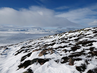
Ahead a cloud descended over Curlywee and when it quickly lifted it had left a light dusting of snow. It was indeed cold and windy. Still an enjoyable walk as this section of the SUW was new to me.
Craiglee trig visible top left
Finally I arrived at gate with the style to the side. This is clearly a gate where the coos like to stand alongside waiting for the farmer and grub. It was slightly soft today but jumping across the protruding tussocks made it manageable. The coos have not been here for some time. At other times of the year I can see that this would be coo quagmire, good luck then.
Straight ahead I could see the trig in the distance but I knew from walking reports that I had about an hour of classic pathless Galloway tussock terrain to endure to get there. That prediction of an hour was almost spot on.

These slabs are made for walking
Walking on this awkward terrain I pick a rock or some other spot, not too far away and make that my objective and keep repeating this to achieve small self pats on the bag. Keeps the motivation going and the slog in this terrain seems shorter.
The coos helped in some ways as they had created paths here and there. The problem being the soft ground and their not insignificant weight meant plenty of big muddy holes around. My god how deep they went in at times.
About half way up there were lateral lines of rock protruding which was a welcome relief to walk along, made it easier instead of the hard work in the tussocks.

Solid wall ahead just pick your way up with care
After these short sections some light clambering up grassy escarpments to get to the top. Unbelievably, even on these steep sections, huge coo hooves had churned it up. Coos can climb!
Merrick
For the last third I had been leeside of the wind but boy that changed at the trig, it was blowing a hoolie and Baltic cold.
Excellent views all around. Curlywee and Lamachan Hill to one side. 

Curlywee pointed bit and Lamachan Hill flat bit
The Merrick very close on the other. Loch Dee below is meant to be one of Scotlands best hidden trout waters, well the day we were there the trout were well hidden. Beautiful surroundings though.
Looking back to start of walk at Glen Trool
A few steps down out of the wind for a snack and enjoy the view. This is one rugged landscape. You have to work harder to appreciate the beauty but it is undoubtedly there. Wild and remote just what I wanted.
On the descent Curlywee still to bag this might be the way
Back down the same way and shortly after rejoining the SUW I spotted some movement on the flanks of Lamachan. Wild mountain goats. 
Nice horns
I had a very brief glimpse last year but they were in no rush today grazing away. Surprisingly on the way back I saw three more different groups in different areas, al least 20 goats in total, that surely made my day. Just that last slog uphill left.
Another pair
That was my 111th Sub2k, a number unlucky to Australian cricketers but not for me today. Unless the government make us stay at home which if that happens this number will not rise for a while!!

Wildlife: Mountain Goats; Raven (pair); Carrion Crow; Great Tit; Long Tailed Tit (a group); Chaffinch; Meadow Pipit; Caterpillar same as the other day.
Time: 4.10
Ascent: ft (683m)
Distance: m (14.7km)

Friday 20 March 2020

Self Isolating on a hill.....Craignell

Hill: Craignell
Category: Sub2K
Height: 477m
I was looking for a triple whammy from today's walk. A new hill to climb, nobody to catch the virus from and nobody to give it to, that is in the unlikely event I have it!!

After some deliberation a good choice was made. Craignell rises southwest of Clatteringshaws Loch in the Galloway Forest Park. You rarely see anyone on a weekend in the minor Galloways so today was perfect, not a sole apart from some forestry workies in a van, no close contact.
Clatteringshaws Loch
I parked a bit further away from where you could start but on this beautiful calm blue sky morning I wanted to walk alongside Clatteringshaws Loch. I hoped to see fish rising, nope, and I hoped to see some birds on the water, nope. Still the calm water and the surrounding scenery were enough of a treat.
Little Craignell with quarry in front, ridge running to Craignell
Ahead I could see the slopes of Little Craignell which I would be ascending before doing the ridge walk to its big brother. The quarry is a bit of an eyesore but the rest just fine. Birds singing like there’s no tomorrow, well at least they should be ok. Amazing amount of Robins on the walk today. I tend to think of them as a garden bird but this lot might be far eastern imports, great singing though.
Head anywhere up there
I come off the forestry route and cut in at a track heading to the slopes. Although grassy it is underpinned with rocks, presumably from said quarry. It actually made it slippy from the frost with no sun getting here at this time of day.
After a short walk up the track I decided to veer off and head up the slopes. I knew what I was in for. Galloway tussocks, hidden holes, tree obstacles, boggy underfoot and it did not disappoint.
Scrambling towards the top I came across a similar rocky path to earlier but it petered out quickly, back to the normal terrain.
Small cairn on Little Craignell
Arrived at Little Craignell in a shower, what the heck I thought, I had left blue skies to come here. Still there were compensations, atmospheric views all around. These hills are best described as rugged but in this changing light they have a beauty all to themselves.
Rugged terrain
From here the ridge walk to Craignell itself looks longer than it did on the map, my mistake for not paying attention to detail. Overall the terrain was reasonable going. I followed 6 sheep with ragged coats who were not pleased that I was behind them. But they were following what looked like a regular trail so it also made my walking easier. 
One of the many lochans
Quite a few lochans dotted about up here but there was no sign of life in any of them.
From Craignell looking back to the ridge and the Loch
Finally reached the cairn of Craignell and spent some time enjoying the views. Looking back there is a patchwork of colour. 
Across the way Millfore I presume.
Merrick & Corserine
Then Corserine and The Merrick hills with some snow lingering. Further west I am sure the prominent hump will be the plug Knockdolian. Overall a nice viewpoint.
At the last moment I decided to make it a circular walk, heading west before heading to the end of the treeline. 
Deforestation ahead
The going was reasonable but care needed to be taken especially the final steep slopes down to the trees. Sideways foot movements no accidents now please.
I took a food break enjoying the views over the slopes and hills. Spotted a caterpillar not far from furry me, a big dark brown one, first of the year for me. Then a small light orange/brownmoth, presumably not a butterfly, flew past and disappeared into the tussocks.

Lots of dead looking trees around
Deforestation is taking place below but no work going on today and after a short muddy section I regained the forest track which took me back to the loch and then the car. 
Although the final section before the loch is now rarely used, it was very muddy, but a bit of fun at the end, but wish I had put those gaiters on.
Frogspawn
 In one of the side water channels I spotted my first frogspawn of the year. This water won't be dried out anytime soon so hopefully they will survive.
Crossbill was bathing in a puddle, plenty around here today
A good decision today. Avoided the news and listened to good music on the drive up and down, my taste, and the excellent walk made the abnormality of the last week seem a long way away.
Time to continue my normal living when I get home with a couple of cold Cullach Brewing IPA beers. Cheers to normality.

Wildlife: Robin; Chaffinch; Wren; Buzzard (pair); Pied Wagtail; Grey Heron; Meadow Pipit; Crossbill; Frogspawn; Caterpillar; Moth
Time: 3.32
Ascent: ft (410m)
Distance: m (11.2km)

Monday 16 March 2020

Three wee Fifers completed the set

Hill: Norman’s Law; Mount Hill; Cairney Hill
Category: All Sub2K
Height: n/a

I was visiting the Kingdom of Fife for a few days with the good lady. Today the good lady opted for an active session touring the shops in St Andrews, always keen to spend her pocket money. Trying hard not to smile too much I thought that this was a fab idea as it allowed me to head for the small hills of Fife and complete my Fife Sub2k’s. It also helped that today was forecast to be the only blue sky day of the trip. Despite it being Friday 13th I braved the traffic and headed to my first hill of the day Norman’s Law.
Norman's Law
Reports for a couple of hills I was completing today said they were mud fests so I used wellies today. Both a good and bad idea.
I started from the quaint village of Luthrie and headed up alongside a working farm whose byres were still full of cattle. There was a surprising and disconcerting notice pinned at the end of one of the byres ‘casualty evacuation point’, is this a battle ground?
It is a straightforward walk until I reached the old farm building which is currently being refurbished and the track is over towards a building where farm and workers vehicles are conveniently parked hiding the signs, deliberate or what?

I reached a point where I had the option of going directly up the hill or to circuit it and come back down the obvious track. I opted for the circuit route and wellies were definitely an asset for plodding through the coo trodden muck. Not a section to slip and fall in!!
A cairn rockpile, a trig and a viewfinder
A short climb winds it way to the top of Norman's Law which surprisingly includes a trig, a cairn and a description board, not bad for a wee hill. It is another ancient hill fort, no wonder with this vista.
Viewfinder looking over to Dundee
The views are superb particularly locally looking down on the Tay estuary and the bridge to Dundee. Further north all the Angus and Perthshire big hills are well covered in snow.
It looks benign but muddy slips coming up

On the descent the wellies get payback, they are old, minimal grip meant a couple of heel slips, pain and muddy clothes along with a few sweary words. You can continue through the field of cows for a slightly longer circuit but as I wanted the three completed today I just backtracked.
Cairney Hill track to the right
Number one done so next it was off to Cairney Hill which is situated beside Lindores Loch, only a short drive away.
The top is in the trees straight ahead
Here a shooting track takes me all the way to the undistinguished top. At least the track is original format of mud and grass and not the modern motorway construction on some estates.
Deer shooting platform
Enclosed at the top alongside the tree line is a shooting platform, obviously not just the pheasants that get blasted here.
Just a couple of minutes later surprisingly for us all, I disturbed a pair of said roe deer, almost coming face to face behind a gorse bush, the wind in my favour. Just as quick they scarper after seeing me.
The stone marks the spot
The top is just as forgettable as the ascent, I head briefly through the undergrowth to find a stone which marks the summit spot. Not a place people would come to unless by accident or bagging
However back to the track and there is decent view of the Fife countryside including the other two hills on today’s trip which are in clear sight.
Back down the same way to enjoy my lunch, a fudge doughnut. Nobody but nobody makes these as good as Fisher & Donaldson. If you have never had one it should be on your bucket list, shops in Cupar & St Andrews. 
Hopetoun monument peeks out of treeline
Now off to the last hill for today, another little Sub2k oddball which has a folly at the top, the Hopetoun monument is Mount Hill‘s claim to fame. It can be seen for miles around.
A straightforward right of way takes you from the farm entrance to the summit. Muddy trail again wellies quids in once again despite slipping and sliding all over, like a fat Bambi on ice!
Nothing too inspirational other than listening to and spotting the birdies in the tree tops until you reach the top. 
The gate is easier than climbing
The folly is surrounded by a very large deer fence, gate padlocked. Some reports say climb it but it is high and loose. A better option is to continue up the bog fest until you reach another gate which this time opens. 
Mount Hill trig
Now you get both the monument and a trig. Why the trig is necessary when it is overshadowed by the huge monument. If you have the money why not.
Back the same way to the car.
Three small hills, an interesting day in good but cold weather. No more Fife hills to bag so time for some real ale. There are plenty of micro breweries around here so looking forward to a good evening.
Another good rambling day but a slight grey cloud as I drive back wondering what damage the credit card has taken?


Wildlife: Coal tit; Blue tit; Great tit; Long tailed tit; Grey squirrel; Roe deer; Blackbird; Buzzard; Robin; Pheasant; Kestrel; Carrion Crow; Yellowhammer; Woodpigeon; Wren; Ladybird (1st this year).
Time: 3.33
Ascent: 589m
Distance: 13.9km


Sunday 8 March 2020

No cats but another excellent ramble on Cat Law

Hill: Cat Law. Possibly (wild) cat. Or Gaelic ‘cath meaning battle. Local history suggests battle of Mons Graupius (Us versus The Romans) was fought nearby but other places claim this as well.
Category: Graham
Height: 698m

On my way home I decided to finish my little trip with the hill across the way from Mile Hill and glad I did, it was a little cracker.
Once again I parked up by the old gatehouse to the castle. Another early morning start with the only the sounds being the singing of the birds and the calling of the sheep and cattle, my kind of walking, peace and tranquility.
A short walk along the road for 200m before going through a gateway into a field opposite the farm. First obstacle couldn’t get the gate open so a wee climb, hope the farmer wasn’t watching.
Onto the moor
Crossed the field to reach a gate, hidden from view, but near the top of the trees, out onto the moor. Thankfully no livestock to negotiate.
White bottoms 
Simply followed the good path. Immediately spotted deer on the horizon who had also spotted me and soon scampered.
Snow stuck to the path despite thawing on the heather
The track soon became white which was a mixture of consolidated snow and ice. On the path, off the path into the heather whichever gave the best footing. I was sweating it was a lovely spring morning even this early.
I could see the front slopes of Cat Law but this was a Graham category so I knew the real top would be a good bit behind.
Not bothered unless an eagle appears
The snow was getting deeper and there was now no real path to be seen. Looking at the map I decided to just go up the hill where I could see half a dozen white coated hares looking at me.
At first the going was easier but when it levelled out on the plateau I was breaking through the snow with each step. At least calf deep but frequently knee deep, this was tough going for an old codger.
I headed for a fence line but realised the banked up snow was even deeper over there, guess which way the wind blows. Even the hares had disappeared. A meadow pipit rose and sang away or maybe just calling its pals saying there was an eejit up here, come and have a laugh.
Pleased to see the trig
Then on the white horizon the trig appeared and I was glad to see it. The true top is a bit further on. The views are extensive and the bigger hills up north are in view but without definition (Schehallion, Mayar, Dreish).
The haze also meant the distant views to Fife & the Pentlands not as clear as I hoped, hey whose complaining they are still good enough.
Shelter over by the fence more for the beaters than walkers I suspect
There is a substantial cairn shelter over at the fence but I did not need it, banana eaten, suitably refreshed back down.
Looking back followed my footsteps going down
At least I could walk in my footsteps so a lot easier descending. Stopped at one of the many gun butts for coffee break, they might not shoot hares but they do in the grouse.
About half way down a couple came up and we had a nice ten minute chat.
Shortly after a single walker appeared with whom I had a very interesting chat with. He was a local beater for the estate. He said that the keeper was an enlightened type and would not cull the hares believing they were beneficial to the moor, good man. I mentioned that from Mile Hill the other day I thought I had spotted an eagle over Cat Law and he confirmed they were here. Lo and behold a couple of minutes later we heard the calling and a pair were cruising the tops further over before circling higher and higher into the sky until even with the binos seen no more, made my walk that bit more special.
A nice colour contrast on the descent
As I descended a red kite glided over, nice to see them as single birds probably the same one from two days ago.
Heading back to the car and had the perfect view of a red squirrel sitting still at the top of a tree, tail curled over its head. Yip as soon as I started to focus the camera it was off.
A cracking hill on a perfect day. This was a good way to finish a super little trip. Solo walking often means more wildlife spotted and this trip was perfect for that.
Sadly back to the winds and the rain for the weekend.

Wildlife: Golden Eagle (pair); Red Kite; Mountain Hares; Meadow Pipit; Peewit; Red Squirrel; Red grouse; Roe deer.

Time: 2.51
Ascent: ft (413m)
Distance: m (7.8km)

A day to remember on Mount Keen

Hill: Mount Keen (Smooth or pleasant hill).
Category: Munro
Height: 939m
This was to be the highlight of my short trip and I am delighted to say that it did not disappoint on both the views and the wildlife.
An enjoyable early morning drive through the stunning Glen Esk to the car park at Invermark, already half a dozen cars in situ so not alone on the hills. A good sign as being selfish they might have broken a snow trail if going up Mount Keen.
It was a long walk through the glen before the climb started but just taking in the scenery helped it to go past. As well as concentrating on not slipping on the icy patches whilst looking around. A pair of skylarks are having a mating ritual whilst a stonechat sings hoping his turn is coming if he can attract a partner.
View of Mount Keen from the glen
Far in the distance the ascent track going up the hill stands out, initially brown but soon turning white, but from here it looked a long way away.
She got about, the Queens Well
Just before the climb started there was time to have a close look at the granite arches of the Queen's Well. The spring waters are still flowing but all a little dilapidated, needs a good clean out. 
Now climbing and the Ladder Burn is crossed via an iron grid which like the Arches is past its best but saved me from getting wet boots.
Poor hare eagles had just started their meal
As the track headed up the Ladder Glen a pair of golden eagles rose from the ground, quickly gaining height. It wasn’t until the descent I spotted the remains of this mountain hare which they had either caught or were scavenging, no doubt back for it later.
The zig-zig ascent was both snow and ice but not enough ice to put on spikes but my breathing told me I was putting in effort.
First view of the top
This middle section was a case of following those ahead whose steps had broken the snow but only a couple of them so other car occupants had gone elsewhere. 
Still, there was still plenty of crust breaking for me and into calf or even knee deep drifts. Not as fit as I once was, this was a good test. 
Getting closer but still a good hour away to the trig
My route reading assured me that there should have been a very obvious path here somewhere but who wants an easy summer walk? Me! The path had merged with the snow landscape.
Take in the view
As always stopping for a breather let me look around. Cracking views over to Lochnagar and its pals. Looking backwards just as good.
Looking forward I could at least still see the objective albeit the wind has picked up and it became distinctly nippy, gloves on. Plenty of red grouse wandering about close by and unconcerned. A lone snow bunting, it is yonks since I saw one of them.

A rockier and very icy section to be cleared before the trig point comes into view, relief.
The crags of Lochnagar middle right
The views are stunning from this the most easterly of the Munros. Walkhighlands describes the surrounding landscape as one of vast, sweeping moorland rather than mountains but it is more than that on a day like this. Well worth the effort.
At the cairn there are a couple of people but not the numbers compared to the cars. From the other side a lady on skies appears followed by a guy who had cycled from the other side as the walk in even longer than Glen Esk.
A close in of some of the red deer herd
On the descent my eye is caught by something on the opposite hill that does not look right. Binos out and vindicated, magnificent it is a single file of red deer herd of 60-70 going to the summit. I have seen plenty of red deer but never seen a snow scene single file train, made my day.
Descending to the glen
Back to the long walk out but it has been an excellent day and really glad that I made the decision to head up to the north east for a few days.

Wildlife: Red Deer (herd 60+); Skylarks mating; Stonehatch; Golden eagle pair; Snow Bunting; Red squirrel; Mistle Thrush; Great Tit; Oystercatcher.

Time: 5.13
Ascent: 748m
Distance: 18.2km