Showing posts with label The good lady. Show all posts

Sunday, 8 March 2026

Two hills required for one blue balloon.....Creag a' Mhadaidh

Hill: Creag a’ Mhadaidh (Cliff of the fox, dog) (612m) & Gualann Sheileach (Willow Hill)

Type: Fiona

Height: 612m


Typically it was once again a mixed weather forecast with rain and low cloud so I changed my plans and decided to go for the lowest hill available to me for my short ramble.

I had two options from the south, one starting at Loch Rannoch and one from the north at Dalnaspidal. I had used the northern route a few years back to the nearby Corbett Beinn Mholach so for a new perspective I opted for the southern start.

I wanted to get back to the good lady sooner than later so I opted to bike in saving about 2 hours on the trip. One of the reports I read mentioned pushing a bike around 2 fields before meeting the path, which was not on with my heavy bike so decision made.

My chosen route followed an old right of way which is a Scottish Hill track and included in the Scotways book (route 152).

As I got ready the light showers were already on/off, it was windy and the waves on Loch Rannoch were already crashing in beside my parking spot, I was close to not bothering.


This side of Perthshire has almost every lay by blocked but I got lucky to park up near my starting point and cycled to the small stone bridge over the Allt a’ Chreagain Odhair. A farm track headed towards Craiganour Lodge but veered north before entering the grounds and chased sheep into the woods.

Pleasant mixed wood

It was a pleasant cycle through the woods but there were a few cattle grids which meant it was a bit stop/start. Must be getting old and feart in the past I would have cycled over them.

Before long I was out of the trees and onto the moor. The good track for cycling was continuing to climb at a good gradient but twisting and turning so never boring.

My hills left and right with Meall na Leitreach under cloud behind them

I was starting to get glimpses of my two hills but just behind them there was a bigger peak with its top under cloud. Some doubt kicked in as I wondered if that indeed was my target. Thankfully it wasn't.

The sheep around here are the sprinting running type, that is sprinting in front of me until a mad leap left or right, my hands fingering the brakes just in case.

I arrived between my two hills and found a small quarry to leave the bike.

This is an interesting pair of hills as both are marked on the OS map as being 612m high but it appears that is is acknowledged that Gualann is 1m lower. Surprisingly the SMC guide to The Grahams makes no mention of this but do a search for Gualann and it is always measured at 612m.

Too climb both was the question, not to be answered until Mhadaidh has been conquered but almost certainly so.

The boggy section to cross first

Some showers running up Loch Rannoch

So off to Mhadaidh it was. There was about 1/2km of rough marshy moorland to cross before any height was gained. Quite wet after the recent rain. There are on/off quad bike and animal tracks but just as much is just using your skills to find the better going. The moor is criss-crossed with water channels, mostly hidden from above and some narrow knee deep ditches so being careful was obvious.

The flat ground up top

Circa 100m of steeper ground before it flattens out again and you realise that the top is about another 500m away over mixed ground.

But the final summit area offers super views over a barren landscape. Tempting to say unmarked by human hand but most of the lochs in this area maybe original water but the hydro industry will be involved somewhere along the line. The SMC book describes the hills name as a misnomer as it is indeed it is just a high point on the moor.

From summit view to Loch Errochty

View back to Loch Rannoch and the track I just cycled up

Still the views up north over Loch Garry and west over to Loch Errochty are quite special, not forgetting the huge mass of Loch Rannoch behind me.

View across to the top of Gualann Sheileach with the trig of Beinn Mholach behind

Looking back the first thing in my view was my 2nd hill for today, Gualann Sheileach, but it is the huge bulk behind it that really catches my eye. This bulk is the Corbett of Beinn Mholach my aforementioned ramble from Dalnaspidal, no bikes then and from up here it looks an even longer walk than I remembered.

Summer has definitely moved on, the wind up here was on the cool side, no time to linger.

Duinish bothy centre left

Whilst descending the sun briefly shone through the clouds illuminating the Duinish bothy, a special moment on a grey day, everything Scotland's weather often unexpectedly delivers.

As per the forecast showers were passing over Loch Rannoch but so far none had encompassed me, long may it continue.

The mid peak on the right is the high spot

On my descent, I had observed a probable ascent route up Gualann via a grass gully. From here the terrain on Gualann looked easier going but not for the first time I was mistaken.

The grassy gully was fairly direct but it held another hidden water course so plenty more hidden narrow holes to do some damage. I could hear the water gurgling away as it dropped but rarely could I see it, lots of prodding with my poles.

Of course when I reached the top of the gully it was similar to Mhadaidh with about half a kilometre to the summit but much more of a contouring route. And if anything this was the worst walking section with tussocks, heather and peat hags to overcome.

Summit the mid point

The three tops thankfully descend in height from my left to right so the first one I reached was the highest top. A small cairn but no sign of the Willows, long since gone.

View from summit to Beinn Mholach

Very rough ground between here and Rannoch Station

View North to Loch Garry on the left

Again it was a smallish hill with decent views and it brought Mholach must closer and even more imposing. The ascent from the other side was fairly straightforward as I recall.

My descent back to the track was easier by picking out better lines, especially ;ower down on the bare grass grazed by the sheep. But then I had a problem. I could not find my bike. Normally I mark a GPS location but did not today. I had come down above where I expected so a frustrating time walking up and down until I spotted a bike handle further down the track towards Rannoch, big relief.

Typical view of the pointed peak of Schiehallion

The fast downhill descent to Loch Rannoch was fun, just over 15mins along with the downhill MTB buzz, a perfect end to a good short ramble.


Ascent: 664m

Distance: 19.6km

Time: 3.21

Wildlife: Common Frog; Meadow Pipit; Wren; Scotch Argus;


Wednesday, 27 August 2025

A Pilgrim ramble.....St Ninians Cave

Walk: St Ninians's Cave


This short ramble was inspired by the Pilgrims walk from Glasgow to Whithorn but this is certainly not the full walk, only a very, very short section, the final mile or so. A recent visit to the Govan Stones and a chat with the staff kicked it off. Many pilgrims past and present would have visited the Govan site en route. Well worth visiting.

I was in the area for a break with the good lady site who was happy with a short walk to visit this historic place.

Scotland has so much history of all kinds and on my rambles I enjoy stopping and immersing myself in locations and try to imagine the sounds, sights, smells etc. of that history.

St Ninians Cave has been documented as a place of worship and healing back to the 8th century. St Ninian is reputed to be the 1st Saint in Scotland, 397AD. That's a huge wow for me. The Latinus Stone on display at the Priory is the oldest surviving Christian memorial.

The ramble will be narrated mainly via the snaps.

Well sign posted

Despite the time of year the birds were still singing in this lovely wooded section

Out of the woods there are options


But we continued straight on down Physgill Glen where the water soon came into view. Despite it being summer the weather was cool, the water was gunmetal grey rather than Mediterranean blue but this is Scotland.

Colourful flora such as this Campion all around the path as we walked down

Evidence of geological upheaval 


A true shingle beach to cross to wards the cave seen ahead. Not much different to what the 8th century pilgrims would have seen

How smooth are these?

A recent podcast suggested that rocks with this quartz strata lining had a good chance of containing a fossil. Same podcast examined rocks from Nairn area and found some minerals had only be found in rocks in Estonia. Considering they started being formed sub equator they have travelled a long way.

Just reflect on the exact spot and cave entrance, those early travellers all stood here. The interior has collapsed so only the entrance is clear, although danger of rockfall signs around.

Not quite sure she is a pilgrim!

Free Sea Kale for your foraging diet

Rock Pipit

Trail back that away

The season is coming to an end

So an excellent short ramble. For those a lot more adventurous the walk can be comfortable extended by doing a circuit from Whithorn or including some of the way marked coastal paths.
Time to relax, some mead would be appropriate.

Friday, 20 December 2024

The good lady's type walk.....Port Appin to Clach Thoull

 Walk: Port Appin to Clach Thoull (Hole in the Rock)


View across Loch Linnhe to Kingairloch, beyond the bright blue sky day!

The weather forecast was for clear blue skies all day and it might have been for some as you can see in the snap but not for us!!

After our very misty short hill walk we came back to sea level and drove along the single track road the delightful small hamlet of Port Appin. I had hoped to visit this spot earlier in the year to get the ferry over to Lismore and cycle the island. The good lady was with me today so that was not an option. Instead the short circular walk to Clach Thoull was more her idea of fun.

Despite the lingering low cloud slightly higher it was lovely at sea level.


Ferry pier on right and Lismore on left
The walk starts behind the hotel walking past some nice houses and steep tree lined crags, then soon coming across a viewpoint area. Three different information boards and superb views over to Lismore and beyond. People were standing on the jetty, presumably waiting for the ferry, a lovely spot to spend some time.


Great Northern Diver

On the calm waters we potted a couple of Great Northern Divers, many cormorants and shags all regularly diving for their lunch.


Canada Geese

The sound of silence was rudely interrupted by the loud honking of geese. Around 20 were flying low across the water but then they kept coming in waves, I reckoned about 200 in total.

Walking on the trees were full of the normal suspects, Robins, Blackbirds and Thrushes.


Clach Thoull

Next stop was the first of two natural sea arches, this one named as Clach Thoull, both of which you can walk through. It was interesting to reflect on all the current climate discussions that at one time the sea level was clearly higher than it is just now for the crashing sea waters to have cut out these arches.


Lynn of Lorn


Cormorant

We took the short track through the bracken to the point of the headland, another tranquil spot with great views. On the near rocks a Grey Heron stood hunched and motionless, probably already fed. A Great Black Backed Gull on the further rocks and a Grey Seal’s snout and head showed briefly.


Walking back a great shot of how trees grow straight out of granite rock, no soil structure, quite amazing.


2nd arch, tried to get away but she found me

We rounded the headland and walked through the second arch with plenty of birds around. Airds Bay was at low tide but had very few birds on the mudflats today.


Then a short but beautiful woodland walk, amazing autumn colours still hanging on here. Birch, Oak, Hawthorn, Ash, Rowan, Holly & Sycamore, quite a mix.


Finally back to Port Appin and the unusual lighthouse lantern full of local information boards, a local historical exhibition. Some were hard to read because of condensation so a wee winter restoration project for some locals perhaps.

Overall a delightful short ramble in a beautiful part of the country and a large and varied amount of birds for a short ramble.

Ascent: 43m

Distance: 2.49km

Time: 1.01

Wildlife: Grey Seal; Canada Geese; Buzzard; Great Black Backed Gull; Hooded Crow; Herring Gull; Coal Tit; Blackbird; Robin; Redpoll’ Redwing; Dunlin; Goldfinch; Chaffinch;


Wednesday, 18 December 2024

A fabulous short ramble.....Glencoe Lochan

 Walk: Glencoe Lochan

On a short trip with the good lady I was looking for some short but scenic rambles that she could enjoy and this looked like a perfect opportunity to explore a rarely visited part of Glencoe village.


There is a well appointed car park but be warned it is a pay car park that does not take cash/card, mobile phone only payment system that come with dodgy reputations so you might be better to park in the village and walk the ‘hard’ extra 5 minutes.

This short circuit was a blockbuster for this time of the year, a short option but one that I would highly recommend for anyone wanting to stretch their legs on their way north or staying in the area.

Good lady eager to get on with it

What's good about it? Actually rather a lot. It is mainly a woodland walk, the trees being planted back in the 1800’s by The Earl of Strathcona to make his Canadian wife feel less homesick, didn't work as she went back to Canada. Still there are a lot of impressive trees, unfortunately a lot non native along with invasive shrubs . Throw in a small but very scenic lochan. There are 3 official coloured walking routes but our ramble incorporated all three.

She is doing well

But still more to come


Pap of Glencoe from the top of the trail

Initially a short but steep climb through the trees, up the blue ‘Mountain Trail’, steep for the good lady, before we got some hill views dominated by the Pap of Glencoe but also more views across Loch Leven.

Down to the lochan and out of the trees, Beinn a Bheithir was silhouetted on the calm water, stunning Autumn view.

No sooner up before we were heading back down to the lochan. We had seen some Redwings in the trees up top but out in the open they were flying over the lochan in huge numbers, hundreds were seen.

From another angle looking back is The Pap

Rounding the lochan a Great Spotted Woodpecker was hammering away, so loud. I cannot remember hearing one so obvious like this at this time of the year, always associated them knocking with Spring. It is a beautiful spot with Beinn a Bheithir silhouetted on the calm water. That brings back memories of a very hot day.

On the final section this American invasive shrub dominated, Gaultheria Shallon

Antler scrape?

The last section was another lovely woodland but at times many trees by storm damage. Mighty Douglas Firs and Sequoias amidst our traditional trees like Ash, Beech, Rowan, Oak etc. Also passed this which was the right height for a red deer to scrape its antlers against.

Looking across to the Corbett Mam na Gualainn with interesting clouds forming

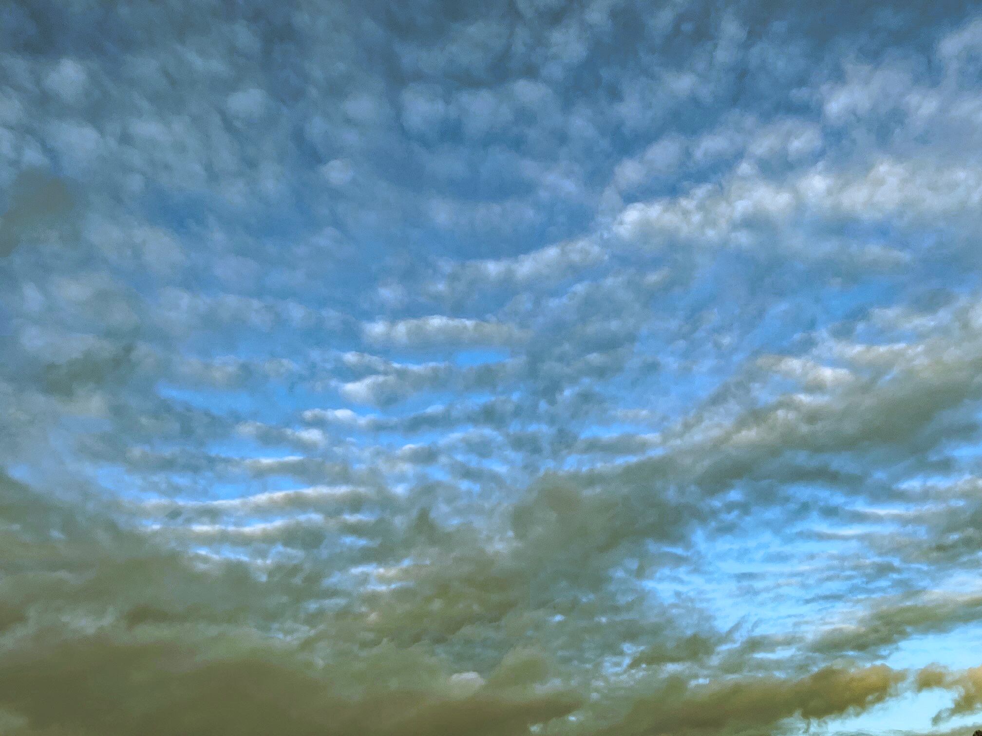
Back at the car zoomed in on these dramatic Altocumulus clouds

A cracking short term ramble which highlighted the beauty and impact of a Highland woodland. The colours and structures were amazing. I was also taken by just how much bird noise there was. As it is Autumn it was obviously not the breeding season but clearly there was a lot of bonding calling going on as groups moved through the trees.

A wee ramble we will do again.

Ascent: 147m

Distance: 2.9

Time: 1.14

Wildlife: Great Spotted Woodpecker; Great Tit; Coal Tit; Long Tailed Tit; Robin;