Wednesday 26 September 2018

A walk in the Parish of St Connel

Hill: Kirkland Hill
Category: Sub2k/Marilyn
Height: 511
An interesting and educational short walk today with the KOIR.
Choose your walk
Our walk began in the village of Kirkconnel, named after St Connel. You can just imagine this village as a one street throughway connecting Ayrshire to the Solway coast.
Near the start Kirkland Hill in sight
The walk starts in the town and we walked via Bakers Burn which almost immediately leaving the village is a beautiful grassy valley walk, twisting and turning always something to keep you interested. 
This size of burn capable of driving a mill wheel
Nearby a sluice links the burn to the old mill site where the water was diverted to power the wheel, amazing such small burns supported industrial mills.
Once away from the burn the route goes cross country to the remains of St Connel’s church, one of the oldest church sites in Scotland dating back to the 9th century. 
St Connel's kirk, the miners cairn and Kirkland Hill

The current ruined site is circa 12th century (albeit rebuilt by the local miners in the 1920’s) and a pleasant place to shelter from the wind for a tea break. The notice board gives more detail of the various graves and tombs discovered at the site.
Keep to the right of the gorge
Our path goes around the side of the hill initially following the old drove road to Lanarkshire, hardy people these drovers, steeply climbing as we meander. You can walk from here to Wanlockhead circa 14 miles, if you are up to it.
The mast at Todholes Hill is prominent and as we climb the radar masts on the Lowthers appear. The Churn burn below meanders constantly changing direction in such a short space.
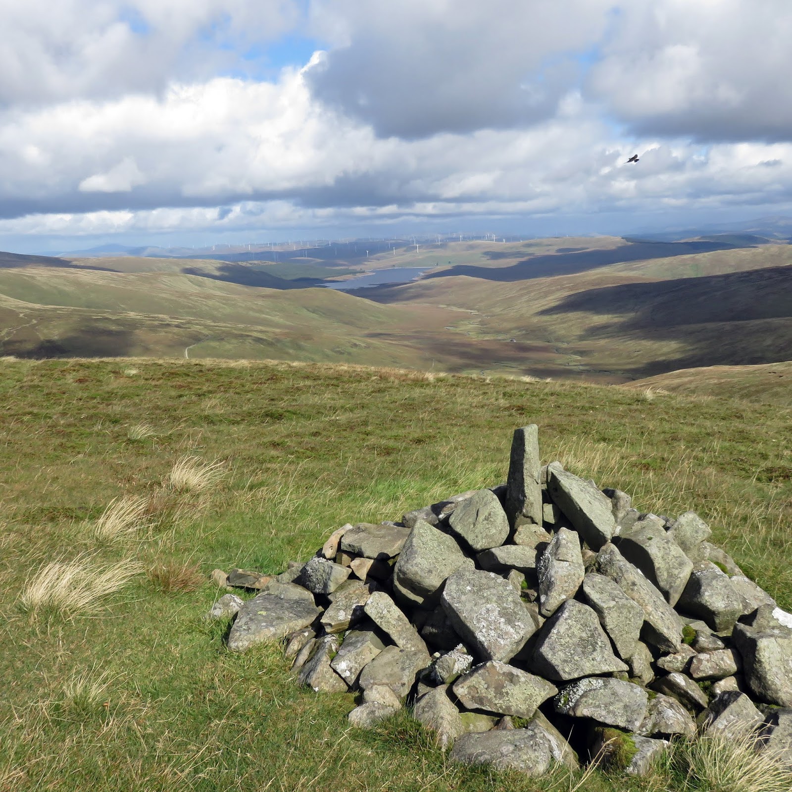
The wind is now strong and cold, yip it is still September, another layer on, as we turn and climb to the top.
Tinto behind trig
Soon we reach the trig at the summit of Kirkland Hill. The views do not disappoint and include: Cairn Table; Tinto; The Lowthers; Culter Fell and Cairnkinna. The flat lands of the Nith valley and west to Ayrshire and Arran, not bad at all.
However, too cold so back down the western slopes, heading to Glenwharrie, finding a wall to shelter behind for lunch.
Surfaceman and poet
Finally a short stroll back to the village where I spot this plaque to ‘Alexander Anderson aka Surfaceman. I assumed this was to do with its mining heritage but it turns out he was a poet. Also turned out he only lived here for a  very short time as an infant, still it counts.
Another good day out.

Wildlife: Raven, Goldfinch,
Time: 3.56
Ascent: 1220ft (532m)
Distance: 7.4m (12.1k)

Wednesday 19 September 2018

Breezy Culter Fell from Glenkirk

Hill: Culter Fell, Gathersnow Hill,
Category: Graham, Donald, 
Height: N/a
A cracking walk despite the high winds and occasional showers. A longish drive took us into the fringe of the borders with its beautiful rolling hills.
The start at Glenkirk farm
After Broughton it was a long drive down a single track to the walk start beside a remote but well maintained farm at Glenkirk.
Immediately we were heading up a steep slope of Congrie Hill. This got us all blowing immediately. 
Culter Fell ridge ahead
Thankfully the gradient eased slightly before climbing onto the ridge of Culter Fell. 
Follow the fence to summit
Another steep ascent following the faint track to the left of the fence and we were at the summit of Culter Fell our highest point at 748m. 
Culter trig looking to Hillshaw Head
The wind kept trying to knock us off our feet but we took in the views from the trig which were still excellent despite the grey skies.
Moss Law then Gathersnow Hill ahead

The descent headed towards the valley via Moss Law where we could get some shelter for lunch. Suitably refreshed it was time to tackle Gathersnow Hill, an appropriate name in winter I am sure. 
Culter reservoir
We had dropped around 250m so had a similar ascent to the flat plateau at the top marked only by a single iron rod, no doubt a boundary marker at some point but this was the top at 688m.
Coomb cairn
Off for another ascent and descent to Coomb Hill at 640m, our final climb of the day.
Descent with Culter Fell behind
The wind was still fierce so we changed our planned route and made a steep descent down into the valley at the old sheep pens.
Finally a pleasant low level walk along the valley, a burn at times accompanying us, hemmed in by the hills on either side. 
Brief sunburst adds colour
The bracken mainly orange now and almost wind free back through the many sheep to the cars. 
We covered the ascent of many a Munro today, these hills should not be under estimated, rolling they might be but there is plenty of height to gain but also superb views.
Wildlife: Red Grouse
Time: 5.09
Ascent: 2412ft
Distance: 13.7km

Friday 14 September 2018

Gana Hill from Durisdeer

Hill: Wedder Law, Gana Hill.
Category: Graham, Donald, 
Height:n/a
My route today was Gana Hill beginning from Durisdeer and taking in Wedder Law. 
Wedder track on left and return track through Glenaggart centre
A simple case of following the estate track all the way to Wedder Law, a constant climb but I have covered this walk before on the blog so rather than bore you I will cover only the Gana Law section. Except to say that again the views were great and the green rolling hills looked magnificent. Red Kites in abundance.
Red Kite
Thankfully the winds were not nearly as bad as forecast and only a couple of very light showers, so far so good.
Gana Hill from Wedder Law
Visibility was very good and from Wedder summit Gana Hill can be clearly seen.
The map suggested following the fence down but I can see a whole lot of peat hags so instead I headed slightly west across the moor before heading towards the grouse gun butts.
Once over these and onto the higher ground I headed towards the next fence line. Boggy in places but easily bypassed I followed a faint track on the left of the fence up to Gana Hill. You don’t see the main cairn until you finally crest the hill (there is a smaller one) but at least there is one, unlike Wedder Law.
Daer reservoir from Gana, meadow pipit photo bombing
The views are super, ignore the turbines. To the north Daer reservoir is shimmering and looking back over Wedder the Lowther radar stuff stand out. Behind me Earncraig & Queensberry which looks ominous as a dark cloud puts it in shadow, two hills for another day to complete this area.
Now I head towards Garroch Fell initially going towards the small cairn when I come across another estate path. If you want off the hard pack then the moorland is easier on your feet. 
Gana Hill from Garroch Fell
Ironically Garroch Fell is the lowest of these three hills but has by far the biggest cairn.
I rejoined the estate track circling around Garroch Fell but next time I will consider going cross country heading for the two sheepfolds before rejoining the track.
Remote track
There is a real feeling of isolation as you are boxed in by the hills and the unpopulated sheep pastures. Close calls with both a kestrel and a buzzard. 
Brief blue sky in the rolling hills
Water levels are high as they course down from the hills with a few of the burn crossings requiring at least one foot full in the water.
Waiting for the partridge shooting season will it survive?
Finally the track reaches the estate bothy before heading down through the tranquil Jock’s Cleuch where I met a birdwatcher, the only person spotted today. This area, Glentaggart is where the partridge shoot takes place.
Wildlife: Red legged partridge, Red grouse, Raven, Red Kite, Buzzard, Kestrel, Meadow pipit, 
Time: 4.25
Ascent: 2689ft 
Distance: 11.77m 

Monday 10 September 2018

Little Wyvis from Silverbridge

Hill: Little Wyvis
Category: Corbett,
Height: 764m
Having done the big brother earlier in the week I had the morning free so opted for a quick ascent of Little Wyvis. Most of the report is about the start lol.
I had noted down instructions to get to the start from another persons walk report and they were absolute rubbish. I then remembered one the trip reviews on Walkhighlands started from the same spot I wanted, time for 4g or not as it turned out. No signal here but a miles’ drive up the Ullapool road and yes bingo, pulled in and brought up the site and found malky_c’s report.
Head up road on the right
So finally at Silverbridge car park, walked to the bridge and had a look around. His report mentioned a road depot, no sign of that just a road to a B & B.
A quick check of the map and up the hill I went to find the depot to the side of the B & B track.
Squeeze to the right
The sign says no entry without permission and to call the landowner re shooting. Being a good boy I phoned the owners number to be told permission wasn’t required, had a pleasant enough chat with him.
At the next fence the sign warns of Stags, hinds, cattle, ponies and sheep gosh what’s coming?
Little Wyvis behind another cloud
From here it is a simple walk just a case of following the zigzag track (marked on OS map) all the way to the top, obviously do not take the turn to the mast.
Zigzag trails and mast trail in clear air
Near the summit I took a track running parallel to the ridge but this was a boggy mess so gained height quickly back on firmer ground. On my way back realised the initial track went almost all the way to cairn.
I did pass sheep, surprised a group of 8 red deer hinds, saw the ponies in the distance and a solitary coo. However no stags.
Just pick out one of the eagles
On the way up a pair of golden eagles glided around the top of the hill, one returned for an anti clockwise pass then gone but great to see.
Summit looking to Ben Wyvis
The weather had been forecast to be poor (fog) but I had views until I reached the cairn. I decided to walk the ridge following the old derelict fence just in case there were views of big brother. Half way along the ridge the clouds descended and you could not see very far at all. Pretty cold now but thankfully just light rain.
Mast trail in different light
Retraced my steps and a couple of hundred metres down it cleared again so good views descending.
Near the bottom a solitary roe deer hiding in the ferns.
Silverbridge
A short Corbett, sad I did not get views of Ben Wyvis, but it did the trick.
Wildlife: Red deer hinds, Roe deer, Golden Eagle pair, Red grouse, Wheatear, Meadow pipit, Blackcap and a probable hen harrier.
Time: 3.08
Ascent: 727m
Distance: 11.7km

Thursday 6 September 2018

Hill: Hill of Nigg
Category: Sub2k/Marilyn
Height: 205m
From Cromarty harbour there are a lot of rigs around the bay today as well as big grey skies.
Cromarty Bay rigs
The forecast was for rain mid afternoon so we decided on a shortish walk over at Nigg this morning, should be another easy Sub2k for the good lady.
Hill of Nigg behind ferry
Our outing began by getting the UK’s smallest car ferry, two cars (Highland Ferries), for the 10 minute crossing from Cromarty to Nigg, a different start to a walk giving good views of the construction yard and the rigs. Interesting watching the cars reverse off the ferry onto a steep slip, not for the nervous drivers.
As we docked the heavens opened and we had to take cover in the bus shelter for a while, an ominous message.
Winding road ahead and grey skies
We headed straight up the steep winding private road to the quarry, dull but in dry conditions. Passing a large mixed flock of small birds including siskin’s and chaffinch.
Past the quarry and head straight down the road to the working farm, the road goes through the middle of it. As we approached the farm a red kite was mobbed by 3 crows then the skies erupted as the rookery on our right rose as one, what a racket, kite disappears.
Soon after passing the farm the heavens opened and we got drenched, only light gear with us. No shelter just walk on and curse.
Nigg hill is not marked on the OS map, just the height but straightforward.
Over this fence
We crossed this gate and headed up through the field of sheep towards the shed in the corner. The rain has thankfully relented.
Good lady approaching summit
Cross another gate and aim for the highest point which is just after the line of trees on your left.
Moray Firth from top
A small stone cairn hardly rises above the grass but this is it. The rain has cleared the air, great views all around. We scan the water where we saw the Minke whale calf yesterday but nothing to be seen today.
Another black heavy rain weather front is approaching so we head back the same route. On a better day we would have extended the walk.
Cromarty Bay from top
On the descent there are views of the rigs in the bay standing out and further on Ben Wyvis is so clear. The construction yards are quiet but a large liner is docked at Invergordon, a different one each day.
At least this rain missed us
As we wait for the ferry I spot a large gathering of agitated birds out at sea and through the binos we can see a pod of dolphins passing through heading back out to sea.
Apart from getting soaked a super little walk, highly recommended if you are in the area.

Wildlife: Red Kite, Buzzard, Hooded Crow, House Martin, Siskin, Chaffinch, Dolphin.
Time: 2.29
Ascent: 238m
Distance: 8.9km

Wednesday 5 September 2018

Ben Wyvis and the Munro Compleatist

Ben Wyvis
Munro: 3431
It was an excellent day, I had a super, good weather, hill climb followed by two surprises on the descent.
The start
I parked at the Ben Wyvis car park fairly early but 2 cars already here. 
From here a I followed the standard path running along the north side of the stream. Walkhighlands says Aspen, birch and rowan trees alongside the stream enliven the ascent but my tree knowledge is crap but I did enjoy this section particularly when the path surroundings become more of an open landscape but giving a gradual height gain and I spot a couple ahead.
1st sighting
Turning a corner there are good views of both An Cabar and the ridge as well as Little Wyvis, maybe Thursday’s objective. I said yesterday on Cnoc Mor that the view from there disappointed as a Munro. From this side it is a full on steep ascent, a proper hill.
In full view more impressive
After some long gradual zigzags the steps are reached and now the ascent of An Cabar is full on.
The construction of these steps are an excellent piece of work and no doubt loads of effort. However, I know my knees will feel them on the descent.
I have now passed two lots, presumably the car occupants and a solo guy has passed me. 
Stairway to heaven
About two thirds of the way up some ptarmigan take flight from amongst the boulder field.
However I am pleased with this climb not taking it out of me as much as I thought.
 
1st Cairn in sight
The wind chill is noticeable so gilet on but the 1st cairn is in sight and the gradient has eased.
2nd cairn and the undulating ridge ahead
Finally the ridge is reached at the top of An Cabar. I am doing my best to follow the stony trail whilst taking in the views. I can see the guy that passed me but I can also see another figure descending from Glas Leathad Mor. If I passed two car loads how did he get here? 
Oil rigs aplenty in the distant Cromarty Firth
Never mind concentrate on the views, how many Munros can be seen from here, not really knowing the area I couldn’t guess but some recognisable shapes.
Half an hour from An Cabar I reach the trig, 2 hours 30 from the start, that’s fine. What a view. The dam at Loch Glascarnoch is prominent in the sun. The 5 Sisters, on this years list but not got there yet. So much more.
The sun has disappeared behind the clouds and it has got decidedly nippy.
I return by the same route and get a super view of Little Wyvis.
Little Wyvis
On the descent my first surprise is meeting this Munro completist, 5 years it took I am told. 
Munro compleatist
On its second round. I enjoyed the chat with the owner.
A short while later my 2nd surprise when I come across this leveret on the track.
Leveret
 This is a new born and sadly it whimpered when I touched it. I was reluctant but it would not survive out in the open so I moved it and put it amongst the nearby heather as a precaution, I hope its mother finds it.
On the way up I had not noticed how much of the ferns were changing into their autumn colours, truely another season is upon us.
Autumn colours
Overall a cracking Munro walk with outstanding long distance views, up there for the best of the year.

Wildlife: Wren, Leveret, Ptarmigan, Meadow Pipit. Red Grouse.
Time: 4.35
Ascent: 978m 
Distance:14.9km