Thursday 31 May 2018

Stunning views from Carn a' Mhaim

I have been fortunate enough to have had some brilliant views this year and it is not often that I would describe views as jaw dropping but today was certainly that. The Munro Carn a’ Mhaim, 1037m was today’s hill. The photos here do not do it a fraction of the justice the scenery deserves.
We started from the Linn of Dee parking area and took he long walk through Glen Lui stopping at the abandoned Derry Lodge for a break. Such a shame nobody has taken this on as a hostel.
Sunlit trees
A nice forest walk to start with the sun streaming through the trees.
The walk follows the River Dee, a great salmon river, no doubt these high reaches are impressive spawning grounds. The native Scots pine forests in this landscape are just magnificent. 
Over bridge to the Lairig Ghru trail
From here we are already getting views of our objective. After about 3 and a half miles we followed the Lairig Ghru trail and crossed the Luibeg burn via the new bridge on the way up but bravely forded the river on the way back. This new bridge was constructed after a flash flood destroyed the old one.
New Luibeg bridge
There is a now a clear track for the ascent and it becomes a well laid stepping stone ladder pretty much all the way up. 
The final climb
This is a pretty steep gradient for over 300 metres so plenty of opportunity to stop, rest, look back and take it all in. Derry Cairngorm is in view to our left and I spot walkers at the top.
Unfussed ptarmigan
Another mountain regular, unfussed with humans ptarmigan, surveys us from its rocky perch. Unconcerned enough to turn its back on us and start preening its feathers.
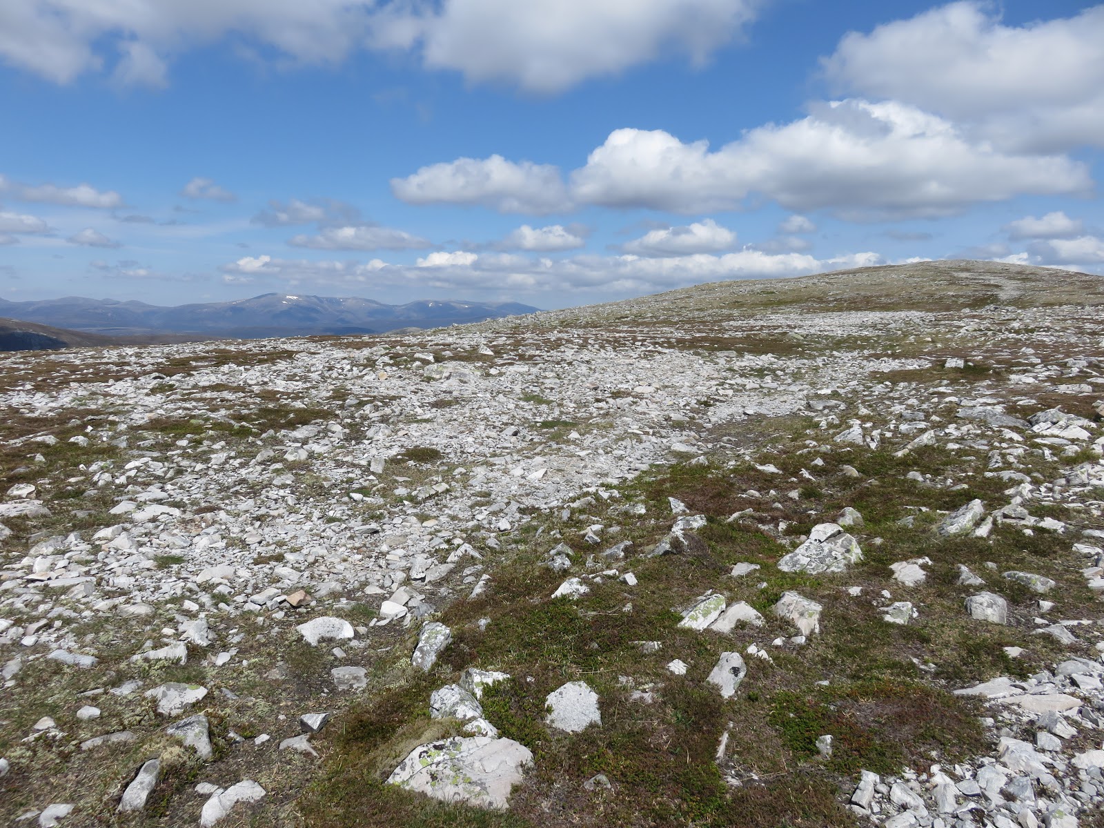
The path becomes just boulders for a short section but the route is clear and simple to read.
Looking up the Lairig Grhu
Finally the top is reached and boy what stunning views are the reward for the effort of getting here. Just stand, look around and be very grateful to be here on this day enjoying this spectacle.
Spot the bothy

Corrour bothy looks a long way away down there guarded by The Devils Point so impressive. The track up from the bothy to the Point looks a might steep one from here.
Glen Geusachan & Devils point
The river Dee meanders below and ahead in the Lairig Ghru.
Glen Geusachan looks menacing and very isolated.
Cairn Toul
The huge mountains of Cairn Toul, Braeriach and Ben MacDui encircle us, alongside the numerous others.
Impressive Coire Bhrochain
I could spend all day here but time to make the long trek back to the cars.
Simply superb I cannot rate it highly enough.

Time: 7.18
Distance: 14.35m
Ascent: 2342ft

Wednesday 30 May 2018

Glas Maol 4 Munro circuit

Today was day 2 and another full on walk was planned. The trip was the Glas Maol circuit which covered 4 Munro category hills.
Carn an Tuirc
The first Munro on the list was the conical shaped Carn an Tuirc as seen here from the start of the walk at the Cairnwell pass.
Following a faint track passing shielings the path reaches a  burn, walk beside this and cross where appropriate, a bit boggy. A runner goes past, fitter than me.
Looking back to the start
As you climb the steep track becomes very stony and at some point just cross them and head up to Carn an Tuirc. Plenty of excuses to stop and look back as there are great views back towards the Cairnwell Pass.
Not shy
Keep your eyes open as the ptarmigan could be right at your feet amongst the boulders, great camouflage.
Cairn of Claise
Cairn of Claise can be seen in the distance an easy walk down and up a grassy plain.
Claise cairn
 Gentle walking until an old wall is reached, follow that up and Cairn of Claise summit is reached on a boulder field.
Grass slopes to Glas Maol
Once again the next objective is in sight as the runner comes past god knows where he had been. Another descent onto a grassy track on your left then simply follow this as it turns left climbing across the hill before a faint track on your right takes you up to the summit plateau and the highest Munro of the day, Glas Maol.
Glas Maol cairn
 Whilst on this route we spotted a pair of dotterel, a rare sight indeed.
Great views and more people around and the 4th Munro looks the most mountain like, definitely not a round grassy peak.
Creag Leacach
So down another easy grassy slope, more great views, until you reach a cairn at the dyke. For most you will return to this cairn so rucksacks can be left.
The going gets rockier and the final two sections are hard going on the feet and ankles. Finally we are there, number 4 Munro, Creag Leacach take it all in and make the difficult walk back to the cairn.
Still big snow pathches
As we follow the narrow track back to the ski centre snow patches still encroach on the track forcing steep slippy grass detours.
Ski slopes don't look right without the snow
Finally all safe we get back through the ski slopes to the cars. Why are descents such a trudge?
Another super day, a grand high level circuit with fabulous views.

Time: 6.58 hours
Distance: 10.77ml
Ascent: 2938ft

Tuesday 29 May 2018

Wildlife spotting on An Socach Braemar

Day 3 from Braemar and today’s outing was a single Munro, An Socach 944m.
The day was already hot when we started the walk at Glen Clunie. 
Sgor Mor ahead
The hills looking fantastic immediately Sgor Mor looks imposing but ours is higher still.
We were looking for an easier day and this route gives a long walk up the glen on a stalkers track, gradually gaining height. The waters of the Baddoch Burn are fairly low but still babbling away at times. This burn is a significant site of scientific research as can be seen from the monitoring equipment dotted about.
This is a very pleasant 3 mile walk taking in the views and the birds; oystercatcher; curlew; lapwing; crossbill.
Cracking skies
The skies were amazing with super cloud formations that were constantly changing sadly i do not what to call them.
never ending track
The track constantly twists and turns, seemingly endlessly at times, but we are gaining height.
An Socach ahead
By the time we headed up the ATV track we were already at 600m. As we headed for the steeper climb a sizeable deer herd was seen coming our way until they spotted us and held their ground. On the slopes to our right another small herd, I wonder if they were trying to join them. Quite a few hares around again.
Highest point over there
Upwards on a narrow track the steepest climb brings you out onto a huge plateau. We head south (left) across very stony ground for a kilometre or so to reach the highest point.
Six metres less up there
Absolutely superb all round views of all the tops we have climbed so far. The Cairngorms, The Cairnwell range, even Mount Keen. Down below Glen Ey and its hills with their patchwork coverings.
Sgor Mor on left
Back along the ridge to the other cairn, 6 metres lower, before starting our descent.
They have spotted us
As we descend some of the deer can be seen cooling on a snow patch in Coire Fhearneasg before running off when they spotted us.
Going down
The descent route is another ascent option but much steeper, better our route.
When we joined the track at the burn an adder was sunning itself on the stones. My first sighting for a few years.
Adder

Back along the track as the sun continues to beat down.
Another superb walk and the wildlife sightings helped make the day. Although 3 days full walking and not one raptor spotted, makes one wonder.

Time: 5.57
Distance: 10.91
Ascent: 2066ft

Monday 28 May 2018

Lochnagar by the long, long route, Invercauld Bridge

I was up for a weeks walking with ARDC starting from Braemar and this was day one.
The Munro, Lochnagar from Invercauld Bridge, was today’s walk conducted in glorious blue sky conditions. This was a real effort of a walk, a very long day, and it also included another Munro, Carn a’ Choir Bhoidheach. Fantastic landscape views, a fine ridge walk but the terrain to reach the lochan to start the ridge was sapping and this was in dry hard top surface. 
Natures best Scots pine trees
I would not like to do this on a wet surface. Apparently this route is one of Ralph Storers top 50 walks, hmm. Sometimes the tourist path is a good option.
From the parking at Invercauld it was a 90 minute walk in through magnificent Scots Pine before reaching a metal structure, a good place for coffee break. 
From the hut heading onto moorland
From here Lochnagar summit can be seen to the left as we look but my route was to walk the ridge anti-clockwise.
The long walk in across the pathless moorland terrain on a hot dry day could be endured as the rewards were anticipated.

First view of The Stuic and the ridge
A few burns to be negotiated again relatively straightforward today but on another day they could be flowing high and difficult to cross.
Lots of mountain hares and red grouse but little other wildlife.

Looking north
Even from here looking back the views are magnificent but unlikely to be replicated on camera with the haze. Bone hard ground with rising Mayflies at each step.
Sandy Loch white sands the corry and snow magnificent
Arrived at the stunning Sandy loch. This high up you have white sand, a view of the full ridge, snow below the ridge on a baking hot day, just outstanding. Hat in water to cool the head I followed a faint on and off trail onto the ridge then I had an easy walk up to the highest point at the top of The Stuic.  
Sandy Loch & Lochnagar
Apart from one loner no one else had been seen on our route I wonder why? But now walkers were popping up all over the place.
The Stuic and a full snow cornice
This snow cornice still hard packed at The Stuic. A great place to have a sandwich and watch some of the group scramble up.
Cairn of Carn a'Ghoir Bhoidheach  looking to Lochnagar
From here you can see the cairn of Carn a’ Choir Bhoidheach a short distance due south so off we toddled. 
Lochnagar summit
Then a walk over to Lochnagars’ cairns, the last bit of climbing today with some great views into cliffs descending deep and far.
Lochnagar (the water) from the cliffs
The descent off Lochnagar to the Sand Loch was a very awkward boulder field with large grassy and heather pockets with deep holes to catch the unwary, full on concentration required. 
Looks benign but really awkward walking

That and the rest of the descent was a relentless trudge, I can't pretend that I enjoyed the long, long walk back to the car park. Dehydration was setting in despite two water bottles, maybe tomorrow needs to be three.


Time: 9.57
Ascent: 1124m
Distance: 14ml

Saturday 26 May 2018

Arran Coastal Way Pirnmill - Lochranza

Rest day of my short break on Arran. The good lady was joining me today so a short section of the Arran Coastal Way was in order.
We got the very busy bus from Brodick to Pirnmill to walk the section back to Lochranza. At Pirnmill a very interesting church not many like this around, a small corrugated iron building and sheep grazing.
Pirnmill Kirk
The down side of this walk was that most of it became road walking rather than coast walking. Sadly too much of the ACW is like this.
Typical boulder strewn coast
The tide was in but even if it was out very few sections are accessible. Those sections that are off road were boulder fields and unless you are a masochist there is no pleasure in walking on this surface. The good lady is not out for a walk to endure so more road sections for us.
One of the swan nests
One group not bothered with the terrain were swans as we went by at least four occupied nests some very close to the road.
Although we had blue skies the wind was full on but thankfully with it behind us for most of the walk it was comfortable. For the many cyclists going round Arran anti-clockwise a very different experience. As I know all too well a headwind cycling is a real strength sapper.
Old graveyard but grass is cut
Midway we came across this graveyard which, from the few stones we could read the markings, was circa 200 years ago. A long time since anyone was buried here but at least someone was keeping it in condition.
A rare off road section
Great views across to Kintyre for the whole walk were its redeeming feature.
I considered the postie path from Catacol to get away from the road but this was vetoed so I will do it myself on another visit.
Postie path hill at Catacol
The driving force for the good lady was the delicious home baking at the Arran distillery but the last mile or so from the ferry was a real walk of endurance as the wind howled down the glen. 
Lochranza castle
Nice views of the castle as people hugged the southern sections to avoid that wind.
Still the cake was excellent and only a couple more sections for me to complete the ACW so job done.

Friday 25 May 2018

Daddy Long Leg attack on Shalloch on Minnoch

This was such a straightforward walk in these glorious conditions that at times it was difficult to appreciate that Shalloch on Minnoch is a Corbett category hill (768m).
Stinchar bridge
We parked at the Stinchar falls car park and added .7 of a mile of road walking each way. There are a couple of nearer off road spots but this is such a short walk just enjoy the beautiful setting at the beginning and endure the road section. There are still ongoing timber operations so the nearer spots might be in use.
Head onto moorland here
Orange tip butterflies have presumably just transformed as there were plenty about at the start.
Cut in at this path and follow the faint track to the burn. Today benign water flow so easy crossing but on other days it could be different.
View north from 1st marker cairn
The faint track continues over some boggy ground crossing over Cairnadloch and heading for Caerloch Dhu where we stopped at the highest point for a snack and enjoy the fantastic views. Out west was Knockdolian and its twin volcanic plug Ailsa Craig, Arran in the haze. Straight ahead (north) was Irvine bay, Maybole & Dalmellington. To the east many lochs including Riecawr, Maceterick, Doon and the Rhinns of Kell, magnificent rugged beauty.
Featureless route ahead
For insect lovers every step on the fairly dry ground brought up at least a dozen spinner/crane flies types coming up to our knees but no further. Skylarks sang above us and a pair of buzzards scanned the ground. A weasel and a hare made up the day.
Now still follow the faint track passing to the left of the lochan and follow the track SW meandering past the rocks to finally turn up just behind the trig at 768.
Loch Riecawr
However, both eyesight and OS map suggest the highest point is further east. In no rush we headed over to that point and at the outcrop looking down at ‘the Maidens bed’ it was indeed 5m higher.
From here you can continue over the Awful Hand ridge to the Merrick, tough but rewarding.
Another trig pose
Today we retraced to the trig intending to have lunch but we were engulfed in a huge swarm of Daddy Long Legs. By the hundreds they swarmed attaching to us, covering bare arms legs and face. Trying to get into clothing. Intensely discomforting but at least they were not biting insects. The odd gust of wind blew them away to return on the calm. For 5 minutes it was a very odd situation. For some it might of freaked them out.
Army camouflaged hills
Lunch delayed we retraced our steps enjoying the primitive but beautifully army camouflaged colours of these treeless hills and the multitude of lochs and lochans.
A warm blue sky day to be enjoyed, a great little walk in good company, parched time for a cold one.

Time: 4.02
Ascent: 1578ft
Distance: 7.71ml