Friday 25 November 2022

Cracking views for not a lot of effort.....Rhue lighthouse & Meall Mor

 Walk: Rhue Lighthouse and Meall Mor

After yesterday's efforts in the wind and rain I woke up this morning all aches and pains. Looking out the window it was grey, drizzly and very low cloud so nothing high today.

Close by was the Rhue lighthouse walk with options, not one I had done before so that will do.

Some days a walk that had minimal expectations ends up being superb and this was one. The views for only slight effort were simply stunning, who needs the big mountains?

A bench with a cracking view
A short walk from the small parking area to a seat to relax and enjoy the views. Through the binos I spotted a couple of porpoises. Spoke to a couple with big scopes who had seen a few dolphins but far out at sea.

Storm clouds over Ben Mor Coigach

Fab rock formations

Beinn Ghobhlach top under cloud
The narrow track goes through the bracken, thankfully dying away and soon the lighthouse. It is a pretty but small lighthouse in a spectacular situation. Spoke to a fisherman who was hoping to catch a Pollock off the rocks. Must bring my spinning rod next time.

Light constantly changing but cloud staying low

Looking north, Ardmair on left
I wandered along the coastline and found a faint track heading round the bay. At times it was very narrow and very exposed. A bit muddy so care required, leaning inland to avoid a big drop into the sea. It is possible it is a local track going round to Ardmair.

Instead, I sat on rocks just admiring the view. For a brief spell it was summer like heat, jacket off. The light was constantly changing and I was simply enjoying it.


I spotted the Shearwater going close to the sea eagle nest. I imagine any chicks will be away by now. But through the binos a big shape took off from the nearby cliffs, gained height and flew down the peninsula separating Little & Loch Broom. Presumably one of the adult birds still hanging around the cliffs, might be its winter roost.

3 anchor hoops, interesting as lighthouse accessible by land, maybe heavy stuff comes by sea
Wandered back to the lighthouse and studied the amazing rock formations surrounding it. Wish I knew more about the geology.

Meall Mor from lighthouse
I ambled back along the road where a big lorry was being loaded with sheep from one of the crofts, just moving or off to slaughter I wondered.

The fence had a clear opening onto a steep grassy track which headed up through the nonchalant sheep to the first level. Then the track turns into a muddy, rocky track, it must be a good ATV to get up this.


Finally reached the mast but the small cairn at the top of Meall Mor was only a few more paces ahead. Meall Mor it is called, only 165m high but in view terms it feels like much, much higher.

Ardmair Bay
I was not anticipating a wow moment, but this was WOW in capitals. Nothing beats a top with a vertical descent into the sea and this was one, don't go too close to the edge. However just look around. On my right was Ardmair Bay overlooked by the huge bulk of Ben Mor Coigach, still immense despite its ridge being under cloud.

Summer Isles directly ahead
Looking straight up The Minch the Summer Isles sat on the blue sea and on the far horizon were the peaks of the hills of Lewis. Truly spectacular. The views west of the coastline and Beinn Ghobhlach also under cloud.

 Loch Broom
Finally, over Loch Broom and Ulapool onwards to the Fannichs, Dearg group etc. Grey today but on another day the 360-degree views would be spectacular. A crisp winters day, ideal.

I don't usually spend too long on a top but today was an exception. The constantly changing light was amazing. Lobster fisherman moving the boat between pink buoys. The boat was rolling big style when out of the sheltered waters. Small private rib could be seen sailing in and out of isolated coves. A great viewpoint even the obligatory Ravens appeared.

Back down and commotion in the trees, the answer evident as a Sparrowhawk appeared, circled above the trees, obviously disappointed at missing out.

Overall, a most unexpectedly splendid short ramble.

Ascent: 196m

Distance:

Time: 2.38

Wildlife: Sea Eagle; Sparrowhawk; Raven; Wood Pigeon; Robin; Porpoise; House Sparrow.


Saturday 19 November 2022

My wettest ramble since the last time I was here.....Meall Doire Faid

 Hill: Meall Doire Faid (Hill of the prophet's grove)

Type: Graham

Height: 729m

This trip has had its problems and today added to that list.

Firstly, the weather has been awful and I tossed and turned last night listening to the rain thundering off the roof. The forecast was for a positive change by lunchtime so after reviewing options I decided to go for this Graham.

Earlier this year I had hoped to bag it with Enaiglair on an ADRC outing but the weather gods changed our plans. There has been so much rain that I did not fancy the steep grassy ascent to the summit we planned for that day. The map showed a better option by continuing to the lochs where a more gradual ascent was possible.

Bleak start

I sat in my car at the start at Braemore Junction as the rain thumped down, remember this from the last time as well. This seemed silly but there was a patch of blue sky to the north. Optimistically I got changed and put the batteries into my GPS but when switched on it indicated low battery, surprised as they had been charged, one of them might be a dud.

Luckily the spare pair worked but how much battery life was in these?

I was following the descent track from last time so had a familiarity, but all the tracks were flowing like burns. Water was cascading from everywhere. I came across a foot wide trench, put my walking stick in right up the handle and it had not touched the bottom!! Great care required.

I reached the Home Loch but I suspected that I was lower down and nearer the loch than I remembered from last time. Tracks across the moor had disappeared. 

This cross moor was a very wet romp, before I reached a raging burn, no way crossing this. I remembered a bridge from the last trip and finally found this. I seemed to remember something more substantial but maybe I am wrong.

The clouds still intensely grey and the blue sky long gone, indeed rain and wind of varying intensity was with me until I got back to this bridge on the descent.


Heading for the top behind the waterfall
I followed the wet track up to the Bealach nam Buthan enjoying walking alongside the raging burn and the waterfall more ferocious than last time.

The Bealach

Crossed strip in middle and up the flank from there

Jinx 2. I took a photo of the lochs when my phone said there was water in the port and was shutting down to prevent damage!! No more snaps as with the wet weather I had not brought my digital. I have ruined too many of them. At least GPS still working.

The map showed a wide strip between the lochs but the reality was it was much narrower albeit no issue to cross.

The gradient was what I expected from the map. Grassy but not steep enough to have a dangerous slip. I had advised the good lady of my route beforehand, but still in these conditions! Any small crags were easily avoided. The only downside was that I had now turned into the direct wind and rain. Head down, watching the rain 
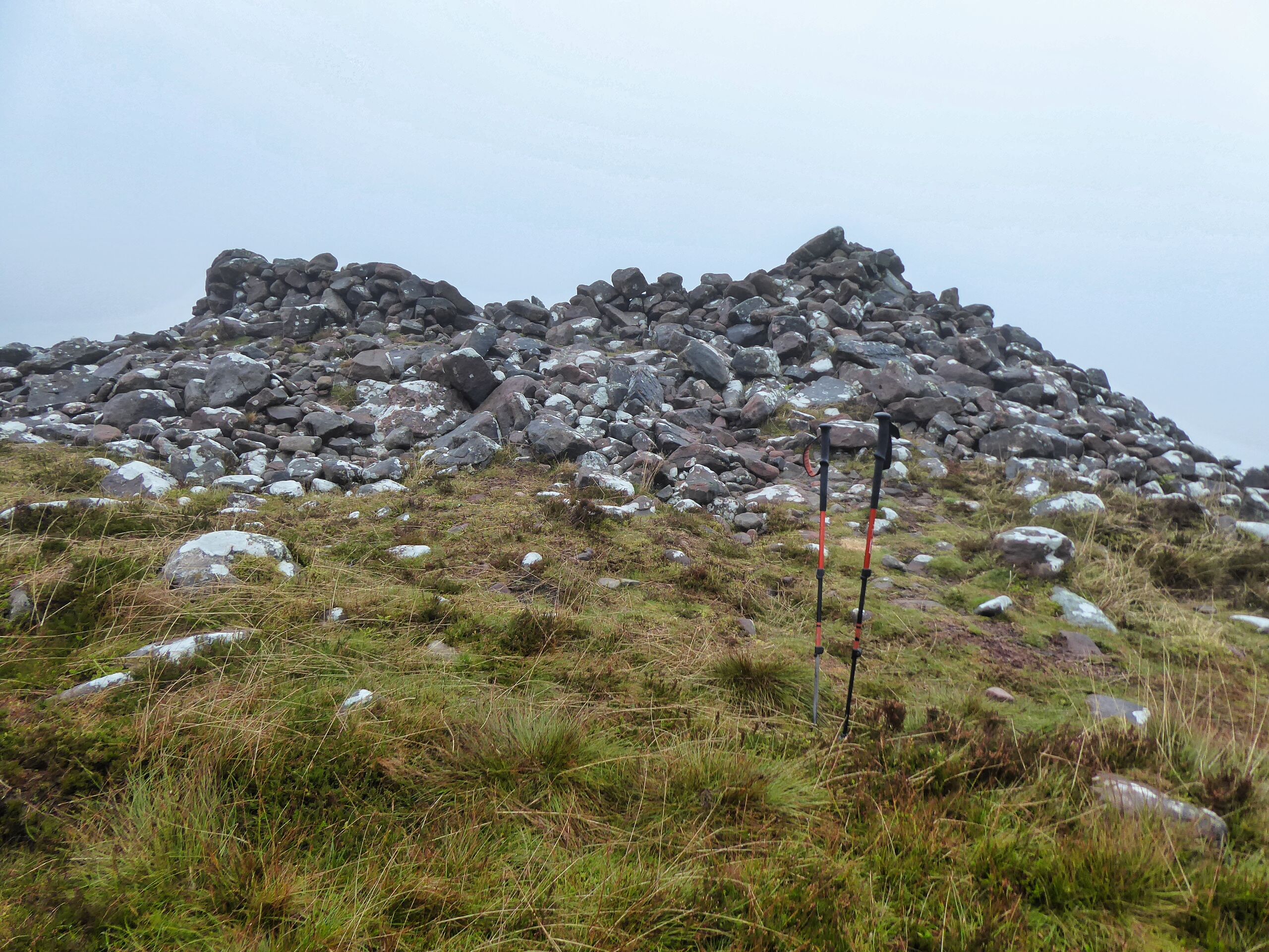
drip off my hood, a steady 20 minutes, roughly 100M climb, got me to the ridge and along to the top and the cairn. High winds, cloud covered and wet not the best top I have been on but another bagged.

Taking no chances I returned exactly the same way. As I reached Home Loch I heard a familiar noise, was I right. Yip a roaring stag soon followed by at least another two. I reckon two of them were close to where I had been 20 minutes ago but the 3rd was much further away. Something to smile about.

I got back to the car and changed just as the rain came again, for once fortunate timing.

Ascent: 580m

Distance: 12.5km

Time: 4.05

Wildlife: Roaring Stags (1st of the year); Meadow Pipit; Kestrel; Siskin flock 10+

Thursday 10 November 2022

WHW.....Crianlarich - Tyndrum

Walk: West Highland Way

Section: Crianlarich - Tyndrum


Woke up to the sound of rain battering the window, not exactly what I wanted to hear. The forecast was to be grim all morning, high winds all day so no high tops today.

As the afternoon was for showers, I decided to get the train to Crianlarich and walk back to Tyndrum via the West Highland Way. Short train journey, but it was packed and humid, the chances of Covid?

As always, the hard bit is finding the start. Crianlarich is a fair bit off the official WHW according to my map. I headed down to the Post Office where I found a tourist map/board. Back up to the station and follow the Drovers Loop which should connect to the WHW. Good but where is this trail at the station. Turns out you go through a tunnel, head up a flight of steps and there is a marker. 

I did not have a map and had not looked at the route beforehand, so I was surprised at how much elevation is gained so quickly and how high above the road the track goes. Still plenty of peace and quiet, only bumped into two people until Dalrigh area.

After a lung bursting ascent from Crianlarich this is what greets you

Typical scenery

I love the moss on top of the rock, a small croft!!

Spotted this unusual plant, Heath Speedwell my app says


Hill middle right one of the Corbetts that was Plan A
There has been much deforestation, but I suppose it does open up the views. Up and down the track goes. I spotted movement on a tree branch, quickly disappearing. I was certain it was not a squirrel which only left a Pine Martin, if so, that would have been my first ever sighting but not conclusive enough.


River in full flow

Just one reason for this being an amazing country
Out of the woods and across the road to the ancient historical ruins at the Fillan's priory and graveyard. As I was looking about the farmer drove into his yard with a trailer. All hell let loose. I assume it was a bull and the noise it was making it was far from happy. I made a quick movement to get through the farmyard gate.

A pleasant stroll then back across the road again for the the final few miles to Tyndrum. I spoke to a Swedish woman with her three daughters. The youngest one looked at her mother and said, 'this is so beautiful'. Despite the poor weather it was a reminder to remember what we have in Scotland.

So, an afternoon of showers and very high wind gusts. When I reached Tyndrum it was just too cold in that wind. But remember the wee girl, no complaining. On a cold day the reward had to be a fish supper at the Real Food Cafe. A good ramble.

Ascent: 391m

Distance: 12.2km

Time: 2.52

Wildlife: Coal Tit; Chaffinch; Blackbird; Swallow; Sand Martin;


Saturday 5 November 2022

Another district high point....East Cairn Hill

Hill: East Cairn Hill

Type: Sub2k

Height: 567m


On this short trip to the east, I had some free time and opted to tick off the Sub2k of East Cairn Hill, principally as it has been on my to-do list for years and it was time to remove it. East Cairn has the status of highest point in the City of Edinburgh district. Its twin peak, West Cairn, is the highest in West Lothian.

Plenty of route options so I hummed and hawed and eventually decided on the start point from Carlops.


It was drizzling when I changed at the Carlops quarry starting point not the best sign. I intended starting at the eastern end of the village as there is a loop option to the North Esk Reservoir which I hoped would give me a bit of a circular and some different scenery on the return. However as soon as I started I could see the nearby Patie’s hill was full of running cows careering across the slopes. I had to pass by, or even over it and did not know if it was fenced off.

Some cows still on Paties Hill. Some now in near field the remainder hidden but soon about to join me

Being a big feartie I back tracked and went up the other route where before long I came to a field with a big herd of agitated cattle. I could see some cows still on Patie’s hill and others crossing the ground at the base. They were being rounded by a quad bike but they had stampeded across the area I would have walked along. Did the farmer have an accomplice warning people? Even here the cows were skittish particularly the calves. This caused some mothers to come close to the small fence beside me, bellowing and wide eyed. Thank god I got passed them.

North Esk reservoir coming into view
At the reservoir for some reason the track is signposted through another livestock field. Cautiously I walked onwards, eyes constantly scanning. It was a big field with no escape route and I was walking through the centre of it. Although signs of droppings no animals.

Might not look much but it was awkward
Looking for coos I missed the turn at the trees and continued to the end of them, going round the other side. This was very rough ground recently tree planted and fenced. I got down through the bracken, thought I had seen a gate but nope my dodgy eyesight. So a big fence needed to be scaled, not easy with a big jump on the other side.


What a start. I was now on the Bore Stane track which was narrow and boggy as it slowly climbed through the moor. The only sound abundant red grouse calling away.

East Cairn Ridge
From this section the clouds were still high I could see East Cairn summit and the ridge to the cairn up on my left but that was the last view as the weather soon closed in. Reached the col but I could not find the Bore Stane.

Mistake I climbed over here to go on left side of wall. Track was on the right behind the trees.

I might have misread or bad memory but I thought that I had read a report where someone had followed the stone dyke to the top. Over I went heading to the left of the wall. I crossed the very rough ground and it was appalling. After about 5 minutes and narrowly missing plunging into two deep hidden pools I was a bit fraught. I did not fancy this terrain all the way up and was contemplating turning back. I headed over to the dyke and stayed close but the going was not much better. I saw a hole in the wall about 50 metres ahead and decided to go to it and if the other side was not any better turn back. Peered through the gap in the wall and surprise, surprise, a gravel track, wow, delighted but how far did it go? I could not see any sign of it on the hillside ahead.

The gravel track petered out within a minute but there was a faint narrow track heading up the hill. Although extremely wet and boggy in places it was a hundred times better than the other stuff. I was now well into the low cloud with light rain so visibility was poor.

Much better than before
On I plod until I reached the true summit at point 567m, but this is not the end of the ramble. 

Heading down from high point to the cairn
The hills main feature is a huge cairn which on a good day can be seen from miles away but is still some way off in the greyness. I wanted to visit it so kept going. Surprised by a shout from a female who was on the other side of the wall. She had started at the more normal point at Baddingsgill Reservoir.


We headed to the cairn chatting away. It is indeed a huge cairn with a hollowed centre big enough for a party.


The clag lifted for about 30 seconds, enough to see West Cairn and down to Harperrig Reservoir.

Heading back to the high point

Not sure what type of grass but its colours brightened up the descent
We parted as she was heading down the slopes to meet up with the Thieves Road whereas I was backtracking my ascent route. It felt very strange each time the clag lifted as I did not recognise anything but at one point I could see the true high point ahead.

The cloud and mist descended covering the high ground but I was descending with my track so no getting lost. I followed this to meet my ascent track about another 50 metres on from where I cut off, sods law.

Heading back to the trees in the distance

I had another look for the Bore Stane but no joy so just had my lunch and enjoyed the peace and tranquility. 

Red Legged Partridge
I had spotted a sparrowhawk near the trees on my way up and on the descent found the remains of a Red Legged Partridge. Feathers strewn everywhere but no carcass, classic Sparrowhawk kill site.

After that a straightforward return, no fence climbing until I reached the field of coos. There was no sign of them but very fresh droppings on the farm track. Not enough for a big herd but maybe an escapee or two! 

Now thats a handsome bull
The only occupant was a beautiful bull who was interested enough at my appearance to start walking towards me. Was I being blamed for his missing ladies? Thankfully he soon found the grazing more interesting. I then came across an open gate on the field opposite where another large bull was sitting. Was he the owner of the dung? But again, thankfully not interested so I walked back to Carlops safely.

An interesting and remote walk just a pity I did not get the good views.

Ascent: 447m

Distance: 16.1km

Time: 4.26

Wildlife: Red Grouse; Buzzard; Carrion Crow; Meadow Pipit; Sparrowhawk.